Bridges of FJR County

Yamaha FJR Motorcycle Forum

Help Support Yamaha FJR Motorcycle Forum:

This site may earn a commission from merchant affiliate links, including eBay, Amazon, and others.
During my travels this year I've also been looking out for interesting bridges. Here are a few of them.

The first ironbridge opened in 1781

ironbridge2.jpg
">

Thomas Telford's Menai Suspension Bridge (1826)

menai.jpg
">

Also by Thomas Telford as part of the London to Holyhead turnpike. The small archbridge underneath dates from Roman times

022.jpg
">

On General Wade's miltary road near Melgarve in the Highlands of Scotland. Built about 1731

GwadeRd6.jpg
">

Forth railway bridge

Forthrailway.jpg
">

Packhorse bridge near Stow in the Scottish Borders (1665)

6101Borders2.jpg
">

On my way to Corsica in 07 and about to cross the Millau Viaduct in Southern France

corsica2065.jpg
">

 
I have some experience with the wooden bridges of B.C.

My opinion is not printable on this forum.
Hey madmike, what's wrong with B.C. bridges? Look at this marvel of engineering - just west of Golden B.C. circa 2011.
Au contrere, mon ami!

2 trips to BC, different experiences with BC wooden bridges during rain storms.

The 2nd trip/experience includes: a bent driving light bracket, scratched left fairing, scraped Kevlar riding suit, helmet cable pulled out of my Autocomm and witnesses..... :huh:

===============================================================================

Orestes, the ancient bridges are very cool to see.

I really like the Forth Railway bridge!

The one in France looks like it would scare the p!$$ out of me. :D

Probably different when one is riding across it.....

 
Last edited by a moderator:
Been a while since anyone has added to MM's great thread. No traffic worries leaving Frank on the new bridge.

IMG_1811.jpg


The old suspension bridge over the river on Iowa Hill road. Much like the bridge on page 1 of this thread, in fact it's the next bridge crossing north of Yankee Jim's crossing .

IMG_1794.jpg


IMG_1807.jpg


IMG_1810.jpg


IMG_1808.jpg


More proof of California's drought, no way this river should be this low in December.

IMG_1801.jpg


Last edited by a moderator:
I have some experience with the wooden bridges of B.C.

My opinion is not printable on this forum.
Hey madmike, what's wrong with B.C. bridges? Look at this marvel of engineering - just west of Golden B.C. circa 2011.
Au contrere, mon ami!

2 trips to BC, different experiences with BC wooden bridges during rain storms.

The 2nd trip/experience includes: a bent driving light bracket, scratched left fairing, scraped Kevlar riding suit, helmet cable pulled out of my Autocomm and witnesses..... :huh:
Hmmmm. Bug's new post directed me to this thread that I apparently missed previously. But I did NOT miss that second trip wooden bridge experience MM2 referenced. :glare:

Witnesses?? I suppose watching that slide in my mirrors qualifies me as one of two known witnesses, and Mikey don' need no steeenking witnesses?!? It looked a little like a takeout slide at second base from where I saw it, including the mirrored image of his right leg up in the air. Playing second and shortstop years ago, I saw and avoided a number of similar performances on dirt, but never on wet pavement. Good thing we weren't going very fast.

This was a slick as snot, wet wooden plank surfaced bridge with a left turn immediately past the end of the bridge. I was virtually on top of that dangerous bit of Canuckistani roadway engineering by the time I saw what the bridge surface was -- too late to hit the push to talk button to warn Mike and Sam behind me. All I could do was ride it out, turn when I got across and transmit something like "wood bridge!" about the same time I saw Mike sliding in my mirrors.

In the rain, that %#@$ing bridge, and one of the two wood plank surfaced bridges between New Denver and Kaslo (the one on the curve) are probably the two most treacherous bridges for motorcycles that I've ever been across. And Mike's right -- they're both in BC. :angry2:

What Mike left out was the downer of having almost a week left on the trip with his Autocom down and bike rashed, and the astounding amount of sand and pea gravel packed between his lower fairing and engine. Oh, and the coup de gras to his communication capabilities with the lost phone the next day in Valemount. :eek:

 
Last edited by a moderator:
...The old suspension bridge over the river on Iowa Hill road.
Geez, Bug, I love that area. Beautiful light in summertime during late afternoons.

Iowa Hill Road (on up the hill going away from civilization/the highway), is also a great

place to get run over by a half-drunk, barefoot, inbred, redneck with a giant f*cking pickup and no concerns about

sharing that narrow-assed road. Every blind corner is a thrill, huh?

biggrin.gif


Let's go!

(...when it gets warmer.)

 
Last edited by a moderator:
Those bridges are of poor quality in comparison to the highly engineered beauties we have in these parts...
I have some experience with the wooden bridges of B.C.

My opinion is not printable on this forum.
We even have some finely engineered bridges in the woods up here in the Great White North...

194097100_cErYc-L.jpg


It is actually a snowmobile bridge.

 
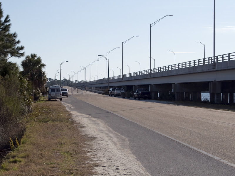
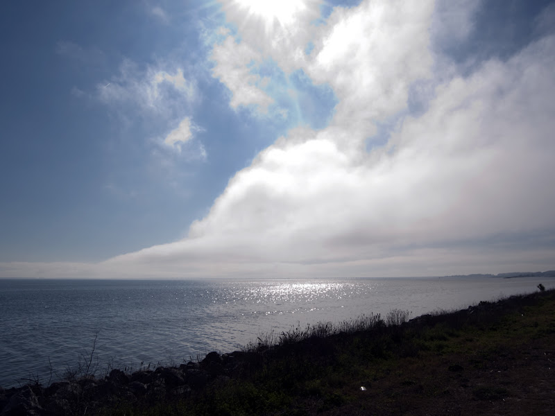
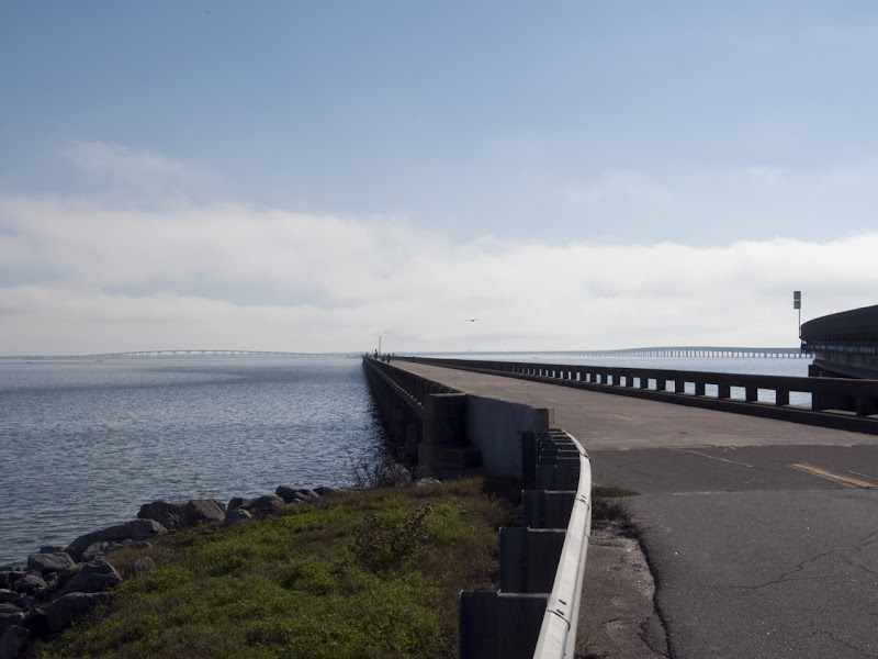
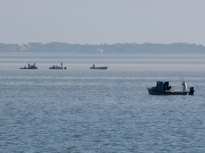
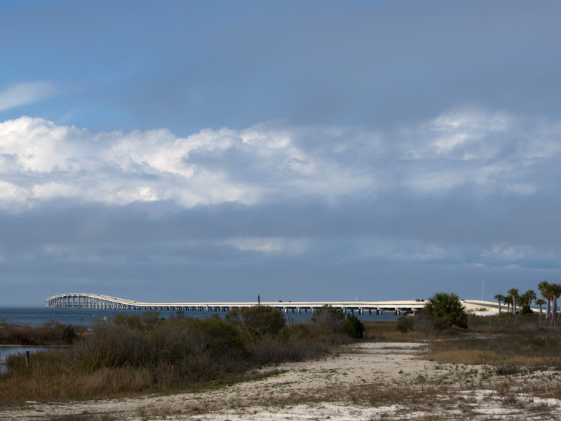
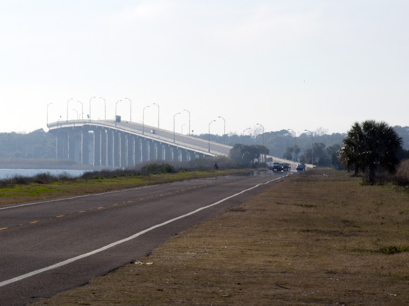
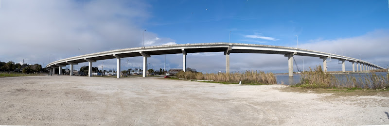
Just a few local bridges, then a story about the first one. The first five pics are from today.

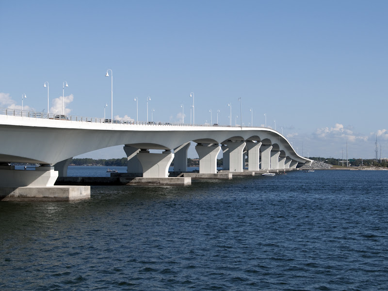
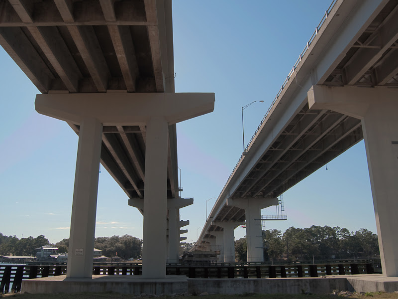
Hathaway Bridge, US 98 across St. Andrew Bay:

DSC_4375.jpg


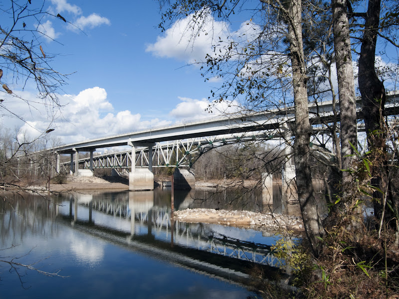
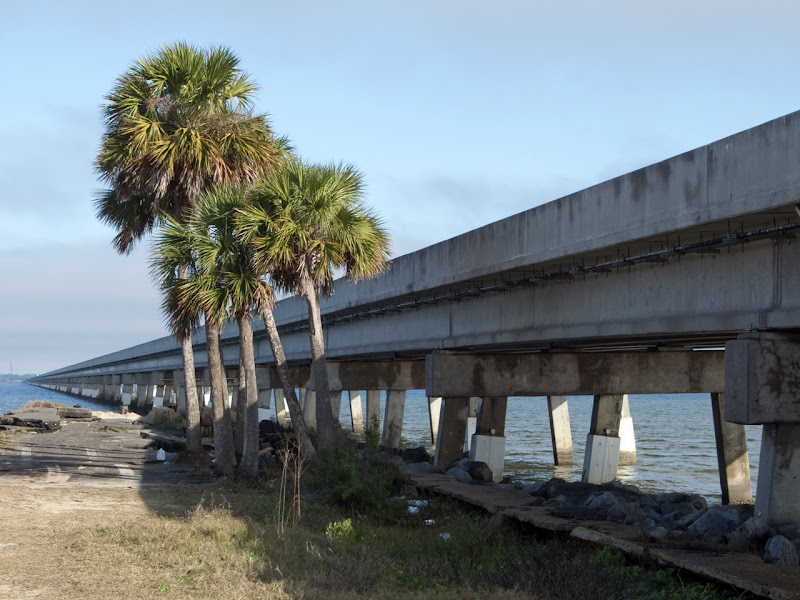
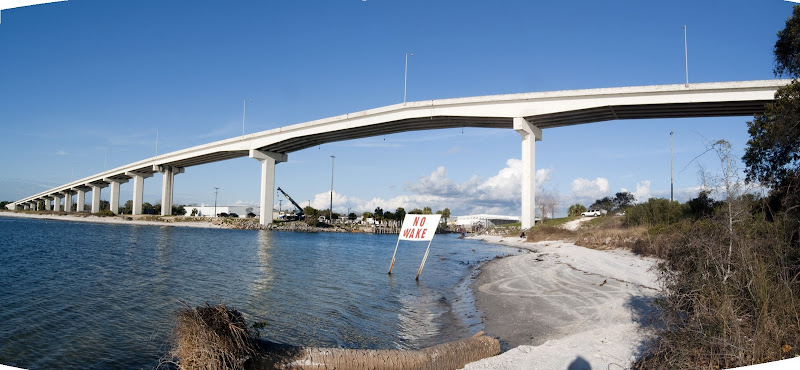
This is SR79 crossing the Intracoastal Waterway. Low in the middle you can see the remaining section of the old bridge (which was a drawbridge) configured as a fishing pier. The piers are wider than the roadway on the left span for a reason. The original drawbridge was replaced with a 2-lane high arch bridge, with enough room for a bit of a shoulder on each side. When SR79 was four-laned, they added the span on the right of this picture, and then replaced the span on the left, but using the existing piers. Didn't need a shoulder on both sides, so the roadway is narrower than before.

DSC_4379-80-HDR2.jpg


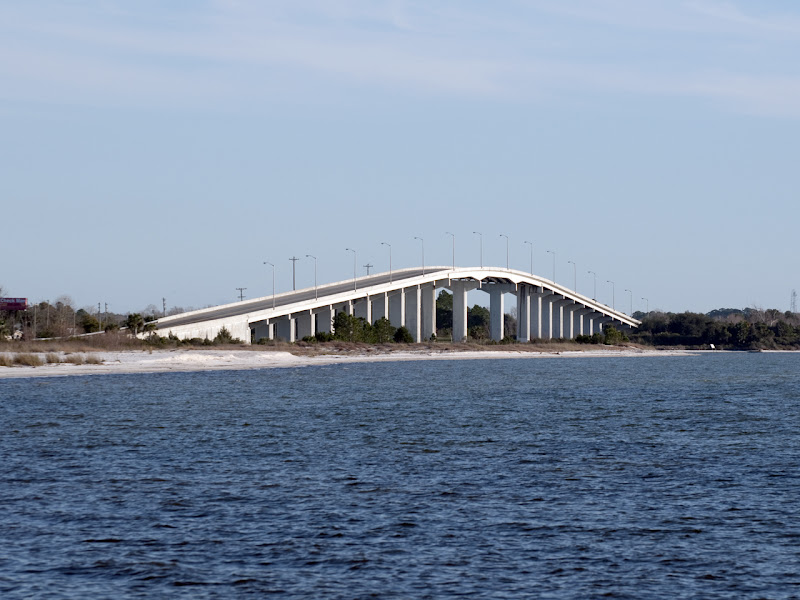
SR77 across North Bay, looking south. The new 4-lane structure is to the right, just a plain beam-on-pier construction, and we're looking down the old highway to the old 2-lane bridge, again left up for fishing. No shipping traffic under this one, so it's fairly low, just enough to clear decent-sized pleasure craft, but no way to get sailboats under it unless the mast comes down and you motor under.

DSC_4403.jpg


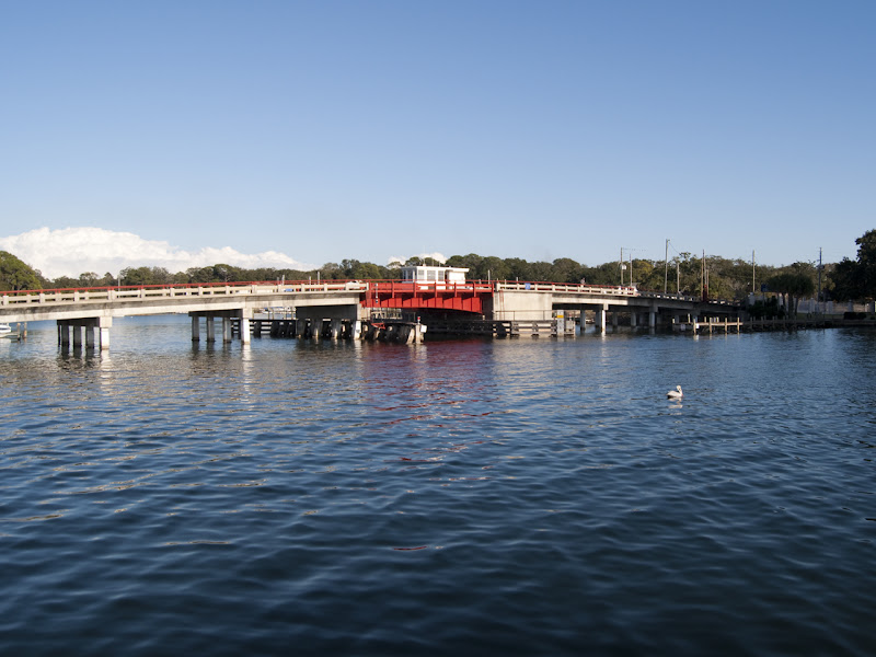
Beach Drive near downtown, crossing Massalina Bayou. Unless I'm sadly mistaken, this is the only drawbridge left in our area. There'a large marina just the other side of this bridge, with both commercial fishing vessels and numerous private boats, both motor and sail, as well as many many homes with private docks.

DSC_4407.jpg


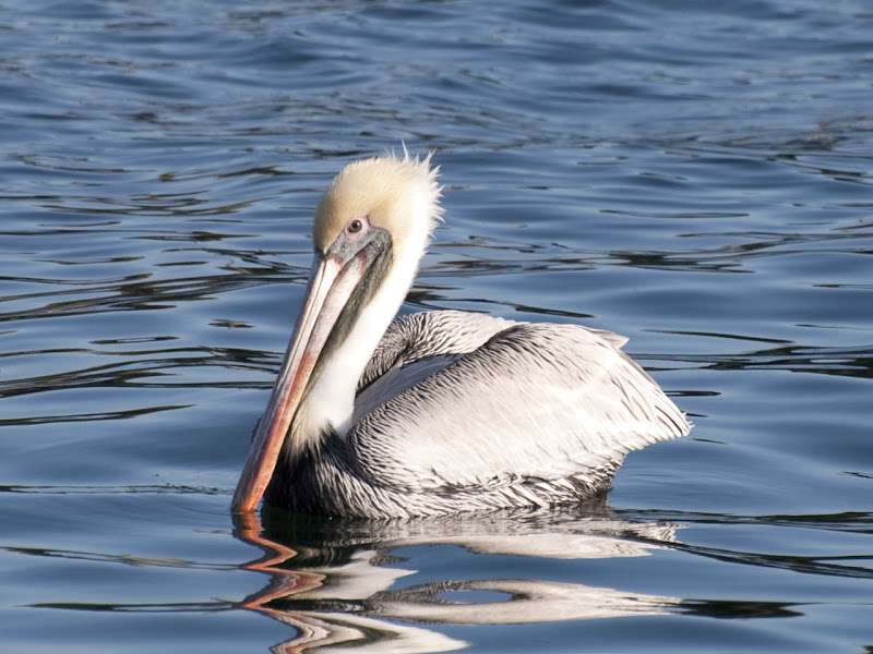
Had to switch to the 300mm and get the pelican:

DSC_4406.jpg


It should be obvious that our bridges are different from bridges elsewhere. We're not crossing canyons or river gorges, we're just crossing waterways, and sometimes the road is only a few feet higher than the water. If the waterway carries shipping traffic, the bridge has to be high enough to clear, or it has to be a drawbridge. Drawbridges have the obvious disadvantage of stopping traffic, which has grown to be more and more unacceptable as traffic counts go up, so we build them high, now.

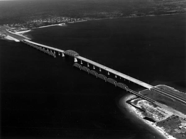
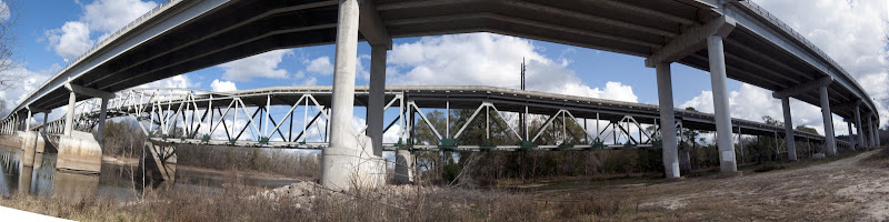
The first bridge pictured above, US98 across the bay here, is in its third iteration. First was a 2-lane truss structure with a center drawbridge, dating back to the 30s, I think. I don't know if the drawbridge was a lift bridge or swing bridge, I've not found any pictures or talked to anyone who knows. (I'm fairly sure it was a swing bridge.) In 1960 they opened the "modern" bridge, 4 lanes, elevated over the water so no interruption of traffic, and only the center span was steel trusswork. Although this bridge was 4 lanes, it had no shoulder space, and a very narrow "walkway" along the side barrier which was not separated from traffic. In 2004 they opened the current bridge, 2 spans each being 80 feet wide, and currently carrying 3 lanes of traffic each direction, with enough space for a very wide shoulder lane on the outside, and a full shoulder lane on the inside. There is also a pedestrian walkway separated from the traffic lanes by a Jersey barrier.

Here's a shot I found of the second bridge when it was new, with the old bridge left in place for diving. I mean, fishing!

Hathaway%2525201960.jpg


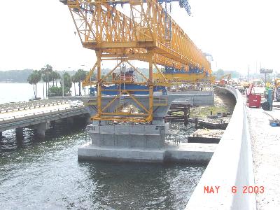
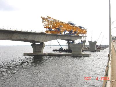
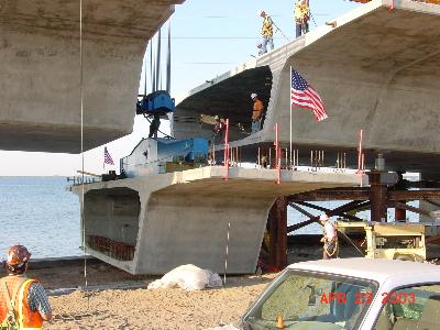
The current bridge was constructed of prefabricated box sections, fifteen feet of roadway installed at a time. These sections were cast on the job site, and floated out to the crane on barges. They built the piers, then erected a very long gantry crane to lift the roadway section into place. The crane had three footings it could put down, and it would span a couple of the piers, then lift the roadway sections and build a 'T' on each pier. When the 'T' was complete, the crane would extend itself to the next pier, put a foot down, and start work from there, basically walking across as the bridge was built. I'm told that the spans are not fastened to the piers, but merely resting on them. Here are some pictures I found of the process:

Hathaway%252520construction%2525204.jpg


Hathaway%252520construction.jpg


Hathaway%252520construction%2525205.jpg


The flag is set up on this one for a ceremony about to take place, as this was the final section of the first span being lifted into place.

Hathaway%252520construction%2525203.jpg


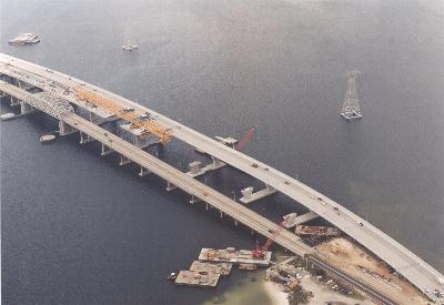
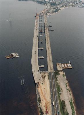
This aerial shot shows one of the new spans nearly complete, with the 1960 4-lane structure next to it. The very old bridge is completely gone.

Hathaway%252520construction%2525202.jpg


When the first span was completed, it was opened to westbound traffic, and eastbound was left on the old bridge. As the new eastbound span neared completion, they had to shift traffic to the complete span in both directions, as they had to tear up some old roadway where the footing of the old and new would overlap. Eventually all was complete and we got 3 lanes and plenty of pull-off room in each direction.

There is a problem with the joints now undergoing repair, though. One joint on the first span has shifted much farther than allowed for, and has actually dropped pieces of road surface into the box section. They stop-gapped it by laying down a steel plate, but this winter they are closing the span, putting all traffic on the "eastbound" side, 2 lanes in each direction, while they effect repairs to that joint. They will also determine if other joints are affected, and how much repair needs to be done. Fortunately, the state got a ten-year warranty in the original contract, so this repair is on the contractor's nickel.

 
Last edited by a moderator:
Thanks to you who are keeping this thread alive.

I was just thinking (yesterday) that I need to work on taking photos of the Sacramento River bridges to add here.

Doug, I rode those bridges with Rich and Barry, long before I decided to start this thread. I wanted to get up the North Fork and take photos....I'm glad you did so.

Walt, I love seeing and learning about the engineering involved in the construction and maintenance of these necessary structures. Thanks for the added information and photos.

 
I did more today, longer ride. From home to Bristol to get the SR 20 bridge across the Appalachicola River, which is the boundary in Florida between Eastern and Central time zones (except for most of Gulf County being Eastern time.) Then down to St. George Island for its access bridge, which crosses 4 miles of open water, although very shallow water. Then home through Port St. Joe to get its bridge across the canal joining St. Joseph Bay to the Intracoastal Waterway. I was surprised by a road I'd never been on before, SR12 through the Apalachicola National Forest, a good portion of which had numerous sweeping turns, very little straight road. (To get there, though, you had to run 5- and 10-mile straights into the area.)

Anyway, bridges. Here's SR20 crossing the river between Blountstown and Bristol. There's an unpaved access road to the river level, I assumed for a boat ramp, but it branches to a closed gate with no trespassing warnings in two directions. Anyway, I could get under the bridge, so I did. This is one of those where they built a new bridge, then decided to keep the old one. The highway is 2 lanes, and the old bridge is NARROW, 14-ft lanes with no shoulders. Originally it had those concrete rail-in-post barriers, the kind no vehicle ever had any trouble punching through to plunge to their doom. The new bridge has room for a shoulder on each side, and when it was completed and carrying traffic, they just decided to renovate the old bridge and keep it. They put Jersey barrier on the sides, fixed what steel needed fixing, and BAM! they had a four-lane crossing. The old bridge (30's era) carries westbound traffic and the new bridge carries eastbound.

DSC_4426.jpg


DSC_4427.jpg


This one isn't so much a picture of the bridge, I just like it as a picture.

DSC_4433.jpg


It appears they've had some high water along with some erosion of the banks . . . . .

DSC_4432.jpg


This car is not parked, he is travelling at speed in the left lane. I told you it was narrow . . . . . :eek:

DSC_4431.jpg


A not-very-good stitch from ground level. My stitch program doesn't really like ultra-wide shots, and I didn't have enough overlap anyway, only four frames end to end.

Hwy%25252020%252520stitch.JPG


Now on US98 between Carabelle and East Point. (I'm not making these up!) There's a bit of fog forming over the sound, and the bridge I want is smack on the edge of it; you can just make it out if you look carefully.

DSC_4434.jpg


Again, part of the old bridge left in place for whatever it is those people are trying to do out there. If you replace the rail with Jersey barrier, you get exactly what the old Hwy 20 bridge now looks like. And they kept both lanes. The new bridge is immediately to the right, and running into the distance, curving right, then left, to go around the island that formed a causeway for part of the old crossing.

DSC_4439.jpg


These are oystermen at work. I don't know why they do this. They make a very poor living, barely getting by, long hours and hard manual work. If I liked oysters and didn't have a shellfish allergy besides, I'd salute them in appreciation. As it is, their product wants me dead, so . . . .

DSC_4440.jpg


Same bridge from the island. Can you guess where the shipping channel is?

DSC_4444.jpg


To cross the Apalachicola Bay you run almost a mile of causeway, then about three miles of this:

DSC_4452.jpg


Then there's another half mile or so of causeway and a little over a mile of elevated section which crosses the mouth of the river proper. Homework: Find Apalachicola on Google Earth and you'll see the difference between the river crossing and the bay crossing, even though they're the same bridge.

DSC_4454.jpg


A decent stitch of the elevated end of the crossing:

appalachicola%252520bridge.JPG


Just north of Port St. Joe, US 98 crosses a canal which connects the Intracoastal Waterway with St. Joseph Bay. Add this to your homework: find the canal and follow it to the waterway. That used to be a drawbridge, but has been replaced with a high arch. For once, there's no old bridge left for a fishing pier, because the water crossing is not wide enough. To get the height, though, the bridge is about a half mile long, so it can cross a channel 150 feet wide.

A shot from north of the bridge:

DSC_4464.jpg


The two piers straight ahead straddle the channel; none of this bridge's piers are wet!

Port%252520St%252520Joe%252520bridge.JPG


Last edited by a moderator:
Blenheim Bridge in Ulster County, NY. The longest single span covered bridge in the world. It was destroyed by hurricane Irene in 2011, so you missed your chance to see it. :(

3.jpg


Thanks to you who are keeping this thread alive.

I was just thinking (yesterday) that I need to work on taking photos of the Sacramento River bridges to add here.

Doug, I rode those bridges with Rich and Barry, long before I decided to start this thread. I wanted to get up the North Fork and take photos....I'm glad you did so.

Walt, I love seeing and learning about the engineering involved in the construction and maintenance of these necessary structures. Thanks for the added information and photos.
We began the bridges thread last year in April in the midst of a very hard winter. This year we are yet to see the winter weather. I'm ready to knock off a bridge when you are....we never did grab Foresthll

 
Last June, I was called out to Atlanta to attend a friend's son's wedding... that alone was a dig as I used to babysit this boy when he was in diapers... but duty called and I made the arrangements. I also started doing a little geography searching and found that my dear FJRforum e-buddy, Mike/Patriot, wasn't too far away. So I decided to extend my visit out that way, rented a car, and headed for Leweeseyana. Mike and his lovely wife, Amy Jo, welcomed me to their home and spent the next few days playing tour guide for this Kalifornya gal which I thoroughly enjoyed!

One of the highlights was visiting the big bridge at the Mississippi River Front which I believe was called the Crescent City Connection near the City Walk. It was dusk and as we rounded the corner to the bridge, we found this really amazing statue that was a tribute to the Mississippi River... the evening was lovely and the view/s spectacular... I was fortunate to catch a few shots that kind of capture the moment... B)

DSC1999-X3.jpg


DSC1984-XL.jpg


DSC1993-XL.jpg


DSC2003-XL.jpg


Oh yeah, and Mike wanted me to make sure that I told everyone that he said, "HI!!" in true FJRforum fashion... :lol:

DSC1981-L.jpg


One of the highlights was visiting the big bridge at the Mississippi River Front which I believe was called the Crescent City Connection near the City Walk.

DSC1984-XL.jpg
this is bridge #1 on the local "8 Bridges Ride" developed by the local Goldwingers and now adopted as one of my standard rides. It crosses the Mississippi River at every bridge which is Louisiana on both banks. New Orleans to St Francisville. Oldest bridge is #2 Huey Long Bridge not far downstrean from New Orleans opened Dec 1935 with newest #8 in St Francisville's John James Audubon Bridge opened May 2011.

More to come when stops with cameras occur along the way.

Would be a good ride for BEFA (Big Easy FJR Adventure) Gathering in April.

 
Don't remember seeing a shot of the

Golden Gate

P5140104.jpg


For Mike (Patriot)

Bridge across the head waters of the Mississippi

041.jpg


I had a blast finding this little gem in the Fremont Canyon on my way to the Pathfinder Dam in Wyoming last month.

IMG_2312_zpsa36a0c95.jpg


A little history..

IMG_2310_zpsa92f5766.jpg


A look downstream.

IMG_2320_zps56132ad7.jpg


Last edited by a moderator:
Top