


hppants
Well-known member
I had a great day on the bike yesterday. I invited others to join me, but all had plans, so alone I went. I decided to follow a bunch of waterways for this ride – in hopes of quenching my thirst for 2 things – my need to ride and of course the heat. It ended up being right at 350 miles total, about 60 of that on the slab, and the rest in my element – 2-way curvy back roads. As expected the bike ran flawless, and my fuel mileage was very good - about 45 mpg, indicative of the leisurely pace with which I rode most of the day.
It’s late July in south Louisiana. The entire world is a sauna. I left the house at a tolerable 75, but by noon, it’s pushing 95 and the humidity is at least 60 percent. I found several nice rain showers in the mid-afternoon, and uncharacteristically, I actually altered my route toward them. The rain was very refreshing as I rode very slow on a desolate country roads.
I managed to find a few new-to-me roads, and as always, I found adventure. Hope you enjoy the pics.
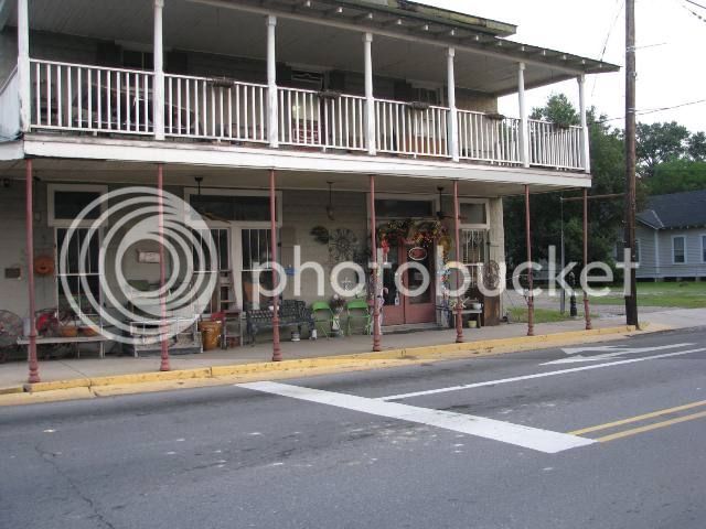
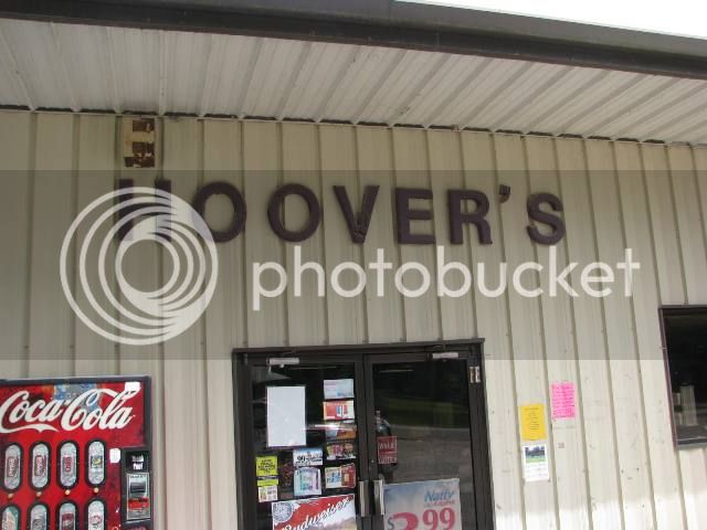
At 6:15 am, with plenty of light, I’m geared up and idling out of the neighborhood. Soon, I’m wiggling my way east through the small Cajun town of Breaux Bridge – the self-proclaimed “Crawfish Capital of the World” Still quiet at this general store.
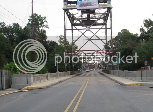
This draw bridge spans the Bayou Teche.
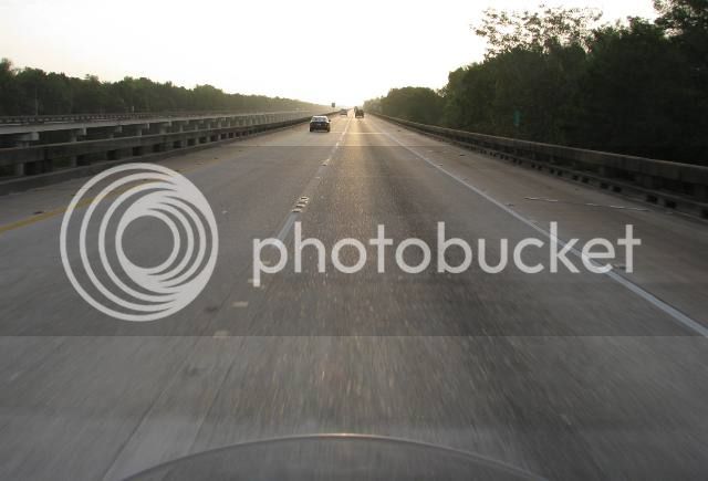
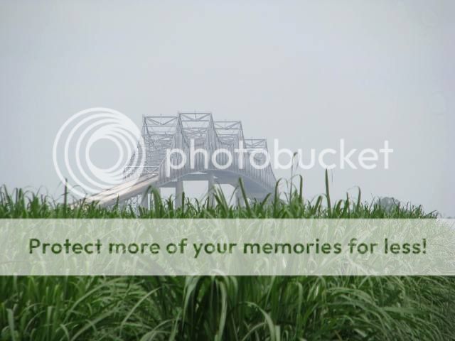
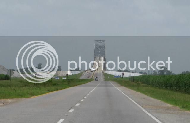
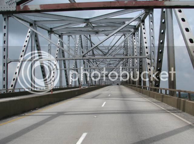
Continuing east, I hit the I-10 slab with the camera around my neck. This is the Atchafalaya Basin Bridge, an 18 mile continuous bridge on I-10 that spans the largest fresh water swamp in the country.
My own version of the “Going to the Sun Highway”
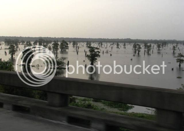
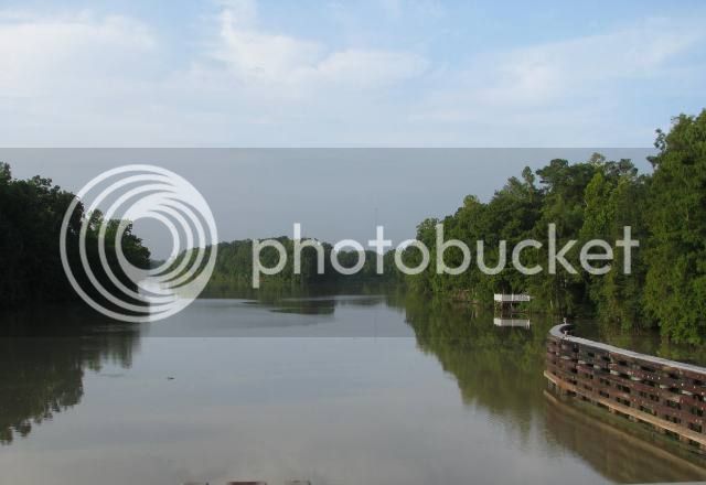
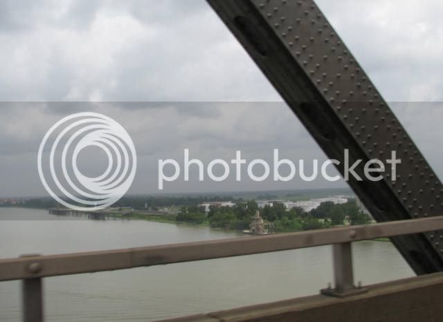
The swamp is quiet this morning
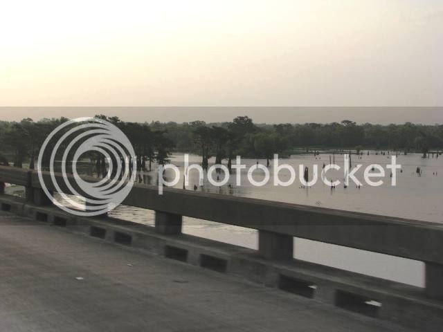
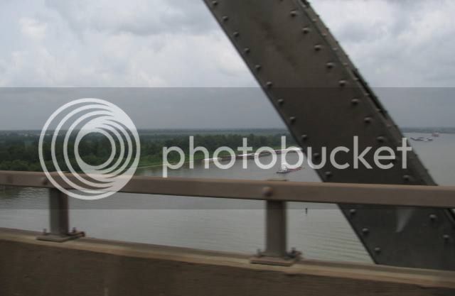
This is the Atchafalaya River, which runs down the center of the swamp. It takes about 30% of the Mississippi River’s water as a flood control measure.
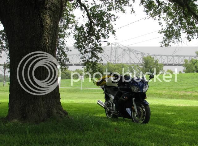
Bike’s looking particularly nice this morning…
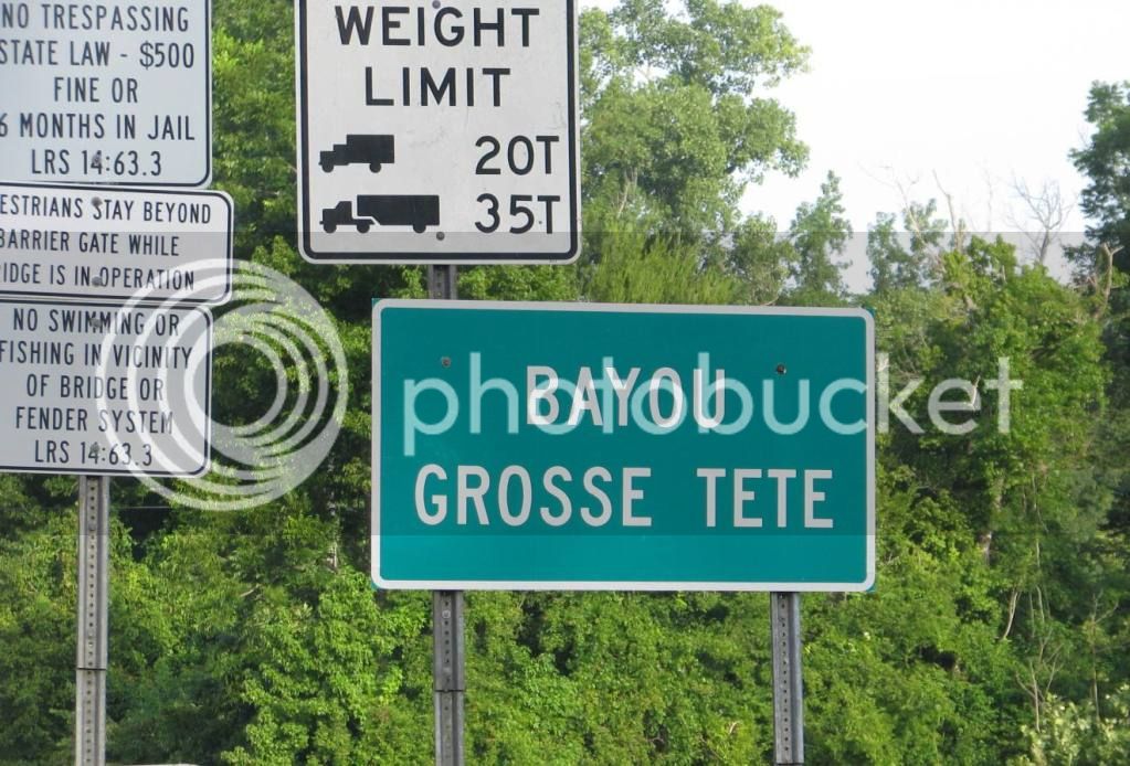
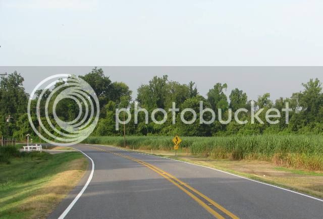
I jump off the slab and start riding along the Grosse Tete Bayou. Now this is more like it.
The sugar cane is tall (perhaps 8 feet) now. But the stalks, which contain the sugar, are still kind of skinny – about 1 ½” in diameter. They will double in diameter before harvesting later this year.
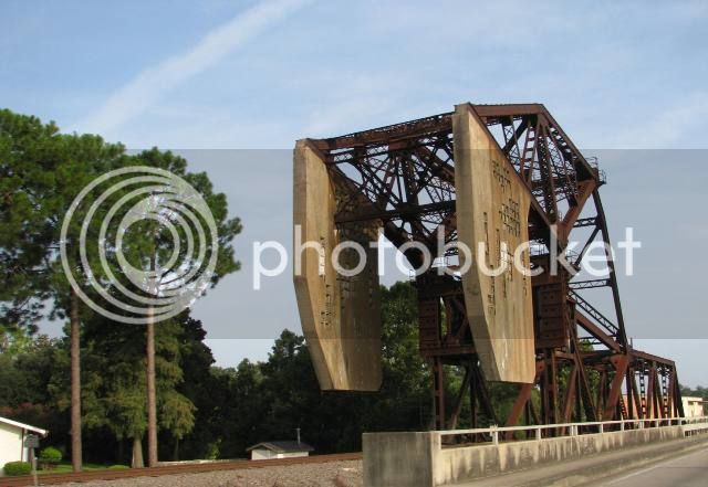
I run though the town of Plaquimine, Louisiana. I’ve always been fascinated with the counterweight on this railroad draw bridge.
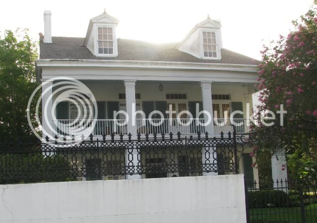
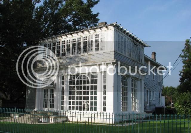
Plenty of antebellum homes here.
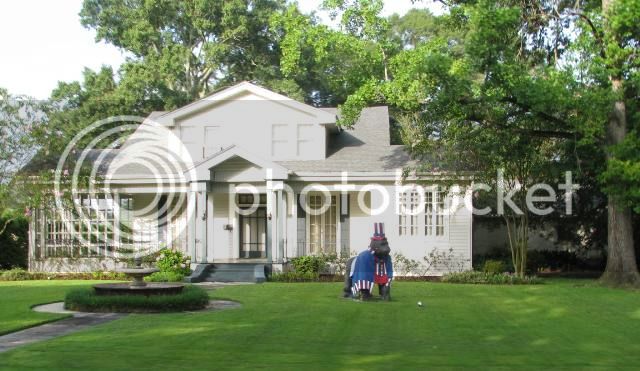
Interesting but patriotic yard art…
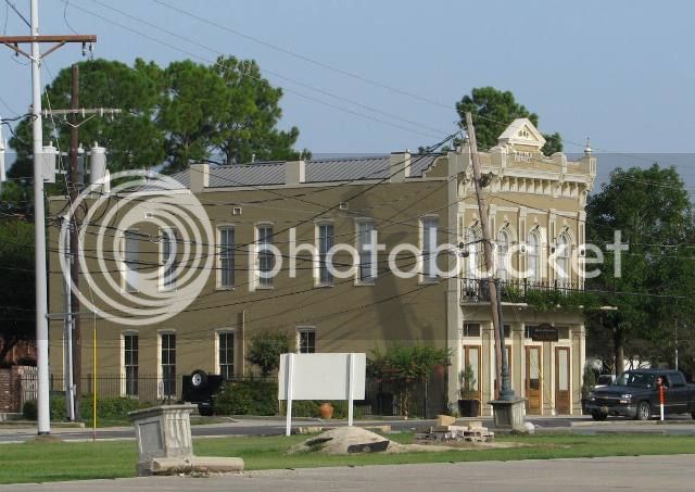
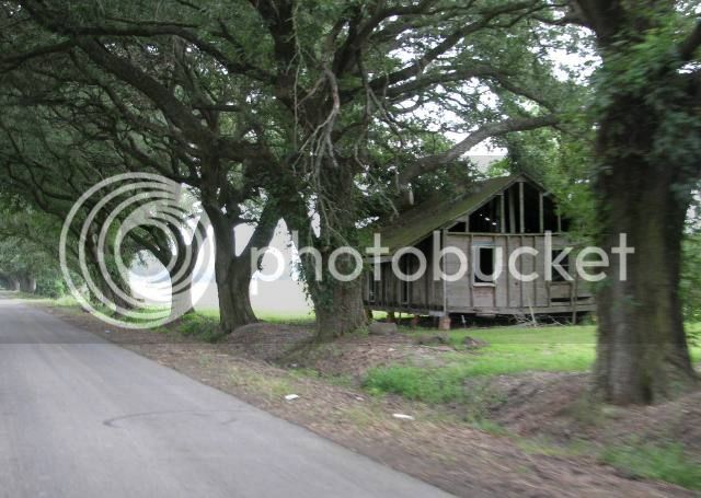
This old building reminded me of the Wild West – I have no idea when it was built.
My self-guided old home tour caused me to just miss the ferry across the Mississippi River.
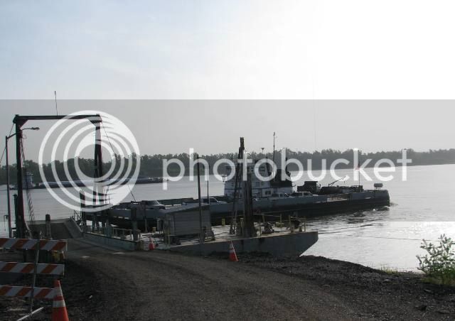
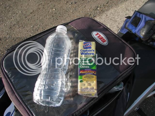
So with a little time to kill, I ate my horse food snack.
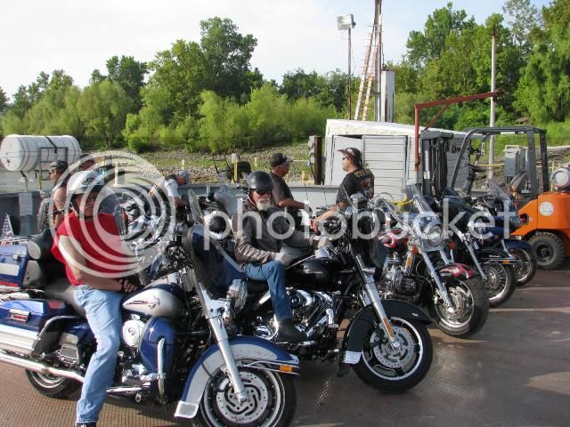
I met a bunch of cruiser riders on the ferry. Nice guys they were riding to some kind of belching contest or something…
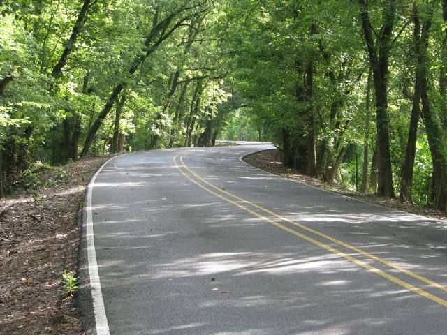
On the east side of the river, I headed toward Alligator Bayou road – one of my favorites.
In some spots, the bayou has dried up pretty good.
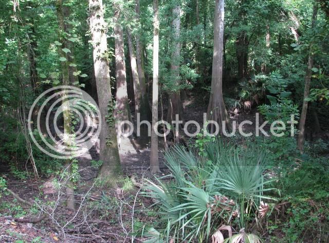
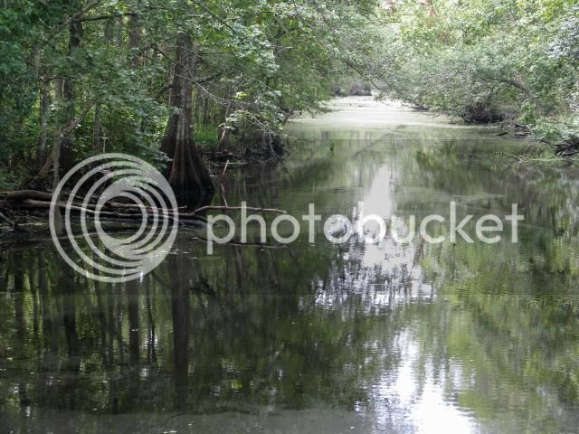
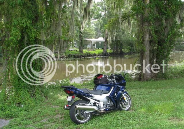
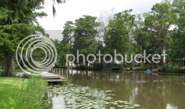
Don’t know the name of this one, but it’s peaceful here and the birds are singing everywhere.
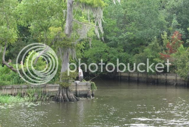
These curvy roads follow many of the bayous and rivers of Louisiana. Here’s the Amite River. These guys were catfishing on their day off.
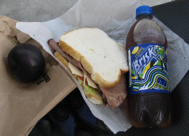
I ride a bit more to the town of French Settlement, Lousiana and stop for lunch.
I asked the owner of this store if she had anything more healthy than pizza or chicken wings. She replied “How about I make you a sandwich?” Not a bad lunch for $4.00.
I waived to the owner of this house next to the store. He stopped his garden tractor and asked me if I’d like to sit in the shade to eat my lunch. Southern hospitality.
After lunch, I’m back on the twisties, enjoying the bike. Not much traffic for a Saturday.
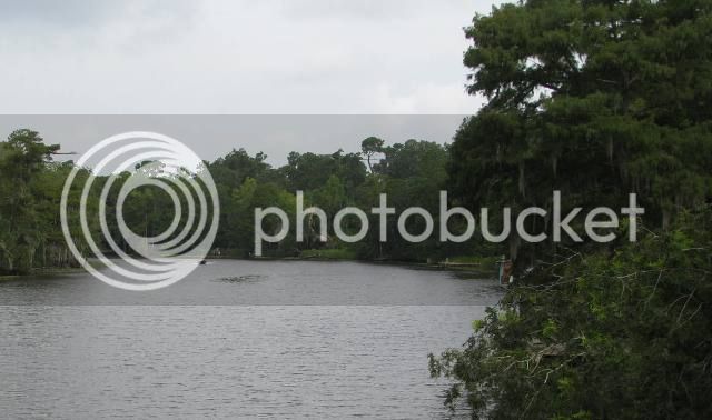
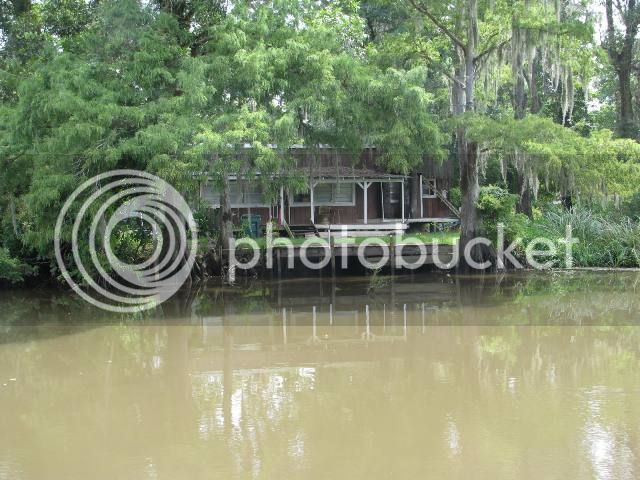
The road follows this beautiful bayou with plenty of camps on the water.
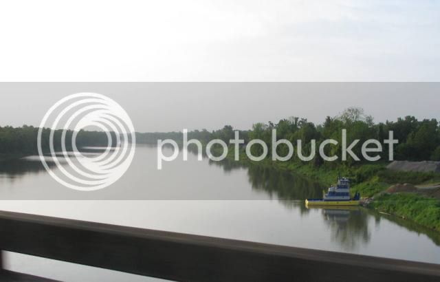
Now heading generally West, I crossed the Mississippi river on the Sunshine Bridge.
Lots of barge traffic on the river today.
Refineries in the petro-chemical industry use the river’s water for heat exchange and shipping purposes.

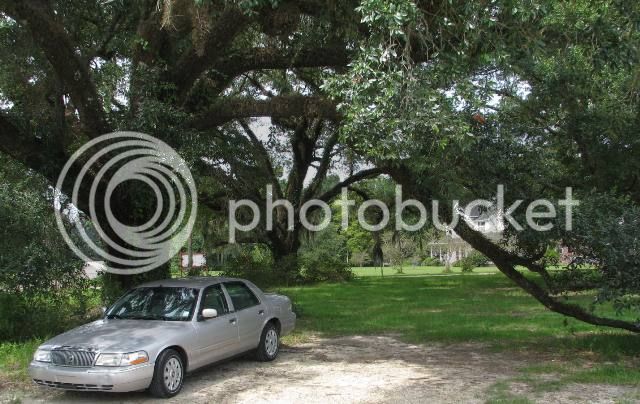
After crossing the river, I decide to stop for a drink under the shade of a Live Oak tree.
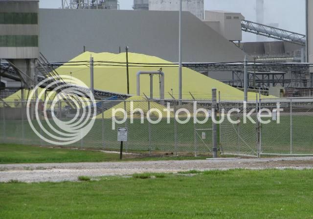
Then I take the river road north in the general direction of home. There’s a pungent odor in the air… must be this enormous pile of sulfur. Peeeee Youuuuu!
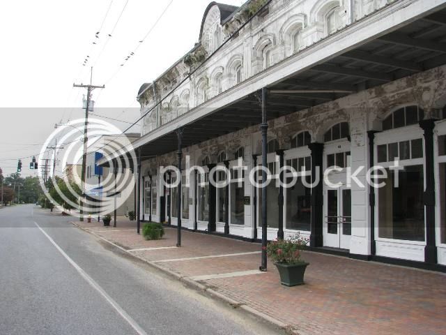
Passed through the town of Donaldsonville. This old mercantile store under renovation will become the town information/welcome center. A saw a lot of neat old stuff in the windows.
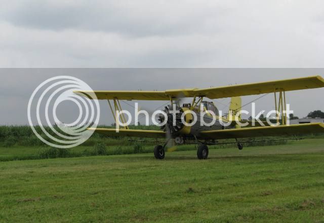
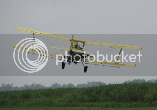
I got a little turned around and wound up on some back farm road. There I spotted this crop duster reloading his tank. So I ride up the head land just in time to see it take off. The engine seems very large for this bi-plane.
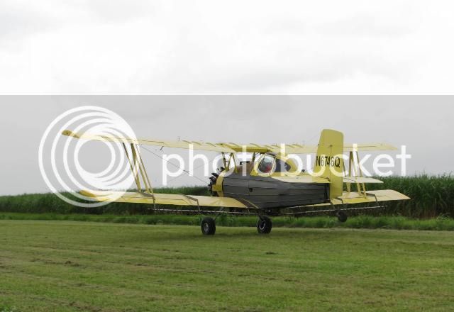
It was neat to watch him fly around the fields and spray.
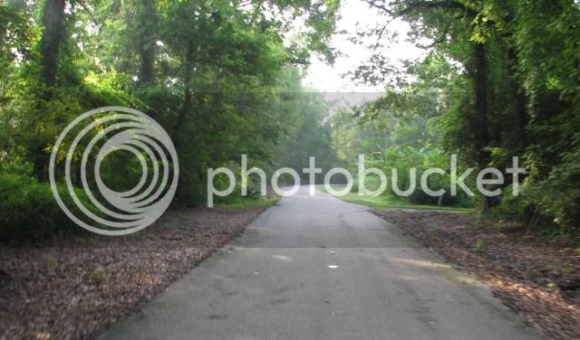
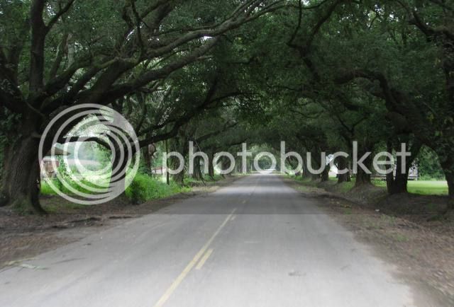
Winding my way back to civilization, I found this oak alley with some very welcomed shade.
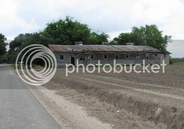
Some old sharecropper’s quarters.
Then the rain showers hit, so obviously no pictures, but I kind of enjoyed riding very slowly along the levee roads in the rain.
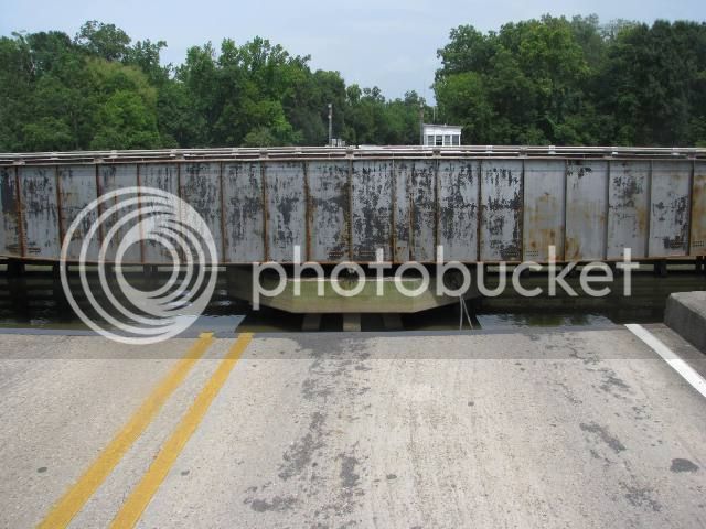
Now heading much closer to home, I stumbled upon traffic stopped.
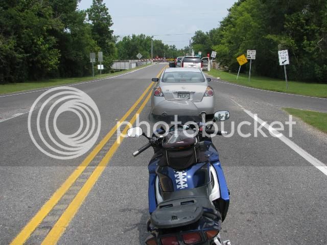
This bridge was temporarily closed for some barge traffic. This one operates on a turntable.
From there, it was just about 10 miles to the slab, where I high-geared it home. A nice time – just me and my horse.
It’s late July in south Louisiana. The entire world is a sauna. I left the house at a tolerable 75, but by noon, it’s pushing 95 and the humidity is at least 60 percent. I found several nice rain showers in the mid-afternoon, and uncharacteristically, I actually altered my route toward them. The rain was very refreshing as I rode very slow on a desolate country roads.
I managed to find a few new-to-me roads, and as always, I found adventure. Hope you enjoy the pics.
At 6:15 am, with plenty of light, I’m geared up and idling out of the neighborhood. Soon, I’m wiggling my way east through the small Cajun town of Breaux Bridge – the self-proclaimed “Crawfish Capital of the World” Still quiet at this general store.
This draw bridge spans the Bayou Teche.
Continuing east, I hit the I-10 slab with the camera around my neck. This is the Atchafalaya Basin Bridge, an 18 mile continuous bridge on I-10 that spans the largest fresh water swamp in the country.
My own version of the “Going to the Sun Highway”
The swamp is quiet this morning
This is the Atchafalaya River, which runs down the center of the swamp. It takes about 30% of the Mississippi River’s water as a flood control measure.
Bike’s looking particularly nice this morning…
I jump off the slab and start riding along the Grosse Tete Bayou. Now this is more like it.
The sugar cane is tall (perhaps 8 feet) now. But the stalks, which contain the sugar, are still kind of skinny – about 1 ½” in diameter. They will double in diameter before harvesting later this year.
I run though the town of Plaquimine, Louisiana. I’ve always been fascinated with the counterweight on this railroad draw bridge.
Plenty of antebellum homes here.
Interesting but patriotic yard art…
This old building reminded me of the Wild West – I have no idea when it was built.
My self-guided old home tour caused me to just miss the ferry across the Mississippi River.
So with a little time to kill, I ate my horse food snack.
I met a bunch of cruiser riders on the ferry. Nice guys they were riding to some kind of belching contest or something…
On the east side of the river, I headed toward Alligator Bayou road – one of my favorites.
In some spots, the bayou has dried up pretty good.
Don’t know the name of this one, but it’s peaceful here and the birds are singing everywhere.
These curvy roads follow many of the bayous and rivers of Louisiana. Here’s the Amite River. These guys were catfishing on their day off.
I ride a bit more to the town of French Settlement, Lousiana and stop for lunch.
I asked the owner of this store if she had anything more healthy than pizza or chicken wings. She replied “How about I make you a sandwich?” Not a bad lunch for $4.00.
I waived to the owner of this house next to the store. He stopped his garden tractor and asked me if I’d like to sit in the shade to eat my lunch. Southern hospitality.
After lunch, I’m back on the twisties, enjoying the bike. Not much traffic for a Saturday.
The road follows this beautiful bayou with plenty of camps on the water.
Now heading generally West, I crossed the Mississippi river on the Sunshine Bridge.
Lots of barge traffic on the river today.
Refineries in the petro-chemical industry use the river’s water for heat exchange and shipping purposes.
After crossing the river, I decide to stop for a drink under the shade of a Live Oak tree.
Then I take the river road north in the general direction of home. There’s a pungent odor in the air… must be this enormous pile of sulfur. Peeeee Youuuuu!
Passed through the town of Donaldsonville. This old mercantile store under renovation will become the town information/welcome center. A saw a lot of neat old stuff in the windows.
I got a little turned around and wound up on some back farm road. There I spotted this crop duster reloading his tank. So I ride up the head land just in time to see it take off. The engine seems very large for this bi-plane.
It was neat to watch him fly around the fields and spray.
Winding my way back to civilization, I found this oak alley with some very welcomed shade.
Some old sharecropper’s quarters.
Then the rain showers hit, so obviously no pictures, but I kind of enjoyed riding very slowly along the levee roads in the rain.
Now heading much closer to home, I stumbled upon traffic stopped.
This bridge was temporarily closed for some barge traffic. This one operates on a turntable.
From there, it was just about 10 miles to the slab, where I high-geared it home. A nice time – just me and my horse.
 h34r:
h34r: