Tiger_993
Well-known member
My family and I take several trips a year up to Lake Superior - the "North Shore" as Minnesotans call it. Most of our family trips are long weekends and occasionally we'll even make a day trip - leaving the house around 6am, driving the 160 miles to Duluth, MN and then spending the day exploring the lakeshore and stopping at the numerous state parks along the way, before turning around and heading back, usually arriving home around 8 or 9pm. Our two young boys love it and we make great memories.
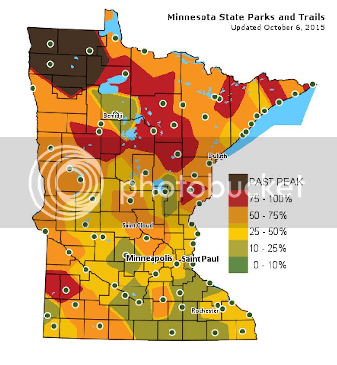
Work and family responsibilities didn't allow me to get away on a fall motorcycle trip in 2014 and I was dead set on not letting that happen again this year. I began tracking the fall color changes in early September and as the fall season progressed I started zeroing in on a narrow window of time where peak color intersects with beautiful weather. By the end of September, I could see that the leaves would be peaking in the northern part of the state in the next few days, so it was time to make my move.
Fall color map from October 5th and 6th:
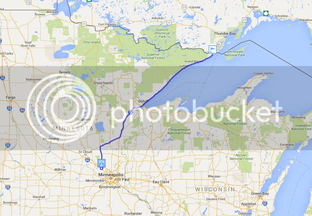
I have a narrow two-day window available where work and family commitments will permit me to go explore. I check the forecast - looks great - and make a couple minor adjustments to my calendar for the two day period. I'm planning to leave on Sunday, October 4th at the crack of dawn and will be returning home the following night. It's just a quick up and back trip, but one that will allow me to hit most of my favorite photo op locations along the North Shore. Total two day round trip length will be 630 miles from my house to Grand Portage State Park on the U.S. and Canadian border, and then back home.
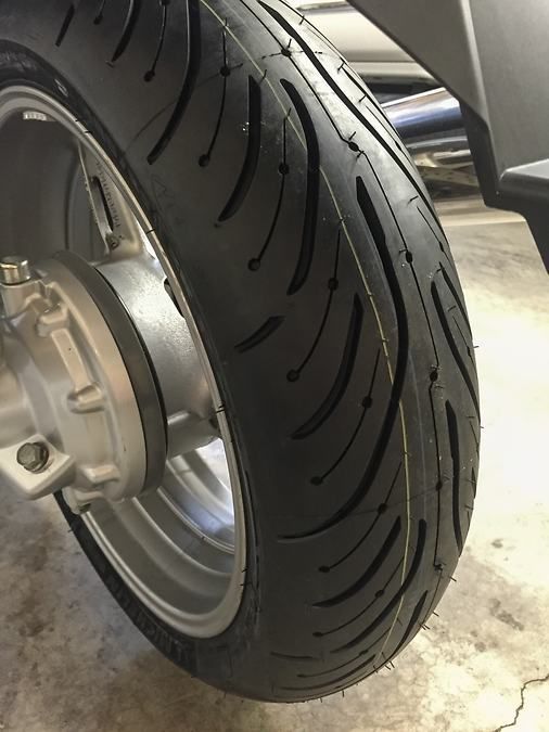
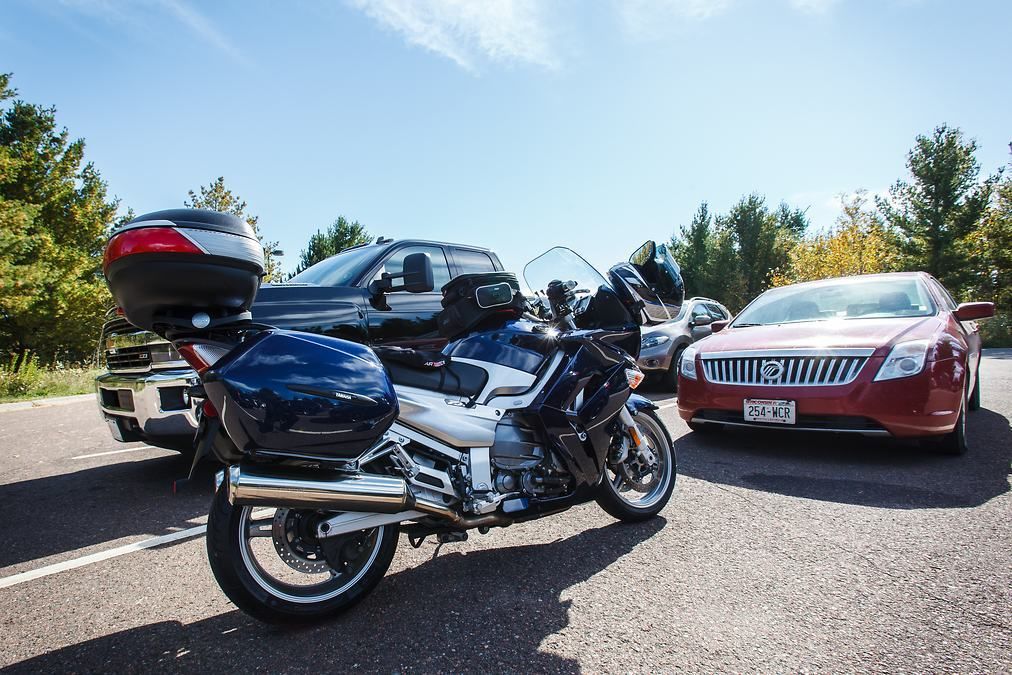
The first order of business is to address my rear tire. I have been hoping to get by on the current tire until spring, but by now I have erased all evidence of the wear bars in the center of the tire and if I return home from the trip with threads showing, my wife will not be happy. So I make plans to have a new PR4 installed by the guys at Empire Cycle in Loretto, MN. I pull the rear wheel off on Friday morning and take it to Empire Cycle at lunch that day. They have the new rubber on and balanced and I'm out the door in under 30 minutes.
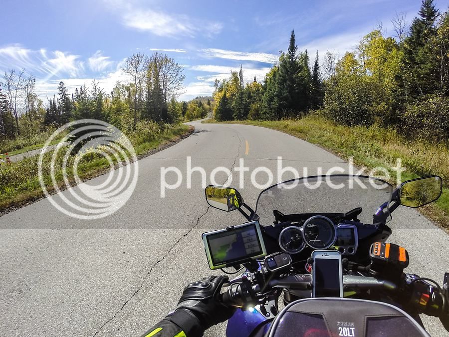
Day 1: Saint Michael, Minnesota to Grand Marais, Minnesota - 268 miles
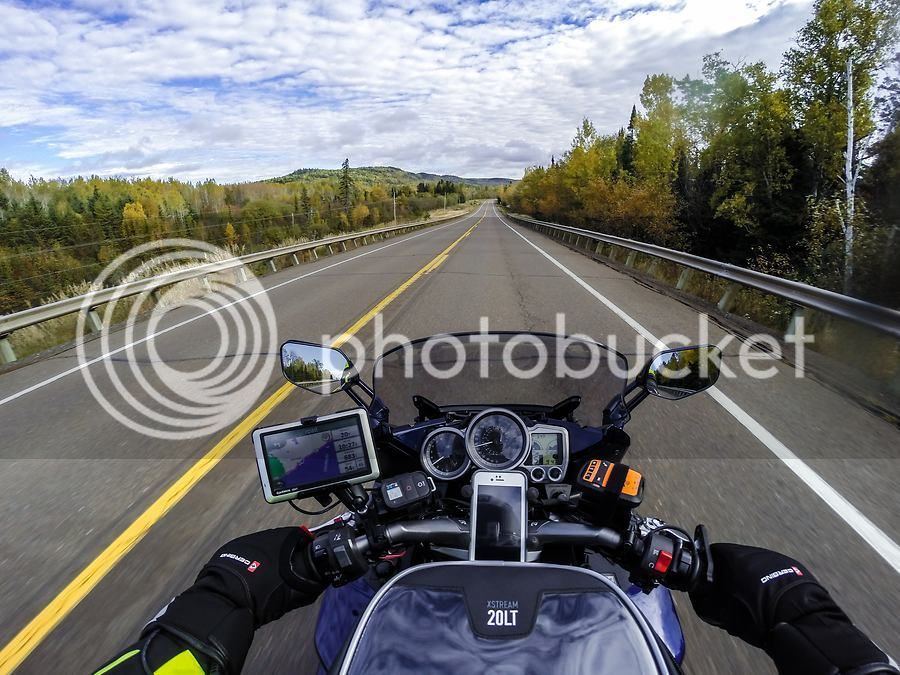
I plan to leave at first light on Sunday morning so I pack up the bike the night before. The weather at departure time on Sunday a crisp 37 degrees. I take mundane US 169 north to Milaca, MN and then cut northwest over to I-35 near Hinkley where I pick up the slab and take it north to Duluth. Traffic is super light as it typically is on Sunday morning and by 9am, the air temp has already risen to 43 degrees. The skies are blue with white wispy clouds and I can tell it's going to be a beautiful day. My Gerbing heated jacket liner and heated gloves make for comfortable and cozy riding in this weather.
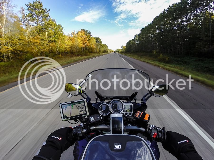
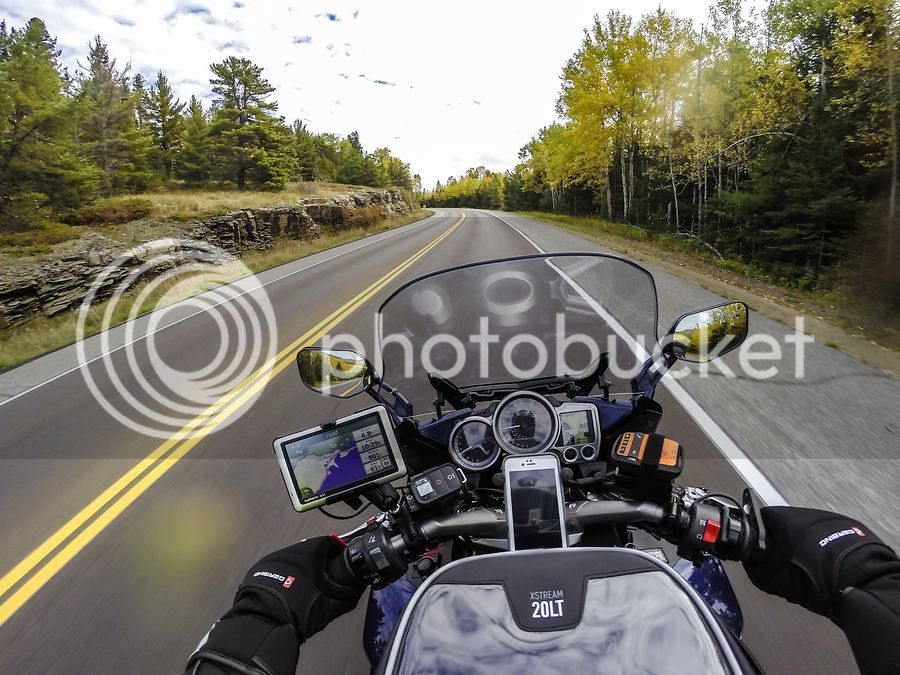
The 160 mile ride to Duluth goes quickly. Duluth is a significant Great Lakes shipping port and industrial town and is also the gateway to Lake Superior's North Shore. There are some neat sights to see and things to explore around the downtown lake walk and harbor area but I am taking this trip to see the fall color so I'm not stopping in Duluth this time; the north shore and north woods are my destination.
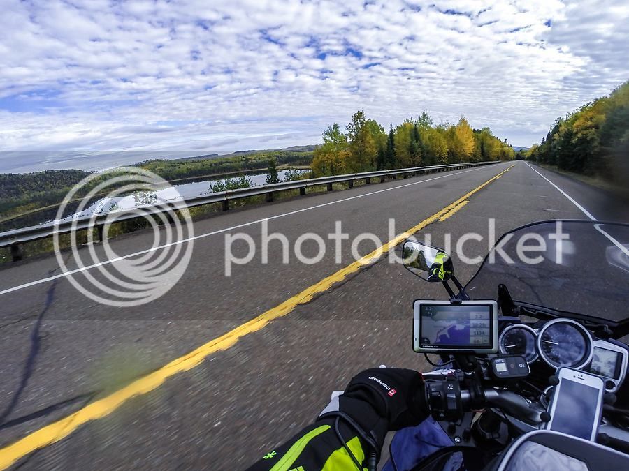
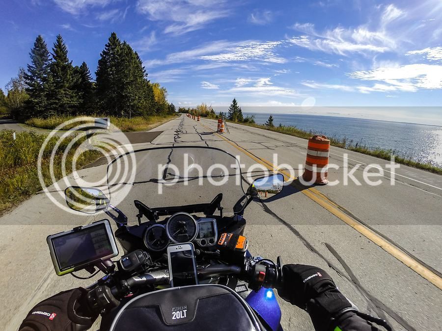
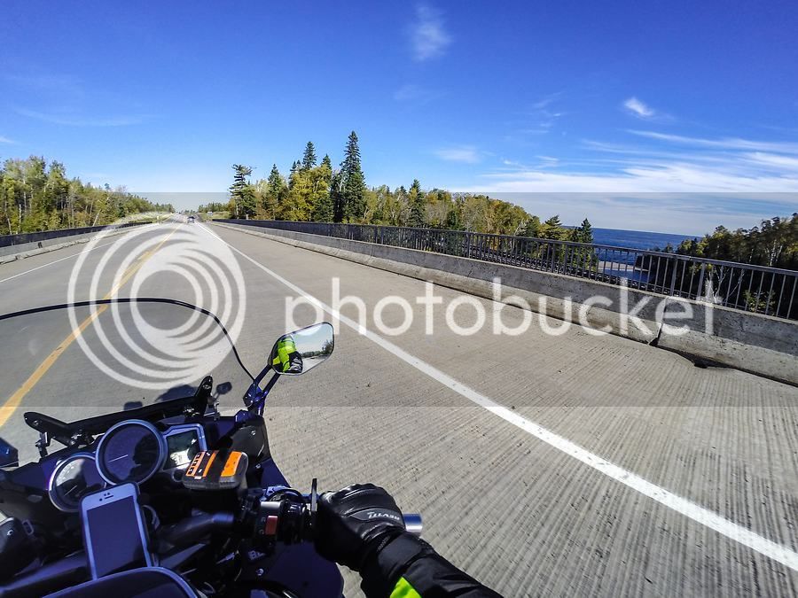
I take Scenic 61 north out of Duluth and am immediately presented with views of blue water to my right. As I ride, I feel so blessed to have the open road in front of me, the wind in my chest, the smells of the lake all around me. The largest fresh water lake in the world is a mere three hours' ride from my house and I savor it's majesty and moods.
Scenic 61 can be bypassed by a divided 4-lane highway that runs parallel to it for 20 miles. The bypass offers no views of anything, really, so I prefer to take the quaint two lane Scenic 61 which provides a near continuous view of the lake. On this day, the northbound lane of Scenic 61 is barricaded off for road work. Fortunately, even though the northbound lane is closed, it is the southbound traffic that has to detour over to the non-scenic bypass. So Scenic 61 is effectively a one-way road, for today at least, as northbound traffic is diverted onto the southbound lane.
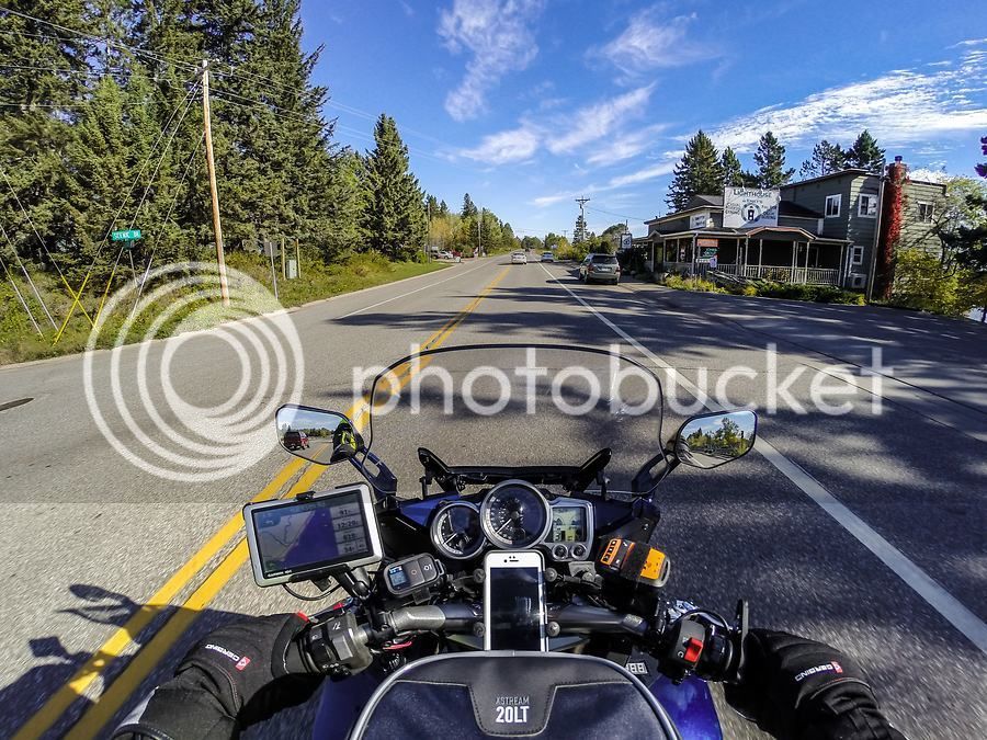
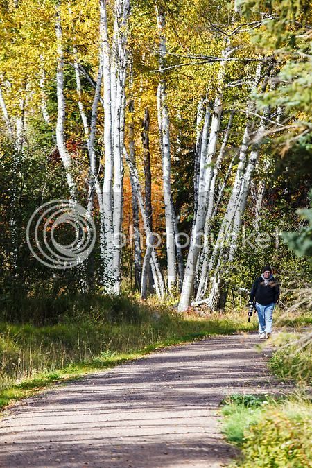
Continuing up Scenic 61, I pass through Knife River, Minnesota, one of many tiny towns along the shore of Lake Superior.
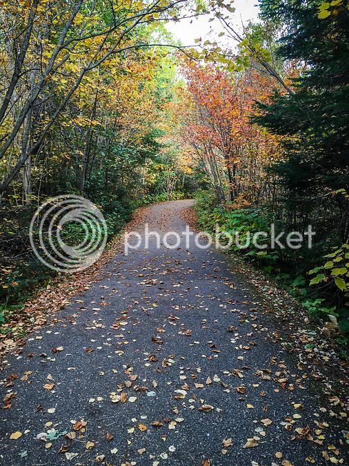
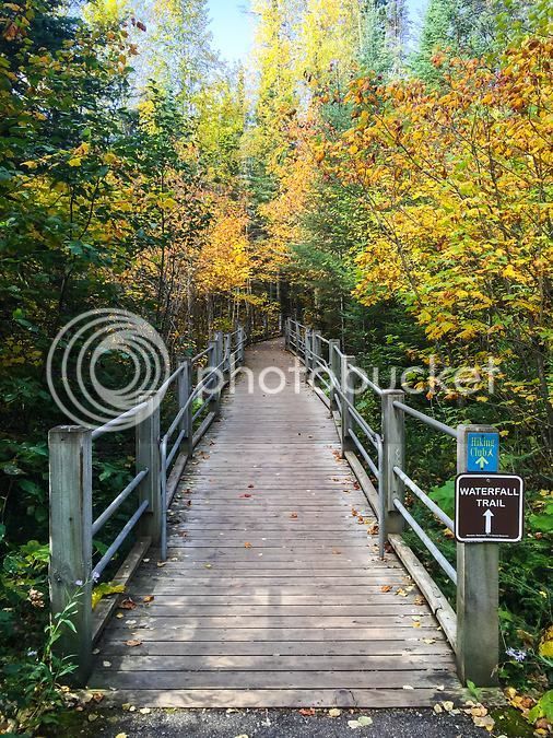
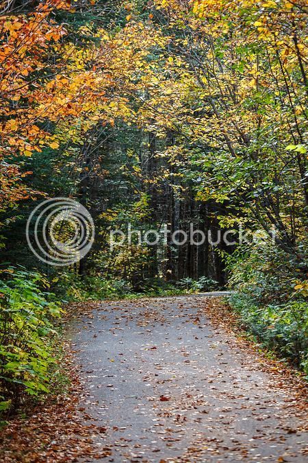
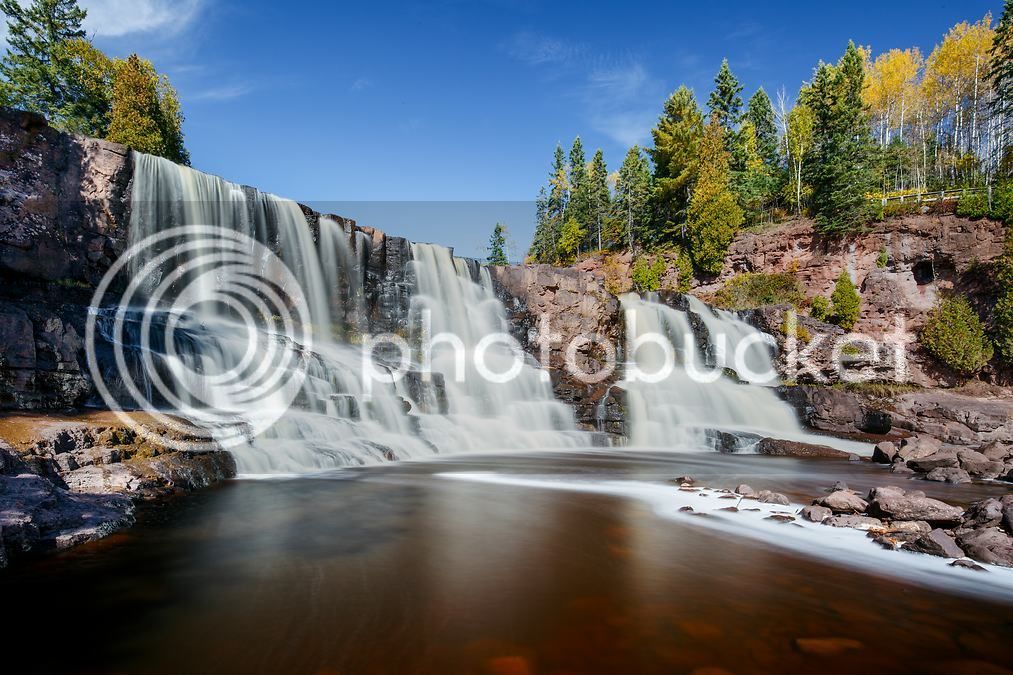
I make a quick gas stop in Two Harbors, MN. It is here that Scenic 61 and the bypass section of MN-61 merge back together, hugging the Lake Superior shoreline continuously for the next 125 miles to the Canadian border. Just north of Two Harbors lies my first stop of the trip: Gooseberry Falls State Park. I grab a parking spot and change into some more comfortable gear for hiking, flower sniffing, and photo taking. One of the most visited state parks in Minnesota, Gooseberry Falls offers very easy hiking, spectacular elevated views of Lake Superior, and a series of fantastic waterfalls along the Gooseberry River.
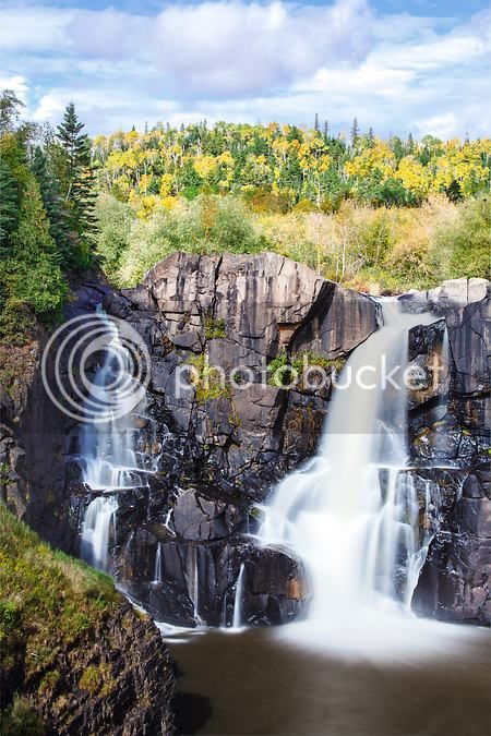
I take the paved trail from the parking lot, past the visitor's center, and down to the middle falls. I have photographed the middle falls so many times you'd think I'd be tired of it by now, but that is definitely not the case. I survey the scene looking for the right spot to shoot from. The river is flanked with cedar and spruce so fall colors are a bit absent in the immediate area of middle falls, but there are a few yellow aspens at peak color so to I work to incorporate them into the shot. I find a perspective I like, wait a bit for some of the other park visitors to exit my frame and then capture a suitable photo of the middle falls.
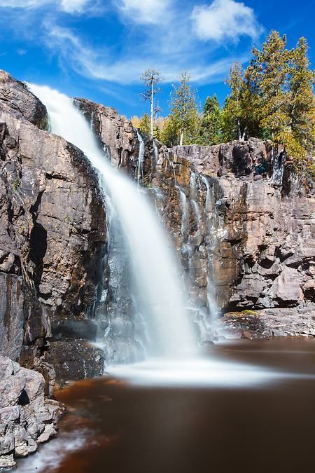
Next, I hike down the trail that runs along the Gooseberry river for a short distance and set up for a photo of the lower falls.
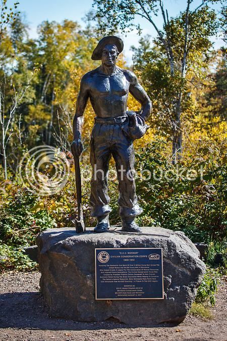
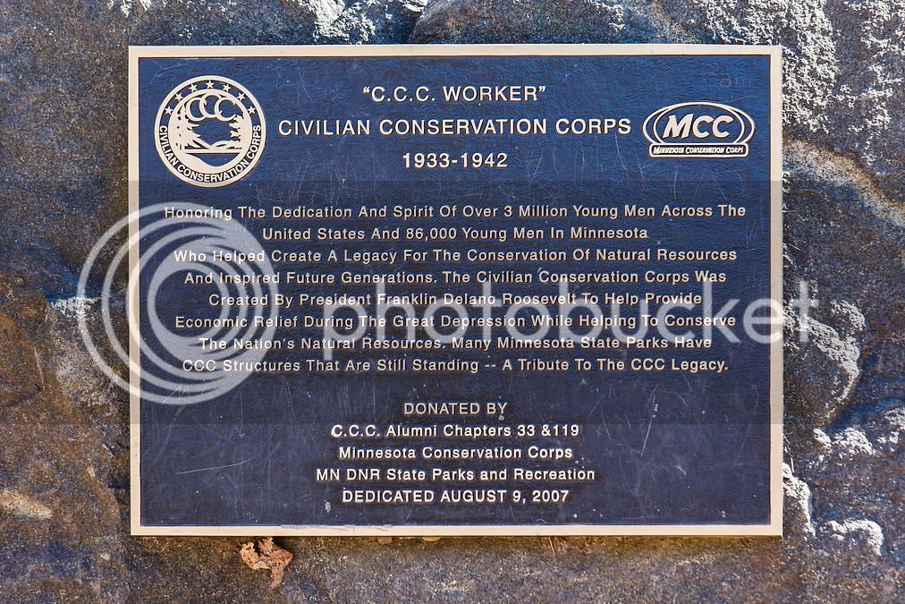
Many of the state parks in Minnesota owe their existence to the Civilian Conservation Corps that was active in the state in the 1930's and and 40's. Gooseberry has some nice info panels and this statue to commemorate the efforts of some 86,000 CCC workers who worked in Minnesota during this time:
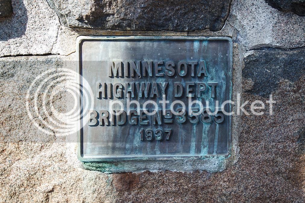
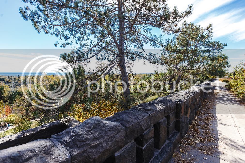
The CCC built, among other things, the retaining wall shown below. Originally, the wall's purpose was to support a parking concourse above it for cars to park on. MN-61 runs adjacent to and above the wall so back in the day, cars would pull off the road and park along the concourse. Visitors would then have access to the trails and views of the falls.
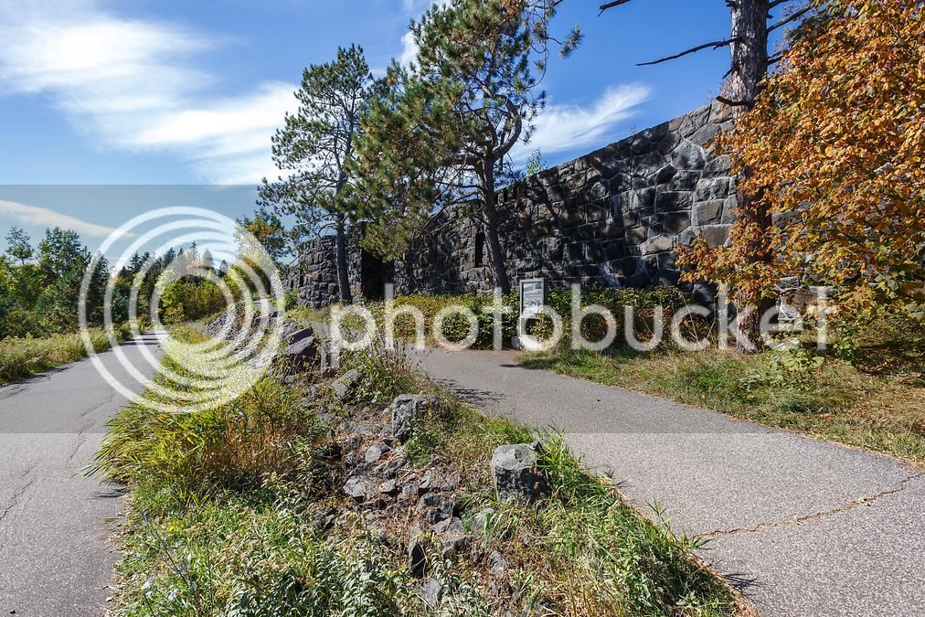
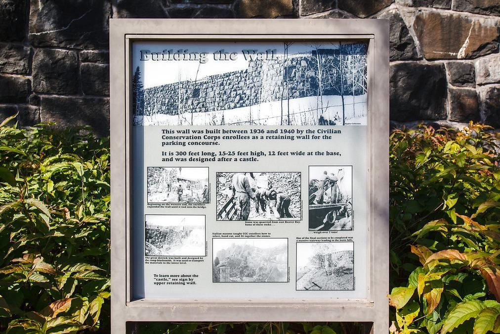
Today, the concourse is a pedestrian plaza with signs explaining the geology of the area, the engineering effort needed to construct the Gooseberry bridge, and other noteworthy facts about the Lake and CCC workers. MN-61 is still located adjacent to the wall but cars are not able to stop and park any longer. Access to Gooseberry Falls is exclusively via the state park entrance.
I spend an hour and a half or so photographing and hiking the falls area before heading back to the bike. Next stop: Split Rock Lighthouse State Park.
Split Rock Lighthouse State Park is named after Split Rock Lighthouse which is considered to be one of the most photographed and picturesque lighthouses in the U.S. Some interesting background, courtesy of Wikipedia:
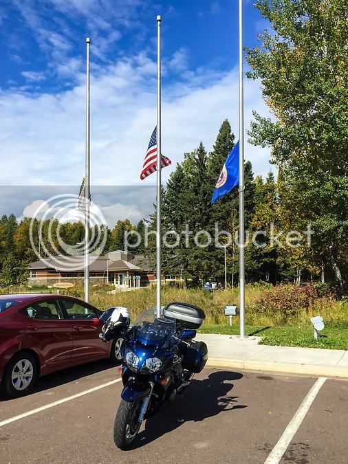
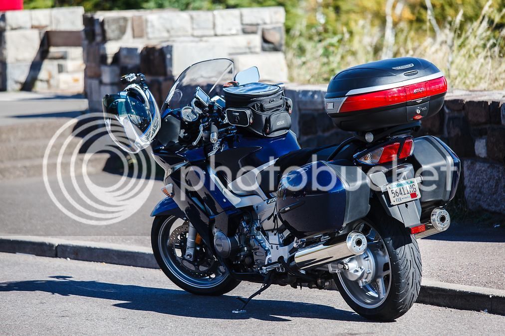
The FJR looks good at the overlook too

After photographing Split Rock Lighthouse from the overlook, I hop back on the bike and head into the park.
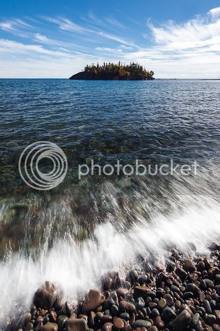
There is a large parking lot at the lighthouse where most tourists go to see the light up close and tour the museum. But a much less busy location with amazing photo ops is to the south of the lighthouse where a paved parking lot provides access to both paved and unpaved trails. From this location, the lakeshore is only 100 yards away. I follow a trail out to the rocky beach and set up to photograph Ellingson Island. Ellingson is a small island just off the shoreline and from this beach, my boys and I have tossed thousands of these rocks back into the lake on past family trips.
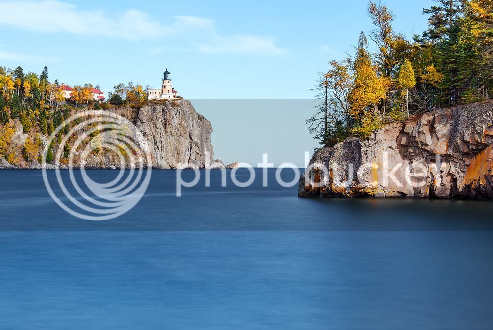
I walk about 100 yards to the south for my next photo. This is, in my opinion, the best location from which to shoot the iconic lighthouse, perched 130 feet above the lake. The tip of Ellingson Island is in the foreground on the right hand side of the frame.
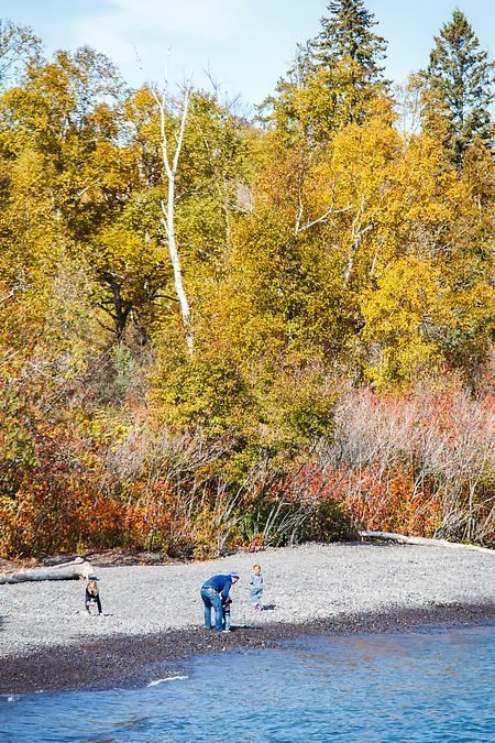
A dad and his kids were nearby playing on the rocky beach, a scene my boys and I duplicate on our family trips.
By now, it was 3pm and I still have quite a few miles left to ride, another stop to make, and a hike to take before dark. I gather up my gear and start the five minute walk back to the parking lot where I left the bike. I pass another photographer on the trail; he's headed out to the spot I had just left with plans of photographing the lighthouse as well.
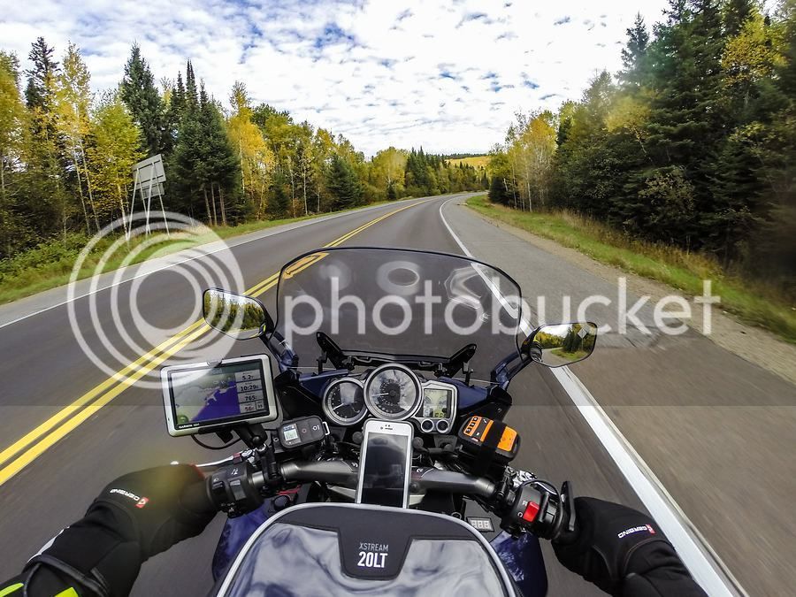
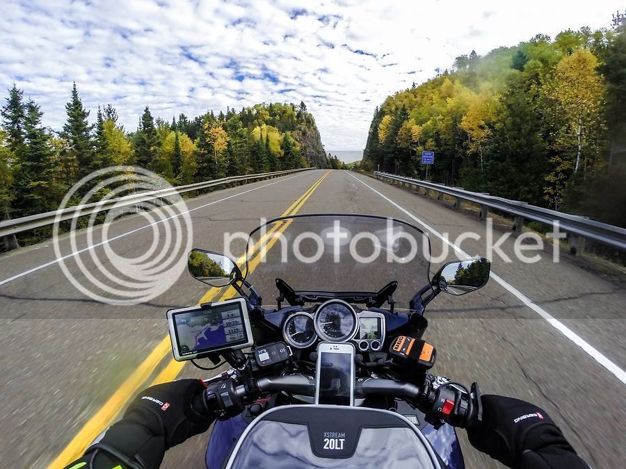
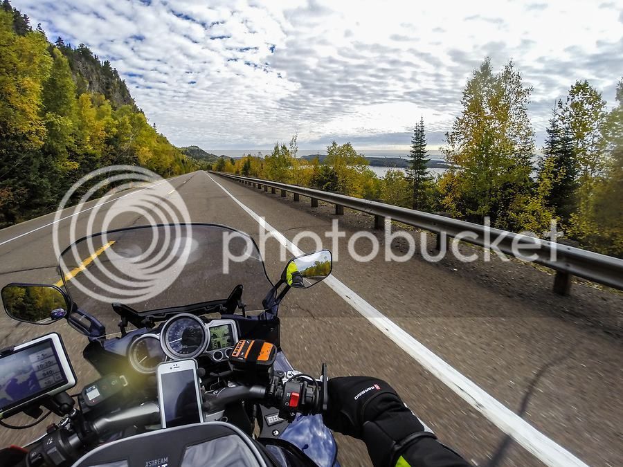
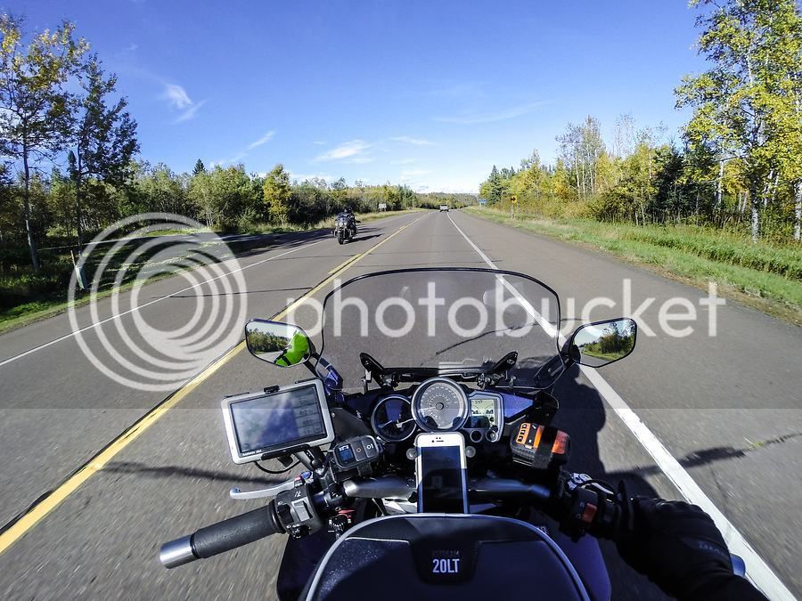
Before hopping back on the bike, I shed the mid-layer jacket I had been wearing under my Klim Latitude. I had already put the heated gloves away earlier in the day when I left Gooseberry. The daytime temps are in the mid-50's and with plenty of sunshine, it is wonderful fall riding weather. North of Split Rock on MN-61, the traffic lightens and the towns are fewer. It's a marvelous section of road that crosses a number of cascading rivers flowing into Lake Superior.
I can usually get the cruiser riders to wave back at me when I wave at them first.
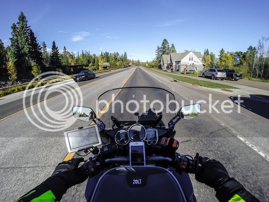
Schroeder, Minnesota
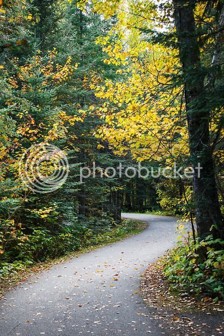
My final stop of the day for hiking and photos is Oberg Mountain near Tofte, Minnesota which is about 45 miles north of Split Rock on MN-61. I have hiked Oberg before but never in the fall so I'm really looking forward to viewing and photographing the fall colors from the top of the mountain. I had carefully planned my day and each stop so that I could reach Oberg with enough daylight left to make the hike up, hike around the summit loop trail, and capture the photos that I wanted, while still having enough daylight left to make the hike back down to the bike before dark. Oberg Mountain is in Superior National Forest and the only road in is a gravel Forest Service road. Fortunately, the 2-mile road is fairly hard packed and although it does have a few washboard sections that rattle the bike a bit more than I like, it's an easy ride.
At the end of this road is a dirt parking lot and imagine my surprise when I pull into the lot and see another FJR (2005?) parked in the distance. A man and woman are standing near the bike talking to another guy driving a pickup truck and they gave me a hard look as I ride towards them. I give the couple a big wave and a thumbs-up, assuming they were the ones on the FJR, and they waved back. Unfortunately, I only have two hours of daylight left and must get to the top of the mountain, so I don't take time to stop and chat.
I park the bike, lock up my riding jacket, pants, boots, and gloves in the hard bags, grab my camera gear and start up the trail. Round trip, the hike is only 2.3 miles. There is a nice elevation gain on the way up the mountain but it's nothing like hiking the Rockies. It's just enough to get the blood circulating good. My 5 and 7 year old boys have hiked it with us and while the pace is slower with them, they manage it just fine.
I'm carrying my camera gear in a lightweight backpack made for that purpose. I also have a carbon fiber tripod attached to the backpack so with camera, three lenses, some miscellaneous items and the tripod, my pack weighs in at about 23lbs. It's not a huge burden but what does get to be a hassle is having to stop and open the bag up and pull the camera out for a shot while I'm hiking along a trail. So I've begun using my iPhone to snap photos while on the trail and it does a fine job. The next couple of photos were taken with the iPhone as I was hiking up the mountain.

Once the trail reaches the summit, it forks and makes a loop around the top of the mountain. I had previously scouted the location I wanted to photograph from based on sun direction and time of day, so I take the left fork of the trail which is the most direct route to my location of choice. This takes me along the western edge of the mountain. There are two different spots on the summit that work well for a late day westerly shot. The lighting was perfect and exactly what I was hoping to have - long shadows for detail and low, direct light on the fall foliage for vivid colors.
After grabbing the shots I was after, I check the time and have an hour of daylight left so I continue my hike around the summit loop trail.
As the trail swings around the east side of the mountain, a jaw-dropping panoramic view of Lake Superior is served up. I sat on an overlook for a few minutes just taking in the view and gazing at the peaceful lake below. iPhone video clip of the view from the overlook:
The shadows are getting even longer now so I gather myself up and make the hike back down the mountain and reach the parking lot just as the sun was setting. Only a couple of vehicles were still there, including a Chevy Lumina with a really nice license plate frame.

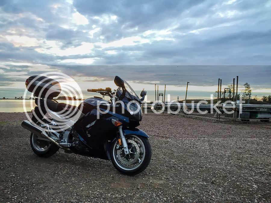
The temperature will drop quickly now that the sun has set, so I put my heated jacket liner back on. I make the short and uneventful 25 mile ride to reach the Best Western in Grand Marais, MN where I have a room booked. I arrive at 7:30pm, check in, and am pleasantly surprised with the quality of the room. I haven't stayed in many Best Westerns so I didn't have a lot to compare it to, but my room is very clean and recently updated. It's a great place to crash after a long day.
Conspicuously absent from my day so far are any meal stops. That's because there weren't any! I have been only vaguely aware throughout the day of the fact that I have not eaten since I left home at 7am. Being on the bike, enjoying the riding experience, hiking and photographing the amazing North Shore was apparently all the sustenance I needed. That is, until I reach my hotel room and am struck with a ravenous hunger. I walk over to the gas station next door and pick up a gourmet meal which I devoured back in my room.

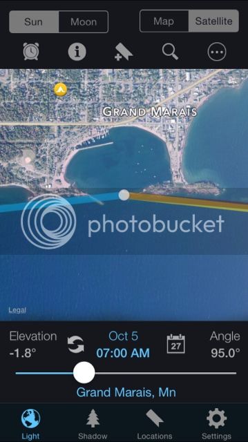
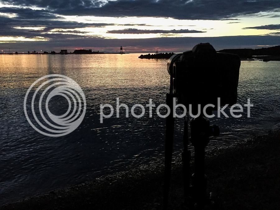
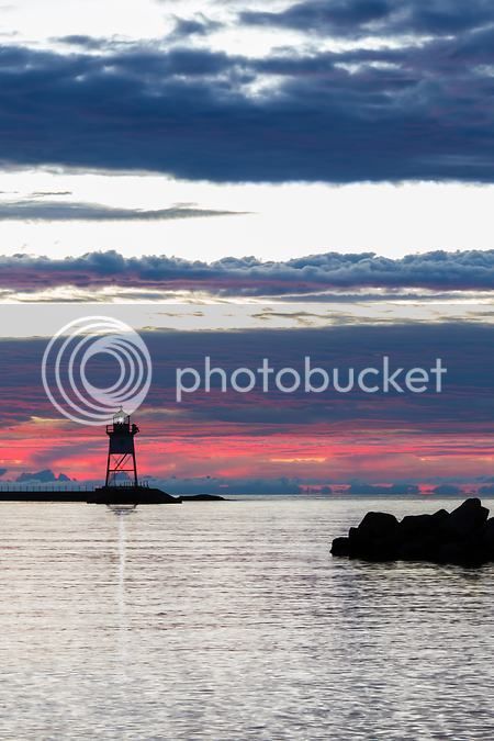
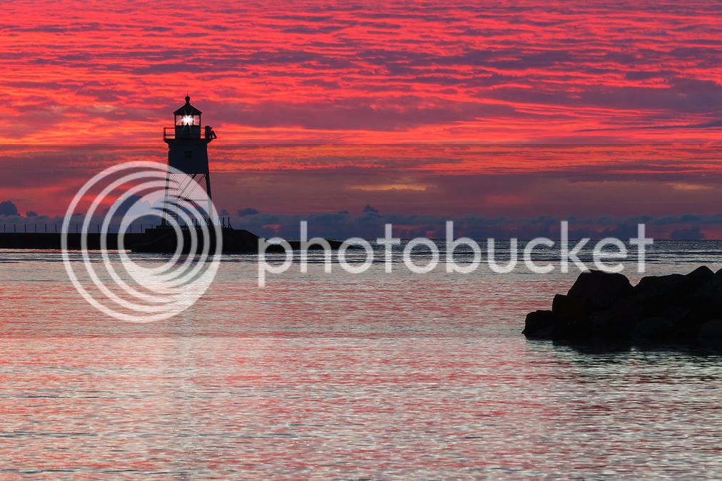
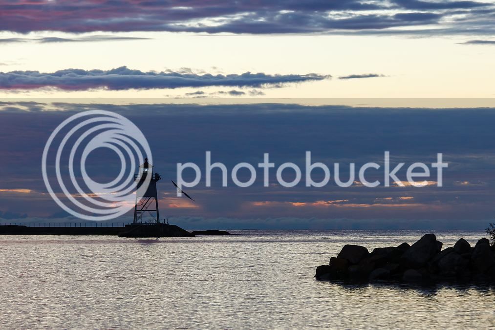
After dinner, I check email, glance at the weather forecast - tomorrow will be another nice day but with more clouds - and read some news on the iPad. Lastly, I make a call home to say goodnight to my wife (the boys were already in bed by now). Tomorrow morning will begin at 5:30am - more than an hour before sunrise. I've planned for a special photo at Grand Marais harbor and need to be set up at the harbor by 6:15am.
Coming up next: Day 2 with a Lake Superior sunrise, a morning ride to the Canadian border, another waterfall hike, and the ride home.
Work and family responsibilities didn't allow me to get away on a fall motorcycle trip in 2014 and I was dead set on not letting that happen again this year. I began tracking the fall color changes in early September and as the fall season progressed I started zeroing in on a narrow window of time where peak color intersects with beautiful weather. By the end of September, I could see that the leaves would be peaking in the northern part of the state in the next few days, so it was time to make my move.
Fall color map from October 5th and 6th:
I have a narrow two-day window available where work and family commitments will permit me to go explore. I check the forecast - looks great - and make a couple minor adjustments to my calendar for the two day period. I'm planning to leave on Sunday, October 4th at the crack of dawn and will be returning home the following night. It's just a quick up and back trip, but one that will allow me to hit most of my favorite photo op locations along the North Shore. Total two day round trip length will be 630 miles from my house to Grand Portage State Park on the U.S. and Canadian border, and then back home.
The first order of business is to address my rear tire. I have been hoping to get by on the current tire until spring, but by now I have erased all evidence of the wear bars in the center of the tire and if I return home from the trip with threads showing, my wife will not be happy. So I make plans to have a new PR4 installed by the guys at Empire Cycle in Loretto, MN. I pull the rear wheel off on Friday morning and take it to Empire Cycle at lunch that day. They have the new rubber on and balanced and I'm out the door in under 30 minutes.
Day 1: Saint Michael, Minnesota to Grand Marais, Minnesota - 268 miles
I plan to leave at first light on Sunday morning so I pack up the bike the night before. The weather at departure time on Sunday a crisp 37 degrees. I take mundane US 169 north to Milaca, MN and then cut northwest over to I-35 near Hinkley where I pick up the slab and take it north to Duluth. Traffic is super light as it typically is on Sunday morning and by 9am, the air temp has already risen to 43 degrees. The skies are blue with white wispy clouds and I can tell it's going to be a beautiful day. My Gerbing heated jacket liner and heated gloves make for comfortable and cozy riding in this weather.
The 160 mile ride to Duluth goes quickly. Duluth is a significant Great Lakes shipping port and industrial town and is also the gateway to Lake Superior's North Shore. There are some neat sights to see and things to explore around the downtown lake walk and harbor area but I am taking this trip to see the fall color so I'm not stopping in Duluth this time; the north shore and north woods are my destination.
I take Scenic 61 north out of Duluth and am immediately presented with views of blue water to my right. As I ride, I feel so blessed to have the open road in front of me, the wind in my chest, the smells of the lake all around me. The largest fresh water lake in the world is a mere three hours' ride from my house and I savor it's majesty and moods.
Scenic 61 can be bypassed by a divided 4-lane highway that runs parallel to it for 20 miles. The bypass offers no views of anything, really, so I prefer to take the quaint two lane Scenic 61 which provides a near continuous view of the lake. On this day, the northbound lane of Scenic 61 is barricaded off for road work. Fortunately, even though the northbound lane is closed, it is the southbound traffic that has to detour over to the non-scenic bypass. So Scenic 61 is effectively a one-way road, for today at least, as northbound traffic is diverted onto the southbound lane.
Continuing up Scenic 61, I pass through Knife River, Minnesota, one of many tiny towns along the shore of Lake Superior.
I make a quick gas stop in Two Harbors, MN. It is here that Scenic 61 and the bypass section of MN-61 merge back together, hugging the Lake Superior shoreline continuously for the next 125 miles to the Canadian border. Just north of Two Harbors lies my first stop of the trip: Gooseberry Falls State Park. I grab a parking spot and change into some more comfortable gear for hiking, flower sniffing, and photo taking. One of the most visited state parks in Minnesota, Gooseberry Falls offers very easy hiking, spectacular elevated views of Lake Superior, and a series of fantastic waterfalls along the Gooseberry River.
I take the paved trail from the parking lot, past the visitor's center, and down to the middle falls. I have photographed the middle falls so many times you'd think I'd be tired of it by now, but that is definitely not the case. I survey the scene looking for the right spot to shoot from. The river is flanked with cedar and spruce so fall colors are a bit absent in the immediate area of middle falls, but there are a few yellow aspens at peak color so to I work to incorporate them into the shot. I find a perspective I like, wait a bit for some of the other park visitors to exit my frame and then capture a suitable photo of the middle falls.
Next, I hike down the trail that runs along the Gooseberry river for a short distance and set up for a photo of the lower falls.
Many of the state parks in Minnesota owe their existence to the Civilian Conservation Corps that was active in the state in the 1930's and and 40's. Gooseberry has some nice info panels and this statue to commemorate the efforts of some 86,000 CCC workers who worked in Minnesota during this time:
The CCC built, among other things, the retaining wall shown below. Originally, the wall's purpose was to support a parking concourse above it for cars to park on. MN-61 runs adjacent to and above the wall so back in the day, cars would pull off the road and park along the concourse. Visitors would then have access to the trails and views of the falls.
Today, the concourse is a pedestrian plaza with signs explaining the geology of the area, the engineering effort needed to construct the Gooseberry bridge, and other noteworthy facts about the Lake and CCC workers. MN-61 is still located adjacent to the wall but cars are not able to stop and park any longer. Access to Gooseberry Falls is exclusively via the state park entrance.
I spend an hour and a half or so photographing and hiking the falls area before heading back to the bike. Next stop: Split Rock Lighthouse State Park.
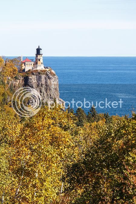
Split Rock Lighthouse State Park is named after Split Rock Lighthouse which is considered to be one of the most photographed and picturesque lighthouses in the U.S. Some interesting background, courtesy of Wikipedia:
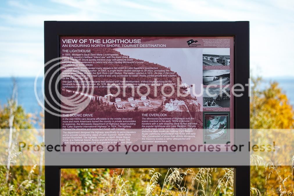
There is an awesome scenic overlook that lies just before the entrance to the state park on MN-61. From the overlook, you have a panoramic view of Lake Superior as well as a postcard view of the lighthouse which stands two thirds of a mile away. I stop at the overlook for a couple of quick photos.Split Rock Lighthouse was built in response to the great loss of ships during the famous Mataafa Storm of 1905, in which 29 ships were lost on Lake Superior. One of these shipwrecks, the Madeira, is located just north of the lighthouse.
https://en.wikipedia.org/wiki/Split_Rock_Lighthouse
It is built on a 130-foot (40 m) sheer cliff eroded by wave action from a diabase sill containing inclusions of anorthosite. The octagonal building is a steel-framed brick structure with concrete trim on a concrete foundation set into the rock of the cliff. It is topped with a large, steel lantern which features a third order, bi-valve type Fresnel lens manufactured by Barbier, Bernard and Turenne Company in Paris, France. The tower was built for a second order lens, but when construction went over budget, there was only enough funding remaining for the smaller third order lens. The lens floats on a bearing surface of liquid mercury which allows near frictionless operation. The lens is rotated by an elaborate clockwork mechanism that is powered by weights running down the center of the tower which are then reset by cranking them back to the top. When completed, the lighthouse was lit with an incandescent oil vapor lamp that burned kerosene.
https://en.wikipedia.org/wiki/Split_Rock_Lighthouse
https://en.wikipedia.org/wiki/Split_Rock_Lighthouse
At the time of its construction, there were no roads to the area and all building materials and supplies arrived by water and lifted to the top of the cliff by crane. The light was first lit on July 31, 1910. Thanks to its dramatic location, the lighthouse soon became a tourist attraction for sailors and excursion boats. So much so, that in 1924 a road (now Minnesota State Highway 61) was built to allow land access.
https://en.wikipedia.org/wiki/Split_Rock_Lighthouse
https://en.wikipedia.org/wiki/Split_Rock_Lighthouse
In 1940, the station was electrified and the lamp was replaced with a 1000 watt electric bulb, and the incandescent oil vapor lamp was moved to Au Sable Point Lighthouse in Northern Michigan. Split Rock was outfitted with a fog signal housed in a building next to the light tower. The original signal was a pair of sirens driven by two Franklin 30 hp (22 kW) gasoline-driven air compressors manufactured by Chicago Pneumatic Tool Company. In 1932 the gasoline engines were replaced with diesel engines. The steam sirens were replaced with a Type F-2-T diaphone (be-you) type signal in 1936. The station and the fog signal were electrified four years later, but was discontinued in 1961.
https://en.wikipedia.org/wiki/Split_Rock_Lighthouse
https://en.wikipedia.org/wiki/Split_Rock_Lighthouse
The light was retired in 1969 by the U. S. Coast Guard. The lighthouse is now part of the Split Rock Lighthouse State Park and is operated by the Minnesota Historical Society. The site includes the original tower and lens, the fog signal building, the oil house, and the three keepers' houses. It is restored to appear as it did in the late 1920s. The site was added to the National Register of Historic Places in 1969. Notwithstanding that the light has been retired, every November 10 the lighthouse emits a light in memory of the SS Edmund Fitzgerald which sank on that date in 1975. On June 30, 2011, the lighthouse was designated as a National Historic Landmark.
https://en.wikipedia.org/wiki/Split_Rock_Lighthouse
The FJR looks good at the overlook too
After photographing Split Rock Lighthouse from the overlook, I hop back on the bike and head into the park.
There is a large parking lot at the lighthouse where most tourists go to see the light up close and tour the museum. But a much less busy location with amazing photo ops is to the south of the lighthouse where a paved parking lot provides access to both paved and unpaved trails. From this location, the lakeshore is only 100 yards away. I follow a trail out to the rocky beach and set up to photograph Ellingson Island. Ellingson is a small island just off the shoreline and from this beach, my boys and I have tossed thousands of these rocks back into the lake on past family trips.
I walk about 100 yards to the south for my next photo. This is, in my opinion, the best location from which to shoot the iconic lighthouse, perched 130 feet above the lake. The tip of Ellingson Island is in the foreground on the right hand side of the frame.
A dad and his kids were nearby playing on the rocky beach, a scene my boys and I duplicate on our family trips.
By now, it was 3pm and I still have quite a few miles left to ride, another stop to make, and a hike to take before dark. I gather up my gear and start the five minute walk back to the parking lot where I left the bike. I pass another photographer on the trail; he's headed out to the spot I had just left with plans of photographing the lighthouse as well.
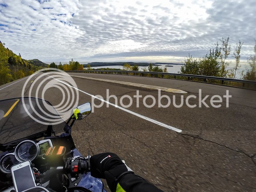
Before hopping back on the bike, I shed the mid-layer jacket I had been wearing under my Klim Latitude. I had already put the heated gloves away earlier in the day when I left Gooseberry. The daytime temps are in the mid-50's and with plenty of sunshine, it is wonderful fall riding weather. North of Split Rock on MN-61, the traffic lightens and the towns are fewer. It's a marvelous section of road that crosses a number of cascading rivers flowing into Lake Superior.
I can usually get the cruiser riders to wave back at me when I wave at them first.
Schroeder, Minnesota
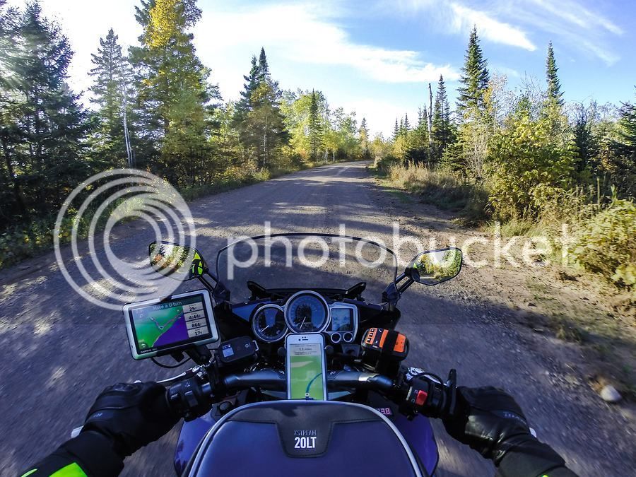
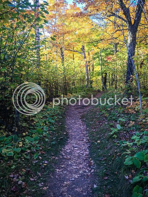
My final stop of the day for hiking and photos is Oberg Mountain near Tofte, Minnesota which is about 45 miles north of Split Rock on MN-61. I have hiked Oberg before but never in the fall so I'm really looking forward to viewing and photographing the fall colors from the top of the mountain. I had carefully planned my day and each stop so that I could reach Oberg with enough daylight left to make the hike up, hike around the summit loop trail, and capture the photos that I wanted, while still having enough daylight left to make the hike back down to the bike before dark. Oberg Mountain is in Superior National Forest and the only road in is a gravel Forest Service road. Fortunately, the 2-mile road is fairly hard packed and although it does have a few washboard sections that rattle the bike a bit more than I like, it's an easy ride.
At the end of this road is a dirt parking lot and imagine my surprise when I pull into the lot and see another FJR (2005?) parked in the distance. A man and woman are standing near the bike talking to another guy driving a pickup truck and they gave me a hard look as I ride towards them. I give the couple a big wave and a thumbs-up, assuming they were the ones on the FJR, and they waved back. Unfortunately, I only have two hours of daylight left and must get to the top of the mountain, so I don't take time to stop and chat.
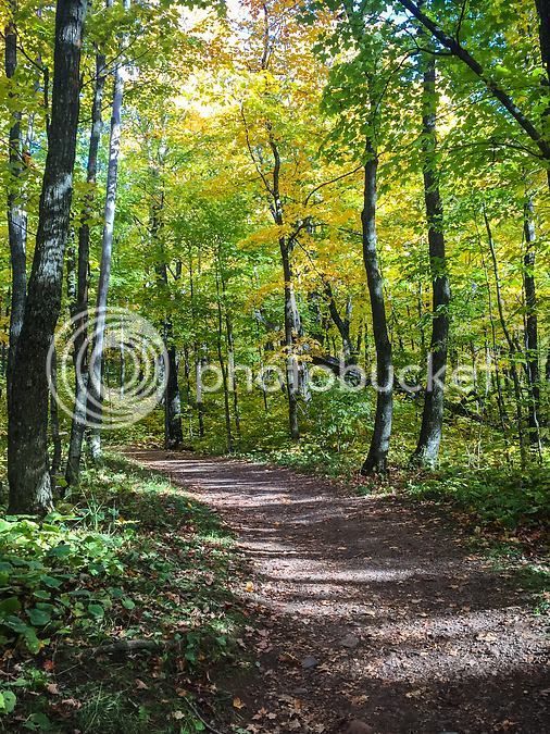
I park the bike, lock up my riding jacket, pants, boots, and gloves in the hard bags, grab my camera gear and start up the trail. Round trip, the hike is only 2.3 miles. There is a nice elevation gain on the way up the mountain but it's nothing like hiking the Rockies. It's just enough to get the blood circulating good. My 5 and 7 year old boys have hiked it with us and while the pace is slower with them, they manage it just fine.
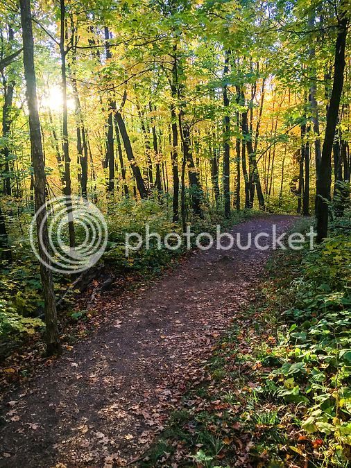
I'm carrying my camera gear in a lightweight backpack made for that purpose. I also have a carbon fiber tripod attached to the backpack so with camera, three lenses, some miscellaneous items and the tripod, my pack weighs in at about 23lbs. It's not a huge burden but what does get to be a hassle is having to stop and open the bag up and pull the camera out for a shot while I'm hiking along a trail. So I've begun using my iPhone to snap photos while on the trail and it does a fine job. The next couple of photos were taken with the iPhone as I was hiking up the mountain.
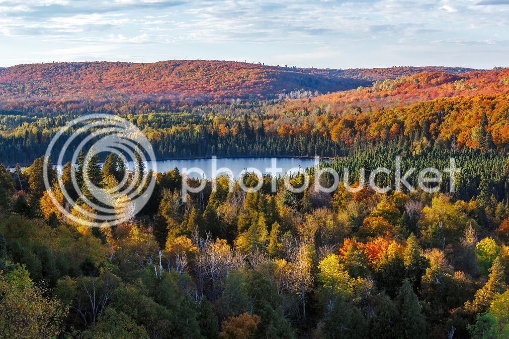
Once the trail reaches the summit, it forks and makes a loop around the top of the mountain. I had previously scouted the location I wanted to photograph from based on sun direction and time of day, so I take the left fork of the trail which is the most direct route to my location of choice. This takes me along the western edge of the mountain. There are two different spots on the summit that work well for a late day westerly shot. The lighting was perfect and exactly what I was hoping to have - long shadows for detail and low, direct light on the fall foliage for vivid colors.
After grabbing the shots I was after, I check the time and have an hour of daylight left so I continue my hike around the summit loop trail.
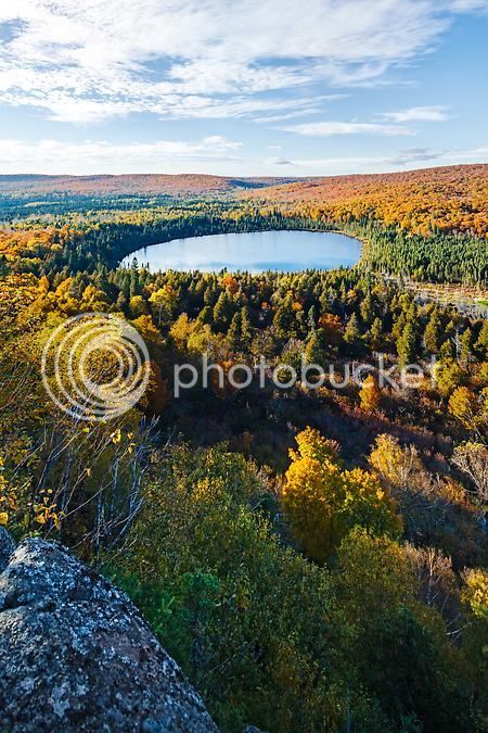
As the trail swings around the east side of the mountain, a jaw-dropping panoramic view of Lake Superior is served up. I sat on an overlook for a few minutes just taking in the view and gazing at the peaceful lake below. iPhone video clip of the view from the overlook:
The shadows are getting even longer now so I gather myself up and make the hike back down the mountain and reach the parking lot just as the sun was setting. Only a couple of vehicles were still there, including a Chevy Lumina with a really nice license plate frame.
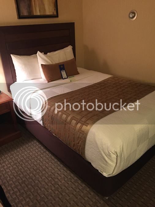
The temperature will drop quickly now that the sun has set, so I put my heated jacket liner back on. I make the short and uneventful 25 mile ride to reach the Best Western in Grand Marais, MN where I have a room booked. I arrive at 7:30pm, check in, and am pleasantly surprised with the quality of the room. I haven't stayed in many Best Westerns so I didn't have a lot to compare it to, but my room is very clean and recently updated. It's a great place to crash after a long day.
Conspicuously absent from my day so far are any meal stops. That's because there weren't any! I have been only vaguely aware throughout the day of the fact that I have not eaten since I left home at 7am. Being on the bike, enjoying the riding experience, hiking and photographing the amazing North Shore was apparently all the sustenance I needed. That is, until I reach my hotel room and am struck with a ravenous hunger. I walk over to the gas station next door and pick up a gourmet meal which I devoured back in my room.
After dinner, I check email, glance at the weather forecast - tomorrow will be another nice day but with more clouds - and read some news on the iPad. Lastly, I make a call home to say goodnight to my wife (the boys were already in bed by now). Tomorrow morning will begin at 5:30am - more than an hour before sunrise. I've planned for a special photo at Grand Marais harbor and need to be set up at the harbor by 6:15am.
Coming up next: Day 2 with a Lake Superior sunrise, a morning ride to the Canadian border, another waterfall hike, and the ride home.
Last edited by a moderator: