


sapest
Well-known member
[with apologies to James Cagney]
Cape Flattery is the northwesternmost point in the contiguous USA. And in my backyard. Lets go!
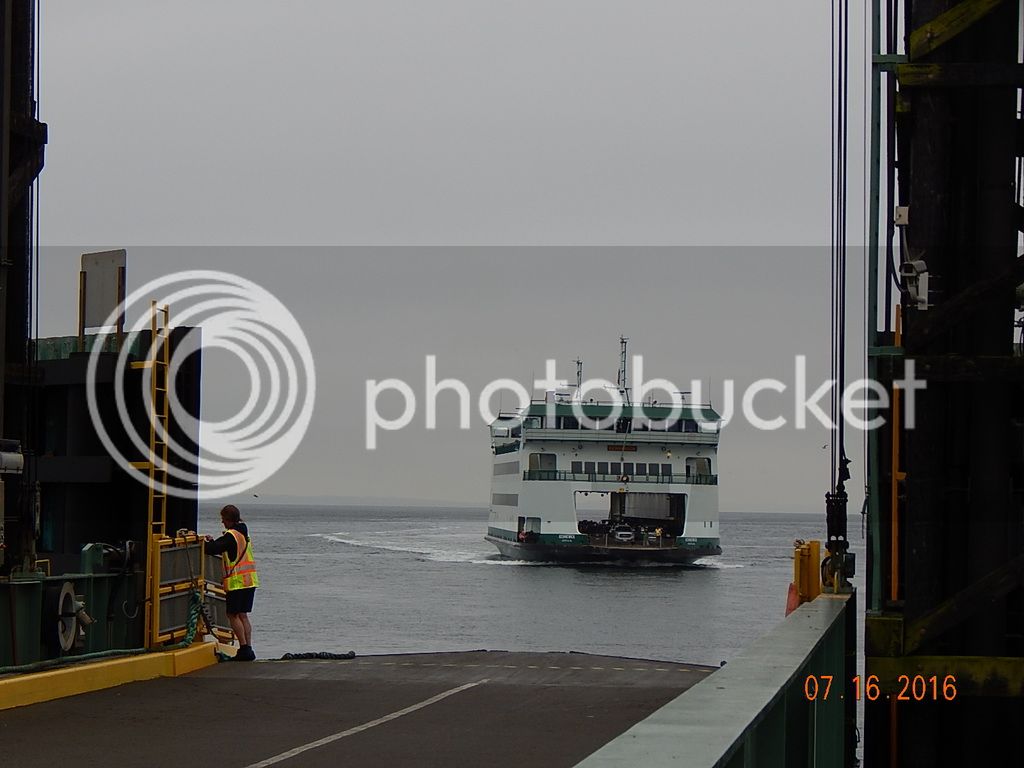
Sat morning, thru the border, south on I-5, Highway 20, Deception Pass bridge,Whidbey Island (love those planes @ the NAS entrance) to the Coupeville ferry terminal. Boarded the Kenniwick for a $6.10 journey to Port Townsend.
Cruised by Fat Smitty's, worth a photo stop, but not for food.(then I forgot to take a photo, doh!) Still on State 20, south onto the 101, thru Brinnon, and down the west side of the Hood Canal. (Destination Highways 22)
Twisty and scenic bits here and there, and most definitely in PNW redneck territory.
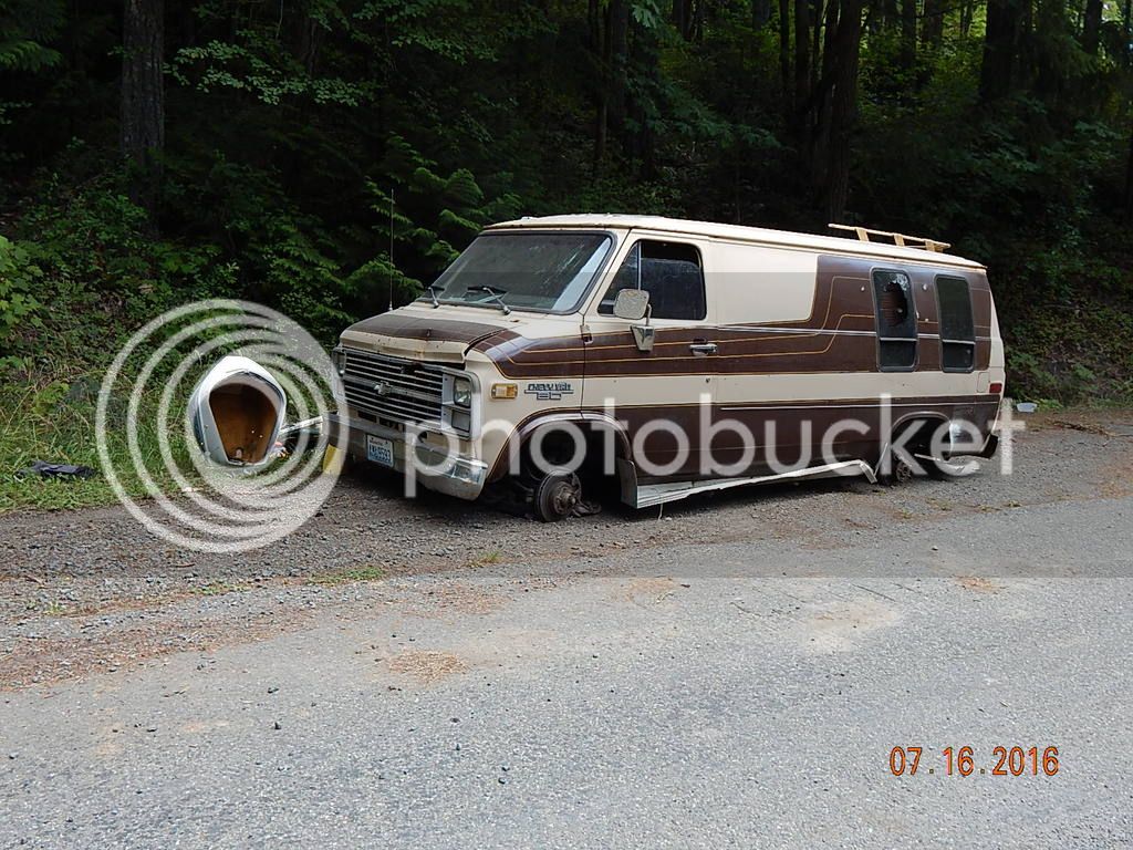
This is glamping 'Brinnon style'.
Potlatch State Park to get rid of some coffee, and at Kamilche, onto 108 west to catch State 8. More twisty bits here.
Into Aberdeen, for lunch @ Duffys, and the Star Wars shop.
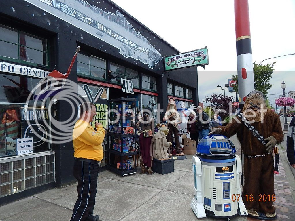
I counted 17 Millenium Falcons for sale, & I wasn't looking that hard. Worth a visit, where else can you purchase a "Death Star" waffle maker? (OK, maybe on Amazon)
Going north now on the 101, passing thru Humptulips, and a personal fave - Humptulips Dyke Rd. One theory - Humptulips comes from a Native American term meaning "hard to pole" (I know, let the jokes begin) as in poling down the river in a canoe. Not encountering much traffic at all, and very little road construction - bonus!
Passing thru Amanda Park and the Quinault Rain Forest - home to the Valley of the Giants. 6 champion (largest living example) species of conifer trees. Explored them last time, not stopping this time. 10 FEET of rainfall a year grows big trees. Note there is 24hr self serve gas here, handy to know where there is gas on this side of the Olympic Penn. Gas station at Queets and then home for the night at Kalaloch Lodge.
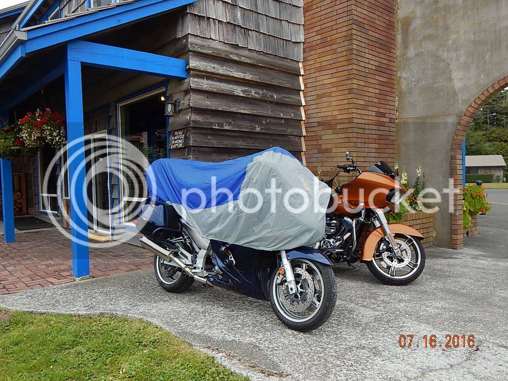
Bikes tucked in, private parking for two.

Looking north up the beach to LaPush.
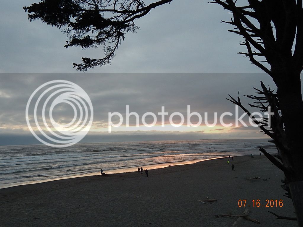
Sunset. Beach fires to follow.
<sidebar>
While the lodge is nice, I would not stay there again. Its just too spendy, rooms and food. (& no WiFi/internet) I suggest either the motel at Amanda Park, or one of the motels in Forks. Either one is close enough to Neah Bay to make the next day travel workable.
<end>
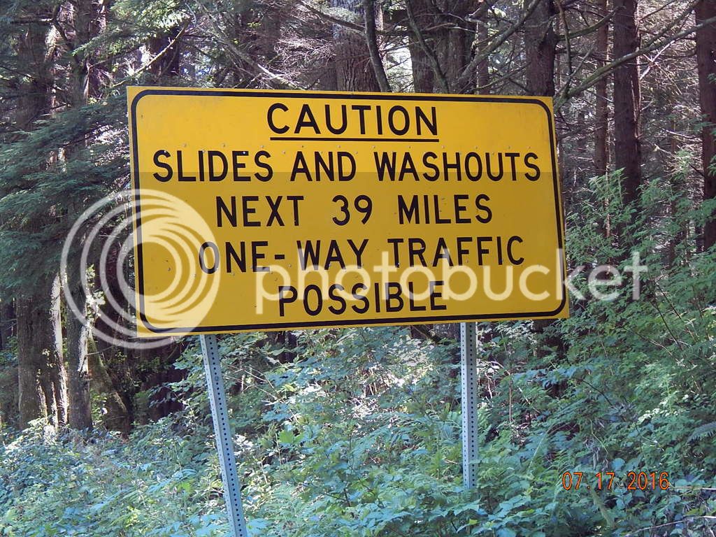
Next day starts on DH20, Highway 101 thru Forks to Sappho. Gas available at both locations. Pavement is in pretty good condition, some nice sweepers and twisty bits. Past Forks is the cut off to LaPush, if you have the time, its worth exploring. At Sappho, onto Highway 113, DH10, along with Highway 112. Major fun here, no traffic, decent roadbed. You really do not want to wad things up, you are in the wilderness, and help is a long way off.
Clallum Bay and Sekiu stare at each other across Clallum Bay, not much to see in either town, there is a nice view stop at the top of the hill just past Sekiu. The water is the same blue as my bike. Vancouver Island (Canada) is right there, about 15 miles across the Juan De Fuca Straight.
Still on Highway 112 (now DH49).
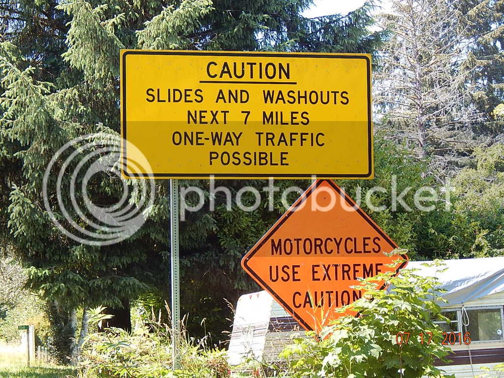
Here's a hint about the road conditions. Not a mile later, a washout, and half the road is gone for about 100 yards.
This road is very twisty, in very bad condition and the locals are known for passing on blind curves. Take your time and enjoy the view.
Arriving at Neah Bay; first stop is the Museum, to purchase permits ($10) to park at the trailhead. The staff advise that motorcycles get a pass from those that monitor the parking. This is the place to use the restroom. They are the cleanest in a 100 mile radius.
<Full disclosure>
The Makah Reservation is drug and alcohol free. No adult beverages served in restaurants. You get a warning when you enter the reserve.
<end>
Another warning - do not speed thru 'downtown' Neah Bay. Speed limit is 25 mph. Rumour has it that the band can pay for two tricked out F-250's every yr just from speeding fines.
Its about 7.5 miles from town out to the trailhead parking lot. This is, without a doubt, the best pavement in the area. Those $10 permits are being spent well. Have fun on this nice twisty road. There is one spot with a break in the pavement. That's it.
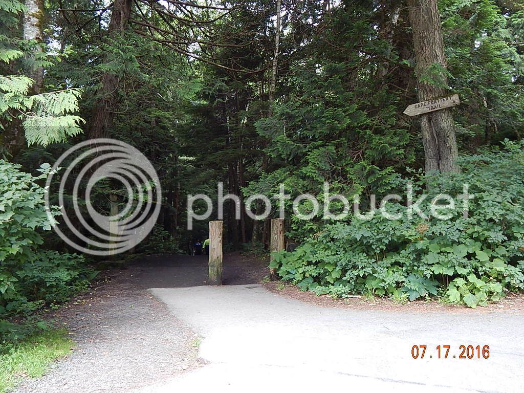
The trailhead. You do not want to use the restrooms at the parking lot. You have been warned.
The trail is about 3/4 of a mile, its all downhill on the way out (200' elevation change) some on dirt, some on raised boardwalks. You can rent walking sticks if need be. Watch for mud, wet wood, and while you are watching your feet, look up once in while so you don't take a shot to the head from a tree limb.
There are two or three side paths to viewpoints, check them all out, but you are not done till you hit the 3/4 step ladder up to the last platform.
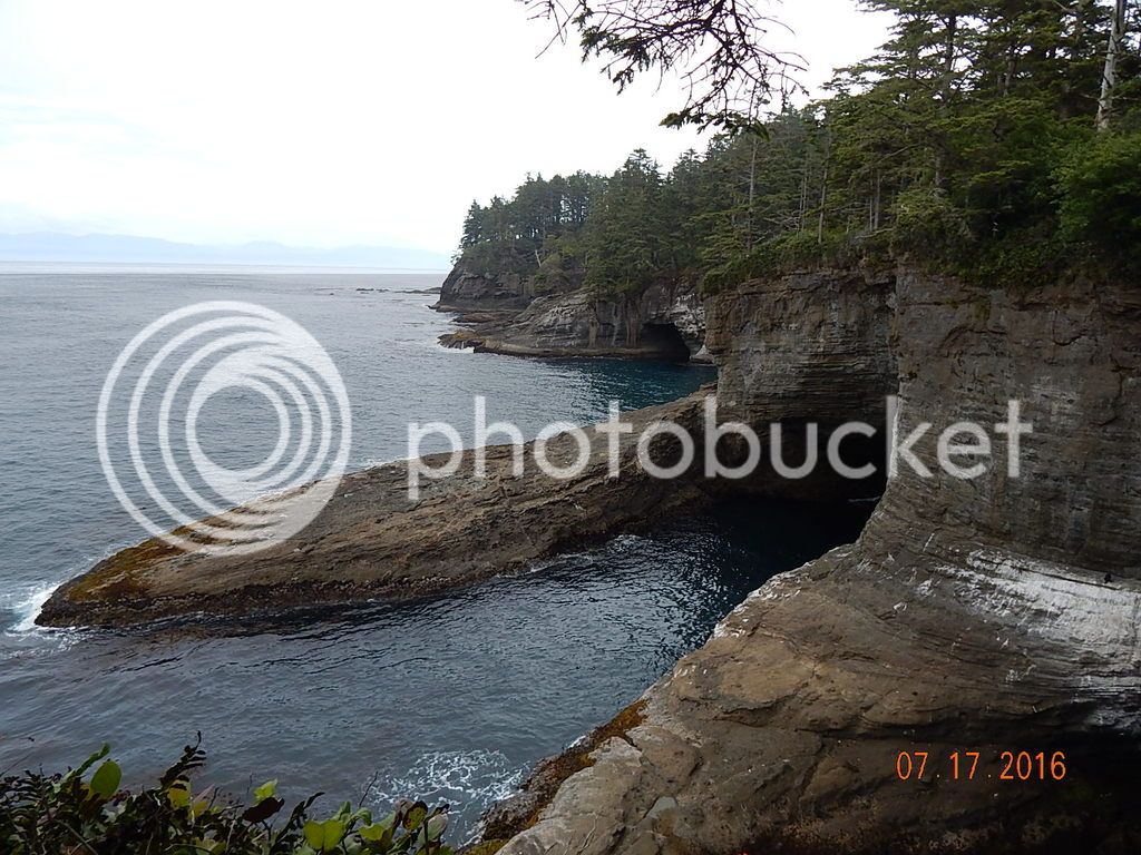
This is the edge of the world.
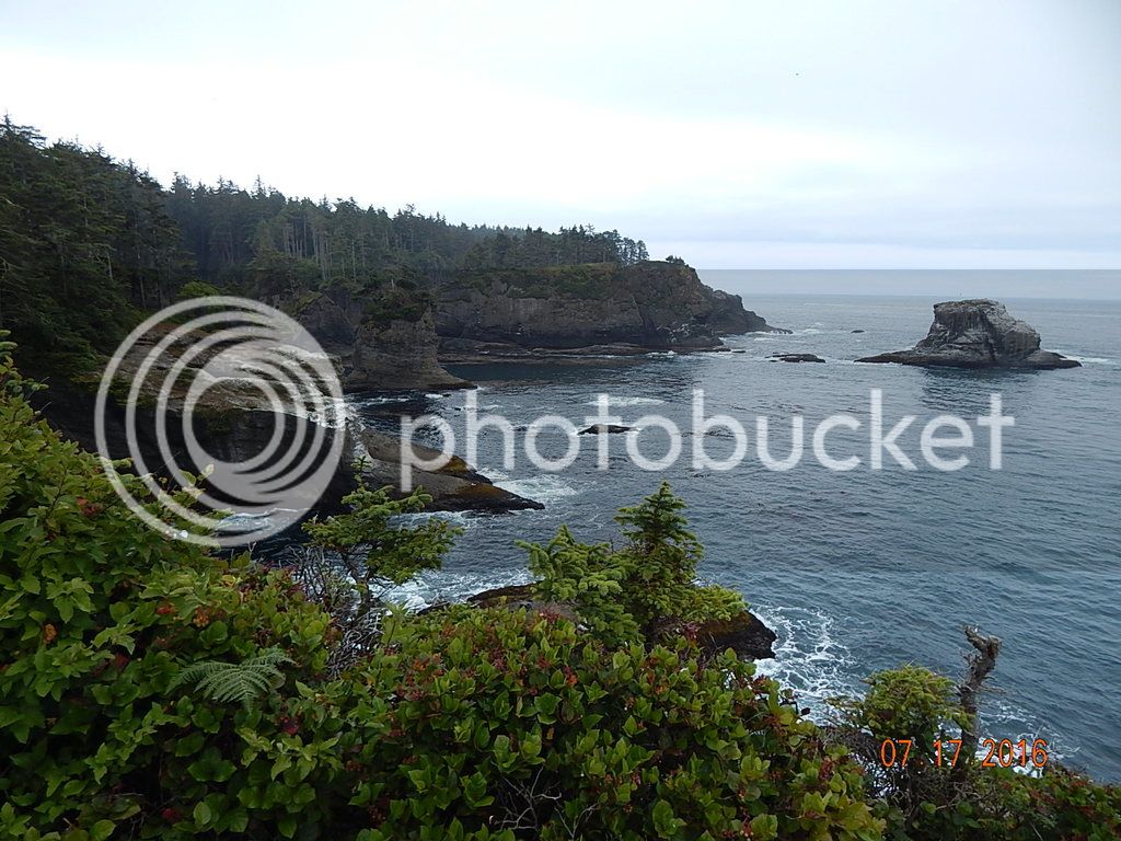
Looking south, nothing between you and the Antarctic shoreline.
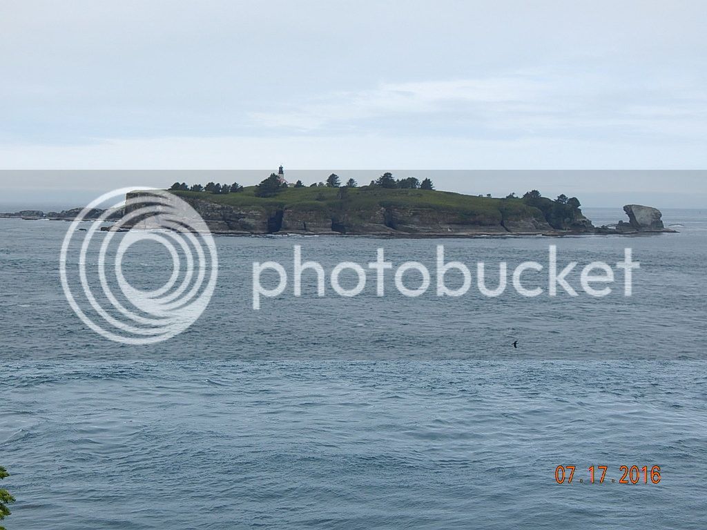
Tatoosh Island, then northern Japan.
Looking north, Vancouver Island (Port Renfrew, start of the West Coast Trail)
The waves pound the rocks, the wind blows, birds everywhere. Note the white 'painted' rocks. No sea lions this time.
Time to go, back up the trail to the parking lot. The road back to Neah Bay is just a much fun in this direction.
If you can stand it, here are 7 minutes of the trip back.
(cant get linky to work, will try posting link another time)
On the way back, more warnings to heed.
Back in Neah Bay, lunch at the Warmhouse. Its OK, the best feature is that they are open (mostly) as their posted hours indicate.
Past Clallum Bay there are two choices to finish the circle; along the coast - Highway 112 (DH28) - or inland, around Lake Crescent.(HD15) I like both, inland would be my choice if forced to pick one.
Either way, you end up in Port Angeles. If you have the time, be sure to make the trip to Hurricane Ridge. 20 miles each way. Then back to Port Townsend and the ferry to Coupeville.
<Ferry hints>
Do make an online reservation. The reservation is free as long as you travel that day. (even if you get on a different sailing and miss your reservation) $4 is the no show fee. Having said that, I have never seen a motorcycle be refused boarding. Do not wait in line, if there is one, lane split up to the gates. I find it easier to park to the side of the gate and pay at the window off the bike, unless the ferry is leaving in the next 2 minutes. Pay for both ways on the way over, you will get a coupon, not a reservation, for the return, saves having to fumble for $$.
<end>
About 450 easy miles over 2 days. Not a hint of rain, big bonus in the PNW.
-Steve
Cape Flattery is the northwesternmost point in the contiguous USA. And in my backyard. Lets go!
Sat morning, thru the border, south on I-5, Highway 20, Deception Pass bridge,Whidbey Island (love those planes @ the NAS entrance) to the Coupeville ferry terminal. Boarded the Kenniwick for a $6.10 journey to Port Townsend.

Cruised by Fat Smitty's, worth a photo stop, but not for food.(then I forgot to take a photo, doh!) Still on State 20, south onto the 101, thru Brinnon, and down the west side of the Hood Canal. (Destination Highways 22)
Twisty and scenic bits here and there, and most definitely in PNW redneck territory.

This is glamping 'Brinnon style'.
Potlatch State Park to get rid of some coffee, and at Kamilche, onto 108 west to catch State 8. More twisty bits here.
Into Aberdeen, for lunch @ Duffys, and the Star Wars shop.

I counted 17 Millenium Falcons for sale, & I wasn't looking that hard. Worth a visit, where else can you purchase a "Death Star" waffle maker? (OK, maybe on Amazon)
Going north now on the 101, passing thru Humptulips, and a personal fave - Humptulips Dyke Rd. One theory - Humptulips comes from a Native American term meaning "hard to pole" (I know, let the jokes begin) as in poling down the river in a canoe. Not encountering much traffic at all, and very little road construction - bonus!
Passing thru Amanda Park and the Quinault Rain Forest - home to the Valley of the Giants. 6 champion (largest living example) species of conifer trees. Explored them last time, not stopping this time. 10 FEET of rainfall a year grows big trees. Note there is 24hr self serve gas here, handy to know where there is gas on this side of the Olympic Penn. Gas station at Queets and then home for the night at Kalaloch Lodge.

Bikes tucked in, private parking for two.

Looking north up the beach to LaPush.

Sunset. Beach fires to follow.
<sidebar>
While the lodge is nice, I would not stay there again. Its just too spendy, rooms and food. (& no WiFi/internet) I suggest either the motel at Amanda Park, or one of the motels in Forks. Either one is close enough to Neah Bay to make the next day travel workable.
<end>
Next day starts on DH20, Highway 101 thru Forks to Sappho. Gas available at both locations. Pavement is in pretty good condition, some nice sweepers and twisty bits. Past Forks is the cut off to LaPush, if you have the time, its worth exploring. At Sappho, onto Highway 113, DH10, along with Highway 112. Major fun here, no traffic, decent roadbed. You really do not want to wad things up, you are in the wilderness, and help is a long way off.
Clallum Bay and Sekiu stare at each other across Clallum Bay, not much to see in either town, there is a nice view stop at the top of the hill just past Sekiu. The water is the same blue as my bike. Vancouver Island (Canada) is right there, about 15 miles across the Juan De Fuca Straight.
Still on Highway 112 (now DH49).

Here's a hint about the road conditions. Not a mile later, a washout, and half the road is gone for about 100 yards.
This road is very twisty, in very bad condition and the locals are known for passing on blind curves. Take your time and enjoy the view.
Arriving at Neah Bay; first stop is the Museum, to purchase permits ($10) to park at the trailhead. The staff advise that motorcycles get a pass from those that monitor the parking. This is the place to use the restroom. They are the cleanest in a 100 mile radius.
<Full disclosure>
The Makah Reservation is drug and alcohol free. No adult beverages served in restaurants. You get a warning when you enter the reserve.
<end>
Another warning - do not speed thru 'downtown' Neah Bay. Speed limit is 25 mph. Rumour has it that the band can pay for two tricked out F-250's every yr just from speeding fines.
Its about 7.5 miles from town out to the trailhead parking lot. This is, without a doubt, the best pavement in the area. Those $10 permits are being spent well. Have fun on this nice twisty road. There is one spot with a break in the pavement. That's it.

The trailhead. You do not want to use the restrooms at the parking lot. You have been warned.
The trail is about 3/4 of a mile, its all downhill on the way out (200' elevation change) some on dirt, some on raised boardwalks. You can rent walking sticks if need be. Watch for mud, wet wood, and while you are watching your feet, look up once in while so you don't take a shot to the head from a tree limb.
There are two or three side paths to viewpoints, check them all out, but you are not done till you hit the 3/4 step ladder up to the last platform.
This is the edge of the world.

Looking south, nothing between you and the Antarctic shoreline.

Tatoosh Island, then northern Japan.

Looking north, Vancouver Island (Port Renfrew, start of the West Coast Trail)
The waves pound the rocks, the wind blows, birds everywhere. Note the white 'painted' rocks. No sea lions this time.
Time to go, back up the trail to the parking lot. The road back to Neah Bay is just a much fun in this direction.
If you can stand it, here are 7 minutes of the trip back.
(cant get linky to work, will try posting link another time)
On the way back, more warnings to heed.

Back in Neah Bay, lunch at the Warmhouse. Its OK, the best feature is that they are open (mostly) as their posted hours indicate.
Past Clallum Bay there are two choices to finish the circle; along the coast - Highway 112 (DH28) - or inland, around Lake Crescent.(HD15) I like both, inland would be my choice if forced to pick one.
Either way, you end up in Port Angeles. If you have the time, be sure to make the trip to Hurricane Ridge. 20 miles each way. Then back to Port Townsend and the ferry to Coupeville.
<Ferry hints>
Do make an online reservation. The reservation is free as long as you travel that day. (even if you get on a different sailing and miss your reservation) $4 is the no show fee. Having said that, I have never seen a motorcycle be refused boarding. Do not wait in line, if there is one, lane split up to the gates. I find it easier to park to the side of the gate and pay at the window off the bike, unless the ferry is leaving in the next 2 minutes. Pay for both ways on the way over, you will get a coupon, not a reservation, for the return, saves having to fumble for $$.
<end>
About 450 easy miles over 2 days. Not a hint of rain, big bonus in the PNW.
-Steve
Last edited by a moderator:
