


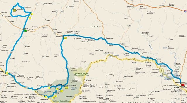
Here's a story about a trip that I finished just over four months ago. It started on Oct 30 and ended on Nov 11. Normally I would try to get something posted much sooner, but I've been so busy with work and other projects recently that I just haven't been able to get on the forum for quite some time. And I'm really lazy. I have a whole new level of respect for FJRfarrier who posted her last trip report on a day-by-day basis while still out on the trip. I could never pull that off! Better late than never, I suppose, so here it goes:
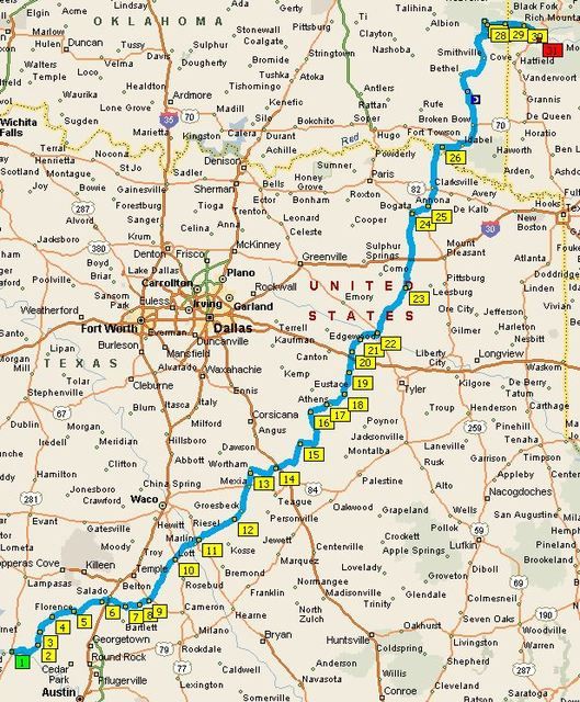
In November of '15 I had to bid for whatever vacation time I needed for 2016. My riding buddy, Pete, and I usually do a two-week ride in late Sept/early Oct. Our recent rides have covered the west coast, the Rocky Mountains, and most everything in between. One area that was conspicuously absent for the past few years was Texas and the Ozarks. With the exception of a quick pass through NW Arkansas in Nov '14 (fly-n-ride trip for my new 2012 purchased in Florida), I hadn't ridden the Big Bend area, TX Hill Country, or the Ozarks since 2008. Pete has never ridden any of those areas, so I told him that we were heading east. Due to the warmer temps down south, we needed our vacation time to be a bit later in the year for the weather to cool down a bit...so we bid for time off in early November. Pete was concerned about possible crappy weather, but I mentioned a previous Ozarks trip in November ('06)...the temps were perfect and the trees were almost at peak color. There shouldn't be much to worry about. Or so I thought.
Day #1, 10/30
Palm Springs to Safford AZ
444 miles
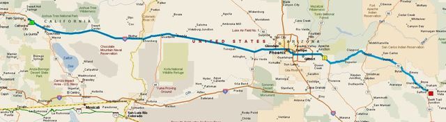
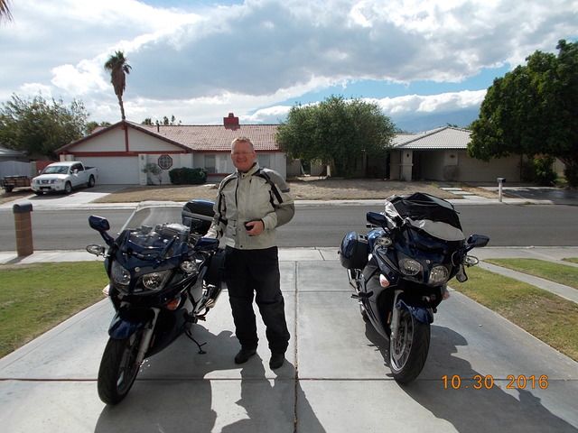
The big day had finally arrived. The bike was ready to go with only 120 miles on fresh oil and tires. Normally, I don't take the Givi V46 on a trip unless the wife is riding with me; but this trip was going to be in excess of 5000 miles, so I brought some basic tools and oil filters along with the plan of doing an oil change somewhere along the way. It was good to have the extra storage space. Pete had a work conflict that kept us from leaving at dawn, so we hit the road at 1pm.
Heading east out of Palm Springs is pretty boring. I try to avoid the slab as much as the next guy, but we wanted to get as far east as we could as fast as possible. That meant droning along on I10. Not my idea of a good time. The temps were in the mid-90s, but as long as we kept moving it wasn't too bad. We crossed into AZ and made our first fuel stop at Buckeye, about 250 miles down the road. We pressed east through Phoenix in the evening, luckily missing the worst of the rush hour traffic. The sun set as we passed Mesa, and it was completely dark by the time we reached Superior. We pressed on for two more hours in the dark, calling it quits in Safford. I sure like those Hella FF50 driving lights at night, but I'm seriously considering investing in a set of Clearwaters. We checked into a hotel around 8pm and headed for the restaurant across the street. We got there at 8:30 with a closing time of 9pm. The waitress was a really good sport about it. I had a few beers and the prime rib special...a huge amount of chow for about $10. Is that what Las Vegas was like in the old days?
Day #2, 10/31
Safford to Marfa TX
547 miles
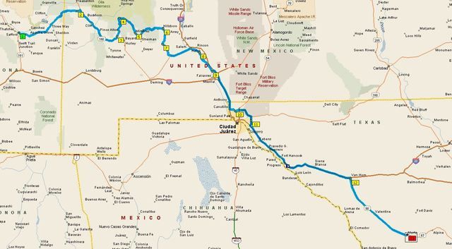
We woke up about an hour before sunrise, planning on being on the road around 15 minutes after sunrise. After coffee and a snack at the hotel breakfast area, we were on our way. That would generally be the morning ritual for the rest of the trip. One big difference from our big tour last spring, where we had no clue where we were headed on pretty much every day of the ride, was that I had a route already programmed into the Garmins. That sure saved a lot of time every morning.
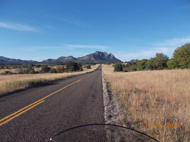
We headed east out of Safford on 191, which then angles northeast towards the village of Three Way. There we joined 78 headed east to the New Mexico border. After so many miles of straight/boring roads, we were thrilled to finally see some curves as the road climbed up into a small mountain range right on the border. It was still early and the sun was in our eyes as we plowed into some turns still in the shadows. That made it rather tough to ride at our normally spirited pace. As we neared the top, we stopped for a quick photo...thats a nice stretch of pavement down below:
We turned south on 180 and headed to Silver City. We took a quick break there before heading north on 15 up into the Gila National Forest. That was a fun little two-lane stretch...for some reason I didn't stop to take any pics. Then southeast on 35 through Mimbres, and then east on 152. Hwy 152 is a nice stretch of road, with some fun curves and great views as it crosses Emory Pass. Unfortunately, the highway department had "repaired" some pavement in what could be really fun corners. The new pavement was utter crap, with lots of gravel all over the road. That made for some slow going for a few miles. Finally heading down from the pass, the pavement improved and we could have fun with the corners again. At Hillsboro we headed south on 27; not a spectacular road, but it roughly parallels I25, and any backroad is preferable to the slab. We then joined 26 for a rather boring stretch into Hatch. With 256 miles on that tank of fuel, it was time to top off as we passed through town. We headed south on 185 which again runs parallel to I25. Still shunpiking, as Neil Peart would say. To avoid slogging through the city of Las Cruces, we finally joined up with I25 at Dona Ana. From there it was 37 boring miles southbound until we could join Loop 375 which would take us all the way around El Paso. As if 37 miles of slab isn't bad enough, I'm sure many of you are familiar with the feed lots along the west side of I25 between Las Cruces and El Paso. There are a few cows out there. I mean, a few thousand. And the wind was blowing from the west. We spent way too many miles enjoying the stench wafting across the road. That's a seriously nasty, pungent odor. I enjoy eating a tasty cow as much as the next guy, but I can't imagine living near or working on a cattle feed lot. I'm just glad there are people out there willing to do it.
After looping around El Paso in the afternoon traffic (just happy that we didn't take I10 through the middle of town), we joined I10 for the 106 mile drone down to Van Horn. I saw numerous signs for the hotel at Fort Hancock TX. As we passed by the Fort Hancock exit, I could only think of the movie Shawshank Redemption (one of my favorites). After Andy Dufresne escaped Shawshank, he crossed the border at F.H. on his way to Zihuatanejo, mailing Red a postcard as he passed through.
Reaching Van Horn, it was time to refuel after 215 miles on the tank. There's a whole lot of nothing south of Van Horn on 90, so it's always better to refuel early. While at the gas stop, I figured I should secure some lodging for the night. I figured we could make it to Fort Davis just as it was getting dark, so I called the three motels I could find on Google Maps. Two of them didn't answer, and the guy at the third place was clueless. He had no idea if any rooms were available, and there was no check-in past 7:30pm. Scratch the layover in Fort Davis then. I called three hotels in Marfa. One didn't answer, one was $240/night (in Marfa Texas??), and the last one had a suite for $179. Pete grumbled about spending that much on a room, so I said the other choice was to call it quits there in Van Horn. Lots of hotels, but it was Van Horn. On Interstate 10. Not cool. When Pete considered that option, he was suddenly okay with $179/night in Marfa. So we then continued south on 90.
About 15 miles south of Van Horn, I noticed an Amtrak train (probably the Sunset Limited) running in the same direction on the tracks that were some distance from the highway. After a few more miles, the tracks were right beside the road. The train was running at a steady 78 mph, according to the GPS. It was pretty cool to pace the train, and we ran alongside for 15 miles. With the low evening sun, we could see people in the dining car; a few people were watching and waving at us. I waved back as best I could with a 78mph wind blast. Approaching the small town of Valentine, I told Pete that we needed to stop for some window shopping. He had no idea what I was talking about, but I told him to trust me, and stop at that small building up ahead. So we watched the train pull ahead into the distance as we stopped at...
The Prada store:
Shoes and handbags, anyone? Pete was baffled. It's art, apparently. I rode past it at night back in 2008, and it was dimly lit...no photos possible. I guess I don't understand art, but it sure is weird to see this structure alongside a road in west Texas. At least I was able to get a pic this time. It sure was a pretty sunset.
We saddled up and rode the remaining 35 miles into Marfa in the dark. We found the Hotel Paisano easily enough. The sign tends to stand out on a dark night in a small town.
What a cool old hotel. It's beautifully maintained and the room was really nice. It was a small suite with a kitchen, and I would sleep on the pull-out sofa bed. There were two little balconies in the room overlooking the center courtyard and fountain. Very bro-mantic...although I think it would have been better to enjoy that kind of thing with my wife rather than my riding buddy. The hotel is somewhat known because the cast (Liz Taylor, Rock Hudson, James Dean) and crew of the movie Giant stayed there during production back in 1956. There are a lot of neat photos on the walls showing the cast and crew while at work on the movie. The restaurant is named The Jett Grill, after James Dean's character. Jett's had some good beer choices on tap, and the food was outstanding. I had a fantastic pork chop (a huge improvement over last spring's trip where I couldn't find a single pork chop on a 12-day ride), and Pete went on and on about how that was the best burger he'd ever had in his life...and that dude is a picky eater. It was Halloween, and a few people (including our server) had costumes on. You know, I think I could stay at this place again on the return trip a few days later. After a few beers, I got a route through Big Bend programmed for the next day. And then it was snooze time.
Day #3, 11/1
Marfa to Del Rio TX
596 miles
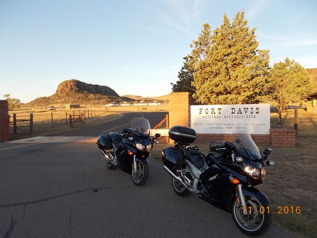
We were awake at the usual time. Jett's Grill had free coffee and $4 breakfast burritos. I prefer free, but $4 is still pretty cheap. We chowed down and hit the road. The sun was shining and the temp was in the mid-40s. We headed north on 17 to Fort Davis, where I snapped a quick shot at the entrance. I would like to check out the actual fort someday when I have time.
We headed west on 118 into the mountains. Nice pavement, some fun curves, beautiful scenery. I had my eyes constantly moving to the shoulders watching for forest rats. We saw a few, but none close enough to the road to cause concern. Let's keep it that way, eh, ya little bastards? We took the quick detour up to the observatory to enjoy the view in the morning light.
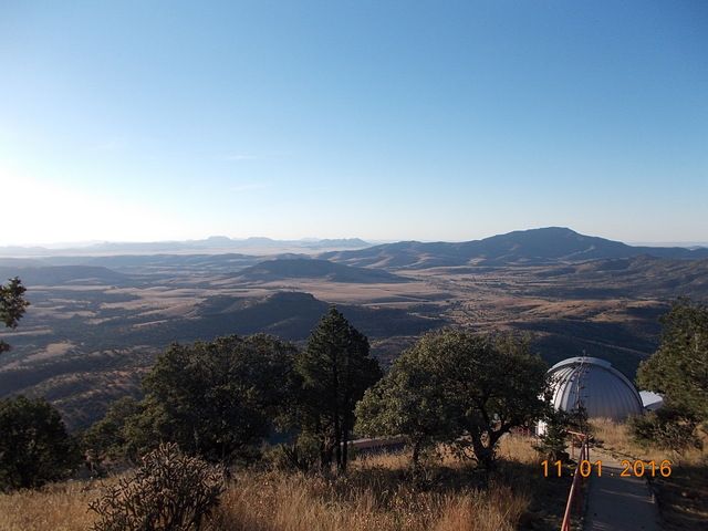
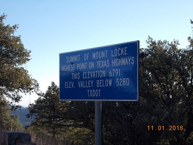
I knew that the mountains near Ft Davis were pretty tall by Texas standards, but I completely forgot that they went almost to 7000 feet.
We then continued west on 118, but after a while the road narrowed and became pretty lumpy. We slowed the pace but still enjoyed the views. We then turned south on 166 to loop back to Ft Davis. Nice rock.
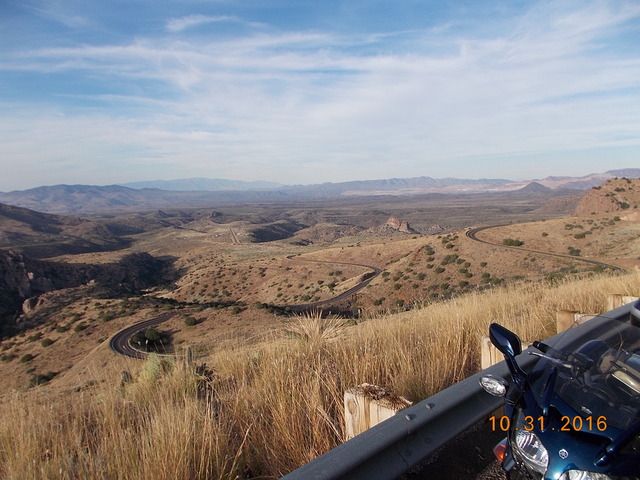
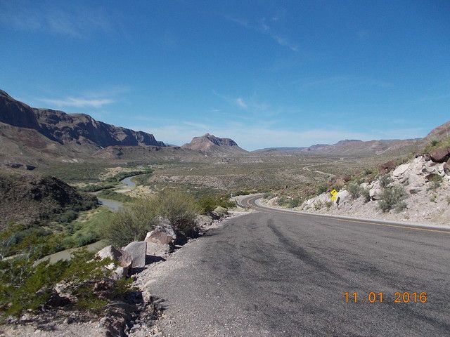
We rejoined 17 just south of Ft Davis and then headed south. Passing through Marfa again, it had been a 112 mile loop thus far. We stopped at the Paisano again to make use of their facilities, and I was able to acquire a Marfa sticker for my Givi lid. I'm not a big fan of stickers all over the outside of the bike, but the inside of the luggage lids are fair game. We continued south on 67 to Presidio, located right on the Rio Grande River and the border with Mexico. The road heading south wasn't terribly exciting, but the views off in the distance were still entertaining. We came up behind three Harleys puttering down the road. I wouldn't call it a formation, because they were kinda spread out, and had zero lane discipline. They each tended to wander all over the lane. That's just weird to me; if I'm in the lead while on an open/straight stretch of road, I hold a steady lane position and speed to make it easier for Pete to follow. If I'm following, I stay in a steady position so Pete always knows where to look for me in his mirrors. But the Harley guys probably think our riding style is weird too. And this is Texas, so of course they had no helmets on. I'll never understand that. We passed them easily and they soon vanished from our mirrors. We refueled in Presidio, having covered 255 miles since topping off in Van Horn the night before. Presidio was a rather depressing little town. I can't imagine having to live there, and we were glad to head eastbound on 170, the River Road. It's a nice stretch of road once you get away from town. Smooth pavement, lots of curves and ups and downs as the road traverses the many washes making their way to the river. Most of the curves are well cambered, but there was the occasional surprise off-camber turn. Here's a view looking west, where you can see the road turning and dipping. And just across the river there is...Mexico.
Here's a view looking east from the same spot. It gets pretty rugged down there by the river.
A few miles further east, there's another turnout with a great view. The pavement is so steep, however, that the only way to park the bike while snapping a pic is to shut off the engine and leave the transmission in gear. Otherwise it'll roll forward right off the sidestand.
It's really beautiful riding along the Rio Grande River, but the thought that kept coming back to me was Donald Trump. "We're gonna build a wall. A big, beautiful wall..." And I could only laugh because politicians that make statements like that have obviously never been to this area of the border and they have no idea how rugged it really is.
Are we having fun yet?
I had to stop and get a shot of the Terlingua sign. Back in the '70s, my dad owned a small amount of property near here, apparently for the deer hunting rights. I guess the hunting didn't work out so well, and he sold the property a few years later.
I'm not sure why people still go to the Terlingua area...it's very remote and doesn't seem to have a lot to offer. But there were a couple of areas jam-packed with RVs. I guess it's like a mini-Burning Man for people that are into that whole camping thing. That's just not my thing. I prefer real beds and a shower every day.
Next on the agenda. Crappy weather, eh?
We headed into the park on 118, and then headed south on the Ross Maxwell Scenic Drive. It's about 30 miles to the bottom where the pavement ends right on the river. The temp had climbed to the mid-90s by that point, so we tried to keep moving to avoid sweating too much. We stopped briefly at the Santa Elena Canyon overlook. That gap in the distance is where the Rio Grande (and the border) makes a sharp turn and cuts into the canyon. It's so steep and rugged, I'd say the border there is self-securing. No need for a wall.
Nice view from an overlook on the ride back to 118.
At that overlook, I finally figured out how to attach the camera to a lanyard so I can get some shots while moving.
After a few miles further east on 118, we took Basin Drive south to the lodge in the Chisos Mountains. Only six miles down and then reverse the route back out. It's really strange to see this type of topography and realize that we were actually in...Texas?
After that brief excursion, the rest of the day was uneventful. We exited the park on 385 to the north, heading for Marathon. We topped the tanks in Marathon, with 240 miles covered since Presidio. After that, it was a rather boring 175 mile stretch to Del Rio. There was some decent scenery for some of the miles, but the road itself wasn't terribly inspiring. At least the sun wasn't in our eyes. The sun set near Sanderson, so the last two hours were in the dark. We rolled into Del Rio, topped the tanks and found a hotel. After stowing our gear it was a five minute walk to Applebees. We generally prefer to avoid chain restaurants, but when in Del Rio...what can you do? I put down a few tall Shiner Bocks and chowed down. I already had a route in mind for the following day, but fell asleep before I could get the Garmin programmed.
Day #4, 11/2
Del Rio to Marble Falls TX
447 miles
We hit the Starbucks just a few minutes after sunrise. Oddly, this was our only Starbucks visit for the entire trip. The temp was in the upper 70s, but with a low overcast and some mist. While having my oatmeal and hot chocolate, I quickly put the day's route into my Garmin and then transferred the route over to Pete's. The plan for today was to hit some gold and red-rated roads on the Hill Country Butler map.
We headed east on 90 to Brackettville and then north on 674 towards Rock Springs. Since it looked like it could rain at any moment, I kept the camera stowed. Hwy 674 was a decent road, getting more entertaining as we headed north. The pavement was smooth enough, but it's that chip-seal variety that just feels rough on the tires. I kept an eye out for the dreaded forest rats, but, shockingly, I never saw a single one. We topped the tanks again in Rock Springs, only 97 miles after leaving Del Rio. I had no real idea of where fuel is located out in Hill Country, and I wanted a full tank before we started zig-zagging around the area. It started raining while fueling, of course, so it was time to dig out the rain gear. Just great...curvy roads in our immediate future, and they're going to be wet.
We headed east on 377 and 41, then south on 335. That was the entry point for us to hit the Three Twisted Sisters that Texas riders love so much. Luckily, the rain let up to a light mist as we headed south on 335. The road was more damp than wet, so we were able to move at an almost normal pace. At Camp Wood we headed east on 337 to Leakey, then north on 336, east on 41, and then back south on 83 to Leakey again. By that time the rain/mist had finally stopped. Being almost noon, it was time for a snack. We stopped at the Frio Canyon Motorcycle Stop just west of Leakey. I had stopped there on my BMW on previous tours, and I wanted to grab a sticker for my GIVI lid. The sun was starting to peek out from time to time, and there were actually a couple of Harleys parked out front. Those were the first bikes we had seen all day. Of course our FJRs were the only non-Harley bikes to be seen.
While stopped, I had a novel idea...why not grab lunch? For the first three days of the trip, we would grab chow for breakfast, snack during fuel stops, and then do a big dinner at the end of the day's ride. No lunch. So this day would be different. I had a pretty damn good sando; I even splurged with a Dr Pepper. Hey man, don't judge me...I'm on vacation! We actually took about an hour break, which is very rare for us while on a trip. While having lunch, a couple more Harleys pulled in. I couldn't help but laugh at the way these pirates dress. No safety gear whatsoever, sleeveless shirts with a silly vest adorned with patches. What is the point of the vest? It offers no protection whatsoever. But I guess it's supposed to look cool. Oh, and we can't forget the wallets attached to their owners by a chain. I know, I know...it's a whole lifestyle, different strokes for different folks and all that. But I just don't get it.
Now that the rain had let up and the pavement was dry, I was able to get the camera out again. Here are a few shots eastbound on 337 towards Vanderpool and Medina. It's a fun road.
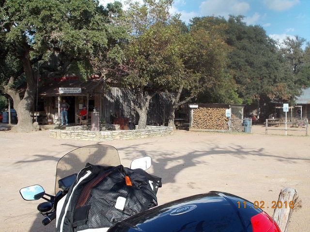
At Medina we turned north on 16 towards Kerrville, and had to slog our way through the mid-day traffic in Kerrville to reach 1341, oddly a Butler gold-rated road. It was a nice road, curvy and scenic...but I'm not sure why Butler gave it such a high rating. My fuel gauge started blinking as we approached the small town of Comfort. Since the town is located adjacent to I10, I figured we could find fuel as we passed through town. Wrong. Our route through town passed no gas stations. Apparently it would take a detour up to the interstate to find gas. We didn't realize that until we passed through town, of course. I didn't want to backtrack, so we pressed on. The FJR can do 60 miles on reserve, so I wasn't too concerned about it. We took 473 east to Sisterdale, which was a small village with no fuel. Then north on 1376, with a plan to head east on 1888 to Blanco. But first, we had to make a quick detour up to Luckenbach. I had stopped there once back in 2006, but I wanted to stop again for another sticker. I grew up in Texas and knew the Willie Nelson song. I figured Pete and most other people had heard of Luckenbach Texas. Apparently not. Pete had no idea what I was talking about. He dutifully followed the leader and we stopped for about 30 minutes. I got my sticker, of course. Pete struck up a conversation about rifles and gun legislation with the guy behind the bar. Pete later said, "these are my kind of people."
It was getting late in the afternoon, and we needed to press on. But first, I needed to figure out where we would stop for the night. I was thinking about heading through Marble Falls and then finding some small town to the northeast to spend the night. I called my brother, John, near Conroe, who had been watching our progress with the SPOT tracker. He recommended stopping in Marble Falls. My projected route after that would not put us in a good spot to find a hotel before dark. He checked and found a room for us at the Hampton Inn, and there was a brewery restaurant one block away. Plus, there was an airport nearby and he could fly over in his homebuilt RV-8 and meet us for dinner. And another plus, a buddy of ours from many years ago lives in Marble Falls and could pick John up at the airport and bring him into town. Sweet! I love it when a plan comes together.
We left Luckenbach and headed east on 1888 towards Blanco. I was really starting to sweat the fuel. I was searching for a gas station on the Garmin as we approached town. It sure was a relief to see that Shell station ahead on the right. After 274.6 miles on that tank, I pumped 6.4 gallons into the FJRs 6.6 gallon tank. That was close! After that it was an easy ride north on 281 to Marble Falls. Initially I thought John was going to fly into the airport at Horseshoe Bay, so we worked our way over to the small terminal at that airport. Upon our arrival, I saw a text stating that he was flying into the airport up the road at Burnet. Crap! I punched that into the Garmin and our ETA was only about five minutes behind his. Nineteen miles later, we pulled into the airport at Burnet as John was walking from the flight line towards the parking lot. And there was our old buddy Glen. We've known Glen since 1985, but I hadn't seen the dude since 1993. Geez, time flies. We met Dave through an aviation connection. My brother and I stayed in aviation, and Glen went into law enforcement. He's now the #2 guy in charge of the Marble Falls Police Department. That's pretty cool considering the goofy shit we've all done over the years. We rode back south to the hotel, ditched our gear and headed to the brewery for dinner. Glen was on-call with his department, and John still had to fly home, so they couldn't have a beer. Poor bastards! Just to make up for their lack of drinking, I had an extra beer with my dinner. It was really fun seeing my brother and a buddy that I had not seen in 23 years.
Day #5, 11/3
Marble Falls to Mena AR
517 miles
It was time to start heading for Arkansas. I had the road atlas out during breakfast at the hotel, and I traced a route from one backroad to another working our way to northeastern Texas and southeastern Oklahoma. It was cool and overcast again, and there was a lot of rain showing on the Weather Channel. Wonderful. We topped the tanks on our way out of town. We took a chance and kept the rain gear stowed, but we soon saw that it was a bad choice. Not even 10 miles out of town, the rain started coming down. We found a wide shoulder and donned the rain gear. And we continued on to the east and north and east, etc. I still have the route mapped out, but there are just too many little roads to be mentioned here. And it kept raining. Sometimes just a light shower, and other times it was a real frog-strangler. It rained for 200 miles. Needless to say, we never saw any Harleys out on the road. Passing through the small town of Marlin, we actually saw a Honda ST1300 heading the other direction. That guy was as crazy as we were for riding in that shit. The rain gear kept me dry enough, but my non-Goretex gloves were soaked.
We topped the tanks in Malakoff and grabbed a burger at McDonalds. Eventually the rain started to let up a bit, and by the time we passed through Mineola we could actually stop and ditch the rain gear. What a treat that was. My hands were stained black from the dye in my wet gloves. Lovely. As we continued north towards the border my gloves started to dry out. Another quick fuel stop in Broken Bow OK and we were in the final stretch for the day. There are a few miles of 259 that are really fun just before you reach the Talimena Scenic Byway. I really enjoyed hustling the FJR through those curves after slogging through so much rain earlier in the day. The ridgeline off in the distance is where we're headed.
We reached the Talimena just before sunset and headed east. I have hit this road in the fall before, and it was spectacular. When the sun was shining, of course. This evening, the low clouds blocked any sunlight from hitting what colors might have been in the trees. A few times the roadway climbed up into the fog and it was tough to see much of anything.
The pavement is starting to deteriorate as well...it was pretty rough in a few places. We finally reached the eastern end of the TSB and descended into Mena just as it was getting pitch dark. We topped off and headed to a hotel on the east side of town. After stowing the gear, we walked to a really neat restaurant two doors down from the hotel. Stache's Cookery was an old house converted to a restaurant. The dinner was fantastic, and the waitress was delightful. She had that Arkansas twang in her voice which was highly entertaining. We tipped her well. No beer on tap, but they had some good local stuff in bottles. And they even had live entertainment...three guys playing guitars in a corner. That was a good way to end a day of not-so-awesome riding.
So that's five days covered, with eight more to go. I'll try to not take four months for the next installment.
In November of '15 I had to bid for whatever vacation time I needed for 2016. My riding buddy, Pete, and I usually do a two-week ride in late Sept/early Oct. Our recent rides have covered the west coast, the Rocky Mountains, and most everything in between. One area that was conspicuously absent for the past few years was Texas and the Ozarks. With the exception of a quick pass through NW Arkansas in Nov '14 (fly-n-ride trip for my new 2012 purchased in Florida), I hadn't ridden the Big Bend area, TX Hill Country, or the Ozarks since 2008. Pete has never ridden any of those areas, so I told him that we were heading east. Due to the warmer temps down south, we needed our vacation time to be a bit later in the year for the weather to cool down a bit...so we bid for time off in early November. Pete was concerned about possible crappy weather, but I mentioned a previous Ozarks trip in November ('06)...the temps were perfect and the trees were almost at peak color. There shouldn't be much to worry about. Or so I thought.
Day #1, 10/30
Palm Springs to Safford AZ
444 miles

The big day had finally arrived. The bike was ready to go with only 120 miles on fresh oil and tires. Normally, I don't take the Givi V46 on a trip unless the wife is riding with me; but this trip was going to be in excess of 5000 miles, so I brought some basic tools and oil filters along with the plan of doing an oil change somewhere along the way. It was good to have the extra storage space. Pete had a work conflict that kept us from leaving at dawn, so we hit the road at 1pm.

Heading east out of Palm Springs is pretty boring. I try to avoid the slab as much as the next guy, but we wanted to get as far east as we could as fast as possible. That meant droning along on I10. Not my idea of a good time. The temps were in the mid-90s, but as long as we kept moving it wasn't too bad. We crossed into AZ and made our first fuel stop at Buckeye, about 250 miles down the road. We pressed east through Phoenix in the evening, luckily missing the worst of the rush hour traffic. The sun set as we passed Mesa, and it was completely dark by the time we reached Superior. We pressed on for two more hours in the dark, calling it quits in Safford. I sure like those Hella FF50 driving lights at night, but I'm seriously considering investing in a set of Clearwaters. We checked into a hotel around 8pm and headed for the restaurant across the street. We got there at 8:30 with a closing time of 9pm. The waitress was a really good sport about it. I had a few beers and the prime rib special...a huge amount of chow for about $10. Is that what Las Vegas was like in the old days?
Day #2, 10/31
Safford to Marfa TX
547 miles

We woke up about an hour before sunrise, planning on being on the road around 15 minutes after sunrise. After coffee and a snack at the hotel breakfast area, we were on our way. That would generally be the morning ritual for the rest of the trip. One big difference from our big tour last spring, where we had no clue where we were headed on pretty much every day of the ride, was that I had a route already programmed into the Garmins. That sure saved a lot of time every morning.
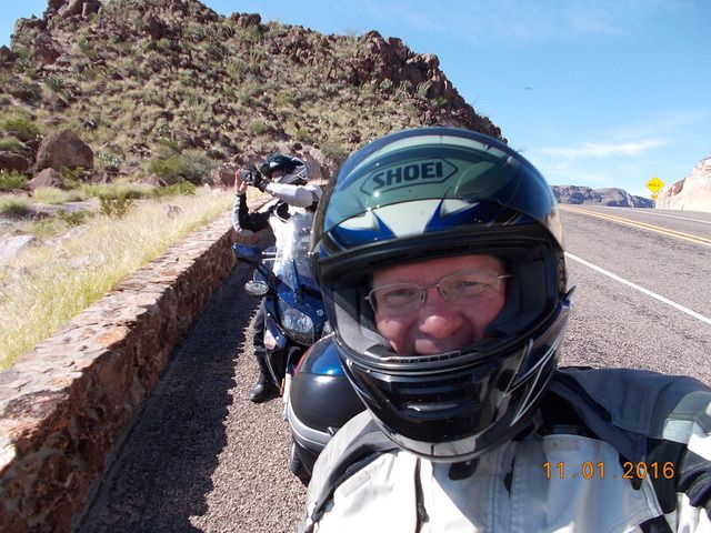
We headed east out of Safford on 191, which then angles northeast towards the village of Three Way. There we joined 78 headed east to the New Mexico border. After so many miles of straight/boring roads, we were thrilled to finally see some curves as the road climbed up into a small mountain range right on the border. It was still early and the sun was in our eyes as we plowed into some turns still in the shadows. That made it rather tough to ride at our normally spirited pace. As we neared the top, we stopped for a quick photo...thats a nice stretch of pavement down below:

We turned south on 180 and headed to Silver City. We took a quick break there before heading north on 15 up into the Gila National Forest. That was a fun little two-lane stretch...for some reason I didn't stop to take any pics. Then southeast on 35 through Mimbres, and then east on 152. Hwy 152 is a nice stretch of road, with some fun curves and great views as it crosses Emory Pass. Unfortunately, the highway department had "repaired" some pavement in what could be really fun corners. The new pavement was utter crap, with lots of gravel all over the road. That made for some slow going for a few miles. Finally heading down from the pass, the pavement improved and we could have fun with the corners again. At Hillsboro we headed south on 27; not a spectacular road, but it roughly parallels I25, and any backroad is preferable to the slab. We then joined 26 for a rather boring stretch into Hatch. With 256 miles on that tank of fuel, it was time to top off as we passed through town. We headed south on 185 which again runs parallel to I25. Still shunpiking, as Neil Peart would say. To avoid slogging through the city of Las Cruces, we finally joined up with I25 at Dona Ana. From there it was 37 boring miles southbound until we could join Loop 375 which would take us all the way around El Paso. As if 37 miles of slab isn't bad enough, I'm sure many of you are familiar with the feed lots along the west side of I25 between Las Cruces and El Paso. There are a few cows out there. I mean, a few thousand. And the wind was blowing from the west. We spent way too many miles enjoying the stench wafting across the road. That's a seriously nasty, pungent odor. I enjoy eating a tasty cow as much as the next guy, but I can't imagine living near or working on a cattle feed lot. I'm just glad there are people out there willing to do it.
After looping around El Paso in the afternoon traffic (just happy that we didn't take I10 through the middle of town), we joined I10 for the 106 mile drone down to Van Horn. I saw numerous signs for the hotel at Fort Hancock TX. As we passed by the Fort Hancock exit, I could only think of the movie Shawshank Redemption (one of my favorites). After Andy Dufresne escaped Shawshank, he crossed the border at F.H. on his way to Zihuatanejo, mailing Red a postcard as he passed through.
Reaching Van Horn, it was time to refuel after 215 miles on the tank. There's a whole lot of nothing south of Van Horn on 90, so it's always better to refuel early. While at the gas stop, I figured I should secure some lodging for the night. I figured we could make it to Fort Davis just as it was getting dark, so I called the three motels I could find on Google Maps. Two of them didn't answer, and the guy at the third place was clueless. He had no idea if any rooms were available, and there was no check-in past 7:30pm. Scratch the layover in Fort Davis then. I called three hotels in Marfa. One didn't answer, one was $240/night (in Marfa Texas??), and the last one had a suite for $179. Pete grumbled about spending that much on a room, so I said the other choice was to call it quits there in Van Horn. Lots of hotels, but it was Van Horn. On Interstate 10. Not cool. When Pete considered that option, he was suddenly okay with $179/night in Marfa. So we then continued south on 90.
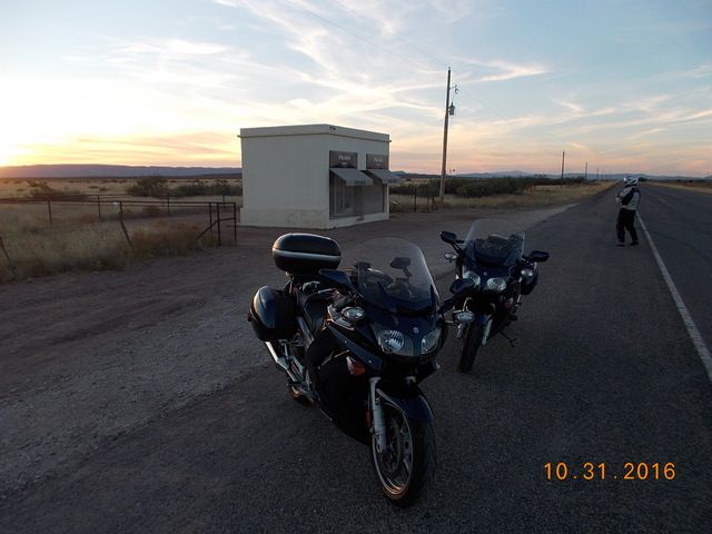
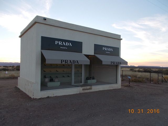
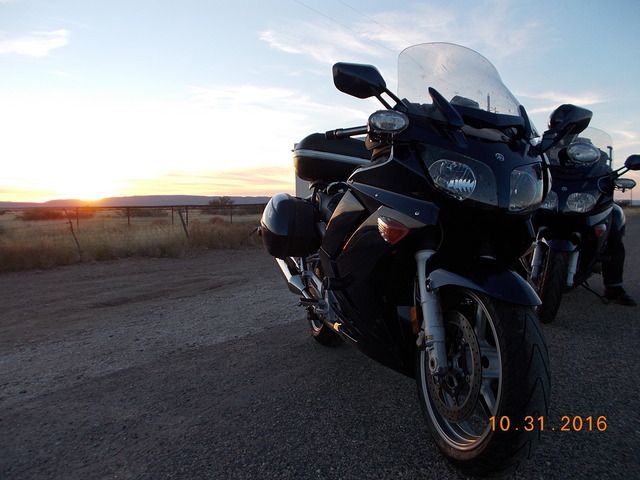
About 15 miles south of Van Horn, I noticed an Amtrak train (probably the Sunset Limited) running in the same direction on the tracks that were some distance from the highway. After a few more miles, the tracks were right beside the road. The train was running at a steady 78 mph, according to the GPS. It was pretty cool to pace the train, and we ran alongside for 15 miles. With the low evening sun, we could see people in the dining car; a few people were watching and waving at us. I waved back as best I could with a 78mph wind blast. Approaching the small town of Valentine, I told Pete that we needed to stop for some window shopping. He had no idea what I was talking about, but I told him to trust me, and stop at that small building up ahead. So we watched the train pull ahead into the distance as we stopped at...
The Prada store:


Shoes and handbags, anyone? Pete was baffled. It's art, apparently. I rode past it at night back in 2008, and it was dimly lit...no photos possible. I guess I don't understand art, but it sure is weird to see this structure alongside a road in west Texas. At least I was able to get a pic this time. It sure was a pretty sunset.

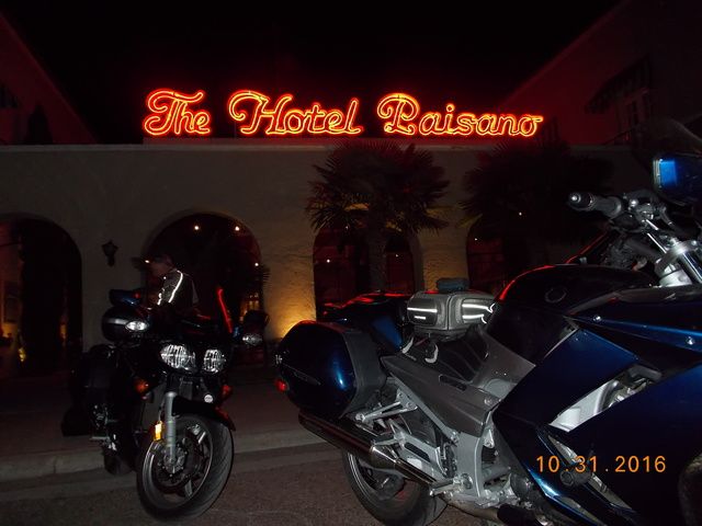
We saddled up and rode the remaining 35 miles into Marfa in the dark. We found the Hotel Paisano easily enough. The sign tends to stand out on a dark night in a small town.

What a cool old hotel. It's beautifully maintained and the room was really nice. It was a small suite with a kitchen, and I would sleep on the pull-out sofa bed. There were two little balconies in the room overlooking the center courtyard and fountain. Very bro-mantic...although I think it would have been better to enjoy that kind of thing with my wife rather than my riding buddy. The hotel is somewhat known because the cast (Liz Taylor, Rock Hudson, James Dean) and crew of the movie Giant stayed there during production back in 1956. There are a lot of neat photos on the walls showing the cast and crew while at work on the movie. The restaurant is named The Jett Grill, after James Dean's character. Jett's had some good beer choices on tap, and the food was outstanding. I had a fantastic pork chop (a huge improvement over last spring's trip where I couldn't find a single pork chop on a 12-day ride), and Pete went on and on about how that was the best burger he'd ever had in his life...and that dude is a picky eater. It was Halloween, and a few people (including our server) had costumes on. You know, I think I could stay at this place again on the return trip a few days later. After a few beers, I got a route through Big Bend programmed for the next day. And then it was snooze time.
Day #3, 11/1
Marfa to Del Rio TX
596 miles

We were awake at the usual time. Jett's Grill had free coffee and $4 breakfast burritos. I prefer free, but $4 is still pretty cheap. We chowed down and hit the road. The sun was shining and the temp was in the mid-40s. We headed north on 17 to Fort Davis, where I snapped a quick shot at the entrance. I would like to check out the actual fort someday when I have time.

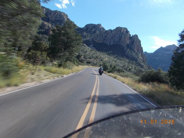
We headed west on 118 into the mountains. Nice pavement, some fun curves, beautiful scenery. I had my eyes constantly moving to the shoulders watching for forest rats. We saw a few, but none close enough to the road to cause concern. Let's keep it that way, eh, ya little bastards? We took the quick detour up to the observatory to enjoy the view in the morning light.

I knew that the mountains near Ft Davis were pretty tall by Texas standards, but I completely forgot that they went almost to 7000 feet.

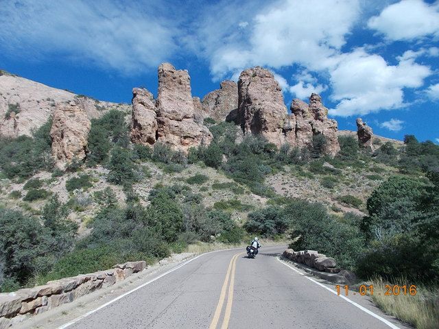
We then continued west on 118, but after a while the road narrowed and became pretty lumpy. We slowed the pace but still enjoyed the views. We then turned south on 166 to loop back to Ft Davis. Nice rock.

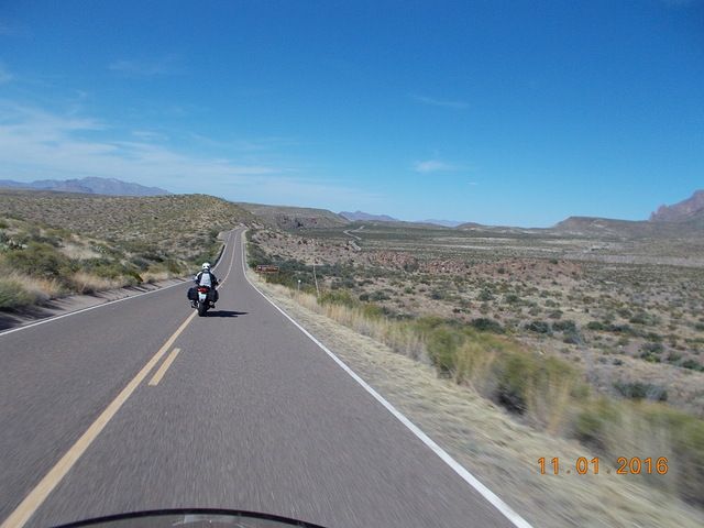
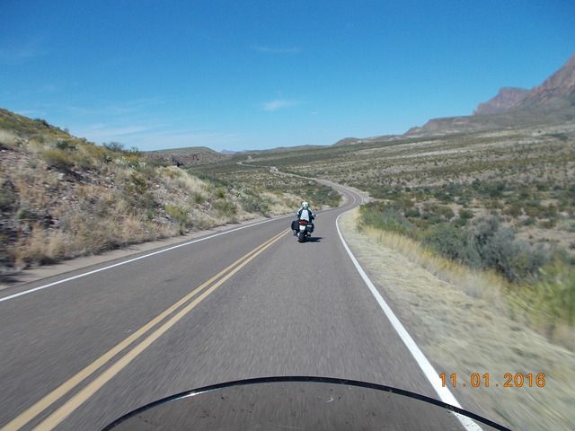
We rejoined 17 just south of Ft Davis and then headed south. Passing through Marfa again, it had been a 112 mile loop thus far. We stopped at the Paisano again to make use of their facilities, and I was able to acquire a Marfa sticker for my Givi lid. I'm not a big fan of stickers all over the outside of the bike, but the inside of the luggage lids are fair game. We continued south on 67 to Presidio, located right on the Rio Grande River and the border with Mexico. The road heading south wasn't terribly exciting, but the views off in the distance were still entertaining. We came up behind three Harleys puttering down the road. I wouldn't call it a formation, because they were kinda spread out, and had zero lane discipline. They each tended to wander all over the lane. That's just weird to me; if I'm in the lead while on an open/straight stretch of road, I hold a steady lane position and speed to make it easier for Pete to follow. If I'm following, I stay in a steady position so Pete always knows where to look for me in his mirrors. But the Harley guys probably think our riding style is weird too. And this is Texas, so of course they had no helmets on. I'll never understand that. We passed them easily and they soon vanished from our mirrors. We refueled in Presidio, having covered 255 miles since topping off in Van Horn the night before. Presidio was a rather depressing little town. I can't imagine having to live there, and we were glad to head eastbound on 170, the River Road. It's a nice stretch of road once you get away from town. Smooth pavement, lots of curves and ups and downs as the road traverses the many washes making their way to the river. Most of the curves are well cambered, but there was the occasional surprise off-camber turn. Here's a view looking west, where you can see the road turning and dipping. And just across the river there is...Mexico.

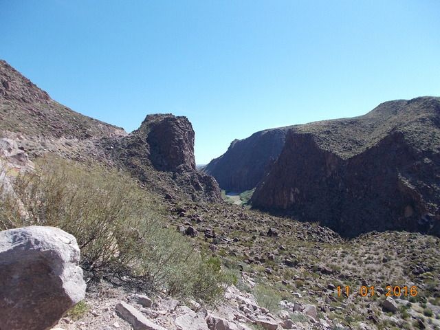
Here's a view looking east from the same spot. It gets pretty rugged down there by the river.

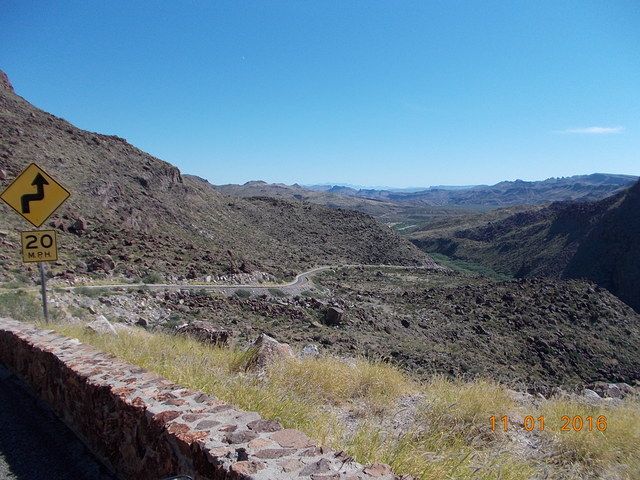
A few miles further east, there's another turnout with a great view. The pavement is so steep, however, that the only way to park the bike while snapping a pic is to shut off the engine and leave the transmission in gear. Otherwise it'll roll forward right off the sidestand.

It's really beautiful riding along the Rio Grande River, but the thought that kept coming back to me was Donald Trump. "We're gonna build a wall. A big, beautiful wall..." And I could only laugh because politicians that make statements like that have obviously never been to this area of the border and they have no idea how rugged it really is.
Are we having fun yet?

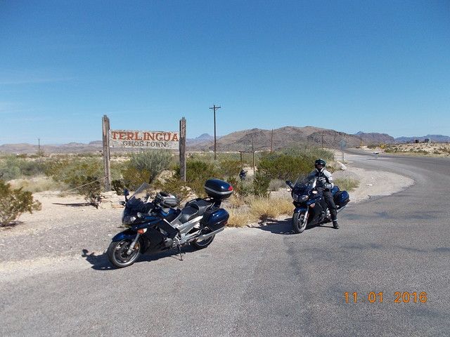
I had to stop and get a shot of the Terlingua sign. Back in the '70s, my dad owned a small amount of property near here, apparently for the deer hunting rights. I guess the hunting didn't work out so well, and he sold the property a few years later.

I'm not sure why people still go to the Terlingua area...it's very remote and doesn't seem to have a lot to offer. But there were a couple of areas jam-packed with RVs. I guess it's like a mini-Burning Man for people that are into that whole camping thing. That's just not my thing. I prefer real beds and a shower every day.
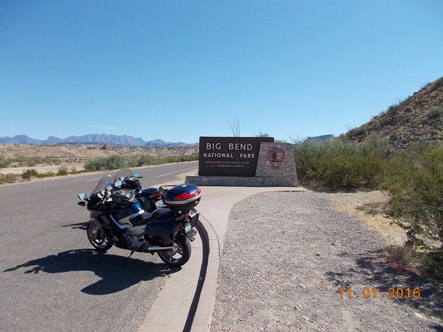
Next on the agenda. Crappy weather, eh?

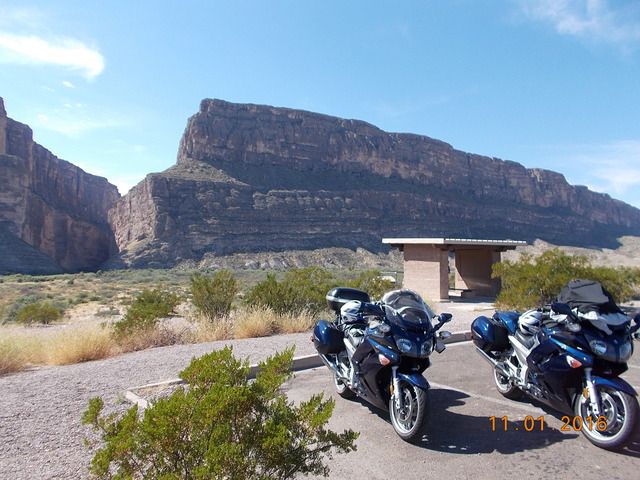
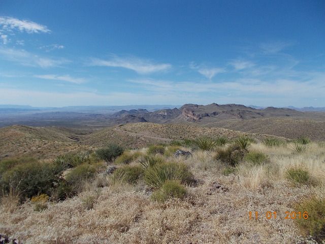
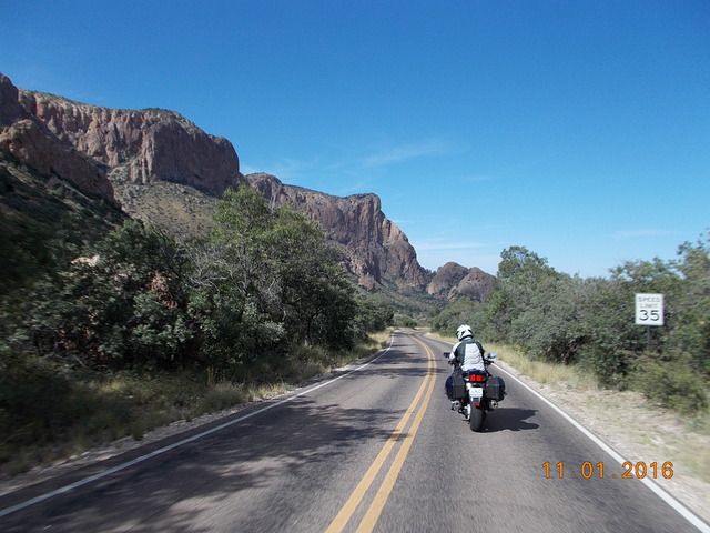
We headed into the park on 118, and then headed south on the Ross Maxwell Scenic Drive. It's about 30 miles to the bottom where the pavement ends right on the river. The temp had climbed to the mid-90s by that point, so we tried to keep moving to avoid sweating too much. We stopped briefly at the Santa Elena Canyon overlook. That gap in the distance is where the Rio Grande (and the border) makes a sharp turn and cuts into the canyon. It's so steep and rugged, I'd say the border there is self-securing. No need for a wall.

Nice view from an overlook on the ride back to 118.

At that overlook, I finally figured out how to attach the camera to a lanyard so I can get some shots while moving.


After a few miles further east on 118, we took Basin Drive south to the lodge in the Chisos Mountains. Only six miles down and then reverse the route back out. It's really strange to see this type of topography and realize that we were actually in...Texas?


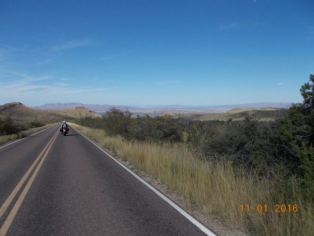
After that brief excursion, the rest of the day was uneventful. We exited the park on 385 to the north, heading for Marathon. We topped the tanks in Marathon, with 240 miles covered since Presidio. After that, it was a rather boring 175 mile stretch to Del Rio. There was some decent scenery for some of the miles, but the road itself wasn't terribly inspiring. At least the sun wasn't in our eyes. The sun set near Sanderson, so the last two hours were in the dark. We rolled into Del Rio, topped the tanks and found a hotel. After stowing our gear it was a five minute walk to Applebees. We generally prefer to avoid chain restaurants, but when in Del Rio...what can you do? I put down a few tall Shiner Bocks and chowed down. I already had a route in mind for the following day, but fell asleep before I could get the Garmin programmed.
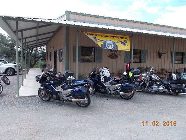
Day #4, 11/2
Del Rio to Marble Falls TX
447 miles

We hit the Starbucks just a few minutes after sunrise. Oddly, this was our only Starbucks visit for the entire trip. The temp was in the upper 70s, but with a low overcast and some mist. While having my oatmeal and hot chocolate, I quickly put the day's route into my Garmin and then transferred the route over to Pete's. The plan for today was to hit some gold and red-rated roads on the Hill Country Butler map.
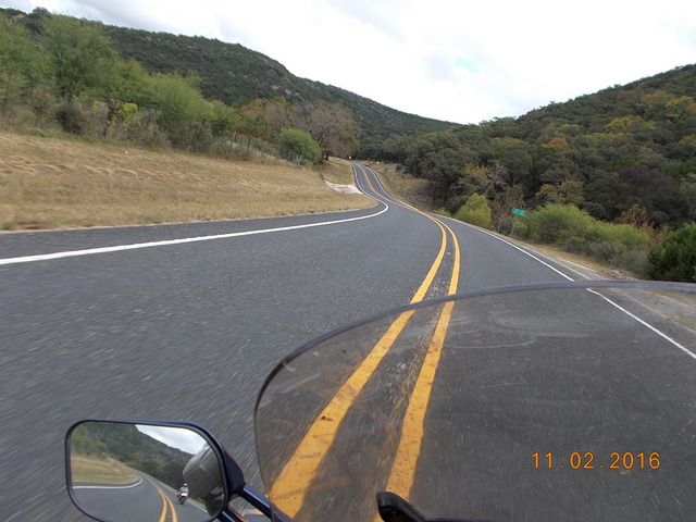
We headed east on 90 to Brackettville and then north on 674 towards Rock Springs. Since it looked like it could rain at any moment, I kept the camera stowed. Hwy 674 was a decent road, getting more entertaining as we headed north. The pavement was smooth enough, but it's that chip-seal variety that just feels rough on the tires. I kept an eye out for the dreaded forest rats, but, shockingly, I never saw a single one. We topped the tanks again in Rock Springs, only 97 miles after leaving Del Rio. I had no real idea of where fuel is located out in Hill Country, and I wanted a full tank before we started zig-zagging around the area. It started raining while fueling, of course, so it was time to dig out the rain gear. Just great...curvy roads in our immediate future, and they're going to be wet.
We headed east on 377 and 41, then south on 335. That was the entry point for us to hit the Three Twisted Sisters that Texas riders love so much. Luckily, the rain let up to a light mist as we headed south on 335. The road was more damp than wet, so we were able to move at an almost normal pace. At Camp Wood we headed east on 337 to Leakey, then north on 336, east on 41, and then back south on 83 to Leakey again. By that time the rain/mist had finally stopped. Being almost noon, it was time for a snack. We stopped at the Frio Canyon Motorcycle Stop just west of Leakey. I had stopped there on my BMW on previous tours, and I wanted to grab a sticker for my GIVI lid. The sun was starting to peek out from time to time, and there were actually a couple of Harleys parked out front. Those were the first bikes we had seen all day. Of course our FJRs were the only non-Harley bikes to be seen.

While stopped, I had a novel idea...why not grab lunch? For the first three days of the trip, we would grab chow for breakfast, snack during fuel stops, and then do a big dinner at the end of the day's ride. No lunch. So this day would be different. I had a pretty damn good sando; I even splurged with a Dr Pepper. Hey man, don't judge me...I'm on vacation! We actually took about an hour break, which is very rare for us while on a trip. While having lunch, a couple more Harleys pulled in. I couldn't help but laugh at the way these pirates dress. No safety gear whatsoever, sleeveless shirts with a silly vest adorned with patches. What is the point of the vest? It offers no protection whatsoever. But I guess it's supposed to look cool. Oh, and we can't forget the wallets attached to their owners by a chain. I know, I know...it's a whole lifestyle, different strokes for different folks and all that. But I just don't get it.
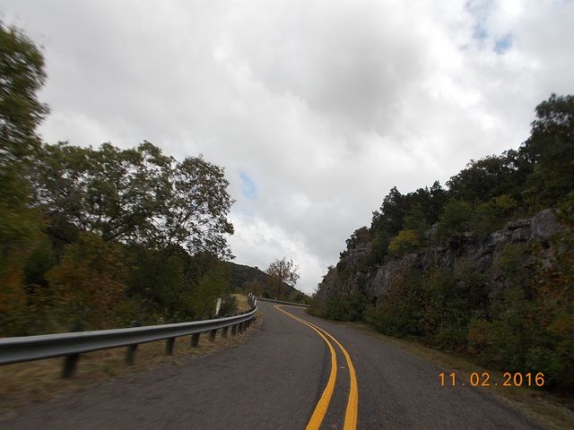
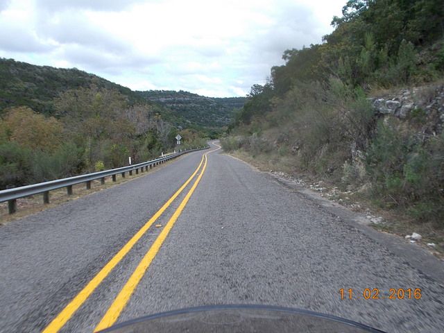
Now that the rain had let up and the pavement was dry, I was able to get the camera out again. Here are a few shots eastbound on 337 towards Vanderpool and Medina. It's a fun road.


At Medina we turned north on 16 towards Kerrville, and had to slog our way through the mid-day traffic in Kerrville to reach 1341, oddly a Butler gold-rated road. It was a nice road, curvy and scenic...but I'm not sure why Butler gave it such a high rating. My fuel gauge started blinking as we approached the small town of Comfort. Since the town is located adjacent to I10, I figured we could find fuel as we passed through town. Wrong. Our route through town passed no gas stations. Apparently it would take a detour up to the interstate to find gas. We didn't realize that until we passed through town, of course. I didn't want to backtrack, so we pressed on. The FJR can do 60 miles on reserve, so I wasn't too concerned about it. We took 473 east to Sisterdale, which was a small village with no fuel. Then north on 1376, with a plan to head east on 1888 to Blanco. But first, we had to make a quick detour up to Luckenbach. I had stopped there once back in 2006, but I wanted to stop again for another sticker. I grew up in Texas and knew the Willie Nelson song. I figured Pete and most other people had heard of Luckenbach Texas. Apparently not. Pete had no idea what I was talking about. He dutifully followed the leader and we stopped for about 30 minutes. I got my sticker, of course. Pete struck up a conversation about rifles and gun legislation with the guy behind the bar. Pete later said, "these are my kind of people."

It was getting late in the afternoon, and we needed to press on. But first, I needed to figure out where we would stop for the night. I was thinking about heading through Marble Falls and then finding some small town to the northeast to spend the night. I called my brother, John, near Conroe, who had been watching our progress with the SPOT tracker. He recommended stopping in Marble Falls. My projected route after that would not put us in a good spot to find a hotel before dark. He checked and found a room for us at the Hampton Inn, and there was a brewery restaurant one block away. Plus, there was an airport nearby and he could fly over in his homebuilt RV-8 and meet us for dinner. And another plus, a buddy of ours from many years ago lives in Marble Falls and could pick John up at the airport and bring him into town. Sweet! I love it when a plan comes together.
We left Luckenbach and headed east on 1888 towards Blanco. I was really starting to sweat the fuel. I was searching for a gas station on the Garmin as we approached town. It sure was a relief to see that Shell station ahead on the right. After 274.6 miles on that tank, I pumped 6.4 gallons into the FJRs 6.6 gallon tank. That was close! After that it was an easy ride north on 281 to Marble Falls. Initially I thought John was going to fly into the airport at Horseshoe Bay, so we worked our way over to the small terminal at that airport. Upon our arrival, I saw a text stating that he was flying into the airport up the road at Burnet. Crap! I punched that into the Garmin and our ETA was only about five minutes behind his. Nineteen miles later, we pulled into the airport at Burnet as John was walking from the flight line towards the parking lot. And there was our old buddy Glen. We've known Glen since 1985, but I hadn't seen the dude since 1993. Geez, time flies. We met Dave through an aviation connection. My brother and I stayed in aviation, and Glen went into law enforcement. He's now the #2 guy in charge of the Marble Falls Police Department. That's pretty cool considering the goofy shit we've all done over the years. We rode back south to the hotel, ditched our gear and headed to the brewery for dinner. Glen was on-call with his department, and John still had to fly home, so they couldn't have a beer. Poor bastards! Just to make up for their lack of drinking, I had an extra beer with my dinner. It was really fun seeing my brother and a buddy that I had not seen in 23 years.
Day #5, 11/3
Marble Falls to Mena AR
517 miles

It was time to start heading for Arkansas. I had the road atlas out during breakfast at the hotel, and I traced a route from one backroad to another working our way to northeastern Texas and southeastern Oklahoma. It was cool and overcast again, and there was a lot of rain showing on the Weather Channel. Wonderful. We topped the tanks on our way out of town. We took a chance and kept the rain gear stowed, but we soon saw that it was a bad choice. Not even 10 miles out of town, the rain started coming down. We found a wide shoulder and donned the rain gear. And we continued on to the east and north and east, etc. I still have the route mapped out, but there are just too many little roads to be mentioned here. And it kept raining. Sometimes just a light shower, and other times it was a real frog-strangler. It rained for 200 miles. Needless to say, we never saw any Harleys out on the road. Passing through the small town of Marlin, we actually saw a Honda ST1300 heading the other direction. That guy was as crazy as we were for riding in that shit. The rain gear kept me dry enough, but my non-Goretex gloves were soaked.
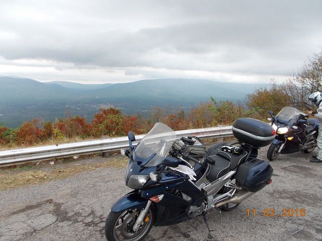
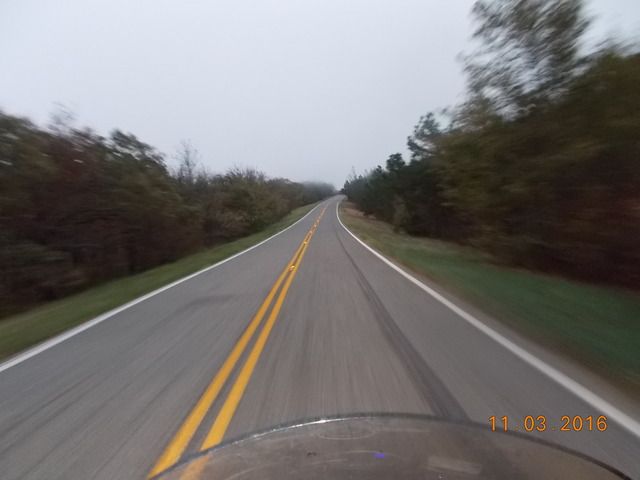
We topped the tanks in Malakoff and grabbed a burger at McDonalds. Eventually the rain started to let up a bit, and by the time we passed through Mineola we could actually stop and ditch the rain gear. What a treat that was. My hands were stained black from the dye in my wet gloves. Lovely. As we continued north towards the border my gloves started to dry out. Another quick fuel stop in Broken Bow OK and we were in the final stretch for the day. There are a few miles of 259 that are really fun just before you reach the Talimena Scenic Byway. I really enjoyed hustling the FJR through those curves after slogging through so much rain earlier in the day. The ridgeline off in the distance is where we're headed.

We reached the Talimena just before sunset and headed east. I have hit this road in the fall before, and it was spectacular. When the sun was shining, of course. This evening, the low clouds blocked any sunlight from hitting what colors might have been in the trees. A few times the roadway climbed up into the fog and it was tough to see much of anything.

The pavement is starting to deteriorate as well...it was pretty rough in a few places. We finally reached the eastern end of the TSB and descended into Mena just as it was getting pitch dark. We topped off and headed to a hotel on the east side of town. After stowing the gear, we walked to a really neat restaurant two doors down from the hotel. Stache's Cookery was an old house converted to a restaurant. The dinner was fantastic, and the waitress was delightful. She had that Arkansas twang in her voice which was highly entertaining. We tipped her well. No beer on tap, but they had some good local stuff in bottles. And they even had live entertainment...three guys playing guitars in a corner. That was a good way to end a day of not-so-awesome riding.
So that's five days covered, with eight more to go. I'll try to not take four months for the next installment.
Last edited by a moderator:


