Second Trip Post Retirement

Yamaha FJR Motorcycle Forum

Help Support Yamaha FJR Motorcycle Forum:

This site may earn a commission from merchant affiliate links, including eBay, Amazon, and others.

Fontanaman

Robin Trower
Joined
Oct 29, 2009
Messages
2,004
Reaction score
1,060
Location
Spokane, Wa
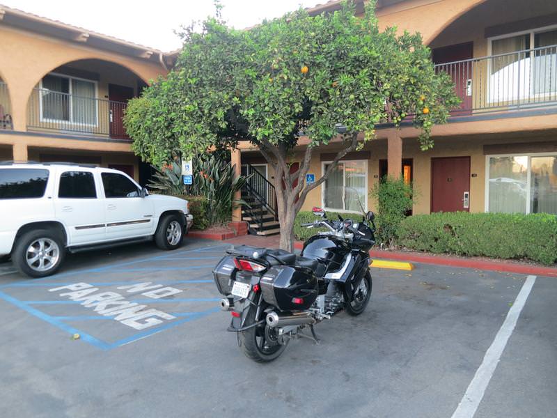
On the last day of my first post retirement trip, October 9th, I was in a motel in Fort Bragg, Ca, when I happened to change the TV channel to a local news to find fires in Napa Valley burning out of control and wrecking havoc. My route took me through the blazes and the only road south open was Hwy 1 and I wasn't really interested in riding through San Francisco - this was a camping trip after all.

I had been camping for a week. Weather at my destination, Kings Canyon National Park, called for temps in the upper 20's. Not one for cold weather camping I said nuts to it and drove home in one day with unfinished business on my mind. There was a window of good weather out of Seattle on Monday October 16 and with that I was headed back to California.

Day 1

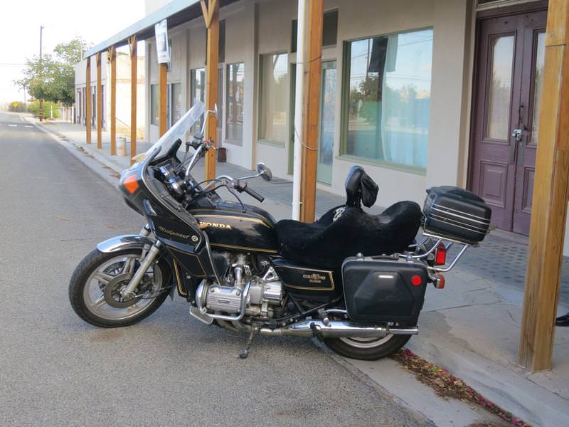
Everything is packed. While putting on my motorcycle boot I notice the zipper tangs separating ruining the boot as there is no secondary closure. This sucks. After some fiddling I find zipping down to the damaged tangs I can just barely get the boot on. Delays, delays. I ride I-5 to Yreka.

Day 2

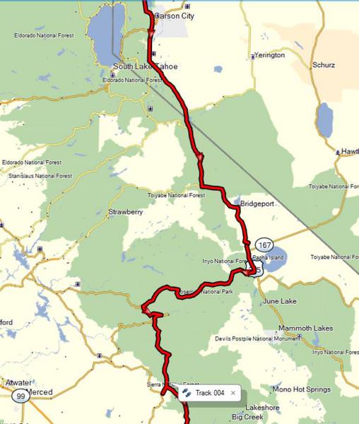
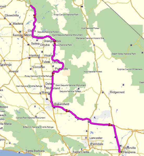
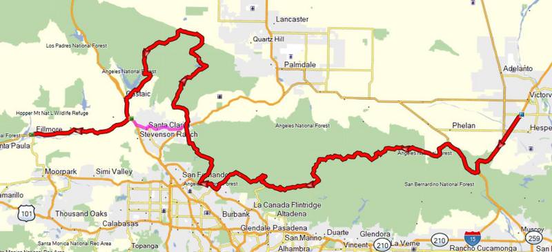
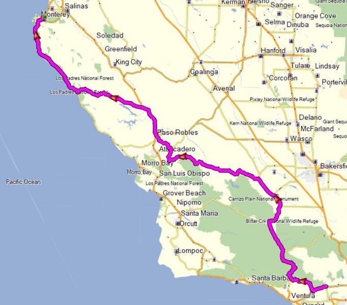
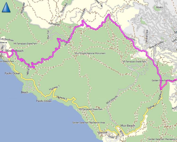
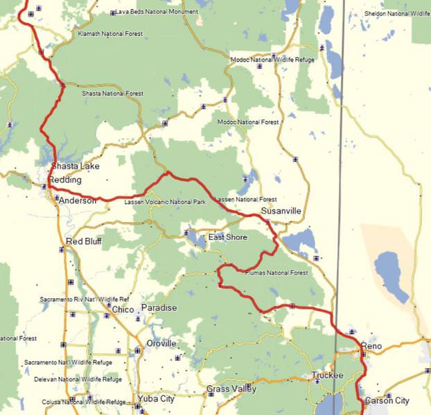
The theme of this trip is to ride roads rode not often or never, skip camping and stay in hotels. Today's route takes me to some roads in the never rode category and the route looks something like this:

D48MgoM.jpg


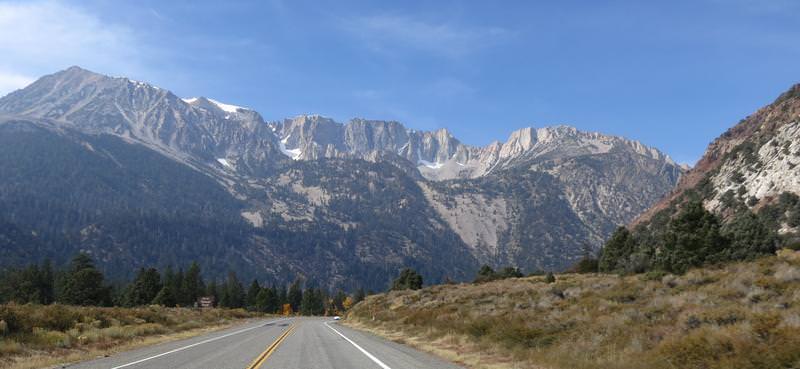
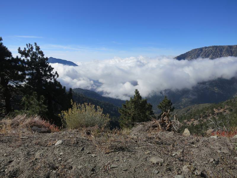
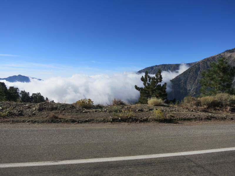
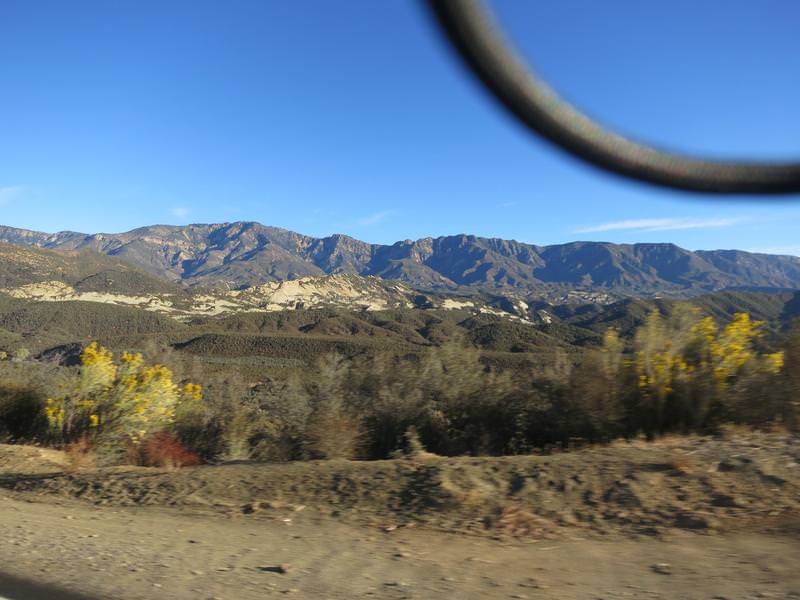
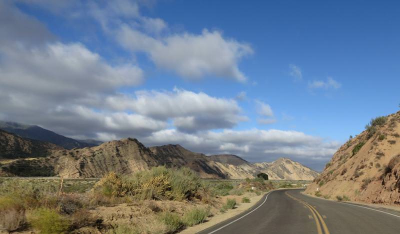
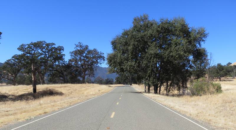
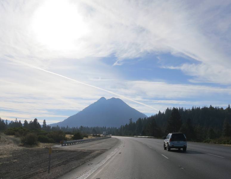
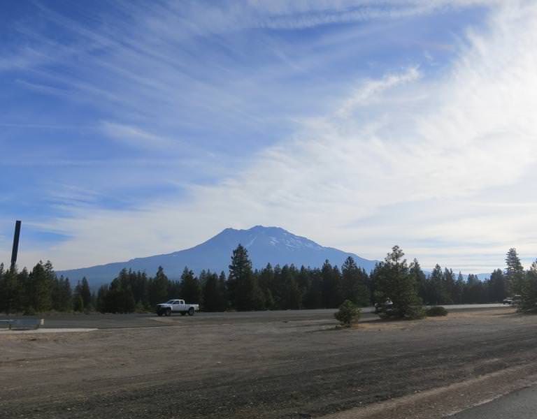
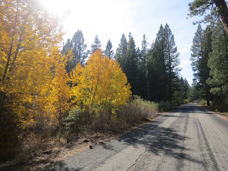
The day starts by forcing my foot into the boot with the zipper failing - unusable even. Rat in fratting fricking ratting...... Fortunately there was motorcycle dealer n Yreka, unfortunately they didn't have any suitable street boots, so I detoured to Cycle Gear in Redding California. Here are a couple of photos near Mt. Shasta. Shooting in the to the sun is a drag.

zuXjxVk.jpg


C3set8y.jpg


Cycle Gear has a lot of boots but nothing I really wanted but I was a man in need and want had darn little to do with this. A lot of trying on this and that I found some discontinued entry level race boots, originally priced at $185, now going for $49.95. Perfect and I had a thought these might even work out long term. It was a fleeting thought.

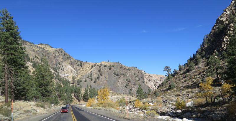
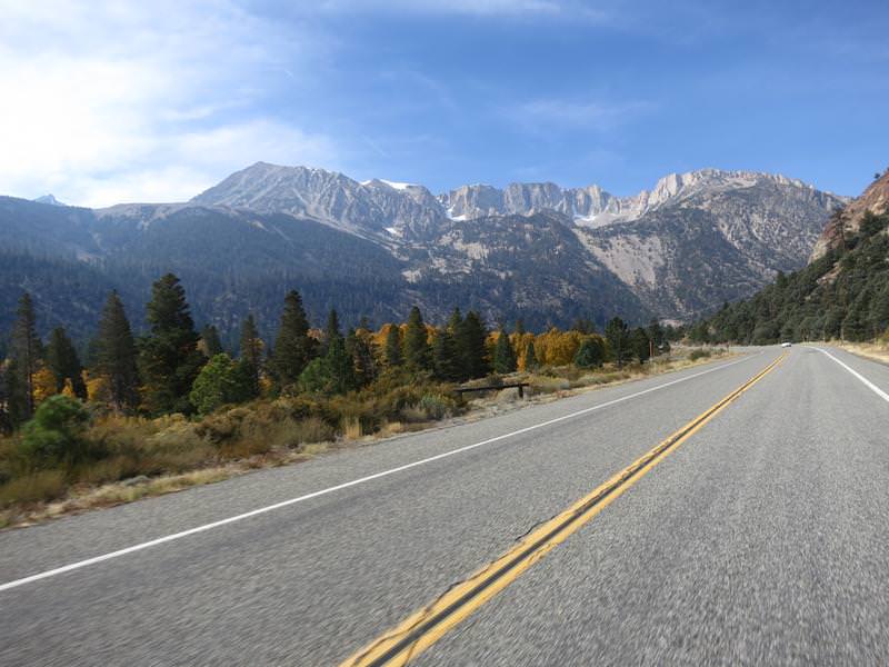
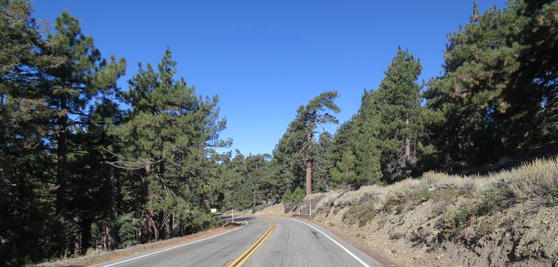
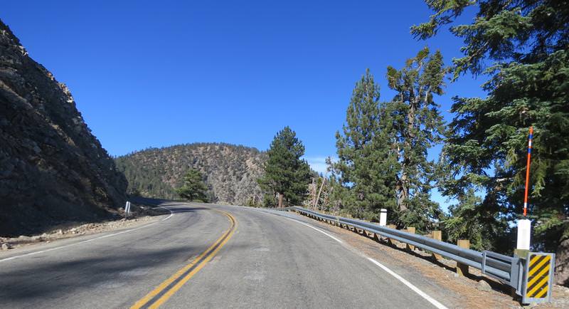
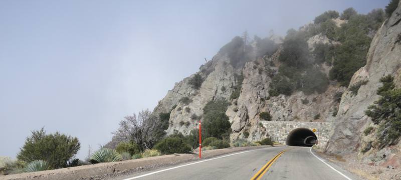
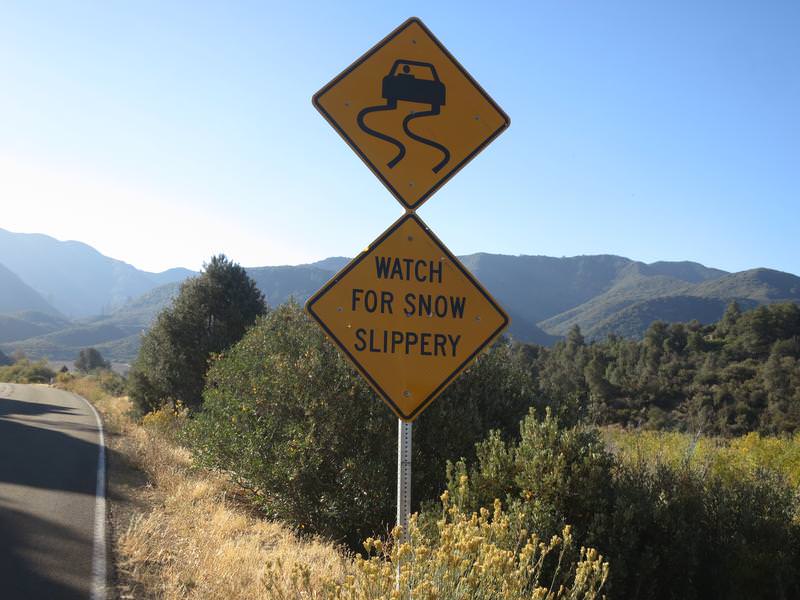
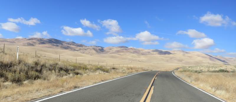
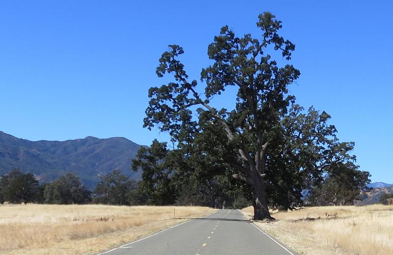
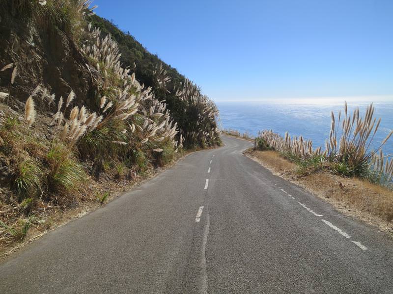
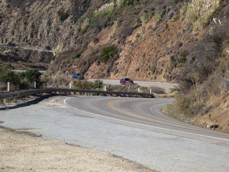
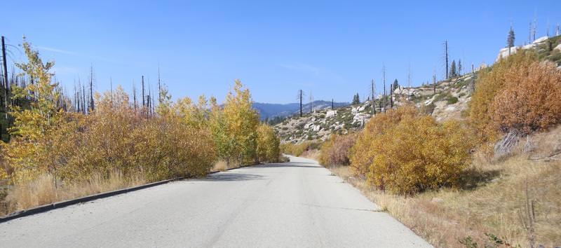
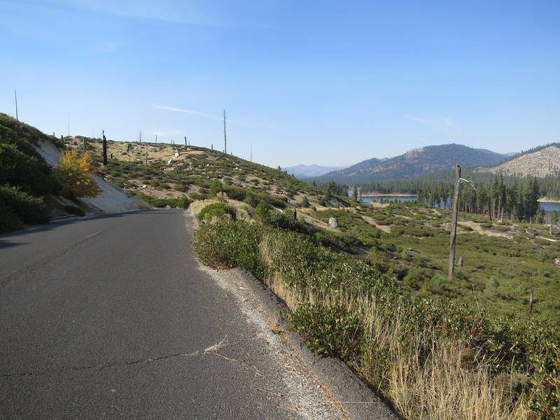
The overall goal today was to ride FSR 43/01 between Taylorsville and Janesville. Why you ask? These roads are rated a DH42 in Destination Hwy's Northern California with a twistiness factor of 30/30. I have never road it, so I am in. So after a long ride to get there from Redding it starts out with pavement like this and this was expected.

U8vvrO1.jpg


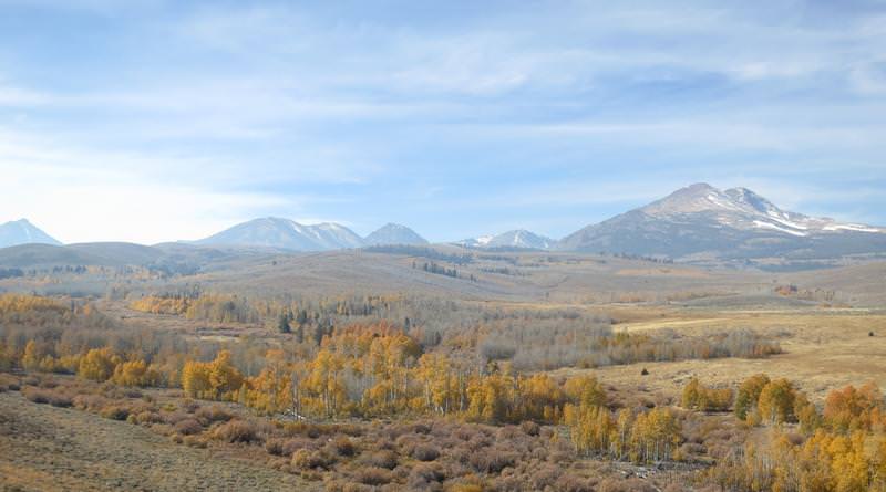
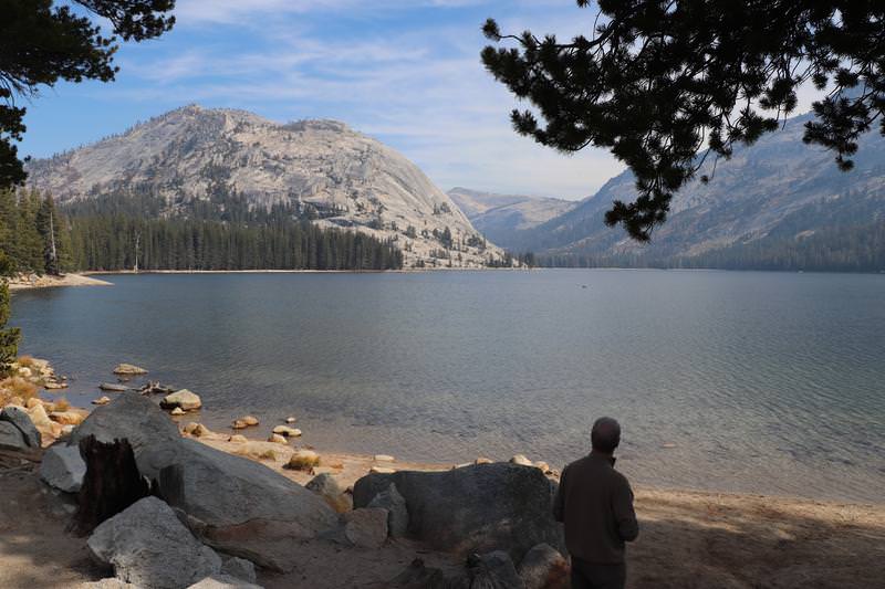
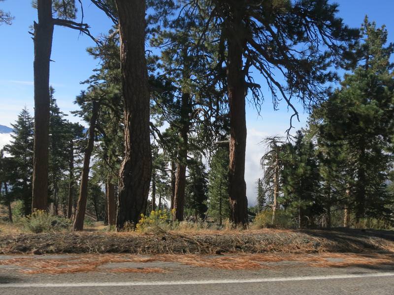
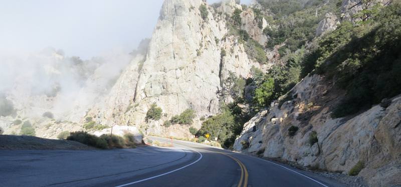
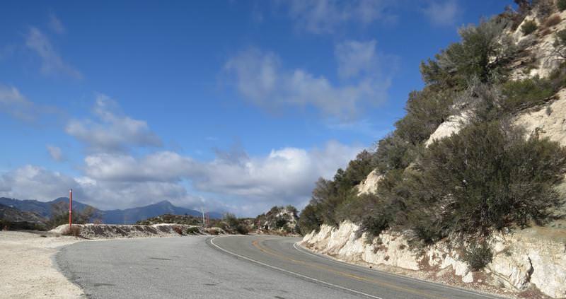
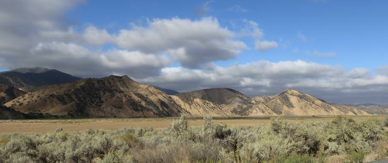
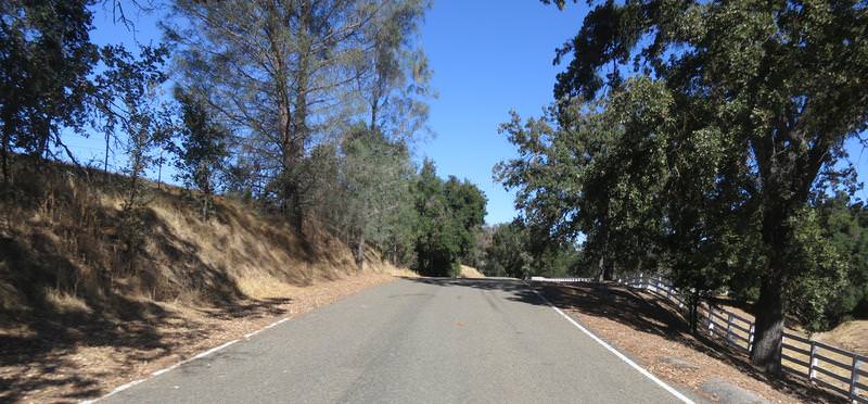
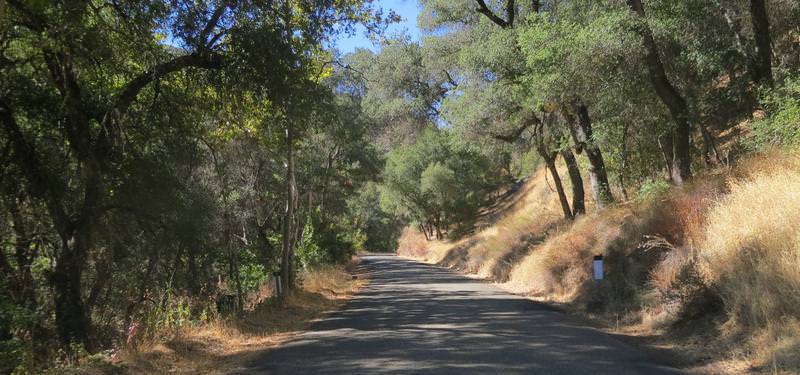
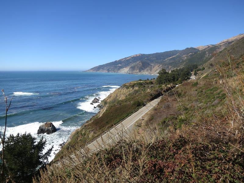
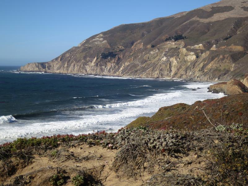
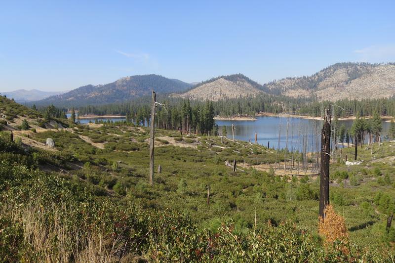
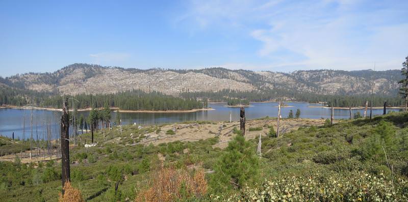
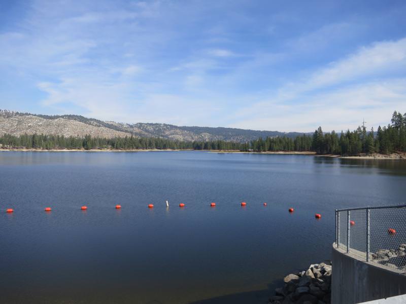
Then the pavement improved and so did the views as I approached Antelope Lake. The views improved due to a recent forest fire. Speaking of fires I had been seeing some smoke since Oregon and it lingered with me for a few days. Yuck to smoke.

rwHhFa8.jpg


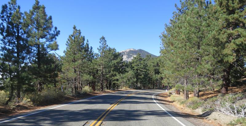
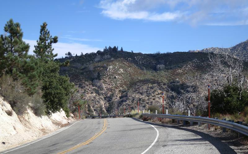
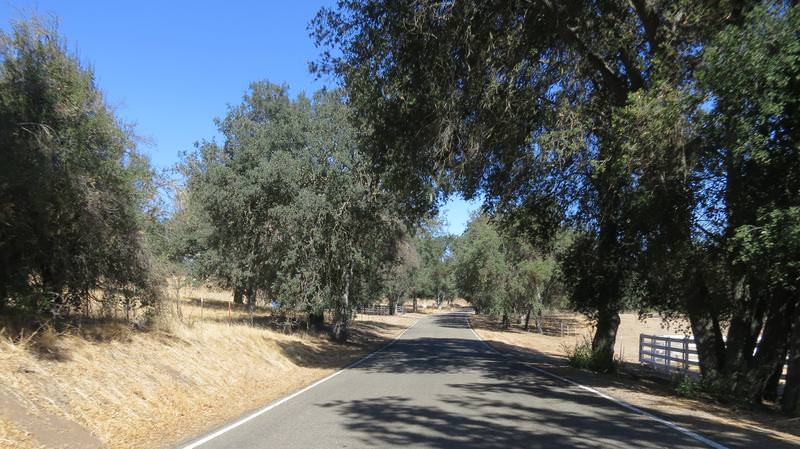
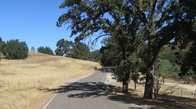
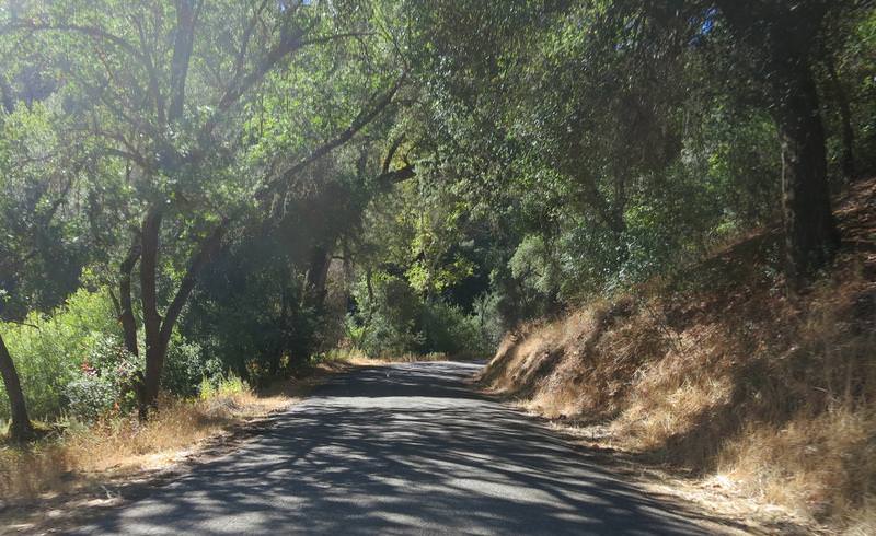
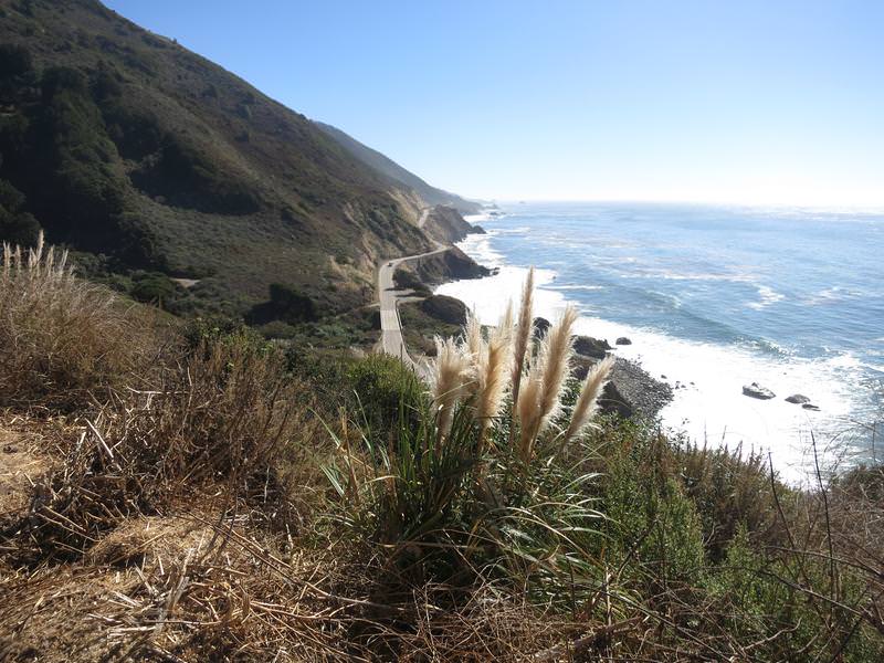
The twistiness was nice too when the pavement was good.
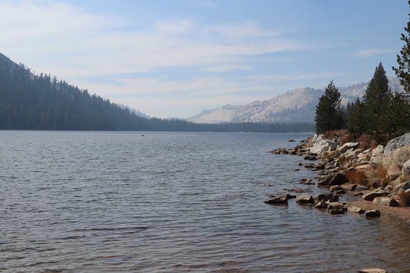
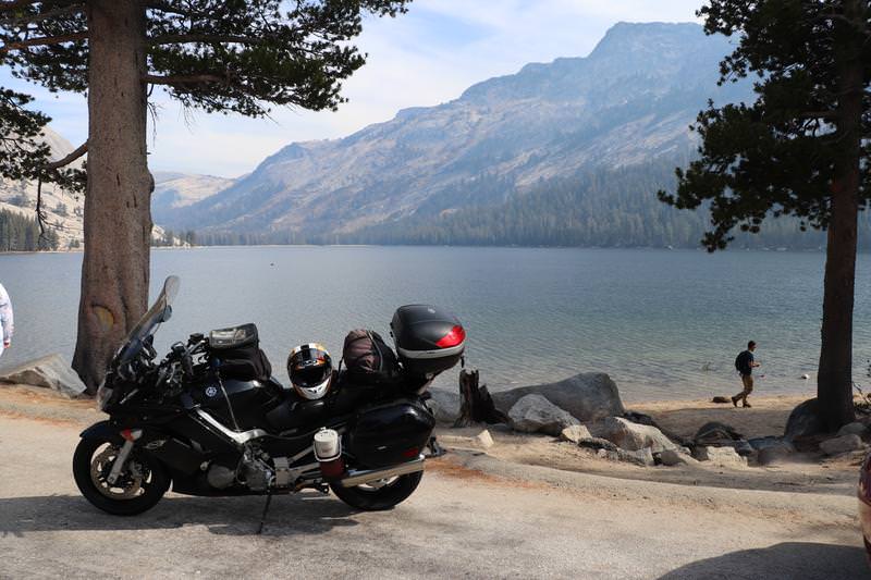
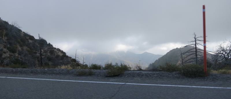
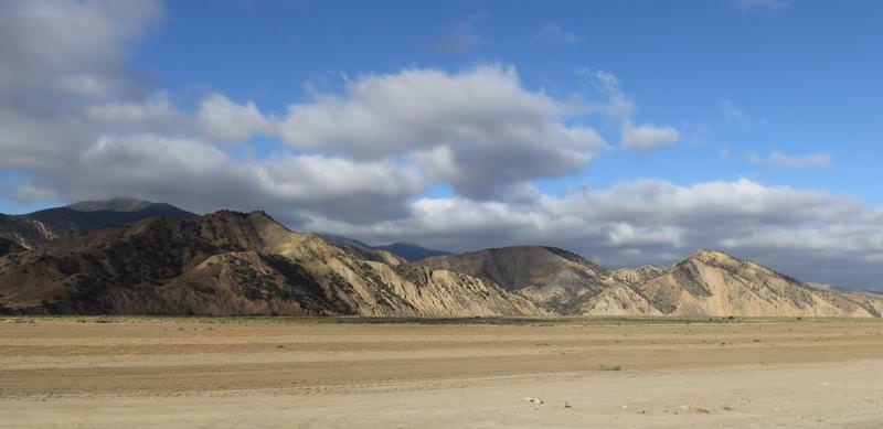
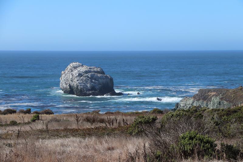
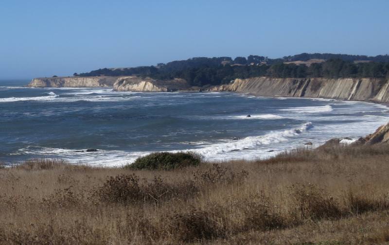
Antelope Lake

t2TFaZz.jpg


exoz3j7.jpg


9ATZYZy.jpg


InBIeFo.jpg


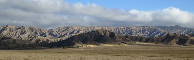
At this junction near Taylorsville, see next pic, the silly Garmin 590 decides the best route was due daft down a dirt road to Hwy 70. Later I compare the Basecamp route I created vs. the route the GPS created. The Basecamp route was as planned so why can't Garmin create a GPS that loads the route as planned in Basecamp without alteration? I have the GPS set to avoid gravel road as well and I compared the routing options in Basecamp and the GPS and they are the same. Come on Garmin get with it. We spend $800 for something that does this? BS.

Anyway I am not going down the dirt road so I went around on Hwy 89 through Quincy and then Hwy 70. About now I realized I left my Destination Hwy California Map at home. Bummer. I really like these maps as I can ride like a local finding all the good roads.

0B4TF8V.jpg


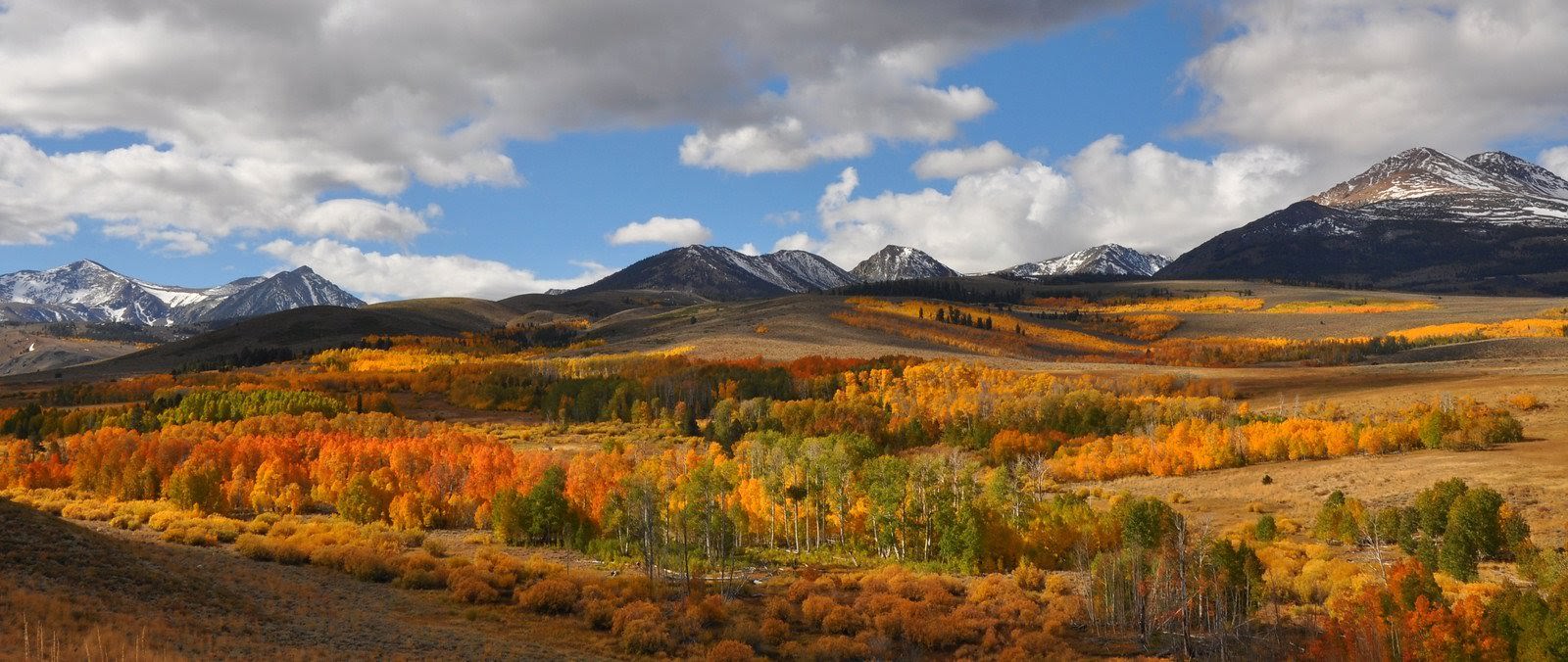
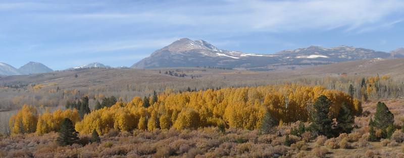
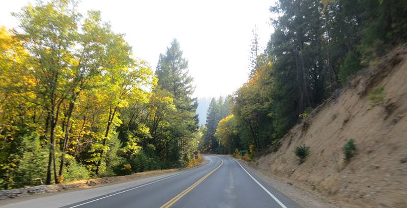
On the way to Carson City fall colors provided entertainment when the road didn't.

NjVo5ZW.jpg


By now the inexpensive boot experiment had become very painful for my little toe in the left boot. The right one was fine. I stopped at a Walgreen's and got some moleskin. The toes slider nut plate was riding on my toe. The boots are Cycle Gear's in house brand Built. How about not well Built or Built like.... (add your own adjective here - I did several times.)

I get a room in Carson City right in the middle of town have good dinner at a English style pub then enjoyed a cigar while entertaining thoughts of staying in town for a couple of days. I like it here. The Nevada State Museum is nearby as is historic Virginia City and good roads are nearby too.

End of Day 2
 
Last edited by a moderator:
Great to see you continue to enjoy retirement
punk.gif
-- OldMike will be upset once again
rolleyes.gif


As for shooting in the sun ---- did not hurt the pic quality at all. :)

The boot sliders, are they removable ?

 
Last edited by a moderator:
By now the inexpensive boot experiment had become very painful for my little toe in the left boot. The right one was fine.
Which boot did the zipper fail on your old pair? (You see where I'm going with this dont'cha?
smile.png
)

I remember and enjoyed your last report. Looking forward to the rest here.

 
Last edited by a moderator:
Had fun following along and stalking you Fontanaman...helped with the recent daily doldrums!

Looking forward to the report & pics.

--G

 
The enjoyment of a Laphroaig with a fine cigar Tuesday night while thinking about staying in Carson City a couple of days was short lived as reality came calling. The forecast for Thursday is sustained wind from 20-30 mph with gust to 50 in the morning with snow in the Sierra Passes in the afternoon. It was time to get out of dodge and head south.

On October 15, 2011 Tyler took this photo. It is fantastic.

mIFXcvN.jpg


Tyler’s fantastic photo provided the inspiration to drive down Hwy 395 but I am getting ahead of myself. First off Thanks Tyler for the inspiration!

Next today’s route:

Pw8PuUB.jpg


With snow in the forecast I had the opportunity to ride one Sierra Pass and that would be Tioga Pass as the east entrance to Tioga Pass is near Tyler’s autumn leaves photo. I would end up on Oakhurst for the night.

Highway 395 was a delight. Pretty good pavement with many changes in scenery with the Sierra’s to my right. Very nice. A reason to return include riding the Kingsbury Grade road Hwy 207 going up to Stateline.

Along the way I enjoyed many autumn leaves.

6hiiQxH.jpg


oqYMzjM.jpg


I arrive at the location of Tyler’s awesome photo. Here is my photo.

J4aF21z.jpg


My photo sucks and that is fine for it is not about the photo but having the opportunity to ride down a fine road with terrific scenery.

This pic isn’t half bad.

pzd9cgH.jpg


After getting fuel in Lee Vining it was time to begin the ascent of Tioga Pass. I was following a Mazda Miata and he was keeping a good pace. Here are a couple of pics on the ascent.

68haRWJ.jpg


qV6B0mW.jpg


I reach the entrance to Yosemite Park where the nice lady wants $25 for the privilege for the right of passage. I say hello and ask to buy a Golden Turkey pass explaining I will be 62 next month and perhaps the Federal Government could be so kind to give me a early birthday gift. The response was today it will be $25. Well frinking ratting fratting....

The smoke getting worse as I headed west as was the pain caused by the damn nut plate in the left boot.

My next stop was Tenya Lake. Here is a photo from Sunday June 29, 2003. The 1988 BMW R100RT was mine.

ttEn5YQ.jpg


Today the scene was a bit different. As I walked down to take this photo the pain in my left toe lit up. I whipped out my Swiss Army Knife found the Phillips screwdriver to remove the toe skid plate and screws. The relief was instantaneous and I had no problems with the Built boots the rest of the trip.

RCUkFdT.jpg


The fellow in the foreground tried to move out of the way. I said no please just look at the scenery as having you in the foreground of the image adds interest to my shot so he did.

UUabStd.jpg


Tenya Lake near the photo op from 2003.

sXUwrsb.jpg


I stop a Tuolumne Valley to take this photo.

oU3C496.jpg


I was hoping for this. Yeah right.....
icon_e_biggrin.gif


The smoke was getting thick. I was thinking about the poor souls who had travelled many a mile for YFO only to find the grand passes of the Sierra's closed tighter than, ah hem.
icon_e_biggrin.gif


Despite it being a weekday there was no fun in Mudville with respect to the traffic - it was getting ridiculous and I want to to move. Grin and bear it while enjoying smoke filled skies.

Lmz69xF.jpg


A close up.

kSpsa9R.jpg


7xYBV81.jpg


All smoke and traffic convinced me to skip King’s Canyon and Sequoia National Parks. I wanted to ride roads less travelled and I knew exactly where to go!

I arrived in Oakhurst cleaned the bike and enjoyed a dinner with a couple of beers at a local establishment while watching some of the baseball game. Go Dodgers!

 
Last edited by a moderator:
Deb and I were standing at this ^^^^^^ same exact spot last month, the day of the first rock slide.

Kinda ghostly looking now - a shame.

Cool pics Jim
smile.png
- thanks for doing this. It's nice to be following both your RR's having ridden many of the same roads ourselves -- putting ourselves quietly in the picture -- if that makes sense.

 
Last edited by a moderator:
Deb and I were standing at this ^^^^^^ same exact spot last month, the day of the first rock slide.Kinda ghostly looking now - a shame.

Cool pics Jim
smile.png
- thanks for doing this. It's nice to be following both your RR's having ridden many of the same roads ourselves -- putting ourselves quietly in the picture -- if that makes sense.
Thank for the complement and you are welcome. I enjoy writing ride reports. My contribution to the forum and a good way to meet people.

 
Day 4

For the ride on day four I considered loop rides east of Fresno or or heading further south. The forecast was for rain on Thursday near Fresno so I laid out a route south. The riding in the morning would be great but the afternoon left me on the freeways in the Mojave Desert.
icon_rolleyes.gif


Butler Map Southern California was helpful creating route on the east side of Bass Lake, to Aubery Road, Hwy 168, back roads to Hwy 180 to Dunlap Road, Hwy 245 to Yokohl Road and onto Hesperia.

Highlights of the day included Dunlap Road and Hwy 245, both are very twisty and have great pavement. Exciting so exciting I didn’t get my camera out. Just go ride these roads.

Low lights of the day are Yokohl Road and the long haul on freeways to Hesperia California. I included Yokohl Road because it looked twisty on the map and it was but the goat factor was extremely high with a lot of second gear work. Really rough pavement, single lane and no paint on the road. In a right turn I was doing about 25 mph when the front tire hit some white sand and the front end started to slide. The pucker factor was high and before I could say I’m screwed the bike stopped sliding. Maybe I was able stop the slide by bringing the bike upright or the tire found some solid pavement or a bit of both - I don’t really know. The problem was, even at 25 mph, the sight line was so poor I could not see the white sand. Tall grass on the right side of the road impeded my site line. Bottom line is I was going to fast for this turn.

Here is my route:

J8NPTRS.jpg


And here is the sole photo to shot today.

zc6TtMN.jpg


Tomorrow will be better I promise! Do you really think I’d ride on freeways through the desert without a payoff?
icon_e_biggrin.gif


Last edited by a moderator:
California Department of Transportation has a pretty good app for highway information called CalTrans Quickmap. A quick look this morning revealed Ebbets, Sonora and Tioga Passes were all closed due to snow. There was snow in the ground near Lake Tahoe so the idea to head south paid off. The forecast for today was for winds from 20-30 mph with gust to 50. Then increasing temperatures for the next three days topping out near 100 degrees in Los Angeles. I had considered riding in the desert east of San Diego. There is some great roads there such at Mt. Laguna but the the prospects of riding in Santa Anna winds with temps over 100 were about as welcome as a shaker of salt is to a slug.

After yesterday I was tired and didn’t sleep well. Just one of those things. This town was no place I wanted to stay yet high winds were in the forecast. I decided to just set off and land in Fillmore just north of LA, take it easy and bail directly to Fillmore if the wind became extreme.

The route was set using Butler Map Southern California and includes Angels Crest Hwy, and few Canyon roads I’d never been on. Better yet I it was a shorter day, not many miles on the freeway and lots of great roads. And to top it off I was staying at a Best Western, certainly and upgrade from the dump I had stayed in in Hesperia. The only redeeming quality of Hesperia is it is near the east entrance to Angeles Crest Highway.

Here is a map of today’s route:

APvIHpZ.jpg


Hesperia gives me one last jab by having to endure a traffic jam on I-15.

The fog on the way to Angels Crest Hwy along I-15.

EHEY6Cq.jpg


Once the morning fog cleared I became aware today there was no smoke in the air for the first time since day one. Beneath my helmet there was a big smile on my face. Clear air was nice, very nice.

Other nice things include stopping for this photo at the entrance to Angeles Crest Highway one of the premier sport bike roads in America.

G2RBuqB.jpg


I had decided to motor along in tourist mode today. I don’t recall the sight lines being terrific and there was a lot of rocks on the road especially in the oncoming lanes. In some places the entire oncoming lane was covered with rocks. Give Cal Trans credit for along the 50 or so miles there were five dump trucks with snow plow blades to clear the road. I have all of them thumbs up. My slower pace today allowed me time to enjoy this wonderful road and take some photos.

And there were a lot of sights to see like some fog in the valley.

C4i6nW9.jpg


And trees with clear blue skies.

Sh2qehV.jpg


With fog in the valleys behind the trees.

AyThtJ7.jpg


And scenic mountains. Riding along I was listening to Cannonball Adderley and Keith Jarrett. I was great to listen to jazz as it was a good counterpoint to riding this great road. The MP3 player on the Garmin 590 is very good as it accepts a 32 gig chip and is easy to use. Nice!

gZN1Cl4.jpg


3CULLIs.jpg


uERBgF2.jpg


Did I say there were rocks in the road. I was thrilled to be going east to west as rocks were mostly in the oncoming lane. Mostly....
sherlock2.gif


kAwuB2p.jpg


And some more fog.

xAspBPE.jpg


u2s0AOl.jpg


The scenery was very entertaining.

BUaIZhg.jpg


p4at0nM.jpg


TST7A4a.jpg


paxHPni.jpg


And that is the end of the picture show of Angels Crest Highway. Go ride the road. Due to steep terrain the road washes out frequently during winter rains and can remain closed for six month or more. Ride it while you can.

My route included Little Tujunga Canyon road but I missed a turn and before I realized it the GPS rerouted me to my next destination highway Bouquet Canyon. Oh well. Bouquet Canyon was a delight. Never been on the road and it is highly recommended.

Garbage cans along the side of the road where a clue to slow down because it was trash pickup day.

cixNc7W.jpg


jAcK41Y.jpg


It was a great day. The strong winds didn’t happen, I spent fewer hours in the saddle, had more fun and landed at a good hotel. When I arrived I enjoyed a soak in the hot tub, set my route for the next day and enjoyed some good Mexican food while watching playoff baseball. Nice day!

 
Looks like you enjoyed yourself Jim. Looking forward to spending winter south and exploring.

 
Choices choices. I enjoy thrill rides and we don’t have those in the Seattle area. Where I am today is near a Six Flag park and I have a choice. My route for the next two days is Hwy 1, through San Francisco across the Golden Gate Bridge and north. Today is Saturday so if I go to Six Flags I have to endure Monday morning rush hour traffic in San Francisco. If I skip Six Flags I can go through San Francisco on Sunday morning. I opt for skipping Six Flags.

The route for today is below and I land at a HoJo’s in Seaside California. The landing zone sets me up well for a ride through San Francisco on Sunday.

fN98fcy.jpg


The day start off like this. I was parked near an orange tree and I had snagged a orange off the tree. Ended up bringing the orange home and I haven’t cut it open yet.

EXWkUUY.jpg


I ride up to Ojai on my way to Hwy 33. I was a cool morning out starting out at around 50 degrees. I didn’t get many photos of Hwy 33 as it was all in shadows with bright blue skies a recipe for blown out moto photos. The ride up Hwy 33 summits at Pine Mountain Pass elevation 5200 which is in the clouds with a bit of a breeze at 36 degrees. Click go the heated grips. Hwy 33 joins with Hwy 58 and I continue west. Along the way I see a 1979 Gold Wing.

Z2HgV8A.jpg


I also took a few photos.

Mountains in the background with a camera lanyard in the foreground.

SBegiwA.jpg


I smirked when I saw this, yup snow is slippery.

ilEtzW3.jpg


On the road the scenery kept me entertained:

7DwHIeT.jpg


CfI2qDK.jpg


L84mskN.jpg


SgxRR2f.jpg


Ew25uNB.jpg


The Nacimiento-Fergusson Road is listed as a Dangerous Road in California. I was not aware of this until writing this report but I was aware the road was twisty and was along a military base. It starts out tamely enough and was actually rather scenic so I whip out my camera for some on the go moto photos.

C9CvOSa.jpg


Lot of Oak trees with white paint but no centerline. It was all good.

ALeRSqY.jpg


Ttxpdze.jpg


W7tnfwc.jpg


I really like this photo. The single tree alongside the road is just different.

gZ1Cvjv.jpg


Then I loose the white paint and the pavement deteriorates.

NL5IVvp.jpg


Y4gSo2s.jpg


After that photo the road gets very twisty heading down the ocean and the camera goes into my pocket. It was Saturday and there was lot of bicyclist riding up this terribly bumpy twisty road. I was going slow and was safe out here but the bicyclist must have a death wish. All it would take is one fast motorist and that is it. At 20 mph it seemed like this damn road would never end but then there it was, the Pacific Ocean.

GGJ9K6U.jpg


01EnFhr.jpg


The cat tails caught my eye.

UqSDJx3.jpg


Finally Hwy 1. It was an easy decision to ride eight miles south on Hwy 1 where it is closed until sometime in 2018. The road closure is the reason there is so much traffic on the Nacimiento-Fergusson Road.

Photos along Hwy 1. Great road and there was no fog.

bJvYfYu.jpg


q58rLjn.jpg


QA7dtmn.jpg


B8rcTpM.jpg


CLnRkQc.jpg


Big Creek Bridge in the background:

M0FrFvk.jpg


I used the camera's built in high dynamic range to make a bolt artistic image.

kGKoROy.jpg


Another fantastic day of riding on California.

 
I am writing this post about 9 days after the end of my trip. This morning’s breakfast included the oranges I picked off this tree. It sure was yummie.

EXWkUUY.jpg


Today’s ride goes from Seaside California to Fort Bragg. The route is simply follow Hwy 1 with a detour along the Panoramic Hwy outside of San Francisco. The detour was necessary because Hwy 1 was closed so I didn’t get a vote.

igDuy4R.jpg


The Detour

HWDRzdN.jpg


I had never travelled on Hwy 1 from Santa Cruz to San Francisco. Usually I take the Skyline Divide aka Hwy 9 or once I road around through Oakland. Boy those stadiums for the Oakland A and Raider sure look rough - downright ugly even.

Hwy 1 is very straight from Santa Cruz to San Francisco but it makes up for it in scenery. Very nice.

I was at a pull out taking some photos. A surfer, with board under arm, was literally running for the beach. I don’t know what the hurry was. Perhaps the waves are better during an incoming tide. It was Sunday morning and there were surfers and bicyclist everywhere.

H4GoURq.jpg


Pigeon Point Lighthouse

UZ23OOh.jpg


The ride up through San Francisco wasn’t bad, just busy, with three lanes of traffic in each direction. Gotta be alert here. Tourist were walking on the Golden Gate Bridge. I was surprised how many people were out and about.

GC1x0iN.jpg


The detour on Panoramic Hwy outside of San Francisco looked promising with all the turns on the map. Hiker and cyclist love this place to death. I picked the wrong day to be here. It reminded me of Seattle. Mt Rainier and the hiking trails off I-90 are loved to death. Spokane will be different.

Even along Hwy 1 it was crowded and slow. The crush of people didn’t really subside until I reached Jenner California a full 90 miles and 3 hours from San Francisco. The parking lots for every restaurant, store and trinket and tash shop was just jammed along Hwy 1. People would stop in the middle of the road and try to figure out where to park. I simply went around on the right side to get to the front of the line for a while. Along the way there was lots of great scenery.

b2LZhqu.jpg


9rLaXqb.jpg


eC29BnT.jpg


The next photo is typical of riding on the coast. You get a quick glimpse of the ocean while diving into a turn.

A a traffic signal regulated one way traffic in a construction zone where I pulled to the head of the line just in time as the light turned green. Glad I did. I came upon a set of six or eight turns carved into the cliff. The pavement was just twisty no up or downs. Entering turn one you could see the outside of all the turns. It was the best set of turns of the day. The Dunlops RS III worked well.
icon_e_biggrin.gif


kK9y8zq.jpg


RNS3W8e.jpg


5MtA2Aq.jpg


I landed in Fort Bragg in time to watch the end of the Seahawks game while enjoying a couple of beers at the North Coast Brewery. Nice place.

 
Last edited by a moderator:
Wow what a great RR and photos. Haven't been on the forum much with work and all, but this was great to come back to. Thanks for giving us working stiffs a taste of retirement. Looking forward to more.

 
Last edited by a moderator:
Top