FODS V

Yamaha FJR Motorcycle Forum

Help Support Yamaha FJR Motorcycle Forum:

This site may earn a commission from merchant affiliate links, including eBay, Amazon, and others.

UberKul

Tire Assassin
Joined
Jan 11, 2006
Messages
922
Reaction score
209
Location
Wilseyville, CA
FODS V

i-3QCgsK5-S.jpg


Dates are now set, March 15th-18th, 2012.

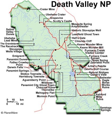
As much as I would like to make this start on one side of the park and end on the other I just don't think it's practical. Getting the trucks/trailers to the finish point would require too many non-riders to jockey vehicles while we play.

The Longstreet Inn and Casino (775) 372-1777 will be the primary base of operations for this assault on the desert. Those that prefer The Stagecoach in Beatty can make the 30 minute ride down to meet up for the rides.

Don Stanley (BeemerDonS) had to play poker with TWO women to get us a reduced rate at the Longstreet Casino and I appreciate your efforts sir. This rate only applies to three nights occupancy of March 15-17, 2012. If only two nights are booked it will be $10 higher per each of the categories below!

Please note the pool is closed until Memorial Day and the spa is down for maintenance. :angry:

$39.95 for a Standard Room with two queen beds on the Highway side of the property; still very quiet.

$49.95 for a Standard Room on the pond/park side of the property; also with two beds, but away from the main highway!

$59.95 for a Suite; these are really nice and swank; on the pond/park side with a King Extra Bed, fireplace and patio.

When FJR Forum Members book they must mention FODS and either throw out the name of Don Stanley or 'UberKul' Brad.

When AZ Beemers Members book they must mention Death Valley Daze 2012 and throw out the name Don Stanley or BeemerDonS.

Please post up in the original thread when you have booked a place to live for this ride and I will keep a running list of attendees.

I will work up a couple rides for Friday and Saturday in the 150-200 mile range but they should all be big bike friendly with a gas stop shoved in there somewhere. VStroms etc. should be fine on all these roads with some reduced tire pressure.

These will be unsupported rides so bring food, fuel and tools to take care of yourself for a whole day out riding in varied weather conditions. There is little to no cell service in this park and any problems we have will be self rescue unless life threatening. I'm still a rookie Death Valley rider but feel free to PM me if you have any questions or concerns.

Short and long sleeve t-shirts can now be purchased here with zero mark-up over the CafePress price.

If you don't have a dual sport bike feel free to come anyway. The weather should be good but us dirty boys will have all the fun stories and mock the slaves to pavement mercilessly! ;)

DVDazed pavement pounders

Fairlaner, street bike

dj bill, street bike

Tom and Son, street bike

marcusorelius and Duke, street bike

Jim in Phoenix

Dirty FODSies

BeemerDonS, Miss Donna and Seth, dual sport and Jeep

Jorsten, dual sport

ynotride, dual sport

OCfjr and wife, dual sports

UberKul and daughter Erin, dual sports

CAJW and son, dual sports

Bluestreek, dual sport

rcsnclh and six buddies!, dual sports

Don (Subaru Plus) Wilke and 4 buddies, dual sports

SaharaJp99 and co-worker, dual sports

AZ Beemer Mark - mnelson

Dougc, dual sport

Bugnatr, dual sport

AZ Beemer DaveO

AZ Beemer Jerry

AZ Beemer Pat Kenney

Uncategorized misfits with undisclosed or undecided means of transport. :huh:

RenoJohn

Some ride possibilities in GPX format. Click the link, go to file then download and view in your favorite map program.

FODS Day 1 162 miles

FODS Day 2 216 miles

FODS North Park 329 miles

Goler Loop 229 miles

Trona Pinnacles 301 miles

1042374223_rbuba-M.jpg


The little icon thingy for this FODS
i-6BGZJV9.gif


Last edited by a moderator:
Brad,

Put me under the testing the water heading: Oct dates won't work, have MSF refresher course that weekend. Second thought, doc said to limit activity so rather and screw up his seamstress work, I'd better pass. Please post up details and if I'm able, the Mrs. and I might join in for an evening of refreshments and retelling of embellished shady facts. Crap... this is yet ANOTHER FODS I've not been able to make... :angry2:
Brad, I'm in the same boat as CAJW; the October dates will not work because Son Seth and I are riding the Utah National Parks and I'm leading a group into Mexico for my 63rd Birthday. Also, are you aware that NAFO / CFR is also going to be held in June of 2012. If you could come up with a different time that would be great! Would May 2012 be too early or would July 2012 be too late?

Definitely interested in FODS V! Might even consider camping out on the trail with Son Seth in the Jeep!

 
Last edited by a moderator:
Interested. My weekends are booked solid until October 17th so it looks like I can make it. I dont have bike camping gear so motels each night works for me. I do have a toy hauler if you decide to camp in one spot. I will keep an eye on the thread until solid dates are locked down.

 
I have not missed one of these yet. If at all possible I will be there.

Would there be any interest in a ride thru Death Valley? There are a lot of unpaved roads there we could explore.

 
I'm watching. I wondered if, who and when it might happen.

I can't do 4 days...there's this work-thing that keeps getting in the way. But something where I could join in the parade after Friday's embellished campfire/parking lot repartee.... :dntknw:

Of course, that also means more local is better for me but I will make anything work.

As with beemerdons, I've already "blocked out" June 2012 for NAFO on my calendar.
Loco Miguel Dos hablas la Verdad, please avoid interference with NAFO / CFR if at all possible! MEM - Maria Elena, Miss Barb and Mademoiselle Kasey would cry themselves to sleep every night if madmike2 and BeemerDonS were not in attendance at Castlegar, British Columbia, Canada next June.

And madmike2, take it from SkooterG and Papa Chuy Viejo; that work-thing is highly overrated, Greg and Don just can't get into that work-thing at all! jes' sayin' and nuff' said!

 
Last edited by a moderator:
I have not missed one of these yet. If at all possible I will be there.

Would there be any interest in a ride thru Death Valley? There are a lot of unpaved roads there we could explore.
Senor Brad, Papa Chuy is not trying to hijack your ride in any way, shape or form; the Tahoe/Yosemite Sierras would be incredible, but Steve-O does have a brilliant idea with our dual sport riding Death Valley NP.

Death Valley indeed has lots of unpaved roads that we could explore all day long. Inyo National Forest also has a ton of off road riding. To keep with the Rolling Rally theory, perhaps the first night in Lone Pine, CA.

Everyone has enjoyed the Best Western Lone Pine, this would make a great first nights meeting place for our get together and our first dinner as a group. Then perhaps Friday and Saturday night in Amargosa Valley, NV.

Fairlaner and Papa Chuy have established an excellent relationship with the Longstreet Inn and Casino, from our both booking FJR Forum and AZ Beemers Club riding events for many years now, we get discounted pricing!

The beauty of DVNP and Inyo is they can be ridden earlier in the fringe months such as November and March-April, due to the weather in both locations being mild and comfortable; whereas N. Sierras will be snowed in then.

Just food for thought, whatever you come up with would be fine with Seth and I. As a courtesy, if you do go with DVNP / Inyo I would recommend that you send a PM to Fairlaner; so, this does not step on his annual DV ride.

https://bestwesterncalifornia.com/hotels/best-western-plus-frontier-motel https://www.longstreetcasino.com/ https://www.ohranger.com/inyo-natl-forest https://motorcycle-intelligence.com/death-valley/91/

 
Last edited by a moderator:
I haven't read every post but I'd be up to some fairly easy to moderate off-roading/camping next year sometime. Like others NAFO will be a primary interest however. Very tentative interest on my part depending on how plans develop.

 
I'm listening......but I'm already negative on vacation days this year :D ........maybe a two day run for us.........screw all ya retired SOBs :p

I just took off the knobbies and mounted Tourances on the Wee, no more two foot silt beds for a while. :unsure:

 
I am interested. Buttt would need to be next year for me. Time off and the distance from Oregon. I have been trying to make one of these events without success. I will keep an eye out for whatever is scheduled then see if I can make it.

 
I am digg'in the idea of the Death Valley location Don. It does open up the timing to the months outside traditional ride months. Getting over the Sierras could be a problem for those coming from the north but trucking/trailering could solve that. I can take a small fleet of bikes down with me if someone just needs bike transport on a flatbed.

Lone Pine night #1, Amargosa #2 and Stovepipe #3 sounds like an appealing and equitable split for everyone. Looking at the average temps we could do early March and still not kill any campers. :blink:

Just shot Fairlaner an email (no PM's for Richard at this time?)to hear when he plans to do his thing.

I will probably go for the motel lodging for a Death Vally trip since the group campgrounds hold little appeal for me. If no one needs bike transport I will tack a day on to each end to ride down and back via the back roads.

Thanks for all the input folks. Once we get some dates nailed down I can put it out with some lodging options. Looks like a lot of exploring can be had and everyone could go as hard or soft in that department as they wish. Now all we need is someone, anyone (bugnator :p ) who knows the best dual sport routes so we don't miss any of the good stuff. :yahoo:
Sounds great Brad, I like it when the "A Team" gets a plan together. I will copy and paste this myself to Sir Richard also, I definitely do not want to step on his Annual Death Valley Romp.

Also, with your kind permission I would like to post this up to my AZ Beemers Club GS section; Club President Brian Boles has ridden both his R100GS and F800GS all over Death Valley, he too can lay out a number of great routes.

 
Last edited by a moderator:
Brad, here are 15 off road destinations in Death Valley National Park itself; many more are just outside. Thousand miles of offroading in Death Valley NP!

https://www.nps.gov/deva/planyourvisit/loader.cfm?csModule=security/getfile&PageID=129616

death-valley-national-park-map.jpg


1) Hole-in-the-Wall

Vehicle needed: high-clearance

first 4 miles; 4x4 required

beyond

Distance: 4 miles to the “hole”;

2 more miles to road’s end

Start: 5.5 miles east of Furnace

Creek Inn on Hwy 190

Camping: yes, after first 2 miles

Description: This road traverses

east up a gravel wash. After

passing through the 400' deep

gap called Hole-in-the-Wall, the

road becomes rougher.

2) Echo Canyon

Vehicle needed: high-clearance

first 3 miles, 4x4 required

beyond

Distance: 10 miles to Inyo Mine

Start: 2 miles east of Furnace

Creek Inn on Hwy 190

Camping: yes, after first 2 miles

Description: The road tends to

have deep gravel and is quite rocky 3

miles from the highway. The Needle’s

Eye, a natural arch, is located within the

canyon narrows. A side road to the left

climbs over a small saddle and

eventually leads to Amargosa Valley,

but is very rough, requiring a short

wheelbase 4x4 and an experienced

driver. The main road continues to

the Inyo Mine with its old

structures and remnants of

mining

equipment.

4) Titus Canyon

Vehicle needed: high-clearance

Distance: 27 miles

Start: Nevada Highway 374

(Daylight Pass Road), 2 miles

east of park boundary

Camping: no

Description: This popular road is

ONE-WAY from east to west.

The road re-enters the park and

winds through the Grapevine

Mountains, then drops down

through one of Death Valley’s

most spectacular canyons.

Along the way watch for the

ghost town of Leadfield and

petroglyphs at Klare Spring.

Please report sightings of

Bighorn Sheep to the visitor

center. A free information

handout describing the trip

highlights can be picked up at

the visitor center.

5) Phinney Canyon

Vehicle needed: high-clearance first 21

miles, 4x4 required beyond.

Distance: 23 miles to pass

Start: 11.7 miles north of Beatty, Nevada

on Highway 95, watch for gated road to

the left

Camping: yes

Description: Heading west across

Sarcobatus Flats, the road forks in 12

miles to Strozzi Ranch on the left, and to

Phinney Canyon on the right. Pinyon

pine woodlands appear after the canyon

is entered, and the road quickly becomes

4x4. From the pass there are views of

the Grapevine Mountains high country

and glimpses of the Sierra Nevada

Range.

◆ A vehicle with high-clearance will be

necessary for all of the roads described

below, but four wheel-drive may also be

required on some of the rougher roads.

Inquire at the Furnace Creek Visitor

Center or other ranger stations for

additional information and current road

conditions.

3) Chloride City

Vehicle needed: high-clearance first 2

miles, 4x4 required beyond

Distance: 14 miles

Start: 3.4 miles east of Hell's Gate on

Daylight Pass Road

Camping: yes, after first 2 miles

Description: One of the earliest sites of

mining in Death Valley can be reached

via a loop drive. Two miles from the

Daylight Pass Road is Monarch

Canyon where the road becomes deeply

rutted. The side road to Chloride City

and Chloride Cliff beyond climbs

steeply to the right at 5.3 miles. Loop

back to the paved road an easier way by

continuing northeast down the road

from the Chloride City junction.

◆ Please stay on established roads and

respect wilderness closures.

◆ Do not remove or disturb any cultural

or natural features in the park.

◆ Be sure to carry plenty of water; never

rely on backcountry water sources.

◆ Backcountry camping is restricted to

certain areas, please check in at the

visitor center before planning an

overnight trip and fill out a free

Backcountry Camping Permit.

◆ Travel and camp using "Leave No

Trace" principles.

Inquire about all unpaved road

conditions before traveling.

Backcountry Roads

Death Valley National Park

9) Cottonwood and

Marble Canyons

Vehicle needed: high-clearance first

8 miles, 4x4 recommended beyond

Distance: 13 miles Marble Canyon;

16 miles Cottonwood Canyon

Start: east of the Stovepipe Wells airstrip

Camping: yes, after first 8 miles

Description: For the first 8 miles, the

road crosses Mesquite Flat and climbs

a broad alluvial fan before reaching the

canyon mouth. The road drops into the

wash and becomes rocky and rough.

One mile past the end of the first

narrows, a side road leads up to Marble

Canyon. Hikers can continue up the

canyon beyond road’s end to see some

of the finest canyon narrows in the

park. Two miles beyond road's end up

Cottonwood Canyon is a flowing

stream lined with cottonwood trees.

10) Tucki Mine Road

Vehicle needed: 4x4 required

Distance: 10 miles

Start: 1.7 miles up Emigrant Canyon

Road from Emigrant Junction. At the

mouth of the canyon the road can be seen

climbing up the bank on the other side

Camping: yes, after first 2 miles

Description: After following along the

base of the mountains the road enters

Telephone Canyon. Two and a half

miles from its mouth, the canyon forks.

A short walk up the right fork will

bring you to a natural arch and an old

mill site. The road continues up the left

fork to the ruins of Tucki Mine.

11) Trail Canyon

Vehicle needed: high-clearance first 4

miles, 4x4 required beyond

Distance: 12 miles

Start: 5 miles from the north end of

West Side Road

Camping: yes, after first 2 miles

Description: This road leads to a spring

and old mining area at the forks of the

canyon. After entering the wash, the

first side canyon on your left (south)

makes a nice short hike.

12) Hanaupah Canyon

Vehicle needed: high-clearance first 5

miles, 4x4 recommended in wash

Distance: 8 miles

Sart: 11 miles from the north end of

West Side Road

Camping: yes, after first 2 miles

Description: It climbs the huge alluvial fan

before dropping into the gravel wash at

the canyon’s mouth 5 miles in. Follow

the south fork of the canyon to road’s

end, downstream from Hanaupah

Springs. Hikers can continue past the

end of the road to the spring and old

mining area.

13) Johnson Canyon

Vehicle needed: high-clearance first

6 miles; 4x4 beyond

Distance: 10 miles

Start: about 20 miles from either end of

the West Side Road

Camping: yes, after first 2 miles

Description: Beyond the end of the road

a 2 mile hike leads up the canyon to

Hungry Bill’s Ranch, with its rockwalled

terraces and fruit trees.

Continue on foot up the south fork

another ½ mile to several old mining

prospects.

14) Butte Valley via

Warm Springs Canyon

Vehicle needed: high-clearance first 10

miles to talc mines; 4x4 required

beyond

Distance: 21 miles to Butte Valley

Start: West Side Road, 2.9 miles from

southern end

Camping: yes, after first 2 miles

Description: This road follows Warm

Springs Canyon past several talc mines

before leading into scenic Butte Valley,

at an elevation of 4500'. A rough road

leads out of the park over Mengle Pass

and into Panamint Valley to the west

via Goler Wash (4x4 required).

15) Greenwater Valley

Vehicle needed: high-clearance

Distance: 28 miles

Start: Dante's View Road, 7.5 miles

south of Hwy 190

Camping: yes, after 2 miles from either

end

Description: From the Dante's View

Road to Hwy 178, this road follows the

length of this mid-elevation valley.

Good for spring wildflowers if winter

rains fall. Once bustling during mining

booms, little remains of the ghost

towns of Furnace and Greenwater

accessible via side roads. A rough,

dead-end road to Gold Valley (4x4

required) leads off to the west 17 miles

from the north end.

6) The Racetrack

Vehicle needed: high-clearance

Distance: 28 miles to The Racetrack

Start: Ubehebe Crater Road

Camping: yes, after first 2 miles, but no

camping between Teakettle Junction

and Homestake Dry Camp.

Description: This road leads to The

Racetrack, a dry lakebed famous for its

“moving rocks." Two miles beyond the

playa is the ruins of the Lippincott

Mine and an informal camping area

known as Homestake Dry Camp.

Do not drive onto the dry lakebed!

7) Hunter Mountain and

Hidden Valley

Vehicle needed: high-clearance to

Hidden Valley; 4x4 recommended over

Hunter Mountain

Distance: 40 miles from Teakettle

Junction to Hwy 190

Start: Teakettle Junction, Racetrack Road

Camping: yes

Description: From Teakettle Junction the

road becomes rougher. At the junction

3.2 miles in, the left fork (NE) continues

10 miles to White Top Mountain (4x4)

while the right fork leads one mile up

to the Lost Burro Mine. The main road

continues through Hidden Valley and

Ulida Flat, passing several abandoned

mining areas. The road climbs steeply

up onto the wooded plateau that is

Hunter Mountain. Snow and icy

conditions may make this section

impassable in winter. The road

improves after it joins the southern end

of Saline Valley Road to Hwy 190.

8) Saline Valley

Vehicle needed: high-clearance, but

may require 4x4 in winter. Subject to

winter closures.

Distance: 78 miles from Hwy 190 to

Big Pine Road

Start: 13.7 miles west of Panamint

Springs on Hwy 190

Camping: yes

Description: One of the most remote

locations in California, this desert

basin is surrounded by rugged

mountains on all sides. Finest Joshua

tree forest in the park located 8 miles

in at Lee Flat. Also salt marsh, sand

dunes, warm springs, and stunning

views of Inyo Mountains.

 
Last edited by a moderator:
Also, with your kind permission I would like to post this up to my AZ Beemers Club GS section; Club President Brian Boles has ridden both his R100GS and F800GS all over Death Valley, he too can lay out a number of great routes.
That's fine Don, FODS has never really been a bike/forum specific event. I am quite positive just about anyone will be more trail savvy than I down there.

My vision of this thing is to keep it very loose. Meet up in the evening to eat, tell lies and let people make plans but definitely no schedule.

Thanks for the above info. Makes putting together a day-route to hit the good stuff much easier.


Latest posts

Top