


Fontanaman
Robin Trower
Due to family obligations, fall house and yard chores, Christmas lights and working too much overtime at the airplane factory near Seattle, not to mention the usual crummy fall Northwet weather I have not been riding much lately. That changed on Sunday.
The weekend weather for Western Washington was for fog, freezing fog with temps in the low 30 to near 41 and nearly no afternoon clearing. Yuck.
Much to my surprise the weather on Sunday morning was clear. I also found clear skies on the Washington State web cam system and above freezing temps on my route. Excellent!
So around 8:30 on Sunday morning the wife said have fun. Yeah a free pass! Air in tires check, get the winter gear - where is that stuff I have not wore for 10 months. Cameras in hand check, get sundries needed check. As you can see it took a while to depart.
The route is the Hood Canal on of my favorite winter rides in Western Washington. The pavement is smooth along US Hwy 101 and there is virtually no traffic along the in the winter. Hood Canal was created during the last ice age with the rest of the Puget sound. For motorcyclist that means interesting terrain and good riding!
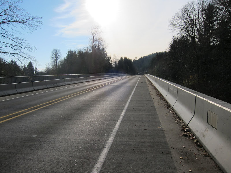
The ride begins by crossing the Tacoma Narrows Bridge the site of Galloping Gertie the failed bridge all first year Engineering students study. It went splash in 1940. Recently the state completed a second bridge.
After the bridge the weather got cloudy and cooler. I was riding with my heated jacket, pants and electric grips all turned to medium to keep me toasty and warm. I was hoping to get a photo of the Olympic Mountain near Union Washington but clouds obscured the view. The temps during the ride where between 39 and 45 degrees. Not bad for the Northwest.
Below is a photo taken March 2011.
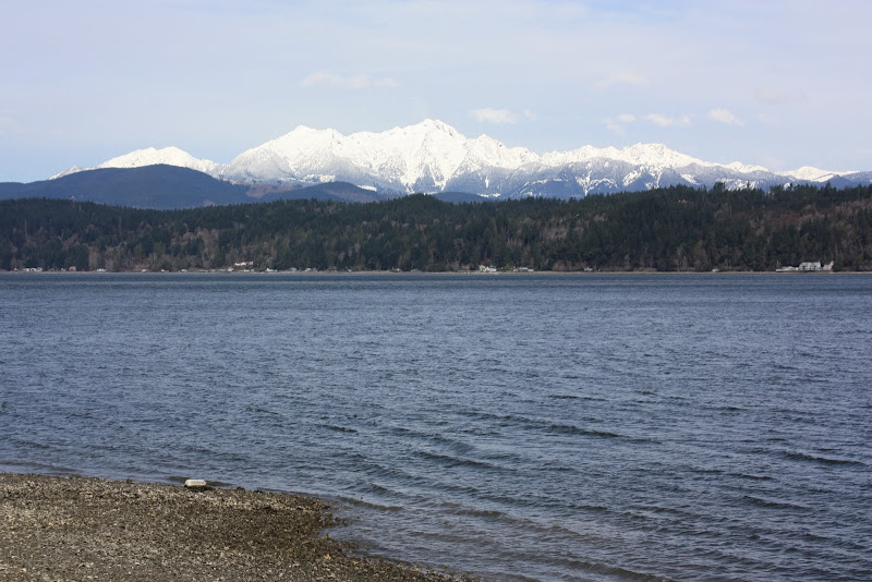
The parking lot at Alderbrook Resort was full. Alderbrook is a nice place to stay for a weekend and the Alderbrook golf course is nearby.
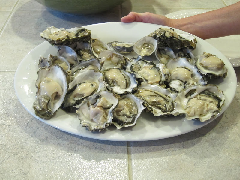
Onward to Skokomish, Potlatch State Park and northward I ride. Riding this route from south to north is highly recommended because you don't have to ride into the low angle winter sun and the highway site lines are better along Hwy 101. I usually stop at the Hama Hama Seafood store in Lilliwaup to get some yummie oysters. Chuck those suckers in the saddle bag in 3 bags with ice, get a New Year strip steak on the way home at a local meat market and the evening is set. Not today though.
Here is a photo of a plate of fresh shucked oysters from a ride earlier in 2011.
Had to skip the oysters today for I was going to meet my son at the University of Washington after my ride.
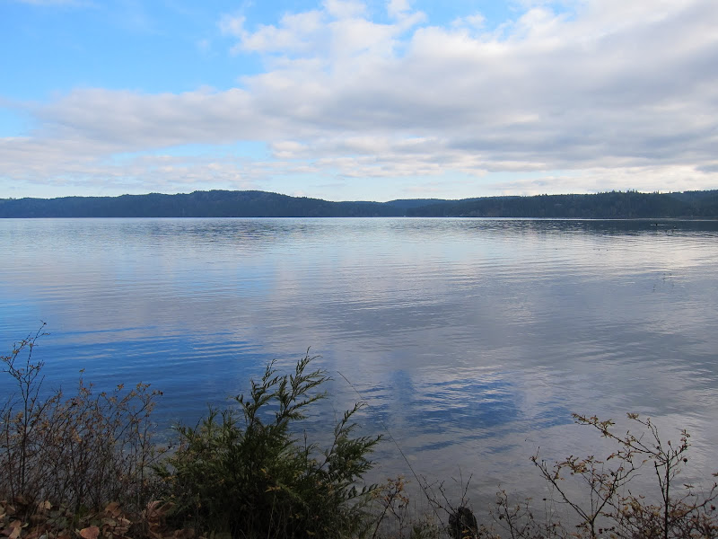
The clouds started to break up north and the scenery improved. I really enjoy winter photography with the low angle of the sun. It provide for some great photo ops even for hacks like me.
Here is one of those photos. Blue sky to the north clouds and a partly obscured sun to the south. The shadows are great. The entire day I left my DSLR in the saddle bag and shot all these photos with a Canon S95 - a pocket camera.
This is shot from the same spot, but includes the highway which is right along the water.

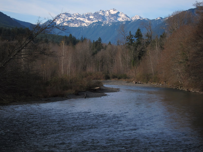
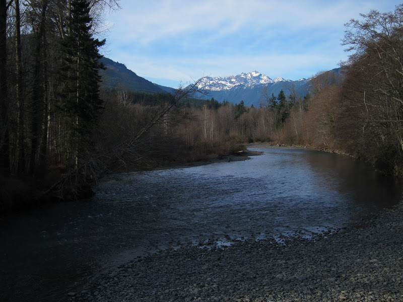
Here is another shot along the road with the river and mountains in the background.
Or this:
Looking south in to the sun. Now you can see why it is best to ride this north bound not sound bound.
I leave US Hwy 101 at Quilcene and head to Dabob Bay along Coyle and Thordyke Road. These are county road rougher and technically more difficult in comparison to US Hwy 101. The road surfaces are more interesting with vegetation, loose gravel on a chip sealed surface. I go this way because I like the view from Admiral's Row just south west of the Hood Canal Bridge. I also like the challenge of the roads. There are some nice twisties here.
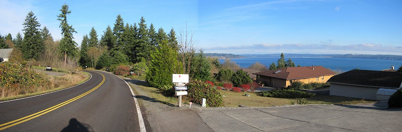
Here is a stitch shot of the view near Admiral's Row. The thin line in the background is the Hood Canal Bridge. Where is that confounded bridge.....
I go across Hood Canal Bridge, happy it is still there. In 1979 the western half the bridge sunk during a storm. Kinda spoiled motorcycling in the area for a till it reopened in 1982.
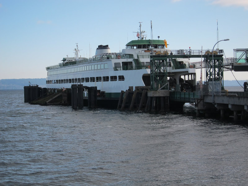
I motor through Port Gamble hoping for a nice photo but there are advertisement signs on all the Victorian architecture. The town has is Victorian theme and some nice older homes from it's Mill Town origins. On this day it is National Historic Registered tourist trap. I quickly ride on through to the Kingston Ferry.
Here is my ride back across the sound to the "main land".
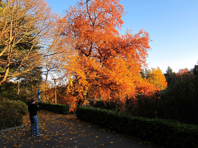
I motored on to the UW to visit with my son. We walk around campus and end up have dinner together.
Here is a photo I shot at the UW Campus.
It was a great day to go for ride and spend time with my son.
The End.
The weekend weather for Western Washington was for fog, freezing fog with temps in the low 30 to near 41 and nearly no afternoon clearing. Yuck.
Much to my surprise the weather on Sunday morning was clear. I also found clear skies on the Washington State web cam system and above freezing temps on my route. Excellent!
So around 8:30 on Sunday morning the wife said have fun. Yeah a free pass! Air in tires check, get the winter gear - where is that stuff I have not wore for 10 months. Cameras in hand check, get sundries needed check. As you can see it took a while to depart.
The route is the Hood Canal on of my favorite winter rides in Western Washington. The pavement is smooth along US Hwy 101 and there is virtually no traffic along the in the winter. Hood Canal was created during the last ice age with the rest of the Puget sound. For motorcyclist that means interesting terrain and good riding!
The ride begins by crossing the Tacoma Narrows Bridge the site of Galloping Gertie the failed bridge all first year Engineering students study. It went splash in 1940. Recently the state completed a second bridge.
After the bridge the weather got cloudy and cooler. I was riding with my heated jacket, pants and electric grips all turned to medium to keep me toasty and warm. I was hoping to get a photo of the Olympic Mountain near Union Washington but clouds obscured the view. The temps during the ride where between 39 and 45 degrees. Not bad for the Northwest.
Below is a photo taken March 2011.
The parking lot at Alderbrook Resort was full. Alderbrook is a nice place to stay for a weekend and the Alderbrook golf course is nearby.
Onward to Skokomish, Potlatch State Park and northward I ride. Riding this route from south to north is highly recommended because you don't have to ride into the low angle winter sun and the highway site lines are better along Hwy 101. I usually stop at the Hama Hama Seafood store in Lilliwaup to get some yummie oysters. Chuck those suckers in the saddle bag in 3 bags with ice, get a New Year strip steak on the way home at a local meat market and the evening is set. Not today though.
Here is a photo of a plate of fresh shucked oysters from a ride earlier in 2011.
Had to skip the oysters today for I was going to meet my son at the University of Washington after my ride.
The clouds started to break up north and the scenery improved. I really enjoy winter photography with the low angle of the sun. It provide for some great photo ops even for hacks like me.
Here is one of those photos. Blue sky to the north clouds and a partly obscured sun to the south. The shadows are great. The entire day I left my DSLR in the saddle bag and shot all these photos with a Canon S95 - a pocket camera.
This is shot from the same spot, but includes the highway which is right along the water.
Here is another shot along the road with the river and mountains in the background.
Or this:
Looking south in to the sun. Now you can see why it is best to ride this north bound not sound bound.
I leave US Hwy 101 at Quilcene and head to Dabob Bay along Coyle and Thordyke Road. These are county road rougher and technically more difficult in comparison to US Hwy 101. The road surfaces are more interesting with vegetation, loose gravel on a chip sealed surface. I go this way because I like the view from Admiral's Row just south west of the Hood Canal Bridge. I also like the challenge of the roads. There are some nice twisties here.
Here is a stitch shot of the view near Admiral's Row. The thin line in the background is the Hood Canal Bridge. Where is that confounded bridge.....
I go across Hood Canal Bridge, happy it is still there. In 1979 the western half the bridge sunk during a storm. Kinda spoiled motorcycling in the area for a till it reopened in 1982.
I motor through Port Gamble hoping for a nice photo but there are advertisement signs on all the Victorian architecture. The town has is Victorian theme and some nice older homes from it's Mill Town origins. On this day it is National Historic Registered tourist trap. I quickly ride on through to the Kingston Ferry.
Here is my ride back across the sound to the "main land".
I motored on to the UW to visit with my son. We walk around campus and end up have dinner together.
Here is a photo I shot at the UW Campus.
It was a great day to go for ride and spend time with my son.
The End.
Last edited by a moderator: