St. Joe River

Yamaha FJR Motorcycle Forum

Help Support Yamaha FJR Motorcycle Forum:

This site may earn a commission from merchant affiliate links, including eBay, Amazon, and others.

Fontanaman

Robin Trower
Joined
Oct 29, 2009
Messages
2,005
Reaction score
1,060
Location
Spokane, Wa
The inspiration for this ride was to see the St. Joe River near peak flow this spring. Weather in Spokane Washington was perfect at about 65 - 72 degrees. Head out on I-90 till I get to the good stuff on Hwy 3 the White Pine Scenic Hwy.

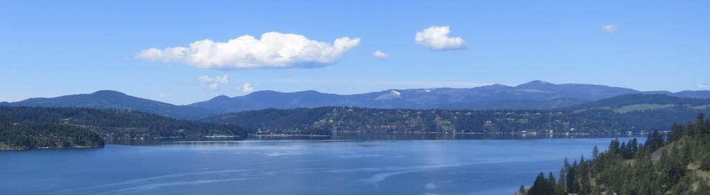
Along the way I get some good views of Lake Coeur D' Alene and around here it is called CDA because there are too damn many vowels in the name and a hyphen I don't need not to mention should it be a lower or upper case D?

Lake CDA.

ltMvzcT.jpg


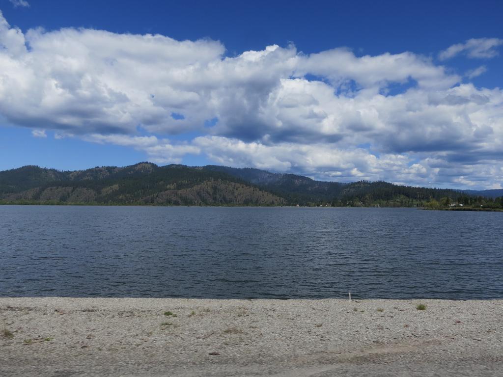
I was on Hwy 3 early this year when the lakes were still frozen over. Today they look like this:

aGptAie.jpg


Nice riding along Hwy 3 with some sweepers and no sand on the road today. Yea.
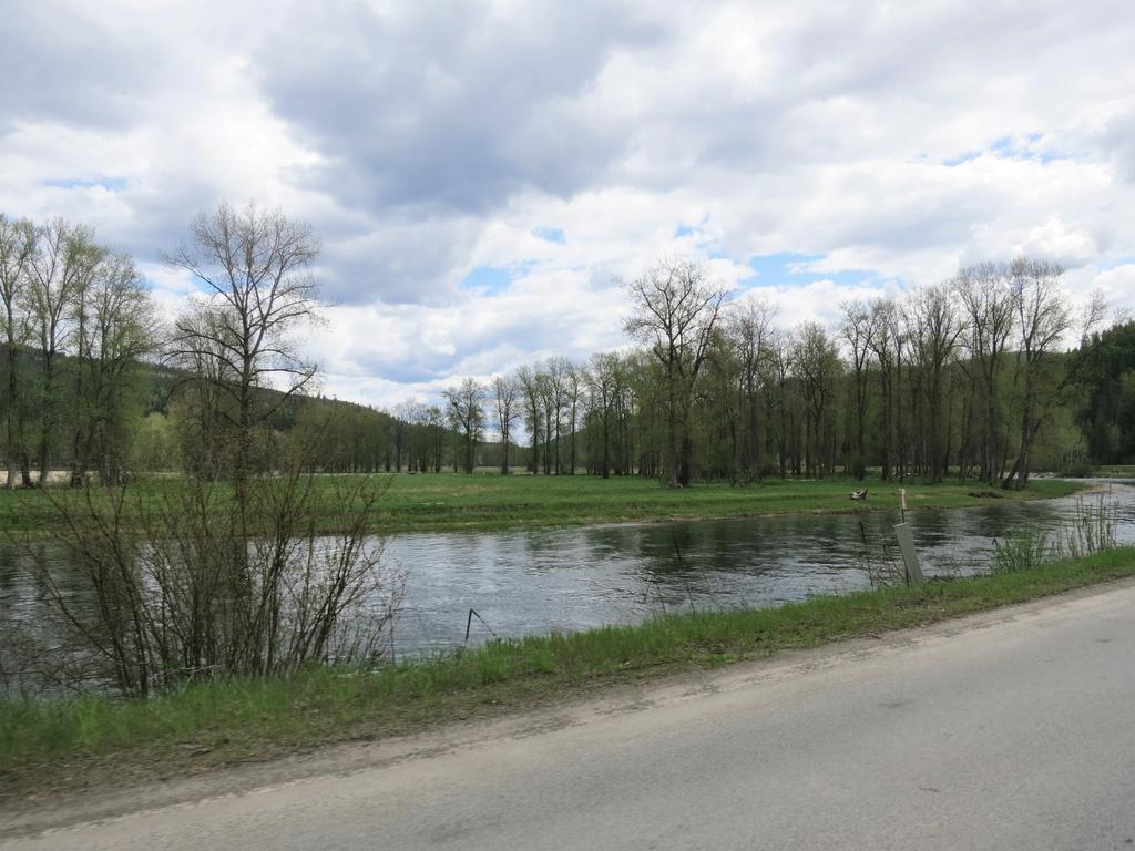
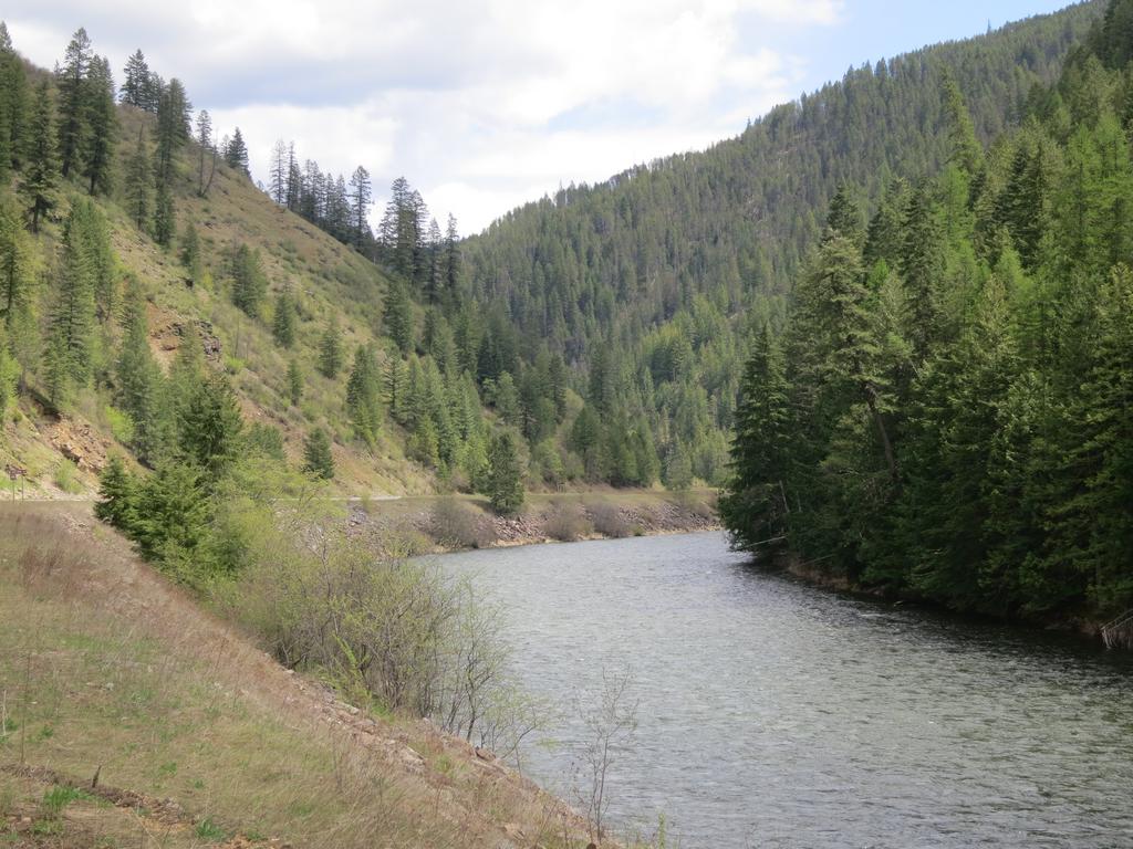
The St. Joe River.

qNsMLuL.jpg


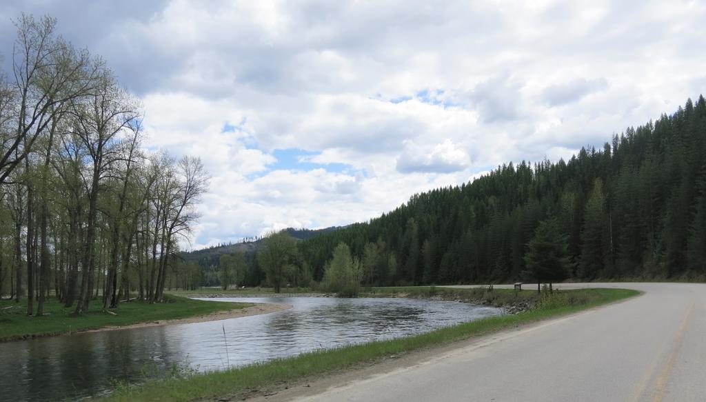
I had been on this road once last year and forgot there is not much elevation change and not much drama or white water rapids. Bummer.
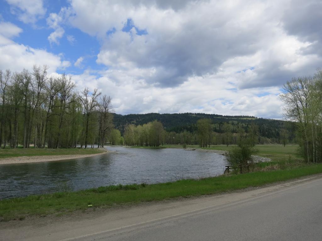
More river photos.

GkmVhjE.jpg


g4HMa5z.jpg


izliSrA.jpg


d9M40u6.jpg


I turned around at Avery. This is a down and out unless you like gravel. This time of year I am sure the road to Montana is closed due to snow.

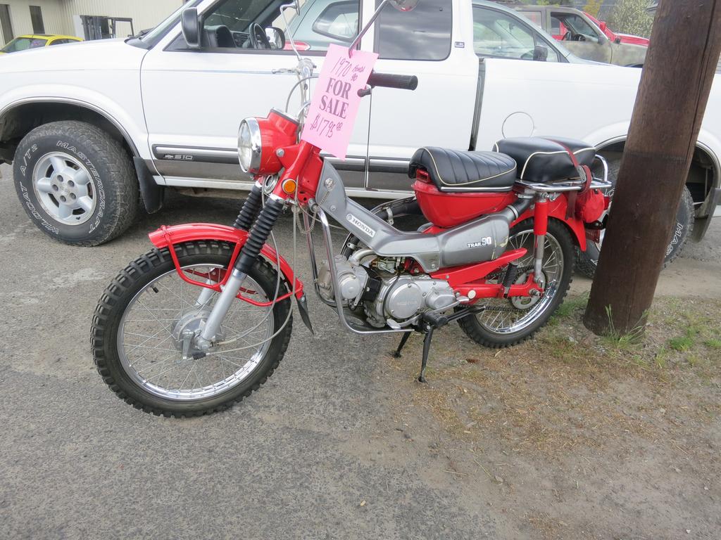
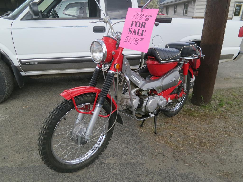
Back to St. Maries where a found a 1970 Honda Trail 90. Nice. I had a 1968 model - my first motorcycle.

vGJmqsK.jpg


j8P0Ndd.jpg


Time to head home. I got lucky and hit the twisty bit on Hwy 5 south of Lake CDA without much traffic. Nice.

It was a great day to be on the FJR.
 
Been there, done that....several times. Its a great road over the hill into Montana but more fun starting in Montana and doing the gravel portion uphill.

 
Last edited by a moderator:
Hey there Fontanaman,

You just posted some helpful info about a route I've been lusting after riding, as an alternate (west > east OR east > west) to lovely ID hwy 12.

I've assembled a larger, 4 day ride for a handful of my buddies and I, heading down from Edmonton, AB, overnighting in Kalispell, then deciding which east to west route to take on our 2nd day:

  • tried & true ID hwy 12
  • the collection of roads connecting Superior, MT through to Greer, ID (new for us)
  • the collection of roads connecting St. Regis, MT through to St. Maries, ID (new for us)
As we are riding FJRs and similarly non-ADV oriented machines, I have been cautious about committing to something that could force us to ride many miles of gravel - we've done it elsewhere on other trips, but it's not fun - especially if weather gets nasty.

I had thought that the road east of Avery, ID was still paved most of the way - based only on the scraps of info I've found online so far.

Funny - I have even tried a few times to use the Idaho 511 website online Contact Us form to request up to date info, but each time I submit my web form, their server pukes (!).
fool.gif


Tried to call their automated info line a few times, and walked through the menus, trying to just get through to a live human so I could quickly as for more info I need (clarification on above routes) - but they've done a fine job of blocking us I guess (?)

Could you share more knowledge / awareness with me on both St. Joe River road, and the other one (have you ever ridden it?) from Superior, MT through to Greer, ID ?

We ride rain or shine, kickstands up starting next Friday AM (20190517), so this is coming soon for me.

Thanks in advance for whatever you can offer.

 
The road from St. Regis to the Idaho border is gravel for about the last 10 miles but very well maintained. It is pretty smooth although it may have a light layer of pea gravel and is uphill all the way. I have ridden it on a V-Strom, FJR, and 1800 Goldwing without any problems at all. After you get to the Idaho border it’s paved and downhill all the way to St. Maries.

 
Last year I road the paved Idaho side of the St. Joe River road to the summit at the Idaho Montana border. It is gravel in Montana. I'd contact the Forest Service to find out if the road is clear of snow.

St. Joe Ranger District


St. Maries Office

222 S. 7th, Suite #1
St. Maries, ID 83861
(208) 245-2531
Avery Office

34 Hoyt Drive
Avery, ID 83802
(208) 245-4517
I have never been on the road between Superior, MT through to Greer, ID. Based on my Idaho Benchmark Recreation map a good portion of this is gravel. Contact the Clearwater National Forest North Fork Ranger Station (208-476-8267) for updates and ask for info on FS 247 and FS250.

Also contact inmate MCRider007 as he has been over the St. Joe River road into Montana on his FJR.

 
Last edited by a moderator:
Great - and very speedy responses - thanks Fontanaman.

Really looking forward to this trip, and hoping to make others that couldn't join us a bit jealous. The GoPro cameras will be on...

 
I think you will find that Highway 11 east of Greer is the only paved road going East to Superior and the gravel roads are best traveled with dual sport bikes or high clearance 4 wheel drives.

The road from Orofino to Greer (going through Pierce) is a very nice ride and adds about 60 miles to just following Highway 12 over Lolo Pass. Caution: Highway 12 has been patrolled for years by a Idaho State Patrolman who lives about 10 miles west of the Lochsaw Lodge which is about 10 miles west of the Montana border...so....when you are about 25 miles from the Montana border, slow down and enjoy the scenery.

 
OK MCRIDER007 - thanks for the tip on ID hwy 11 too.

Yes, in past years we became aware of the LEO presence on ID hwy 12, but accepted it as natural, given the enticing curves and fact that it's just 2 lanes.

A couple years ago we ventured north from Orofino; Dent Bridge Road was amazing, but as it got very steep and turned to gravel road just north of the bridge, we turned around to be safe / avoid an unscheduled dismount(!).

Lots of potential for adventure in this area.

We've also explored Old Hwy 7 up through Cavendish / Southwick / Cameron as a way to change it up.

 
The road past Avery up to the summit was pretty rough in places last time I rode it. Stuff growing out of cracks in the asphalt. But there were a few stretches which were recently repaved approaching the top which were twisty and fun!

 
I've pulled my BushTech Trailer from St Reggis to St Maries in the rain once, I'd like to do it when it's dry once.

Rode from St Maries to Orofino going thru Elk River the same day. From Elk River to the Dent Suspension Bridge is gravel and a bit rough.

Linky, https://goo.gl/maps/aviuBrvhnKx5z3Ki8

 
Last edited by a moderator:
Top