Fontanaman
Robin Trower
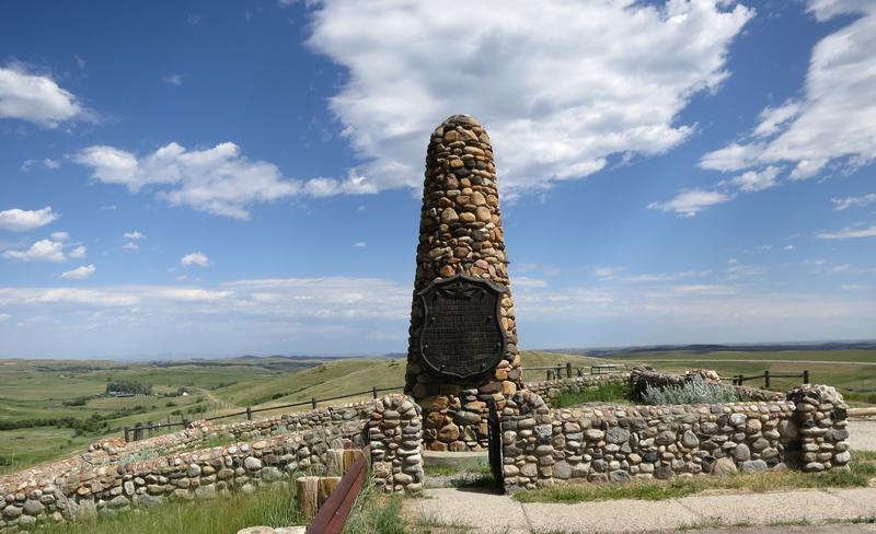
Last winter I read The Fetterman Massacre: Fort Phil Kearny and the Battle of the Hundred Slain by Dee Brown. It documents the battle where 81 men where lost in December 1866. A very good read to learn about US relations with the Native Americans. Out of this I decided I wanted to visit the battle site. There are some great roads in the area plus I can pick off the remaining points on the back of the Rendezvous Red Lodge 2016 tee shirt. It is always fun to ride to new places. Gee there are lots of reason for this ride and non of them involve rocks.
Leaving from Spokane I go over Thompson Pass, see one deer and and another damn near ran into me. Motorcyclists don't hit deer, a deer hits motorcyclist. Thompson Pass isn't all that scenic nor is the pavement twisty. I have no desire to return soon. This one was too close of a call. Though northern Idaho I-90 is as scenic as Thompson Pass and a hell of a lot safer.
Near Thompson Falls.
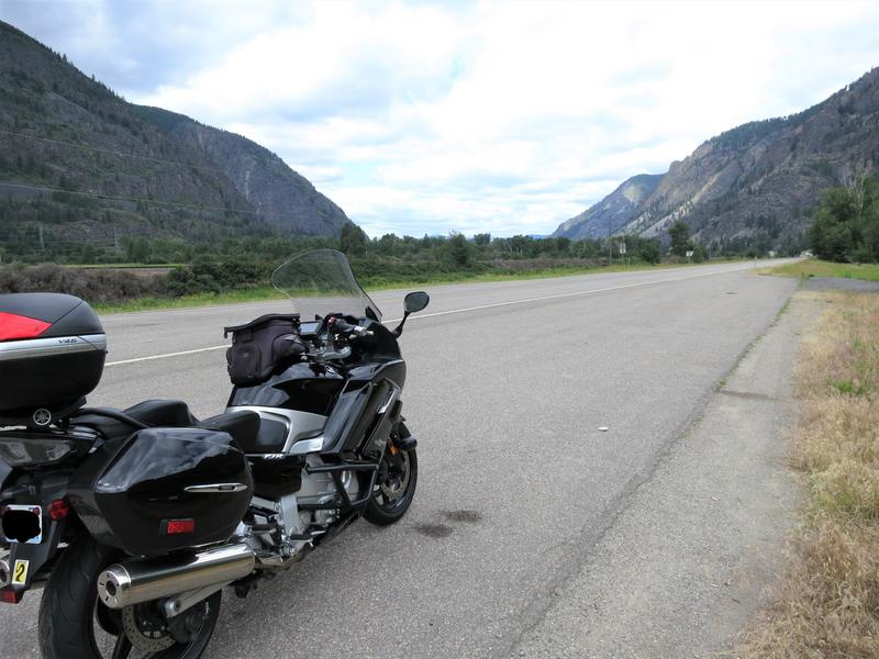
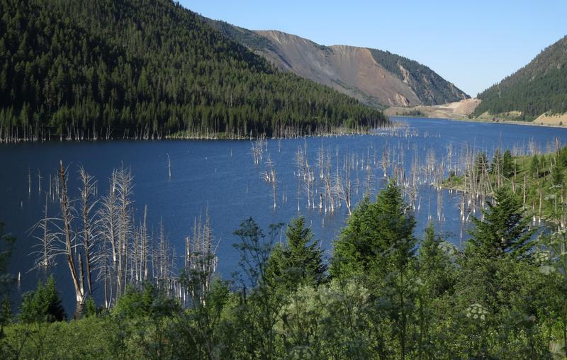
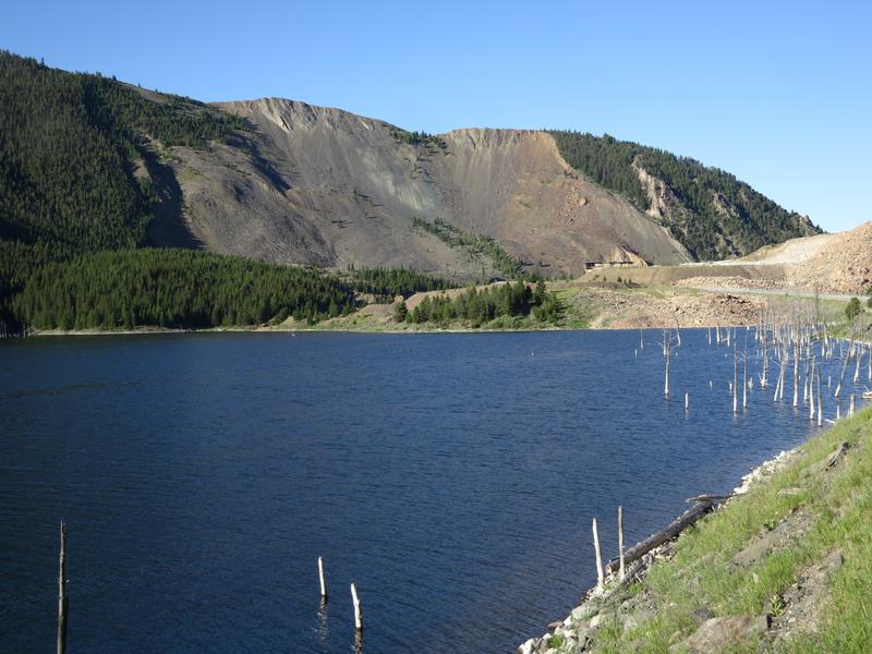
The Missoula Floods Ice Damn was just west of here by 20 miles or so. It is easy to see how and Ice Damn could block the Clark Fork River. The elevation here is about 2600 feet and the maximum water depth of Glacial Lake Missoula was 4200' nearly topping this canyon.
The reason to ride over Thompson was to was visit this area and ride Montana Hwy 200 which roughly parallels I-90 to the north till Helena. This is one of the roads I have never been on before due to the W word. Work always provided constraints but I am not working any more so I have time to do it just a little different these days. Note to you working stiffs. Don't work any longer than you absolutely have to. I am nearing 65 and over the last two years have developed two annoying aches and pains that will most likely remain with me for life. Nothing serious but just annoying and it could be a lot worse. Get out while you can because soon you will start thinking could this be my last motorcycle?
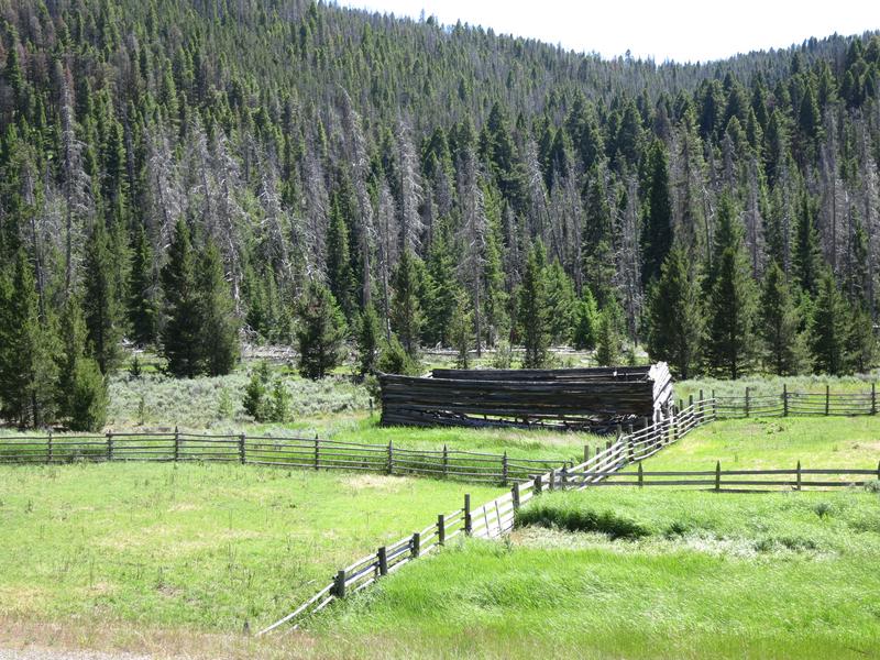
I pass along a lot rivers on this day and noticed a several cars at the river access parking lots. Folks really like fishing here and recreating on the rivers. The other thing I notice is this:
Ya heard of urban blight? Well I call this ranch blight. In many cases a newer building nearby but the old one never is demolished but simply left to rot. Just observational humor.
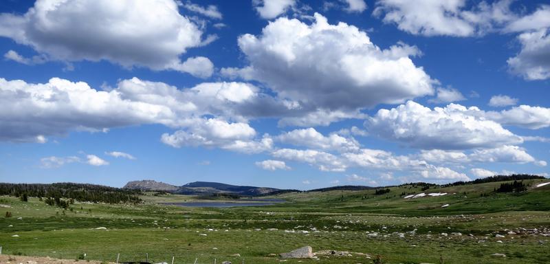
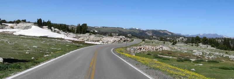
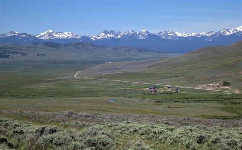
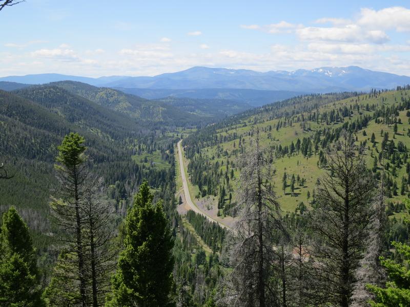
I leave Hwy 200 and choose Hwy 279 to go over Flesher Pass, again another road new to me. Nice. This photo is near the summit of Flesher Pass.
And this is a nice view from there.
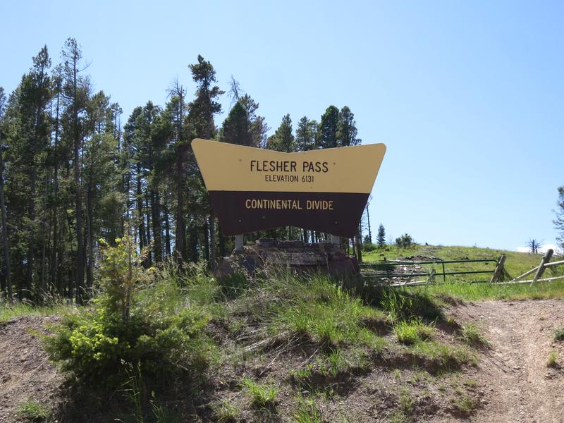
Self explanatory. What is not self explanatory is crossing the Continental Divide means leaving the Columbia River basin so there no more commentary on on the great floods in this ride report. Plus I don't know jack about the geology in Montana and Wyoming other than Jellystone sits on a hot spot on the earth's crust and the North American Plate is move SW over the hotspot so someday the hotspot will be over Billings Montana a fitting place for a hot spot!
I ride by Silver City Montana and Pterodactyl's place onto Hwy 287 with construction for a few miles riding on dirt. This is not necessary. It is a four lane road and it is all busted up. Why can't crews complete one side then route traffic to the new pavement while work on the other side is completed? I have a answer. Cause this is the way we have done it for years! I get to Helena hop on I-90 to Bozeman where I spend the night.
Day 2
Last night at dinner I spoke with a local who said tourism at Jellystone was down due to Covid-19. This conversation was helpful shaping this trip. I also downloaded the Montana DOT app to avoid further, I wish I had a S-Ten moments, due to road construction.
I left the hotel and found myself at McDonald's eating a couple of breakfast sandwiches along with a cup of coffee in the parking lot. Didn't notice the picnic tables till later. Oh well. With the bike and myself well fueled it was down I-90 for a bit to Livingston. It is hard to avoid I-90 in Western Montana as most of the roads go north and south.
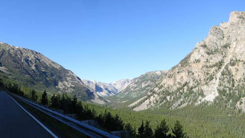
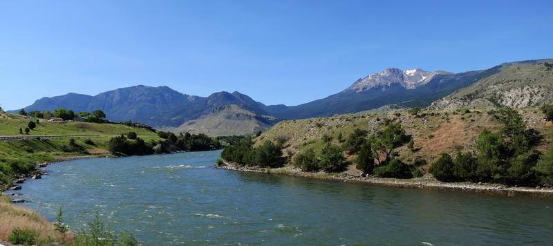
Once off the freeway at Livingston good scenery returns following the Jellystone River into Gardiner.
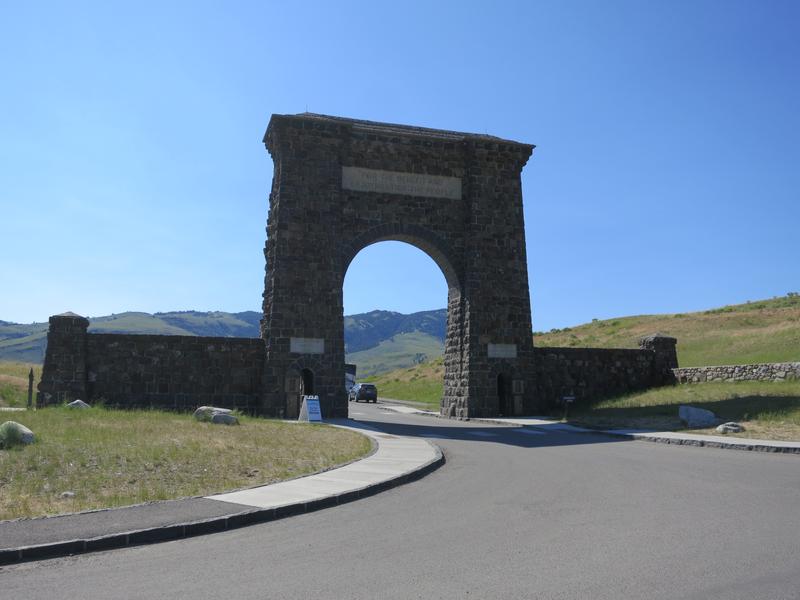
The Roosevelt Arch at the North Entrance to Jellystone. It is a crummy photo shooting into the sun but the Arch is cool. Rather narrow inside too showing how small cars where back in the day.
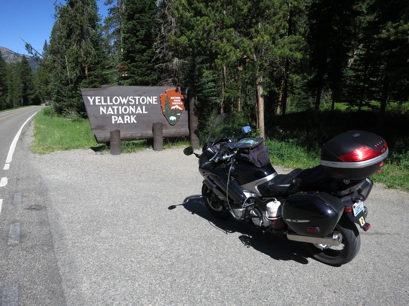
It was a five car wait to enter the park. Last time I was here the line was much longer.
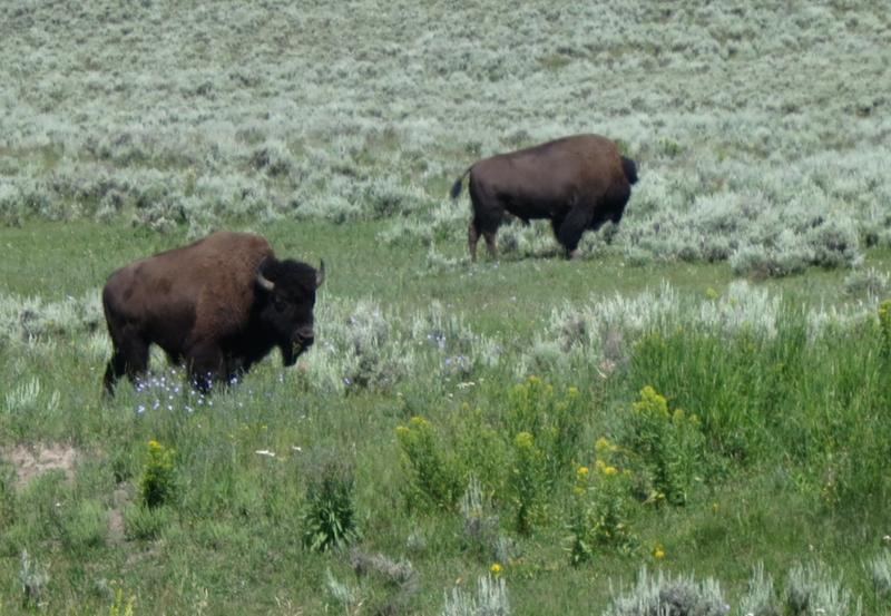
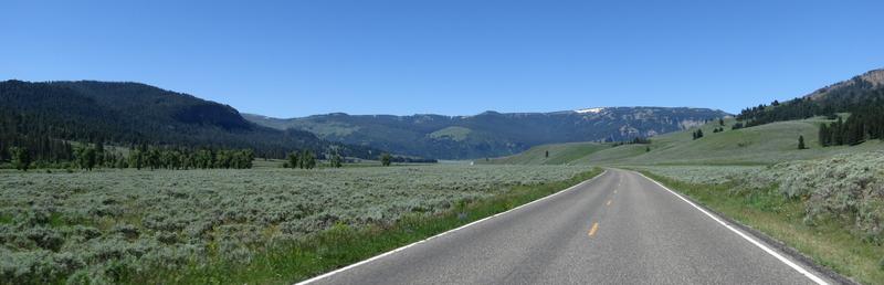
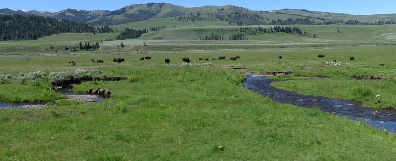
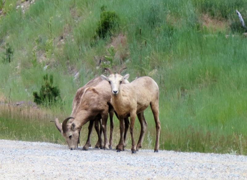
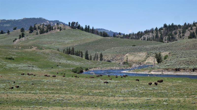
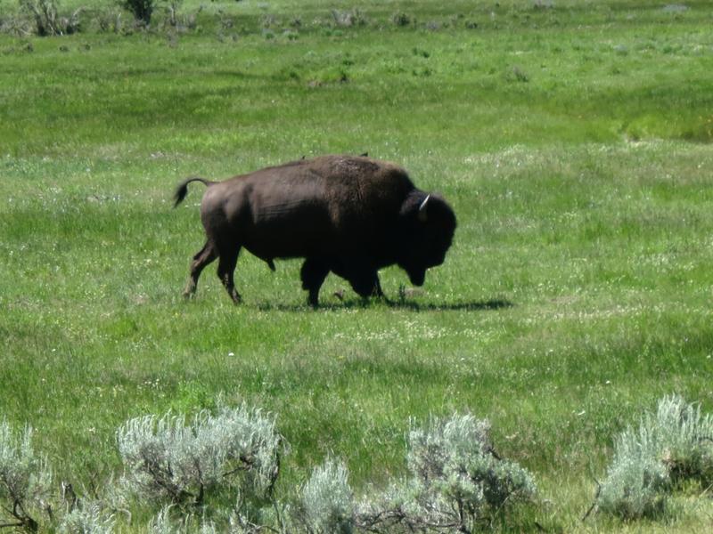
I ride across Lamar Valley to see buffalo. Traffic was light.
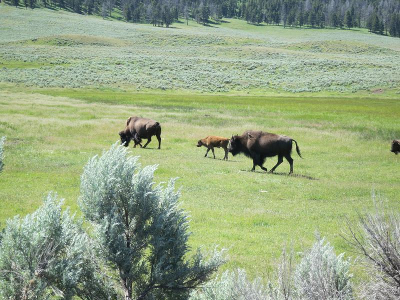
The beasts are all over including the road. I watched a couple of males butting heads, their bodies shaking after the collision. Even at 200 yards it was an impressive site. A lady with a huge telephone lens must have got some great shots of that scene. She had the camera mounted on a tripod. If those telephoto lenses weren't so damn expensive I'd get one and do like her, just chill at a pullout with my camera.
Buffalo in the road are an interesting dilemma unless you got a dual sport bike. One buffalo was just hanging out in the on coming lane with traffic backed up in both directions. I sat back and waited for an opportunity to go by. The cars ahead of me cleared out while the buffalo had two hoofs on the shoulder facing away from me. This was my cue to ease on by. The beast decided to start moving just I got near. My response was more right wrist to clear the scene quickly without making a scene. I turned around to get a photo of this guy to see none of the traffic had moved since I went by including a couple of Harleys.
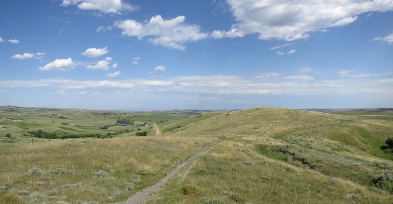
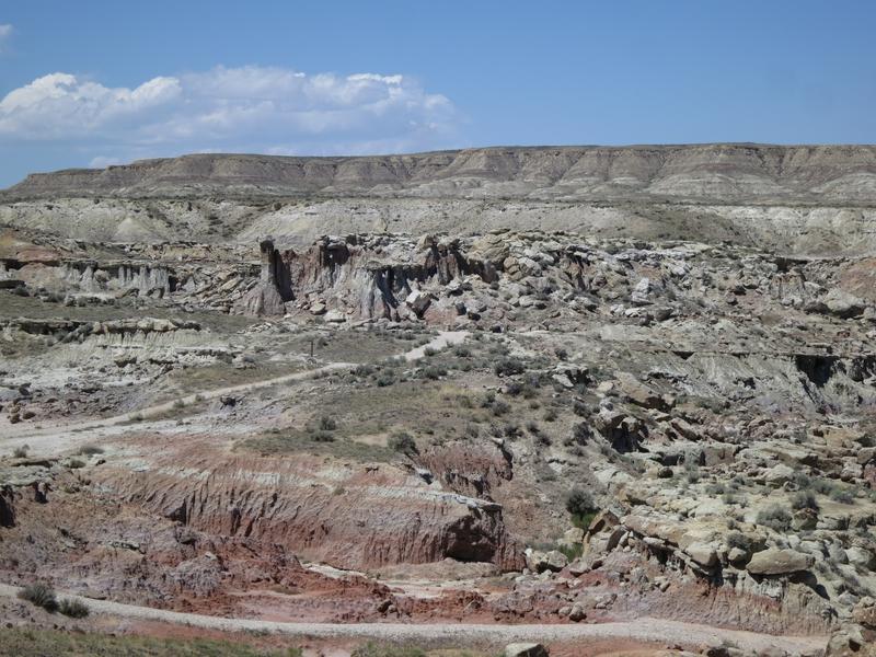
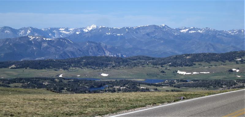
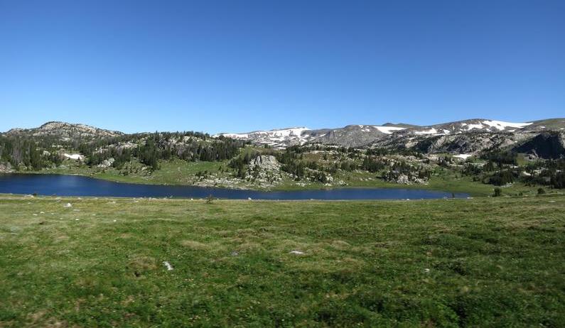
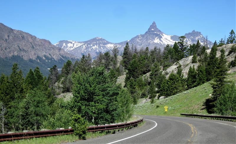
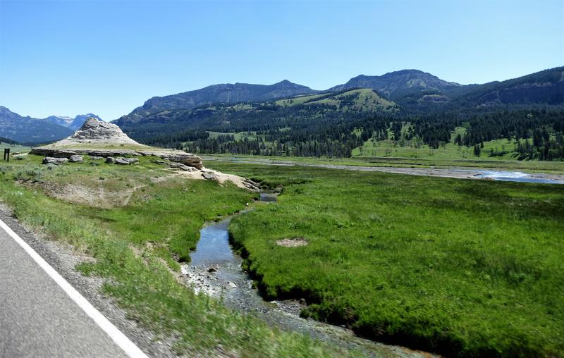
The sole geological feature along the road in the valley.
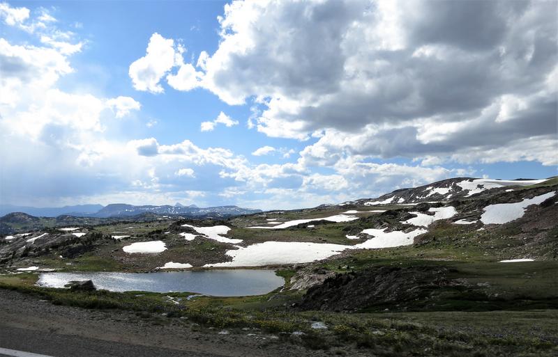
Having my fill of Buffalo entertainment it was time to head to Chief Joseph Pass and turn it up a bit.
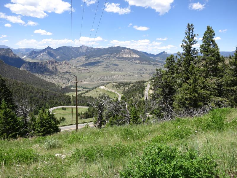
One the way up to the summit. Curse the power lines but they make this vista possible.
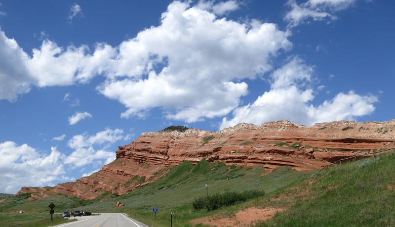
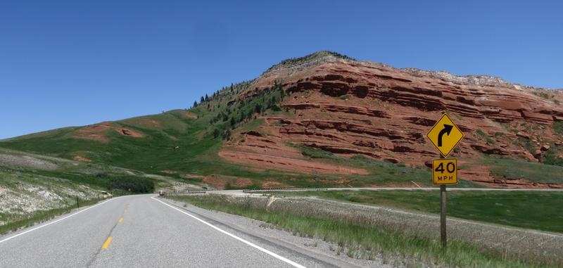
And on down the other side to see some red rock.
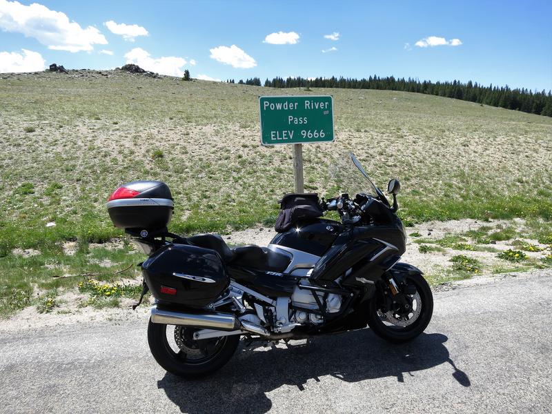
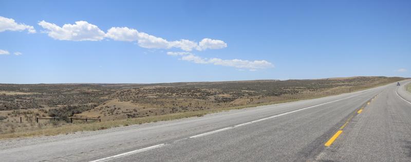
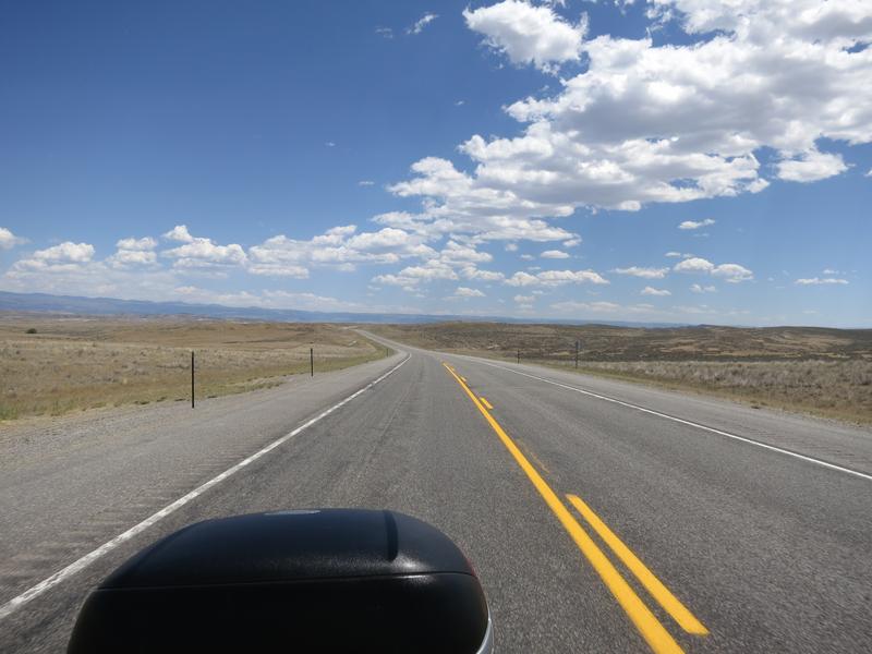
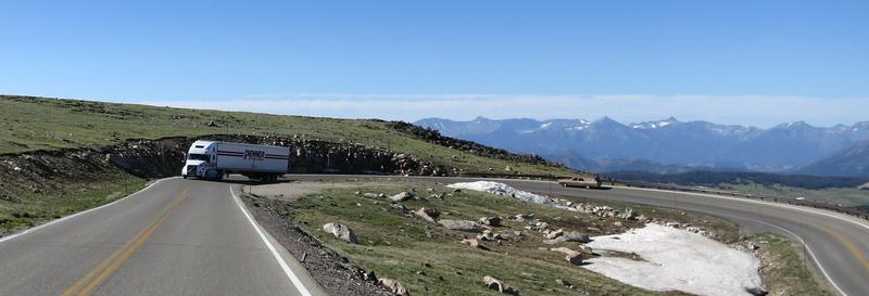
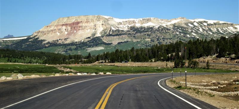
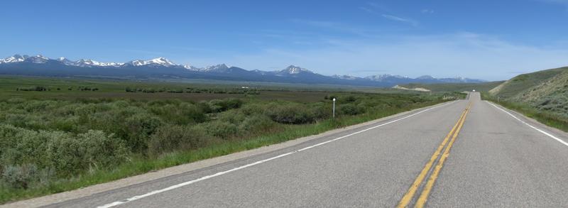
On to Cody taking Hwy 14 to Shell Wyoming crossing the basin of no joy for FJR riders. The road is flat and straight for 100 miles.
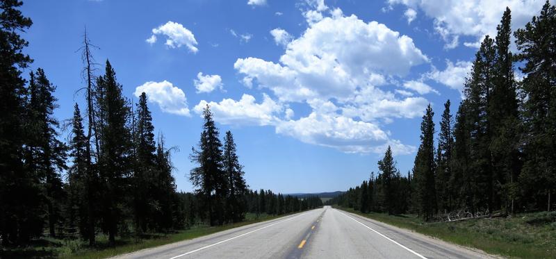
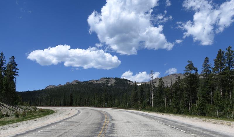
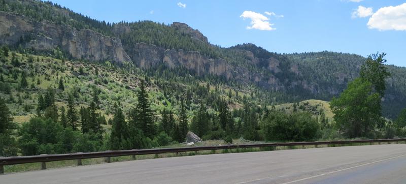
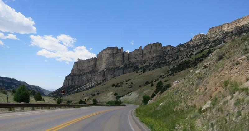
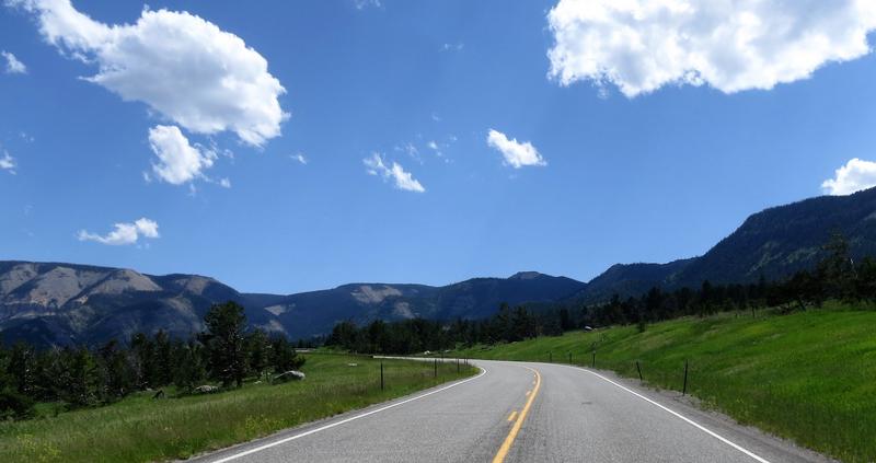
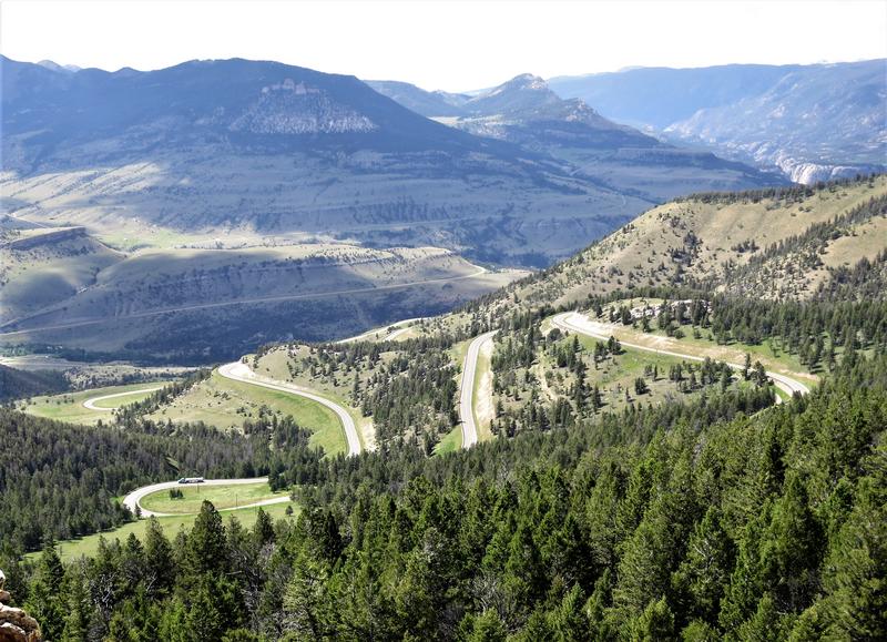
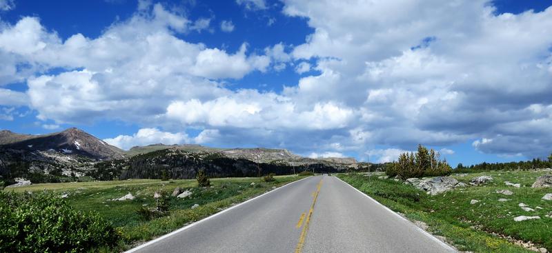
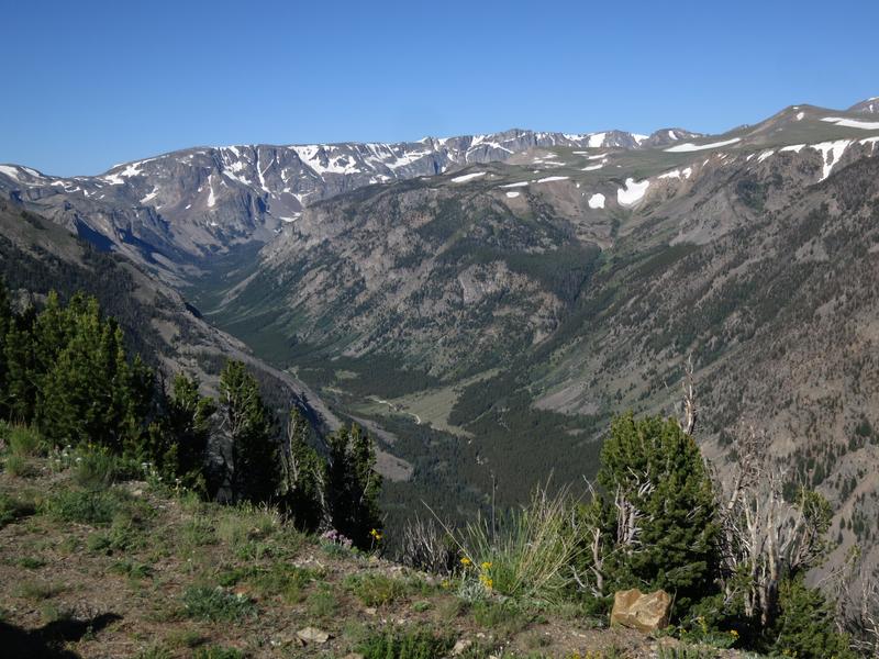
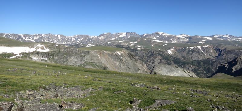
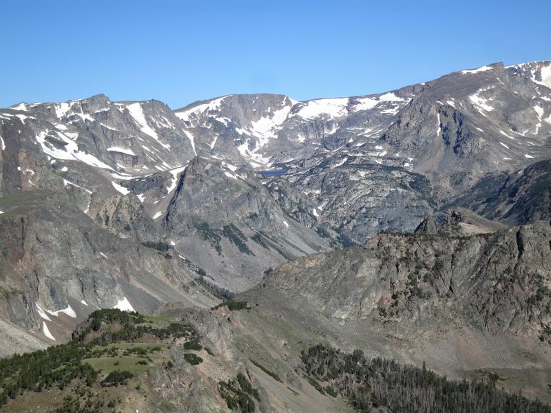
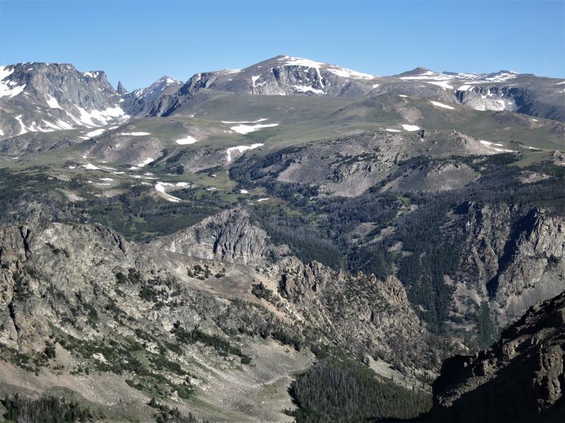
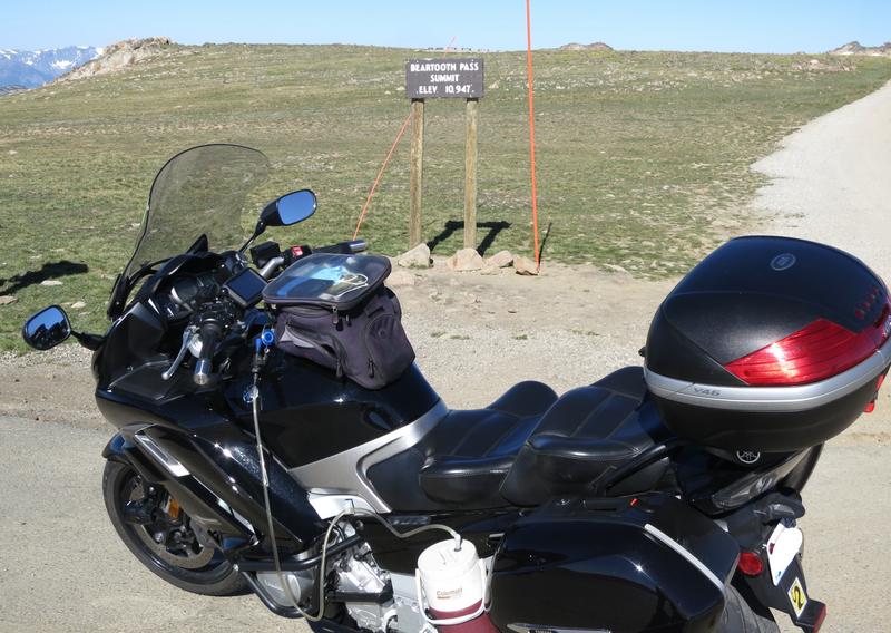
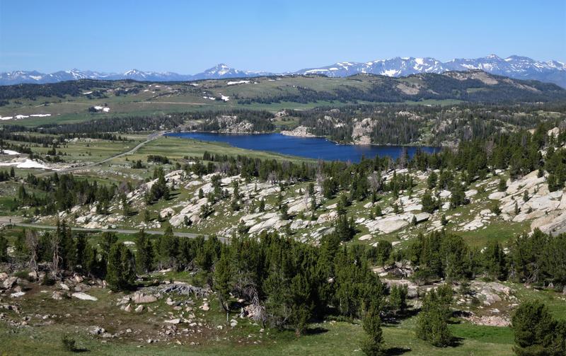
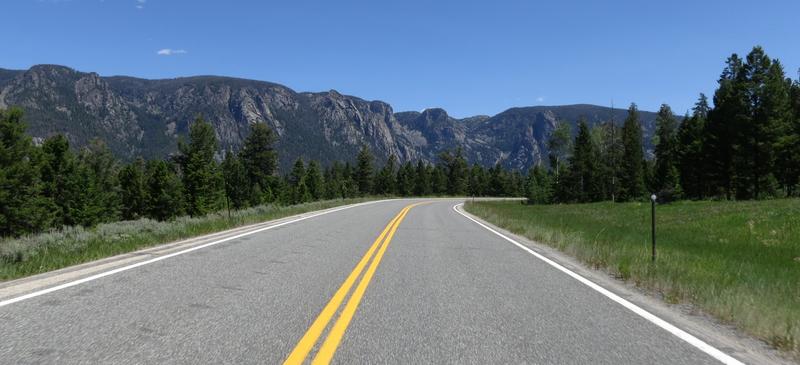
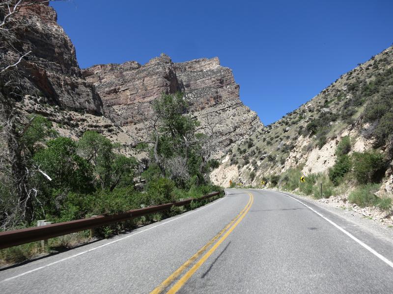
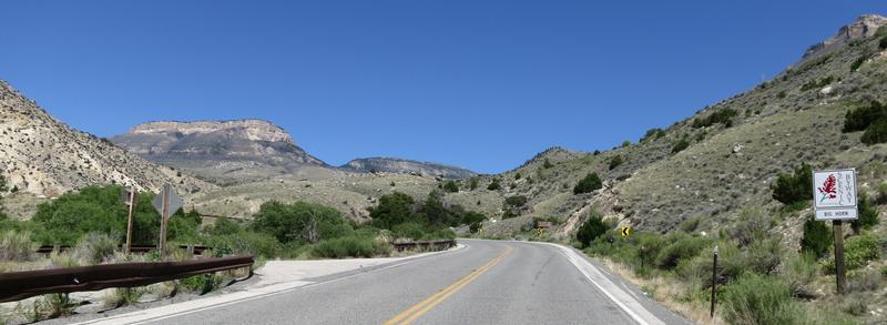
Things change after leaving Shell. This is one of the roads I have never been on and it is a good one going from 4400' to 9000' at the aptly named Granite Pass in 22 miles.
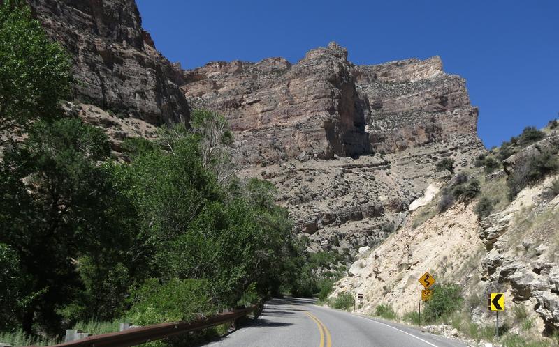
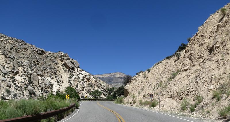
Nice road, great fun and just a few pictures.
On to Burgess Junction and down down down at a 40mph speed limit behind a gaggle of cars to I-90 to stay the night in Sheridan. I picked a Best Western and this one had a bike wash where I knocked off a few of the darn Wyoming bugs. Nice I liked that bike wash station. Nice place to stay too with a clean comfortable room right in the downtown area with good food choices nearby.
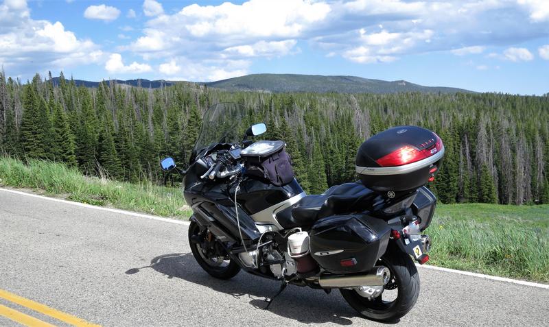
Great day to be on the FJR.
To be continued...
Leaving from Spokane I go over Thompson Pass, see one deer and and another damn near ran into me. Motorcyclists don't hit deer, a deer hits motorcyclist. Thompson Pass isn't all that scenic nor is the pavement twisty. I have no desire to return soon. This one was too close of a call. Though northern Idaho I-90 is as scenic as Thompson Pass and a hell of a lot safer.
Near Thompson Falls.
The Missoula Floods Ice Damn was just west of here by 20 miles or so. It is easy to see how and Ice Damn could block the Clark Fork River. The elevation here is about 2600 feet and the maximum water depth of Glacial Lake Missoula was 4200' nearly topping this canyon.
The reason to ride over Thompson was to was visit this area and ride Montana Hwy 200 which roughly parallels I-90 to the north till Helena. This is one of the roads I have never been on before due to the W word. Work always provided constraints but I am not working any more so I have time to do it just a little different these days. Note to you working stiffs. Don't work any longer than you absolutely have to. I am nearing 65 and over the last two years have developed two annoying aches and pains that will most likely remain with me for life. Nothing serious but just annoying and it could be a lot worse. Get out while you can because soon you will start thinking could this be my last motorcycle?
I pass along a lot rivers on this day and noticed a several cars at the river access parking lots. Folks really like fishing here and recreating on the rivers. The other thing I notice is this:
Ya heard of urban blight? Well I call this ranch blight. In many cases a newer building nearby but the old one never is demolished but simply left to rot. Just observational humor.
I leave Hwy 200 and choose Hwy 279 to go over Flesher Pass, again another road new to me. Nice. This photo is near the summit of Flesher Pass.
And this is a nice view from there.
Self explanatory. What is not self explanatory is crossing the Continental Divide means leaving the Columbia River basin so there no more commentary on on the great floods in this ride report. Plus I don't know jack about the geology in Montana and Wyoming other than Jellystone sits on a hot spot on the earth's crust and the North American Plate is move SW over the hotspot so someday the hotspot will be over Billings Montana a fitting place for a hot spot!
I ride by Silver City Montana and Pterodactyl's place onto Hwy 287 with construction for a few miles riding on dirt. This is not necessary. It is a four lane road and it is all busted up. Why can't crews complete one side then route traffic to the new pavement while work on the other side is completed? I have a answer. Cause this is the way we have done it for years! I get to Helena hop on I-90 to Bozeman where I spend the night.
Day 2
Last night at dinner I spoke with a local who said tourism at Jellystone was down due to Covid-19. This conversation was helpful shaping this trip. I also downloaded the Montana DOT app to avoid further, I wish I had a S-Ten moments, due to road construction.
I left the hotel and found myself at McDonald's eating a couple of breakfast sandwiches along with a cup of coffee in the parking lot. Didn't notice the picnic tables till later. Oh well. With the bike and myself well fueled it was down I-90 for a bit to Livingston. It is hard to avoid I-90 in Western Montana as most of the roads go north and south.
Once off the freeway at Livingston good scenery returns following the Jellystone River into Gardiner.
The Roosevelt Arch at the North Entrance to Jellystone. It is a crummy photo shooting into the sun but the Arch is cool. Rather narrow inside too showing how small cars where back in the day.
It was a five car wait to enter the park. Last time I was here the line was much longer.
I ride across Lamar Valley to see buffalo. Traffic was light.
The beasts are all over including the road. I watched a couple of males butting heads, their bodies shaking after the collision. Even at 200 yards it was an impressive site. A lady with a huge telephone lens must have got some great shots of that scene. She had the camera mounted on a tripod. If those telephoto lenses weren't so damn expensive I'd get one and do like her, just chill at a pullout with my camera.
Buffalo in the road are an interesting dilemma unless you got a dual sport bike. One buffalo was just hanging out in the on coming lane with traffic backed up in both directions. I sat back and waited for an opportunity to go by. The cars ahead of me cleared out while the buffalo had two hoofs on the shoulder facing away from me. This was my cue to ease on by. The beast decided to start moving just I got near. My response was more right wrist to clear the scene quickly without making a scene. I turned around to get a photo of this guy to see none of the traffic had moved since I went by including a couple of Harleys.
The sole geological feature along the road in the valley.
Having my fill of Buffalo entertainment it was time to head to Chief Joseph Pass and turn it up a bit.
One the way up to the summit. Curse the power lines but they make this vista possible.
And on down the other side to see some red rock.
On to Cody taking Hwy 14 to Shell Wyoming crossing the basin of no joy for FJR riders. The road is flat and straight for 100 miles.
Things change after leaving Shell. This is one of the roads I have never been on and it is a good one going from 4400' to 9000' at the aptly named Granite Pass in 22 miles.
Nice road, great fun and just a few pictures.
On to Burgess Junction and down down down at a 40mph speed limit behind a gaggle of cars to I-90 to stay the night in Sheridan. I picked a Best Western and this one had a bike wash where I knocked off a few of the darn Wyoming bugs. Nice I liked that bike wash station. Nice place to stay too with a clean comfortable room right in the downtown area with good food choices nearby.
Great day to be on the FJR.
To be continued...