


Fontanaman
Robin Trower
Day One
I was considering a ride to South Dakota to see the sites but the moon and stars did not align. Instead I spent 4 wonderful days with the wife on a get away to Kokanee Spring Golf Resort in BC. A very low key, unpretentious and casual place. It is a slice of heaven on earth. We had a blast.
So with three days of free time I pondered my options and decided to ride to the Columbia River Gorge. The goal was to ride roads not rode often enough, 250 miles per day, find roads never rode before and take some photos along the way.
Here is my route for day one.
I planned on a 9:00am start time or so. No hurries on this trip, no big mileage days, just a relaxing day on the FJR. With the bike pack I was donned my helmet and went to get the sunglasses. No sunglasses. Nuts. They were in my car and my wife drive the car to work, 30 miles away. I arrive at the car, open the door and no sunglasses. This is when I remembered I had already put the sunglasses in my tank bag the night before. The tank bag was on the bike. Shuckin's and pashaw.
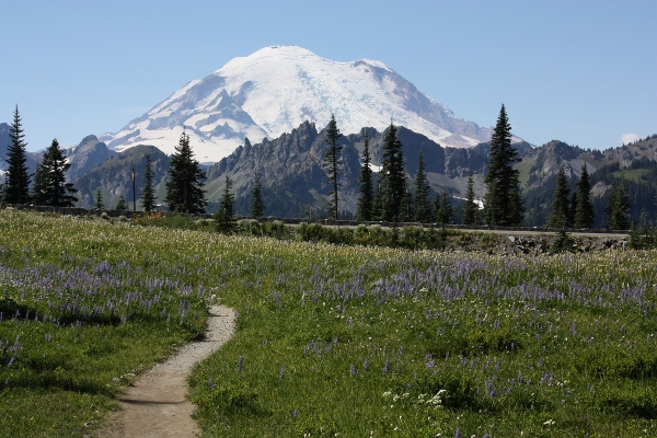
With sunglasses mounted on my nose I get gas in Enumclaw and head the first road not rode often, Sunrise at Mt. Rainier. It was a Thursday and the traffic was light and the riding fantastic. With temp in the mid '60 and clear blue skies this could be a good day for photos. And it was.
Mt Rainier along Sunrise Road near Inspiration Point
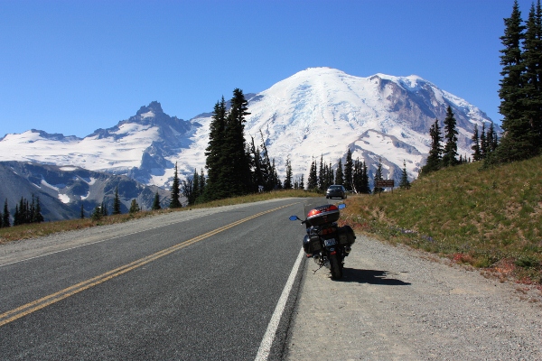
Mt Rainier along Sunrise Road near Inspiration Point
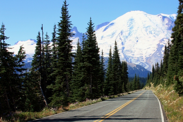
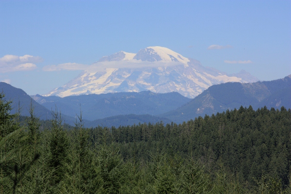
From here I went on to Mather Memorial Parkway where clear skies where cooperating today.
Mt Rainier from THE viewpoint along Mather Memorial Parkway. The road continues on and you can see this view for about 1 mile.
Next up was a road road often, Chinook Pass. The goal was to take some photos of the wild flowers at Tipsoo Lake. Chinook Pass open usually around Memorial Day weekend. Tipsoo Lake is snow free by the second week of July or a bit later.
Here is a photo from July 8th this year.
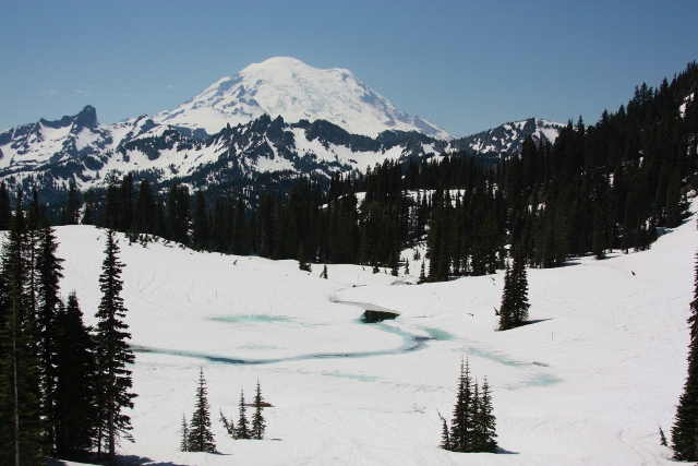
Here are some photos taken on September 7, 2012 of wild flower at Tipsoo Lake with Mt. Rainier in the background. One reason I love this place is the season bring lots of change.
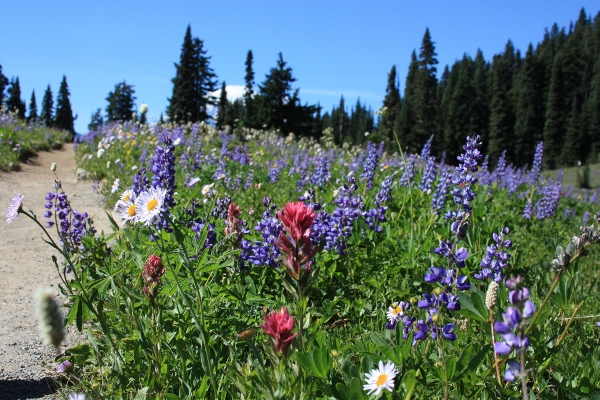
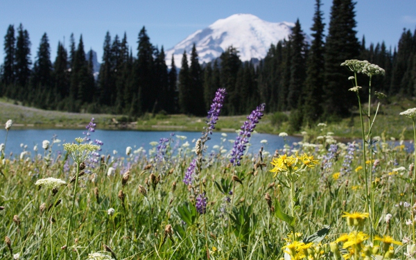
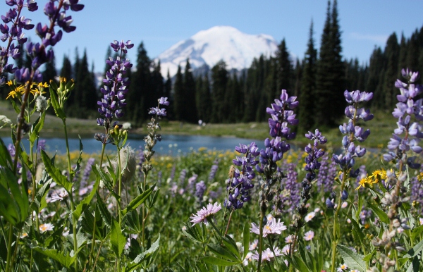
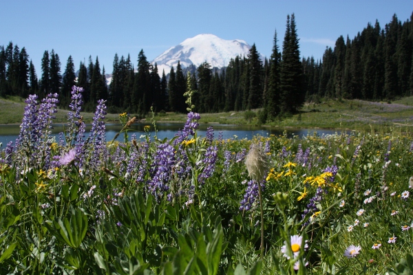
I walked around the entire lake taking about 100 photos here using my Canon XSi, with a Canon 28-135 lens along with graduated neutral density filters to avoid contrast blowout. Very relaxing.
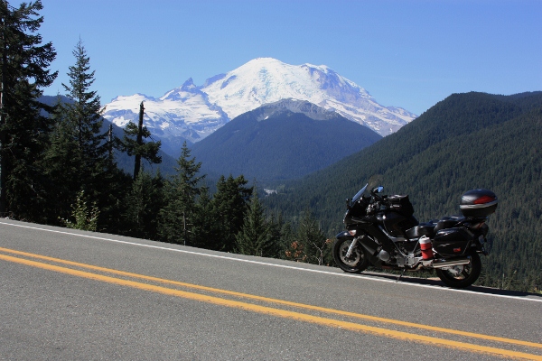
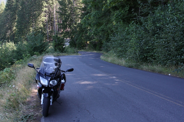
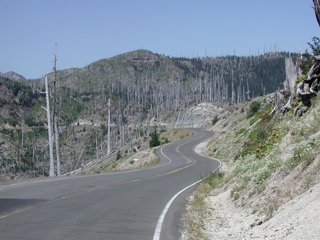
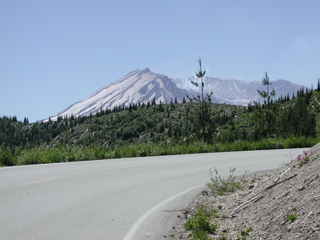
Next it was off to Windy Ridge on Mt. St. Helens to enjoy some fine twisties on FS 99. Mission accomplished, except the last 4 miles of the road are closed until October 5, 2012. Along the way on FS 25 I shot these photos.
Mt Rainier from FS 25 just south of Randle.
The photos above was shot at the location below. The pavement after this is terrible until you reach FS 99, a distance of about 10 miles.
Below is FS 99 the road to Windy Ridge. I shot this photo in August 2006. There is much more vegetation now.
FS 99. I shot this photo July 2007 and it my GPS on boot image. The small sappling along side of the road are no longer small and are reducing the sight line, sticking out 2 feet into the road and are 6 feet high in places. Go there soon to get the best this road has to offer.
FS 99. How about a volcano with your twisties?
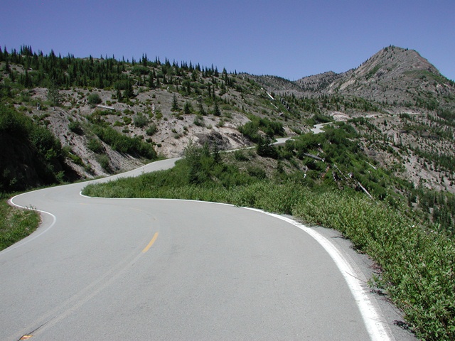
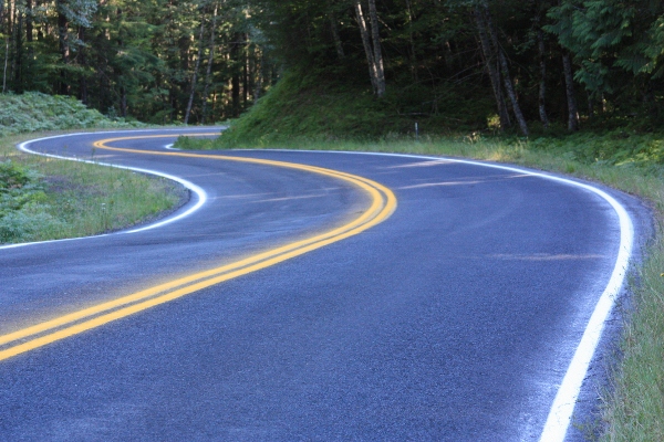
The next road not rode often enough was from Windy Ridge to Wind River Highway and on to Carson Washington. Here you will find six miles of sublime twisties. If this road doesn't leave a silly grin on your face it is time to sell your bike. The rest of it it is also a great road.
That is new paint on the road and the road surface is very nice. Turn, turn, turn. I decide to stop here because I a truck ahead was painting the right while line. I turned around and found a good spot for a photo op. No sense in wasting good turns following a slow truck you can't pass.
Wind River Hwy - the road goes like this for six miles.
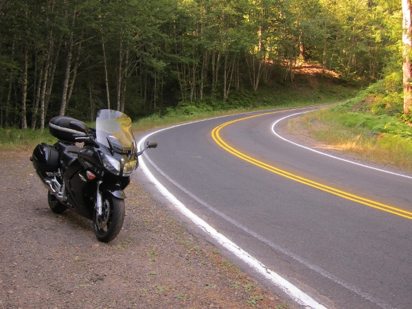
My FJR along Wind River Hwy
Before arriving in Carson I notice the smell and see smoke in the air. I was not aware of a forest fire and on of the reason for this trip as opposed to Idaho or Montana is both of those areas have active fires. Nuts.
I finish the day by riding to Stevenson Washington where there is a Rodeway Inn and decent restaurants. Later that evening I learned there was a 100 acre forest fire along my route for Friday.
The End
I was considering a ride to South Dakota to see the sites but the moon and stars did not align. Instead I spent 4 wonderful days with the wife on a get away to Kokanee Spring Golf Resort in BC. A very low key, unpretentious and casual place. It is a slice of heaven on earth. We had a blast.
So with three days of free time I pondered my options and decided to ride to the Columbia River Gorge. The goal was to ride roads not rode often enough, 250 miles per day, find roads never rode before and take some photos along the way.
Here is my route for day one.
I planned on a 9:00am start time or so. No hurries on this trip, no big mileage days, just a relaxing day on the FJR. With the bike pack I was donned my helmet and went to get the sunglasses. No sunglasses. Nuts. They were in my car and my wife drive the car to work, 30 miles away. I arrive at the car, open the door and no sunglasses. This is when I remembered I had already put the sunglasses in my tank bag the night before. The tank bag was on the bike. Shuckin's and pashaw.
With sunglasses mounted on my nose I get gas in Enumclaw and head the first road not rode often, Sunrise at Mt. Rainier. It was a Thursday and the traffic was light and the riding fantastic. With temp in the mid '60 and clear blue skies this could be a good day for photos. And it was.
Mt Rainier along Sunrise Road near Inspiration Point
Mt Rainier along Sunrise Road near Inspiration Point
From here I went on to Mather Memorial Parkway where clear skies where cooperating today.
Mt Rainier from THE viewpoint along Mather Memorial Parkway. The road continues on and you can see this view for about 1 mile.
Next up was a road road often, Chinook Pass. The goal was to take some photos of the wild flowers at Tipsoo Lake. Chinook Pass open usually around Memorial Day weekend. Tipsoo Lake is snow free by the second week of July or a bit later.
Here is a photo from July 8th this year.
Here are some photos taken on September 7, 2012 of wild flower at Tipsoo Lake with Mt. Rainier in the background. One reason I love this place is the season bring lots of change.
I walked around the entire lake taking about 100 photos here using my Canon XSi, with a Canon 28-135 lens along with graduated neutral density filters to avoid contrast blowout. Very relaxing.
Next it was off to Windy Ridge on Mt. St. Helens to enjoy some fine twisties on FS 99. Mission accomplished, except the last 4 miles of the road are closed until October 5, 2012. Along the way on FS 25 I shot these photos.
Mt Rainier from FS 25 just south of Randle.
The photos above was shot at the location below. The pavement after this is terrible until you reach FS 99, a distance of about 10 miles.
Below is FS 99 the road to Windy Ridge. I shot this photo in August 2006. There is much more vegetation now.
FS 99. I shot this photo July 2007 and it my GPS on boot image. The small sappling along side of the road are no longer small and are reducing the sight line, sticking out 2 feet into the road and are 6 feet high in places. Go there soon to get the best this road has to offer.
FS 99. How about a volcano with your twisties?
The next road not rode often enough was from Windy Ridge to Wind River Highway and on to Carson Washington. Here you will find six miles of sublime twisties. If this road doesn't leave a silly grin on your face it is time to sell your bike. The rest of it it is also a great road.
That is new paint on the road and the road surface is very nice. Turn, turn, turn. I decide to stop here because I a truck ahead was painting the right while line. I turned around and found a good spot for a photo op. No sense in wasting good turns following a slow truck you can't pass.
Wind River Hwy - the road goes like this for six miles.
My FJR along Wind River Hwy
Before arriving in Carson I notice the smell and see smoke in the air. I was not aware of a forest fire and on of the reason for this trip as opposed to Idaho or Montana is both of those areas have active fires. Nuts.
I finish the day by riding to Stevenson Washington where there is a Rodeway Inn and decent restaurants. Later that evening I learned there was a 100 acre forest fire along my route for Friday.
The End
Last edited by a moderator:


