Bluestreak and MCML Ride to Alaska

Yamaha FJR Motorcycle Forum

Help Support Yamaha FJR Motorcycle Forum:

This site may earn a commission from merchant affiliate links, including eBay, Amazon, and others.
I am presently on Vashon Island in the Puget Sound (Seattle) visiting with friends. I tried to reach Barabus today but failed. We are eating spareribs and about to tackle the strawberry shortcake. Some Ridge zinfandel is also involved. I am going to try to catch up with Slap N Pop tomorrow. I am guessing sushi knowing our history but we shall see.

Most of this report will have to wait until I get home to Tarzana but, for now, here are two addtional photos. The first was taken by Steve, with my camera, as we approached Atigun Pass from the north on our way back down the Dalton Highway. The second was taken at the Boreal Lodge in Wiseman, AK roughly halfway back down to "civilization" so threee-quarters through the ride on the Haul Road. Ice Road Truckers is on the tube as I write this!

I guess we really were there, although it seems surreal now.

P7010296.jpg


And to think of all those "dirty" bikes being spruced up at the bike washing area at the Kuskanax Lodge in Nakusp.

P7020298.jpg


Last edited by a moderator:
I like the aux fuel cells...IBA approved???

Seriously, looks like you are having a great ride!

 
Last edited by a moderator:
Man, oh man do I wanna ride to Alaksa. These RR's are killin' me.

Folks, while I, and if I may speak for Steve, too, appreciate the kudos it is fair to say that you ain't seen nothing yet. Where I left off we had not even started up the Haul Road yet!
More soon.
Why? WHY do ya have to tease me so??

Can't wait!

 
Arrived home about 5:30 pm Thursday after spending the night in Eugene.

Two days shy of four weeks and 10,330 miles. A trip I will always remember.

Joe If you need a place to stay or you just wanna kick back for a while before heading back to Tarzana give me a call.

 
I spent Wednesday night in the Seattle area. Thursday night in Yreka after a visit to Battle Ground, WA. 600 plus miles left to go which I plan to run down I-5 today.

Steve, thanks for the offer. I will call if I need to take a break as I come through the Central Valley.

 
holy canoles! your still not home yet?? lol! glad you had fun visiting the north pole!!!

 
WOW! What a great ride and I really enjoyed your ride reports. It looks like Karen and I just missed bumping into you at Skagway by a couple of days -- that would have been cool! :clapping:

 
25 days

9,929 miles (I should have done another day ride out of Nakusp!)

Home safely. I think that I prefer grizzlies and gravel to the L.A. freeways. . . .and I still hate gravel.

Funny thing, but I have absolutely no recollection of walking into the dealer and saying "I'd like something I can ride to the Arctic Ocean, please."

Ric, that would have been very, very cool. Next time!

...and those fuel cells were "CBA" approved.

More later, right now I am going shower and sleep.

 
25 days 9,929 miles (I should have done another day ride out of Nakusp!)

Home safely. I think that I prefer grizzlies and gravel to the L.A. freeways. . . .and I still hate gravel.

Funny thing, but I have absolutely no recollection of walking into the dealer and saying "I'd like something I can ride to the Arctic Ocean, please."

Ric, that would have been very, very cool. Next time!

...and those fuel cells were "CBA" approved.

More later, right now I am going shower and sleep.
So glad you're home safe. Looking forward to hearing the stories and seeing the photos.

Wonder what the dealer would have said, had you asked for a bike that would take you to the Arctic Ocean and back? Maybe he would have told you that there is no such thing, and that people don't DO things like that?

+1 on the grizzlies and gravel over the LA freeway inhabitants.

 
MCML's Spot Tracker From Start to Finish

Unsurprisingly, things have not yet begun to get closely enough back to what passes for normal around here for me to spend a significant amount of time at the keyboard. However, I do want to get started. And so I shall. I ask the indulgence of those of you who might be expecting something along the lines of the report I wrote last summer. Please remember that that was (I sincerely hope) a once in a lifetime confluence of events. While that report really was a labor of love that took many, many, many hours to compile and edit, this report is gong to be a far less rigorous exercise.

Now, where was I?

Magically, as I was transferring the photos from my camera to the computer, the image of Officer Steen reappeared. This photo was taken as he was exiting his patrol car with our souvenirs in hand. Imagine, 65 mph on that road. What a couple of hooligans!

P6270179.jpg


As you recall from a previous post, after the good officer departed with a cheery "Have a better rest of the day" we rode on to Valdez and then backtracked to Glennallen, AK. From Glennallen, we rode through Anchorage (my impression was that of Los Angeles-esque urban sprawl) and on to Homer. The approach to Homer,AK, on the Kenai Peninsula, runs along a huge fiord. The city of Homer sits on the edge of a mountain-ringed bay and part of the city consists of a spit of land that projects out into that bay.

P6280214.jpg


P6280218.jpg


We had a great meal that night at a restaurant called Fat Olive’s in Homer. If you are in that town you could do much worse than to check it out. Riding back up the peninsula, the next day, and through the town of Soldatna, I saw this sign. Being a native-born Californian I had to take the photo.

P6290221.jpg


That day we rode from Homer up to the town of Cantwell, just south of the main entrance to Denali National Park. The views of the mountain, however, are said to occur further south but are infrequent. Although it was a pretty clear day we did not get to see Denali. We did stop at a viewing area and saw some great mountains but, as a fellow tourist pointed out, “Denali is going to be white” (snow covered). Perhaps, though, we were seeing just the very top of the mountain. I never could quite match up what we were seeing with the outline on the sign.

P6290232.jpg


P6290233.jpg


We spent the night at the Blue Home B&B a few miles up a (mostly) paved road just out of town. We had a fifteen-mile ride, each way, to dinner that night to the Creekside Inn. After the thousands of miles we had come a thirty mile dinner run seemed logical. One of the cars in the parking area at the Creekside had an interesting license plate. The young couple to which the car belonged walked right passed our bikes without a glance or comment so I do not believe that they realized that the plate had any significance.

P6300241.jpg


P6290236.jpg


The next morning, we continued north, past Fairbanks, and on past this sign. It was going to be interesting to learn if everything we had heard, and read, about the road was true.

P6300244.jpg


Last edited by a moderator:
Wow, makes me wish I was going to WFO to hear the Alaska stories

Great pics! Thanks...

 
"It's twoo, it's twoo!"

Lilly von Schtupp (Madeline Kahn) in Blazing Saddles


For several days, we had been debating whether or not to ride up to Deadhorse (Prudhoe Bay). After all, we were on FJRs not on dual sports. Three factors ultimately played a major part in the decision to press on to the north. First, we had been monitoring the weather by internet during the entire trip and it looked as if we were going to have two or three days of good weather. Of course, we did “shop” the forecasts a bit. If Weather dot com did not have a forecasts that we liked we checked out Weatherbase or Wunderground looking for better news. Second, John Ryan had just run the road a couple of weeks earlier on an FJR so we knew that it could be done and Ryan was running much faster than we intended to run - and he had done it in the rain. Then again, it took Ryan four tries (snow, flat tire and rock through oil pan) to complete his up and back journey. Still, it was, the empirical evidence suggested, do-able, Third, get this close and not give it a shot? What, you’re gonna’ kick yourself for the rest of your life?

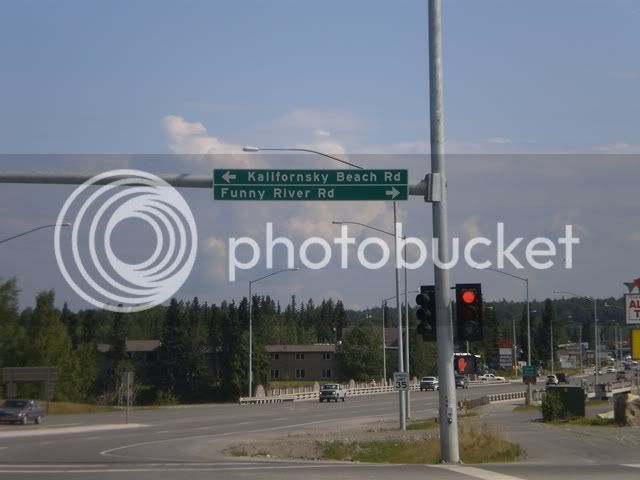
We did not pause at the intersection. At least I did not, as Steve was ahead of me and when I got there he was nowhere to be seen (he did stop a few miles up the Highway).

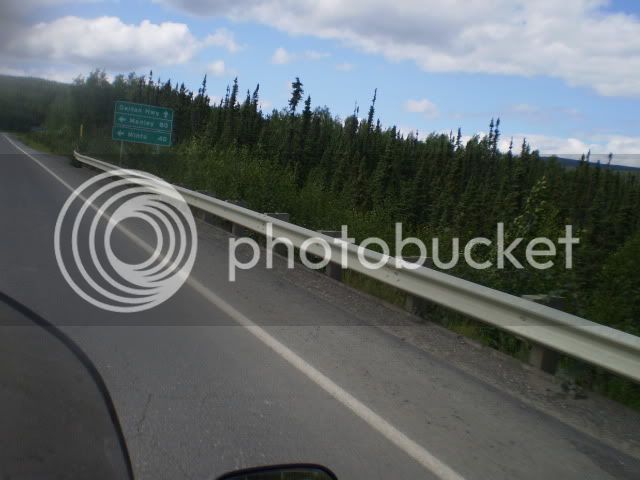
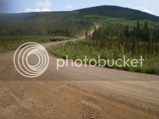
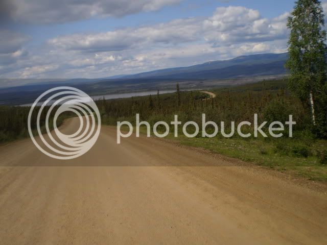
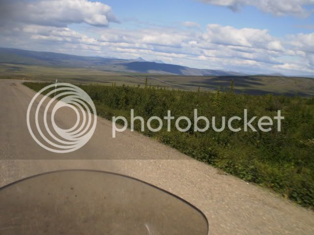
Here are some views of the southern section of the Dalton as we began our trek. For some reason an old Allman Brothers Band song, that I could not quite place, kept playing in my head. Why was that?

P6300246-1.jpg


P6300249.jpg


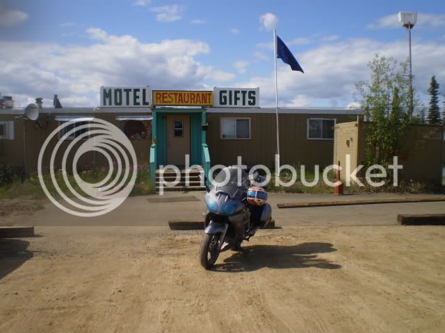
Our first fuel stop was at the small "town" of Yukon River located, not surprisingly just on the northern side of a bridge that crosses the Yukon River. We actually rode right on past it without realizing that we were seeing the town which is, essentially a prefab building with a restaurant and some rooms and a fuel pump off to one side.

P6300251.jpg


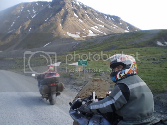
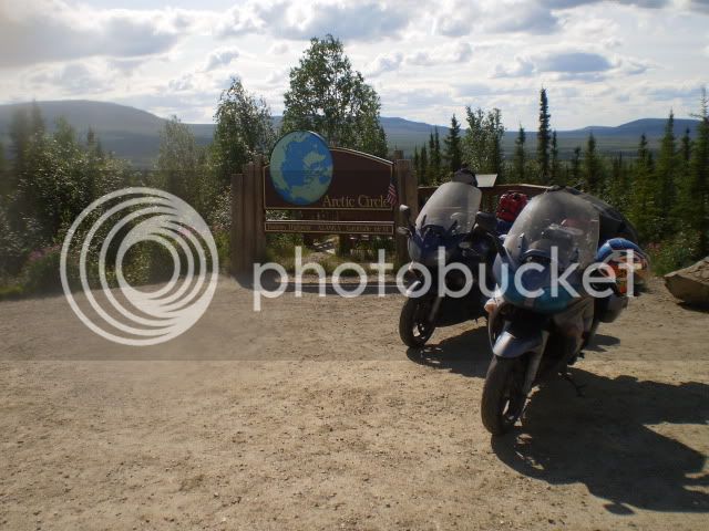
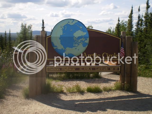
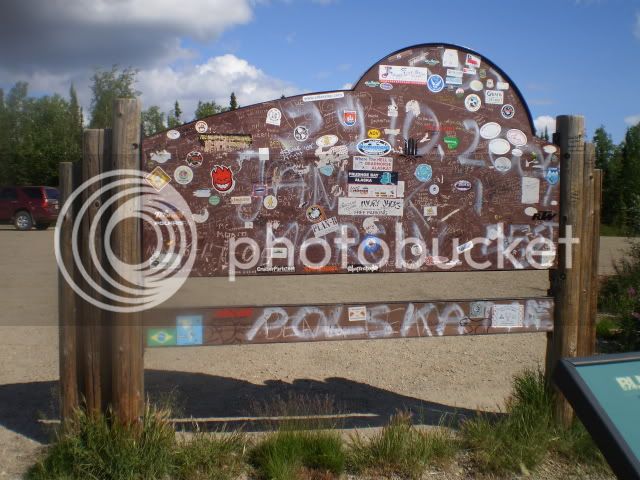
The next milestone we reached was the Artic Circle. The Arctic Circle. We definitely were not in Kansas anymore. We took a break and snapped some photos. The sign is pristine from the front. Apparently, all of the vandals, and those who wish to leave a symbol of their passing this way have a code of honor or sorts and exhibit their handiwork on the back of the sign.

P6300256.jpg


P6300253.jpg


P6300255.jpg


We also performed a symbolic ritual while stopped at the Artic Circle and, while I do not feel it appropriate to post the photos here, let’s just say that one of our dear, departed friends did, indeed, make it to the Artic Circle and that he left something of himself there, too. Those who might want to see the photos are welcome to PM me.

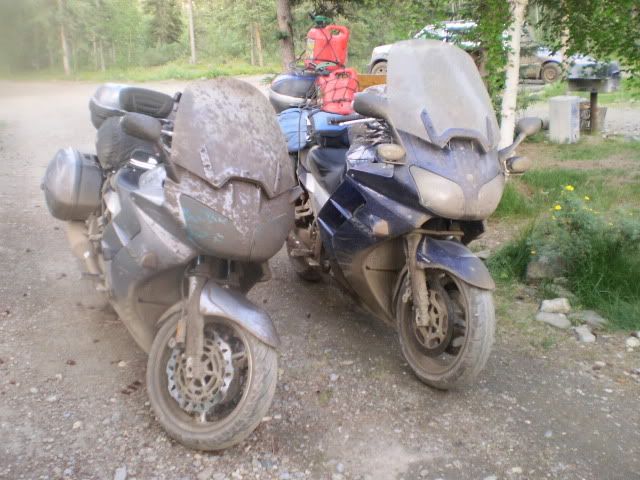
The Dalton Highway is a very interesting road. The road surface changes often. We rode on pavement, chip seal, hard-packed dirt, hard pack with loose gravel on top, and firm gravel. We also rode on loose, thick gravel and, when a dirt section was wet, something that resembled snot on glass. It did not rain while we were on the highway (yeah!) but every once in a while we came upon a section where water trucks had soaked/were soaking the hard packed dirt and steering got pretty damned vague. Oh, and potholes. Any surface, any time. Big enough to blow a tire, bend a rim, leave one stranded by the side of the road waiting for the grizzlies to come say hello.

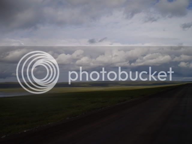
Here are a couple of photos taken south of Coldfoot, where we stopped for fuel and food (surprisingly good at the truckers' meeting place that you see on Ice Road Truckers). Coldfoot is roughly half way up the Dalton.

P6300261.jpg


…and the road goes on forever (yes, that was the song).

P7010272.jpg


The thing is that if you could see the horizon you knew that you were going to ride that far. Until you reached the Artic Ocean. And speaking of seeing, when trucks went by going the other direction the dust they kicked up left you blind for three to five seconds. The best one could do was set up the “pass” so that you knew that the road ran straight for a while after you went by each other and hope that the dust cleared before you needed to perform a course correction.

Our plan was to ride to Wiseman, just north of Coldfoot and spend the night. The next day we planned to ride to Deadhorse (Prudhoe Bay), take a short break and then ride back to Wiseman.

 
Last edited by a moderator:
Sunrise/sunset times Joe?
If you go to the US Naval Observatory web site and and look up the astronomical data for Prudhoe Bay on 30 June 2009 you will get the following message:

Note: Missing Sun phenomena indicate Sun above horizon for extended period of time.

The Farmers Almanac site simply shows sunrise and sunset as ocurring at the same time.

 
Last edited by a moderator:
This is the most delicious shaggy dog story I've heard in a long, long time. I'm on the front of the chair anxiously waiting for more. :clapping: Did you actually get to see any grizzlies on the Dalton? Did you ever fall in love with those grader's berms of spongy gravel cleverly left exactly where you had to cross them to avoid the truckers? And the slimey mud shoulders!! Oh, what marvels we miss here in California! I'm loving reliving some memories.

Alan

 
Top