


My buddy Pete and I usually try to get two big rides done every year...7-10 days in the spring and again in the fall. Normally in the spring, we'd leave in late May, but this year the vacation bids didn't allow that, so we had to leave in late April. Touring that early in the year means no UT/CO/ID/MT/WY mountains. This ride would have to stay at the lower elevations to avoid snow and seasonal road closures. We've done Highway 1 up the coast a number of times in the past, so this time we decided to head north along the western Sierra foothills and see how far into Oregon and Washington we could get. With a complete collection of Butler Motorcycle Maps, we thought we'd try to hit as many highlighted roads as possible.
Normally when heading out, I'll have a pretty solid plan worked out for the first few days of riding. After about day #3, the plan becomes a bit more fluid depending on our progress. This time, however, we had no real plan. On the first day, I thought we could make it to Oakhurst. That turned out to be a bit optimistic.
Day #1, 4/19
Palm Springs to Three Rivers CA
440 miles
On most big rides, I'd be on the road at sunrise or earlier. Not so this time...I got home from work the night before around 10:30pm, and I had to do a quick load of laundry and pack. In bed after midnight. I hit the road at 8:15 and met Pete at 8:30. We slabbed it on I10 through San Bernadino and north on 215 towards Wrightwood. We got to the back roads south of Palmdale, and then west on N2. We then headed north past Willow Springs and into Tehachapi. A brief run west on 58 brought us to Caliente-Bodfish Road. That's a fun little road, though a bit choppy in some places. We topped the tanks at Lake Isabella, and grabbed a bite at Burger King. I'd have preferred to hit the diner at the Kernville Airport, but apparently Pete was too hungry to make the extra 14 miles to get there. Awesome. So we then headed north out of Kernville, hoping to take the Kern River Highway up to CR107/190 through the Giant Sequoia National Monument. A few miles north of Kernville, a sign was posted advising that the road was closed at Johnsondale. We pressed on until I found Johnsondale on the Garmin. It's located prior to the intersection with CR107. Crap. That's turnback #1 (of an eventual 6). We headed back south and then west on 155. I think 155 could be a fun road if the pavement were better and the corners were clean; as it was, it was slow going with a lot of dirt/gravel on almost every tight corner. Then we headed NW to Fountain Springs. I asked a CalFire crew if M56 was open all the way up to CR107 so we could rejoin the earlier planned route. The were *pretty* sure it was open, so we headed east. M56 is a really fun road, with a lot of nice swooping curves through the pastures. As we climbed, the road started to get a bit dirty. And then came the sign, "CLOSED TO THROUGH TRAFFIC." Well, the road still looked passable, so we pressed on the see how far "through" we could get:

The higher we got, the dirtier the road got. We were kicking up a lot of dust, and had our doubts about making it all the way to CR107:

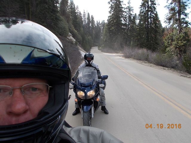
Finally, 31 miles later, we got to the turn for CR107. The barrier was down, no way to get around it. Crap. Turnback #2. We headed 31 miles back to the west, and then NW to Porterville. We stuck to the back roads as much as possible. No way to make Oakhurst that night with the roadblocks. We rolled into Three Rivers just before sunset and found a hotel within walking distance to a restaurant. The bikes were a mess from riding on the dusty roads. We got them cleaned up a bit and headed out for chow. The restaurant was fairly new and looked promising. I had the grilled chicken which was quite possibly the worst grilled chicken I've ever had. I still cleaned my plate, however. Pete commented that I rarely say anything negative about any meal, so it must have been pretty bad. Headed back to the room and tried to get some planning done for the next day, until I dozed off...


