


russperry
Well-known member
So it was off for two weeks with Brodie on a tour planned to hit multiple National and state parks. In the end we ended up in 10 National Parks and untold forests and state parks to round it out. My odometer said we did 5480 miles on the trip, and here's a link to the Spotwalla track for the whole 15 days Trip Linky
Day 1
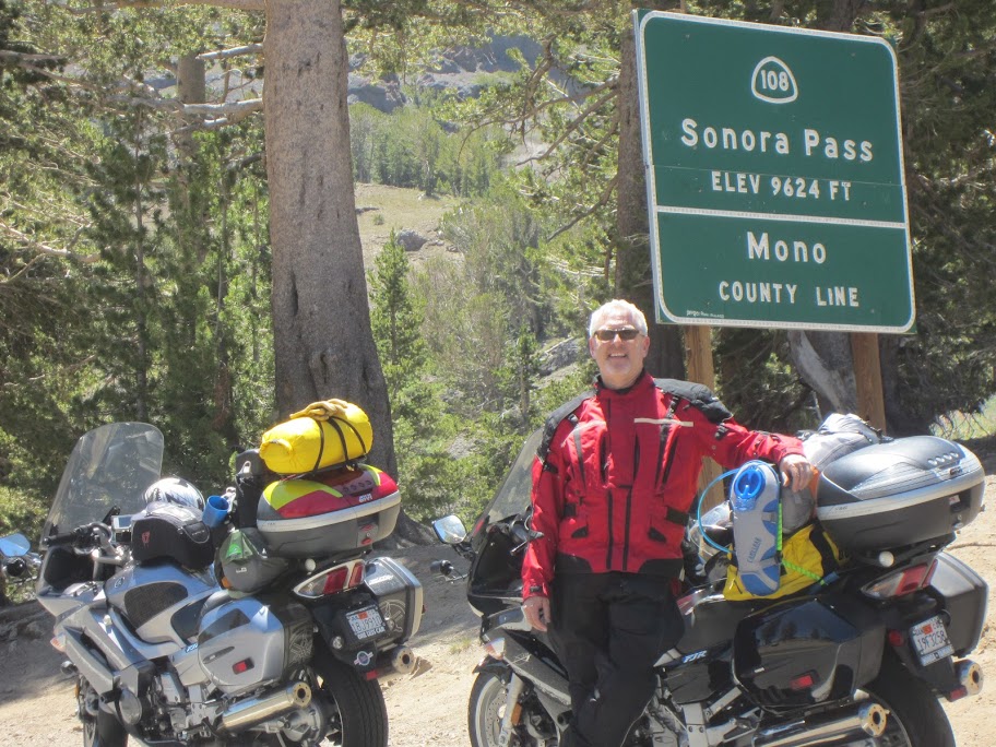
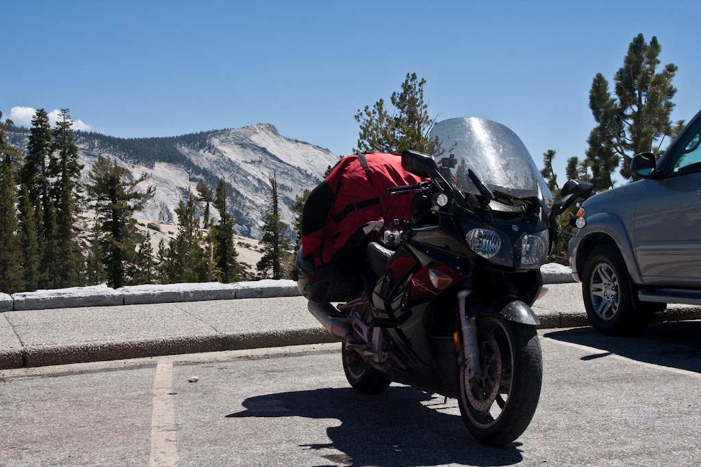
We started out in the Bay Area and decided to take Sonora Pass across the Sierras. The road was pretty busy and the stop at the top of the pass was pretty full. There's no parking or turnouts so it was just several bikes at a time pulled over to check out the markers and take some pictures. Weather was great for the ride
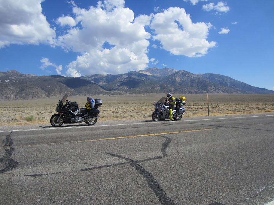
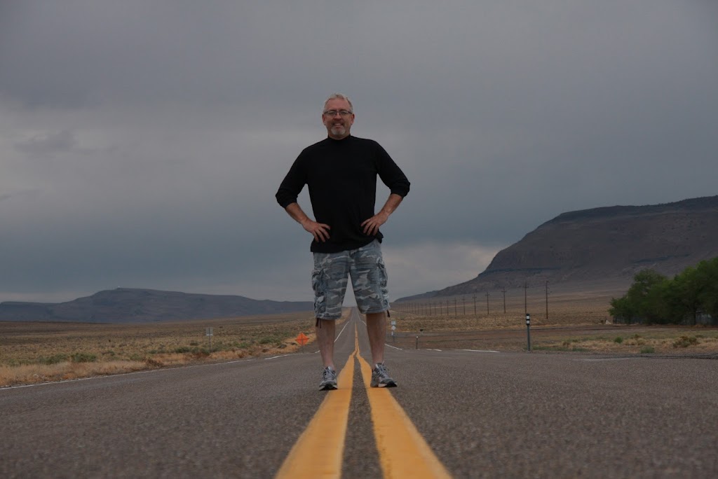
After the pass it was out to 395, then south to Lee Vining. I'd been told that CA120 was a nice ride to the east so off we went. The road is pretty desolate as you're heading out into no-man's land - lots of whoops and pretty country. There's lots of stark mountains and seemingly endless miles of straight roads as you get past Mono Lake, but we stopped once or twice for a picture. This one shows Boundary Peak Nevada in the background..
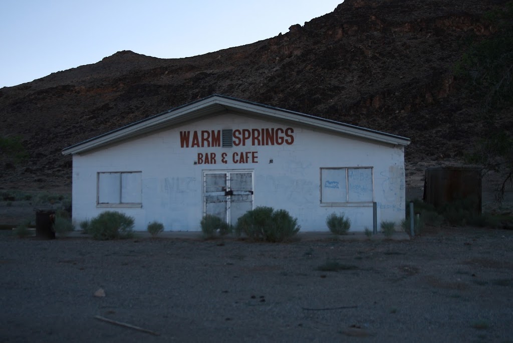
The next town of any size is Tonopah. We stopped there for some groceries as we knew we were going to end up camping somewhere remote out in the Nevada desert - we had no idea how interesting this part of the trip was going to be. We asked one of the locals where to camp and he said "Warm Springs". A quick reference of the AAA map showed a small black circle labeled Warm Springs at the intersection of US6 and Nevada Highway 375, the so-called Extra Terrestrial Highway. We figured there would be something there if AAA showed it on the Western States map, so off we went. Here's what we found when we got to Warm Springs. You can see a little patch of grass to the right of the abandoned bar, but unfortunately there was already a couple there looking to camp for the night.
The guy was nice enough to tell us there was a rest stop up US6 about 15 miles but we didn't want to spend another 30 miles of our range on a out-and-back so we considered camping across the street near an abandoned and collapsing hut. Brodie thought we could pull the bikes down into a little field where we could camp next to a tiny creek, but with my being a chicken about off-roading on the FJR we decided to head up the road and set up camp at the rest stop. Turned out to be a good decision, but we'll come back to that later.
As we rode up Highway 6 we could see lightning off to the east, but luckily no rain for us at the time. We found the rest stop, and boy are rest stops different in Nevada than they are in California. The entire "rest stop" was 2 or 3 picnic tables and 1 strange pump for water - no other facilities of any kind.
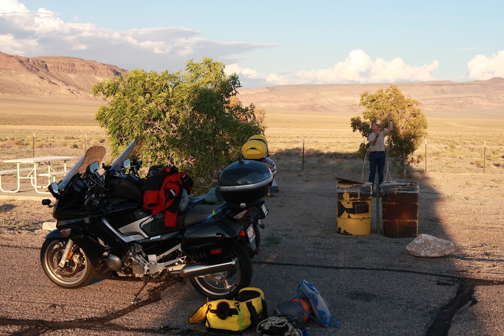
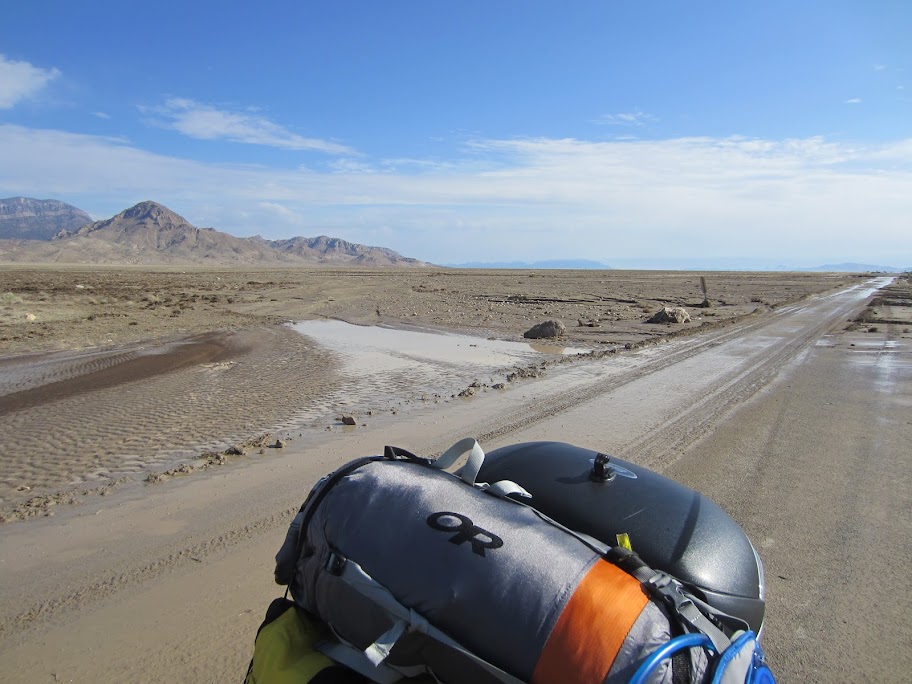
We had some bovine friends making some noise, and there was a Nevada DOT facility up the road a mile or so, but other than that it was very quiet. We set up camp, had a pretty nice dinner of steak, salad and beer, and off to sleep. I woke up about 3:00AM to the sound of rain on the tent and thunder all around. I went back to sleep hoping that we wouldn't be underwater when it was time to head out in the morning, and sure enough it stopped raining by 7:00 so we were able to pack in relative ease. I set up one shot on the highway here - good example of how isolated things are out there - I set up my camera on a mini-tripod and snapped off a few dozen shots without a car in sight in either direction.
Day 2
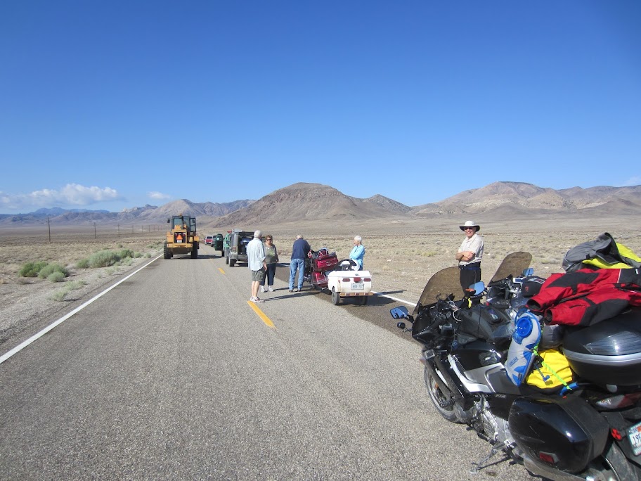
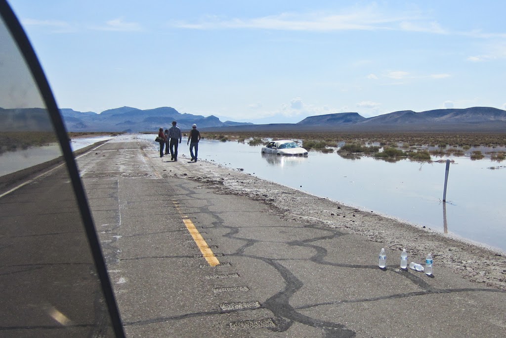
So off we went, but not too far before we hit a HUGE water and mud slick across Highway 6 - it looks like the evening of rain had unleased some flash floods. Brodie hit the first one at pretty high speed and just about went under water. I got lucky and snuck my way across this first obstacle.
Unfortunately we moved only about another mile when we came on a line of cars waiting for some more clearing work to be done up ahead. We heard that there was up to 3 feet of mud on some parts of the road so we waited here for about an hour before we were able to move on - it was a nice chance to chat with some folks from Canada, Nevada, and other places.
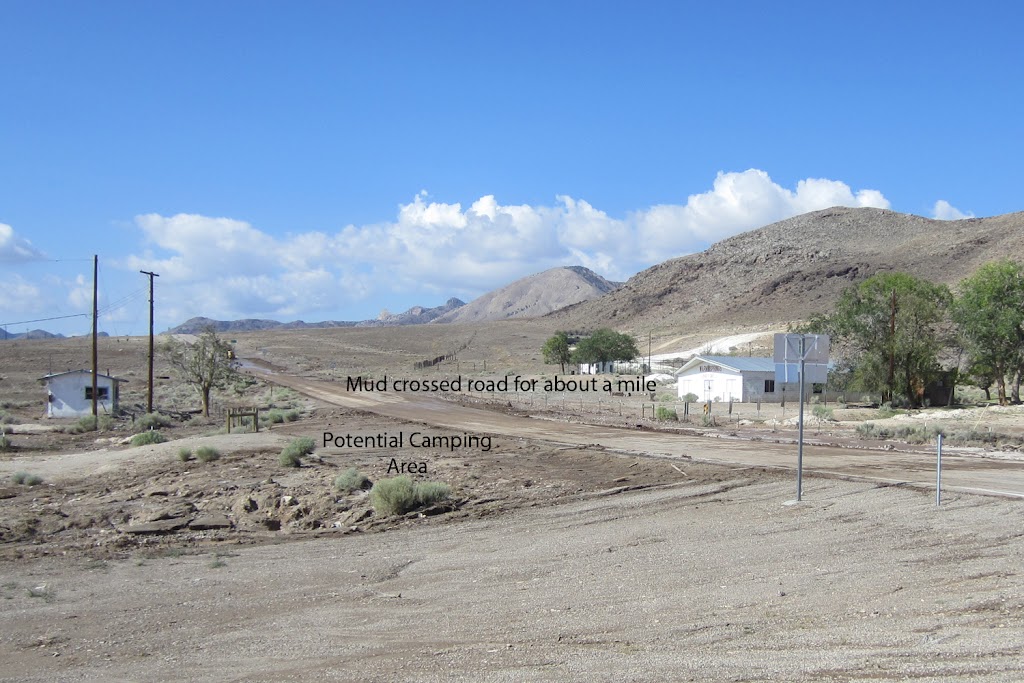
After we cleared this mess we were able to get back to Warm Springs - when we got there we let out a big sigh of relief. It turned out that the water from the flash floods had boiled over the highway and blown right through the area we had considered setting up camp and parking the bikes. That might have been an unpleasant end of our trip on the very first night!
We finally got moving across Nevada 375 when we came across another stoppage. There was water running pretty heavily across the road and a car before had spun and ended up in a ditch with water up nearly to the windows. There had been 4 people in the car including a baby, but fortunately they had all gotten out OK. There were some locals there trying to put a chain on to tow it out and there wasn't much we could do to help, so we carefully traversed the water and moved on.
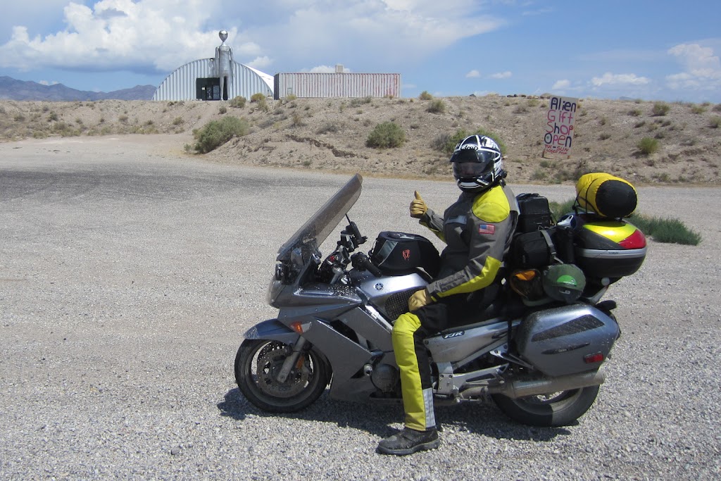
Highway 375 ends up at a nice place called Crystal Springs. There's actually quite a bit of water running through the small valley so things are green and lush, at least within 50 yards of the creek. Its also the home of some of the ET watchers, so there are places selling ET jerky (I was curious but at the end avoided that shop - who knows what they're drying and selling?) and anything else you might associate with beings from other worlds. The highlight was this shop with a giant blow-up alien - and the tall silver thing in the background isn't too bad either.
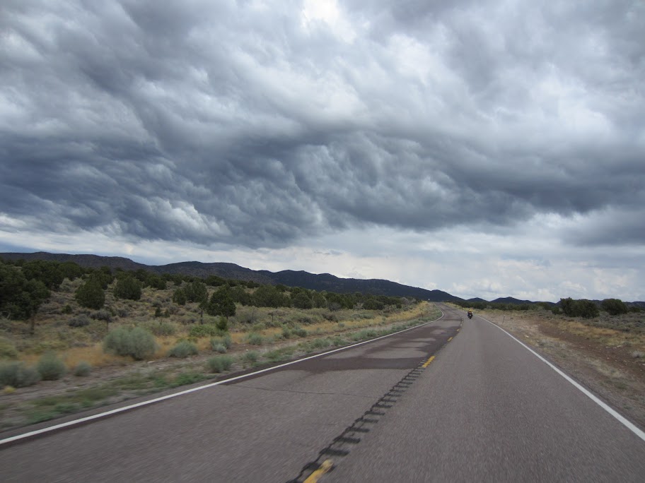
We had to continue east as our destination for the night was St. George Utah. We were dodging weather for most of the afternoon, and took a pretty heavy shower as we were headed along US93. The country out along 93, Nevada 319, and Utah Highways 56 and 18 is spectacular. A couple of shots here show some of the terrain and the weather - I was half expecting the cloud to turn into a giant Voldemort skull, but I must have seen too many Harry Potter movies!
Day 2 ended in a torrential thunder and rain storm in St. George. We relented and ended up staying in a motel for the first and only time of the trip.
Day 3
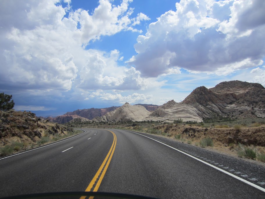
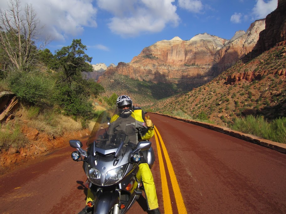
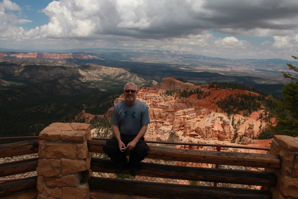
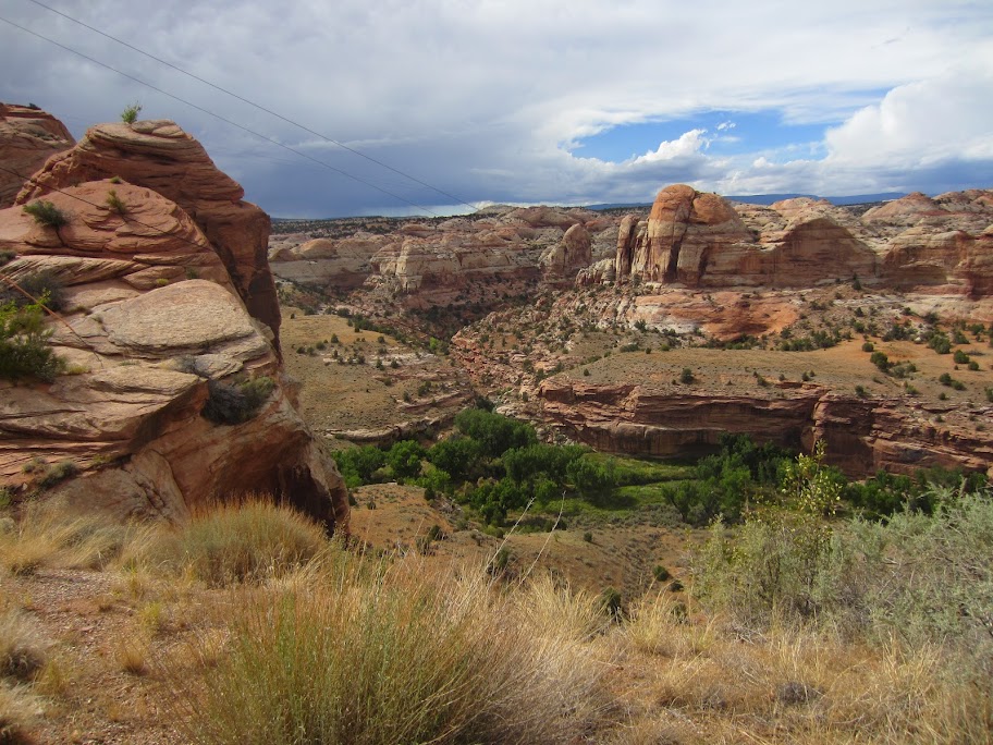
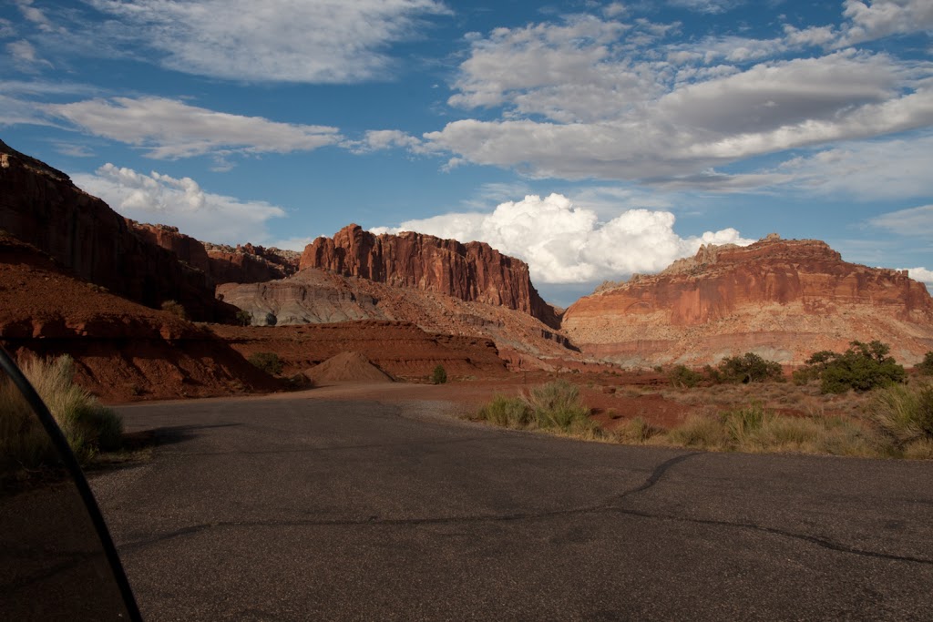
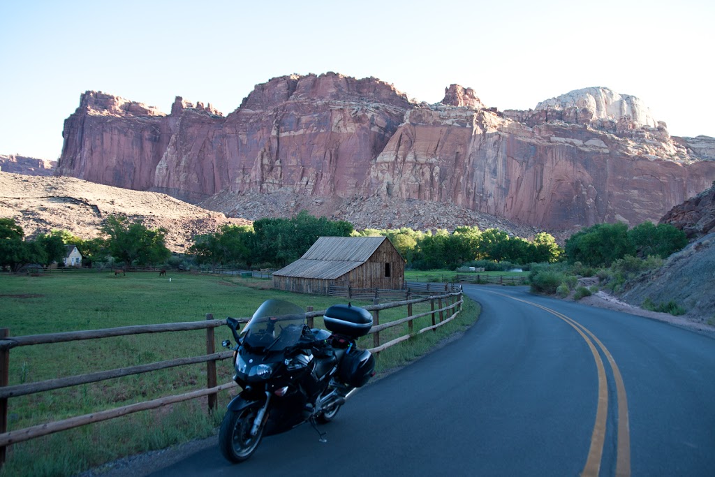
The plan for Monday was to stop at multiple parks in Utah and get as far north as we could, with the hopes of getting into the Yellowstone area by Tuesday night. We decided not to go all the way around to Moab but would try to see Zion, Bryce and Capitol Reef, as well as hit the famous Utah Highway 12. I won't spend too many words on it, but the day was incredible. The rock formations through the parks, the engineering efforts in the 30's to put together most of these roads, and the roads themselves made for a fantastic day. The photos below are a sampling of the various parks and monuments we saw that day. Also filmed a great video down by Caliente that I need to edit and post up - that will come later..... We ended up camping in Capitol Reef NP, which has a great campground that was only about half full - highly recommended for you tent campers out there.
Day 4
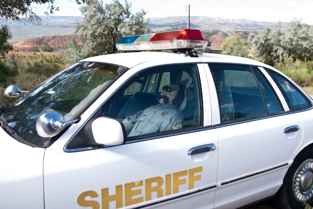
Tuesday started with the obligatory photo of the Capitol Reef area including the Mormon settler developments including the photo inspired by Tyler. I didn't do anything particularly fancy with the shot but include it here anyway. Next stop was for the famous "dummy sheriff" - I don't mean that in a mean way, but in a direct and honest way. I know I've seen a similar photo posted on the forum before, and I'm not 100% sure but I think it was in Torrey on Highway 24.
Since our goal was to head north, we jumped on Utah Highway 72 and I'm sorry to report I was not running my GoPro camera through there. It was a fantastic stretch of sweeping turns that went on for about 35 miles with nearly no traffic - I would love to have a chance to run that stretch of highway again. After that we took Highway 10 and stopped in the town of Duchesne for lunch. We took highways 35 and 150 across the Wasatch National Forest and it was an incredible ride. Sure was better than slabbing up through Provo and SLC!
We did want to get as far north as possible so we kept pushing with the idea of getting near Jackson for the night. As the sun was setting we tried to find a place to pitch a tent near Afton. Brodie struck up a conversation with a local guy and he suggested we head for a national forest camp in the hills east of town. So off we went hoping to find a camp. We seemed to be on the right path but after going into the hills for about 5 miles we determined we must have missed something and decided to get back to the highway and keep heading north.
We finally ended up in a RV camp near Thayne, WY called the Flat Creek RV Campground. It really was a nice place that was cheap, had a clean shower and running water - all told a good place to keep in mind if you're in that area. Unfortunately we rolled into town at about 9:30 after every restaurant had closed, and even the mini-mart had shut off all the hot food, so we ended up with the worst meal of the trip, a jar of spaghetti sauce on noodles, and we finally finished eating and cleanup by about 11:00PM.
Day 5
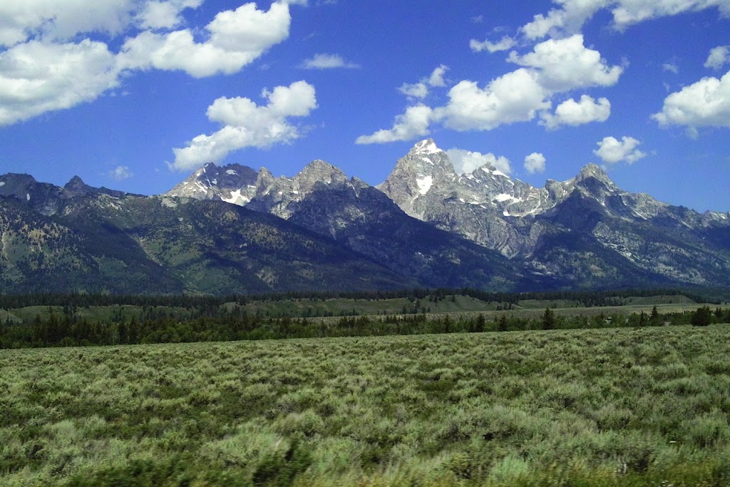
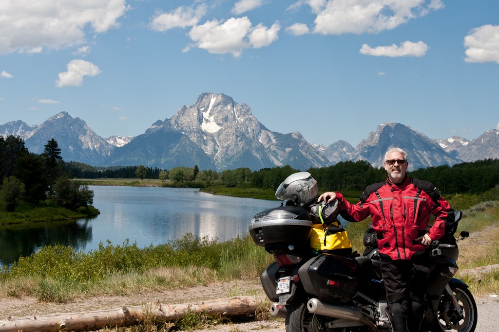
So its Wednesday morning and after a big breakfast at Tootsie's its time to hit the bigtime of the Grand Tetons and Yellowstone. We saw our first elk in Grand Tetons NP, much to Brodie's dismay (lots of you know that story already) and were stopped by road construction a couple of times so was able to take a couple of snapshots.
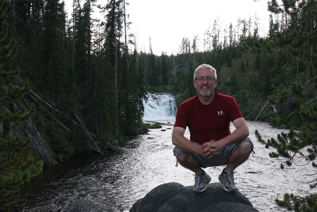
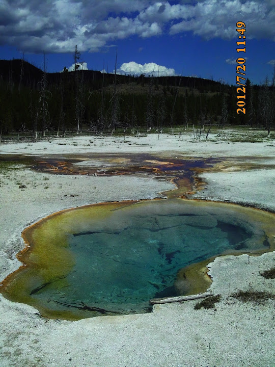
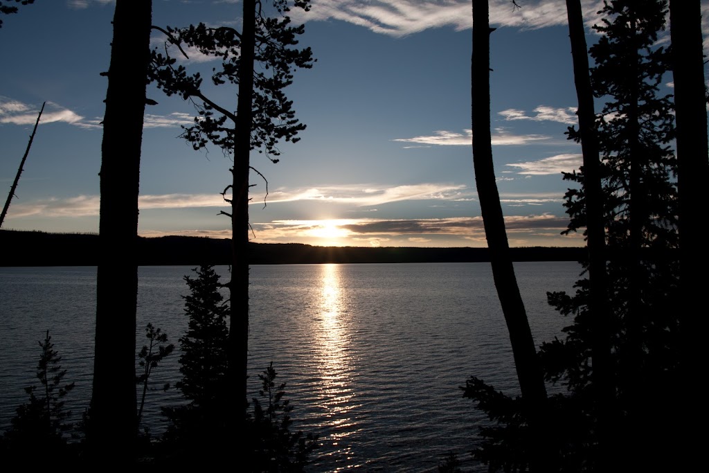
Campgrounds apparently are always packed in Yellowstone, so we grabbed the first campground we could at Lewis Lake. Its inside the south entrance and seems to be the best chance for finding a spot in the entire park. Its about 10 miles from the nearest facilities at Grant Village but was a fine place to camp. We had camp setup by about 2:30 and took a ride around Yellowstone Lake but didn't have a lot of time before the sun started coming down. Our first night there we ended up camped next to a nice guy named Pablo, a guy born in Canada, living in Mexico but roaming the US on a Harley. I went back to Lewis Falls to get a couple of shots.
Day 6
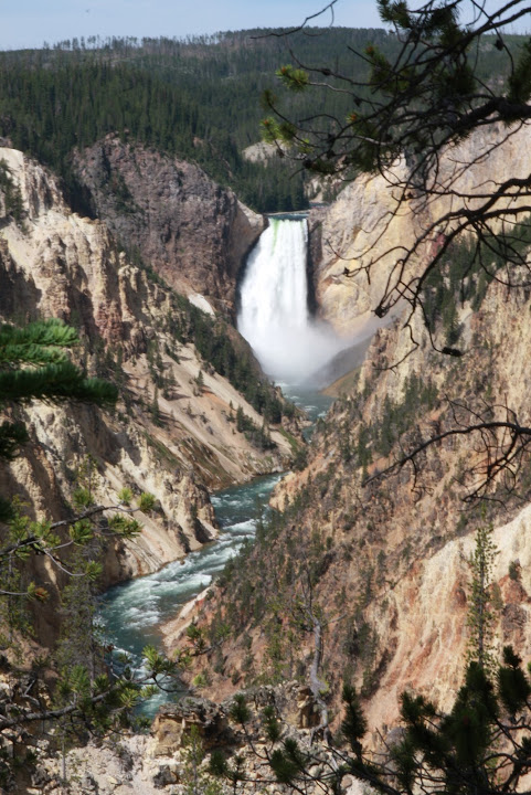
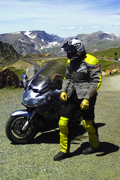
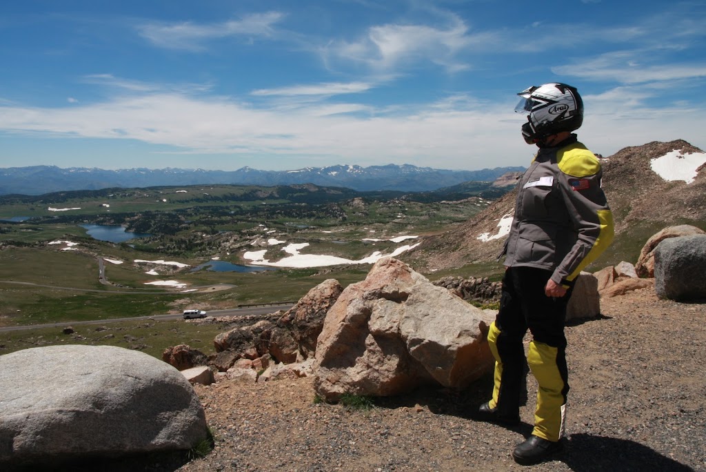
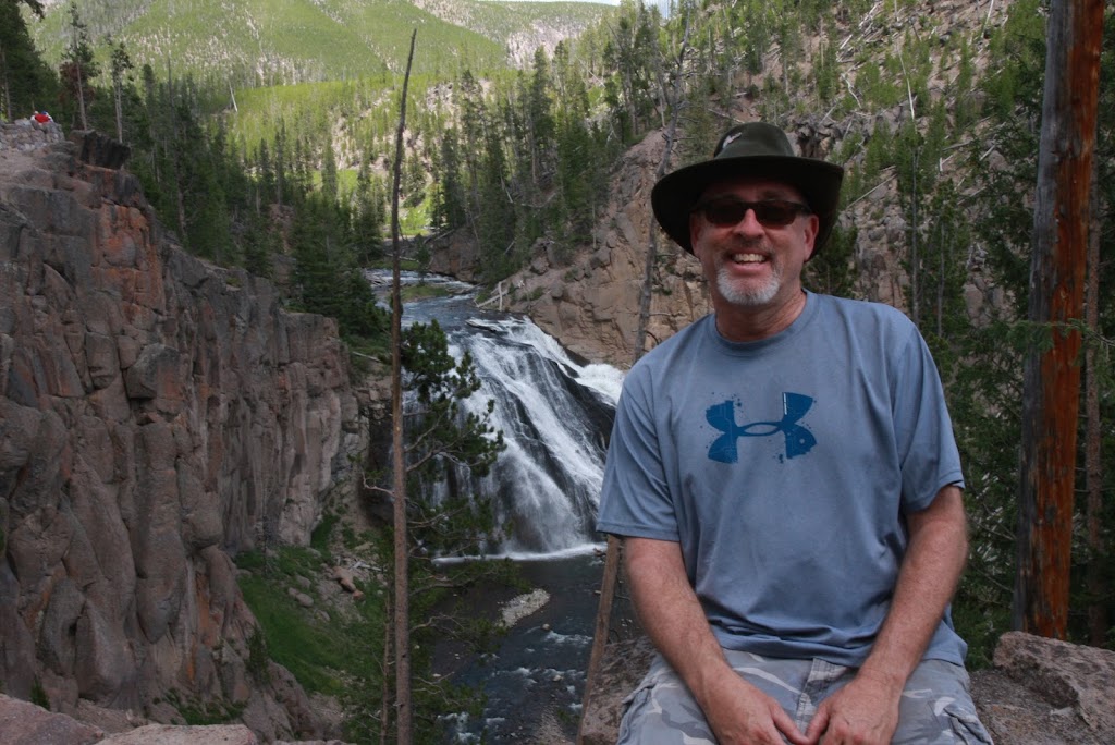
Its finally time for Beartooth Highway! Knowing that the road takes you up as high as 10,800 feet we packed up heated gear but in the end there was no need. It was a beautiful day with the temps never dropping below the high 60's across the pass. First there were several stops along the roads in Yellowstone including a lengthy stop on the Yellowstone River with photo op of the Lower Falls as a highlight. After the long trip over the pass we ended up the outbound ride in Red Lodge Montana. It turns out we got there just 2 days before their annual rally. The streets were already packed with Harley's, nearly all of them with fringe hanging off the clutch and brake levers! Lunch was had at the Red Lodge Cafe and Lounge and we had a good heavy meal, perfect for the long, hot, sleepy haul to Cody.
Day 7
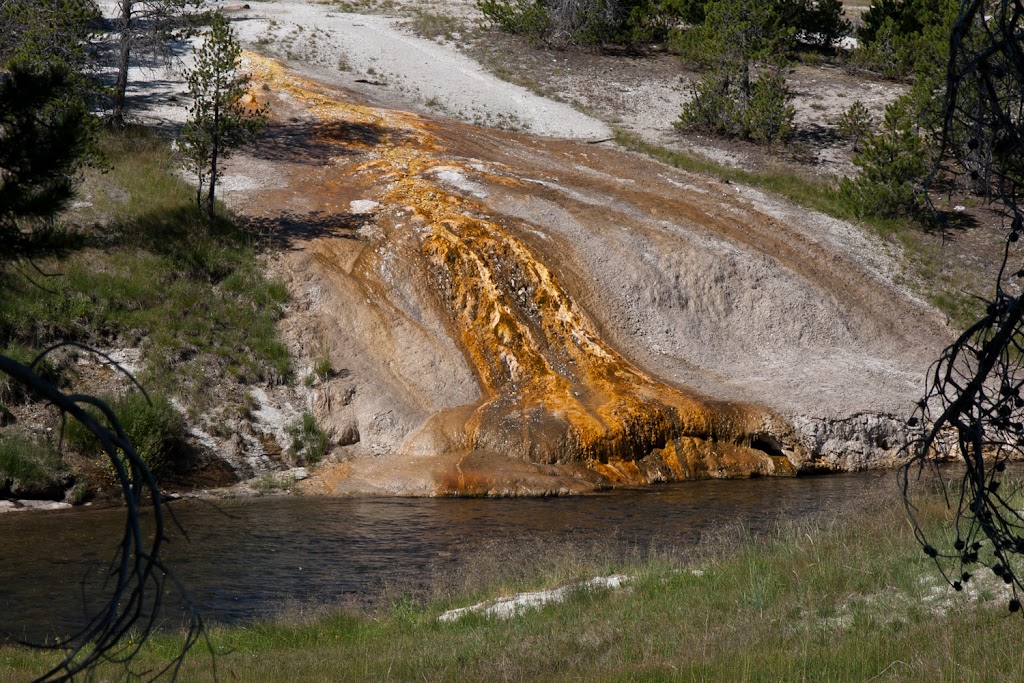
Its time to do a more leisurely tour of the park including the required stop at Old Faithful and the other hot spots along the Firehole River. The colors of the fountains and pools are really amazing where the different types of bacteria live at specific temperatures. We also made a quick run by Firehole Falls - it sounds like they named it after some of the hot BBQ sauce they make in the area! Also took time out to get an evening shot of Lewis Lake - it stays light very late and I think this last shot was taken at nearly 10PM.
Day 8
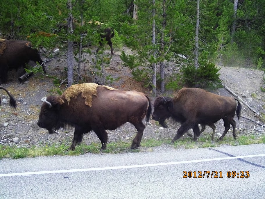
This was a pretty long travel day - we had to get from our camp at Lake Lewis up to the West Entrance which is a pretty long haul since the speed limit is 45. We did come across a herd of buffalo that was being driven by a park ranger in a truck along the opposing lane of traffic. I wish I had had the camera in movie mode but a still shot will have to stand as the proof.
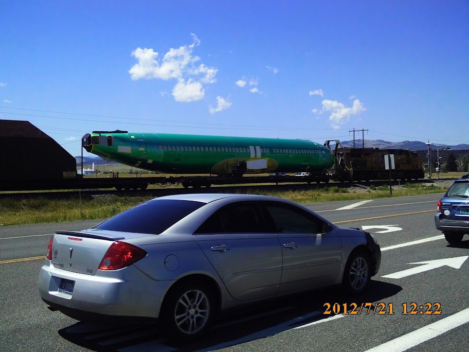
Our goal was to get up into the Whitefish/Kalispell area for the next day's traverse of Going to the Sun Road and a hop up into Canuckistan. The run up from West Yellowstone area to Helena is not very memorable at least as far as I can remember. The most interesting site was this train carrying aircraft fuselages and parts.
We ended up getting pretty lucky in Whitefish - we made a call at about 5:00PM and found the last two spots open for tent camping at the KOA. It was a nice stop - way more crowded, but there were clean showers, a hot tub, pool, and a store where some treats could be had. I think I splurged on a chocolate chip cookie / ice cream sandwich.
Day 9 - Going to the Sun Road
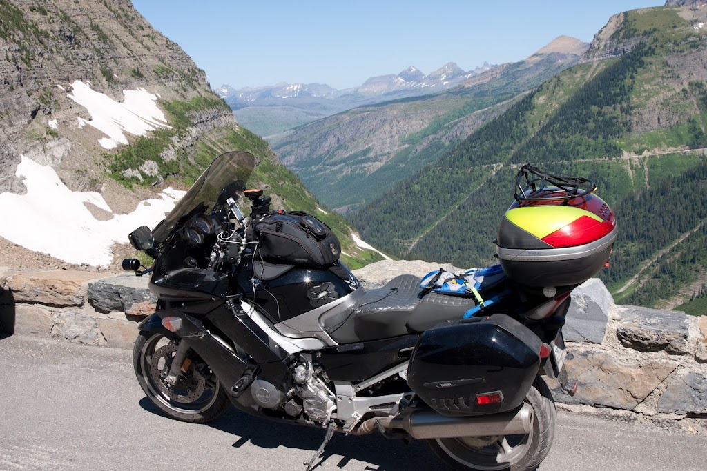
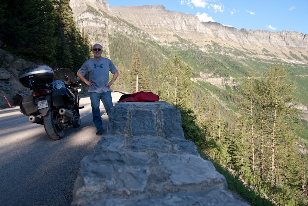
I've got to admit that this was one of my main reasons for taking this trip. I'd been in the Kalispell area once before on a business trip but hadn't had time to drive through the park, and I'd seen a National Geographic program that talked about the clearing and maintenance they do each spring so it was something I was really looking forward to. I'm glad to report that it did not disappoint. The road is a spectacular achievement, and you can see when you're on it how much work and how dangerous it must be to keep it open and safe each year. One thing I wish I had prepared for would have been a hike to Hidden Lake at Logan Pass. I've seen photos of it on Google but its a pretty long walk out and back from the visitor center and I didn't have the right gear or enough time. One thing I saw was pretty cool - some kid, about 12 or 13, was wearing ski boots and carrying a pair of skis up the trail - apparently he was going to get a 30-60 second run down the remains of the snow pack in exchange for an hour long hike up the trail in those monstrous clogs - oh to be young again!
Looking down from the wall
Mt. Reynolds
Waterton Lakes National Park in Canada
Looking up the road in late afternoon
Last light on Lake McDonald
We did cross into Canada on the Chief Mountain International Peace Highway - the border crossing was just about deserted as we had expected and the road out there was quiet and in good condition. The park itself was pretty neat. Saw a bear off the road on the way to Red Rock Canyon, and spent a little time in the creek cooling off. We saw a couple of other folks on cycles out there including another FJR guy from near Calgary (sorry but I can't remember your name).
If anyone goes there to take pictures, the late afternoon and evening are great. The road is almost deserted in the last hour of light, and of course the colors and contrasts are much more dramatic. Due to working the soft lighting until late, we got into West Glacier way past dark and barely got into a restaurant before closing. There were two ladies from the Bay Area who were finishing up a week of backpacking and camping in the park, and they said they had had 4 fairly close encounters with brown bears. All in all a very cool day.
Day 10 - Turn around day
Well it's time to head for home and we've decided its down to Missoula and across Idaho's Highway 12 to end up somewhere in the Lewiston area. This was another long day and I only remembered to take a couple of photos all day. We stopped at the Lolo Pass visitors center, and had a nice lunch at some place along the river where we were not the only motorcycling customers. 4 guys on adventure bikes and a couple of others on BMW touring bikes were also there. Maybe Brodie can add the name of the place? Food was good but service was pretty slow for how few customers there were. Anyway, no pictures to post here, but I did get some good video so hopefully there'll be an entry in the future.
We ended up staying in a campground in Walla Walla. There was some kind of baseball tournament going on so downtown was actually pretty busy for a Monday night. We ate dinner at a place called Jacobi's where the food AND the service were good. There was a little train museum but we were there too late to take a look. Really porked out there with a full course meal including tiramisu and coffee. Overall I was pretty impressed with Walla Walla - it looked pretty plain from the highway but downtown was actually pretty vibrant.
Day 11 - to La Pine
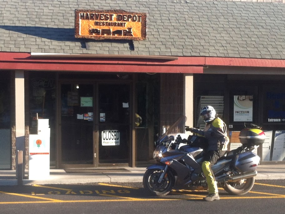
So we know there's a big RTE happening in September, so we decided that La Pine was the place to go and sample the food in case we can't make the September trip. Imagine our surprise when FJRay's buddies place was closed <_<
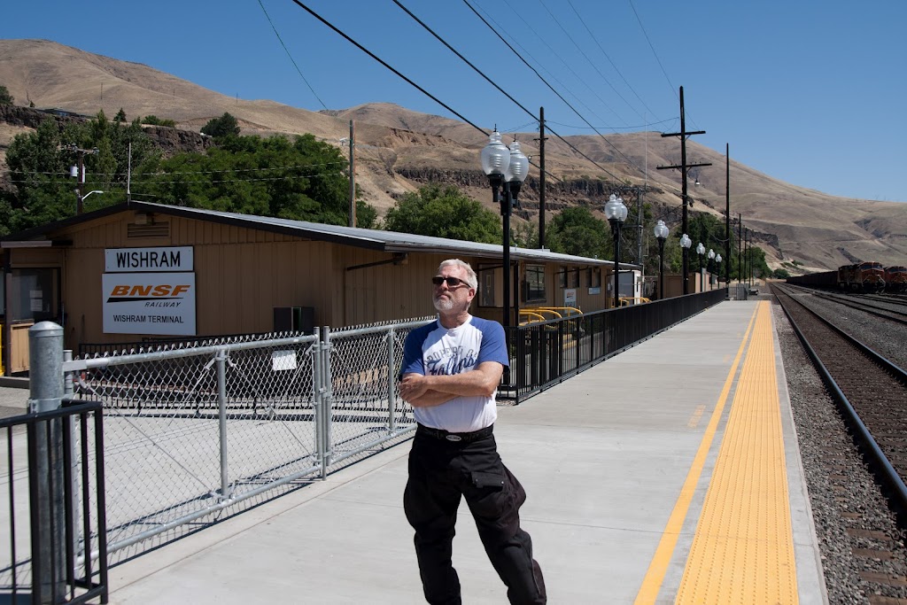
But the ride down the Columbia River Gorge and surrounding country was great. We followed the north shore of the river in Washington on Highway 14 instead of getting on the interstate. A sign on the road for a "Historic Train" caught Brodie's eye near the town of Wishram - what a strange little place. It seems to be an old railroad company town but it seems pretty run down, like time has passed it by, and there's switching tracks alongside the river. But for some reason there's also an active Amtrak station there - probably explains why Amtrak loses money every year and needs subsidies to function.
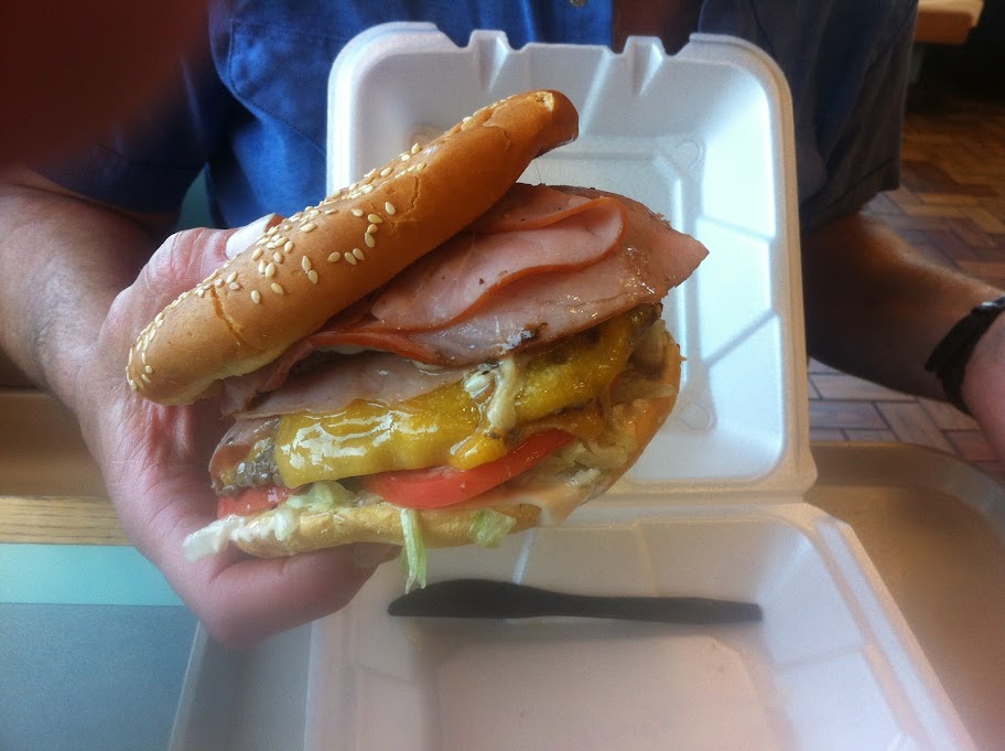
We arrived in a town called The Dalles around lunchtime, and the gas station attendant (this is Oregon after all) suggested a place called Big Jim's. I don't know how many may have heard of Big Jim's, but they have a huge menu and make some monster burgers. Brodie can eat prodigious quantities of food, so he orders the T-Rex, a $12 burger that had two ground beef patties, four pieces of sliced ham, at least two pieces of cheese, and is served on a bun about as big around as a frisbee. He ate the whole darned thing too.
Next stop - La Pine. We got into town and a nice fella at the gas stop told us about how we could camp by the Deschutes River for free - the only thing that worried me was when he said "I ride my quad down there all the time". Anyway, we found the Forest Service road which wasn't too bad, then had to take some soft stuff including exposed tree trunks to get down to the campsite - I'll tell you I was sweating some bullets as my 900+ pound fully loaded vessel was bouncing around but luckily kept it upright. I was playing around with some remote flashes and put together the following shot - I like it, but probably not quite ready for prime time.
In homage to Tyler I tried to get a flower + other type of shot of the Deschutes River - still need some work...
Day 12
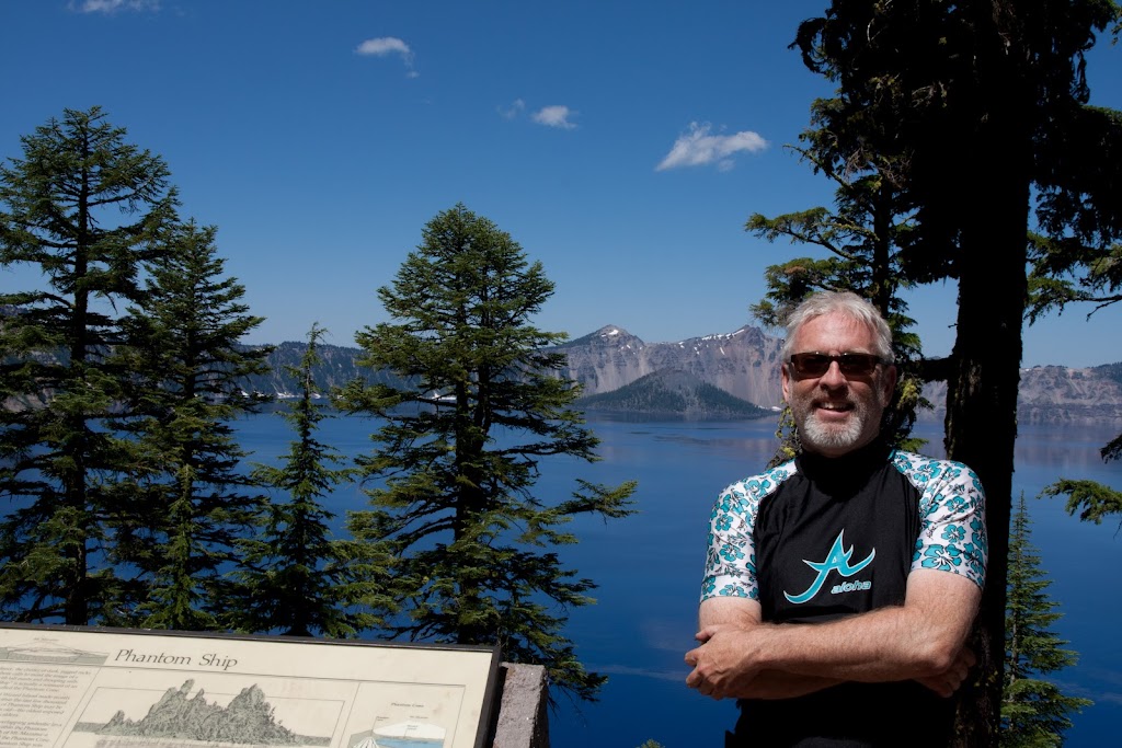
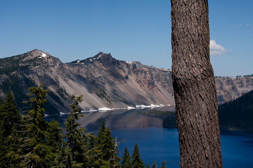
The next day we planned a ride down 97 to Crater Lake, then across to Grant's Pass, on to Crescent City, then ending up in Eureka. The ride down to Crater Lake was nice, good weather, road not too crowded, and of course all of you that have been to Crater know how beautiful the lake is. Here are a couple of the standard shots but with some ugly Sasquatch-type guy in one of them.
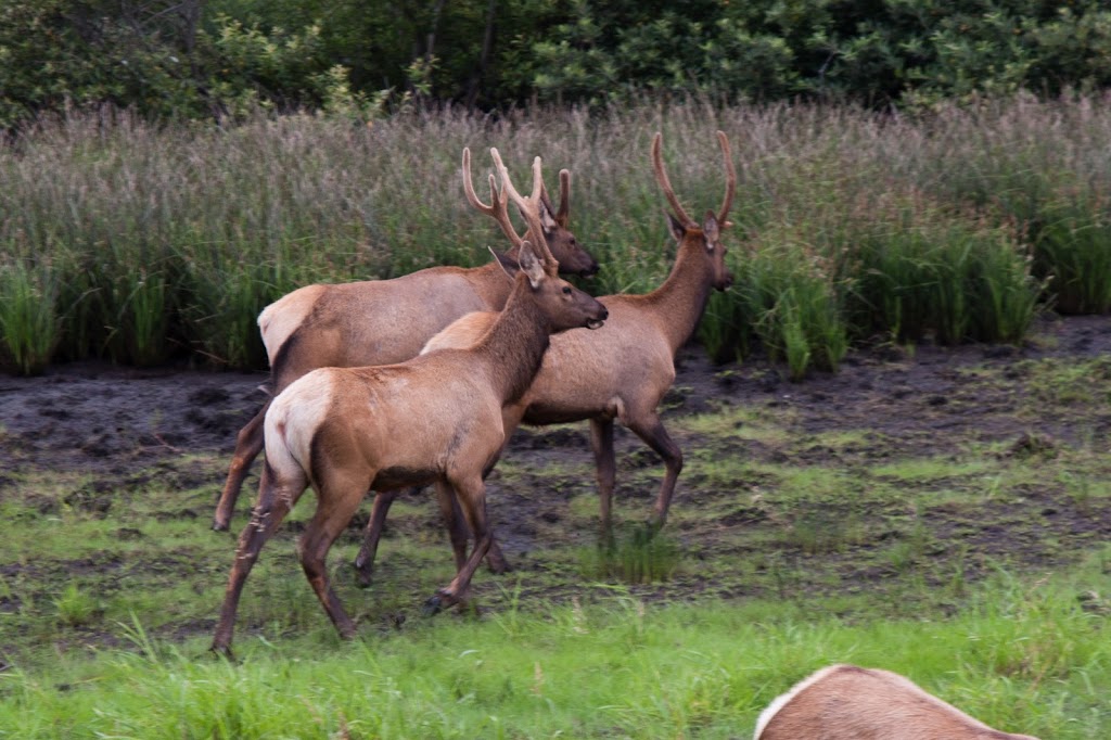
So its off to Grants Pass - we stop at Shari's for a big lunch and its hot - pushing the 100F point, so I'm glad to be in the air conditioned spot to eat. As we push off we head down to Crescent City and somewhere along the way, I think at the tunnel near the California border, it transitions from hot-hot-hot to cold-cold-cold. I've got all the vents on my jacket opened, I'm wet underneath from perspiration, and all of a sudden its 52 degrees and I'm on the verge of hypothermia. We have to ride about an hour along the coast including a run through the elk preserve, another spot where Brodie is all of a sudden nervous and quiet - well maybe I'm overstating that. Anyway we make it past the scene of a prior incident without spotting any hulking four-legged beast when we come around a corner and there's 20 cars pulled over and an entire herd by the side of the road (insert requisite photo here)
The day ends in McKinleyville where we have a nice dinner at the 6 Rivers Brewery (thanks for the recommendation Eddie!) Camp is at the Widow White RV Campground which is nice and quiet, with a huge grassy area for tenters, but there's some treachery in the grass which we'll have to cover later.....
Day 13
The end is in sight, but at this point we decide to string out the trip with a day ride around Eureka - after all if we head home now, we'll be home Thursday in time to back to work on Friday, and who wants that? So we head off on what is something of a habit, which is 299 to 96 to 3 to 299 and back. But something's different this time - we've arranged to meet Eddie after dinner and we need to be back by about 4:30, so we need to cut off some miles if we want to be on time. Back to the AAA map and we see that there are some roads cutting between 96 and 3 that could cut off some serious miles, but who can be sure? After all, the AAA map told us there was a town in Nevada called Warm Springs and we all know how that turned out.
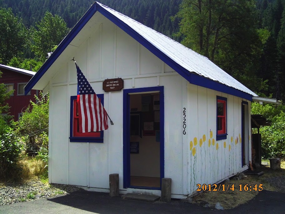
The ride is nice as always along 299 and 96, when we get to Somes Bar and turn east. I'll tell you that the ride was fantastic! From goaty to medium speed, single lane, steep drops down to the Salmon River, then nice roads through farms and ranches on the way to Etna. I didn't take too many still shots but I have the whole 57 miles on video - I think you'll all enjoy it (once and if I get the editing done). The whole trip is along an isolated river through the hills but miraculously there are two post offices (one of which is pictured here) that serve something like 500 people - must be very good service!
So its back to Eureka to meet Eddie. He joins us at the camp, we catch up quickly, then its time for some touring of Eureka and then off to dinner at the Samoa Cookhouse. For some reason, Brodie picks this particular moment to play motocross in the wet grass, guns the motor on the AE, and spins that giant car tire in the grass, and quickly the FJR ends up on its side. I quickly dismount to help him pick it up, and its only after its back on two wheels that realize I've made a huge mistake by not getting a photo. I know he's going to deny it without photographic proof, but here it is for all to see in writing - you saw it too, right Eddie?
Day 14
OK - we've got one more full day before we head for home and we've got a full slate. We're going to take the 140 mile piece of asphalt from Fortuna to Red Bluff known as Highway 36, then across to Mt. Lassen Volcanic National Park, meet my son and his buddies near Mineral, then south on 89 to Truckee.
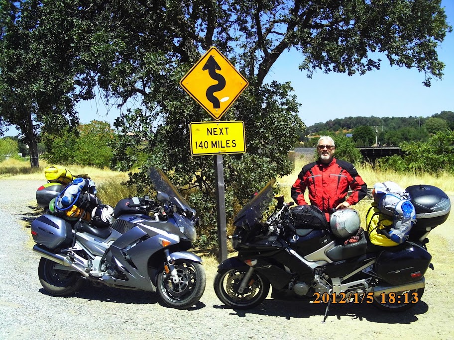
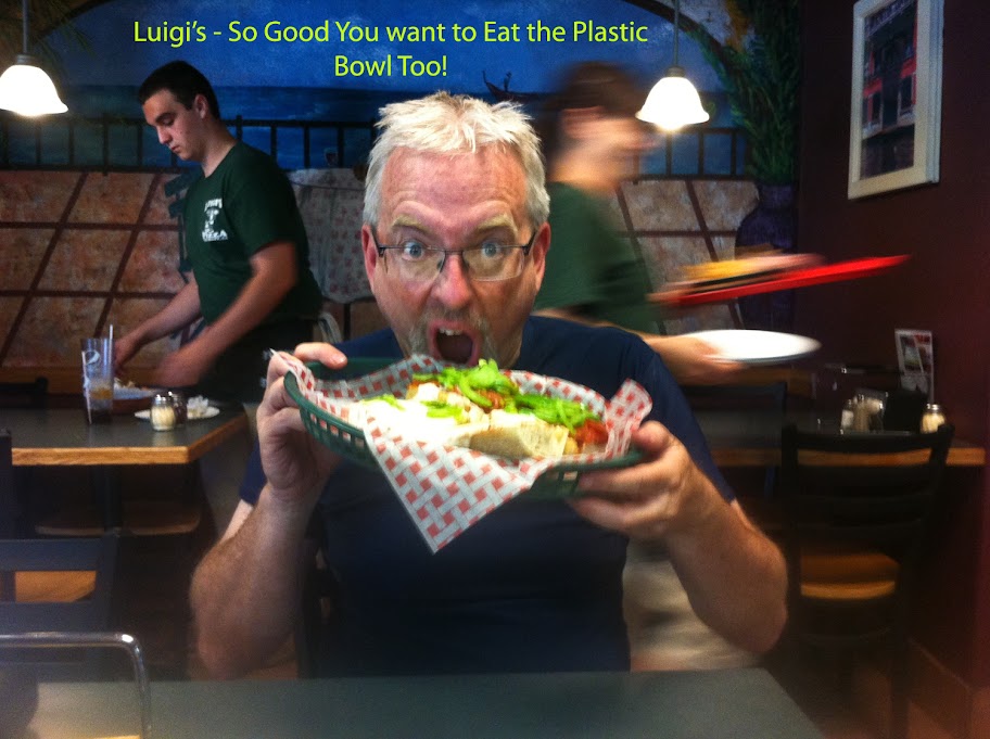
Highway 36 is awesome as everyone knows - I'm actually feelin' it today and pushing pretty hard - about 50 miles in I have a scary moment - I come around a corner and there is a cow, complete with cowbell tied with a red ribbon standing perpendicular to the direction of traffic, about half blocking the opposing lane. To make things worse, there is a semi coming the other direction who sees Bessie, and swerves into MY LANE to avoid - oh SH**! I'm hauling the big beast down as fast as a I can and fortunately the truck passes the future hamburger before I get there and all is well. We get to the junction with highway 3 and Brodie asks if I have the GoPro running and caught all the action - OH NO! User error!!! None of the twisties nor the near miss have been recorded! I am still mad about that as I type this story. Anyway, I turn the thing on and capture the 2nd half of the trip. We take the obligatory photo with the best sign in motorcycling legend then its lunch at Luigi's (highly recommended - good food and great prices) in Red Bluff.
Next stop is Lassen - we decide to take a little road between 36 and 44 called Manton Road so we can enter the park through the north entrance - that road was a lot of fun though poorly marked and we end up reversing field twice before we reach the town of Shingletown on Highway 44.
Lassen Park is pretty cool - lots of switchbacks across the face of the volcano. The entire trip through the park is relatively quick, and we end up in Mineral at about 4:30. My son and his friends, who are supposed to be camping nearby know to meet us at the general store but in true teenager fashion they blow us off without a peep. We need to keep moving if we want to get a campsite near Tahoe on a Friday evening so we wait for about 30 minutes then its off again on the road.
Tahoe is crazy on weekends and we ended up there too late to find any spot near Truckee, so we ended up backtracking up Highway 89 for about 20 miles before finding a single open space in any of the Forest Service campgrounds. I took an attempt at a night shot of the Big Dipper, but I've got a lot of work to do on technique to make a career of this.
The Last Day!!
Since we had bypassed Yosemite on the way out, we decided we would run past Lake Tahoe, down the ?? grade into Carson City, then 395 down to Lee Vining with the plan of entering the park via Tioga Pass. The ride was great though quite a bit of traffic as you get through Gardinerville. We ate lunch at Mono Cones in Lee Vining, a little red shack that sells burger, fries and shakes right on 395. The food was good - BUT IT WAS $17!!!
Anyway - Yosemite was beautiful as always - here's a shot from Olmsted Point with Cloud's Rest in the background. I climbed that peak back in '09 with some friends from work - the views are forever, but its a 13 mile round trip that took nearly all day and there was no time to try it today.
We make it through the park and start the home stretch. Highway 120 takes you through Groveland, a popular jumping off point for whitewater rafting on the Tuolumne (pronounced twal-a-me) River. Right after Groveland there's a nice twisty piece of road known as Priest Grade. Brodie and I decide to take the new road instead of the steep alternative known obviously as Old Priest Grade. Things are going along swimmingly until we swoop around a corner and find multiple vehicles and 1 Harley near the edge of a cliff. We stop quickly and it becomes clear that someone has gone over the edge. There are two guys about 75' down the hill, one of them the rider, the 2nd is his friend who has parked his bike and gone down to check things out. The guy seemed in reasonable shape, was conscious, coherent, and not too banged up. We lower a rope and the guy climbs up the hill under his own power. He's cut, bruised, and totally freaked out, but other than that seems OK. His buddy follows up and it turns out that they're from Boston and just turning east to head home. He says his buddy was looking to the right and down at the water treatment plant at the bottom, was surprised by the turn, ground metal on the left side, straightened up and rode right over the edge. Here's a shot I took of the bike but its so far down you really can't see it too well in the brush but I think you can see the chrome of the exhaust pipe.
The emergency guys showed up pretty quick so we shoved off and headed for home. From there it was smooth sailing - back home in another 2 hours or so and time to get cleaned up :yahoo:
Thanks to anyone who made it to the end of this long-winded story. Overall I'd say we were very fortunate - we missed a couple of potential bad incidents by small margins, we had only one night rained out that required motel lodging, the vehicles held up great, and the weather was extremely mild for most of the trip. There was one interesting finding regarding some cross-talk between farkles but I'll start a separate thread for that.
I hope to post up a couple of the videos once I get around to the editing. My track record is poor - usually takes me months to get around to it so noone should be holding their breath. Hope everyone has equally good travels through the rest of the summer, especially that lucky crew riding the Alps this month!
Day 1
We started out in the Bay Area and decided to take Sonora Pass across the Sierras. The road was pretty busy and the stop at the top of the pass was pretty full. There's no parking or turnouts so it was just several bikes at a time pulled over to check out the markers and take some pictures. Weather was great for the ride
After the pass it was out to 395, then south to Lee Vining. I'd been told that CA120 was a nice ride to the east so off we went. The road is pretty desolate as you're heading out into no-man's land - lots of whoops and pretty country. There's lots of stark mountains and seemingly endless miles of straight roads as you get past Mono Lake, but we stopped once or twice for a picture. This one shows Boundary Peak Nevada in the background..
The next town of any size is Tonopah. We stopped there for some groceries as we knew we were going to end up camping somewhere remote out in the Nevada desert - we had no idea how interesting this part of the trip was going to be. We asked one of the locals where to camp and he said "Warm Springs". A quick reference of the AAA map showed a small black circle labeled Warm Springs at the intersection of US6 and Nevada Highway 375, the so-called Extra Terrestrial Highway. We figured there would be something there if AAA showed it on the Western States map, so off we went. Here's what we found when we got to Warm Springs. You can see a little patch of grass to the right of the abandoned bar, but unfortunately there was already a couple there looking to camp for the night.
The guy was nice enough to tell us there was a rest stop up US6 about 15 miles but we didn't want to spend another 30 miles of our range on a out-and-back so we considered camping across the street near an abandoned and collapsing hut. Brodie thought we could pull the bikes down into a little field where we could camp next to a tiny creek, but with my being a chicken about off-roading on the FJR we decided to head up the road and set up camp at the rest stop. Turned out to be a good decision, but we'll come back to that later.
As we rode up Highway 6 we could see lightning off to the east, but luckily no rain for us at the time. We found the rest stop, and boy are rest stops different in Nevada than they are in California. The entire "rest stop" was 2 or 3 picnic tables and 1 strange pump for water - no other facilities of any kind.
We had some bovine friends making some noise, and there was a Nevada DOT facility up the road a mile or so, but other than that it was very quiet. We set up camp, had a pretty nice dinner of steak, salad and beer, and off to sleep. I woke up about 3:00AM to the sound of rain on the tent and thunder all around. I went back to sleep hoping that we wouldn't be underwater when it was time to head out in the morning, and sure enough it stopped raining by 7:00 so we were able to pack in relative ease. I set up one shot on the highway here - good example of how isolated things are out there - I set up my camera on a mini-tripod and snapped off a few dozen shots without a car in sight in either direction.
Day 2
So off we went, but not too far before we hit a HUGE water and mud slick across Highway 6 - it looks like the evening of rain had unleased some flash floods. Brodie hit the first one at pretty high speed and just about went under water. I got lucky and snuck my way across this first obstacle.
Unfortunately we moved only about another mile when we came on a line of cars waiting for some more clearing work to be done up ahead. We heard that there was up to 3 feet of mud on some parts of the road so we waited here for about an hour before we were able to move on - it was a nice chance to chat with some folks from Canada, Nevada, and other places.
After we cleared this mess we were able to get back to Warm Springs - when we got there we let out a big sigh of relief. It turned out that the water from the flash floods had boiled over the highway and blown right through the area we had considered setting up camp and parking the bikes. That might have been an unpleasant end of our trip on the very first night!
We finally got moving across Nevada 375 when we came across another stoppage. There was water running pretty heavily across the road and a car before had spun and ended up in a ditch with water up nearly to the windows. There had been 4 people in the car including a baby, but fortunately they had all gotten out OK. There were some locals there trying to put a chain on to tow it out and there wasn't much we could do to help, so we carefully traversed the water and moved on.
Highway 375 ends up at a nice place called Crystal Springs. There's actually quite a bit of water running through the small valley so things are green and lush, at least within 50 yards of the creek. Its also the home of some of the ET watchers, so there are places selling ET jerky (I was curious but at the end avoided that shop - who knows what they're drying and selling?) and anything else you might associate with beings from other worlds. The highlight was this shop with a giant blow-up alien - and the tall silver thing in the background isn't too bad either.
We had to continue east as our destination for the night was St. George Utah. We were dodging weather for most of the afternoon, and took a pretty heavy shower as we were headed along US93. The country out along 93, Nevada 319, and Utah Highways 56 and 18 is spectacular. A couple of shots here show some of the terrain and the weather - I was half expecting the cloud to turn into a giant Voldemort skull, but I must have seen too many Harry Potter movies!
Day 2 ended in a torrential thunder and rain storm in St. George. We relented and ended up staying in a motel for the first and only time of the trip.
Day 3
The plan for Monday was to stop at multiple parks in Utah and get as far north as we could, with the hopes of getting into the Yellowstone area by Tuesday night. We decided not to go all the way around to Moab but would try to see Zion, Bryce and Capitol Reef, as well as hit the famous Utah Highway 12. I won't spend too many words on it, but the day was incredible. The rock formations through the parks, the engineering efforts in the 30's to put together most of these roads, and the roads themselves made for a fantastic day. The photos below are a sampling of the various parks and monuments we saw that day. Also filmed a great video down by Caliente that I need to edit and post up - that will come later..... We ended up camping in Capitol Reef NP, which has a great campground that was only about half full - highly recommended for you tent campers out there.
Day 4
Tuesday started with the obligatory photo of the Capitol Reef area including the Mormon settler developments including the photo inspired by Tyler. I didn't do anything particularly fancy with the shot but include it here anyway. Next stop was for the famous "dummy sheriff" - I don't mean that in a mean way, but in a direct and honest way. I know I've seen a similar photo posted on the forum before, and I'm not 100% sure but I think it was in Torrey on Highway 24.
Since our goal was to head north, we jumped on Utah Highway 72 and I'm sorry to report I was not running my GoPro camera through there. It was a fantastic stretch of sweeping turns that went on for about 35 miles with nearly no traffic - I would love to have a chance to run that stretch of highway again. After that we took Highway 10 and stopped in the town of Duchesne for lunch. We took highways 35 and 150 across the Wasatch National Forest and it was an incredible ride. Sure was better than slabbing up through Provo and SLC!
We did want to get as far north as possible so we kept pushing with the idea of getting near Jackson for the night. As the sun was setting we tried to find a place to pitch a tent near Afton. Brodie struck up a conversation with a local guy and he suggested we head for a national forest camp in the hills east of town. So off we went hoping to find a camp. We seemed to be on the right path but after going into the hills for about 5 miles we determined we must have missed something and decided to get back to the highway and keep heading north.
We finally ended up in a RV camp near Thayne, WY called the Flat Creek RV Campground. It really was a nice place that was cheap, had a clean shower and running water - all told a good place to keep in mind if you're in that area. Unfortunately we rolled into town at about 9:30 after every restaurant had closed, and even the mini-mart had shut off all the hot food, so we ended up with the worst meal of the trip, a jar of spaghetti sauce on noodles, and we finally finished eating and cleanup by about 11:00PM.
Day 5
So its Wednesday morning and after a big breakfast at Tootsie's its time to hit the bigtime of the Grand Tetons and Yellowstone. We saw our first elk in Grand Tetons NP, much to Brodie's dismay (lots of you know that story already) and were stopped by road construction a couple of times so was able to take a couple of snapshots.
Campgrounds apparently are always packed in Yellowstone, so we grabbed the first campground we could at Lewis Lake. Its inside the south entrance and seems to be the best chance for finding a spot in the entire park. Its about 10 miles from the nearest facilities at Grant Village but was a fine place to camp. We had camp setup by about 2:30 and took a ride around Yellowstone Lake but didn't have a lot of time before the sun started coming down. Our first night there we ended up camped next to a nice guy named Pablo, a guy born in Canada, living in Mexico but roaming the US on a Harley. I went back to Lewis Falls to get a couple of shots.
Day 6
Its finally time for Beartooth Highway! Knowing that the road takes you up as high as 10,800 feet we packed up heated gear but in the end there was no need. It was a beautiful day with the temps never dropping below the high 60's across the pass. First there were several stops along the roads in Yellowstone including a lengthy stop on the Yellowstone River with photo op of the Lower Falls as a highlight. After the long trip over the pass we ended up the outbound ride in Red Lodge Montana. It turns out we got there just 2 days before their annual rally. The streets were already packed with Harley's, nearly all of them with fringe hanging off the clutch and brake levers! Lunch was had at the Red Lodge Cafe and Lounge and we had a good heavy meal, perfect for the long, hot, sleepy haul to Cody.
Day 7
Its time to do a more leisurely tour of the park including the required stop at Old Faithful and the other hot spots along the Firehole River. The colors of the fountains and pools are really amazing where the different types of bacteria live at specific temperatures. We also made a quick run by Firehole Falls - it sounds like they named it after some of the hot BBQ sauce they make in the area! Also took time out to get an evening shot of Lewis Lake - it stays light very late and I think this last shot was taken at nearly 10PM.
Day 8
This was a pretty long travel day - we had to get from our camp at Lake Lewis up to the West Entrance which is a pretty long haul since the speed limit is 45. We did come across a herd of buffalo that was being driven by a park ranger in a truck along the opposing lane of traffic. I wish I had had the camera in movie mode but a still shot will have to stand as the proof.
Our goal was to get up into the Whitefish/Kalispell area for the next day's traverse of Going to the Sun Road and a hop up into Canuckistan. The run up from West Yellowstone area to Helena is not very memorable at least as far as I can remember. The most interesting site was this train carrying aircraft fuselages and parts.
We ended up getting pretty lucky in Whitefish - we made a call at about 5:00PM and found the last two spots open for tent camping at the KOA. It was a nice stop - way more crowded, but there were clean showers, a hot tub, pool, and a store where some treats could be had. I think I splurged on a chocolate chip cookie / ice cream sandwich.
Day 9 - Going to the Sun Road
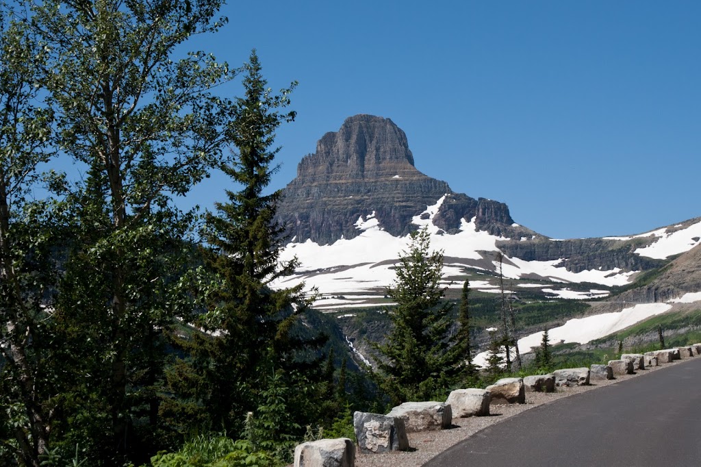
I've got to admit that this was one of my main reasons for taking this trip. I'd been in the Kalispell area once before on a business trip but hadn't had time to drive through the park, and I'd seen a National Geographic program that talked about the clearing and maintenance they do each spring so it was something I was really looking forward to. I'm glad to report that it did not disappoint. The road is a spectacular achievement, and you can see when you're on it how much work and how dangerous it must be to keep it open and safe each year. One thing I wish I had prepared for would have been a hike to Hidden Lake at Logan Pass. I've seen photos of it on Google but its a pretty long walk out and back from the visitor center and I didn't have the right gear or enough time. One thing I saw was pretty cool - some kid, about 12 or 13, was wearing ski boots and carrying a pair of skis up the trail - apparently he was going to get a 30-60 second run down the remains of the snow pack in exchange for an hour long hike up the trail in those monstrous clogs - oh to be young again!
Looking down from the wall
Mt. Reynolds
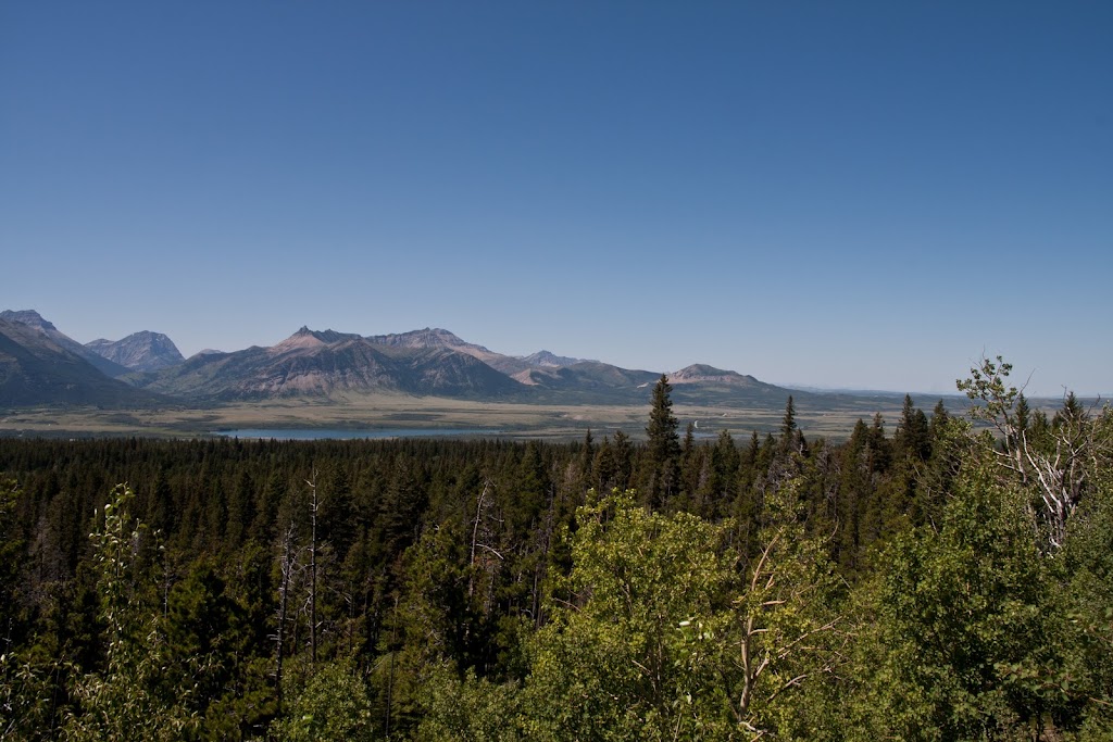
Waterton Lakes National Park in Canada
Looking up the road in late afternoon
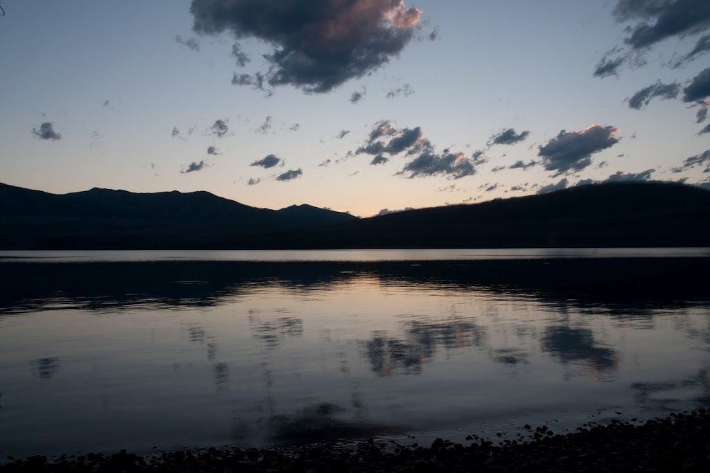
Last light on Lake McDonald
We did cross into Canada on the Chief Mountain International Peace Highway - the border crossing was just about deserted as we had expected and the road out there was quiet and in good condition. The park itself was pretty neat. Saw a bear off the road on the way to Red Rock Canyon, and spent a little time in the creek cooling off. We saw a couple of other folks on cycles out there including another FJR guy from near Calgary (sorry but I can't remember your name).
If anyone goes there to take pictures, the late afternoon and evening are great. The road is almost deserted in the last hour of light, and of course the colors and contrasts are much more dramatic. Due to working the soft lighting until late, we got into West Glacier way past dark and barely got into a restaurant before closing. There were two ladies from the Bay Area who were finishing up a week of backpacking and camping in the park, and they said they had had 4 fairly close encounters with brown bears. All in all a very cool day.
Day 10 - Turn around day
Well it's time to head for home and we've decided its down to Missoula and across Idaho's Highway 12 to end up somewhere in the Lewiston area. This was another long day and I only remembered to take a couple of photos all day. We stopped at the Lolo Pass visitors center, and had a nice lunch at some place along the river where we were not the only motorcycling customers. 4 guys on adventure bikes and a couple of others on BMW touring bikes were also there. Maybe Brodie can add the name of the place? Food was good but service was pretty slow for how few customers there were. Anyway, no pictures to post here, but I did get some good video so hopefully there'll be an entry in the future.
We ended up staying in a campground in Walla Walla. There was some kind of baseball tournament going on so downtown was actually pretty busy for a Monday night. We ate dinner at a place called Jacobi's where the food AND the service were good. There was a little train museum but we were there too late to take a look. Really porked out there with a full course meal including tiramisu and coffee. Overall I was pretty impressed with Walla Walla - it looked pretty plain from the highway but downtown was actually pretty vibrant.
Day 11 - to La Pine
So we know there's a big RTE happening in September, so we decided that La Pine was the place to go and sample the food in case we can't make the September trip. Imagine our surprise when FJRay's buddies place was closed <_<
But the ride down the Columbia River Gorge and surrounding country was great. We followed the north shore of the river in Washington on Highway 14 instead of getting on the interstate. A sign on the road for a "Historic Train" caught Brodie's eye near the town of Wishram - what a strange little place. It seems to be an old railroad company town but it seems pretty run down, like time has passed it by, and there's switching tracks alongside the river. But for some reason there's also an active Amtrak station there - probably explains why Amtrak loses money every year and needs subsidies to function.
We arrived in a town called The Dalles around lunchtime, and the gas station attendant (this is Oregon after all) suggested a place called Big Jim's. I don't know how many may have heard of Big Jim's, but they have a huge menu and make some monster burgers. Brodie can eat prodigious quantities of food, so he orders the T-Rex, a $12 burger that had two ground beef patties, four pieces of sliced ham, at least two pieces of cheese, and is served on a bun about as big around as a frisbee. He ate the whole darned thing too.
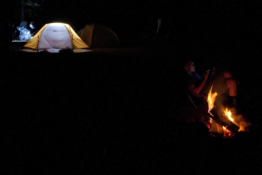
Next stop - La Pine. We got into town and a nice fella at the gas stop told us about how we could camp by the Deschutes River for free - the only thing that worried me was when he said "I ride my quad down there all the time". Anyway, we found the Forest Service road which wasn't too bad, then had to take some soft stuff including exposed tree trunks to get down to the campsite - I'll tell you I was sweating some bullets as my 900+ pound fully loaded vessel was bouncing around but luckily kept it upright. I was playing around with some remote flashes and put together the following shot - I like it, but probably not quite ready for prime time.
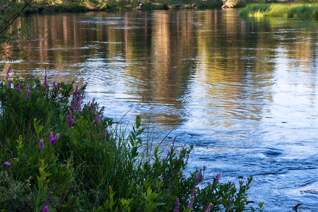
In homage to Tyler I tried to get a flower + other type of shot of the Deschutes River - still need some work...
Day 12
The next day we planned a ride down 97 to Crater Lake, then across to Grant's Pass, on to Crescent City, then ending up in Eureka. The ride down to Crater Lake was nice, good weather, road not too crowded, and of course all of you that have been to Crater know how beautiful the lake is. Here are a couple of the standard shots but with some ugly Sasquatch-type guy in one of them.
So its off to Grants Pass - we stop at Shari's for a big lunch and its hot - pushing the 100F point, so I'm glad to be in the air conditioned spot to eat. As we push off we head down to Crescent City and somewhere along the way, I think at the tunnel near the California border, it transitions from hot-hot-hot to cold-cold-cold. I've got all the vents on my jacket opened, I'm wet underneath from perspiration, and all of a sudden its 52 degrees and I'm on the verge of hypothermia. We have to ride about an hour along the coast including a run through the elk preserve, another spot where Brodie is all of a sudden nervous and quiet - well maybe I'm overstating that. Anyway we make it past the scene of a prior incident without spotting any hulking four-legged beast when we come around a corner and there's 20 cars pulled over and an entire herd by the side of the road (insert requisite photo here)
The day ends in McKinleyville where we have a nice dinner at the 6 Rivers Brewery (thanks for the recommendation Eddie!) Camp is at the Widow White RV Campground which is nice and quiet, with a huge grassy area for tenters, but there's some treachery in the grass which we'll have to cover later.....
Day 13
The end is in sight, but at this point we decide to string out the trip with a day ride around Eureka - after all if we head home now, we'll be home Thursday in time to back to work on Friday, and who wants that? So we head off on what is something of a habit, which is 299 to 96 to 3 to 299 and back. But something's different this time - we've arranged to meet Eddie after dinner and we need to be back by about 4:30, so we need to cut off some miles if we want to be on time. Back to the AAA map and we see that there are some roads cutting between 96 and 3 that could cut off some serious miles, but who can be sure? After all, the AAA map told us there was a town in Nevada called Warm Springs and we all know how that turned out.
The ride is nice as always along 299 and 96, when we get to Somes Bar and turn east. I'll tell you that the ride was fantastic! From goaty to medium speed, single lane, steep drops down to the Salmon River, then nice roads through farms and ranches on the way to Etna. I didn't take too many still shots but I have the whole 57 miles on video - I think you'll all enjoy it (once and if I get the editing done). The whole trip is along an isolated river through the hills but miraculously there are two post offices (one of which is pictured here) that serve something like 500 people - must be very good service!
So its back to Eureka to meet Eddie. He joins us at the camp, we catch up quickly, then its time for some touring of Eureka and then off to dinner at the Samoa Cookhouse. For some reason, Brodie picks this particular moment to play motocross in the wet grass, guns the motor on the AE, and spins that giant car tire in the grass, and quickly the FJR ends up on its side. I quickly dismount to help him pick it up, and its only after its back on two wheels that realize I've made a huge mistake by not getting a photo. I know he's going to deny it without photographic proof, but here it is for all to see in writing - you saw it too, right Eddie?
Day 14
OK - we've got one more full day before we head for home and we've got a full slate. We're going to take the 140 mile piece of asphalt from Fortuna to Red Bluff known as Highway 36, then across to Mt. Lassen Volcanic National Park, meet my son and his buddies near Mineral, then south on 89 to Truckee.
Highway 36 is awesome as everyone knows - I'm actually feelin' it today and pushing pretty hard - about 50 miles in I have a scary moment - I come around a corner and there is a cow, complete with cowbell tied with a red ribbon standing perpendicular to the direction of traffic, about half blocking the opposing lane. To make things worse, there is a semi coming the other direction who sees Bessie, and swerves into MY LANE to avoid - oh SH**! I'm hauling the big beast down as fast as a I can and fortunately the truck passes the future hamburger before I get there and all is well. We get to the junction with highway 3 and Brodie asks if I have the GoPro running and caught all the action - OH NO! User error!!! None of the twisties nor the near miss have been recorded! I am still mad about that as I type this story. Anyway, I turn the thing on and capture the 2nd half of the trip. We take the obligatory photo with the best sign in motorcycling legend then its lunch at Luigi's (highly recommended - good food and great prices) in Red Bluff.
Next stop is Lassen - we decide to take a little road between 36 and 44 called Manton Road so we can enter the park through the north entrance - that road was a lot of fun though poorly marked and we end up reversing field twice before we reach the town of Shingletown on Highway 44.
Lassen Park is pretty cool - lots of switchbacks across the face of the volcano. The entire trip through the park is relatively quick, and we end up in Mineral at about 4:30. My son and his friends, who are supposed to be camping nearby know to meet us at the general store but in true teenager fashion they blow us off without a peep. We need to keep moving if we want to get a campsite near Tahoe on a Friday evening so we wait for about 30 minutes then its off again on the road.
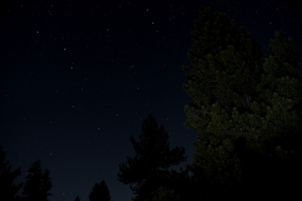
Tahoe is crazy on weekends and we ended up there too late to find any spot near Truckee, so we ended up backtracking up Highway 89 for about 20 miles before finding a single open space in any of the Forest Service campgrounds. I took an attempt at a night shot of the Big Dipper, but I've got a lot of work to do on technique to make a career of this.
The Last Day!!
Since we had bypassed Yosemite on the way out, we decided we would run past Lake Tahoe, down the ?? grade into Carson City, then 395 down to Lee Vining with the plan of entering the park via Tioga Pass. The ride was great though quite a bit of traffic as you get through Gardinerville. We ate lunch at Mono Cones in Lee Vining, a little red shack that sells burger, fries and shakes right on 395. The food was good - BUT IT WAS $17!!!
Anyway - Yosemite was beautiful as always - here's a shot from Olmsted Point with Cloud's Rest in the background. I climbed that peak back in '09 with some friends from work - the views are forever, but its a 13 mile round trip that took nearly all day and there was no time to try it today.
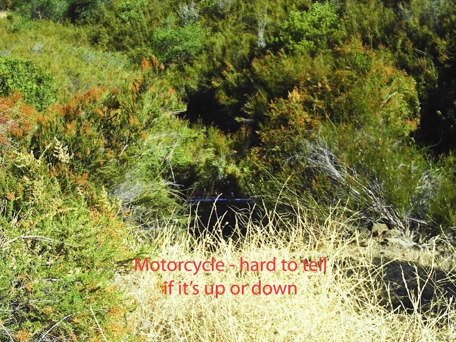
We make it through the park and start the home stretch. Highway 120 takes you through Groveland, a popular jumping off point for whitewater rafting on the Tuolumne (pronounced twal-a-me) River. Right after Groveland there's a nice twisty piece of road known as Priest Grade. Brodie and I decide to take the new road instead of the steep alternative known obviously as Old Priest Grade. Things are going along swimmingly until we swoop around a corner and find multiple vehicles and 1 Harley near the edge of a cliff. We stop quickly and it becomes clear that someone has gone over the edge. There are two guys about 75' down the hill, one of them the rider, the 2nd is his friend who has parked his bike and gone down to check things out. The guy seemed in reasonable shape, was conscious, coherent, and not too banged up. We lower a rope and the guy climbs up the hill under his own power. He's cut, bruised, and totally freaked out, but other than that seems OK. His buddy follows up and it turns out that they're from Boston and just turning east to head home. He says his buddy was looking to the right and down at the water treatment plant at the bottom, was surprised by the turn, ground metal on the left side, straightened up and rode right over the edge. Here's a shot I took of the bike but its so far down you really can't see it too well in the brush but I think you can see the chrome of the exhaust pipe.
The emergency guys showed up pretty quick so we shoved off and headed for home. From there it was smooth sailing - back home in another 2 hours or so and time to get cleaned up :yahoo:
Thanks to anyone who made it to the end of this long-winded story. Overall I'd say we were very fortunate - we missed a couple of potential bad incidents by small margins, we had only one night rained out that required motel lodging, the vehicles held up great, and the weather was extremely mild for most of the trip. There was one interesting finding regarding some cross-talk between farkles but I'll start a separate thread for that.
I hope to post up a couple of the videos once I get around to the editing. My track record is poor - usually takes me months to get around to it so noone should be holding their breath. Hope everyone has equally good travels through the rest of the summer, especially that lucky crew riding the Alps this month!
Last edited by a moderator:
")
