


Fontanaman
Robin Trower
The idea for this ride was to find some roads I have never been on. I whip out my favorite book.
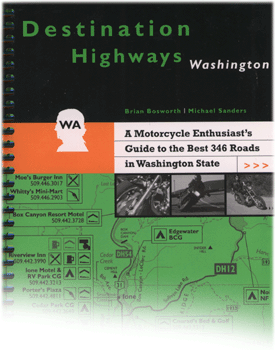
Best book I ever bought. The best 346 best roads in the state with ratings. And for the most part the author's nailed it.
For some reason the Touchet River road stood out. And what a good choice it turned out to be.
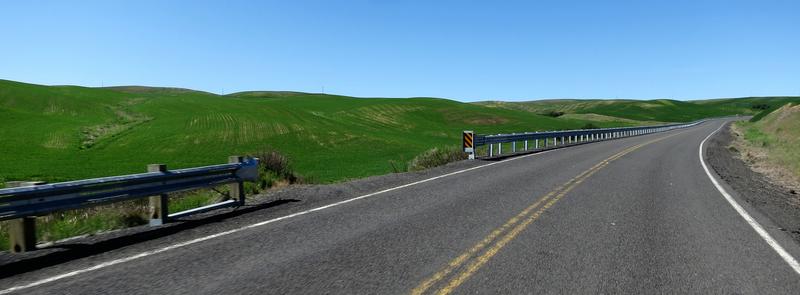
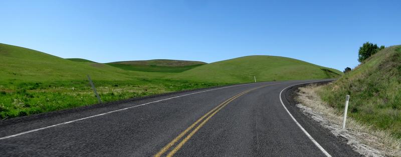
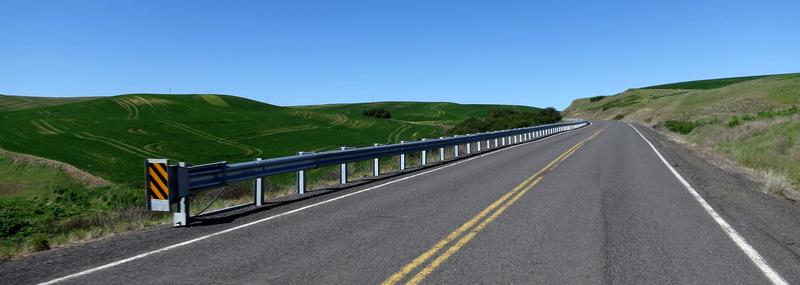
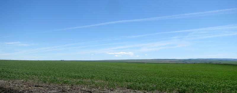
The ride starts out on county back roads in the wheat fields and these are pleasantly entertaining with some twists and bends but moreover it is remote. I like it.
My '17 FJR came with a Garmin 590 GPS so now I have two of them. On this ride I used the "new" one to see if there was any difference in hardware reliability. During the ride the GPS locked up once while changing the music input from my phone to MP3. Other than that it was trouble free. More testing is required. Oh darn.
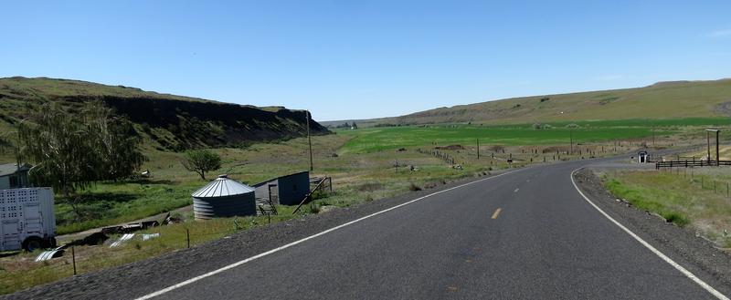
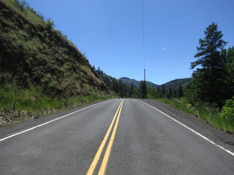
Then it is into the Channeled Scablands named as a result of the Ice Age Flood scouring out the land creating coulees like this minor one south of St. John.
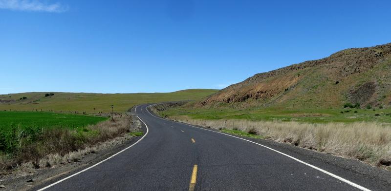
Serious scab land appear near Palouse Falls. Now THIS IS a coulee and and it has water. Most of these are dry falls these days.
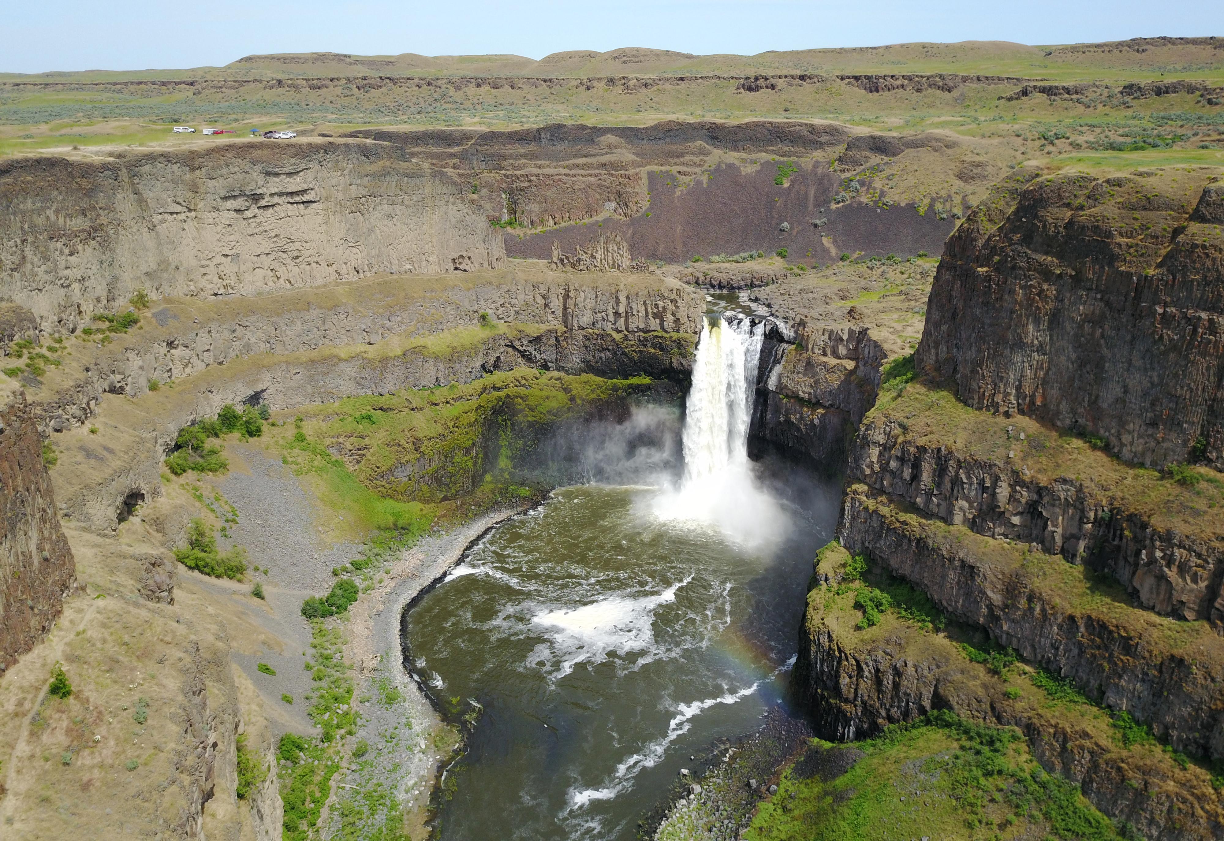
As I approached Hwy 261 there was about 8 cars all turning toward Palouse Falls. This is a great road so I stop to take a photo break and let the cars go on.
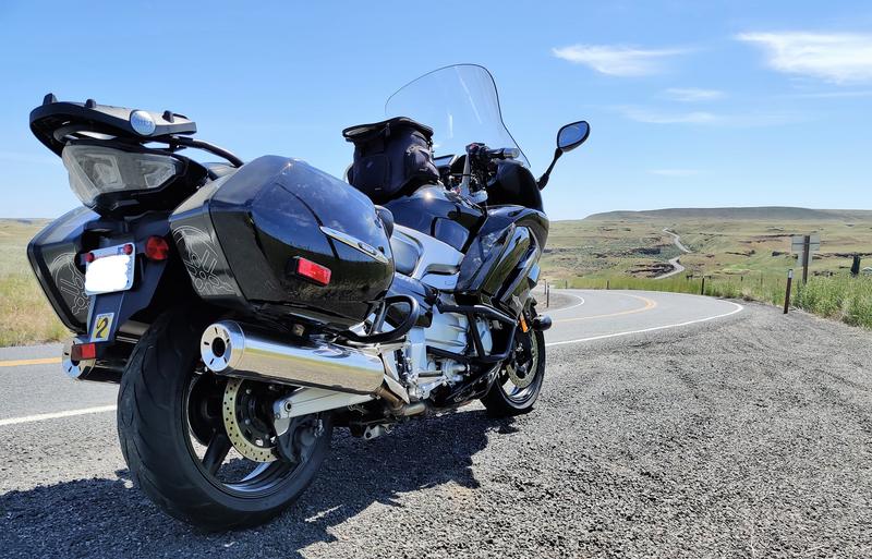
Add a '17 FJR.
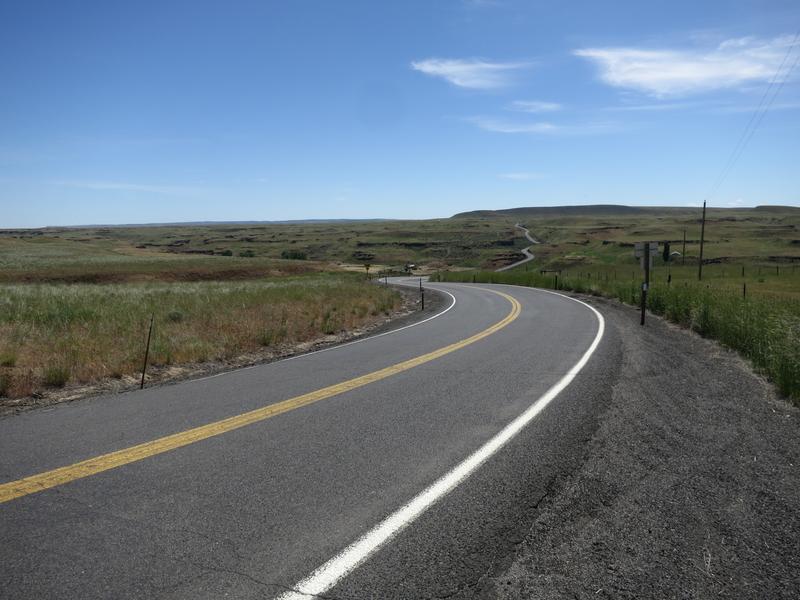
Which of the two photos do you like? I like the first one as it shows more of the road. I wonder of the second one is FJRiders calendar worthy?
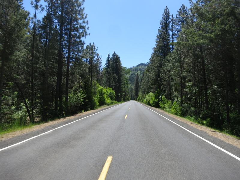
Arriving at Touchet River road Mountains appear for the first time today along with lush green forest. Quite the contrast from the scablands and coulees.
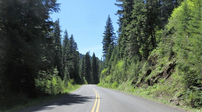
Soon the county road ends and the Forest Service road begins. The road has more twist and turns. Very nice. It reminds me of roads in Western Washington.

The elevation is 4250' where the paved portion Touchet River Road ends 20 miles in. Bluewood ski mountain is up the road a bit farther. The only way out is back. Nice road.
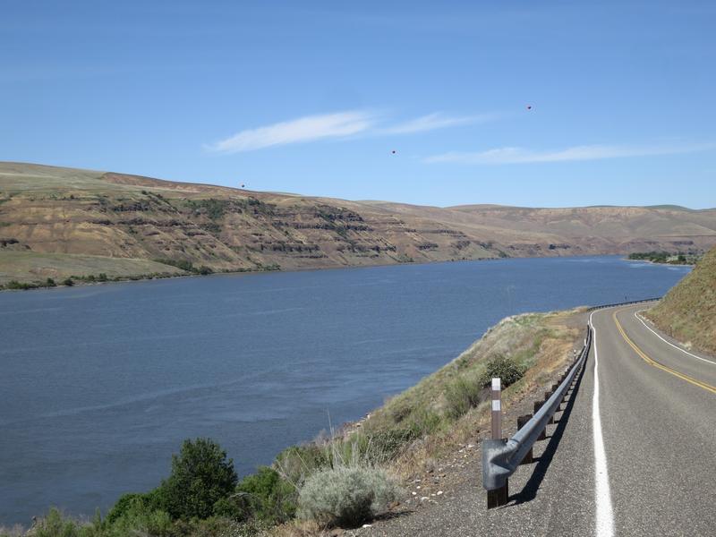
Onward to farm land around the Snake River where the view goes on as far as you can see. There is a lot of diversity in SW Washington. Mountain roads, farm land and scablands and it is without traffic. Nice. Very nice.
Snake River.
One the way home I play with the ES settings. I road most of the day on the lowest preload setting then adjusted the rebound settings on the fly. The bike didn't seem as planted as my 09 with after market suspension so I increased preload setting by one, to rider with luggage. This gave me the planted feeling I was looking for. More testing is needed.
Best book I ever bought. The best 346 best roads in the state with ratings. And for the most part the author's nailed it.
For some reason the Touchet River road stood out. And what a good choice it turned out to be.
The ride starts out on county back roads in the wheat fields and these are pleasantly entertaining with some twists and bends but moreover it is remote. I like it.
My '17 FJR came with a Garmin 590 GPS so now I have two of them. On this ride I used the "new" one to see if there was any difference in hardware reliability. During the ride the GPS locked up once while changing the music input from my phone to MP3. Other than that it was trouble free. More testing is required. Oh darn.
Then it is into the Channeled Scablands named as a result of the Ice Age Flood scouring out the land creating coulees like this minor one south of St. John.
Serious scab land appear near Palouse Falls. Now THIS IS a coulee and and it has water. Most of these are dry falls these days.
As I approached Hwy 261 there was about 8 cars all turning toward Palouse Falls. This is a great road so I stop to take a photo break and let the cars go on.
Add a '17 FJR.
Which of the two photos do you like? I like the first one as it shows more of the road. I wonder of the second one is FJRiders calendar worthy?
Arriving at Touchet River road Mountains appear for the first time today along with lush green forest. Quite the contrast from the scablands and coulees.
Soon the county road ends and the Forest Service road begins. The road has more twist and turns. Very nice. It reminds me of roads in Western Washington.
The elevation is 4250' where the paved portion Touchet River Road ends 20 miles in. Bluewood ski mountain is up the road a bit farther. The only way out is back. Nice road.
Onward to farm land around the Snake River where the view goes on as far as you can see. There is a lot of diversity in SW Washington. Mountain roads, farm land and scablands and it is without traffic. Nice. Very nice.
Snake River.
One the way home I play with the ES settings. I road most of the day on the lowest preload setting then adjusted the rebound settings on the fly. The bike didn't seem as planted as my 09 with after market suspension so I increased preload setting by one, to rider with luggage. This gave me the planted feeling I was looking for. More testing is needed.
