CO,NM,UT,AZ,AR,TN,KY,MS,KS,IN,OH,MO,NV,WV,IL,TX,OK

Yamaha FJR Motorcycle Forum

Help Support Yamaha FJR Motorcycle Forum:

This site may earn a commission from merchant affiliate links, including eBay, Amazon, and others.

LAF

Well-known member
Joined
Aug 2, 2010
Messages
1,046
Reaction score
29
Location
Harrisburg, PA
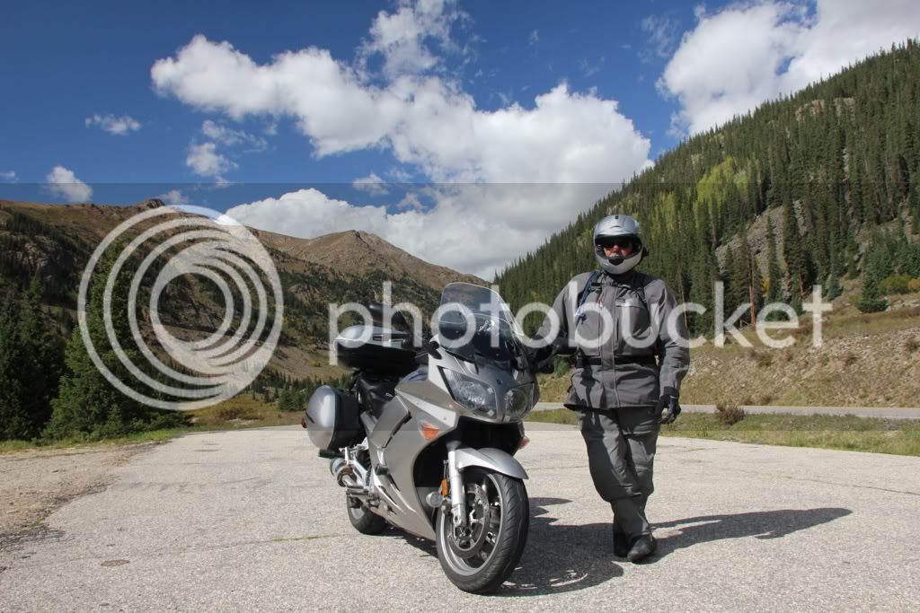
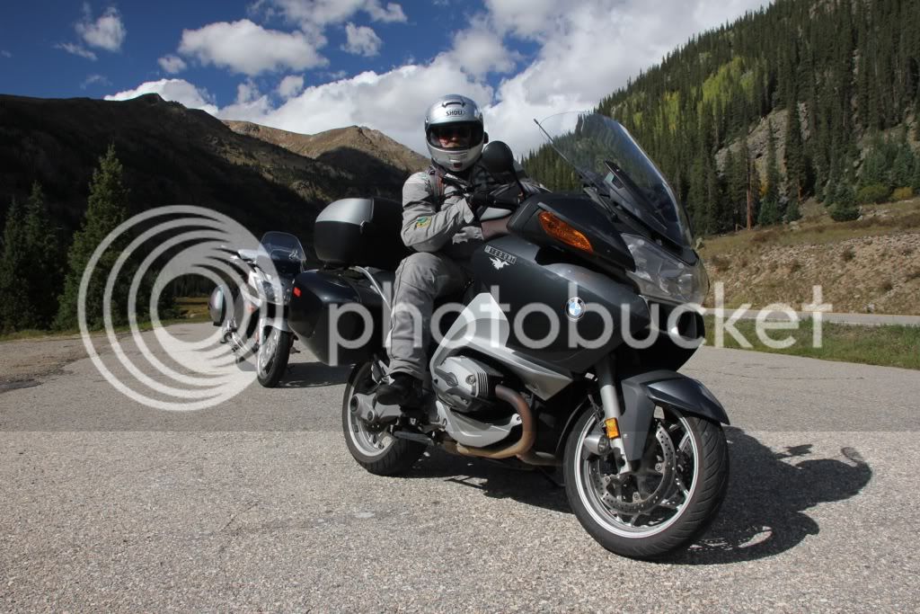
This is my riding partners Journal day to day of our trip.

First Day

So, here we are on the outskirts of beautiful Dayton, Ohio. 439 miles. We left New Cumberland at 7:15 AM and arrived here just before 5:30. Where shall we begin?

Six months ago Lee and I sat around our dining room table figuring out where our annual trip would take us. For several years we took one-week tours as soon as school let out for the summer, it was our way of decompressing. Others might call it a “Behavior Adjustment Road Trip.” Actually that makes for a pretty decent acronym for the Bay Area Rapid Transit in San Francisco or a yellow-haired cartoon wise ass. But I like it for the Behavior Adjustment potential.

Unfortunately, we were running out of one-week tours. New England and New York? Done it. West Virginia? Done it twice. North Carolina? Been there, too. Leave it to my wife to state that since neither of us were going to be working, we could take more than a week. Whoops! Two grown men were acting like kids in a toy store with a map of the United States and eyes awhirl like Mr. Toad when he saw his first automobile. (Watch Wind in the Willows if you missed that last reference.)

At first I considered Nova Scotia for a two-week tour, but that didn’t seem big enough. Journey back two years when Lee crashed and went home just as we were starting to tour the west. It was time for paybacks and we needed to get out west again. Unfortunately, to get there means traveling through the Midwest through states that all begin with vowels. Returning means going back through these same states. Two weeks is just enough time to head out, get there, take a picture, turn around and go home. With regard to dating the United States, this doesn’t even get you to first base! Two weeks became four and then it all came down to route planning, places to stay, places to see, etc.

A few people have said we’re sort of like Lewis and Clark or Daniel Boone. Sorry to disappoint, but we don’t even come close. They had no idea what was out there. We have the advantage of GPS, MapQuest, Google Earth, the Internet, magazines and books all about what’s out there.

And then there was the gamble – when should we leave? Summer was out of the question since most of the western states were going up in flames. Fall can be pretty spectacular, especially when there’s four feet of snow filling up the passes in Colorado. That left us with the month of September. Leaving before the Labor Day weekend would put us Out West with all the other Labor Day tourists. Leaving after Labor Day shortens the good weather time frame. It was decided to leave in the middle of Labor Day, Sunday. I figured that most people would be at their destinations on Sunday as we rode to Dayton, Ohio. On Monday we’d head south to Cincinnati and then take U.S. 50 (two lane) to East St. Louis and avoid the crazies on I-70 duking it out with over-charged four-wheeled mayhem. Throw in some 18-wheelers and it’s bumper cars driven by juveniles off their Ritalin.

We meet at John’s Diner near I-83 and the Turnpike at 6:30 AM. There’s only one car in the parking lot of this 24-hour diner. We exchange greetings, make sure our helmet headsets are connected for communication and head out for the Turnpike. Our first gamble is the Labor Day traffic, the second gamble is to avoid the remnants of Hurricane Isaac which has laid waste to New Orleans and is slowly rolling north into the Midwest and our planned route. If we’re lucky, we’ll get to Dayton before the rain. If not, we’re going to get wet. If we’re really lucky the rain will start as we check into the Motel 6 and be gone by the time we wake up. Yeah, and I have the winning lottery ticket in my wallet.

Gamble #1 pays off. There is hardly any traffic westbound on the Turnpike. The penalty is that my EZ Pass fails to register at the tollbooth. This means I’ll get a letter from the commission with a picture of my butt on the BMW going through a tollbooth without paying. The EZ Pass is strapped to my left arm and I hold it up as I ride through. I don’t get a green light – oh well. I’ll deal with that issue when I get home.

We exit at Somerset for breakfast at the Summit Diner. Again the EZ Pass fails, but breakfast is pretty decent. We stand in the parking lot and check the skies. It’s overcast, but not raining. Let’s roll the dice. Ten minutes later I pull off into an emergency parking area on the Turnpike and struggle into my rain suit. It rains hard for another ten minutes and then stops. I’ll be damned if I’m stopping again to take this gear off.

A few hours later we have ridden into Ohio and are 60 miles south of Columbus on I-70. Rain suits are great for keeping rain out. They’re also great for keeping perspiration in. I’ve been riding for several hours in my own personal sauna. We take an exit and pull into the vacant lot of a church for the Jehovah’s Witnesses. It’s Sunday, where are they? Looking up I can see openings of blue sky among the clouds. Things are looking up in more than one way.

We stop for gas 37 miles east of Dayton. The sky to the west is a solid mass of dark clouds in shades of black and dark grey. Sorry, but there were no fifty shades of grey on this horizon. They are moving east. We are moving west. It’s going to be close.

The local law enforcement employees have been doing their best to generate revenue for the Buckeye State. Consequentially, we keep our speed down, but if ever there was a need for speed this is it. The closer we get to our exit, the closer the clouds move to the same exit. One mile before the exit I see brake lights vanish into a wall of mist. It’s heavy torrential rain and it nails us just one half mile before the exit. I can see the tall, lit sign for Motel 6 shining through the gloom and mocking our pitiful efforts to deny Nature. Actually, I’m the one being mocked; Lee’s riding gear is already waterproof.

There’s a covered entrance that in reality is a drive through for guests registering at the motel. Imagine, you can register and get your room key without leaving your car? Well, maybe somewhere else because a large sign proclaims that the drive-thru window is closed. Looking through the window I see the desk clerk and shout, “Can we park here?” He shakes his head. We drive through and park in front of two motel rooms. Entering the office the clerk asks, “Why didn’t you park under the portico?”

“Hey! That’s what I asked and you said, ‘No.’.”

“Oh, I thought you were asking if the window was open.” Great! I think he’s deaf and he thinks I’m illiterate.

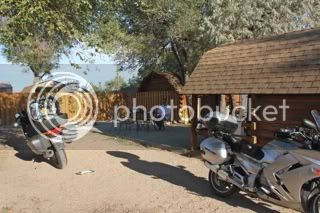
As it turns out, Lance, the desk clerk, is really a decent guy. Yes, we can park our bikes under the portico for the night. It also happens that we parked the bikes in front of our room by happenstance. Or was it just plain luck?

As we unload and carry our gear into the room he brings out some old towels and face cloths that we can use to dry and clean the bikes. More and more motels are starting to do this as a result of other, non-thinking, inconsiderate bikers just use what’s provided in their rooms.

We’ve been on the bikes for a total of 8 hours. We’re tired and sore, but happy to be inside as the rains thunders down outside our room. We make a few phone calls to let the folks back home know that we’re safe. Lance has suggested some nearby; within walking distance, restaurants, but the Waffle House that’s not even a stone’s throw from our room is the winner.

Amber brings us coffee and water while we ponder the menu. She ties a napkin around my mug’s handle to remind her that I drink unleaded (decaf) and Lee drinks high test (regular). The waffles are pretty good, the coffee is hot and I can slowly feel my muscles start to unkink and unwind.

Back in the room I check the weather channel while Lee fine-tunes his helmet’s headset. It looks as though we might miss most of the rain. Currently it has stopped raining in Dayton, but it looks as though Cincinnati is getting hammered. Tomorrow’s forecast shows most of the storm center moving east-southeast. We’ll be skirting its western edge as we head on to St. Louis.

In retrospect I suppose I should say something nice about Ohio. Numerous people have written lengthy articles about riding through the southern part of the state. We weren’t there and we weren’t riding the two lane back roads. Thumper’s mother had a saying, “If you don’t have anything nice to say, don’t say anything at all.” Okay, here’s my nice comment about Ohio, “It ain’t Nebraska.”

We are tired, but well, looking forward to tomorrow. We hope all of you are in the best of health. “cause if you aren’t, I just might have to shorten this distribution list.

I will post as we go.

 
Day two.

Tom Waits had a song on his “Nighthawks at the Diner” album called, “Diamonds on my windshield.” Bob Dylan sang about a “Hard rain’s a’gonna fall.” Peter Gabriel sang about a “Red Rain.” Lee and I endured the first two, but fortunately, not the latter. It has been a day of enduring the final leftovers from Hurricane Isaac. Our wake up call was at six. After showering, dressing and repacking we were on the road before 8 AM. To some this seems a bit longish, but realize that in our final push to leave Harrisburg we just jammed what we needed into any available space. Then it becomes a matter of remembering where you put stuff and then trying to get organized. I figure by the time we get to Lexington we’ll have things worked out. But then we’ll only have one day left to our trip.

Meanwhile – about the rain. When I was a kid my father would take us on summer vacations. The entire family crammed into a four-day sedan heading for New England, Cape Cod or Ocean City, Maryland. I remember once falling asleep on the floor of the back seat with the transmission hump as a pillow. It was quite soothing listening to the continuous hum of the engine and drive shaft coupled with the rhythmic thumps of the tires going over the expansion gaps in the pavement.

For some reason I always looked forward to a drive in the dark when it was raining. The windshield wipers acted as dual metronomes lulling me into a hypnotic trance. Oncoming headlights made the raindrops on the windshield explode into liquid fireworks of white and yellow. It was a magic carpet ride if ever there was one.

Driving south on an interstate to Cincinnati, early in the morning on Labor Day Monday in a tropical downpour is not any of those childhood memories. It is a white knuckled, butt-clenching ride of terror and total concentration. Amusement parks could have a field day with this theme. My windscreen is pretty much obliterated even with the wind driving the water off the surface at 60 miles per hour. I’d go slower but traffic from behind poses a threat if they don’t see us. Going faster is tantamount to leaning into a full powered roundhouse punch by Mike Tyson. So you just hang on and try to convince yourself that it’s just rain.

I suppose I could equate this to a sign I saw on a church bulletin board, “Smooth seas never made a skilled mariner.” The same can be said for those of us venturing out on two-wheeled motorized transports. After a while it becomes a simple matter of trust. Trust in your skills, trust that the other drivers can see you and trust that your motorcycle has no more of a desire to kill itself than you do.

In the meantime we discover that the Garmin Corporation, manufacturers of fine GPS units have decided that they, and only they, know the best routes to take. I have uploaded a route that will take us south past Cincinnati to Route 50, which is, for the most part, a two-lane road to East St. Louis thereby taking us away from Labor Day drivers on the interstate. Although it’s raining, traffic is light, but the Garmin is not happy with our chosen route. For the next 200 miles it tries to reroute us north to I-70 and Indianapolis. We head south; it wants us to go north. We head west on Fifty; it wants us to go north. At every exit it tells us to get off and head north. We persevere and the Garmin begins to pout and sulk. It’s good I can’t hear the voice commands urging us, begging us, pleading with us to take I-70 west.

Crossing into Indiana we begin to enter and exit bands of rain and sun from the remnants of Isaac. This gets frustrating when I have to stop to put on rain gear or stop to take it off. I finally compromise. I’ll wear the rain jacket but not the rain pants. This works quite well until the next band of rain soaks me from the waist down.

We stop in the town of Versailles for breakfast at the only available eatery – a McDonald’s. The parking lot is almost full and there are at least six cars lined up for the drive-thru. Conclusion? This is the only eatery within a fifty-mile radius. Seriously, is the food that good that people will come from miles around?

We park the bikes and enter for the usual McBreakfast fare. At least the food is tolerable and coffee is actually quite decent. (That’s my nice comment for the day.)

At one point I get up and visit the men’s room. There’s a hot air hand dryer mounted on the wall. It does a great job drying my hands. It also does a good job drying the front of my riding pants. Sometimes a good idea needs some serious consideration. If it dries my riding pants it’ll dry what I’m wearing underneath until someone enters the men’s room to discover a 62 year old man standing in front of a hand dryer with his pants down. “Manager! Call the cops! We got us a genooine preevert!”

We leave Indiana and ride into the southern flatlands of Illinois. The southern route through Indiana was quite pleasant through tree-lined roads rolling up and down gentle hills and around gentle bends as the rain gently does its best to ruin your journey. Southern Illinois is flat. The roads are straight at times they’re so straight that if it weren’t for the curvature of the earth and the mountains you could probably see the Pacific Ocean as you head west.

We see a few signs warning us of water on the roads. We don’t see any, but the drainage ditches, low-lying areas and creeks are full to the brim. But it’s too late for the corn. We roll past acres and acres of dead stalks with a few pathetic ears of corn. It’s too much rain and it’s way too late to do any good.

Overcast skies are gone and the sky is a deep brilliant blue. The sun begins to dry things out and in the process raises the air temperature to ninety. We are hot and tired as we finally reach our destination, the KOA campground at Chain of Rocks. This is just half a mile from the old bridge spanning the Mississippi with its oblique angle smack dab in its middle. Google an image of the Chain of Rocks Bridge and you’ll see what I mean.

The desk clerk at the KOA says it’s part of the original Route 66 and you can still walk across it and in the middle stand with one foot in Missouri and the other in Illinois. It sounds like a plan for tomorrow morning’s start.

We learn that there are numerous restaurants a mile from here, but neither of us feels like getting back on the bikes. Plan “B” is for take out and in just under an hour Lee and I are sitting at the picnic table eating personal pizzas.

We’ve called our loved ones at home and will soon take showers and call it a night. Tomorrow is a 439-mile crossing of Missouri and halfway across Kansas on the interstate. For forecast is for heat – lots of it.

We hope all of you are well.

Take care,

Chris

 
Day Three

“Previously on “Out West” Chris and Lee acting on non-sanctioned orders are involved in a covert, black-ops in the Midwest.” Okay, we’ll save that for a time when this journey becomes a hit series on A&E. Any actor trying to portray me will have to be a cross between Wilford Brimley and John Goodman. Lee says he would like Peter Fonda or Bill Murray to have his part. Our agents and lawyers are waiting for your calls.

Our day started with a short ride from the campground to the Chain of Rocks Bridge. For you action movie aficionados, the bridge is used in the film, “Escape from New York.” It’s closed to vehicular traffic but the gate is open. That is really tempting. However, there’s a surveillance camera in the parking lot and leads us “…not into temptation but delivers us from law enforcing type people.”

We park the bikes and step onto history, the Mother Road, the carotid artery of all American travels and folklore – Route 66. It takes little imagination to look at the two motorcycles and transform them into a 1959 Corvette. I know, it was a ’61 Corvette in the series and it was never red, but anyone who wants to split hairs with my imagination is looking for a fight. Since said fight will also be imaginary I proclaim myself victor. Anyone else with a differing opinion is welcome to write his or her own journals.

It is hot and humid as we begin travelling over the western side of Choteau Island. It is an old iron trussed bridge built in 1929. Downstream of the bridge is the “chain of rocks” which made river navigation a problem until a canal was built on the eastern side of the island. Today the waters from a low head dam cover the rocks. With the recent drought the rocks are now partially visible. Downstream we can see major mud flats that should be underwater. It will take a lot more rainfall than what Isaac delivered to refill this river to its banks.

Partway across we meet a young couple. The gentleman asks me if II am “Overeating.” His accent is slightly Germanic, but it sounded as though he asked if I was “overeating.” Well, I did devour an entire 12-inch pizza last night, but how did he know? Then it dawns on me, it’s hot and humid and I’m still wearing my riding gear; “Are you overheating?”

I ask if he is Dutch and he laughs and asks how I knew. I point at his ball cap. It’s orange and has Holland printed in big, bold letters. They’re on a tour around the U.S. and part of Route 66 is on their itinerary.

Lee and I cross the border from Illinois into Missouri while on the bridge. Closer to the Missouri shore the bridge takes an odd 22-degree bend to the right. The outer angle has been enlarged I guess to allow westbound trucks to swing wide so they can make the corner. This is not a curve; it’s a straight-line angle. I’m not sure why or how this happened. I will have to do some research or perhaps an alert reader might provide the answer. My guess is that they built the bridge beginning from both shores. At one point some bright engineer looked through his transit, did a quick calculation and said, “Shit! We aren’t going to meet.” A few pencil lines we added to the blueprints and the problem was solved. It was 1929. Forty years later we landed two men onto the surface of the moon. Think about it. Oh yeah, we also brought them home. Safe passage Neil Armstrong.

We return to the Illinois shore, mount the bikes and ride across the interstate into Missouri. It’s humid and we can see rain just west of St. Louis. In a few minutes we can actually feel the rain and we exit so I can put my raingear on – AGAIN!

An hour later we stop so I can take it off. The skies clear and as the humidity drops the temperatures rise into the 80s and 90s. Just past Kansas City it will be over 100. We have ridden through rain, the tropics and are near roaring along the interstate at 70+ mph into hot dry air. As the sweat evaporated from my clothing it was quite cool. When there was no sweat left to evaporate it just became a hot blast of air. Preheat a convection oven to 104 degrees and stick your head inside for a few hours and you’ll understand what I’m trying to describe.

Shortly after noon we exit for gas and lunch. There’s a gas station right next to a Subway. Everyone else has the same idea and goal. There’s a long line to place your sandwich orders, but the air conditioning compensates for any wait time we are experiencing.

My apologies to anyone currently living in these two states, but I won’t bore the readers with innocuous descriptions of the countryside as being a series of gently rolling hills carpeted with various crops, as the sky is a painter’s palette of pastels. (English teachers take note of the accurate use of alliteration.)

To many the trail across Kansas and Missouri is just one long tortuous travail of tedium. Or should that be a tedious travail of torture? Consider the history that is encountered while travelling. The Mississippi River and Mark Twain. The Missouri River and Lewis and Clark’s Corps of Discovery. Missouri and Harry S. Truman. The Missouri Compromise and the Civil War.

We pass by Kansas City and see the stadiums for the Chiefs and Royals. (A tip to you sports fans.) In Topeka it’s Brown vs. Board of Education. Fort Riley, George Armstrong Custer’s home and the U.S. Cavalry Museum. John Brown and “Bleeding Kansas.” Geographically a traveller can glance at a GPS unit and say, “I know where I am.” But can they look at that place historically and relate to where they are in history and its effects as to where they are now? To future travellers I advise that having a good set of maps may be essential, but some homework into American history and literature can go a lot further that what you can accomplish on a single tank of gas.

We arrive at the KOA in Salina (the “I” is a long “I”) Kansas. Just before six PM. We are hot, thirsty and tired. They have a pool. I haven’t taken a dip in a pool in over 20 years. I have my trunks and so does Lee. We park the bikes, get into our trunks and hit the pool. There’s only one other swimmer in the pool. He says it’s cool but quite comfortable. Since he’s from Wisconsin I’m surprised he didn’t say it was bathwater hot. Lee and I find it a perfect soother for hot tired bodies. The first swimmer’s wife joins us and the four of us spend the next half hour lounging in cool clear waters up to our necks while exchanging tales of our families and our past travels. No texting, facebooking or tweets, just good old-fashioned face-to-face conversations. If I were to tweet what has just been written it would probably come out as, “OMG MO & KS way 2 hot. GTG BBFN.”

As I purchase a couple of cold drinks at the office I look outside and I can barely see our cabin, which is no more than a 100 feet away. The wind is howling, my vision isn’t obscured by rain; it’s dust from the gravel drive in the campground. The sky is dark and threatening. I ask the manager about tornado shelters. He says we should go to the bathrooms. I’ve already been there. They aren’t big enough for all of the campers here. Where’s Toto? Ironic that the OZ Winery is less than fifty miles east of here.

I dash across the drive and help Lee put our gear inside the cabin. The wind intensifies and we have flashes of lightning and huge rumbles of thunder but barely anything in the way of rain. I want to say “I don’t think we’re in Kansas anymore.” But we are.

Dinner is another take out delivery from Domino’s. I have a cheese steak sandwich with a garden salad on the side. Lee enjoys a penne pasta bowl. We sit under the porch roof of the cabin and listen to the wind and thunder. Tomorrow morning a member of the BMW bulletin board that I belong to is coming down to escort us partway across Kansas toward Colorado. Tomorrow evening we’ll be outside Denver looking at the Rockies. We will not be in Kansas any more.

Edit: Hope you find my friend Chris as entertaining as I do. Him and his wife saved my life in my get off in 2010. He has a great perspective and so much like mine.

As we get further along I will post up pics. I know you guys love your pics :)

Lee

 
I like your prose - I don't need any stiiiinking pics, as you are painting perfect pictures.

/quote

To many the trail across Kansas and Missouri is just one long tortuous travail of tedium. Or should that be a tedious travail of torture? Consider the history that is encountered while travelling. The Mississippi River and Mark Twain. The Missouri River and Lewis and Clark’s Corps of Discovery. Missouri and Harry S. Truman. The Missouri Compromise and the Civil War.

/end quote.

As it is too damn hot to enjoy the history of the area on a scooter I vote for "...tedious travail of torture...."

Great report!

 
Well having some issues copying a word document with photo bucket pics in it to show up in a copy and paste on a reply. We will work it out or if anyone can help in how to do that it would be a great help.?

Anyway I am having the time of my life, a "Bucket List" item being checked off for sure!

I did not want ti rip you off on day four because of technical difficulty's so here is something for you who are kind enough and want to follow along.

Lee

Here are a few pictures from our previous days on the road.

The weather

Does Lee have enough USB connectors and charging cables?

Chain of Rocks Bridge

Illinois or Missouri?

Today’s huge debt of gratitude belongs to Wade Moss who was kind enough to ride forty minutes from his home and meet us at the Salina KOA in the morning. After the obligatory “meet and greet” followed by a round of tire kicking wee settled into some casual conversation that turned into a tag team on Wade. Lee would talk and I would finish loading my bike. Then Lee would finish packing and I would talk with Wade.

Finally we finished loading and rode a full half-mile to a gas station located next to an Iron Skillet Diner. While indulging in the “all you can eat” breakfast buffet we regaled each other with stories and tales. There was a brief struggle to see who would pay for breakfast and Wade graciously accepted the fact that we were going to treat him and not vice versa. The fact that I was reaching for my pocketknife may have also led him to rescind his offer to pay. (Just kidding.) Let’s face it; he was outnumbered two to one.

Wade then took us on a leisurely (70 mph) ride up the back roads north of Salina, through Glasco and Beloit and eventually into the town of Cawker, home of the world’s Largest Ball of Sisal twine. After 59 years of contributions at the annual “Ball of Twine Fest” it has gotten quite large. The picture says it all. Unfortunately, there doesn’t seem to be much of a demand to make this a top ten item on anyone’s Bucket List. With the exception of a couple from England who stopped for a photo op; the three of us were the only ones standing on the sidewalk in downtown Cawker.

Which brings this thought to mind – is the U.S. the only country to pride itself on the oddest collection of esoteric memorabilia? Do the Brits have huge statues of Large Mouth Bass or Muskellunge? Balls of twine in France? England has a royal wedding, the Queen’s Jubilee and the Olympics. This couple will return to their home in York and announce to one and all that they drove sixty miles out of their way to see this huge ball of twine. They will then produce a digital image of the two of them standing on either side of this aforementioned ball. At this point their children will disown them, change their last names and the neighbors will whisper about the daft couple that spent their vacation’s allotment of money seeking bizarre monuments to the demented behavior of those “colonists.” They may even get a petition to have them committed. These concerned citizens will then sit down to an evening meal of jellied eels and blood pudding. We will keep our monuments and they can keep their national cuisine. Cheers!

Across the street a large sign announce a Gift Shop that sells “Genuine Ball of Twine Souvenirs.” The lawn is overgrown with weeds, the windows are frosted with dust and the entrance looks to have been closed shut for a year or more. It’s a small town in stage four of rural cancer. A pity when you take a moment to look at a faded photograph taken during the town’s better days.

In comparison, Wade’s casual, soft-spoken demeanor is a lot like the Kansan landscape, laid back, warm and welcoming. If he reads this and blushes, I have accomplished my goal.

Last night’s winds were the leading edge of a cold front. The heat is gone but a stiff wind comes down from the north causing us to lean our bikes to the right as we head west. Windbreaks of steep bluffs and tree lines allow us to ride upright until we exit the lee and get thrown to the left. This can become really exiting when there’s oncoming traffic. Fortunately this there is very little traffic along route 36. Every 30 miles we pass through a town where there are gas stations, farm supplies and the brokers for large farm equipment. John Deere and New Holland depend on western Kansas and its agriculture.

Entering Colorado things change. Well, the terrain remains the same, but the towns are further apart and not all of them have gas stations. Anyone heading west had better leave Kansas with a full tank.

We arrive at the Strasburg (East Denver) KOA around five PM. I thought we’d be arriving around six, but Lee brought it to my attention that we were entering another time zone. We’ve gained an hour. Although I should point out that there’s no deduction from the amount of time we’ve spent sitting in the saddles.

We are now over a mile high in elevation. It’s odd to spend six hours riding over flat and rolling terrain and never realize you have gained almost three thousand feet in elevation. Tomorrow we will climb even higher as we traverse Rocky Mountain National Park and then head south-southwest to Aspen.

 
Anyone heading west had better leave Kansas with a full tank.
Ditto on riding in Utah. 150 miles between gas stations on odd routes is common. I like filling up at 1/2 tank or so and always have a full tank in the evening, especially Saturday evening.
biggrin.gif


Great ride report.

 
Last edited by a moderator:
Hey all we are tired and beat, long day.

Here is what Chris has to say and when the story he is telling will be woven again. What a day and man RMNP is to die for!

Lee

We're a bit wore out so this is a short note. More to follow. Rode from Strasburg, CO up through Rocky Mountain National Park (RMNP) and then down to I-70, west to Glenwood Springs and then southeast to Aspen. Not a lot of miles, but a lot of time in the saddle. Staying at my cousin's condo in Aspen so I should find time to give you the "Director's Cut" of today's journey tomorrow.

 
Standing on the balcony of the condo in Aspen CO about 5:45 am. Corner of Hunter and Main Street. Look to my right and here comes this Black Bear cub meandering down Hunter Street big as you please. Strolls right across Main and goes out of my vision. A truck did have to stop to allow him across.

Yesterdays Journal from Chris should be along later today.

Happy you guys enjoy his writing. He has a very unique outlook, and it seems you are right there with him when you read his "stuff".

Lee

 
Fresh of the Press.

Chris's Journal Day 5

After four rolls of riding from Pennsylvania through the Midwest, it’s time for some hills. Today we got all we had wished for and then some. Our total distance to Aspen is just over 300 miles, but driving through RMNP with a posted speed limit of 35 MPH plus stopping for photographs means it will be a long day.

I’ve set the alarm for 6 AM. I awake before the alarm goes off and roll over to look at my watch, 5:45 AM. Looking across the room I can see that Lee’s bed is empty. He’s already up and getting ready. Outside on the cabin’s patio I can see that he’s already got his Jetboil stove boiling water for coffee. If the bikes run on gas, Lee and I run on coffee. Lee’s has caffeine and mine is without. I suppose my demand for coffee is just the psychological addiction to its taste since I was in college 44 years ago. There’s probably a 12 step program for this, but I can live without that. The program, that is, not the coffee.

Arriving the night before the temperatures were quite warm, during the night the temperature has fallen into the chilly 60s. It may not sound chilly, but having ridden for four days in temperatures in the 80s and 90s, the 60s are chilly.

After our showers we begin the ritual of packing the bikes. Between gulps of coffee we begin to assemble our gear, load it into various cargo bags and start taking it from the cabin to the bikes. Inevitably one or the other of us will find something in the cabin that should have been placed in a particle bag. My spoon should be with my cookset. I find it on the table. My cookset has already been packed. I stuff the spoon into the sidepocket with the first aid kit. I know that tomorrow morning I will end up doing a complete autopsy of the bike until I find the spoon and wonder why it’s with the first aid kit and not with the cookset.

Finally, the bikes are loaded. Lee being smarter than the average biker has backed his bike into the parking area so all he has to do is get on, engage first gear and ride out. I, the lazier of the two, just rode right in. I now have to back the back out. This can be done by sitting on the bike, placing it in neutral and “duckwalking” the bike backwards. But the surface is sand and loose stones which means my foot will slip, I’ll lose control and drop the bike on one side or the other displaying to nearby campers that although I may look like a well-traveled biker, I’m not.

Since discretion is the better part of valor, I decide to just walk the bike into a three point turn until it’s facing in the right direction. Normally the bike weighs about 570 pounds. Fully loaded it weighs a lot more. Why didn’t I turn the bike around before I loaded it? Duh!! Anyway, I manage to get the bike turned around and begin to tip it onto the sidestand. But the sidestand has decided it wanted to retract and is no longer deployed. Leaning the bike over I reach the point of no return. This is the point at which one notices the sidestand isn’t out and the bike has gone beyond the point of no return. Unless you’re an Olympic weightlifter, that sucker is going down. I am not an Olympic weightlifter; the bike goes down with a crunch. The crunch is from the sand and gravel, not my foot getting crushed. With Lee’s assistance we get the bike back up onto its sidestand. With the expenditure of such physical effort there is nothing else to do but sit at the table and take our time finishing the remnants of our morning coffee. So much for an early start to our day.

file-8.jpg


The KOA desk clerk confirms that our best route to the park is to take route 36 west to Estes Park and the entrance to RMNP. This means riding multi-lane expressways that extend from Denver to Boulder dodging the remnants of the morning rush hour.

I was in Boulder attending a conference in 1978. At that time Boulder was pretty much a separate community from Denver existing, for the most park, on the University’s economy. Now it has been incorporated into megalopolis as the Denver population has grown and expanded. Fortunately, the further north we travel, the less traffic we have on the highway. Bicyclists in multi-colored jerseys out on training rides are using the bike lane that occupies both shoulders. There’s an Olympic Training Center in Colorado Springs. I wonder how many of these cyclists have their sights set on Rio in 2016, or perhaps the next Tour de France.

Riding into Estes Park we stop at a scenic view, which has a large stone slab proclaiming that we are entering and viewing Estes Park. The Rotarians donated it and their well-placed icon proves this fact. We take the obligatory posed photos and end up taking pictures for other sightseers as they begin to arrive “en masse” and fill the parking lot. I spot a golden-mantled ground squirrel and a few Mountain Chickadees lurking along the parking lot hoping for an occasional piece of fall out from someone’s bag of snacks.

file.jpg


We stop for gas and brunch in Estes Park and then ride to the park entrance. We take the southern entrance and pull into the visitor’s center to purchase our Park passes. We’re told that passes are purchased at the entrance gate. I suggest that the Department for National Parks change this policy. People who stop at this center should be able to buy their passes here instead of tying up traffic at the entrance gate where people would rather just show their pass and drive through instead of stopping, paying and holding up people behind. Oh well, so it goes. Not to mention that at the gate when they buy their pass they will keep their engines running wasting gas and ruining the lungs of the entrance rangers.

We stimulate the economy of the gift shop and ride out to the entrance gate. Lee and I pull up side by side as a young ranger leans out of his sentry shack.

“Are you paying for a park pass together?” he asks.

“No, we want to buy season passes for all of the National Parks.”

“You don’t look old enough for the senior pass. Are either of you over 62?”

I raise my hand. “I am.”

“Well, you’re in luck. It’s ten dollars and it’s good for a lifetime. When’s your birthday?”

“August 24, 1950.” I answer.

He brightens, smiles and says, “You just made it. Congratulations!”

I hand him ten dollars and he hands me a plastic pass the size of a credit card. It’s attached to a clipboard and there’s a pen for me to sign the back of the card. I ask if I can slip the card under the map case on my tank bag so I don’t to pull it out of my wallet every time we enter a new park. He tells me that that will be just fine.

He asks how long will be riding and I tell him four weeks since I just retired from teaching. Lee mentions that he’s on disability. The ranger says that Lee gets a lifetime pass for free. When he asks if Lee’s a veteran, Lee says yes and the ranger says, “God bless you for your service.” He hands Lee his pass and wishes us a safe and good trip. Lee isn’t too sure about the “lifetime pass” until I show him the back of the card where it says, “Lifetime.” T’s time to roll on and follow the Trail Ridge Road, Route 34, the highest paved route in the U.S. Our highest point during our traverse of the park will be 12, 183 feet.

We haven’t ridden more than two miles when we reach our first scenic overlook. Of course we stop and pull in for photographs. I have switched over from a small Pentax point and shoot digital to a full blow Canon digital SLR with an 18-200mm lens. The Pentax fits nicely in the tank bag. Being larger, the Canon rides in the top case and takes a bit longer to extract, remove from the case and start using. But the final results are worth the time. Eventually I have the top case organized so that I can remove the camera without dislodging other contents only to have them fall onto the parking lot to be crushed by other vehicles or blow into Neverland by a wind that is slowly building in intensity as we climb in elevation.

file-3.jpg


file-6.jpg


file-1.jpg


Communicating with our helmet systems we frequently discuss which pullout looks best and whether or not we pull. We climb above tree line and as Arlo Guthrie mentions in his “Motorcycle” song, “On one side of the mountain road there was a mountain. On the other side, there was nothing.” A low stonewall serves as a suggestion of a barrier to prevent anyone from driving off the road and into the nether regions below. In some stretches there is no stonewall or shoulder, just the edge of the pavement, a marginal fringe of grass and then nothing but steep drop off.

We reach the highest point and walk around taking pictures. Lee encounters a Park Ranger who has been posing for pictures and asks a few questions about the park and the road. We learn that the road usually has its first major snowfall by the end of September, but they have already had storms that dropped large hail and sleet up to two inches. “But,” he said. “It didn’t last too long.”

file-5.jpg


file-4.jpg


We now begin our descent into the western region of the park. The tall, granite crags and spires of slate grey slowly transform into softer slopes of green and brown with patches of brilliant orange and yellows from the aspen trees that are already beginning to turn into their fall colors.

At the exit to the park we stop once more at a visitor’s center where Lee purchases a T-shirt and I buy a book that details the many and varied ways tourists and visitors have died or been injured in the park. I already have several books on this topic about other National Parks: Yellowstone, The Tetons, Grand Canyon and Yosemite. I could easily be on the Board of Directors for the Darwin Awards.

In the parking lot I look over the map pondering the best (quickest/shortest) route to Aspen. Another visitor points out that although my route is shortest in distance, the time is much longer. His friend confirms this fact that pointing out Route 82 over Independence Pass is steep, narrow and limited to 35 mph. (Later I will confirm this through MapQuest. It’s 19 miles from Aspen to the Pass, but will take almost an hour!) Our only decent route is south to the interstate, west to Glenwood Springs and then back southeast to Aspen.

The speed limit to Glenwood varies from 55 to 75 depending on exits, congestion and curves. Nobody seems capable of maintaining a constant speed. I’d love to use the cruse control but it isn’t possible. After a long descent through Vail pass, we stop in Avon for gas and a short break. We still have almost 100 miles to go. The condo office closes at 7 and our GPS shows an arrival time of 7:40. I call the office about our arrival and they tell me there’s a phone next to the office door. Pick it up, talk to a receptionist and security will be told to come and let us in so we can get the keys.

It’s dark when we arrive in Aspen and the streetlights aren’t exactly the brightest pieces of illumination. After walking around the block in the dark I finally locate the office door and the red phone for the property managers. A security officer arrives, gets us our keys and is even kind enough to lead us to the condo.

We park the bikes out front and begin the process of unloading everything we loaded this morning. The condo is a perfect place to stay and a huge tip of the hat and gracious thanks to my cousin. After settling in we just sit and relax. Lee sits with his bourbon and I sit with my scotch. We are too tired to even think of going to a restaurant. A good night’s rest is called for and we plan to deliver. In the morning it will be pleasant to wake up without having to load the gear and move on. We’ll be here for four days. Our agenda is now one of spontaneity.

 
After our showers we begin the ritual of packing the bikes. Between gulps of coffee we begin to assemble our gear, load it into various cargo bags and start taking it from the cabin to the bikes. Inevitably one or the other of us will find something in the cabin that should have been placed in a particle bag. My spoon should be with my cookset. I find it on the table. My cookset has already been packed. I stuff the spoon into the sidepocket with the first aid kit. I know that tomorrow morning I will end up doing a complete autopsy of the bike until I find the spoon and wonder why it's with the first aid kit and not with the cookset.
Excellent prose. I know this drill all too well.

 
Today’s agenda: laundry, groceries, eat somewhere and go for a ride. Our first real priority is to remedy any issues about where to park the motorcycles. Last night there seemed to be a misunderstanding about our parking permit. We were given one, but my understanding was that motorcycles couldn’t park in the condo’s garage. We weren’t sure where we could park downtown. At 8:30 this morning, I walked next door to the parking authority office, which is conveniently located next to the condo. A very nice lady explained that we could park at the beginning or end of a street between the stop sign and the no parking sign as long as the bike was angled in toward the curb. Around the corner from the condo is a section of street that is designated for motorcycles which may park there 24/7. So far, so good. She even gave me a handwritten list of places to eat and what their specialties were. Bonus!

Back at the condo I called the property office and asked about our permit. A young lady on the phone told me it wouldn’t be a problem, but she would check with her boss. She called and said there wouldn’t be an issue because it’s the slow season and there are few tenants. As long as we put both bikes in one space, we will be fine. Trifecta! Before 10 AM we go outside to relocate the bikes under the garage.

As for the other items there is no set agenda. I spend several hours working on the journal until it’s ready to be sent out. Then I don the gear and head down to the garage to meet Lee who has been patiently waiting. The morning’s showers and overcast skies have turned into the blue that we long for and love. We decide to ride, eat and shop in that order. Our first destination is Independence Pass at 12,095 feet. Although it’s only 19.7 miles it will take us over an hour. For two reasons: number one – the tourist take the speed limit and cut it in half, number two, we will stop to take a lot of pictures.

Immediately outside of Aspen the road is well maintained as it curves and twists along the base of the mountains to our left. After a few miles the road begins to get narrower and narrower. In some places the surface is excellent. In others, it’s not so good. A warning sign informs us that heavy trucks and any vehicle greater than 34 feet in overall length is forbidden on the road to the Pass. We are also told that the road is quite steep in places. By Western standards this may be true, but they have miles and miles to get over a mountain. In the East the mountains aren’t as high and there is less distance to reach the summit so the grades are steeper. We are used to Eastern Steepness.

We stop at a wide pullout for some pictures and take our time watching two rock climbers work their way up a rock face. The air is so still that even at a distance I can easily hear the commands between the climber and his friend who has him on belay.

file-1.jpg


file-2.jpg


The rest of the ride to the Pass is scenic beyond words. North Carolina and Tennessee may have “The Dragon” which contains 318 curves within 11 miles but it is through a forest; not unlike riding through a green tunnel. The curves here may not be as rapid or as tight as the Dragon, but the vistas and steep drop offs just made The Dragon take a back seat.

file-4.jpg


file-6.jpg


file-10.jpg


file.jpg


file-7.jpg


At the Pass we pull into a large parking area where we spend some time taking pictures, posing for pictures and taking pictures for people who are also posing. We hope you folks back home are also posing as you read this.

file-14.jpg


file-11.jpg


file-12.jpg


We also spend a considerable amount of time talking with other bikers which usually contains the following: “Where ya’ from? Where ya’ been? How far ya’ goin’? Have ya’ been here, seen this or done that?” For those paying attention this information is the Motherlode for travel data and beats the heck out of Google, MapQuest or any other website. Consider yesterday’s encounter at the RMNP visitor’s center. If it weren’t for those two men, we would have climbed and descended this road in the dark. As a consequence of our encounters, a idle aged couple from Nebraska says we really should go down the eastern side of the Pass for at least five miles because the scenery is great. We also have something in common with these Cornhuskers – we’ve been to Cawker, Kansas to see the World’s Largest Ball of Twine.

We are not disappointed with the views or the riding on the eastern side. Near the bottom we turn around and ride back up and over the Pass on our way back to Aspen and food. We welcome the warmth of the sun as we drop in elevation – it was 47 degrees and quite windy at the Pass. We also can't pass by the "hero" photo ops. I should also note what a thrill it is to ride without all the luggage.

Lee

file-17.jpg


Chris

file-18.jpg


Lunch/dinner is at a local sandwich shop called Johnny Maguires. It’s a narrow, set back shop with high tables and stools out front. The stools are nothing more than wooden posts with circular platforms made from plywood attached on top. I would call them seats but that would be a lie. We have been told that the sandwiches are very filling. Our informant is correct and to be commended should we see him again.

The food is prepared behind the main counter inside the shop. Hand painted menus adorn the walls and rafters explain the various types of sandwiches and then a list of each sandwich under type. Under “Burgers” I go for the “hooved and feathered” burger that is adorned with cheese, lettuce, tomato, bacon and a fried egg. Since I usually find said burgers to be rather small I order the “double patty.” When I get my sandwich I have a mental flashback to an episode of “Man versus Food.” Lee has a corned beef sandwich. The fries are hand cut, fresh cooked and delivered in a small paper bag. I should have brought the camera. We notice that Johnny also does breakfast. Other eateries in Aspen may have to wait for a later visit.

Across the street is a City Market/grocery store. Lee and I stock up on some provisions and head back to the condo. It’s past 6 when we enter the parking garage. I park and get off my bike as Lee pulls in behind me. He gets off his bike and it begins to tip over. Either he caught the side stand or it wasn’t deployed. I get there before the bike touches the ground and together we get the bike upright. We’re even.

Upstairs in the condo we unpack and unwind. I start a load of dark laundry while Lee downloads pictures from his camera. We are beginning to feel “at home.”

We have heard numerous people tell us about the Maroon Bells. I believe it’s a state law that every calendar in Colorado must have at least one month with a picture of the Maroon Bells on it. This might be on tomorrow’s agenda. Either that or a run to Silverton and the “million Dollar Highway.”

 
Top