


I like to include Google Earth (kml/kmz) files with my trip reports so people can view the route I took in detail. However, by default most GPS trackers simply record a sequence of GPS coordinates which aren't "connected" to the actual roads. The resulting route display often cuts off corners and curves (I never knew how often I was riding through the weeds...
") ).
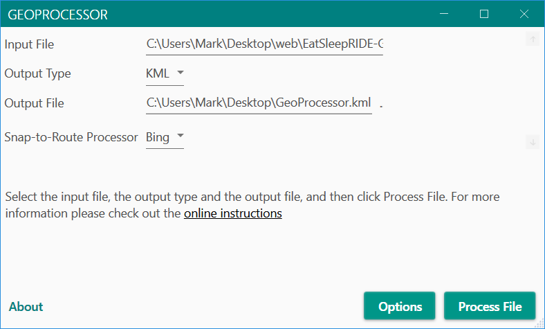
).To get a road-based route you have to snap the GPS points to a database of the actual roads. Both Google and Microsoft provide services to do that but using them requires software to process the GPS coordinates, feed them to the route-snapper, and output the results in kml/kmz format.
I've written a Windows 10 app to do that. You can read about it at https://jumpforjoysoftware.com/2021/02/announcing-geoprocessor/. Be aware that Microsoft, in order to tighten security on downloaded Windows apps, has made the installation process convoluted (I discuss this on the app download page).
If anyone uses the software I'd be interested in your feedback, particularly as to problems you ran into. It works fine on my machine...but that's my development machine, and just because it works there doesn't mean it'll work on any Windows 10 computers
. You'll have to a reasonably up-to-date version of Windows 10.To use the software you will also have to set up either a Microsoft or Google account to access their route-snappers and configure the app to use them (links to how to do this are in the online documentation). Those are free provided you don't send them enormous numbers of GPS coordinates, although I believe Google requires you to set up a payment method just in case you run past the free limit (Microsoft just suspends activity on your account until you fall back below the maximum rate per day).
Enjoy. And let me know how things work out.