To The High Country - June/July 2013

Yamaha FJR Motorcycle Forum

Help Support Yamaha FJR Motorcycle Forum:

This site may earn a commission from merchant affiliate links, including eBay, Amazon, and others.
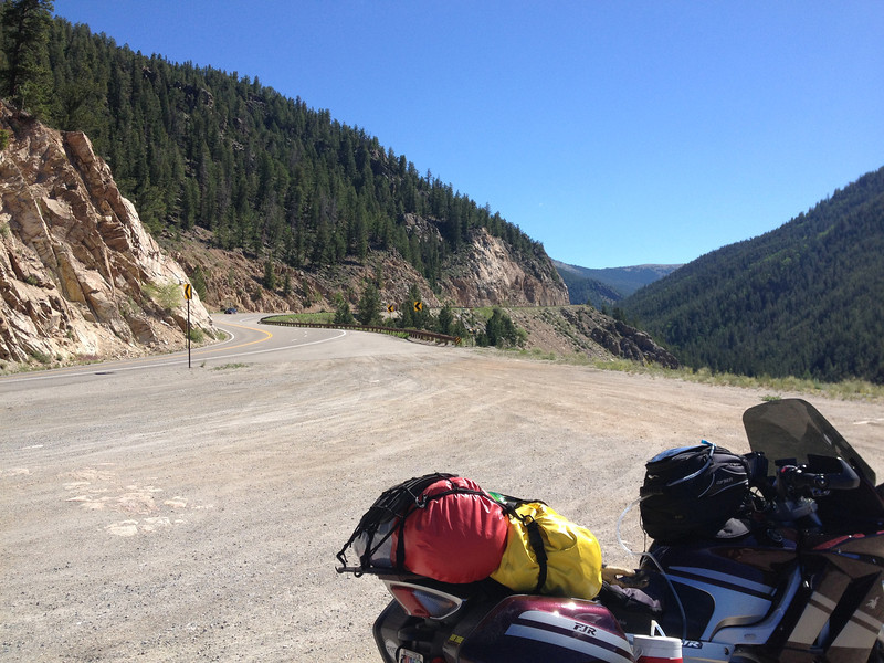
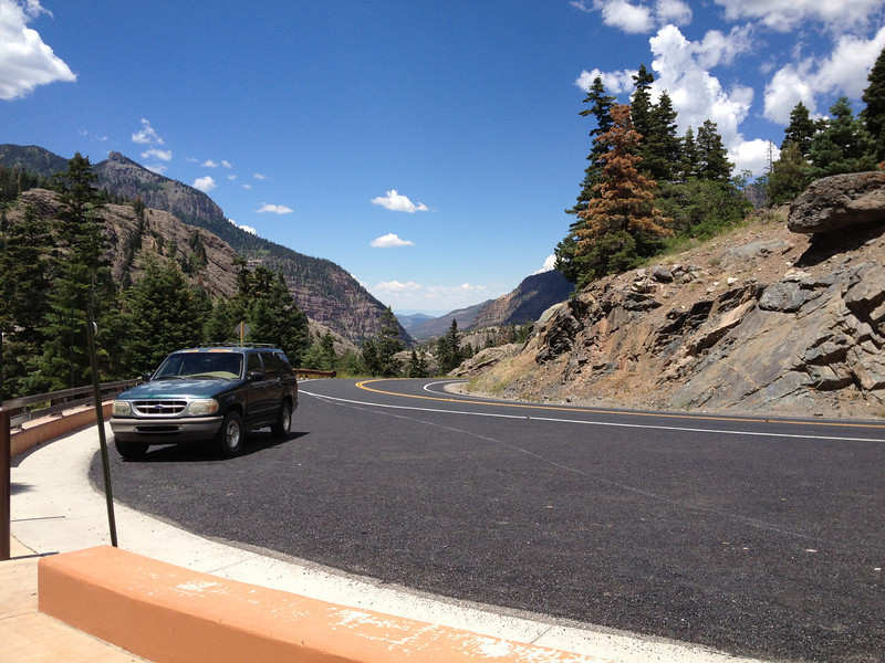
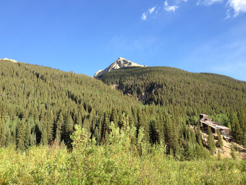
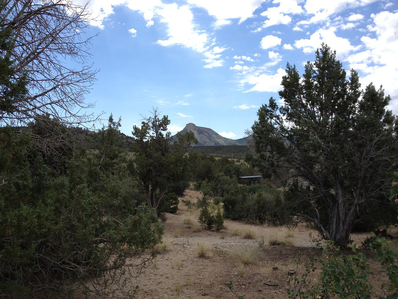
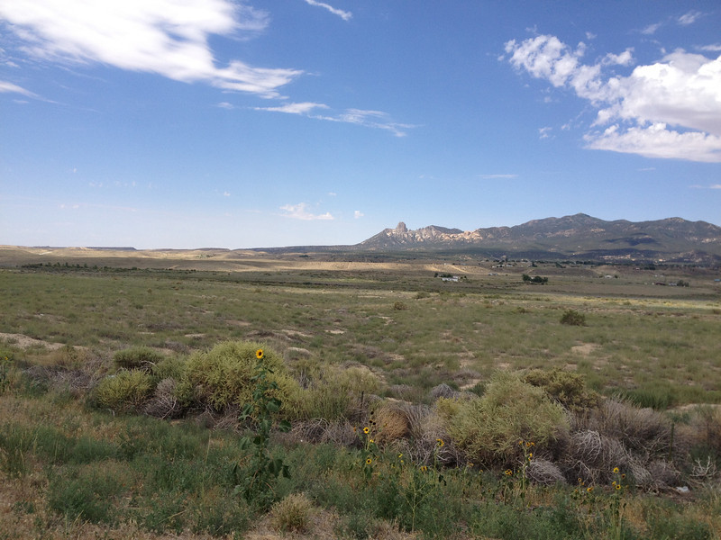
Sunday, June 30th - Mt. Evans and South, beginning the final swings!

Today, I only had one major goal, to run to the top of Mt. Evans, where the highest paved road in the US lies. Mt. Evans is 14,265' tall and one of the peaks that can be seen from the eastern plains, almost from Limon, 105 miles to the east (according to Wikipedia). The road itself comes up to an elevation a little more than 100' below the peak's and costs motorcycles $3 to access. I enjoyed the continental breakfast and some coffee, packed up my trash, and rolled east on I-70 until Idaho Springs, where I caught CO103 south to the Mt. Evans road. I expected a crowd, since Mt. Evans is popular with Denverites, and I was not disappointed....a long line greeted me at the entrance station. I paid my fee, received a warning about the extensive frost heave damage on the road up near the top, and was sent off with a smile.

Starting my journey up...
IMG_2711-L.jpg


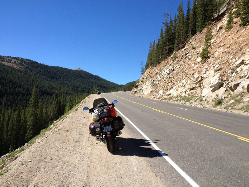
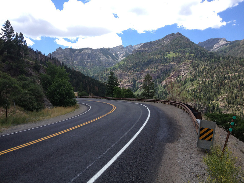
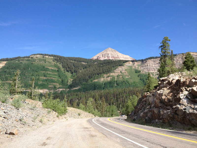
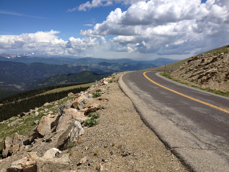
The road's not too bad in the lower portions, but just unpredictable enough, with traffic and damage, you don't want to barge right up...
IMG_2712-L.jpg


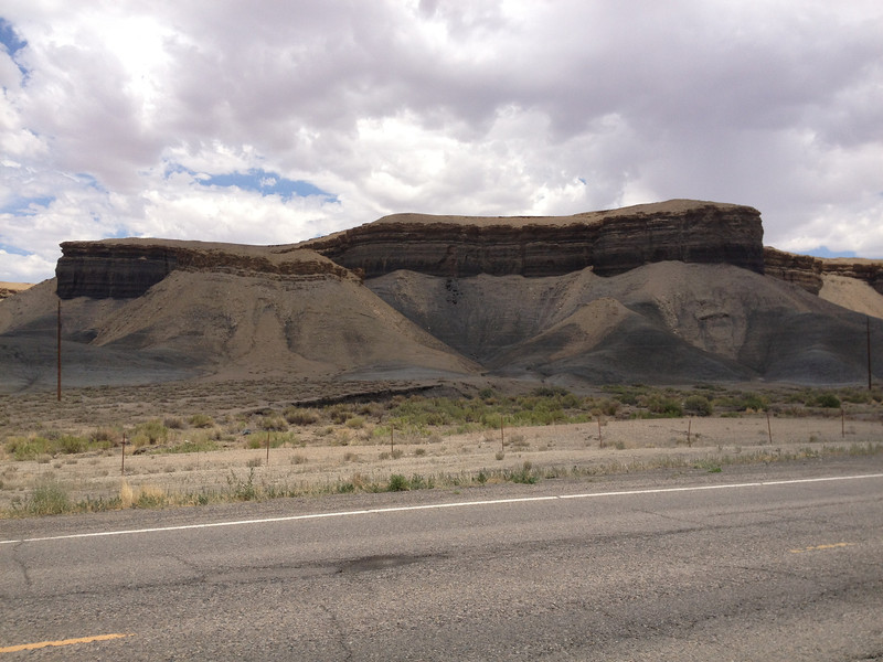
Ah, a little preview of what's coming....a slice across the face of the mountain.
IMG_2713-L.jpg


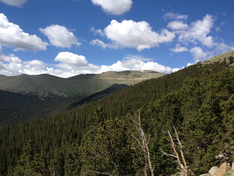
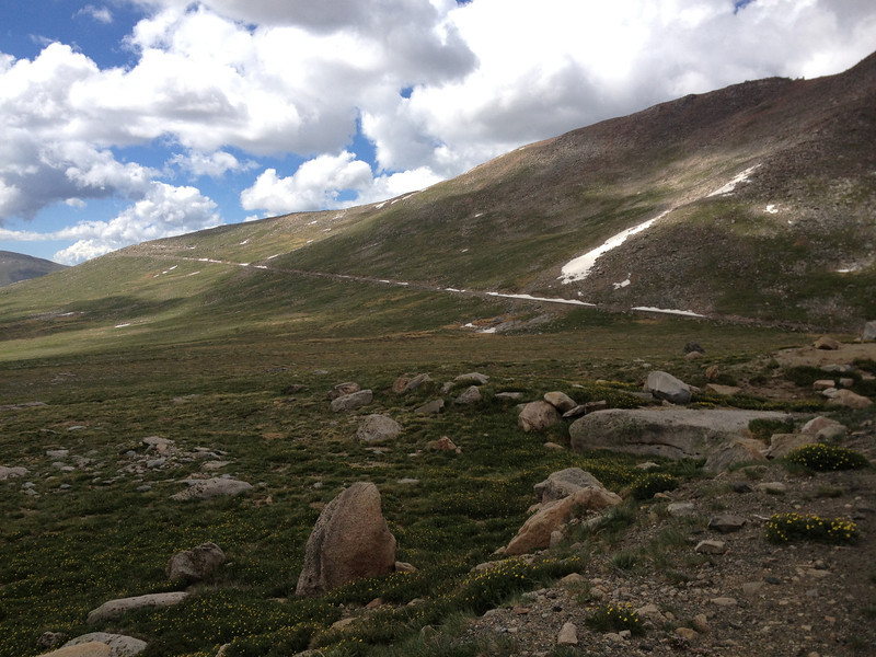
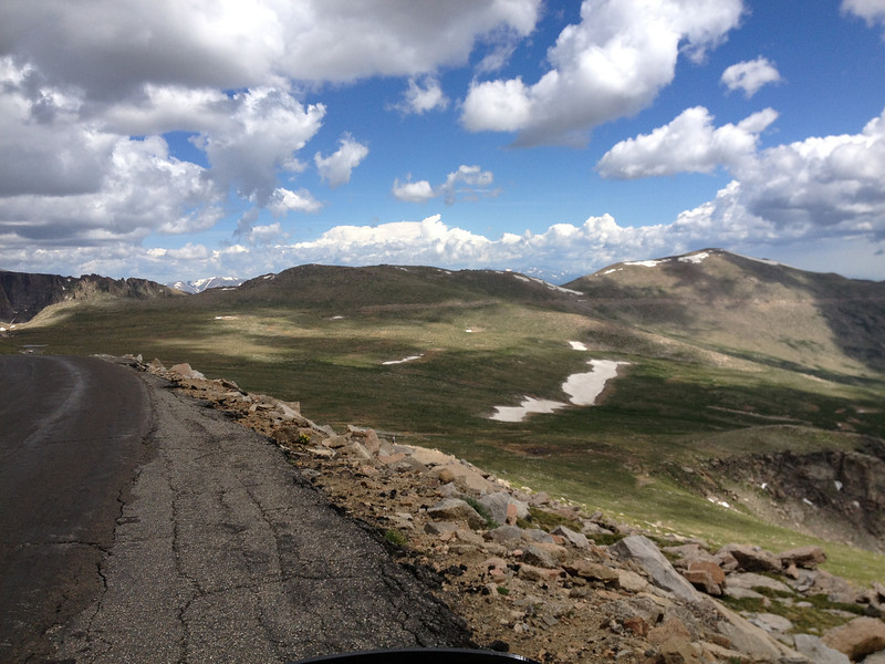
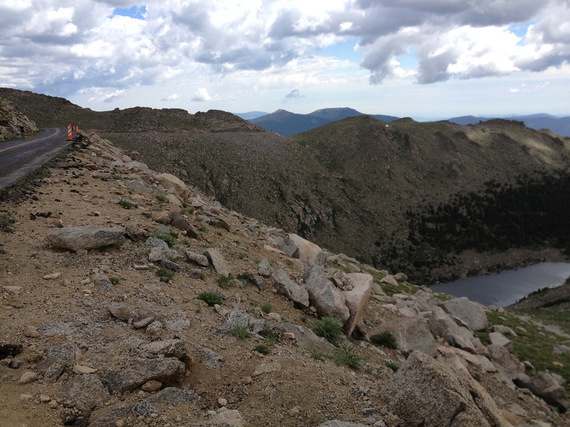
As I continued above treeline, the road's condition got a bit rougher thanks to the wile's of winter...
IMG_2714-L.jpg


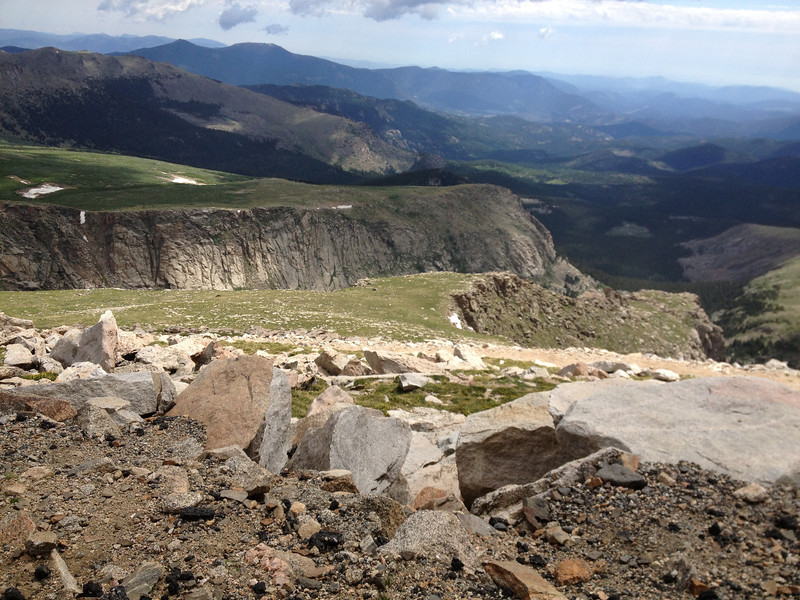
Yes, there is a view...but we're not there yet.
IMG_2716-L.jpg


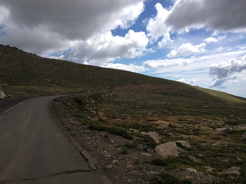
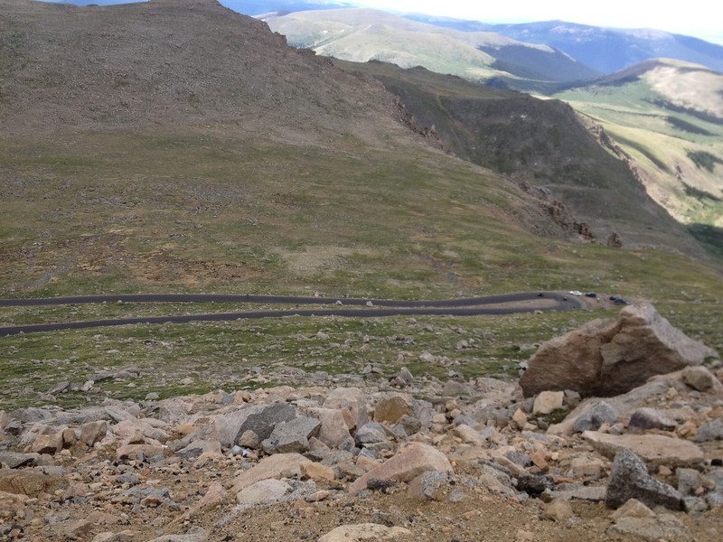
The road turned into a roller coast for a while at this point...heavy frost heaves.
IMG_2717-L.jpg


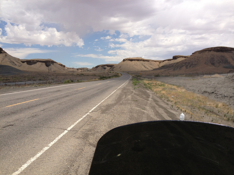
The road continues up....this is the cut seen earlier, from down in the trees.
IMG_2718-L.jpg


Mountain goats and marmots were scattered around the road...still climbing.
IMG_2719-L.jpg


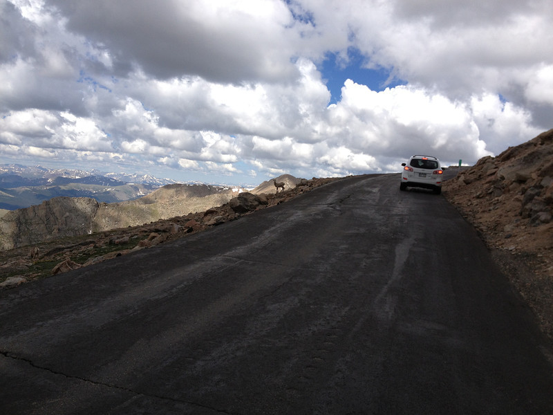
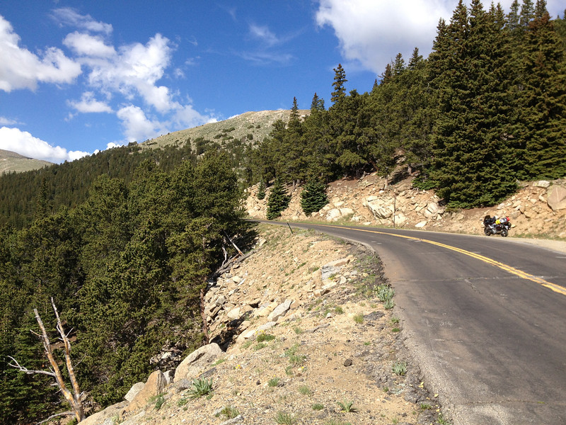
The road has several switchbacks as it climbs up the side of the mountain. Rider tip: Pay Attention
wink.png

IMG_2720-L.jpg


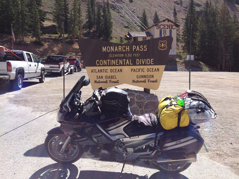
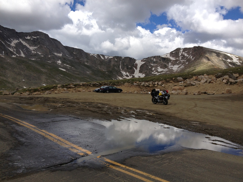
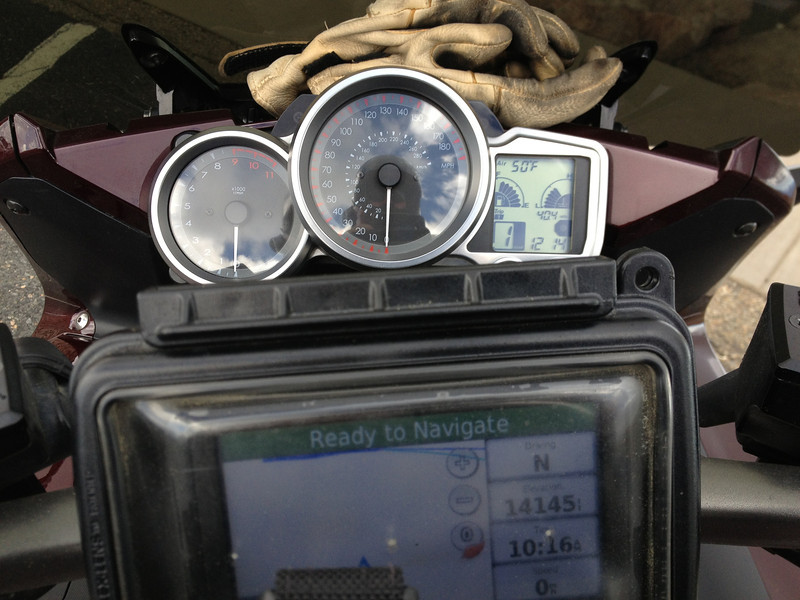
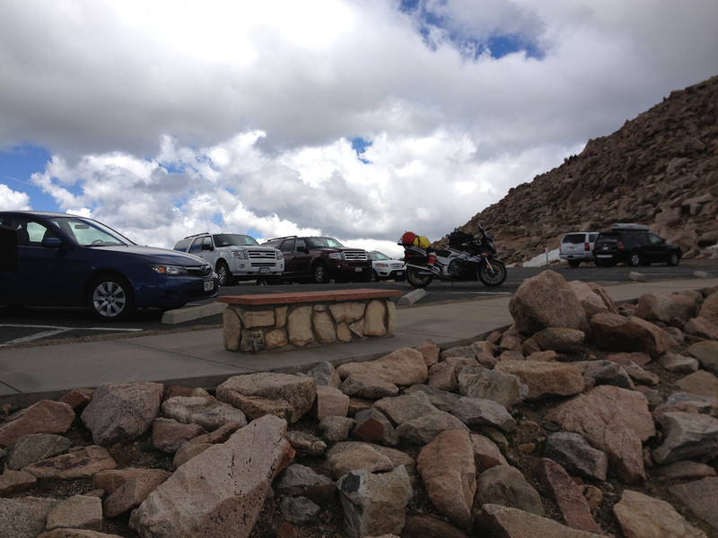
And I made it. The GPS tells the tale. Note the 50 degree temps; in Idaho Springs, at the bottom, it was going past 75. With the wind chill, it was cold at the top. And yes, I never reset the bike's clock for the trip...it remained on east coast time during the trip, lol. I just couldn't be bothered.
IMG_2725-L.jpg


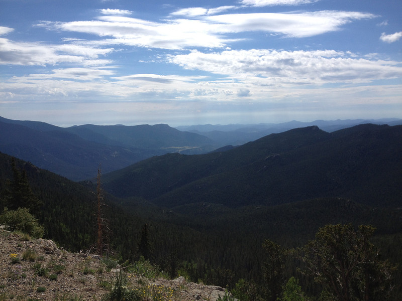
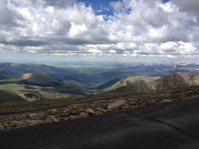
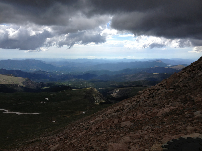
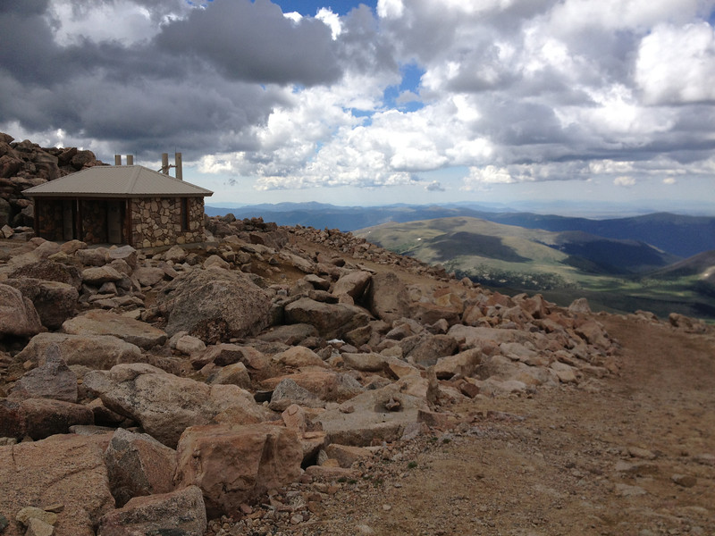
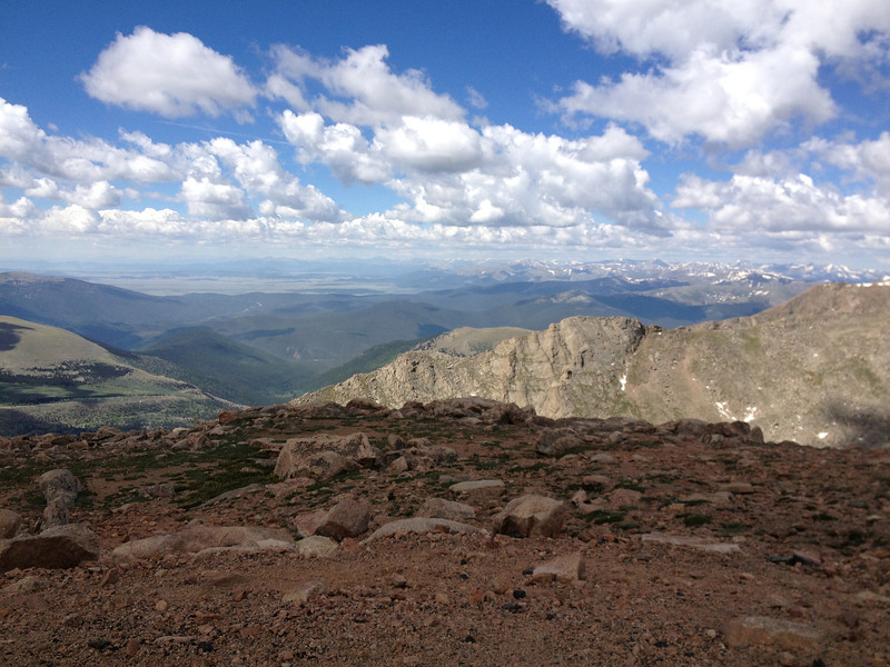
A view east, from the summit. The clouds were quite close, but not close enough to spoil the view.
IMG_2727-L.jpg


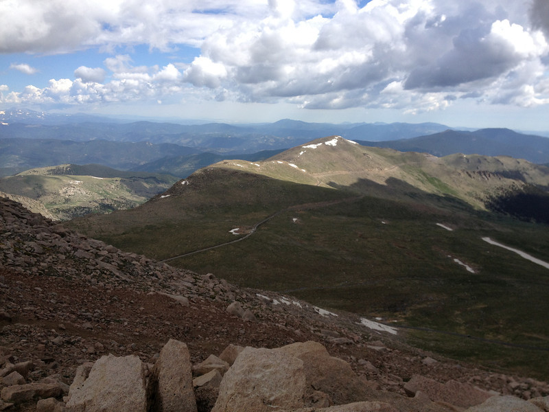
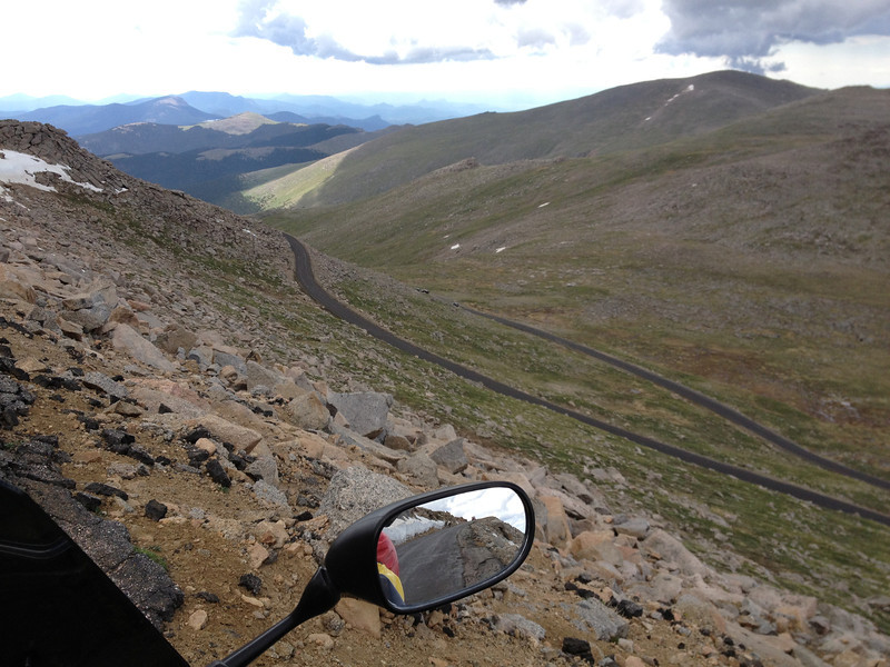
Looking east/north; you can just see the road making its way up the mountain on the left.
IMG_2728-L.jpg


A better view of the road coming up...
IMG_2729-L.jpg


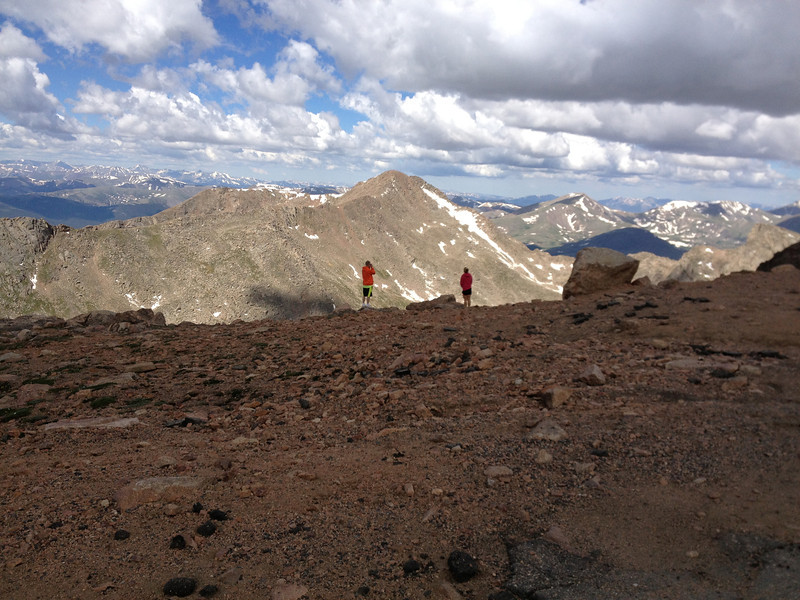
Feej enjoying the view.
IMG_2732-L.jpg


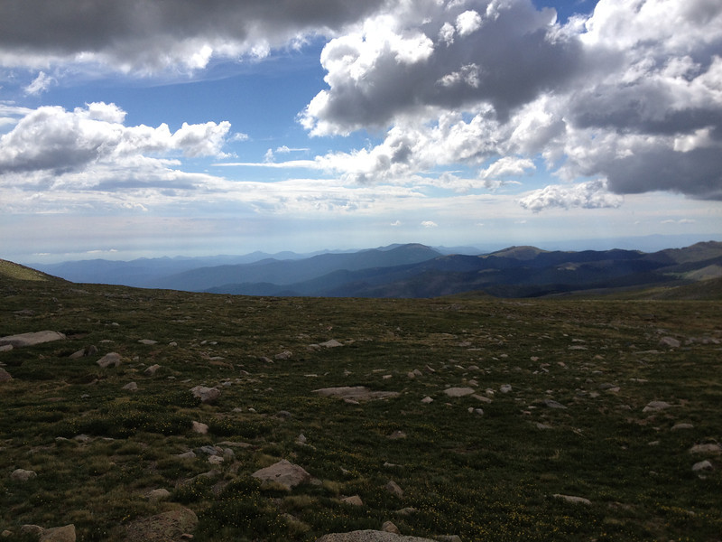
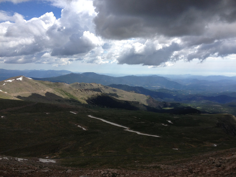
Looking SW from the summit.
IMG_2737-L.jpg


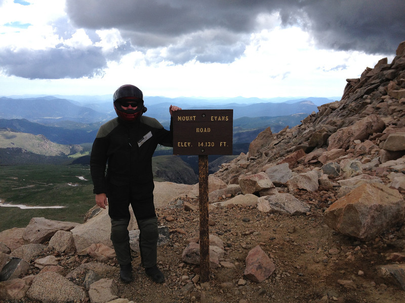
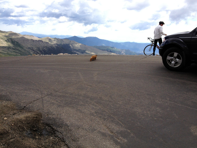
Borrowed a bicyclist to snap this shot of me....YES, it was cold, so I stayed sealed up, ha.
IMG_2735-L.jpg


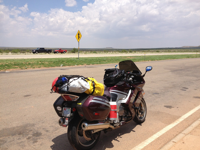
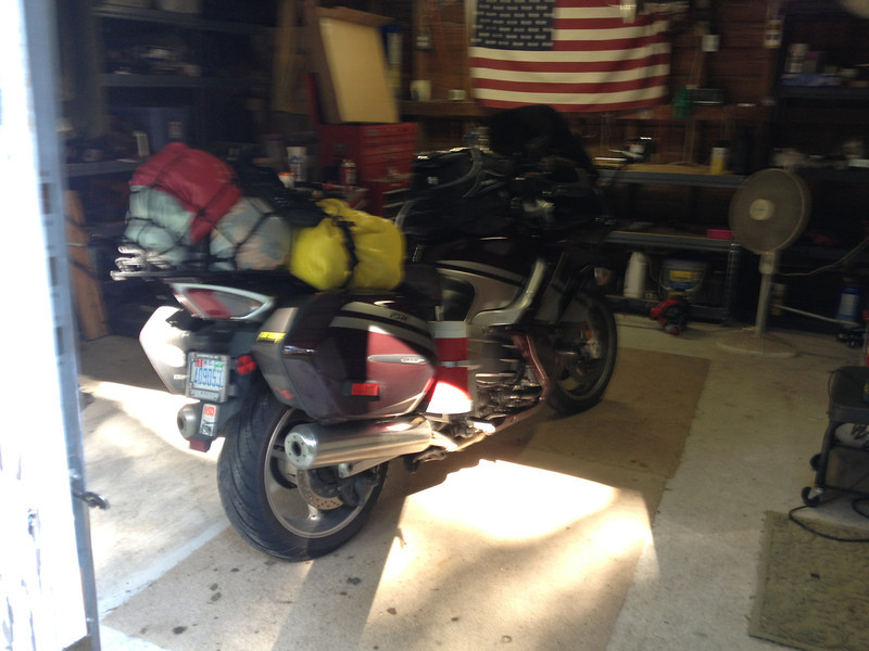
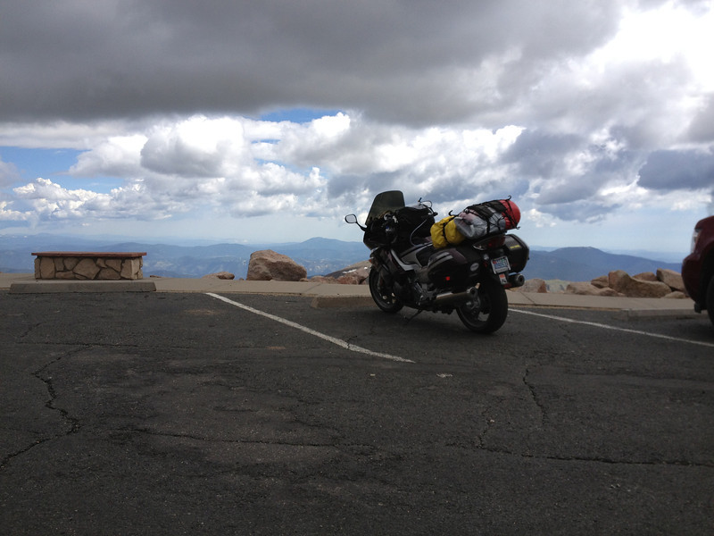
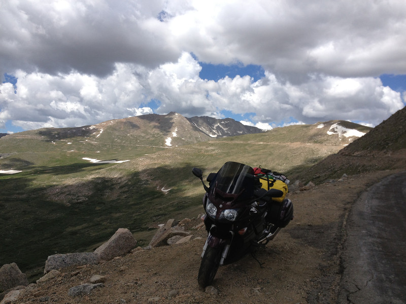
A fine machine that always managed to get the job done on this trip...
IMG_2742-L.jpg


Damn straight I did it...
IMG_2745-L.jpg


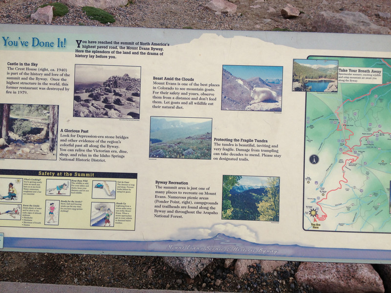
The views from Mt. Evans are simply spectacular; definitely a must do if you have the time.
IMG_2749-L.jpg


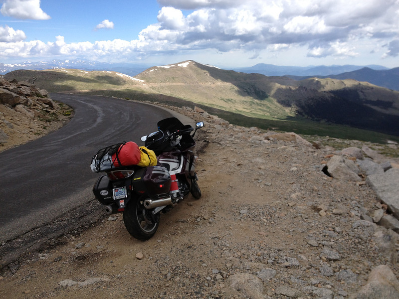
And one more before starting down.
IMG_2750-L.jpg


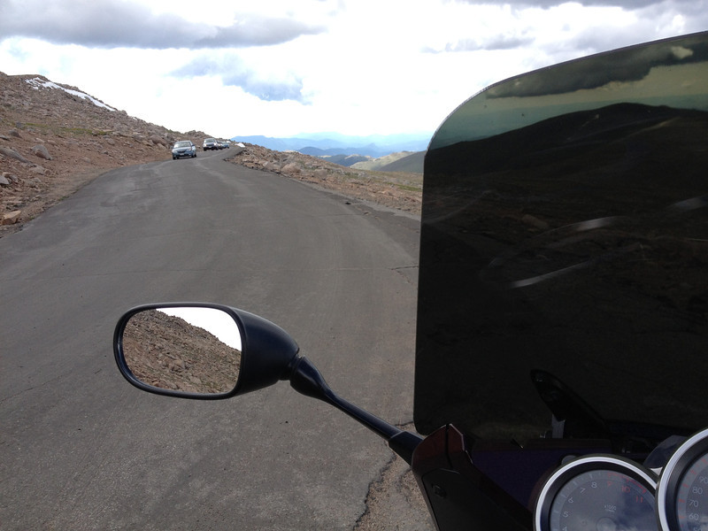
Making my way back down...the up traffic is heavy...
IMG_2751-L.jpg


A little throttle and I bet you could fly....
IMG_2752-L.jpg


Checking out the switchback below...
IMG_2755-L.jpg


The other end...if only the road was smooth...
IMG_2756-L.jpg


Approaching a switchback....I'm loving this road, despite it's condition.
IMG_2758-L.jpg


Pr0n...
IMG_2759-L.jpg


So many features lie just off the road...
IMG_2760-L.jpg


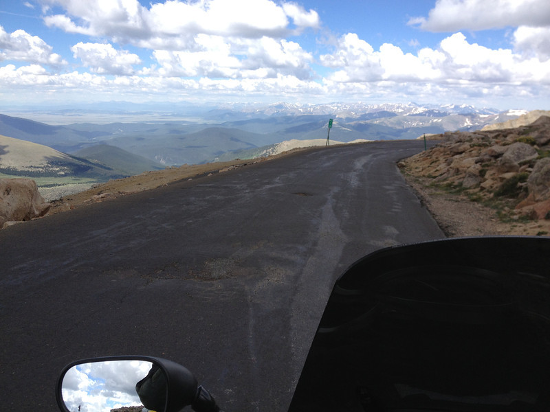
The road ahead as I come back down.
IMG_2761-L.jpg


Minor traffic jam as Mr. Marmot meanders across the road...he wasn't in a hurry.
IMG_2763-L.jpg


And more pr0n...looking back up Mt. Evans.
IMG_2769-L.jpg


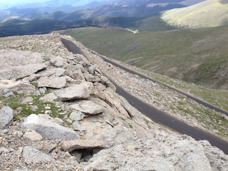
No room for error here.
IMG_2770-L.jpg


Or here.
IMG_2774-L.jpg


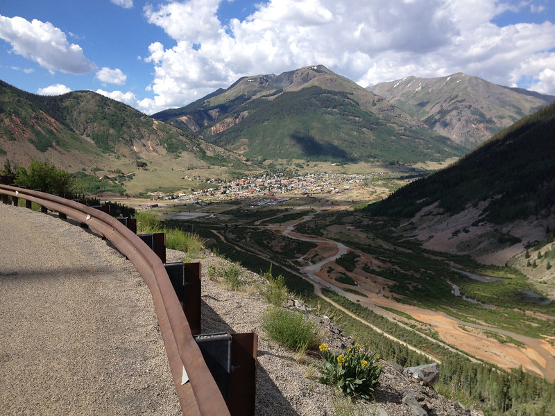
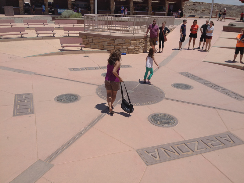
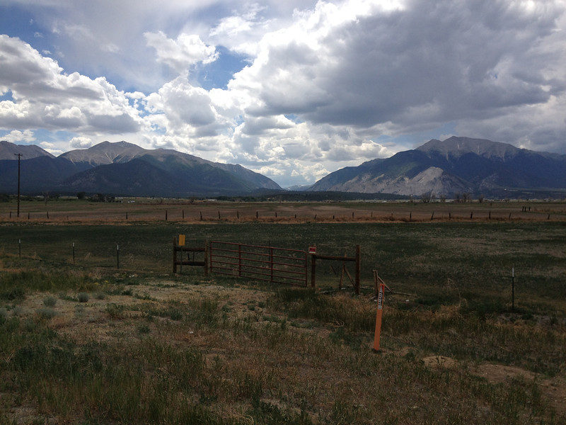
I eventually made my way back down to the visitor's center/store, where I picked up the requisite stickers and talked to a few tourists and bikers, and then popped out my map to see where I should head next. I wanted to get back home by next Saturday, so I figured it was probably time for me to start working my way south again, so I could eventually hit the Million Dollar Highway and the Four Corners Monument. I headed back towards Idaho Springs and blazed west on I-70 and hopped off at Copper Mountain, heading south on CO91.
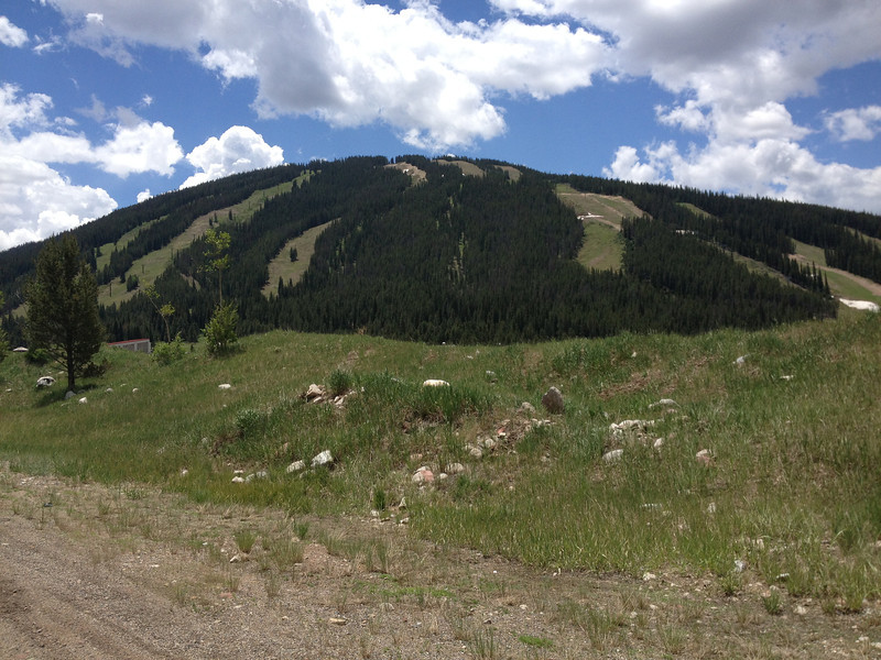
Copper Mountain...
IMG_2775-L.jpg


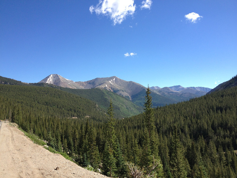
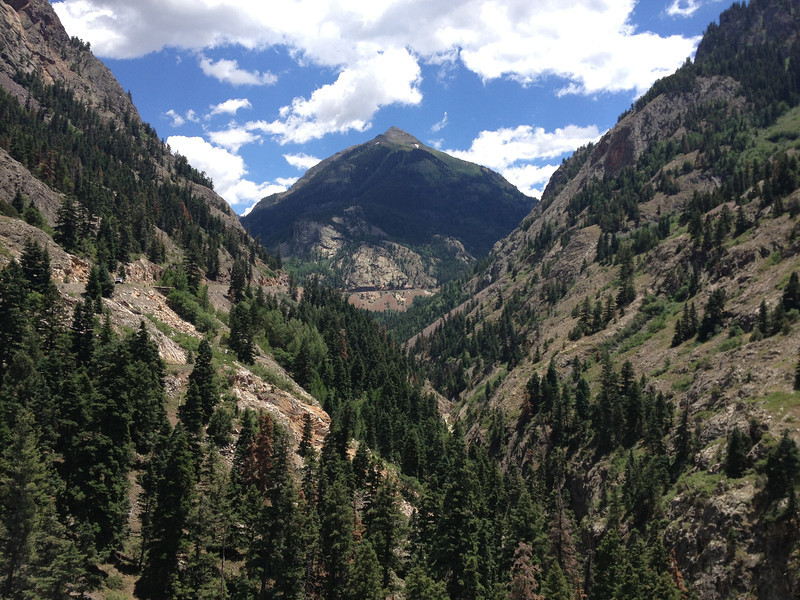
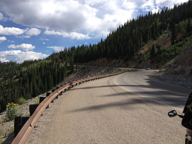
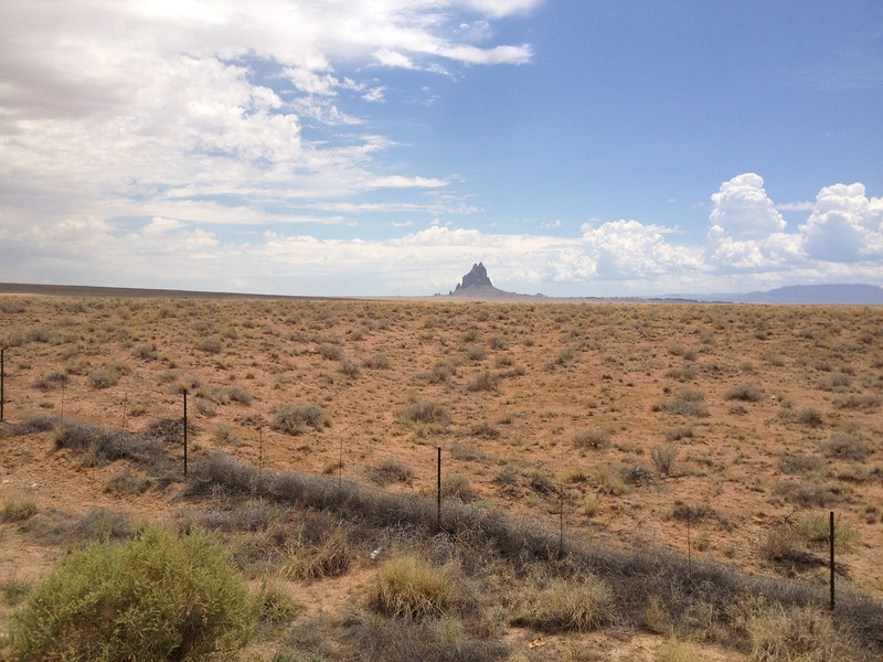
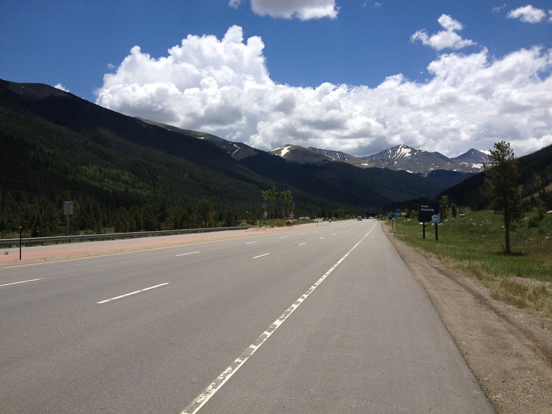
Running south on CO91...looked like pretty country coming up...
IMG_2776-L.jpg


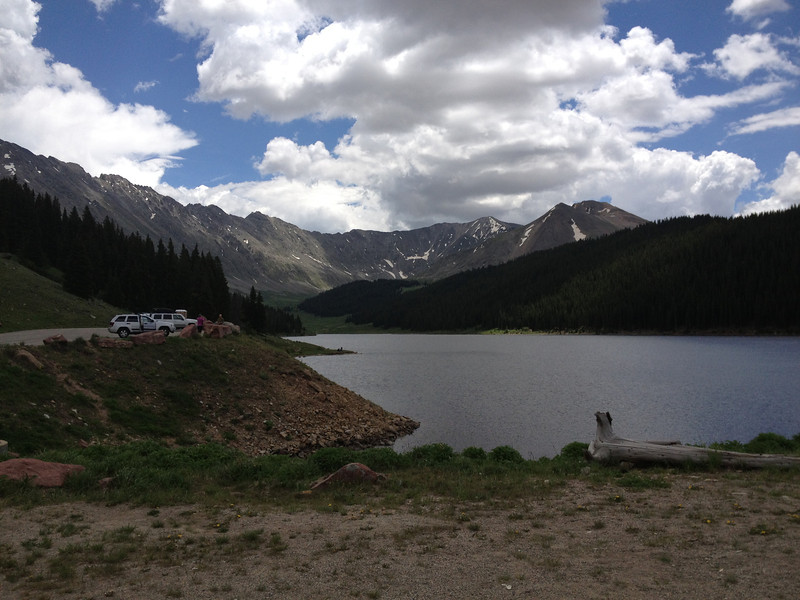
Along CO91, I passed the Clinton Gulch Reservoir, part of a huge meadow reclamation project going on across the road behind me. VERY picturesque I thought...
IMG_2780-L.jpg


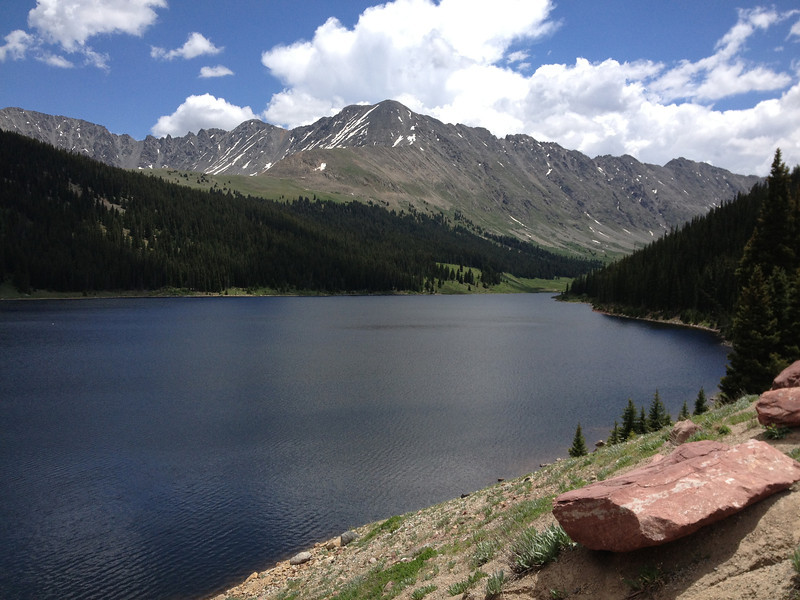
On the other side of the reservoir...still awesome.
IMG_2777-L.jpg


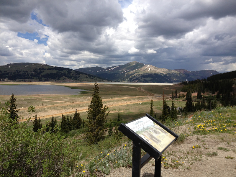
And the mountain meadow involved in a massive reclamation project. This valley was a massive tailings dump for the Climax Mine and now they're restoring it, using a mix of fills, including chipped pine bark beetle-killed trees. Impressive stuff.
IMG_2783-L.jpg


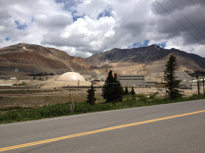
Just a bit further south, you run into the Climax Mine....where it looks like they're disassembling a mountain...
IMG_2785-L.jpg


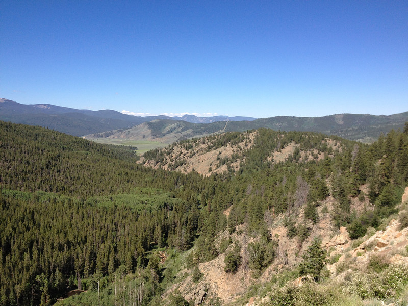
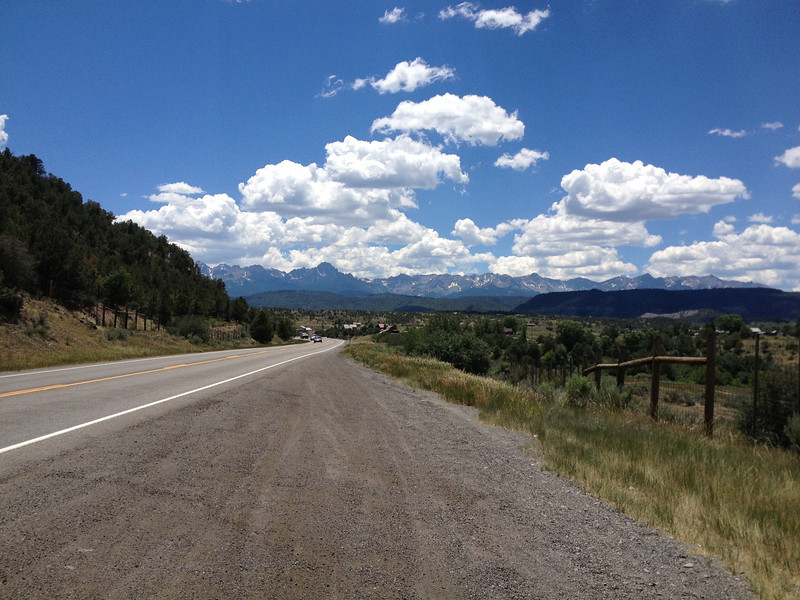
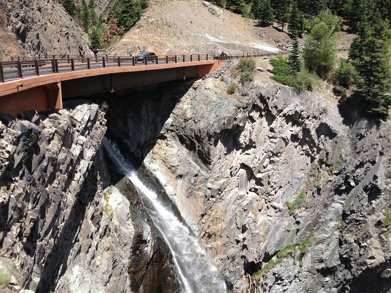
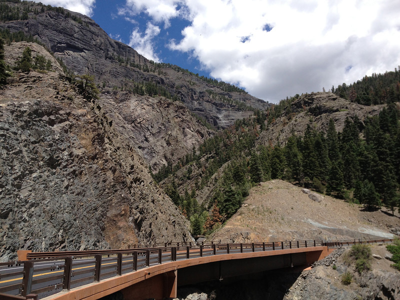
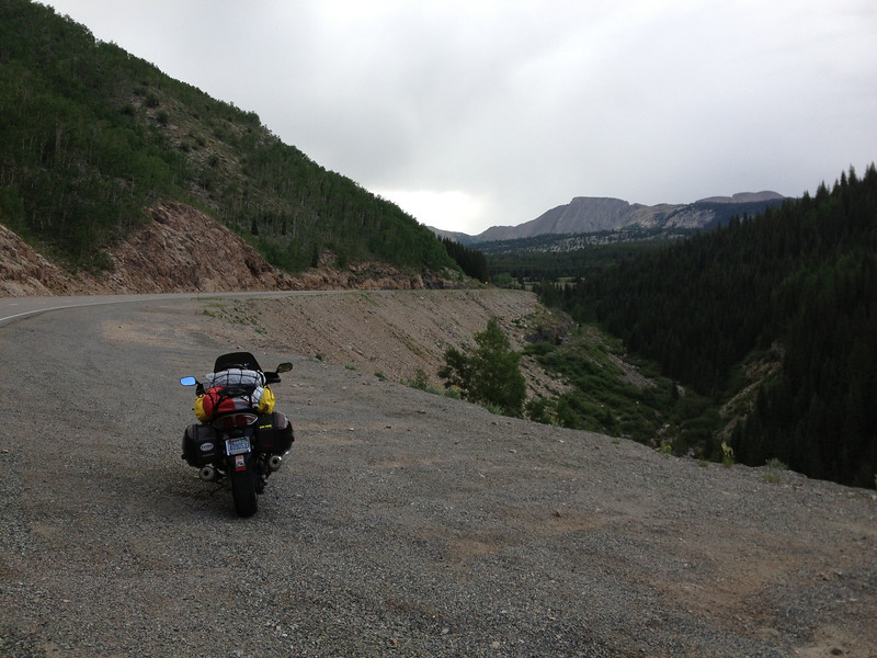
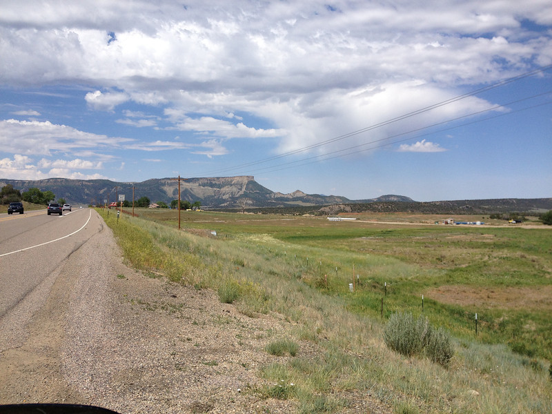
I continued down CO91, quite a nice road, until it turned into US24 at Leadville. It still looked like a Harley HQ, but this time, the rain was watering things down a bit and and everyone was breaking out their signature Harley rain suits...I giggled. Blew through Leadville and continued south on 24 until it turned into US285. Followed 285 until CO291, where I decided to divert and check out the town of Salida...I'd never been there before. As I was doing this, the wind was REALLY gusting as a storm was blowing in.

Along US285, running south.
IMG_2787-L.jpg


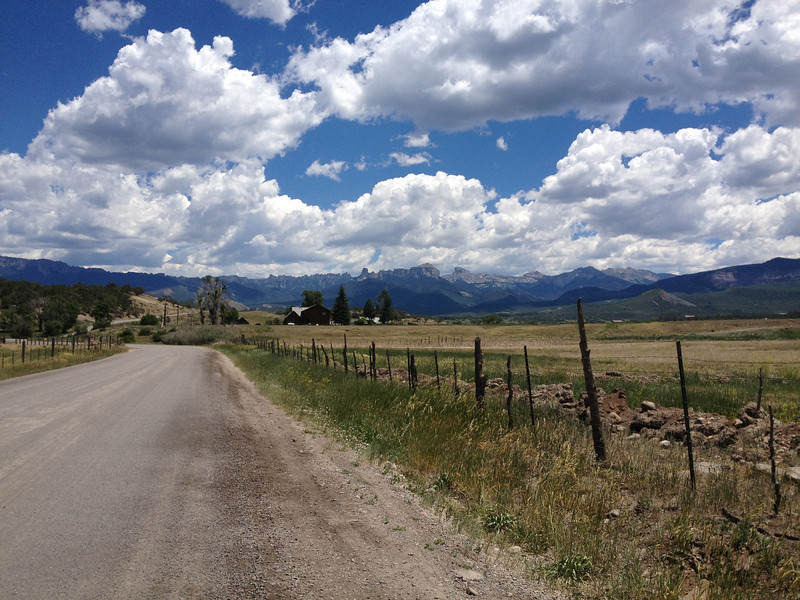
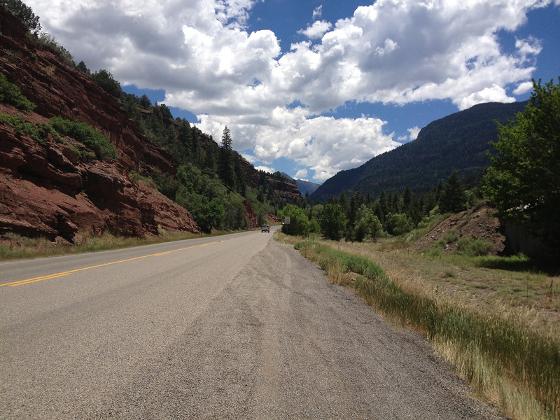
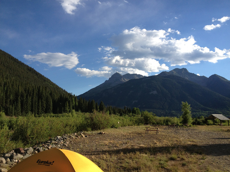
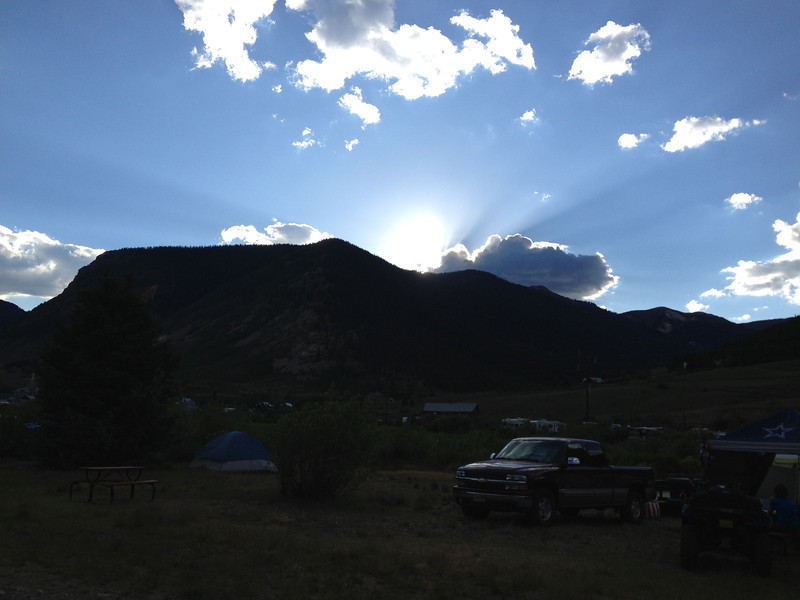
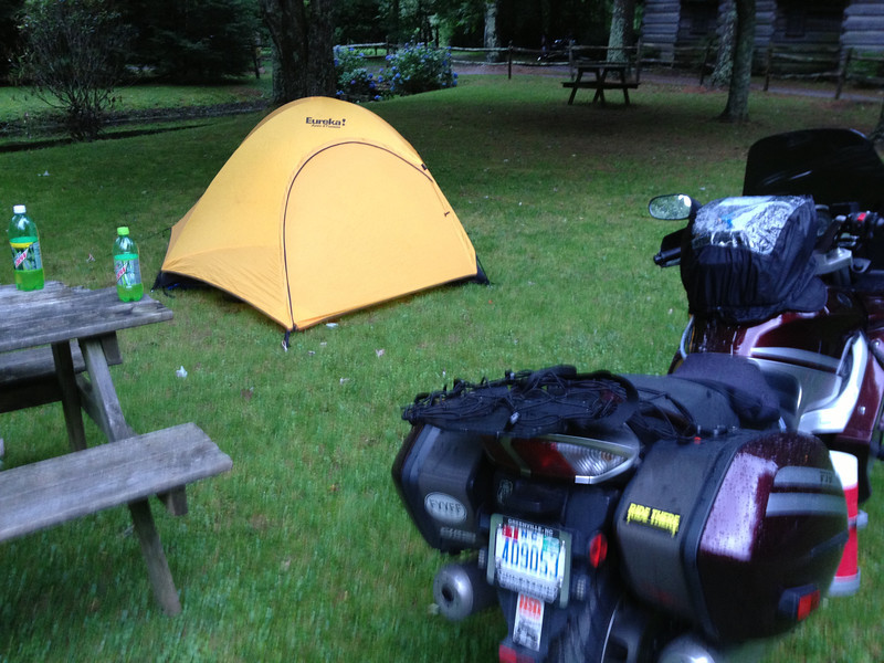
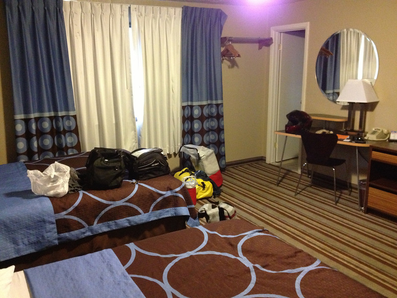
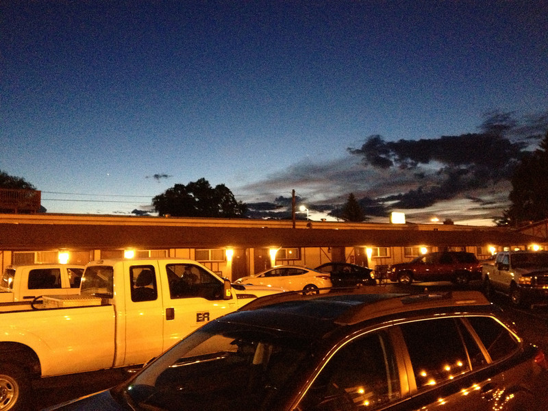
CO291 ended up going through the historic part of Salida and then met up with US50....I turned west and planned to find some camping somewhere on the way towards Montrose (Million Dollar Highway was tomorrow's target). The weather intervened...after getting nailed with hail stones as I approached Poncha Springs and not liking how it felt...OW!...I turned around and went the few miles back to Salida and a Super 8 I'd seen along the way. They had a large gathering of fire fighters and reclamation folks, but had one room left, so I checked in for the night and called it a day while it dumped hail and rain outside.

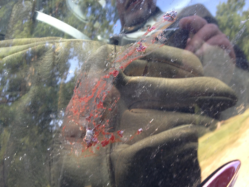
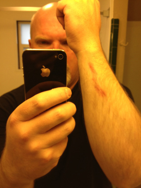
My fall, while waiting for my pizza in Georgetown the other day, was finally presenting itself on my arm....it still stung and looks way too lightweight here, lol.
IMG_2789-L.jpg


At least I had a fancy room...the fanciest I'd seen, lol.
IMG_2790-L.jpg


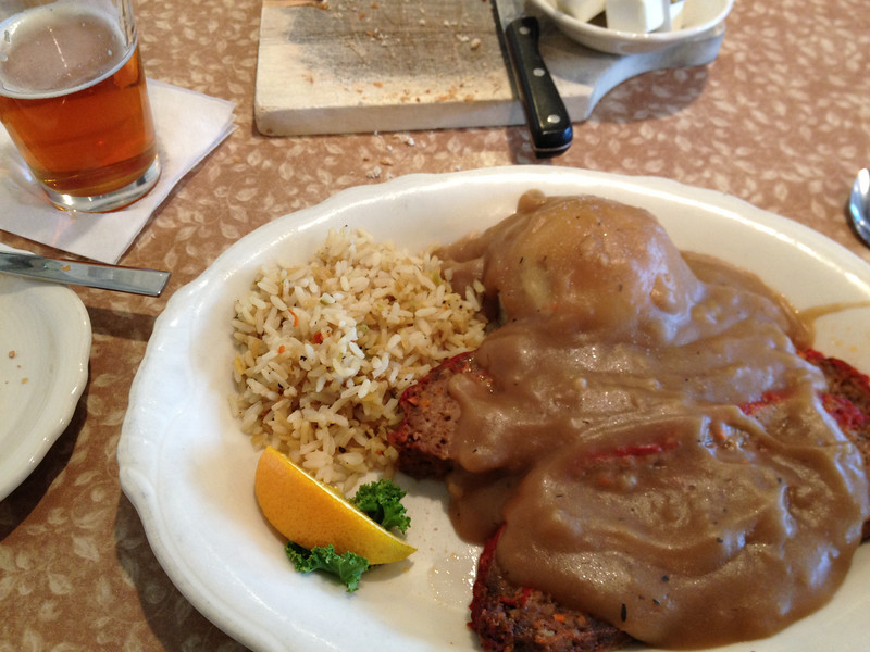
After the rain settled down, I made my way to the restaurant next door and enjoyed a delicious Buffalo, Elk, and beef meatloaf, along with a nice tasting ale.
IMG_2791-L.jpg


Later that night, the storm finally cleared out...and I slept like a baby.
IMG_2793-L.jpg


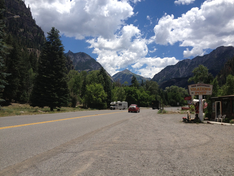
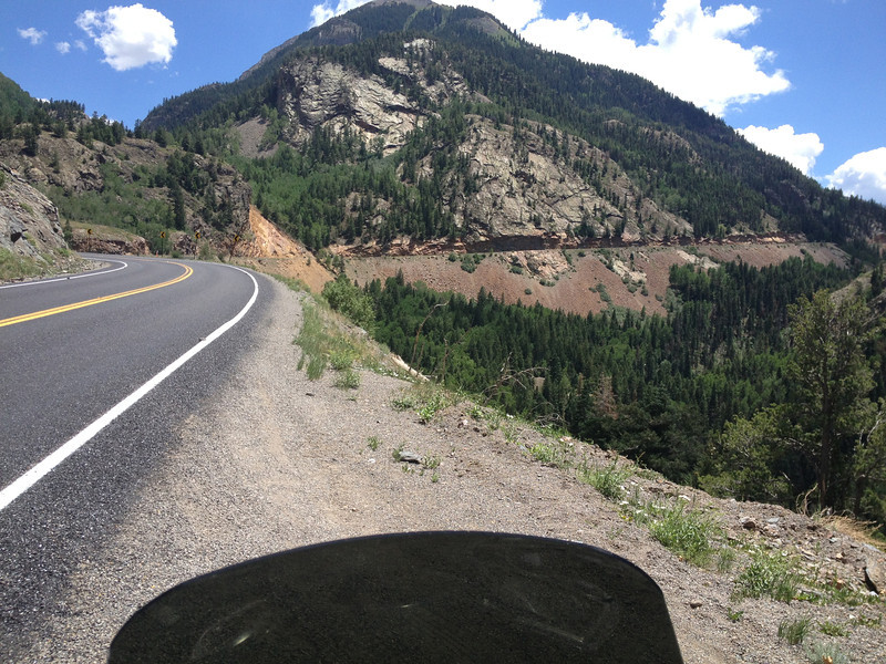
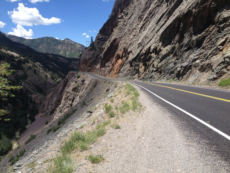
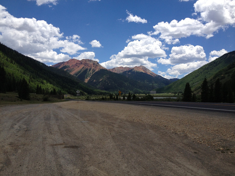
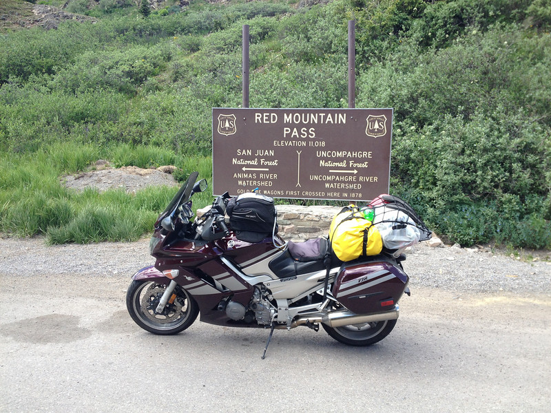
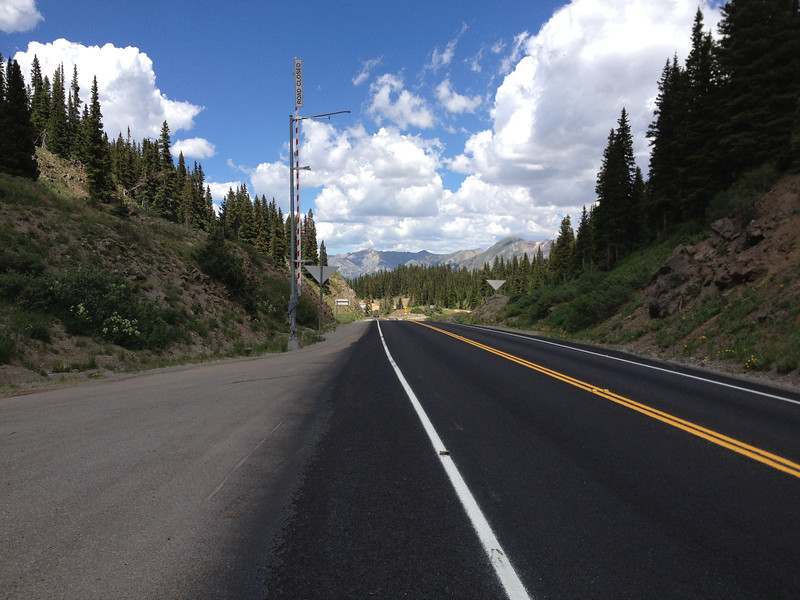
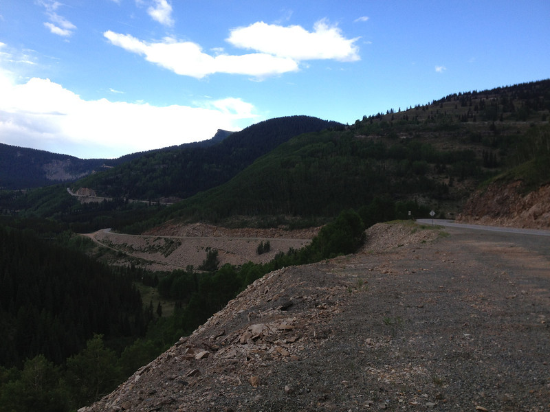
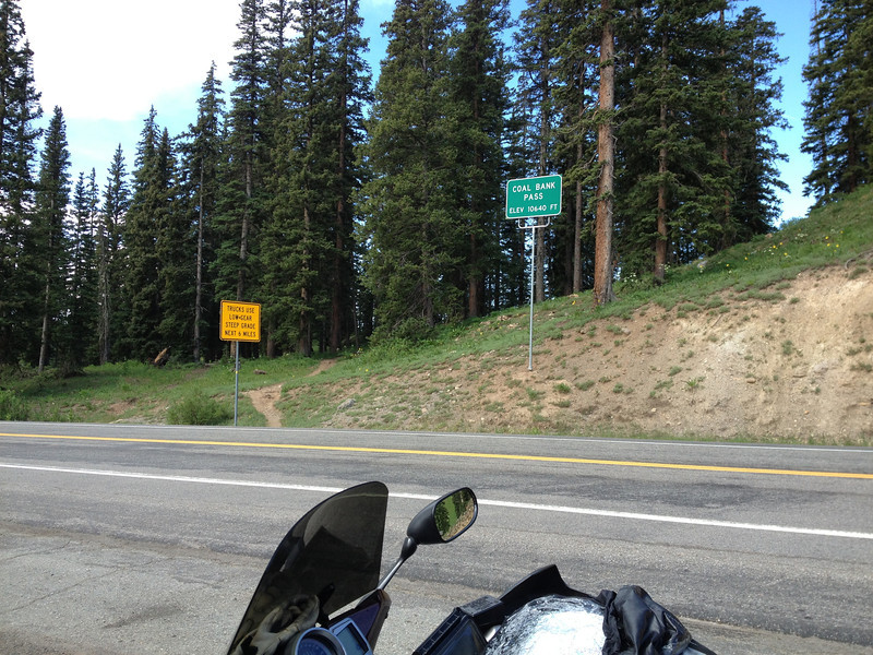
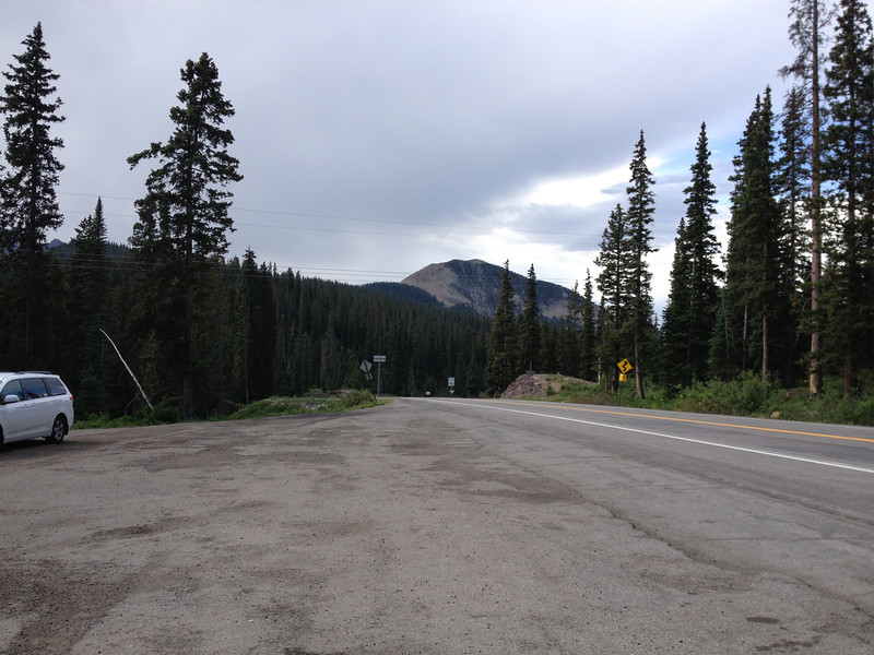
Tomorrow, I'd make my way over to Montrose and then south on US550, hitting the Million Dollar Highway. I was nearing the end of my time in Colorado, but I was going to close it out in style.
biggrin.png


TO BE CONTINUED...

 
Last edited by a moderator:
I love the massive expanse of the Rockies. Although, this spreads out things to see wide apart a bit, I love how you could drive for miles and miles and miles and still be wandering in the Rockies.

Good trip! Looks like you had loads of fun and I am glad you did! :)

 
I love the massive expanse of the Rockies. Although, this spreads out things to see wide apart a bit, I love how you could drive for miles and miles and miles and still be wandering in the Rockies.
Good trip! Looks like you had loads of fun and I am glad you did! :)
Thanks, I'm glad to contribute! I had a blast doing it! :D

I never really noticed the miles rolling by while traversing the state, but it truly is expansive.

 
Your pics are kicking the hell out of mine. Good job! I appreciate you showing me what I missed out on for my alternate routes. You have just made up my mind for me that I will go back and spend more of my time in Colorado. I am really really enjoying this RR. I am trying to decide whether or not I should show it to my Dad and my cousin. Might not end well.

 
Your pics are kicking the hell out of mine. Good job! I appreciate you showing me what I missed out on for my alternate routes. You have just made up my mind for me that I will go back and spend more of my time in Colorado. I am really really enjoying this RR. I am trying to decide whether or not I should show it to my Dad and my cousin. Might not end well.
Thanks! I've seen a few other reports with Colorado in it that have shown stuff that I missed, so I think it's the same problem we all run into, lol. BUT, that does provide an excellent reason to return. :D

 
Monday, July 1, 2013 - Million Dollar Highway, Part 1

Waking up in Salida, the day looked like it'd be a good one...for awhile at least. I made my way to the Super 8 office to grab some breakfast, and then packed up my gear and rolled west on US50, with a rough target being the Million Dollar Highway. My Colorado trip was nearing it's end and there was just no way I'd pass up seeing what that road is all about. My route was to follow US50 over to Montrose, retracing some of my earlier steps, and then turning south on US550. The Million Dollar Highway "officially" starts in Ouray, CO.

US50, on the way to Montrose, before Gunnison, climbing Monarch Pass.
IMG_2794-L.jpg


I've had really good luck on this trip with finding great roads.
IMG_2796-L.jpg


The summit of Monarch Pass (11,312')...I've kinda lost track on the number of passes I've hit during this trip, lol. For a moment, I thought about riding the chairlift...but only for a moment.
IMG_2798-L.jpg


Coming down Monarch Pass, heading towards Gunnison.
IMG_2799-L.jpg


Looking back from where I'd come, on the Monarch Pass summit. FUN.
IMG_2800-L.jpg


Puppychow mentioned the expansiveness of the Rockies and that brought to mind something I didn't really realize until after I returned from the trip. Point A to Point B could be quite long on my Colorado wanderings, but I honestly never gave time and distance a thought except when it came time to find a place to stay for the night. Part of this is probably due to not using my GPS at all while in Colorado and relying, instead, on a "virtual" paper map. The other reasons are probably due to the massive amounts of eye candy that kept my mind busy while the miles passed beneath my tires and the constant pumping of music through my Sena. On more than one occasion, the music perfectly matched the pace...it just doesn't get any better than that. I missed a lot of the traditional touristy things, but covered a lot of territory...thank goodness the FJR makes it easy.

I eventually made it into Montrose and turned south on US550 towards Ouray. Montrose was hot and jammed with traffic and I was happy to pass through it. Just outside of town, on 550, I came up on my second construction halt for the trip, but luckily, it lasted less than 15 minutes and I was on the way to Ouray. On the fly, I decided I would go as far as Silverton for the day since my Allstays app said there was some camping there and I wanted to check out the town and absorb the scenery...and the Million Dollar Highway.
wink.png


US550, heading to Ouray, CO
IMG_2803-L.jpg


Minor diversions...
IMG_2805-L.jpg


Approaching Ouray...the road's already showing signs of fun.
IMG_2807-L.jpg


And a bit closer...we're almost on the Million Dollar Highway...the scenery goes into overdrive.
IMG_2809-L.jpg


In my typical way of doing things, I rolled straight through the town of Ouray. US550, now the "Million Dollar Highway", if Wikipedia is to be believed, starts out steeply from the south edge of town.
IMG_2811-L.jpg


Looking back down the starting climb.
IMG_2812-L.jpg


The town of Ouray, CO. US550 comes from the north through the valley...it's quite dramatic and very scenic.
IMG_2813-L.jpg


This is a sign of what awaited me on the run down to Silverton...
IMG_2815-L.jpg


One more peek towards the NW, over the town of Ouray...staggering scenery!
IMG_2816-L.jpg


On the way to Silverton, US550.
IMG_2818-L.jpg


It's hard not to be amazed...the views are simply stunning. 550 runs along the left edge of the photo and cuts across way in the distance.
IMG_2820-L.jpg


The road was in spectacular condition and traffic was fairly light. I was grinning ear to ear the entire time. Looking back to the north...while paused at the bridge you'll see next.
IMG_2823-L.jpg


A waterfall, a bridge, a curve, a deeeeeep canyon/gorge.
IMG_2825-L.jpg


It's a bit of a drop...
IMG_2827-L.jpg


The scenery didn't let me down for a minute...
IMG_2830-L.jpg


Here, US550 cuts across the base of a mountain...the same cut seen in the distance earlier. This road is friggin AWESOME!
IMG_2831-L.jpg


This photo really sums up the Million Dollar Highway...what a ride! Oh yea, no guardrails, so pay attention!
IMG_2832-L.jpg


Continuing on to Silverton...these peaks are Red Mountain #1 and #3, according to my map. Seems to make sense...
IMG_2833-L.jpg


And another pass falls to Feej, Red Mountain Pass (11,018').
IMG_2835-L.jpg


From Red Mountain Pass summit...
IMG_2837-L.jpg


After an unforgettable ride, I finally came down the mountains into the town of Silverton. US550/Million Dollar Highway, climbs back up the mountain on its way to Durango, but for today, I'd be stopping here to camp and soak up the scenery. Silverton sits to the east of 550, so I made my way into town and passed to the other side, looking for the campground my Allstays app said was there. I found the sign pointing the way and turned off onto a gravel road...very loose gravel, and made my way to the office. As I pulled up into the office's parking lot, I almost lost the bike in axle deep gravel...not fun. After freeing the bike, I checked in and rode the VERY rough dirt road to my campsite, out in the open. It wasn't much, but the views were awesome.

You can just make out US550 cutting up the mountain from Silverton as it heads towards Durango.
IMG_2838-L.jpg


An old mine just adds to the atmosphere of this beautiful country...
IMG_2839-L.jpg


Looking east from my campsite, up a valley popular with ATV's. The campground had a large staging area for 'em.
IMG_2840-L.jpg


It was hot and only mid-afternoon, so after I got my tent setup, I suited up again and headed for town looking for ONE thing...mission accomplished...
IMG_2841-L.jpg


I sat on the bench outside the ice cream parlor for probably a good hour, chatting it up with the old fella that owned the place while we watched the tourists stream through town. The old guy closed up shop, saying he was heading for the Chuckwagon in Durango to watch a show (I think that's the reason), so I decided to sample US550 a bit more before dinner.

Even though I'd be running it in the morning, I decided to run US550 south a bit. Looking back on Silverton...my campsite is at the far edge of town, into that valley heading off to the right. I swear I could almost see my tent.
IMG_2842-L.jpg


The curves and view continue...I got to run it with very little traffic.
biggrin.png

IMG_2843-L.jpg


I ran 550 south for a ways and then back to the north for awhile, just kinda enjoying the moment. Near dinner time, I finally got done playing and tracked down a great steak dinner and a beer. I returned to the campsite as the light was getting long.
IMG_2846-L.jpg


Kendall Peak catching the evening rays of sun...it's hard to tell from how bright things are though.
IMG_2847-L.jpg


Looking to the west, with Silverton in the foreground, as the sun slides behind the peak. Darkness falls fast...
IMG_2848-L.jpg


Going...
IMG_2849-L.jpg


Gone...
IMG_2850-L.jpg


It was a somewhat short day, but it was filled with some of the most spectacular views and riding I'd seen so far. I spent the evening chatting with my neighbor campers while enjoying some cold ones, then let the night bring on the sleep...

Tomorrow, I'd be hitting the rest of the Million Dollar Highway and leaving Colorado...

TO BE CONTINUED...

 
Last edited by a moderator:
Tuesday, July 2 - Million Dollar Highway Part 2, Four Corners, and the turn for home.

I woke to the sound of rain drops tapping gently on my tent...great. I poked my head out and noted the angry clouds rolling over the peaks to the north with the morning sun trying to break through from the valley to the east. During a brief lull, I threw on my riding underclothes and got out to start assessing the situation. Mountain weather typically doesn't last that long, but this little storm was persistent, so I ended up suiting up and then packing the soaked tent into the spare dry bag I carry for such occasions. Got everything lashed down and beat it into town for some breakfast. After enjoying some cinnamon rolls, coffee, and some idle chit-chat with the locals and tourists ("Oh, it must suck to the ride in the rain!" comments really), I hit US550 south with the intention of going through Durango and then turning west to bag the Four Corners Monument.

Between the time of getting packed and eating breakfast, the storm blew out, leaving just small pockets of spitting clouds behind...figures. At least it looked nice south. Anyway, US550, aka The Million Dollar Highway, continued to live up to it's reputation...yes, it was FUN!
IMG_2851-L.jpg


Looking back north...the storm clouds are getting left behind...for now.
IMG_2854-L.jpg


And another pass passes....Coal Bank Pass (10,640'). They really blew the budget on the sign...
IMG_2856-L.jpg


From the summit of Coal Bank Pass, looking southbound. The motorcyclist's favorite sign...up here, it really meant it usually.
IMG_2857-L.jpg


The weather cleared up and the riding continued to be awesome as I continued down towards Durango. I'm pretty sure this is Engineer Mountain...turns out to be one of my favorite pics...
IMG_2860-L.jpg


And then it was over....I dropped out of the mountains and into a valley, leading pretty much straight into Durango. Along the way, I spotted something I'd seen countless documentaries about... The Durango & Silverton Railroad making its way towards Silverton, neat!
IMG_2864-L.jpg


IMG_2865-L.jpg


I stopped briefly in Durango to grab a little snack and properly refill my hydration system (ICE) before turning west onto US160 and heading for Four Corners. Being a minor railroad fan, I almost went to check out the Durango & Silverton, but then I remembered the crap experience that was the Great Smokey Mountain Railroad and decided to pass.

Just west of Mancos, CO...the mountainous terrain is melting away quickly.
IMG_2866-L.jpg


Desert landscapes...I've always loved them.
IMG_2868-L.jpg


I stopped in Cortez for some lunch and continued working towards Four Corners, passing "The Knees" and "East Toe"...take a guess at which is the "toe".
IMG_2869-L.jpg


Desolation...plus a big casino along the way (no photo).
IMG_2870-L.jpg


The official portion of my Colorado visit passed as I entered New Mexico and turned onto the Four Corners Monument road. I had generally low expectations of this monument and those expectations were rewarded...it's really nothing more than a tourist trap. That said, it has always been a place I wanted to at least visit once just so I could say I was there, lol. It was hot, really hot, and I didn't feel like sticking around too long or attempting to stand in all four states at one time because the line was too long for the heat (I rode around the monument into each of the 4 states, so that'll have to do). I snapped some shots of random tourists doing what tourist do.
biggrin.png

IMG_2872-L.jpg


IMG_2874-L.jpg


Yep, it's out in the middle of nowhere...
IMG_2876-L.jpg


The monument is surrounded on all sides by vendor tables, where you can buy various Native American knick-knacks commemorating your visit.
IMG_2879-L.jpg


From Four Corners, I continued south to the junction in Teec Nos Pos, AZ, where I made the turn east, signaling the official start of my journey back to North Carolina, 2048 miles away. I headed for Shiprock, NM on 64, with a ludicrously low speed limit of 60 set for the desert run...if I remember correctly. THERE'S NOTHING OUT HERE...why is the speed limit so low? One possible answer came in the form of a white SUV. I was the only person out there and as I rounded a corner, I saw a white SUV on the side of the road in the distance. As I got closer, the SUV pulled onto the highway and I fell in behind him. He was driving EXACTLY at the speed limit and we had NOTHING ahead of us for miles, but straight pavement. Of course, the first instinct is to blow past him, but I took a closer look...the windows were very darkly tinted, but in the back window, I could JUST make out the profile of what I thought was a light bar....an unmarked officer...hmm. I stuck behind him for a few miles until Ship Rock came into view...I had to snap a pic.

Ship Rock, visible for miles and miles.
IMG_2881-L.jpg


The white SUV continued on ahead while I snapped my pics, but then pulled to the side of the road about a 1/4 mile ahead and just sat there...no one getting out to snap pics or take a leak. I can play; I decided it was a good time for a Cliff bar break. After about 15 minutes, the white SUV, from which no one emerged the entire time, flipped a U'ey and blazed past me...guess I bored him, heh. I continued on to Shiprock.

The desert does offer some visual treats...
IMG_2884-L.jpg


And some bits of fun stuff...
IMG_2885-L.jpg


Yep, it's still there...
IMG_2886-L.jpg


Report Note: Photo quality and quantity drop significantly as I flip into "go home" mode, lol.

I reached Shiprock, NM and stopped for some fuel. From there, I continued on 64 until a little cutoff road that turned south and eventually linked up with US550 (again), heading south. As I rolled SE on 550, somewhere along the way between Shiprock and Cuba fighting the increasing crosswinds, I pulled in to a gas station out in the middle of nowhere to grab a snickers and a cold Mountain Dew. Sitting at the gas pumps was a Gixxer 600 and its rider was just standing there, staring off into the desert...he did this for what seemed an eternity. He finally walked over to me and looked the FJR over... "Man, I wish I had one of those!", he remarked. Turns out he was on a ride from Sacramento to Dallas on that 600. He had been stopped for about a half hour in an attempt to return some life to his wrists...he couldn't remember the number of times he had to stop to do that. We talked bikes for a bit...it seems his girlfriend, a rider herself, was due to get his bike and he was going to upgrade, but not before this trip happened. His bike was not suited for the journey, with the nasty seating position and the haphazard collection of stuff bungied to the pillion seat. It's all about the ride. He turned out to be a really nice fella with some stories to tell. I felt bad for him, but there wasn't a lot I could do other than wish him a safe ride as he finally resumed his voyage about 10 minutes before I did. I'd see him two more times...

The winds were ever-increasing and on the northern horizon, a storm brewed. I passed by the Gixxer fella pretty quickly...he was already favoring his wrists... As I neared Cuba, NM, the storm was in full force along the ridge east of town, complete with heavy lightning and very apparent heavy rain. 550 turned southward at Cuba, putting me just ahead of and parallel to the storm, but not out of touch of it's leading edge winds and pockets of rain/hail. A dual sport rider joined up behind me and, together, we spent the next 70 or so miles battling the storm...the FJR was leaned over heavily and holding relatively solid between the wind-direction-changing hillocks; the dual-sport fella not so much. This continued for what seemed like forever, but as we neared the outskirts of Bernalillo, NM, the storm relinquished its grip. Mr. Dual Sport peeled off into a gas station and I continued on, intent on finding a cheap Super 8 or Motel 6...there'd be no camping tonight, especially since my tent was still wet from the morning wake up. After a 358 mile run and heavy battle with a storm, I found the local Super 8 and thankfully settled in.

Not long after getting checked in, the storm I'd been battling passed overhead with a whimper and a few squirts of displeasure...
IMG_2888-L.jpg


I spread out my wet tent in the room, took a shower, and enjoyed a nice meal at the Denny's across the street. About an hour after dinner, as darkness was falling, I spied a Gixxer 600 roll into the parking lot...it was my friend riding to Dallas! Coincidence at work. We spent about an hour talking bikes and travel again, lol. He'd seen the storm and decided to take a pass on it and wait it out. That, combined with his many wrist-recovery stops, got him in late. Finally, I made it back into my room and dozed off to some anonymous movie playing on TV.

Wednesday, July 3 - The road home. Bernalillo, NM to Elk City, OK - 445 miles.

There was no brilliant route plan to get home, just I-40. My plan, if you want to call it that, was to get home either on Friday or Saturday, giving me some time to unwind before going back to work the week after. Photos are sketchy as I just wanted to roll.

West of Amarillo, I-40, a lot of nothing.
IMG_2889-L.jpg


I laid up for the night in Elk City, OK. There, I enjoyed a lovely Italian meal cooked up by an eastern European fella...it was good.

Thursday, July 4, 2013. Elk City, OK to Forrest City, AR - 534 miles

Not much mystery to today, just run. As I neared Little Rock, the rain was starting to happen a bit more frequently.

Just outside of Oklahoma City, in Midwest City, I found something I hadn't seen in years...unspoiled gasoline! Of course I filled up.
IMG_2891-L.jpg


Just outside Forrest City, AR, I saved Tokyo by taking out Mothra....
IMG_2892-L.jpg


At Forrest City, AR, I found a quiet America's Best Value Inn and settled in. Met up with a group of Harley riders from Louisiana staying there and had a great chat while we were being consumed by monstrous mosquitos. As evening fell, we got to enjoy several distant fireworks shows. Happy Birthday USA!

Friday, July 5, 2013 - Forrest City, AR to Blue Ridge Motorcycle Campground, Cruso, NC - 545 miles

Woke up early, had a rather nice continental breakfast and hit the road. I had 851 miles to go until I reached home, but I knew I wouldn't be able to push it that far without taking a heavy fatigue risk, so I shelved that idea and decided to push for the Blue Ridge Motorcycle Campground in Cruso, NC. For most of the day, the rain fell. As it approached 6:30 in the evening, I finally reached BRMC and setup my tent between the spells of rain and enjoyed a wonderful dinner. If you've never been to BRMC, you're missing a great hangout!
IMG_2895-L.jpg


Around the campground...
IMG_2897-L.jpg


After an evening of shooting the bull with fellow riders, I turned in and dozed off. At around 2:30 in the morning, I awoke and found myself laying on a waterbed! The tent hadn't been leaking, but it had been raining very hard...the spot I had pitched my tent appeared to be covered with 2" of water and the floor of the tent felt like a waterbed...it was weird and fun at the same time (ok, maybe not fun). Sure that my tent's integrity was safe, I passed out.

Saturday, July 6, 2013 - The Last Leg to Rocky Mount - 332 miles.

The morning wasn't much different than earlier in the middle of the night when I awoke...the rain was still falling. Luckily, the ground had drained off and I was no longer imitating a ship at sea. After enjoying a massive biscuits and gravy breakfast (BRMC has GOOD meals), I packed up the wet tent a bit haphazardly, bid ado to those I'd met the night before and beat it home.

It rained off and on while in the mountains, but as I moved further east, things dried up and just stayed hot and humid. A little after 5pm and 5650 miles, I arrived home!
IMG_2900-L.jpg


A trip of a lifetime, made possible by the beautiful machine that is the FJR...

I'll post up an epilogue a bit later...I hope you all enjoyed the trip! I know I certainly did! Seems fitting that this post marks my 1000th in these forums...

 
Last edited by a moderator:
I will say again that your pics turned out much better than mine. I enjoyed this RR very much. I am glad that you enjoyed your trip as much as we enjoyed ours. I completely agree with your assessment of the 4-corners monument but like you said, it has to get tagged.

I also agree with you about the trip being made possible by the FJR. I am certain that the FJR is the correct combination and compromise for Dad. To have handling but a smooth ride, power but smoothness, good wind protection and luggage capacity while retaining sportiness and good looks takes a lot of good engineering. At the end of a long day the 80+ pound weight advantage Dad has over my ST means more than you would think.

Good stuff. Really good stuff.

 
I will say again that your pics turned out much better than mine. I enjoyed this RR very much. I am glad that you enjoyed your trip as much as we enjoyed ours. I completely agree with your assessment of the 4-corners monument but like you said, it has to get tagged.
I also agree with you about the trip being made possible by the FJR. I am certain that the FJR is the correct combination and compromise for Dad. To have handling but a smooth ride, power but smoothness, good wind protection and luggage capacity while retaining sportiness and good looks takes a lot of good engineering. At the end of a long day the 80+ pound weight advantage Dad has over my ST means more than you would think.

Good stuff. Really good stuff.
Thanks RFH...I enjoyed your own report and look forward to others in the future!

For me, the weight of the FJR lends to its stability and on this trip, it made for a better platform in the high crosswinds. Sure, it gets knocked around in a 70mph crosswind, but I remember the DS guy following me near the end of my trip and watching him deal with the winds...looked like he was having a much worse time of it. Just a good all-around bike, the FJR. :D

 
Scott, Thanks for the GREAT RR!!! Wonderful pics (and commentary).

I did a similar trip 5 years ago (Frisco Rally) on my '02 Connie, then this June did it on the FJR (Cortez Rally).

You are so right... the FJR just feels like it was made for a trip to and through Colorado!
punk.gif


Next summer the COG rally is in Helen, GA if you want to join us.

 
Scott, Thanks for the GREAT RR!!! Wonderful pics (and commentary).
I did a similar trip 5 years ago (Frisco Rally) on my '02 Connie, then this June did it on the FJR (Cortez Rally).

You are so right... the FJR just feels like it was made for a trip to and through Colorado!
punk.gif


Next summer the COG rally is in Helen, GA if you want to join us.
Thanks for the comments! I have to work out a return to Colorado; there's much more to explore via FJR. :D

I'll keep COG in mind!

 
Fantastic thread resurrection! I wasn't around when you originally posted this up and I couldn't resist reading the whole thing start to finish. I visited RMNP and Mt. Evans about six weeks ago, all for the first time, but I was traveling in the cage with family. I remarked to my wife at the time that a trip back out on the bike was a certainty.

Great ride report!

 
How did I miss this first time around? Glad it came around again, though; the photos and writeup are superb!

Submarine buddy lives in Denver. We've skied together for 15 years in Colorado, driving over many of the roads in your photos. You are right: this scenery is the best of anywhere in the Lower 48.

Berthoud Pass is extra special for us, even though we've been there four times. First time, Jim pulls into the scenic overlook and starts unloading his snowboard and my skis. WTF? Step over the guardrail at the edge of the parking area, hike across the snowpack for a mile (absolute murder on low-country lungs), stop wherever you fancy, and ski down to a switchback far below.

Hitchhike up, and do it again. All the while surrounded by this gorgeous scenery.

Thanks, burnspot.

 
So you stayed in a hotel 15 miles from my house and rode within 4 miles of my house and didn't bother to mention you were around?

Coulda hooked you up. Oh well...

 
Last edited by a moderator:
Thank goodness for second editions, as I missed this one the first time around.
uhoh.gif
Great pics and excellent write up. Thanks for sharing that awesome ride with us Scott!

 
Top