


Stephen
Well-known member
Here's my mid-Cascade route. I haven't figured how to copy & paste java enabled maps yet. :angry2:
Route: Highway 2 to Stevens Pass, cutoff Highway 2 to Lake Wenachee and Plain on 207, and into Leavenworth via the Chumstick Highway. South on Highway 97, across Blewitt Pass and on into Teanaway via 970. West to Cle Elum and on to Roslyn. North on 903 through Ronald, along side Cle Elum Lake to Salmon la Sac. Returning to Cle Elum and onto I-90 west, across Snoqualmie Pass, taking the 202 cutoff to North Bend, and a stop at Snoqualmie Falls. Then north on 203, through Fall City, Carnation, Duvall and home.
Major stops: Plain, Leavenworth, Blewitt Pass, Roslyn, Snoqualmie Falls
Addition Ride Info: I personally use the "Destinations Highways" book to help develop my routes and to find cool off-the-beaten-track ride routes. I've never been to Lake Wenatchee or Plain nor Blewitt Pass. This trip is shorter in miles (about 300) than last weeks North Cascade Loop Run, however I have planned to stop at more places. This trip is a more sedate, touring, enjoying the journey, photo-taking type of ride.
The Trip:
Sooooo.........
I woke up to a beautiful sunny day (very rare up here in the Northwest lately!). I had prepared the travelling gear the night before so after a quick shower (making sure to powder-up the bum area! ) and a fresh brewed cup of java, I rolled the Silver Bullet out of the garage. All systems were go.
I once again headed east on good old Highway 2, through Sultan, Startup, Gold Bar and Skykomish. Traffic was very light. I'm starting to suspect a trend. $4.00 ++ a gallon?? Hmmmmmm.... :glare:
I stopped at the usually places (Steven's Pass, etc.) I didn't take any pictures because they'd look almost identical to last weeks pictures :blink: (as journalled in last week's Silver Bullets Run).... except the coffee folks weren't at the reststop. WTF? I NEED MORE COFFEE! :angry:
Okay, after much knashing of teeth and stomping around in a coffee-deprived frenzy, I continued on my journey.
At Cole's Corner, I took a left on 207, a nice little road lined with lodges and B & B's.... except the road was being oiled! :dribble: I tip-toed on the road edges to avoid the goop until I finally reached the turn-off to Plain. Because of the road oiling, I decided not to visit Lake Wenatchee on this trip.
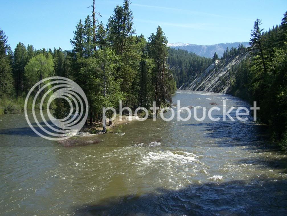
Anyway, on to the tiny mountain burg of Plain. As I crossed the Wenatchee River, I noticed two things: 1) a real cool rock formation (whitish sloping cliff) and 2) the rising river.
I then found myself in downtown Plain, a bustling town of a few, mostly forest workers, farmers, and people who live off-the-grid.
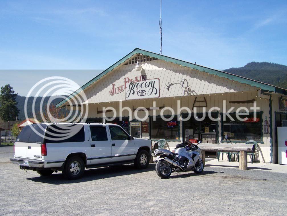
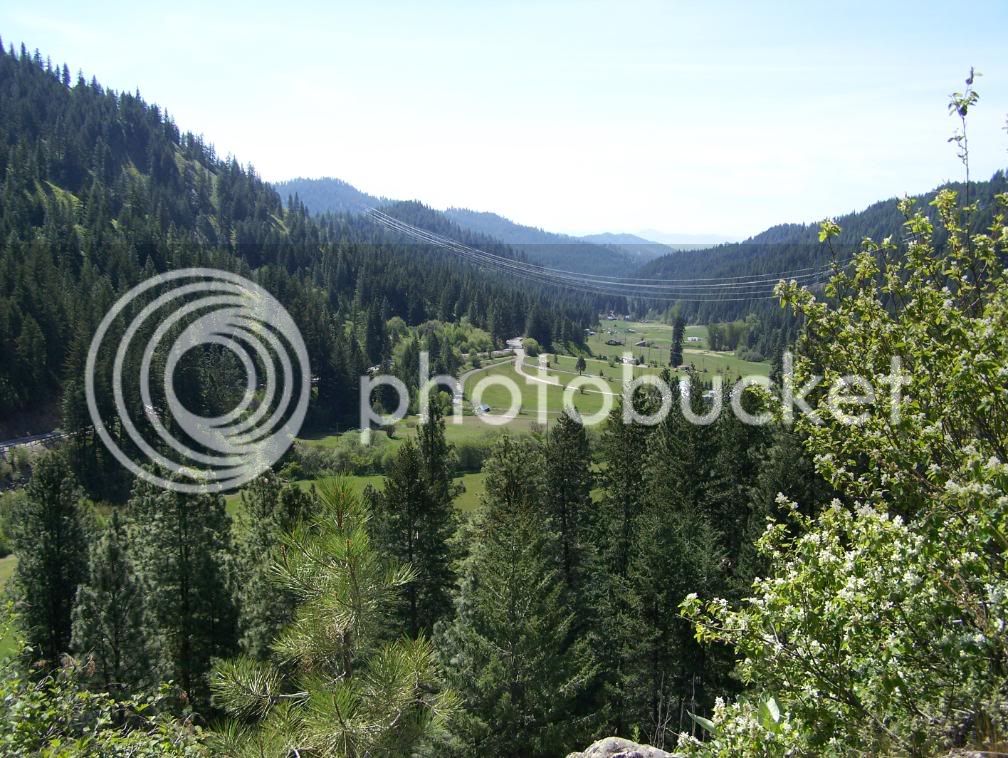
After making a few purchases at The Just Plain Store, I continue south-ish. Oh, but folks, the fun has only just begun. To my surprise, there's a little twisty road that travels up and over a large hill just outside Plain. Shizzammmm! And hot damn! :yahoo: Here's a view of the cool little valley on the other side of the hill.
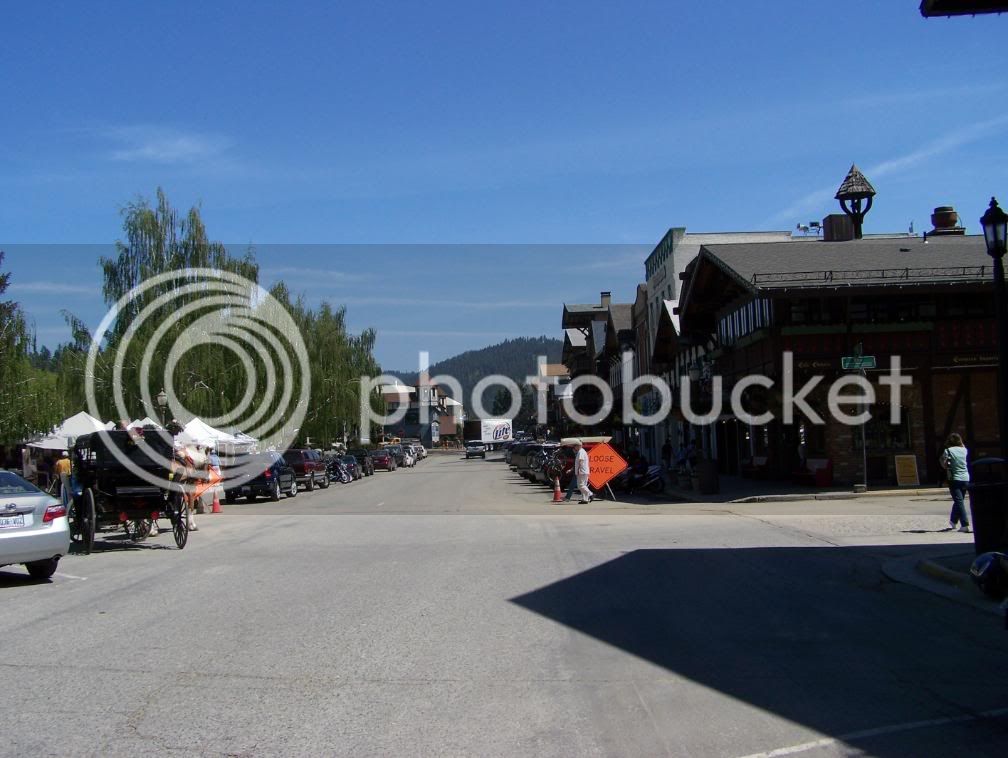
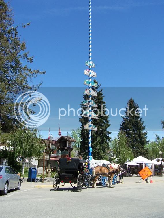
The road settles down a bit and kind of meanders along side Chumstick Creek, thus the name of the road, Chumstick Highway. Duh? On into Leavenworth I went. Leavenworth is usually packed with people from all over the world. I'd say it was about 25% packed. Hmmmmm....
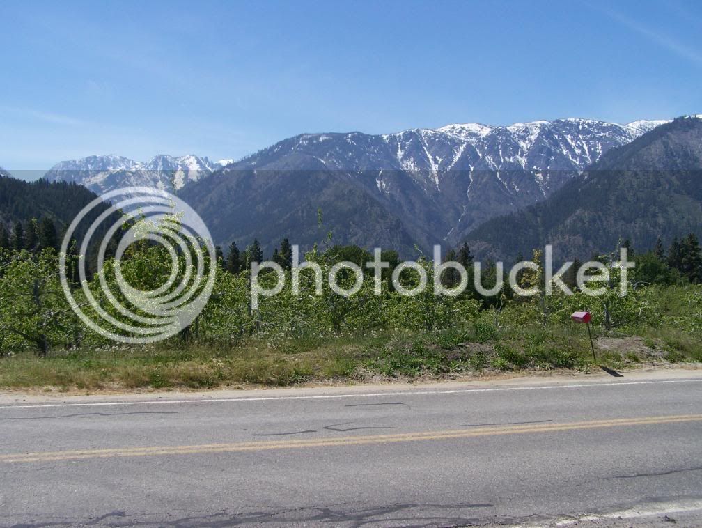
After a short session of people watching, I set out planning to stay on Highway 2 east until 97, the road to Blewitt Pass, however I decided to take a little known country road called North Road. North Road winds through wall to wall fruit orchards and mini-wineries to the back side of Peshastin. Here's a view from one of the many orchards.
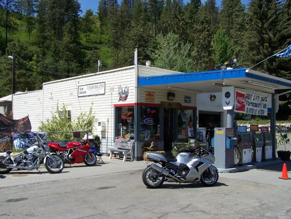
I passed through downtown Peshastin, crossed the bridge and onto Highway 2. At the junction of Highway 2 and the entrance to Peshastin is a funky little bike shop.
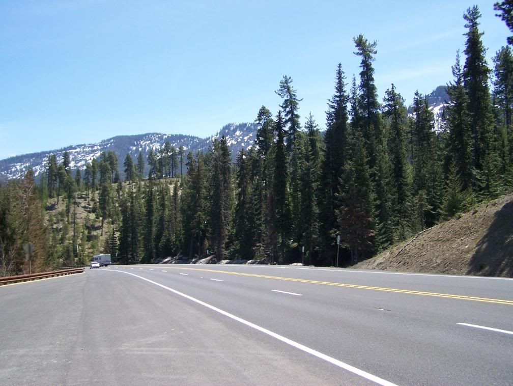
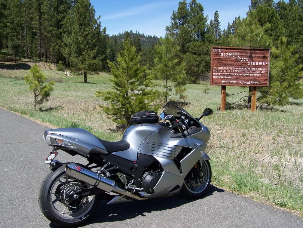
I made my way through the road contruction just east of Peshastin and finally found the cutoff to Blewitt Pass. Folks, Highway 97 was terrific. It appeared to be a brand new surface.... man'oh'man, was it smooth. WDOT has re-lined it so there's more passing zones. The climb is very subtle with lots of fast curves and a few nice twisties thrown in. It was very hard to ignore my righthand requests! Most of the snow has melted. After all, Blewitt Pass is only 4100 feet. This pic was taken at the pass AND where the DOT cameras are installed.
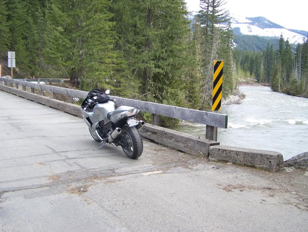
As I continued on down the southern slope, I came upon the cutoff to the old Blewitt Pass Highway. The forest service still maintains sections of the road. It's times like this that I wished I had a dual-sport bike. The single lane semi-paved road winds all through the forest. I drove up the road about a mile or so.
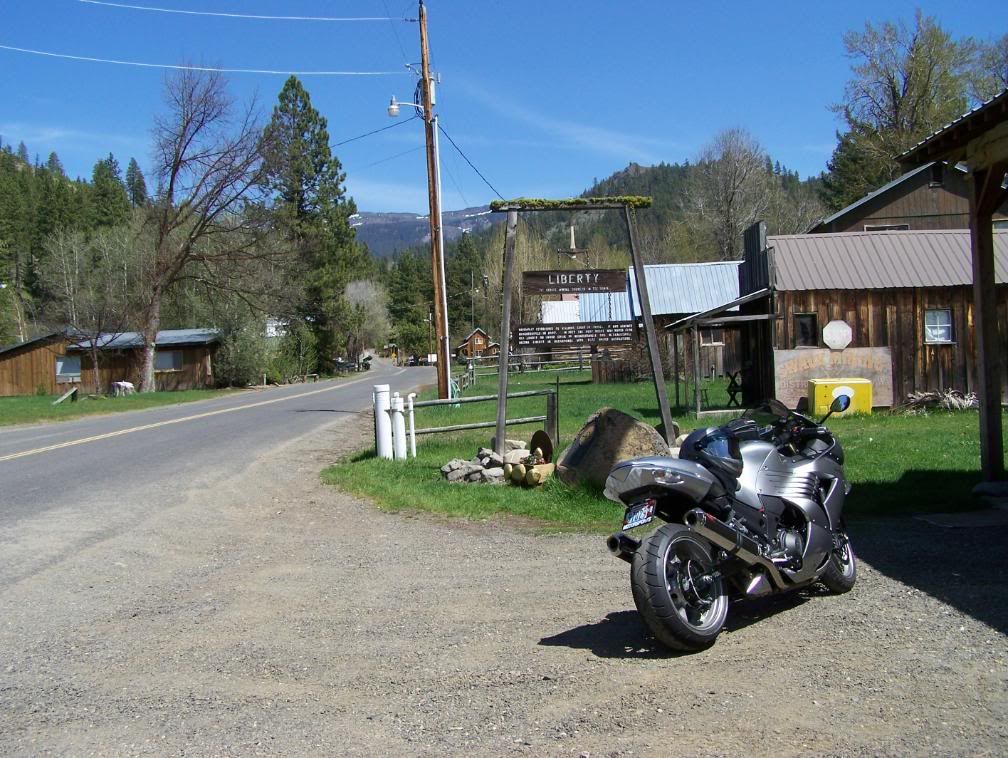
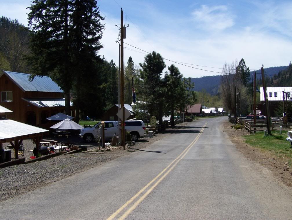
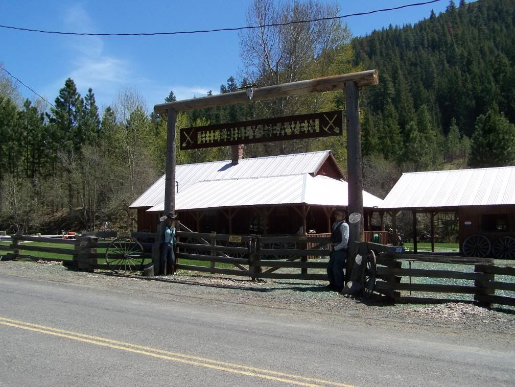
My next stop was Liberty, a tiny active mining town nestled deep in the Wenatchee National Forest. It's definitely off the beaten path. I'm glad I took the time to stop. What a cool little place. People can definitely live off-the-grid there. There's an organization of miners (about 40 in all) that still mine gold. Liberty is one of only a few places on earth where 'string' gold has been found. 'String' gold is worth several times more than regular gold.
Here's the town's firehouse, community center, dance hall, whatever.
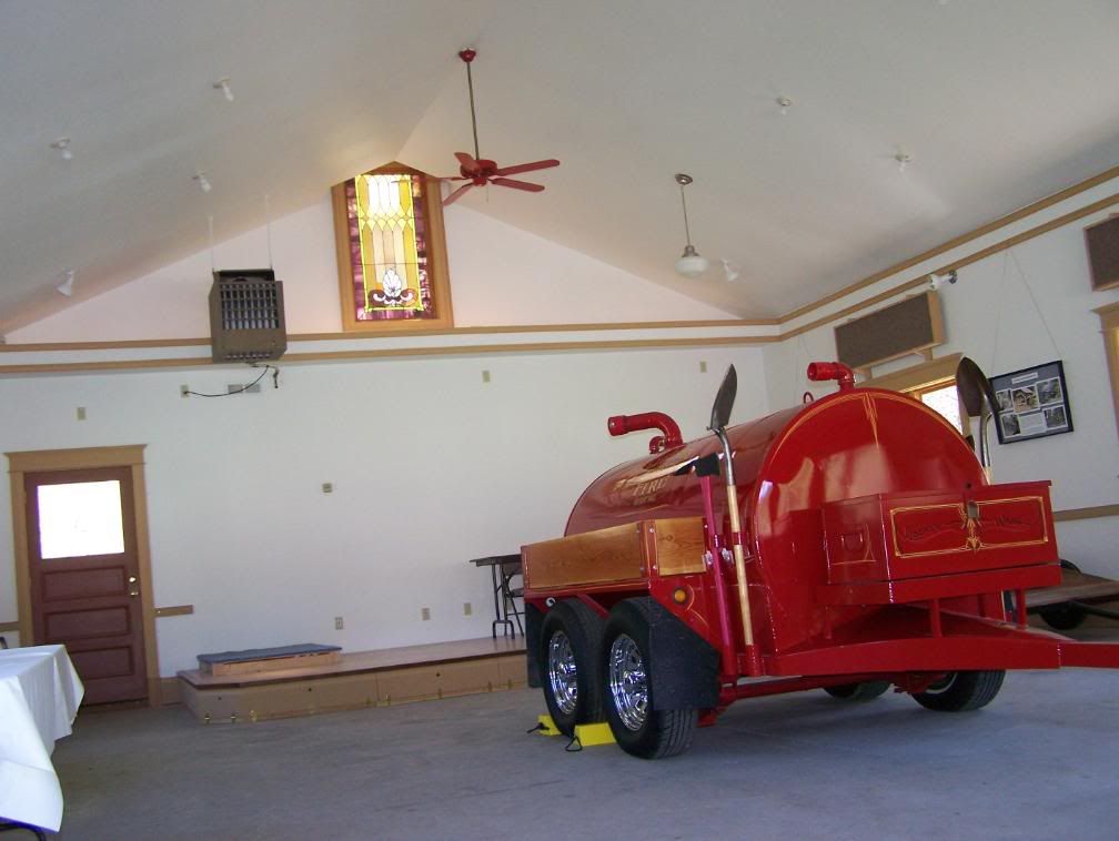
Ah, just what I was looking for......
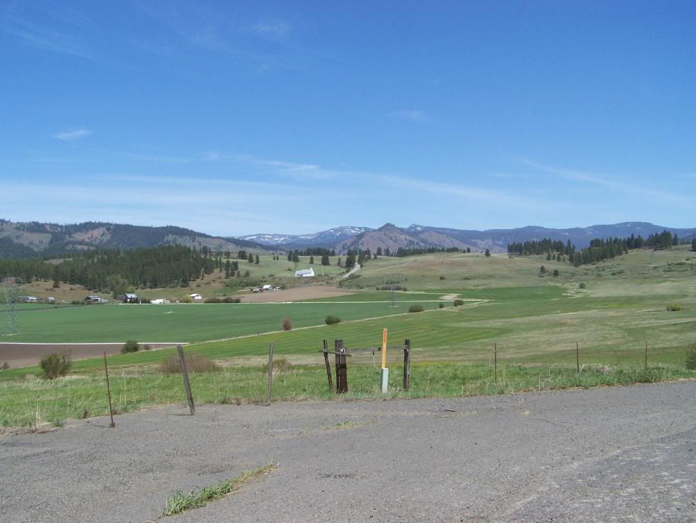
After visiting Liberty, I continued south on 97 through the Swauk Prairie, a very beautiful valley teeming with buffalo, farms and ranches. Due to a variety of reasons, prairies are rapidly disappearing from the American landscape.
A little later, I reached the junction of 97 and 970. I kept to the right to stay on 970 and on into Teanaway and Cle Elum. As I approached Teanaway, I noticed that the Teanaway River was very high and brownish in color. In several places, it appeared the river had breached the banks. Several WDOT crews were out scoping things out.
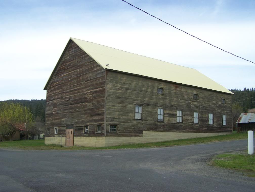
Anyway, after a fuel stop in Cle Elum, I diverted onto 903, motored through Roslyn (more detail in a bit), into Ronald and on to Cle Elum Lake and Salmon la Sac. Here's a very big old structure in Ronald. I don't know what it was. There was no signage and only two doors... one at each end. The entire building is built with hand sawed square-cut timber.
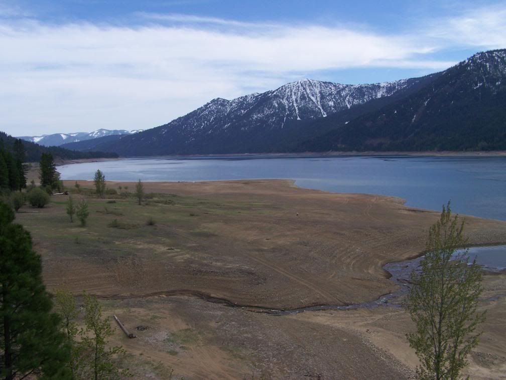
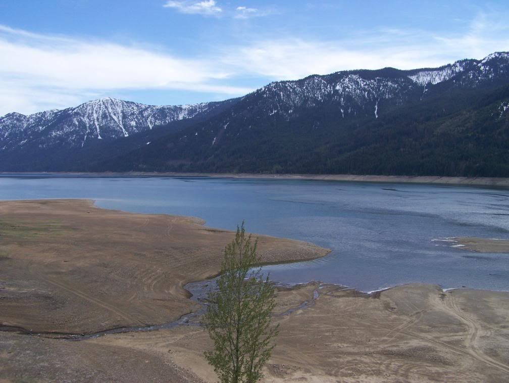
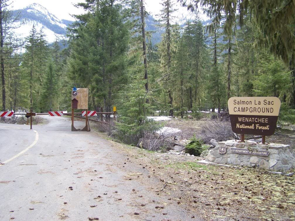
This next series of pictures are of Cle Elum Lake and Salmon la Sac (the actual end of the Highway 903). From Salmon la Sac, the road(s) and trails wind way up into the Alpine Lakes Wilderness area of the Cascade range. This area is prime for backpackers and horse packing. Even though the lake is low, it won't take too much time to fill back up. The Cle Elum River was raging and nearly overflowing its banks. Also, when the lake is low, it becomes an off-roaders paradise. There were lots of 4-wheelers and dirt bikes running around all over the place.
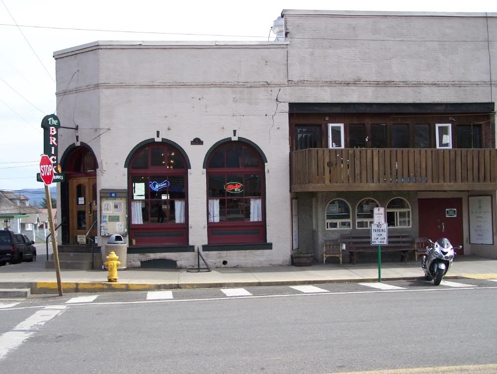
I backtracked through Ronald and into Roslyn. As you probably know, Roslyn has been the filming site of several movies including Northern Exposure. It's a cute little town. Of course, I visited the world famous Brick Tavern. In 1889 (the year Washington gained statehood), the tavern first opened. In 1898, the tavern was rebuilt out of 45,000 bricks and took the name "The Brick." It is the second oldest continuously operating tavern in Washington.
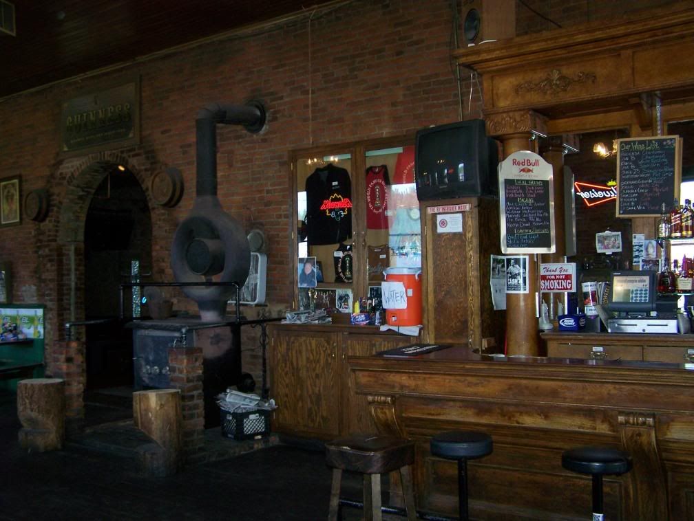
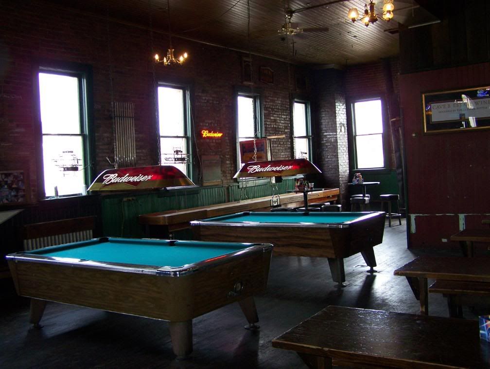
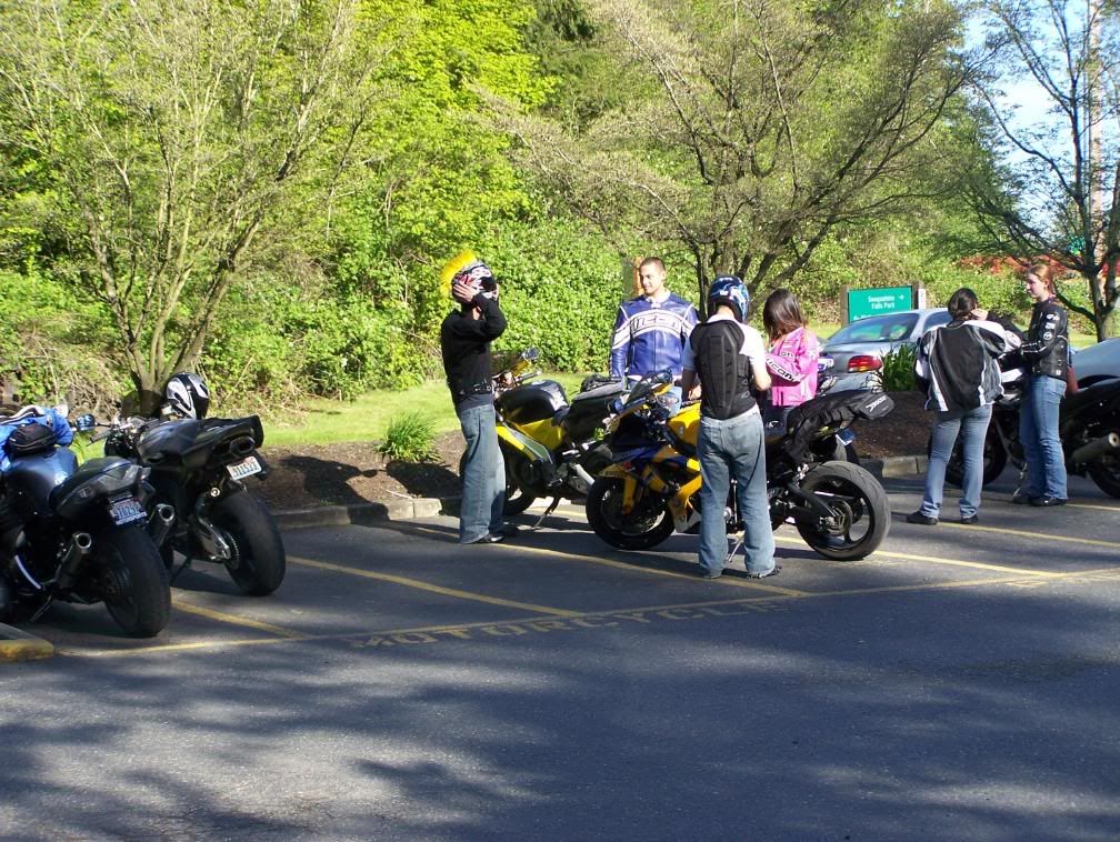
After enjoying a Swiss Mushroom Burger, yummy potato salad and a cold brewsky at the Brick, I make my way to I-90 via Bullfrog Road. I really don't like I-90. But I had to ride on a part of it to get to the North Bend cutoff. I get on the westbound on-ramp, make my way through the maze of I-90 crazy cagers, up the eastern slope of the central Cascades, across Snoquamie Pass, and down the western slope to the Highway 202 exit. I motored through North Bend and Snoqualmie (really cool little towns, by the way!) and into the Snoqualmie Falls parking lot. And to my surprise, I met some of the PNWRiders.com forum folks. They were just leaving to ride to the Triple X restaurant located in Issaquah.
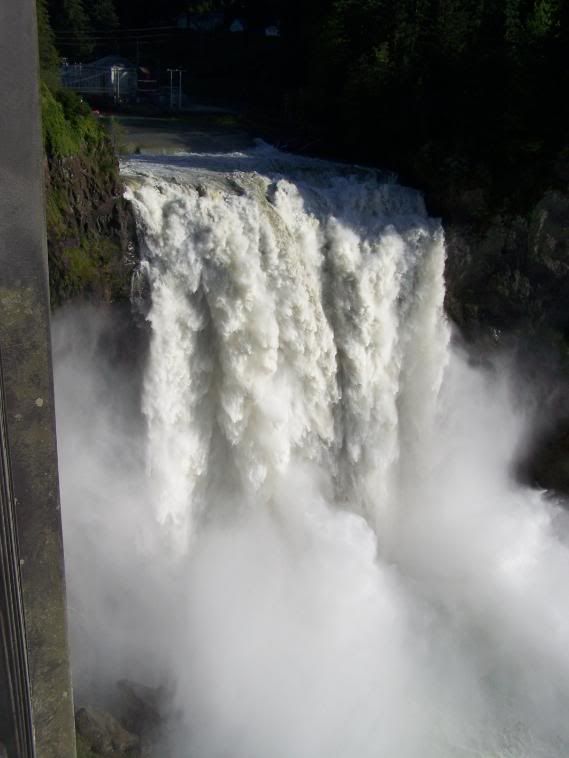
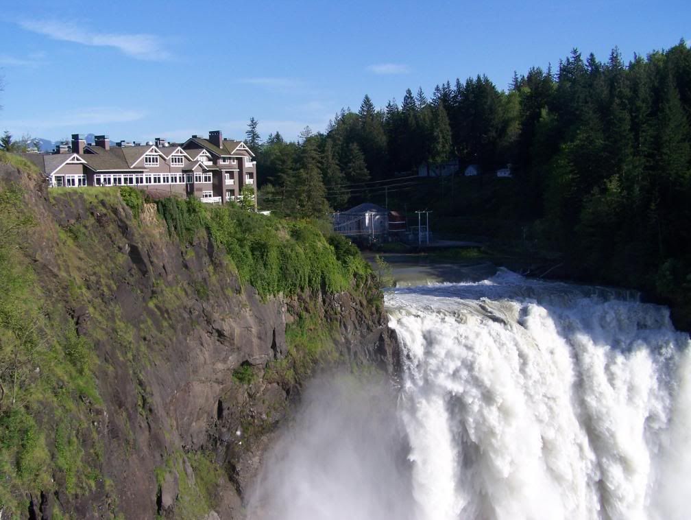
As you can see, the falls were spectacular! I've only seen the falls in the summer when the river is fairly low. Truly, Mother Nature at work. That's the Snoqualmie Lodge perched next to the falls.
After taking pictures from the lookout point, I ordered a hot vanilla latte and sat back to enjoy the moment. I have been given a gift... the ability to ride on a motorcycle anywhere I want to go in this fabulous country. It just can't get any better than that.
Well, the end of the journey is near. A full day of riding and exploring this great land. Getting back in the saddle, I laughed and grinned through the very nice twisties just west of the falls, and continued enjoying the beautiful countryside as I made my way homeward through Fall City (the stupid under-contruction-forever roundabout), Carnation (Pete's Pub & Beer Garden was packed with cruiser folks... what else is new?) and Duvall via 203. As I scooted along the Tualco Valley and into the outskirts of Monroe, the sun was just starting to duck behind the Olympic Mountains and the western horizon.
As I passed the Evergreen Fairgrounds, I noticed it was packed with horse events on one end and the annual Spring Auto Flea Market on the other. Lots and lots of people enjoying the beaautiful weather.
As I rolled into the driveway, my sweetheart had the garage door already open for me. What a gal!
Next stop..... the hot tub! :yahoo:
Final word and observation: Sitting upon nearly every cruiser I saw on todays ride was the "typical" beany capped, patch infested vests or some HD store logo on a wife-beater t-shirt, bare armed Neanderthals (and their pillions mostly dressed like 1960's motorcycle movie hookers). I'm sorry for the stereotyping but damn, folks. :blink: Done now.
Route: Highway 2 to Stevens Pass, cutoff Highway 2 to Lake Wenachee and Plain on 207, and into Leavenworth via the Chumstick Highway. South on Highway 97, across Blewitt Pass and on into Teanaway via 970. West to Cle Elum and on to Roslyn. North on 903 through Ronald, along side Cle Elum Lake to Salmon la Sac. Returning to Cle Elum and onto I-90 west, across Snoqualmie Pass, taking the 202 cutoff to North Bend, and a stop at Snoqualmie Falls. Then north on 203, through Fall City, Carnation, Duvall and home.
Major stops: Plain, Leavenworth, Blewitt Pass, Roslyn, Snoqualmie Falls
Addition Ride Info: I personally use the "Destinations Highways" book to help develop my routes and to find cool off-the-beaten-track ride routes. I've never been to Lake Wenatchee or Plain nor Blewitt Pass. This trip is shorter in miles (about 300) than last weeks North Cascade Loop Run, however I have planned to stop at more places. This trip is a more sedate, touring, enjoying the journey, photo-taking type of ride.
The Trip:
Sooooo.........
I woke up to a beautiful sunny day (very rare up here in the Northwest lately!). I had prepared the travelling gear the night before so after a quick shower (making sure to powder-up the bum area!
) and a fresh brewed cup of java, I rolled the Silver Bullet out of the garage. All systems were go.I once again headed east on good old Highway 2, through Sultan, Startup, Gold Bar and Skykomish. Traffic was very light. I'm starting to suspect a trend. $4.00 ++ a gallon?? Hmmmmmm.... :glare:
I stopped at the usually places (Steven's Pass, etc.) I didn't take any pictures because they'd look almost identical to last weeks pictures :blink: (as journalled in last week's Silver Bullets Run).... except the coffee folks weren't at the reststop. WTF? I NEED MORE COFFEE! :angry:
Okay, after much knashing of teeth and stomping around in a coffee-deprived frenzy, I continued on my journey.
At Cole's Corner, I took a left on 207, a nice little road lined with lodges and B & B's.... except the road was being oiled! :dribble: I tip-toed on the road edges to avoid the goop until I finally reached the turn-off to Plain. Because of the road oiling, I decided not to visit Lake Wenatchee on this trip.
Anyway, on to the tiny mountain burg of Plain. As I crossed the Wenatchee River, I noticed two things: 1) a real cool rock formation (whitish sloping cliff) and 2) the rising river.
I then found myself in downtown Plain, a bustling town of a few, mostly forest workers, farmers, and people who live off-the-grid.
After making a few purchases at The Just Plain Store, I continue south-ish. Oh, but folks, the fun has only just begun. To my surprise, there's a little twisty road that travels up and over a large hill just outside Plain. Shizzammmm! And hot damn! :yahoo: Here's a view of the cool little valley on the other side of the hill.
The road settles down a bit and kind of meanders along side Chumstick Creek, thus the name of the road, Chumstick Highway. Duh? On into Leavenworth I went. Leavenworth is usually packed with people from all over the world. I'd say it was about 25% packed. Hmmmmm....
After a short session of people watching, I set out planning to stay on Highway 2 east until 97, the road to Blewitt Pass, however I decided to take a little known country road called North Road. North Road winds through wall to wall fruit orchards and mini-wineries to the back side of Peshastin. Here's a view from one of the many orchards.
I passed through downtown Peshastin, crossed the bridge and onto Highway 2. At the junction of Highway 2 and the entrance to Peshastin is a funky little bike shop.
I made my way through the road contruction just east of Peshastin and finally found the cutoff to Blewitt Pass. Folks, Highway 97 was terrific. It appeared to be a brand new surface.... man'oh'man, was it smooth. WDOT has re-lined it so there's more passing zones. The climb is very subtle with lots of fast curves and a few nice twisties thrown in. It was very hard to ignore my righthand requests! Most of the snow has melted. After all, Blewitt Pass is only 4100 feet. This pic was taken at the pass AND where the DOT cameras are installed.
As I continued on down the southern slope, I came upon the cutoff to the old Blewitt Pass Highway. The forest service still maintains sections of the road. It's times like this that I wished I had a dual-sport bike. The single lane semi-paved road winds all through the forest. I drove up the road about a mile or so.
My next stop was Liberty, a tiny active mining town nestled deep in the Wenatchee National Forest. It's definitely off the beaten path. I'm glad I took the time to stop. What a cool little place. People can definitely live off-the-grid there. There's an organization of miners (about 40 in all) that still mine gold. Liberty is one of only a few places on earth where 'string' gold has been found. 'String' gold is worth several times more than regular gold.
Here's the town's firehouse, community center, dance hall, whatever.
Ah, just what I was looking for......
After visiting Liberty, I continued south on 97 through the Swauk Prairie, a very beautiful valley teeming with buffalo, farms and ranches. Due to a variety of reasons, prairies are rapidly disappearing from the American landscape.
A little later, I reached the junction of 97 and 970. I kept to the right to stay on 970 and on into Teanaway and Cle Elum. As I approached Teanaway, I noticed that the Teanaway River was very high and brownish in color. In several places, it appeared the river had breached the banks. Several WDOT crews were out scoping things out.
Anyway, after a fuel stop in Cle Elum, I diverted onto 903, motored through Roslyn (more detail in a bit), into Ronald and on to Cle Elum Lake and Salmon la Sac. Here's a very big old structure in Ronald. I don't know what it was. There was no signage and only two doors... one at each end. The entire building is built with hand sawed square-cut timber.
This next series of pictures are of Cle Elum Lake and Salmon la Sac (the actual end of the Highway 903). From Salmon la Sac, the road(s) and trails wind way up into the Alpine Lakes Wilderness area of the Cascade range. This area is prime for backpackers and horse packing. Even though the lake is low, it won't take too much time to fill back up. The Cle Elum River was raging and nearly overflowing its banks. Also, when the lake is low, it becomes an off-roaders paradise. There were lots of 4-wheelers and dirt bikes running around all over the place.
I backtracked through Ronald and into Roslyn. As you probably know, Roslyn has been the filming site of several movies including Northern Exposure. It's a cute little town. Of course, I visited the world famous Brick Tavern. In 1889 (the year Washington gained statehood), the tavern first opened. In 1898, the tavern was rebuilt out of 45,000 bricks and took the name "The Brick." It is the second oldest continuously operating tavern in Washington.
After enjoying a Swiss Mushroom Burger, yummy potato salad and a cold brewsky at the Brick, I make my way to I-90 via Bullfrog Road. I really don't like I-90. But I had to ride on a part of it to get to the North Bend cutoff. I get on the westbound on-ramp, make my way through the maze of I-90 crazy cagers, up the eastern slope of the central Cascades, across Snoquamie Pass, and down the western slope to the Highway 202 exit. I motored through North Bend and Snoqualmie (really cool little towns, by the way!) and into the Snoqualmie Falls parking lot. And to my surprise, I met some of the PNWRiders.com forum folks. They were just leaving to ride to the Triple X restaurant located in Issaquah.
As you can see, the falls were spectacular! I've only seen the falls in the summer when the river is fairly low. Truly, Mother Nature at work. That's the Snoqualmie Lodge perched next to the falls.
After taking pictures from the lookout point, I ordered a hot vanilla latte and sat back to enjoy the moment. I have been given a gift... the ability to ride on a motorcycle anywhere I want to go in this fabulous country. It just can't get any better than that.
Well, the end of the journey is near. A full day of riding and exploring this great land. Getting back in the saddle, I laughed and grinned through the very nice twisties just west of the falls, and continued enjoying the beautiful countryside as I made my way homeward through Fall City (the stupid under-contruction-forever roundabout), Carnation (Pete's Pub & Beer Garden was packed with cruiser folks... what else is new?) and Duvall via 203. As I scooted along the Tualco Valley and into the outskirts of Monroe, the sun was just starting to duck behind the Olympic Mountains and the western horizon.
As I passed the Evergreen Fairgrounds, I noticed it was packed with horse events on one end and the annual Spring Auto Flea Market on the other. Lots and lots of people enjoying the beaautiful weather.
As I rolled into the driveway, my sweetheart had the garage door already open for me. What a gal!
Next stop..... the hot tub! :yahoo:
Final word and observation: Sitting upon nearly every cruiser I saw on todays ride was the "typical" beany capped, patch infested vests or some HD store logo on a wife-beater t-shirt, bare armed Neanderthals (and their pillions mostly dressed like 1960's motorcycle movie hookers). I'm sorry for the stereotyping but damn, folks. :blink: Done now.
Last edited by a moderator: