


Fontanaman
Robin Trower
Around 2007 and 2008 I road a 1000 cc Vstrom on a couple of the Idaho Backcountry Discovery Routes (IBDR). Great fun but I grew tired of the Vstrom as it was a bit much on the gravel roads. 15% out of control 100% of the time and someday My Time was Gonna Come, cue up some Led Zeppelin, when the front end would inevitably wash out someday. The Vstrom went bye bye shortly after buying the 09 FJR but the dream of riding Idaho dual sport roads lived on.
Fast forward to 2018. I move from Seattle to Spokane. Idaho is right next door and it has some of the best dual sport roads in country. It wasn't long before the mighty DR650 was in my new garage in my new home. Idaho was calling.
Family trips 2018 and 2019 got in the way of a week long dual sport ride. Last year I was hoping to do this ride in September 2019 but the weather turned unseasonably cold. There was no 4-5 day window of good weather - it was snowing at many places where I wanted to go. So 2019 my dual sport dream ride went out the window.
I vowed that would not happen this year leaving July, August and September open for riding the mighty DR650. The window for riding is thin. Snow may not melt out till the second or third week of July. By August the temperatures can exceed 100°, thunderstorms can ruin your day and smoke from forest fires can spoil a great trip plan. Finding Goldilocks weather is pretty damn rare. Maybe 1 in 5 years.
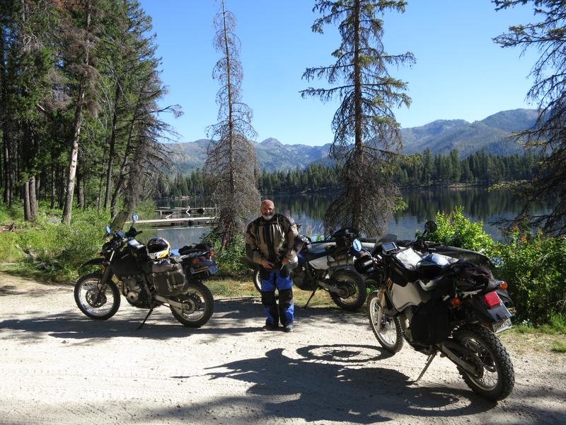
The on Dual Sport thread Bugs learned of my trip plan so we decided to ride this together. His friend Robert joined us. We had 2 DR650s and a Doug's KLR. Robert's 2002 DR650 with around 40k miles has seen better days but it is still rock solid and Robert is a mechanic.
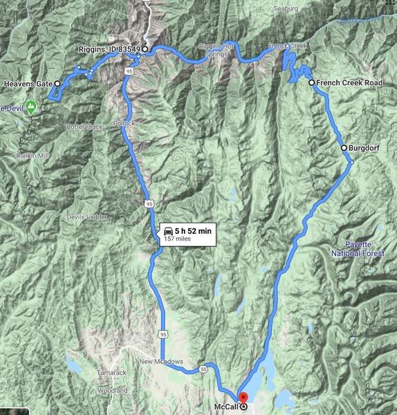
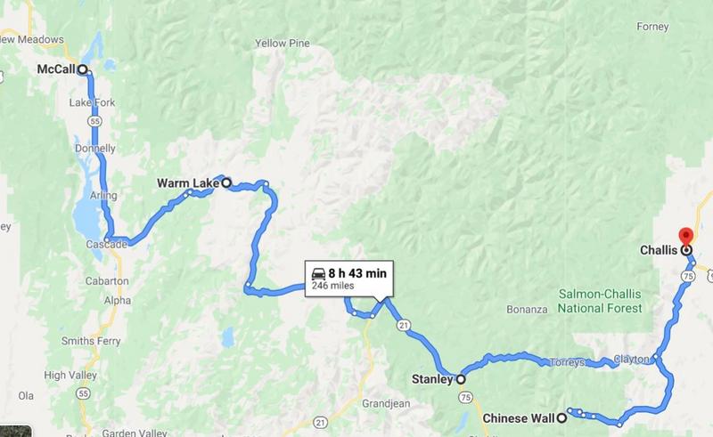
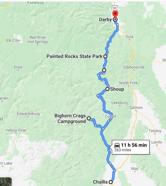
So we hatched a plan to meet in McCall and tour some of the best dual sport routes in Idaho. My sources included personal experience, Mark Sampson's web page BigDogAdventures and Sound Riders! Dual Sport Tour book.
The Garmin 590 comes with City Map North America and it includes all the Forest Service roads we enjoyed. With a little effort (downplayed) I created routes for each day and it never let us down. There was one gap, the road didn't exist on the Garmin map, so the solution was to split the route in half. This worked well.
So that is the backstory.
Day 1.
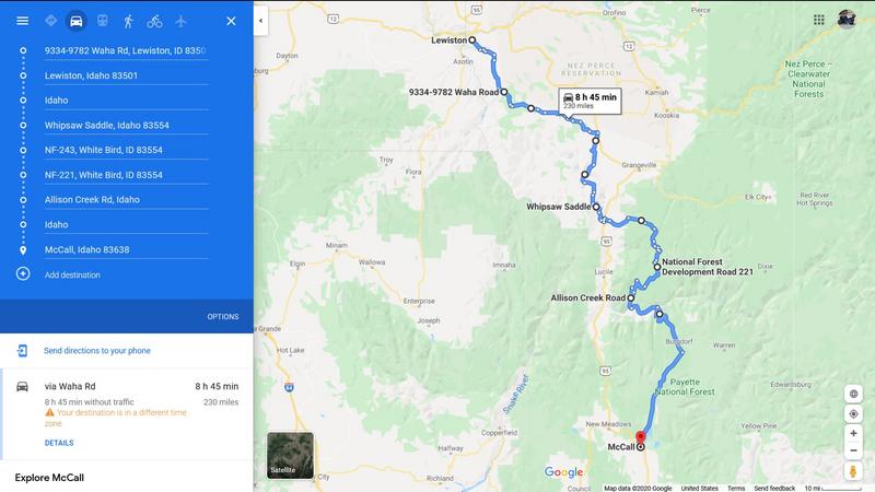
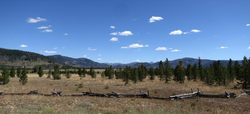
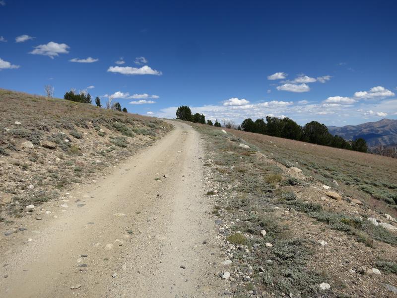
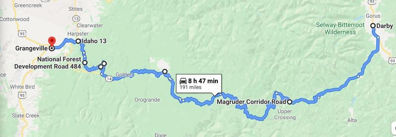
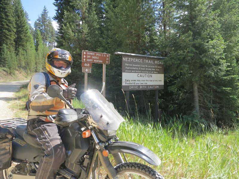
I ride down to Lewiston Idaho from Spokane where get off the main road the remainder of the day. Here is my route from Lewiston along with a image. Google Maps tends to fail on back roads in the winter.
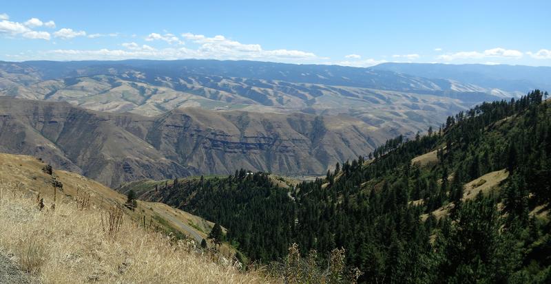
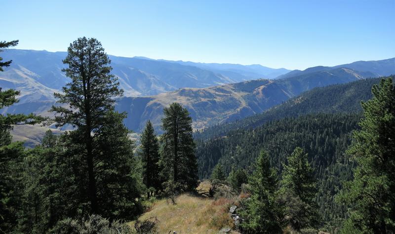
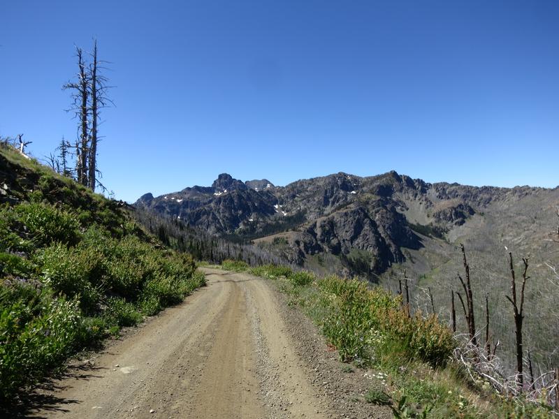
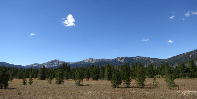
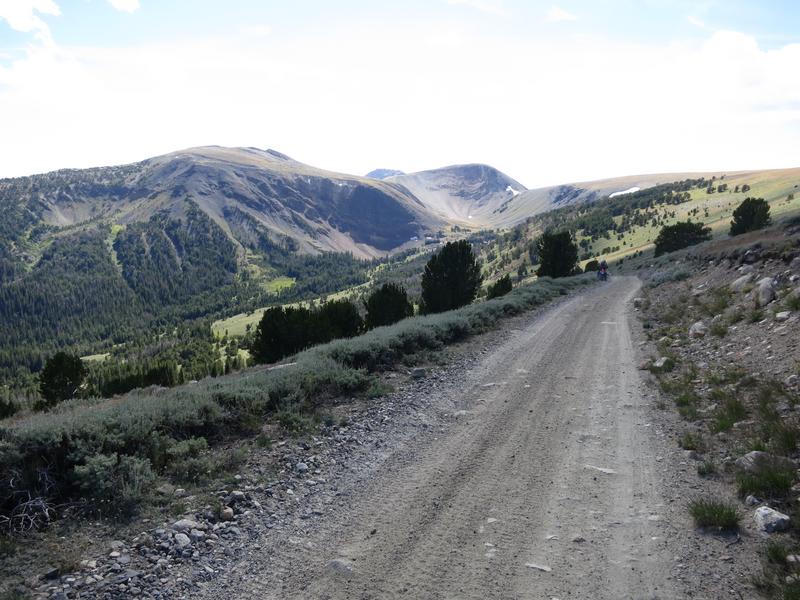
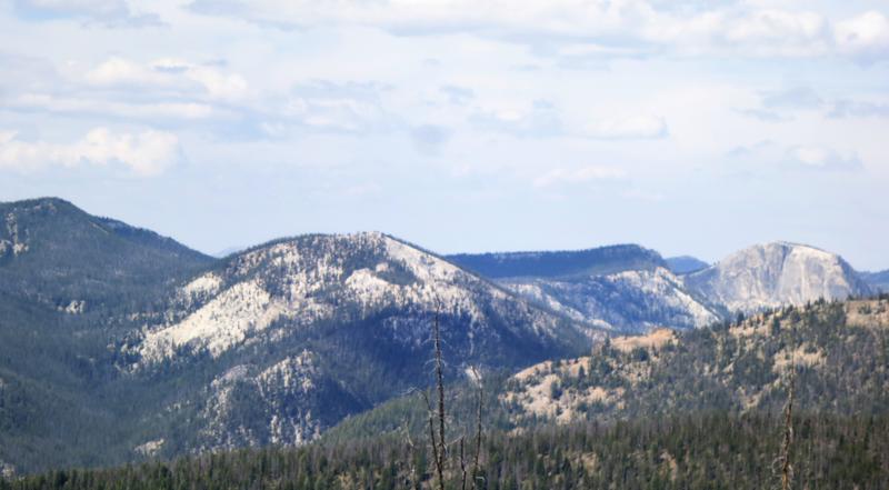
Mountains go forever. Nice.
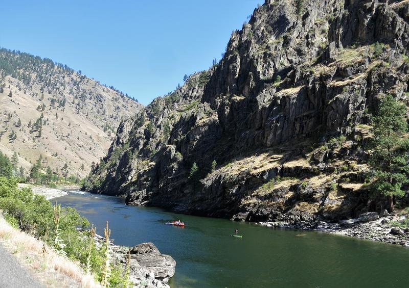
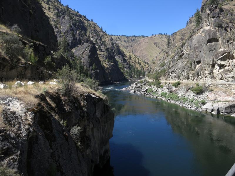
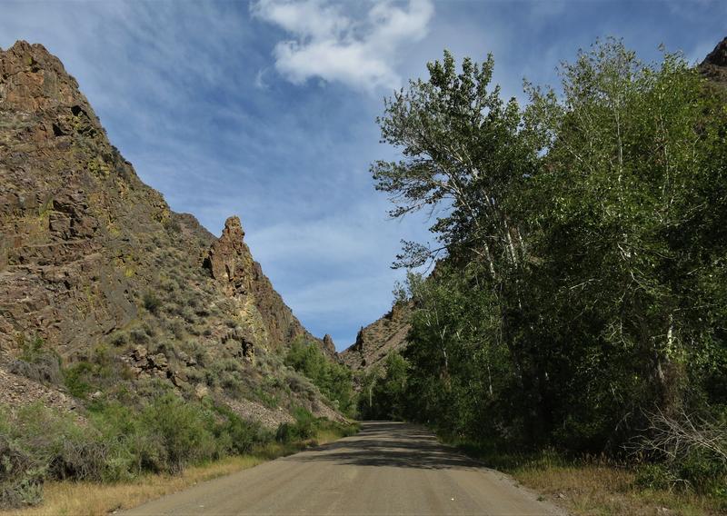
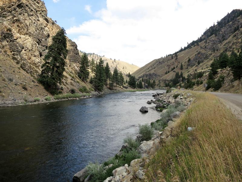
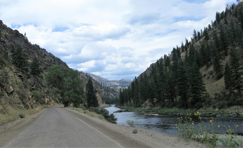
The Salmon River
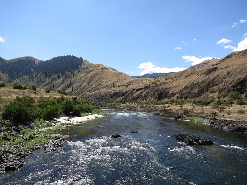
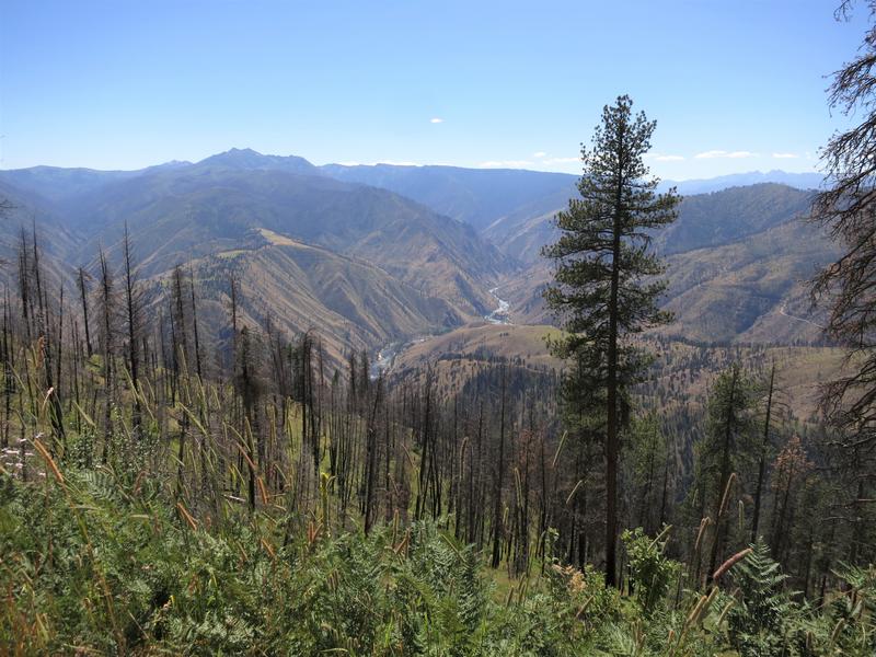
After crossing the river I head back up again. Then just before going down again here is another view of the Salmon River. And that is where I am going.
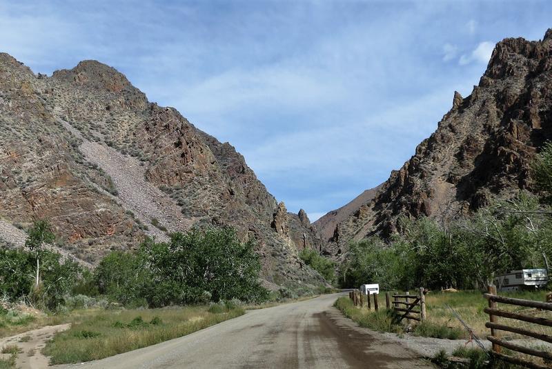
I arrive at the Salmon River road where people are enjoying a float on the river.
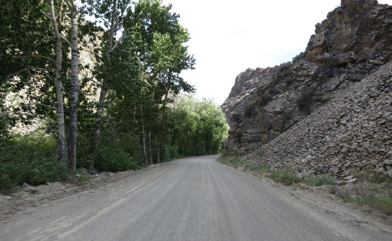
Then I cross this confounded bridge. Doug says it is a half a suspension bridge. I say it is warm out and time to climb up again to cool off.
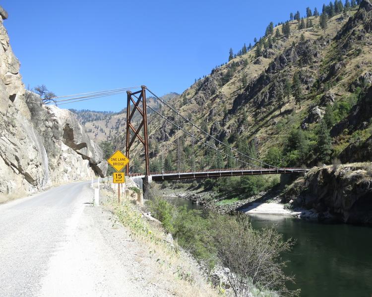
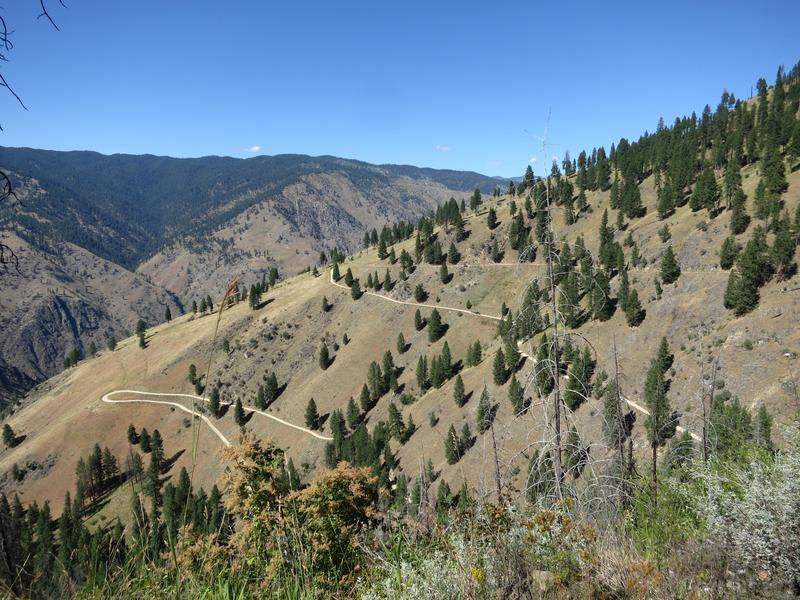
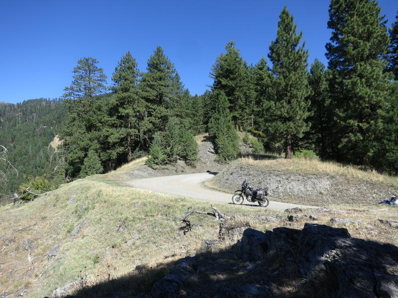
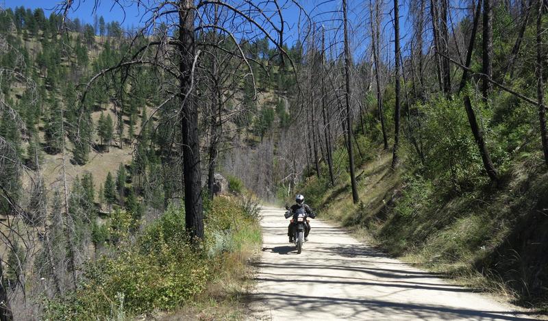
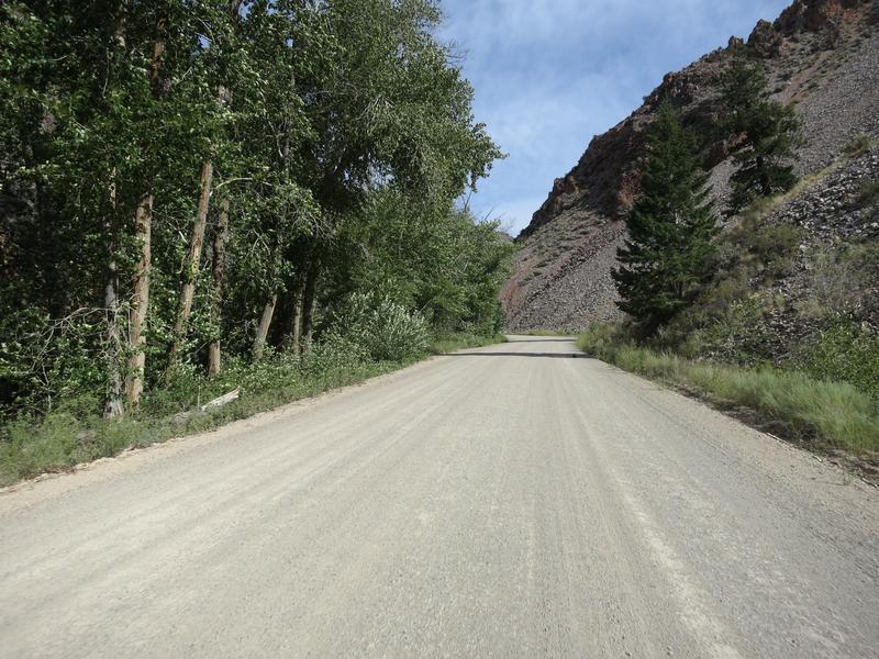
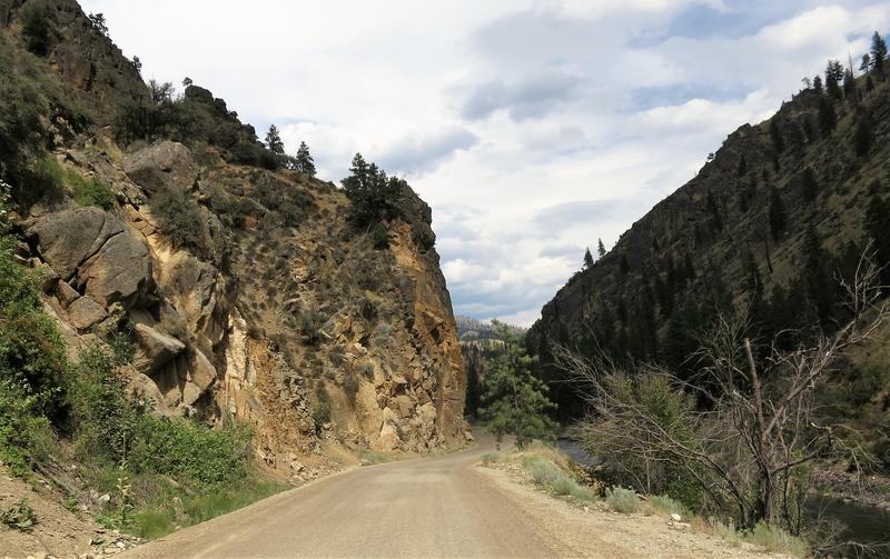
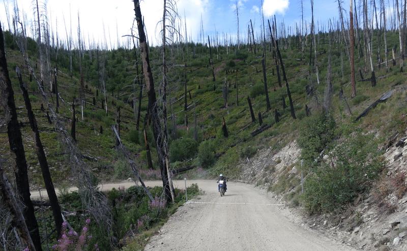
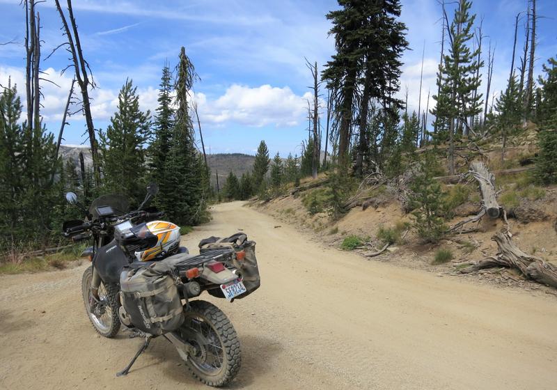
So up French Creek road to find shade and cooler temps. Yep it is a fun as it looks.
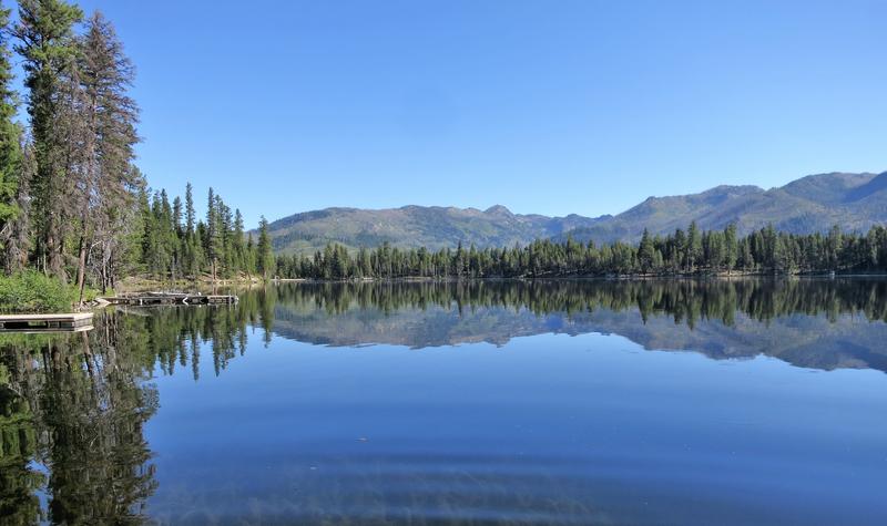
After French Creek it is on into McCall to meet with Doug and Robert. I logged about 350 miles and 230 of that is on backcountry roads. Not a bad day on the mighty DR650.
Day 2.
Did I say this tour was awesome? The weather was absolutely perfect each and every day with temps from mid 50's in the morning to mid 80's in the afternoon but at higher elevations it was in the 70's. And no forest fire smoke. It has been a quiet fire season so far in the Northwest and we are very thankful. Some years this trip would not be possible due to weather or fire.
Today's route was a bit short, only a 160 miles but it was a good way to start the trip after a long day for all of us the day before.
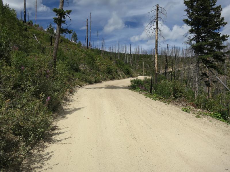
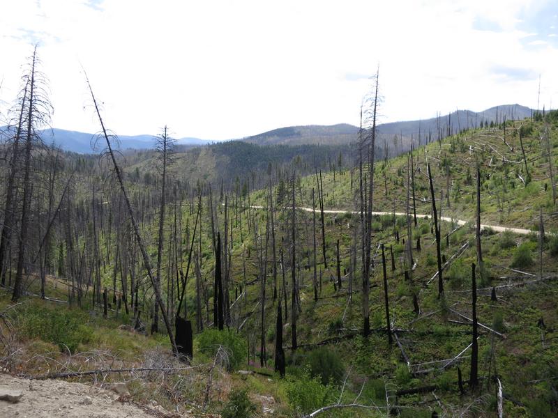
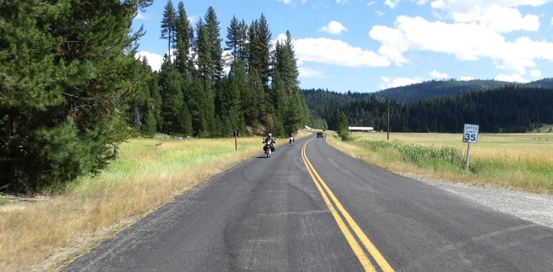
Riding counterclockwise we dispensed with the 45 miles of State and US highway. The rest of the trip was on backcountry roads, mostly unpaved.

The mighty DR650 is happy on backroads especially unpaved ones. It has 36 horsepower and will go 60-70 mph all day. I found 36 horsepower is plenty on a gravel road. It is easy to spin the rear tire and so having more ponies isn't something I need on a gravel road. My newly resprung DR worked great. At this point I am happy with the suspension. It might cost me another $700 to replace the shock and install a fork cartridge. It would be fun to try a DR with those to feel the difference. Instead I spent a few bucks on gear so I can carry water the next time I go out and change where I store my tools.
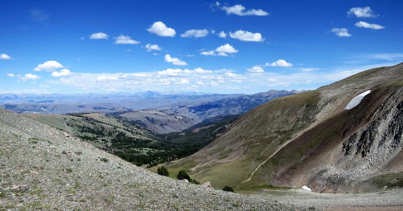
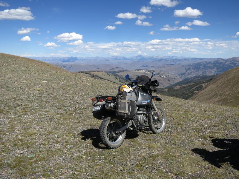
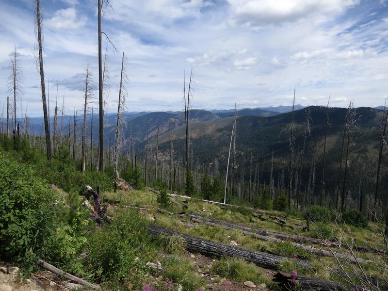
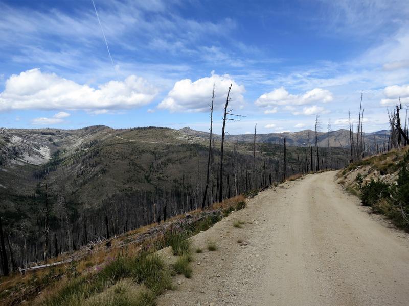
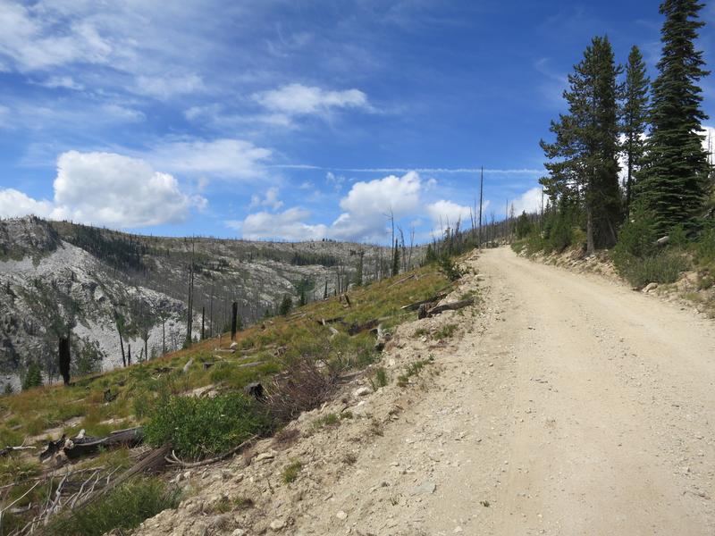
We leave Hwy 95 at the turn off for the Seven Devil's road and begin to climb from 1800' to 8300'. Up and up and up. At one point we could see the Salmon River drainage and the Snake River / Hell's Canyon drainage from the same spot. Nice!
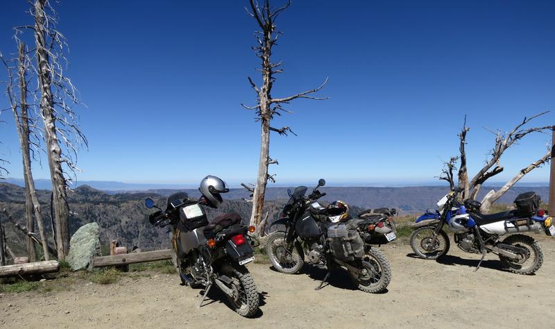
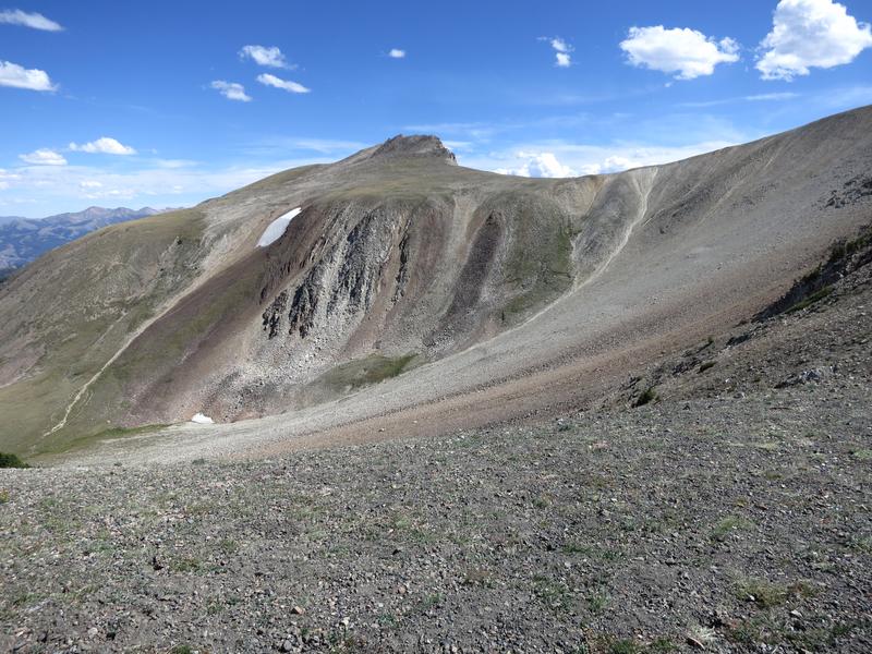
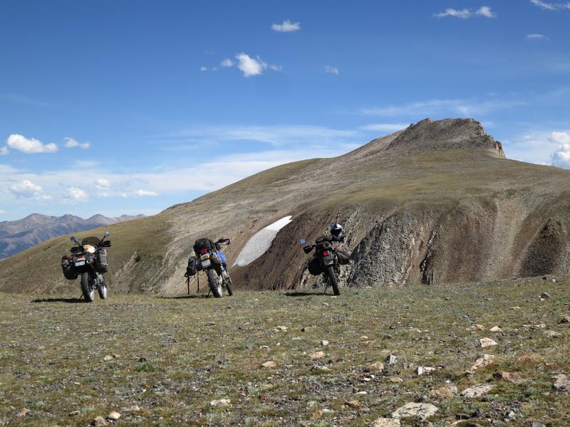
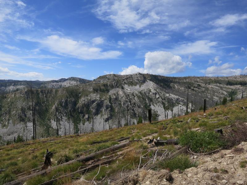
We stopped at a view point to regroup and take a few pictures.
The DR is calling let's go, come on let's go.
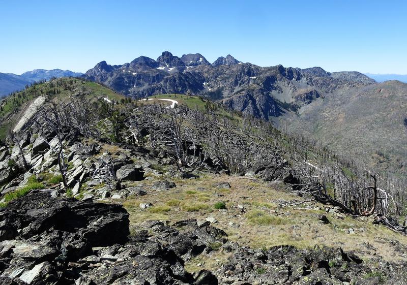
The Seven Devil's each have names. There is He Devil, She Devil and Devil's Throne. Not sure why the remaining peaks don't include the word Devil.
Which Devil this is, oh wait it is Doug!
Here is the me Devil with a peak in the background.
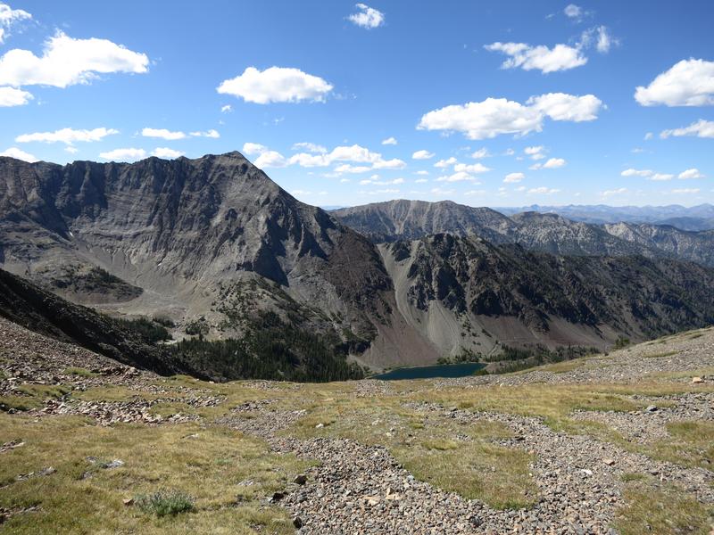
For some reason I thought we could see the Snake River from up here but it wasn't so. Nearby is the Klienschmidt Grade where the river is visible. Been there done that including a jet boat trip on the Snake River so it is great to be here. A new adventure.
The parking lot for the fire lookout tower at Heaven's Gate.
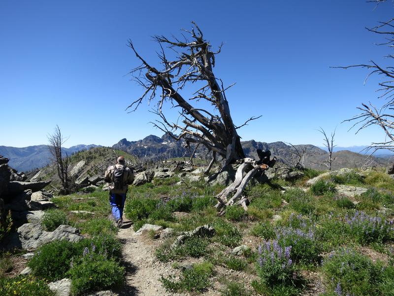
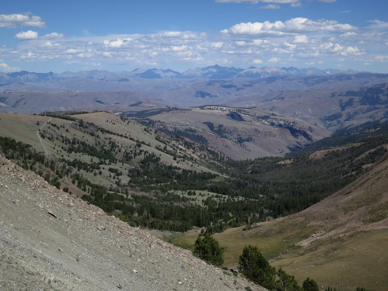
With extra time in our day we hike 0.2 miles up the hill to the fire outlook where the views are 360°. It was worth the effort.
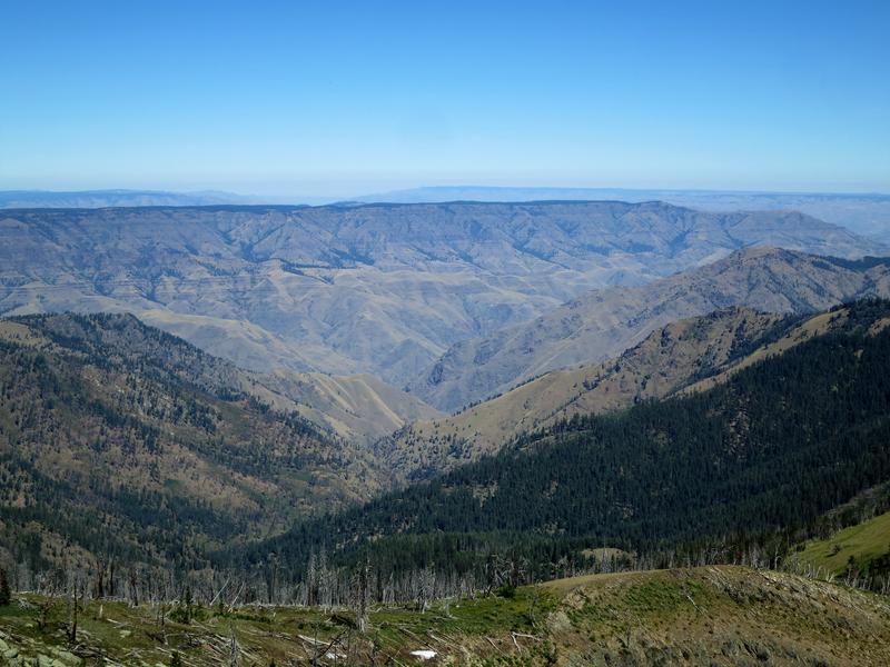
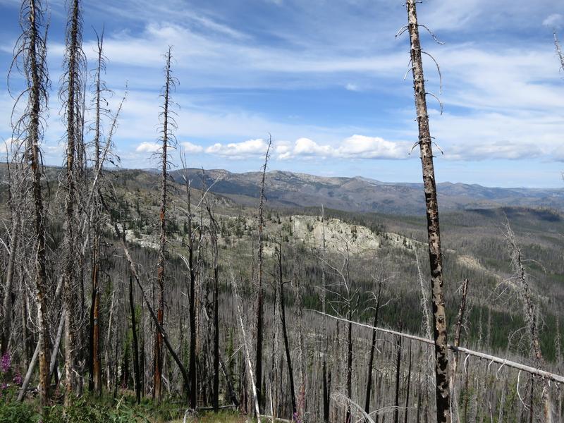
Hell's Canyon, deeper than the Grand Canyon, is below the flat spot on the horizon.
Robert on the way back to the parking lot. And in the parking lot we find a Toyota Prius. No way we'd drive that rig up here. The road was rough in places and the Prius has maybe 7" of ground clearance if that. Hope they made it back.
Devil's on the way out.
We head to Riggins Idaho for lunch and find a bar with great sandwiches. I have something my waistline would regret. Yum!
After lunch it is up the Salmon River road. It starts out paved then goes to gravel. Here is Robert crossing the same bridge I crossed yesterday.
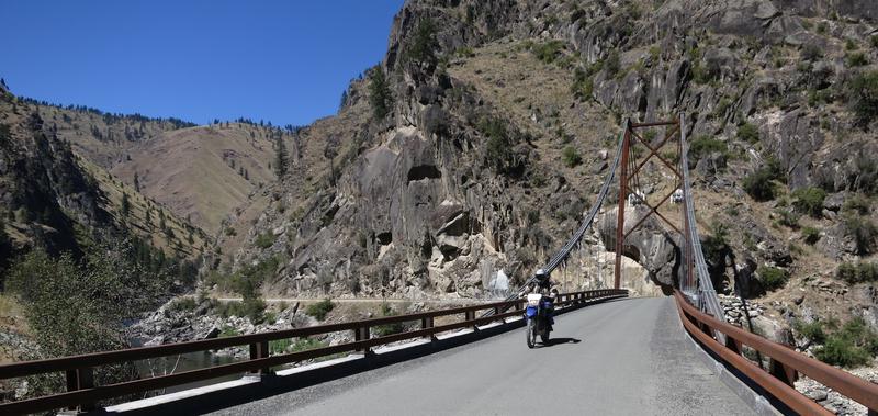
Doug noted it looks like a half of a suspension bridge.
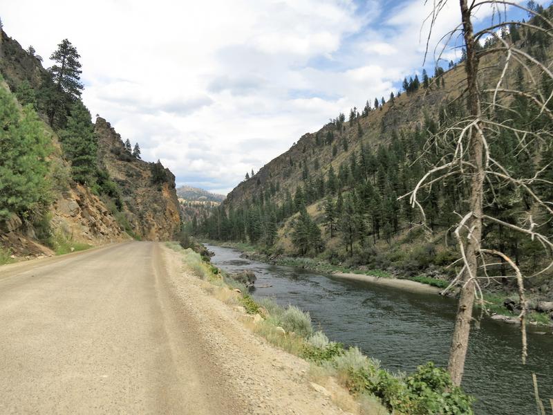
The Salmon River from the bridge.
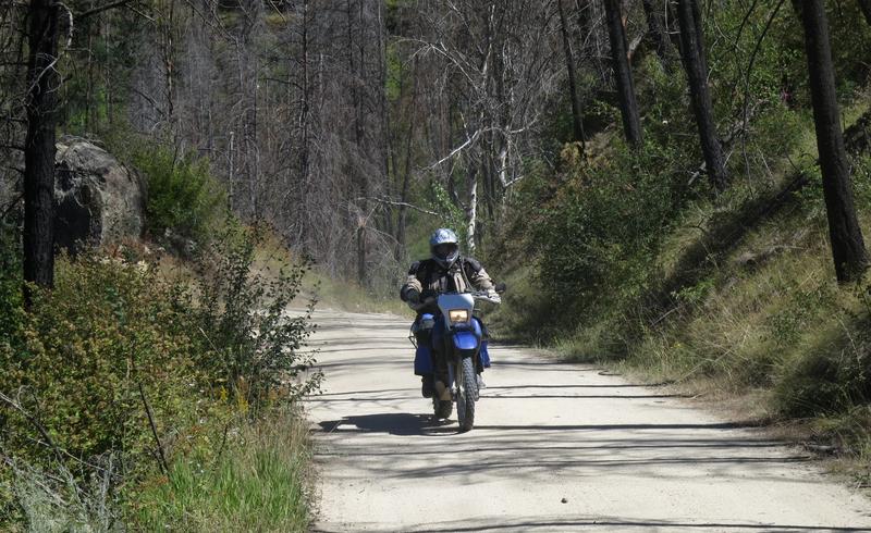
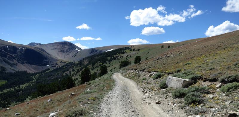
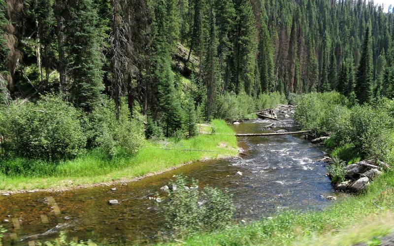
Up the French Creek road we stop several times for photo ops. My favorite is this one.
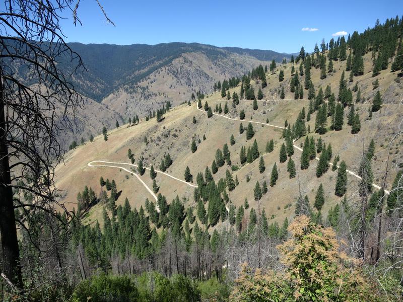
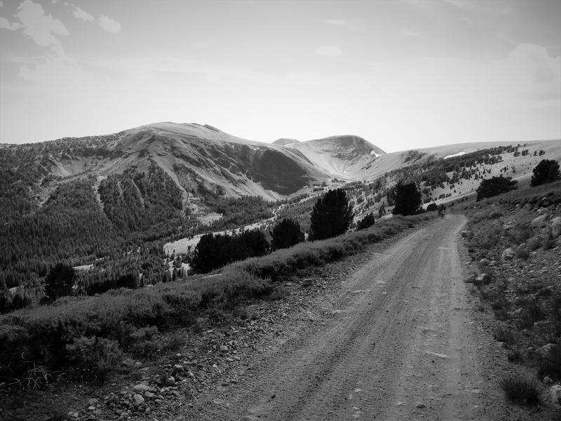
French Creek road climbs from about 2000' to 4800' through the twisty section shown here then to 6400' at Burgdorf Hotspring. It is a great way to cool off.
Doug and Robert along French Creek.
A view on the way to Burgdorf Hotsprings. We didn't take a dip it is closed. I was there last year and the water is hot. My body was submerged with just my head out of the water and my face started sweating within 15 minutes. Nonetheless the it is a very nice spot and attracts a lot of adventure riders.
The road from Burgdorf to McCall is paved and we zipped on back to McCall to have dinner and decide on the route for tomorrow.
Day 3
The original plan was to ride north from McCall to Warren and Yellow Pine via the Warren Wagon Road one of the top notch backcountry routes in Central Idaho. Unfortunately lodging in Stanley was sold out forcing us up the road to Challis.
On Monday night we decided on this alternative.. This saved us about 50-60 miles making it a long day instead of an real real long day. It also set us up for a relaxing day tomorrow. All in all it worked out very well.
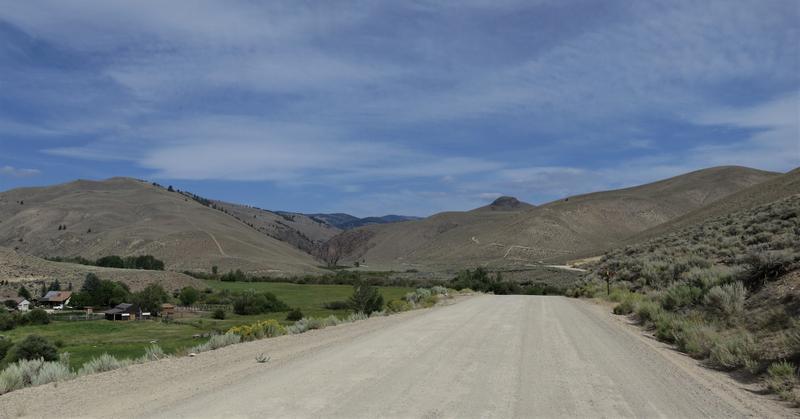
Until this trip I have never been to Warm Lake so this was a new adventure for all of us. I don't know why I was surprise the ride from Hwy 55 to Warm Lake was all paved but it is. Nuts. Oh well it was a pleasant ride and Warm Lake was very scenic.
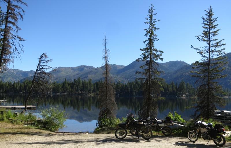
Robert with a big smile at Warm Lake.
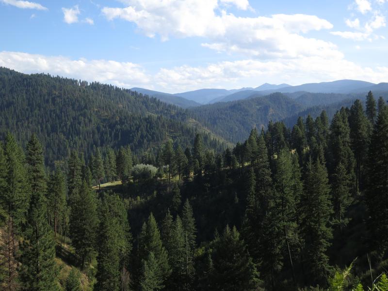
Still on pavement we continue east and climbing 6800' to this viewpoint.
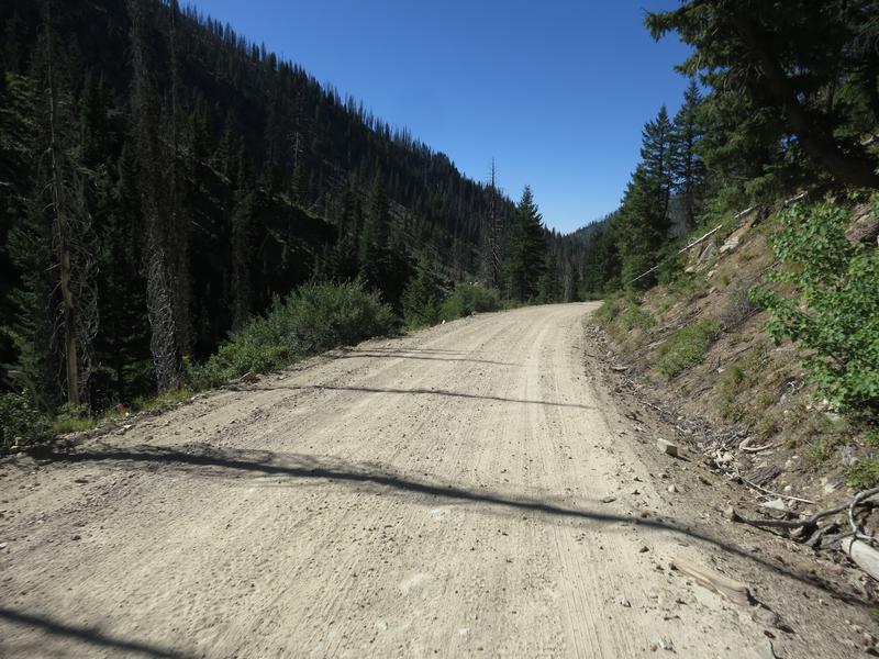
Near Landmark the pavement ends and the surface is 2-3" of fine silty sand. No trouble for the mighty DR650. I road a Vstrom here a few years ago and it wasn't as easy going.
It was a scenic ride back to pavement and for some reason I have no photos of the leg of the ride. Hey a reason to return.
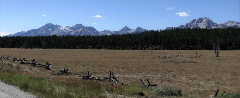
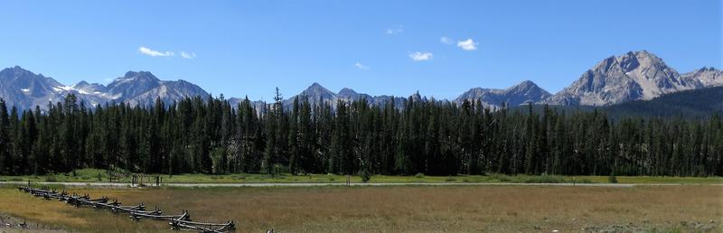
Pavement returns in the form of Hwy 75 and it is on to Stanley Idaho with nice views of the Sawtooth Mountains.
Another picture perfect day.
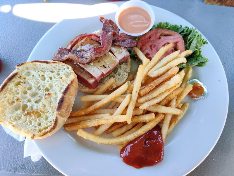
Folks riding a street bike would consider this a highlight of the day. Not us for the best was yet to come! Before we go on though we stop for fuel and lunch. An Ahi Tuna sandwich and it was better than it looks.
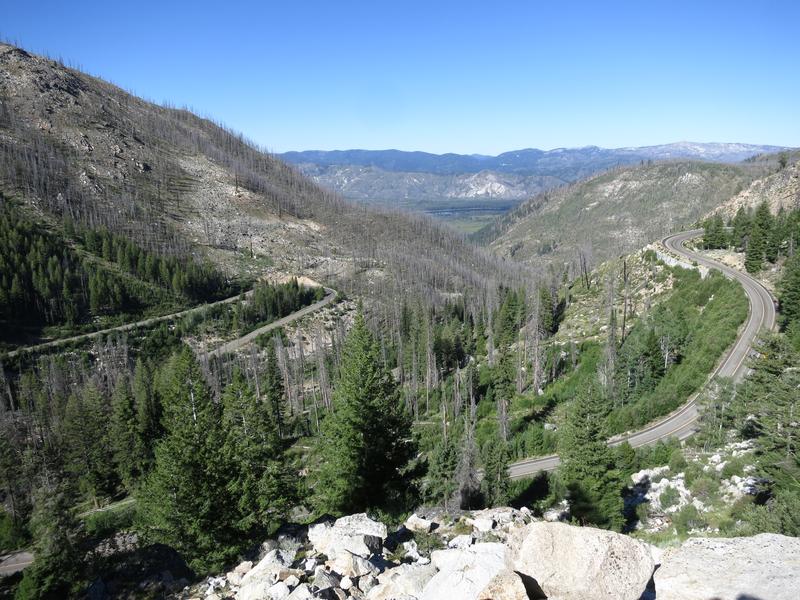
Back on the road to the Chinese Wall the high driveable point in Idaho. This has been on my bucket list for years. We turn off Hwy 75 to E. Fork Rd near Clayton Idaho. East Fork Road was fun and paved for a while. Aspen trees line the road.
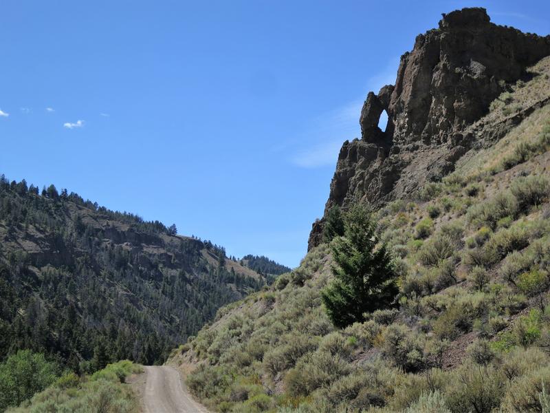
Jug Handle Arch? I don't know but there is a Jug Handle Arch near Arches Utah and it is similar to this.
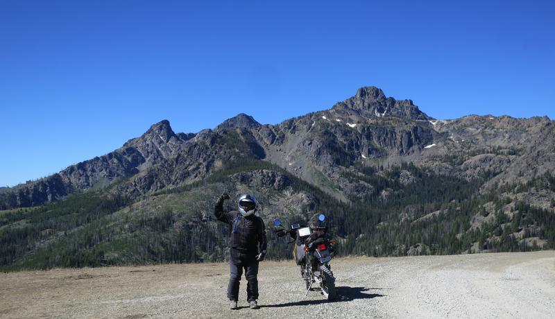
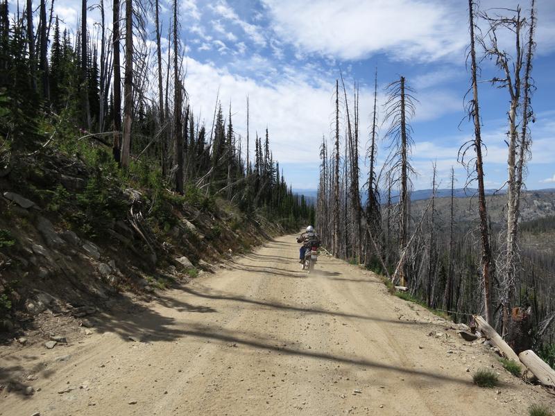
Once the pavement ended the road climbs quickly. Happy to have the DR650 on this road instead of a larger machine. The next photo is close the the top where it levels off.
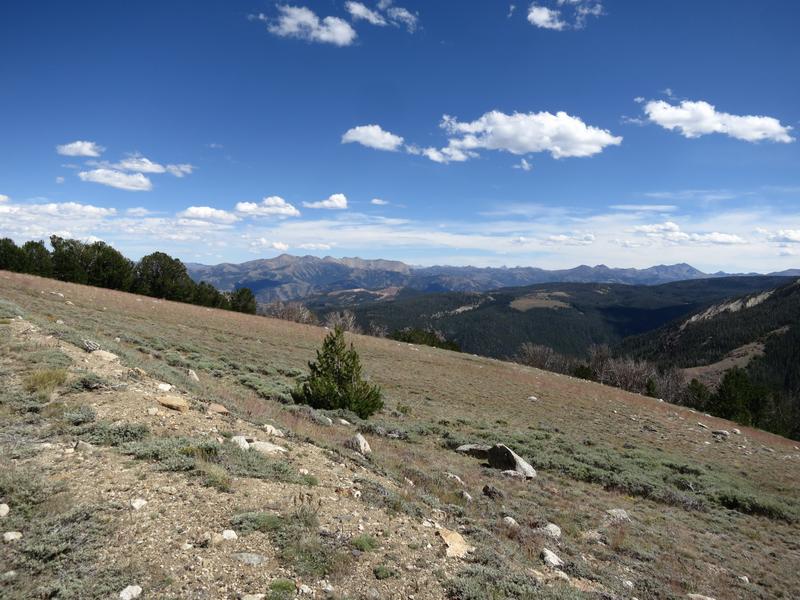
We climb from 5500' to 10400'. Great fun.
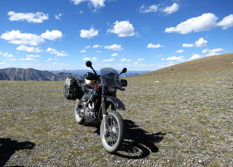
The might DR650 takes a break at the Chinese Wall.
Notice the helmet is resting a Russell Day Long saddle. Some said the saddle wings would prevent me from getting back when standing up. It turns out my legs press against the wings going up hill while standing up - works great.
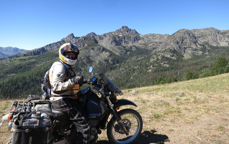
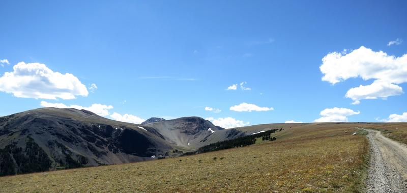
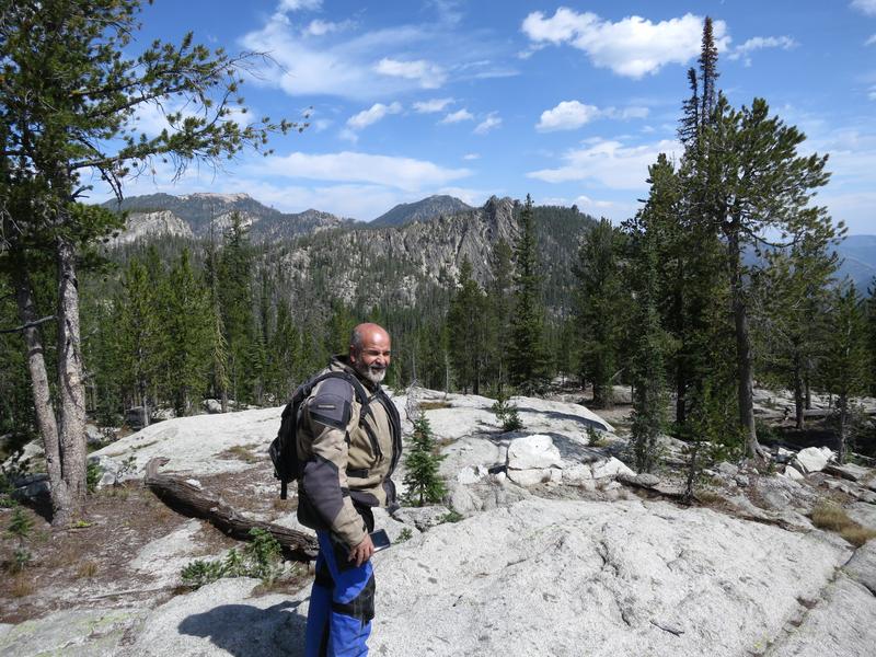
Some photos at the Chinese Wall.
Top of Idaho! Well not really but close enough.
My DR650. Great bike.
Doug on his way to Challis.
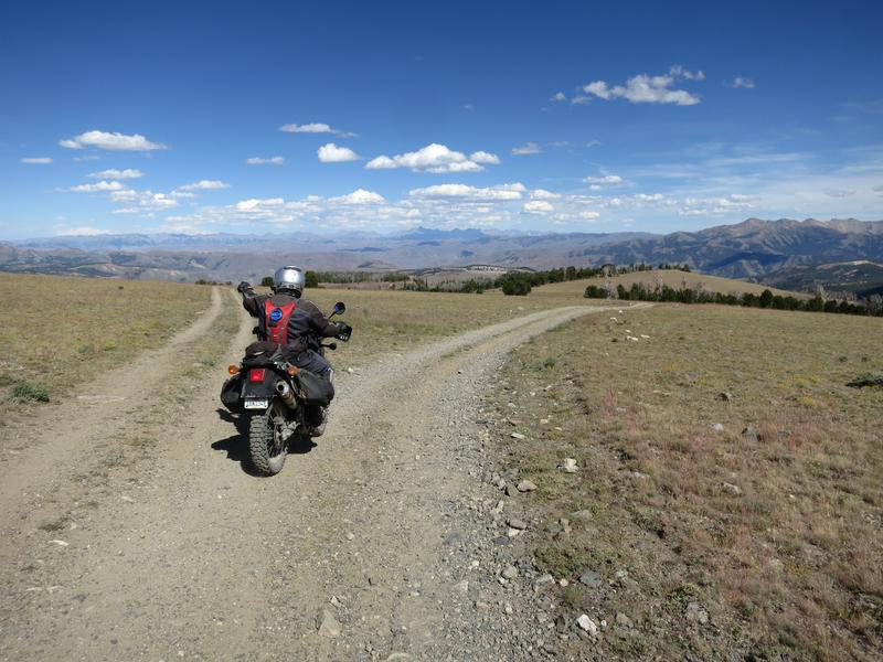
Photo options. Do you like this one?
Or this one?
Back on East Fork Road.
We road on to Challis for the night.
To be continued.
Fast forward to 2018. I move from Seattle to Spokane. Idaho is right next door and it has some of the best dual sport roads in country. It wasn't long before the mighty DR650 was in my new garage in my new home. Idaho was calling.
Family trips 2018 and 2019 got in the way of a week long dual sport ride. Last year I was hoping to do this ride in September 2019 but the weather turned unseasonably cold. There was no 4-5 day window of good weather - it was snowing at many places where I wanted to go. So 2019 my dual sport dream ride went out the window.
I vowed that would not happen this year leaving July, August and September open for riding the mighty DR650. The window for riding is thin. Snow may not melt out till the second or third week of July. By August the temperatures can exceed 100°, thunderstorms can ruin your day and smoke from forest fires can spoil a great trip plan. Finding Goldilocks weather is pretty damn rare. Maybe 1 in 5 years.
The on Dual Sport thread Bugs learned of my trip plan so we decided to ride this together. His friend Robert joined us. We had 2 DR650s and a Doug's KLR. Robert's 2002 DR650 with around 40k miles has seen better days but it is still rock solid and Robert is a mechanic.
So we hatched a plan to meet in McCall and tour some of the best dual sport routes in Idaho. My sources included personal experience, Mark Sampson's web page BigDogAdventures and Sound Riders! Dual Sport Tour book.
The Garmin 590 comes with City Map North America and it includes all the Forest Service roads we enjoyed. With a little effort (downplayed) I created routes for each day and it never let us down. There was one gap, the road didn't exist on the Garmin map, so the solution was to split the route in half. This worked well.
So that is the backstory.
Day 1.
I ride down to Lewiston Idaho from Spokane where get off the main road the remainder of the day. Here is my route from Lewiston along with a image. Google Maps tends to fail on back roads in the winter.
Mountains go forever. Nice.
The Salmon River
After crossing the river I head back up again. Then just before going down again here is another view of the Salmon River. And that is where I am going.
I arrive at the Salmon River road where people are enjoying a float on the river.
Then I cross this confounded bridge. Doug says it is a half a suspension bridge. I say it is warm out and time to climb up again to cool off.
So up French Creek road to find shade and cooler temps. Yep it is a fun as it looks.
After French Creek it is on into McCall to meet with Doug and Robert. I logged about 350 miles and 230 of that is on backcountry roads. Not a bad day on the mighty DR650.
Day 2.
Did I say this tour was awesome? The weather was absolutely perfect each and every day with temps from mid 50's in the morning to mid 80's in the afternoon but at higher elevations it was in the 70's. And no forest fire smoke. It has been a quiet fire season so far in the Northwest and we are very thankful. Some years this trip would not be possible due to weather or fire.
Today's route was a bit short, only a 160 miles but it was a good way to start the trip after a long day for all of us the day before.
Riding counterclockwise we dispensed with the 45 miles of State and US highway. The rest of the trip was on backcountry roads, mostly unpaved.
The mighty DR650 is happy on backroads especially unpaved ones. It has 36 horsepower and will go 60-70 mph all day. I found 36 horsepower is plenty on a gravel road. It is easy to spin the rear tire and so having more ponies isn't something I need on a gravel road. My newly resprung DR worked great. At this point I am happy with the suspension. It might cost me another $700 to replace the shock and install a fork cartridge. It would be fun to try a DR with those to feel the difference. Instead I spent a few bucks on gear so I can carry water the next time I go out and change where I store my tools.
We leave Hwy 95 at the turn off for the Seven Devil's road and begin to climb from 1800' to 8300'. Up and up and up. At one point we could see the Salmon River drainage and the Snake River / Hell's Canyon drainage from the same spot. Nice!
We stopped at a view point to regroup and take a few pictures.
The DR is calling let's go, come on let's go.
The Seven Devil's each have names. There is He Devil, She Devil and Devil's Throne. Not sure why the remaining peaks don't include the word Devil.
Which Devil this is, oh wait it is Doug!
Here is the me Devil with a peak in the background.
For some reason I thought we could see the Snake River from up here but it wasn't so. Nearby is the Klienschmidt Grade where the river is visible. Been there done that including a jet boat trip on the Snake River so it is great to be here. A new adventure.
The parking lot for the fire lookout tower at Heaven's Gate.
With extra time in our day we hike 0.2 miles up the hill to the fire outlook where the views are 360°. It was worth the effort.
Hell's Canyon, deeper than the Grand Canyon, is below the flat spot on the horizon.
Robert on the way back to the parking lot. And in the parking lot we find a Toyota Prius. No way we'd drive that rig up here. The road was rough in places and the Prius has maybe 7" of ground clearance if that. Hope they made it back.
Devil's on the way out.
We head to Riggins Idaho for lunch and find a bar with great sandwiches. I have something my waistline would regret. Yum!
After lunch it is up the Salmon River road. It starts out paved then goes to gravel. Here is Robert crossing the same bridge I crossed yesterday.
Doug noted it looks like a half of a suspension bridge.
The Salmon River from the bridge.
Up the French Creek road we stop several times for photo ops. My favorite is this one.
French Creek road climbs from about 2000' to 4800' through the twisty section shown here then to 6400' at Burgdorf Hotspring. It is a great way to cool off.
Doug and Robert along French Creek.
A view on the way to Burgdorf Hotsprings. We didn't take a dip it is closed. I was there last year and the water is hot. My body was submerged with just my head out of the water and my face started sweating within 15 minutes. Nonetheless the it is a very nice spot and attracts a lot of adventure riders.
The road from Burgdorf to McCall is paved and we zipped on back to McCall to have dinner and decide on the route for tomorrow.
Day 3
The original plan was to ride north from McCall to Warren and Yellow Pine via the Warren Wagon Road one of the top notch backcountry routes in Central Idaho. Unfortunately lodging in Stanley was sold out forcing us up the road to Challis.
On Monday night we decided on this alternative.. This saved us about 50-60 miles making it a long day instead of an real real long day. It also set us up for a relaxing day tomorrow. All in all it worked out very well.
Until this trip I have never been to Warm Lake so this was a new adventure for all of us. I don't know why I was surprise the ride from Hwy 55 to Warm Lake was all paved but it is. Nuts. Oh well it was a pleasant ride and Warm Lake was very scenic.
Robert with a big smile at Warm Lake.
Still on pavement we continue east and climbing 6800' to this viewpoint.
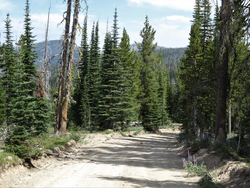
Near Landmark the pavement ends and the surface is 2-3" of fine silty sand. No trouble for the mighty DR650. I road a Vstrom here a few years ago and it wasn't as easy going.
It was a scenic ride back to pavement and for some reason I have no photos of the leg of the ride. Hey a reason to return.
Pavement returns in the form of Hwy 75 and it is on to Stanley Idaho with nice views of the Sawtooth Mountains.
Another picture perfect day.
Folks riding a street bike would consider this a highlight of the day. Not us for the best was yet to come! Before we go on though we stop for fuel and lunch. An Ahi Tuna sandwich and it was better than it looks.
Back on the road to the Chinese Wall the high driveable point in Idaho. This has been on my bucket list for years. We turn off Hwy 75 to E. Fork Rd near Clayton Idaho. East Fork Road was fun and paved for a while. Aspen trees line the road.
Jug Handle Arch? I don't know but there is a Jug Handle Arch near Arches Utah and it is similar to this.
Once the pavement ended the road climbs quickly. Happy to have the DR650 on this road instead of a larger machine. The next photo is close the the top where it levels off.
We climb from 5500' to 10400'. Great fun.
The might DR650 takes a break at the Chinese Wall.
Notice the helmet is resting a Russell Day Long saddle. Some said the saddle wings would prevent me from getting back when standing up. It turns out my legs press against the wings going up hill while standing up - works great.
Some photos at the Chinese Wall.
Top of Idaho! Well not really but close enough.
My DR650. Great bike.
Doug on his way to Challis.
Photo options. Do you like this one?
Or this one?
Back on East Fork Road.
We road on to Challis for the night.
To be continued.


")
