Uncle Hud
Just another blob of protoplasm using up your oxyg
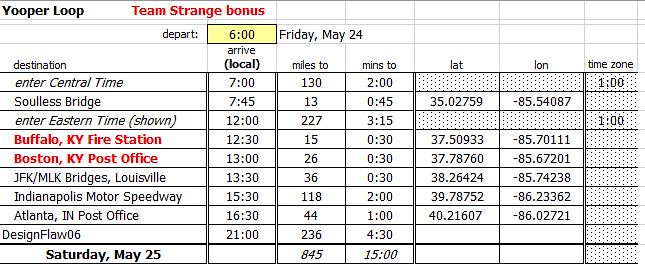
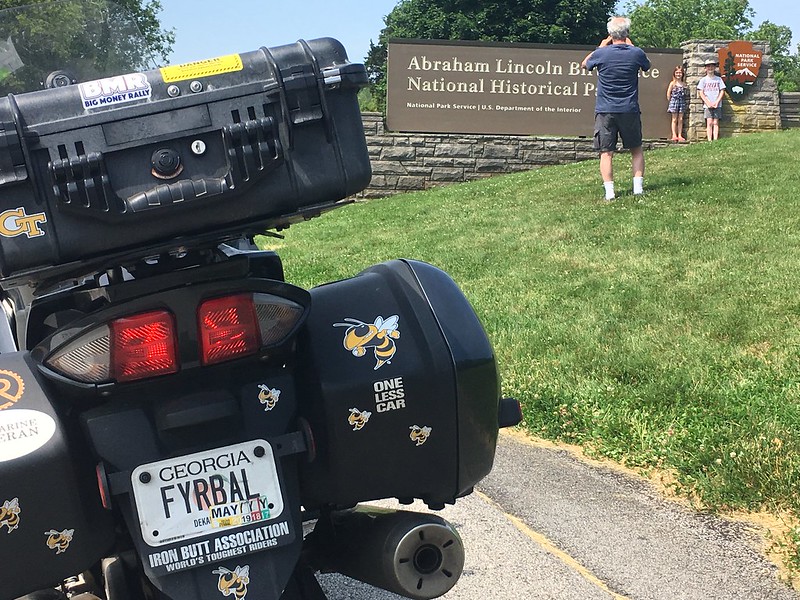
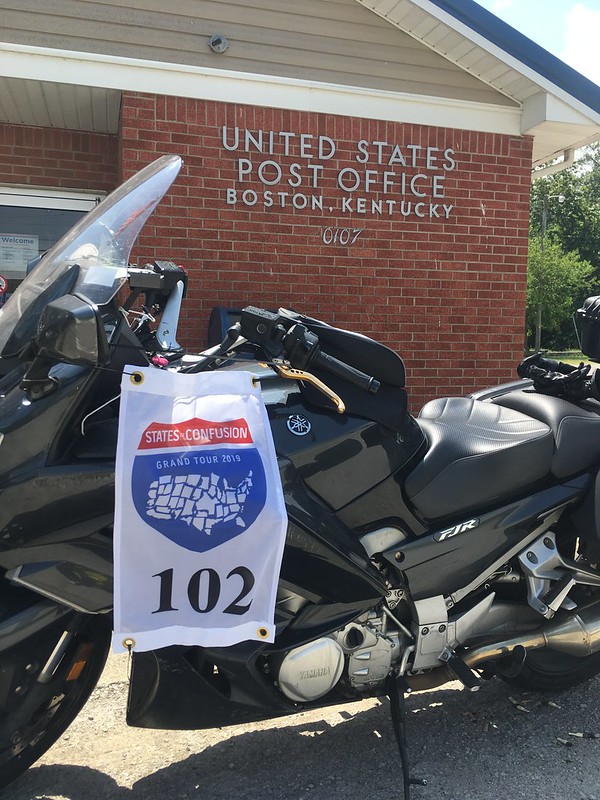
CHAPTER 4, August 2018: Delaware, New York, Ohio, and Kentucky
This set of Atlantas was collected over a three-day ride that was originally supposed to take me to Niagara Falls. When Kelly said she'd rather not go on this trip, the Falls got cut and I saved 3 hours. Hey, those three hours are significant, and Niagara will still be around when my bride and I decide to fly there.
Spotwalla trace can be found here.
This ride had me pondering some philosophical things:
1. I think of my FJR like a cowboy thinks of his horse. "We" made this trip together, and neither of us could have done it without the other.
2. No matter where we rode, there was incredible natural or man-made beauty. We saw National Forests, the Dismal Swamp, Chesapeake Bay, and downtown Cleveland and Cincinnati. We rode alongside the Susquehanna River at flood stage, and through the Great Smoky Mountains at dusk. Didn't stop, but stopping isn't always necessary to appreciate the scenery sliding by. I encourage you to ride 500 miles from home in search of something beautiful. Guarantee you'll find unexpected beauty, too!
3. There are inherent challenges in this style of touring that I relish: planning, navigation, endurance, handling city traffic. Meeting these challenges is fun. Yes, I like twisties as much as you do, but its very rewarding to look at a Spotwalla trace, and realize that you can ride long distances in three days without a lot of effort. It makes me wonder about where to go next.
4. How in the world do some of you guys find time to do these epic two-week trips? Burns me up with jealousy.
.........................
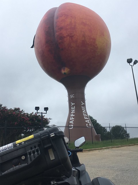
We set off about 8 am Friday, with a weather report that offered 50/50 chances for rain in SC and NC. First stop was the Peachoid, alongside I-85 in Gaffney, SC. This water tower is located in Congressman Frank Underwood's electoral district in the Netflix series House of Cards. From what I hear, its a big thing for tourists. Looks vaguely X-rated, doesn't it?
Stopped in Charlotte to eat lunch with my younger son and his family, then headed to Suffolk, Virginia, and the Super8 for the evening.
Rained almost the entire way from Charlotte to Suffolk. Five hours of mist, drizzle, rain, and downpour. Fine droplets to big goober drops that stung through my gloves and made a loud racket inside my helmet. Bike performed flawlessly, equipment held up fine, and I've seen most of this route several times before, so no big deal.
.........................
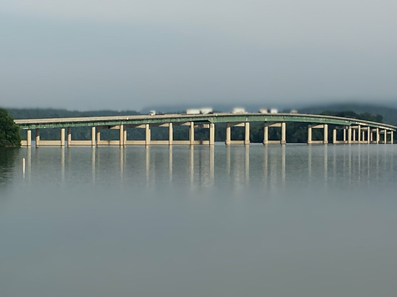
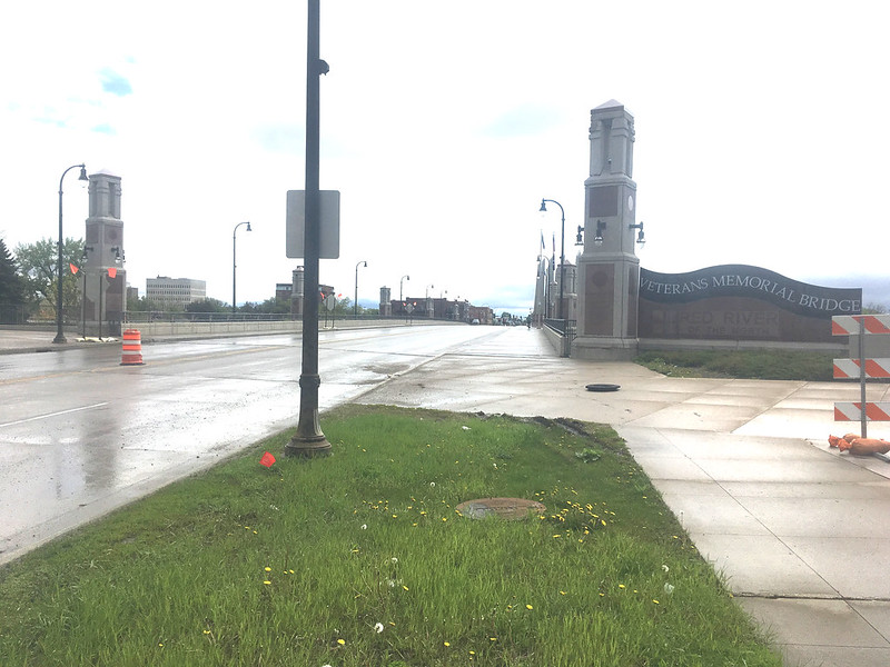
An early start got us to the Chesapeake Bay Bridge-Tunnel before 7:30 on Saturday, but alas, there is no Early Bird Special on the toll.
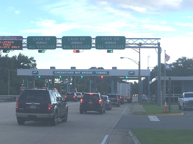
This structure has been a bucket list location for many years, and the weather was perfect for this crossing: clouds over the shore, and clear over the Bay.
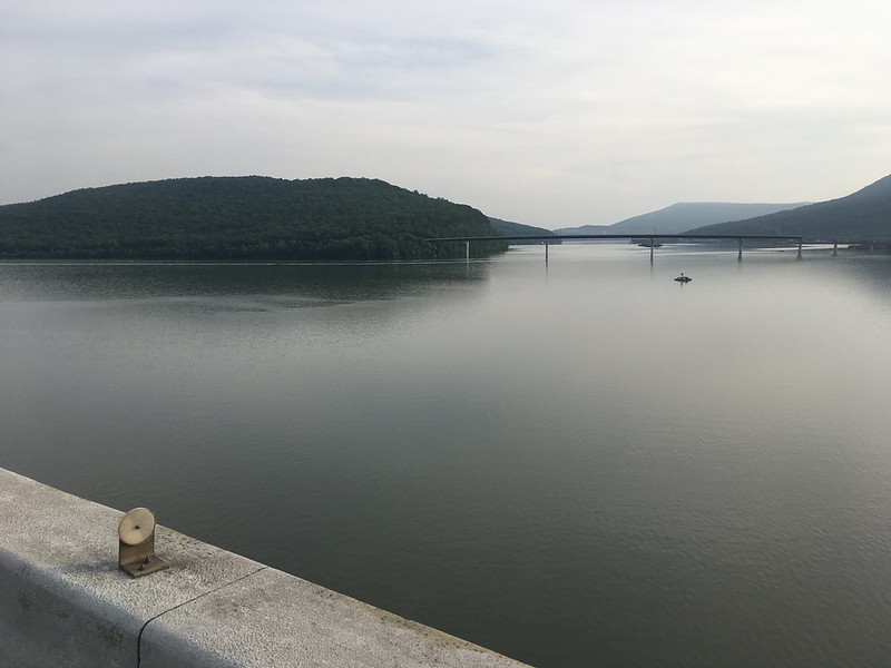
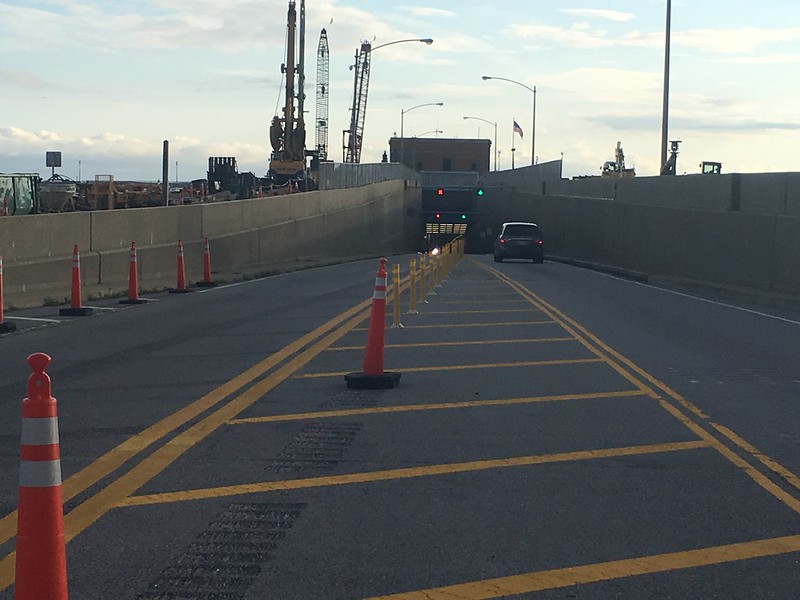
I didn't know there are two sequential tunnels; did you? One tunnel goes under the Thimble Shoal Channel, the other goes under the Chesapeake Channel. Was surprised to find that the bridge sections have two lanes in each direction, but the tunnels have just a single lane in each direction.
A toll lady vacuumed $15 from my wallet in Norfolk, but the Bridge-Tunnel did carry me about 15 miles over and under the water to the eastern shore of Virginia and Maryland. Is $1 per mile a bargain?
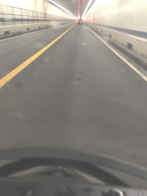
Here's the merge section as we entered the first tunnel.
This photo was taken from my phone, in its magnetic cradle, just as a lark to see what would happen.
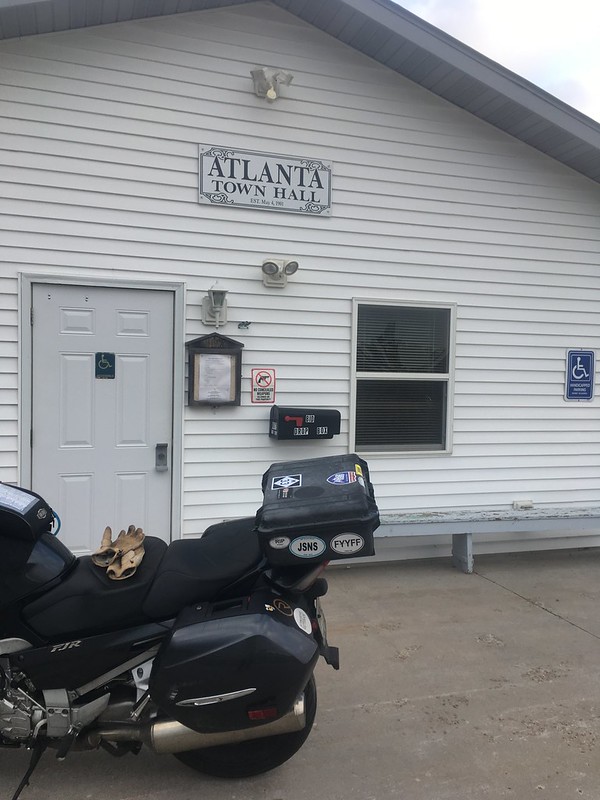
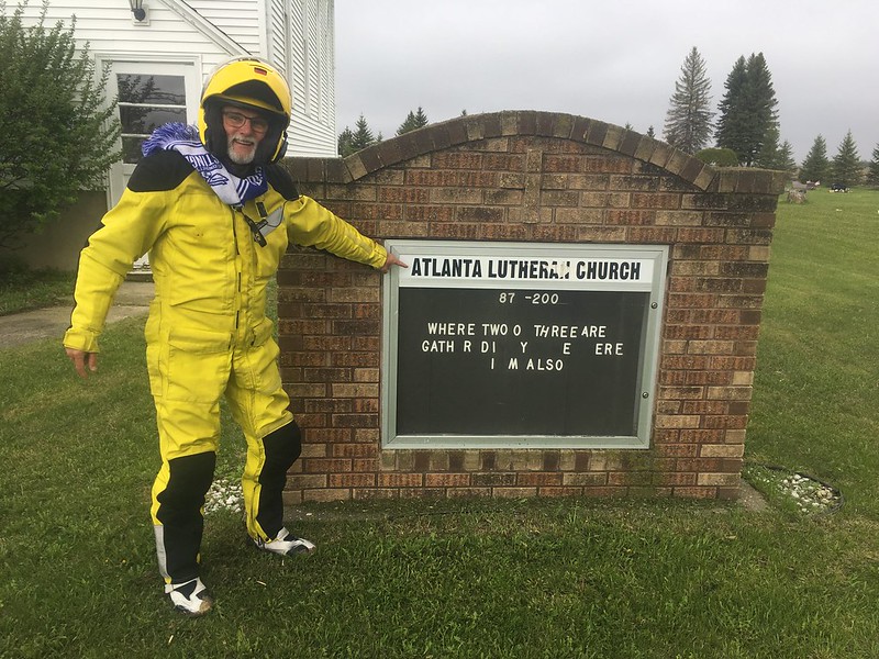
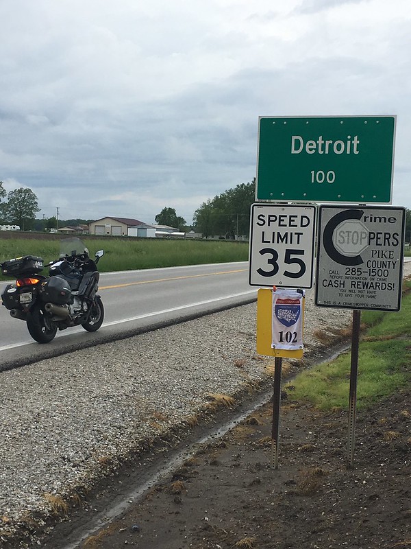
We were now on the Delmarva Peninsula, and a few miles farther north got me to Atlanta, Delaware. If you look carefully at the road sign in the background, it will tell you how to get to Federalsburg or Seaford.
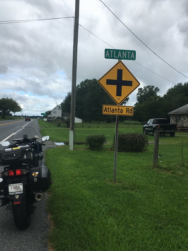
Atlanta, Delaware, is a small cluster of houses surrounded by huge fields of corn and soybeans.
There must have been a lot of chicken houses - even though I only saw a few - because there was a giant Perdue chicken processing plant on US 13, and a giant Tyson chicken processing plant just a couple of miles further north. Two giant chicken factories within a couple of miles, but hardly any chicken farms. Is there a Delaware law that chicken farms must be hidden from the roadway?
The FJR turned left (towards Seaford) and went across the Chesapeake Bay Bridge on US 50 towards Baltimore. This was terrible from a traffic perspective, since everybody in Pennsylvania and New York was also crossing the bridge, going home after their summer beach vacation. Hot and slow; bogged down by construction.
However, this was cool from a geeky perspective because there are actually two separate bridges here, one eastbound and one westbound, that do not share the same structural types. Both have suspension main spans, although with significantly different tower shapes. Each bridge also has a minor span near the east end. Both minor spans are trusses, although one is an arched through truss while the other is a peaked through truss. No photos; I was too frustrated with traffic conditions ... and it was HOT.
I like bridges! Major bridges are huge projects. They consume mass quantities of money during construction, and typically a few lives, but they become powerful symbols: the Golden Gate Bridge, the Brooklyn Bridge, the Ponte Vecchio, and the Tower Bridge in London are all globally familiar.
Recently, I was lucky enough to design a very small piece of the New Goethals Bridge between Staten Island, New York, and Elizabeth, New Jersey. Its a really cool bridge, and its now equipped with the cameras, message signs, and fiber optic cables that I specified!
So anyway, I'm rolling up the highway, mindlessly thinking about bridges for a couple of hours, mindlessly looking at the beautiful scenery of central Pennsylvania, mindlessly following where Miss Google tells me to go, half-mindlessly observing the Susquehanna River well above flood stage, mindlessly passing through Williamsport, PA, and ......... why, lookie here!
My FJR finds interesting stuff every time we go out of town!
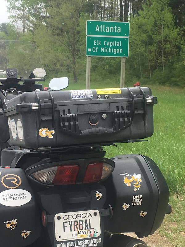
Got to keep moving, though; we have a schedule to keep. So we turned right onto US 15/501 and headed north to Atlanta, New York.
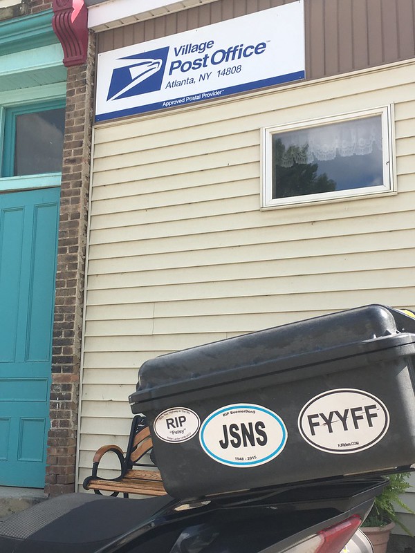
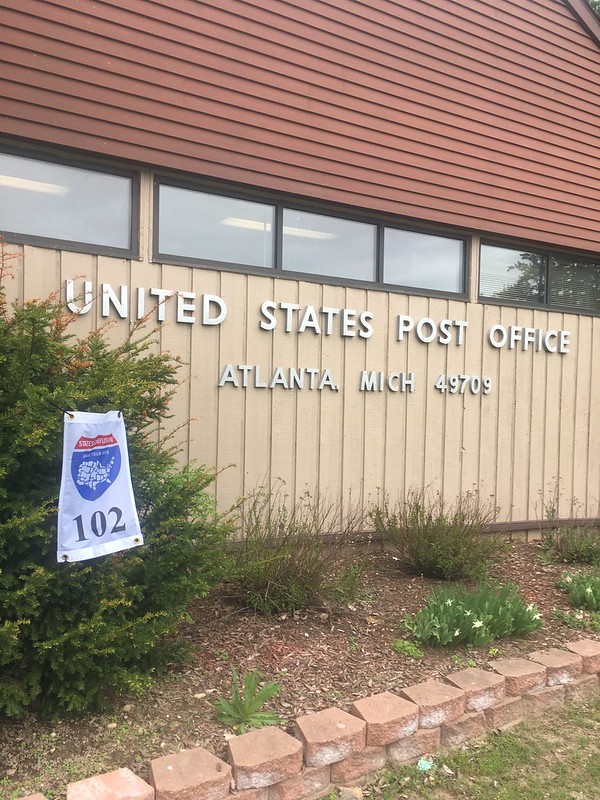
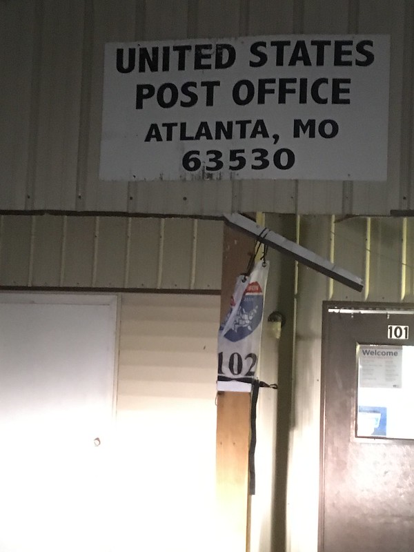
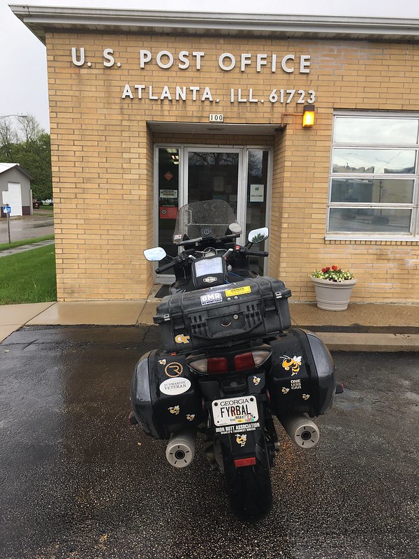
Atlanta, New York, is a small town squeezed up against North Cohocton. (Regular Cohocton is a few miles away. To the south.) It does have a Post Office, although the sign says Approved Postal Provider -- what does that mean, exactly?
Wikipedia says Atlanta, NY, is a hamlet in the northeast part of the town of Cohocton. There are five or six neatly-kept stores along the one-block downtown, surrounded by ten or twelve neatly-kept houses with neatly-kept lawns. It's a neatly-kept little place. We elected to take Atlanta Back Road on our return to the Jamestown Highway. The Back Road is a wickedly fun four miles along a ten-foot-wide asphalt roller coaster of a road, and soon we were back on the freeway headed to Jamestown.
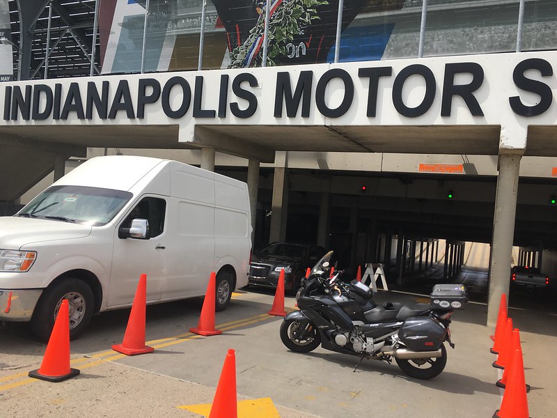
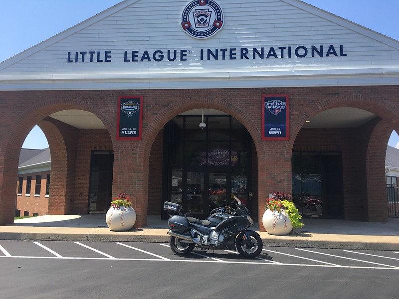
What's in Jamestown, New York? Lots of things, I'm sure, but this is what I wanted to see:
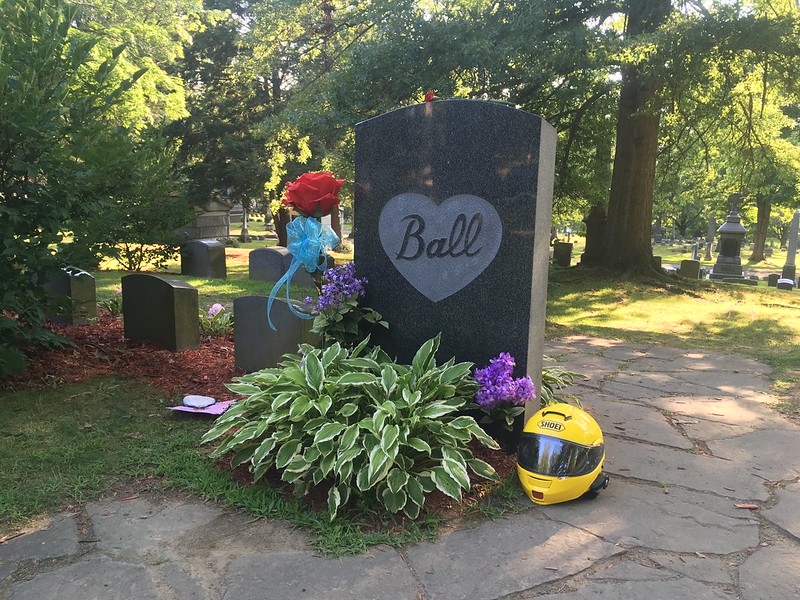
I loved Lucy, and still pause the channel surfing if I see her, or Ricky, or Ethel, or Fred.
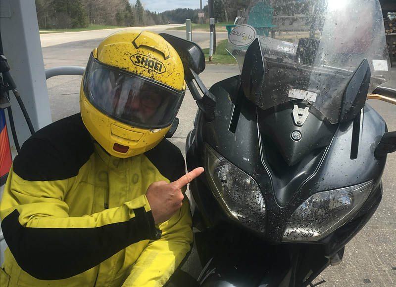
Spent a long time exceeding the speed limit on I-86, the Southern Tier Expressway, before turning in for the night in a tidy, clean motel that was -- I swear -- like time traveling to the 1950s: the Dav-Ed Motel in Kingsville, Ohio. The desk guy owns an R-1, and ooohed and ahhhed appropriately at my FJR.
.........................
Sunday, and we're headed for the barn with a few stops along the way. "Southbound and down, loaded up and trucking, we're gonna do what they say can't be done! We've got a long way to go and a short time to get there, southbound now, just watch your Uncle run."
Shortly after dawn, I snapped a photo for a buddy who's a lifelong Cleveland Browns fan. Blind loyalty is the only reason anyone is a Cleveland Browns fan these days. Gotta respect that.
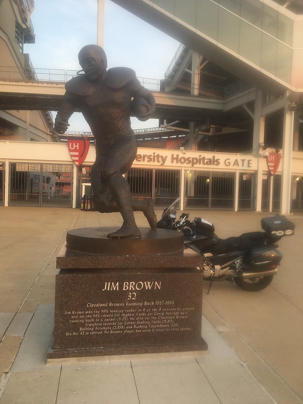
Jim Brown was an NFL hero of my pre-teen years. For two seasons, I seriously thought they named the whole team after him. Mr. Brown also has a long list of credits as a movie actor, and I wonder if he preferred being a running back or an actor.
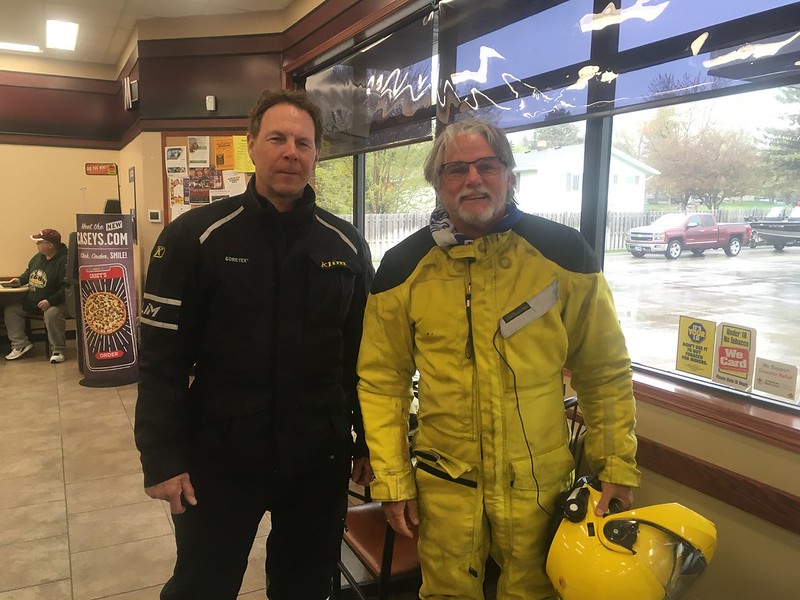
Found this guy, too. He's neither an NFL running back nor a movie star, but he knows that breakfast is the most important meal of the day.
Thanks for breakfast, ElToroJoe, and for the escort down the highway!
Found an entire field of these, and realized BikerGeek99 and Suze must be nearby. Sunday morning isn't the time to surprise folks, so our little train kept a'rolling.
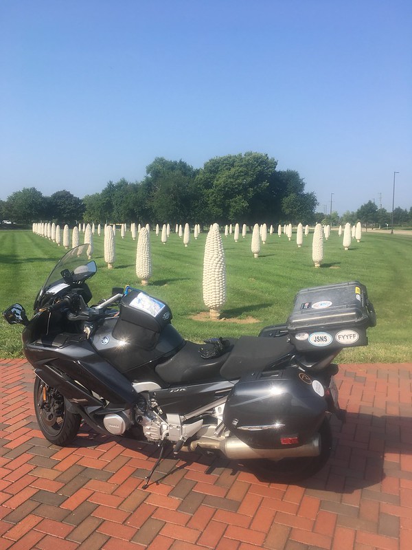
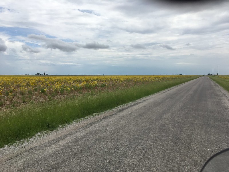
The concrete corncobs are an art installation that represents Ohio's corn farmers. As I rolled through Ohio for the next several hours, I began to see why: miles and miles and even more miles of corn. The corn fields are very long, very wide, and completely uninterrupted to the horizon. If you squint your eyes just right, you can imagine the tops of the corn as ground level, and the highway five or six feet below the surface. I imagined that a lot -- riding in a slot canyon five or six feet below the surface of the Earth -- just to keep away the boredom.
 Seriously, though, it was mind-boggling to think about how many corn cobs were in those fields, and how many people it would take to eat them all.
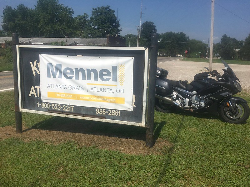
It was appropriate, then, to discover that Atlanta, Ohio, consists of two grain elevators.
I mean that literally: Atlanta, Ohio, isn't a town, just two grain elevators. I took a photo here, because the other location's sign said it was in New Holland. Turns out the Mennel Milling website says their Atlanta Grain facility is also in New Holland, despite the banner shown below. So, Atlanta, Ohio, is nothing but two grain elevators, and neither claims to be in Atlanta.
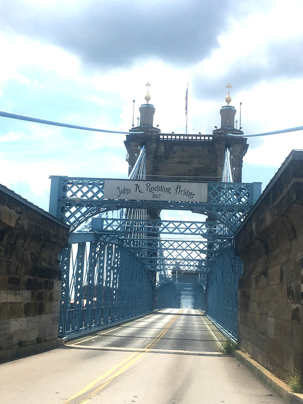
We saddled up and headed south, to Cincinnati and another bridge.
I like bridges! John Roebling designed this one in the heart of Cincinnati to cross the Ohio River. It was the longest suspension bridge in the world when it was built in 1867, over 150 years ago. Mr. Roebling could not have foreseen the physical load it carries today, because gas-powered automobiles weren't developed until the 1900s -- over 30 years after the bridge opened!
It was hot. Really hot. We crossed the river into downtown Covington, Kentucky, and parked on the sidewalk under a shade tree. I took off my Aerostich and realized my clothes were completely soaked in sweat. Looking around, I saw an unoccupied campsite where homeless folks must have been living. Grabbed my swim trunks and a clean t-shirt, hid behind some bushes, took off my wet clothes and put on the clean, dry clothes. What a difference! The wind whipped around my bare legs and my internal temperature dropped immediately.
Lee's Famous Recipe Chicken looked good, mostly because it was air conditioned, but it was a block behind me on a one-way street. The sidewalk was too narrow to turn around, and too high to drive off it into the street.
BMR training took over. I rode down the sidewalk to the street corner in swim trunks and a t-shirt; no helmet and no gloves, although I did have on clunky black moto-boots. Waited for the light to change, rolled down one ped ramp, up a ped ramp on the wrong-way side of the street, and putt-putt-putted on the sidewalk back to Lee's parking lot. (Thank goodness there weren't any police cruisers.)
The chicken was indeed good, and the coleslaw was GREAT.
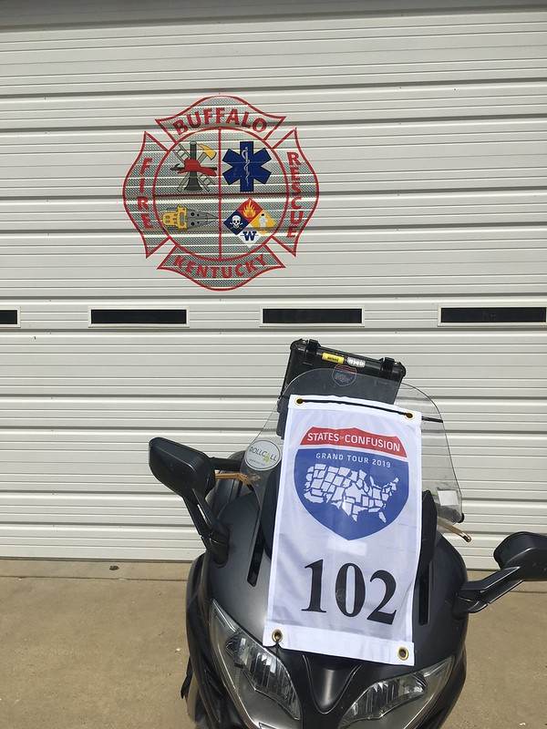
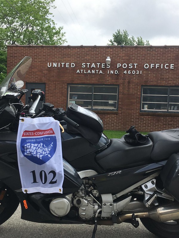
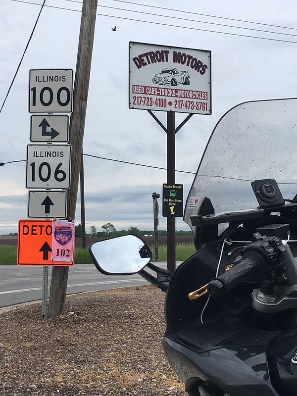
After 45 minutes of cooling off, we headed into the heat again. A few hours later, I'm in BFE, also known as Atlanta, Kentucky. Google Street View showed absolutely nothing here that said Atlanta. Now I understand why: there really isn't anything here. No crossroads, a few houses spread far apart, nothing except this brand-new highway sign to suggest that this is a community. See for yourself:
Wikipedia only says this about Atlanta, Kentucky: "Atlanta is an unincorporated community in Laurel County, Kentucky, United States. Its elevation is 1,010 feet (310 m), and it is located just off Route 30." They left out this part: "Population of Atlanta, KY = zero."
.........................
The sun was starting to go down, and taking the temperature with it. It was still warm, but it was no longer broiling hot. The FJR chugged a full tank of gas while I chugged a big Gatorade, and we rolled quickly along a very familiar stretch of I-75 back to the house.
.........................
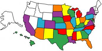
Eleven down, six to go.
+++++++++++++++++++++++++++++++++++++++++++++++++++++++++++++++++++++++++++++++++++++++++++++++++++++++++++++++++++
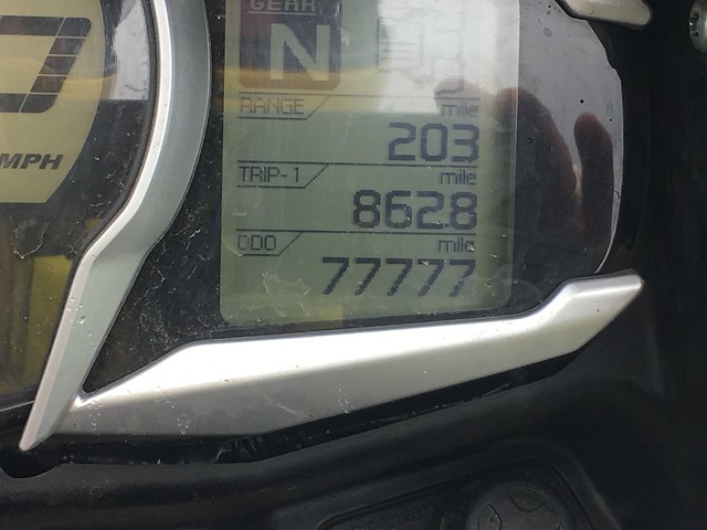
At this moment:

This set of Atlantas was collected over a three-day ride that was originally supposed to take me to Niagara Falls. When Kelly said she'd rather not go on this trip, the Falls got cut and I saved 3 hours. Hey, those three hours are significant, and Niagara will still be around when my bride and I decide to fly there.
Spotwalla trace can be found here.
This ride had me pondering some philosophical things:
1. I think of my FJR like a cowboy thinks of his horse. "We" made this trip together, and neither of us could have done it without the other.
2. No matter where we rode, there was incredible natural or man-made beauty. We saw National Forests, the Dismal Swamp, Chesapeake Bay, and downtown Cleveland and Cincinnati. We rode alongside the Susquehanna River at flood stage, and through the Great Smoky Mountains at dusk. Didn't stop, but stopping isn't always necessary to appreciate the scenery sliding by. I encourage you to ride 500 miles from home in search of something beautiful. Guarantee you'll find unexpected beauty, too!
3. There are inherent challenges in this style of touring that I relish: planning, navigation, endurance, handling city traffic. Meeting these challenges is fun. Yes, I like twisties as much as you do, but its very rewarding to look at a Spotwalla trace, and realize that you can ride long distances in three days without a lot of effort. It makes me wonder about where to go next.
4. How in the world do some of you guys find time to do these epic two-week trips? Burns me up with jealousy.
.........................
We set off about 8 am Friday, with a weather report that offered 50/50 chances for rain in SC and NC. First stop was the Peachoid, alongside I-85 in Gaffney, SC. This water tower is located in Congressman Frank Underwood's electoral district in the Netflix series House of Cards. From what I hear, its a big thing for tourists. Looks vaguely X-rated, doesn't it?
Stopped in Charlotte to eat lunch with my younger son and his family, then headed to Suffolk, Virginia, and the Super8 for the evening.
Rained almost the entire way from Charlotte to Suffolk. Five hours of mist, drizzle, rain, and downpour. Fine droplets to big goober drops that stung through my gloves and made a loud racket inside my helmet. Bike performed flawlessly, equipment held up fine, and I've seen most of this route several times before, so no big deal.
.........................
An early start got us to the Chesapeake Bay Bridge-Tunnel before 7:30 on Saturday, but alas, there is no Early Bird Special on the toll.
This structure has been a bucket list location for many years, and the weather was perfect for this crossing: clouds over the shore, and clear over the Bay.
I didn't know there are two sequential tunnels; did you? One tunnel goes under the Thimble Shoal Channel, the other goes under the Chesapeake Channel. Was surprised to find that the bridge sections have two lanes in each direction, but the tunnels have just a single lane in each direction.
A toll lady vacuumed $15 from my wallet in Norfolk, but the Bridge-Tunnel did carry me about 15 miles over and under the water to the eastern shore of Virginia and Maryland. Is $1 per mile a bargain?
Here's the merge section as we entered the first tunnel.
This photo was taken from my phone, in its magnetic cradle, just as a lark to see what would happen.
We were now on the Delmarva Peninsula, and a few miles farther north got me to Atlanta, Delaware. If you look carefully at the road sign in the background, it will tell you how to get to Federalsburg or Seaford.
Atlanta, Delaware, is a small cluster of houses surrounded by huge fields of corn and soybeans.
There must have been a lot of chicken houses - even though I only saw a few - because there was a giant Perdue chicken processing plant on US 13, and a giant Tyson chicken processing plant just a couple of miles further north. Two giant chicken factories within a couple of miles, but hardly any chicken farms. Is there a Delaware law that chicken farms must be hidden from the roadway?
The FJR turned left (towards Seaford) and went across the Chesapeake Bay Bridge on US 50 towards Baltimore. This was terrible from a traffic perspective, since everybody in Pennsylvania and New York was also crossing the bridge, going home after their summer beach vacation. Hot and slow; bogged down by construction.
However, this was cool from a geeky perspective because there are actually two separate bridges here, one eastbound and one westbound, that do not share the same structural types. Both have suspension main spans, although with significantly different tower shapes. Each bridge also has a minor span near the east end. Both minor spans are trusses, although one is an arched through truss while the other is a peaked through truss. No photos; I was too frustrated with traffic conditions ... and it was HOT.
I like bridges! Major bridges are huge projects. They consume mass quantities of money during construction, and typically a few lives, but they become powerful symbols: the Golden Gate Bridge, the Brooklyn Bridge, the Ponte Vecchio, and the Tower Bridge in London are all globally familiar.
Recently, I was lucky enough to design a very small piece of the New Goethals Bridge between Staten Island, New York, and Elizabeth, New Jersey. Its a really cool bridge, and its now equipped with the cameras, message signs, and fiber optic cables that I specified!
So anyway, I'm rolling up the highway, mindlessly thinking about bridges for a couple of hours, mindlessly looking at the beautiful scenery of central Pennsylvania, mindlessly following where Miss Google tells me to go, half-mindlessly observing the Susquehanna River well above flood stage, mindlessly passing through Williamsport, PA, and ......... why, lookie here!
My FJR finds interesting stuff every time we go out of town!
Got to keep moving, though; we have a schedule to keep. So we turned right onto US 15/501 and headed north to Atlanta, New York.
Atlanta, New York, is a small town squeezed up against North Cohocton. (Regular Cohocton is a few miles away. To the south.) It does have a Post Office, although the sign says Approved Postal Provider -- what does that mean, exactly?
Wikipedia says Atlanta, NY, is a hamlet in the northeast part of the town of Cohocton. There are five or six neatly-kept stores along the one-block downtown, surrounded by ten or twelve neatly-kept houses with neatly-kept lawns. It's a neatly-kept little place. We elected to take Atlanta Back Road on our return to the Jamestown Highway. The Back Road is a wickedly fun four miles along a ten-foot-wide asphalt roller coaster of a road, and soon we were back on the freeway headed to Jamestown.
What's in Jamestown, New York? Lots of things, I'm sure, but this is what I wanted to see:
I loved Lucy, and still pause the channel surfing if I see her, or Ricky, or Ethel, or Fred.
Spent a long time exceeding the speed limit on I-86, the Southern Tier Expressway, before turning in for the night in a tidy, clean motel that was -- I swear -- like time traveling to the 1950s: the Dav-Ed Motel in Kingsville, Ohio. The desk guy owns an R-1, and ooohed and ahhhed appropriately at my FJR.
.........................
Sunday, and we're headed for the barn with a few stops along the way. "Southbound and down, loaded up and trucking, we're gonna do what they say can't be done! We've got a long way to go and a short time to get there, southbound now, just watch your Uncle run."
Shortly after dawn, I snapped a photo for a buddy who's a lifelong Cleveland Browns fan. Blind loyalty is the only reason anyone is a Cleveland Browns fan these days. Gotta respect that.
Jim Brown was an NFL hero of my pre-teen years. For two seasons, I seriously thought they named the whole team after him. Mr. Brown also has a long list of credits as a movie actor, and I wonder if he preferred being a running back or an actor.
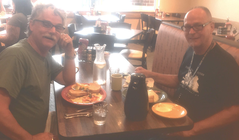
Found this guy, too. He's neither an NFL running back nor a movie star, but he knows that breakfast is the most important meal of the day.
Thanks for breakfast, ElToroJoe, and for the escort down the highway!
Found an entire field of these, and realized BikerGeek99 and Suze must be nearby. Sunday morning isn't the time to surprise folks, so our little train kept a'rolling.
The concrete corncobs are an art installation that represents Ohio's corn farmers. As I rolled through Ohio for the next several hours, I began to see why: miles and miles and even more miles of corn. The corn fields are very long, very wide, and completely uninterrupted to the horizon. If you squint your eyes just right, you can imagine the tops of the corn as ground level, and the highway five or six feet below the surface. I imagined that a lot -- riding in a slot canyon five or six feet below the surface of the Earth -- just to keep away the boredom.
It was appropriate, then, to discover that Atlanta, Ohio, consists of two grain elevators.
I mean that literally: Atlanta, Ohio, isn't a town, just two grain elevators. I took a photo here, because the other location's sign said it was in New Holland. Turns out the Mennel Milling website says their Atlanta Grain facility is also in New Holland, despite the banner shown below. So, Atlanta, Ohio, is nothing but two grain elevators, and neither claims to be in Atlanta.
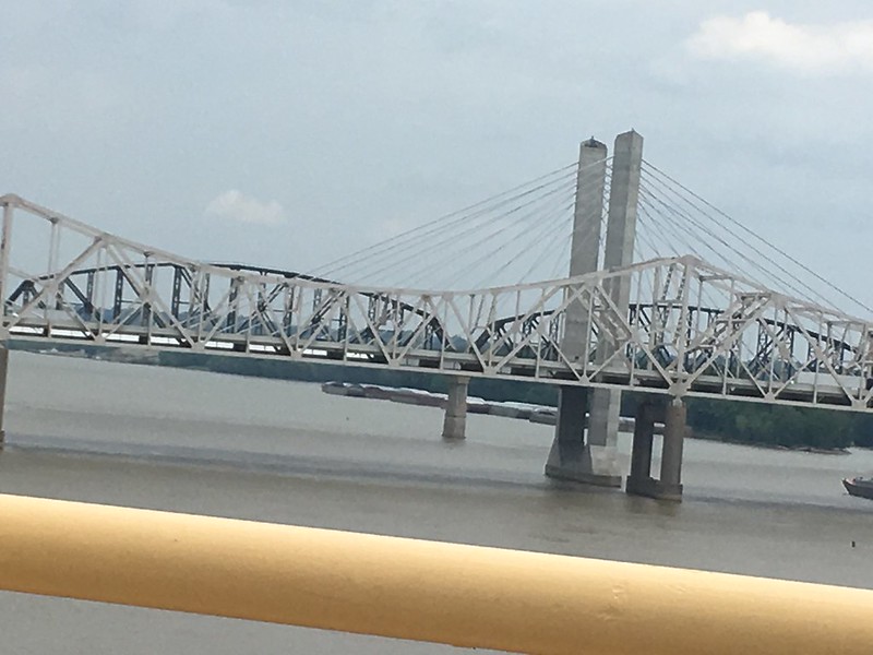
We saddled up and headed south, to Cincinnati and another bridge.
I like bridges! John Roebling designed this one in the heart of Cincinnati to cross the Ohio River. It was the longest suspension bridge in the world when it was built in 1867, over 150 years ago. Mr. Roebling could not have foreseen the physical load it carries today, because gas-powered automobiles weren't developed until the 1900s -- over 30 years after the bridge opened!
It was hot. Really hot. We crossed the river into downtown Covington, Kentucky, and parked on the sidewalk under a shade tree. I took off my Aerostich and realized my clothes were completely soaked in sweat. Looking around, I saw an unoccupied campsite where homeless folks must have been living. Grabbed my swim trunks and a clean t-shirt, hid behind some bushes, took off my wet clothes and put on the clean, dry clothes. What a difference! The wind whipped around my bare legs and my internal temperature dropped immediately.
Lee's Famous Recipe Chicken looked good, mostly because it was air conditioned, but it was a block behind me on a one-way street. The sidewalk was too narrow to turn around, and too high to drive off it into the street.
BMR training took over. I rode down the sidewalk to the street corner in swim trunks and a t-shirt; no helmet and no gloves, although I did have on clunky black moto-boots. Waited for the light to change, rolled down one ped ramp, up a ped ramp on the wrong-way side of the street, and putt-putt-putted on the sidewalk back to Lee's parking lot. (Thank goodness there weren't any police cruisers.)
The chicken was indeed good, and the coleslaw was GREAT.
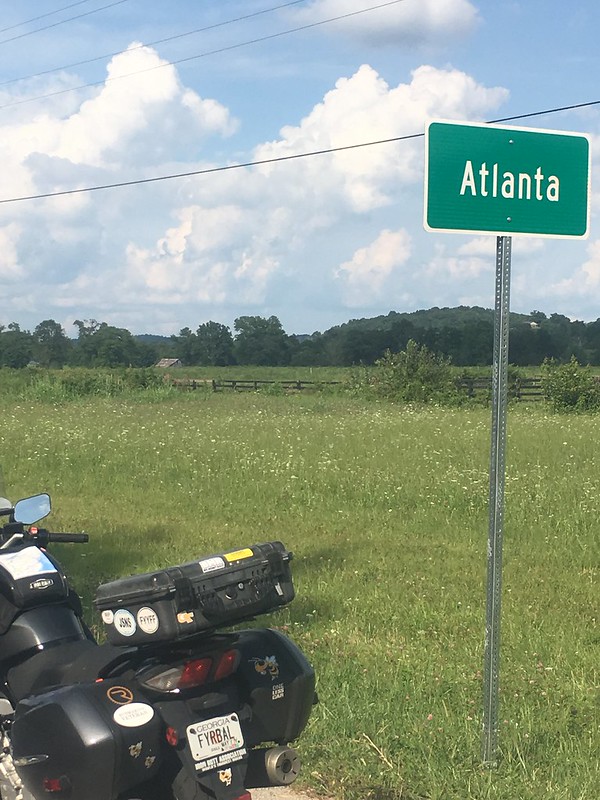
After 45 minutes of cooling off, we headed into the heat again. A few hours later, I'm in BFE, also known as Atlanta, Kentucky. Google Street View showed absolutely nothing here that said Atlanta. Now I understand why: there really isn't anything here. No crossroads, a few houses spread far apart, nothing except this brand-new highway sign to suggest that this is a community. See for yourself:
Wikipedia only says this about Atlanta, Kentucky: "Atlanta is an unincorporated community in Laurel County, Kentucky, United States. Its elevation is 1,010 feet (310 m), and it is located just off Route 30." They left out this part: "Population of Atlanta, KY = zero."
.........................
The sun was starting to go down, and taking the temperature with it. It was still warm, but it was no longer broiling hot. The FJR chugged a full tank of gas while I chugged a big Gatorade, and we rolled quickly along a very familiar stretch of I-75 back to the house.
.........................
Eleven down, six to go.
+++++++++++++++++++++++++++++++++++++++++++++++++++++++++++++++++++++++++++++++++++++++++++++++++++++++++++++++++++
At this moment:
Last edited by a moderator: