MCML
Not All Who Wander Are Lost
[SIZE=14pt]A PDF version of this report is now available here: [/SIZE] Tim "Two Wheel Nut's" Alaskan Adventure
Due to limitations imposed by the Forum's software, this ride report has been posted in four parts. This Post #1 is Part One. Post #2 (below) in this thread is Part Two, Post # 3 is Part Three and, of course, Post # 4 is Part Four.
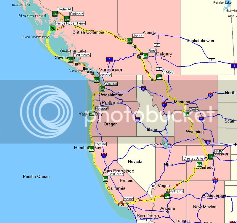
ROUTE MAP
Thanks to the gallant efforts of Gary (Duff on the Forum), Hal (Kaitsdad), Jeff (HaulinAshe), and Rob (Pawtracks, his version appears below), enough data from Tim's GPS was able to be recovered/reconstructed so that a route map could be created:
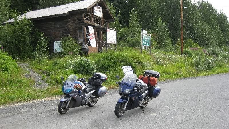
HYDER OR BUST - TIM "TWO WHEEL NUT" BATES' ALASKAN ADVENTURE
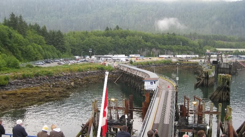
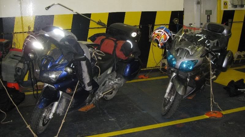
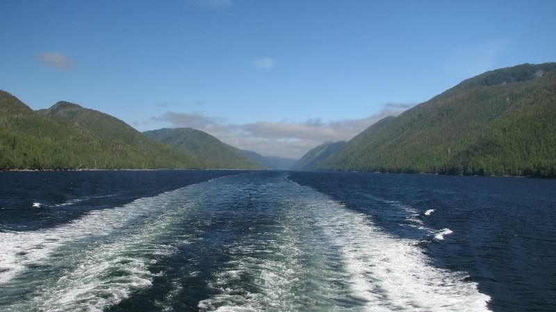
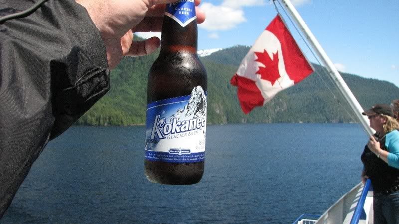
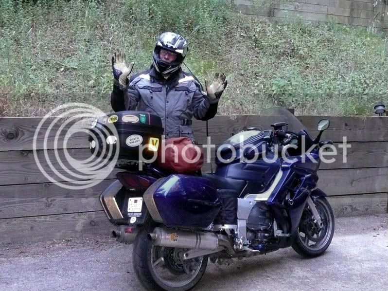
This Ride Report represents an attempt to capture some of the feel, the flavor and the sensibilities of the ride that Tim and I took together just before and after the NAFO meet in Golden, Colorado. We traveled just under 6,000 miles on the FJRs and at least another three hundred on ferries. It was an incredible ride and, combined, we took well over a thousand photographs. Less than one-tenth of those are presented here, but hopefully Tim's joi de vive, his particular love of being on the open road, and his sense of adventure will come through. When I started this project, I naively thought that I had a chance at writing this up as if everything were normal. I was wrong. As a result, while many of the usual components of ride reports are to be found within, the report also contains occasional references to things as they are, as opposed to things being the way that we all wish they were.
PART ONE 19 July 2008 to 30 July 2008
CARPENTERIA, CALIFORNIA to JASPER, ALBERTA CANADA
Saturday 19 July 2008
Carpenteria, California and Tarzana, California to Williams, Arizona
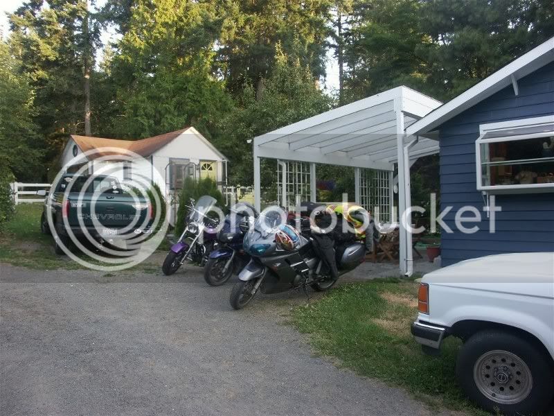
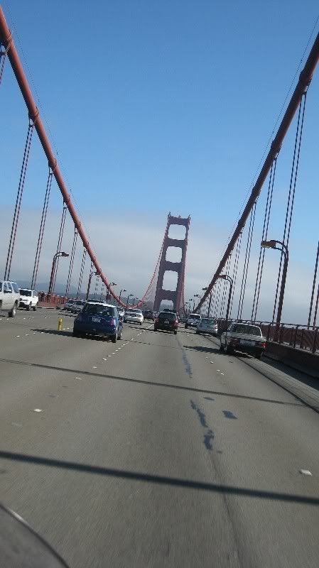
Tim and I met up at Four Points (Palmdale), gassed up, checked out the radios (problems, as always, but that's another long story) and headed east on Highway 138. The day was a scorcher with temperatures reaching over 110 as we traveled north and then east on Interstate Highways 15 and 40. As we climbed up the hills toward Flagstaff things cooled down a bit. We stayed overnight in Williams. The town was basically sold out by the time we arrived and we ended up at a 60's-vintage motel that looked like nothing had been maintained, let alone updated, since the place originally opened, although we did have a great dinner at a local restaurant (al fresco b-b-q steaks, grilled veggies, baked potatoes and iced tea).
Sunday 20 July 2008
Williams, Arizona to Crested Butte, Colorado
We woke early, ready for our first full day on the road away from our respective homes. We rode AZ 64 north from Williams to the South Rim of the Grand Canyon. This portion of the ride climbed upward through forested, mountainous terrain.
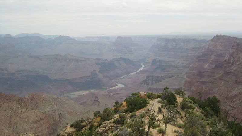
After spending a couple of hours leisurely traversing the South Rim, we headed east to Highway 89 North. We then dropped back down into, and, once again found ourselves crossing, the desert. Our route took us up through Tuba City, we stopped for lunch at a Sonic ("America's Drive In") in Kayenta, AZ, and continued on Highway 160 to Four Corners, which Tim had never seen. On our way, we saw a Reservation Law Enforcement Officer, who was driving a pickup with a camper shell and towing a boat, pull over someone in a BMW sedan. Unfortunately, there is no photo but Tim laughed about it for weeks.
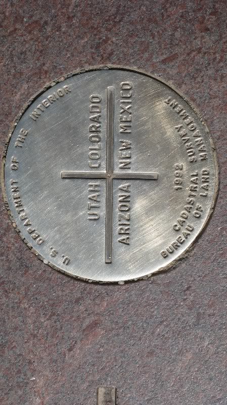
Temperatures were, again, in the triple digits as we turned off the highway and pulled into the Four Corners Monument. This roadside attraction is controlled by the local tribes who, I strongly suspect, laugh their asses off at the thought of the Whiteman's fascination with imaginary lines intersecting in the middle of the desert. Still, they are happy to collect entrance fees so folks can photograph this:
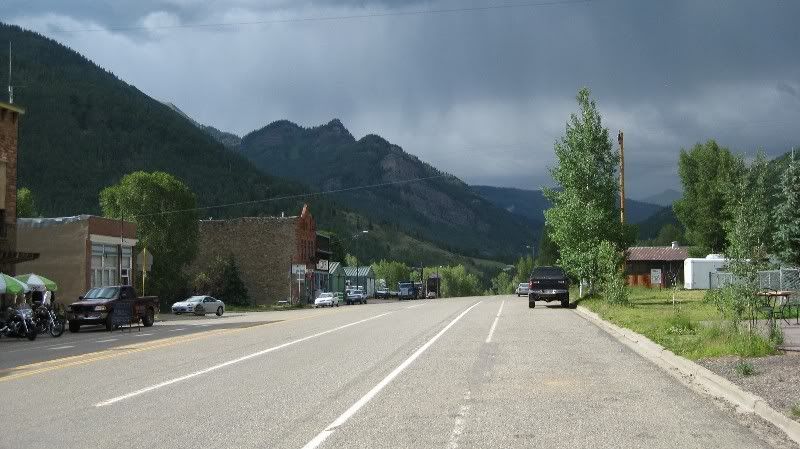
We continued north and stopped for gas in Dolores, Colorado where our climb up into the Colorado Rockies began. High-speed sweepers along a swiftly moving river put big smiles on our faces. We continued uphill, and upstream, to Rico, Colorado where we stopped to take a break and to chat about what we were seeing up the road above Lizard Head pass.
That was rain we were seeing, but we were not "seeing" clearly. We covered our tank bags and duffle bags with rain covers but, still being in the "it's-freaking-hot-so-what-if-it-rains-we'll-just-cool-off-and-it'll-be-great" mode, elected not to don our personal rain gear. Big mistake. Fifteen minutes, and a few thousand feet in elevation gain, later, it's pouring rain, hailing like crazy, the rear ends are stepping out more than a tad, and we are soaked and cold. Lizard Head Pass is as gorgeous as the more famous, and almost-adjacent-just-to-the-east, Million Dollar Highway, but we did not get to see much of it with our eyes glued to the road ahead.
We kept riding until we had dropped back down out of the inclement weather, stopped outside Telluride to change into dry clothing, and continued on Highways 62, 550 and 50 to Crested Butte, Colorado where I have been fortunate enough to have owned a small condo for the past fifteen years. We arrived in time to kill a few $9-a-pop imported French beers (I forget the brand but it was worth the cost, at least after this day's ride) at a local bistro and turned in.
Monday 21 July 2008
Crested Butte, Colorado
We headed down to the local hardware store so that I could buy, and install, an in-line fuse to replace one that had blown on my bike. At least we were hoping that a fuse had blown. Off with the panels. Yep, it's the fuse. My kind of problem. On with the panels. That being our only scheduled task, we spent the balance of a relaxing day hitting the local ski shops, visiting at the post office, and going for a ride. An afternoon thunderstorm cut the ride short so we spent the afternoon on the porch watching it rain. It was as heavy a downpour as either of us had seen in a long, long time. Lots of lightning and thunder, too. Some of it quite nearby.
Later, we took the shuttle bus down the hill into town (due to the rain and the fact that we planned to have a drink or two with dinner, we left the FJRs in the garage) where a friend who lives about five miles south met us with his truck. Now, my friend Michael Baim hails from Chicago and I knew Tim had friends in Crested Butte who also came from the Windy City. A quick "degrees-of separation" conversation ensued. Will anyone be surprised to find out that (1) the Baims knew Tim's friends very well and (2) that there was a lot to talk about over dinner?
Michael and his wife, Mary Shannon (an agnostic Jew and a "retired" Catholic, an eminently workable combination, as Tim and I had long since discovered) had prepared a feast of home grilled beef ribs, good red wine, salad, garlic bread, desert and more. At one point during the preparation phase someone asked if they should cut apart the "extra" slab o' ribs or put them away uncut. Silly question. After dinner, Tim and Michael had a pinball shoot-out on the Baim's wonderfully restored Adams Family-themed pinball machine.
Tuesday 22 July 2008
Crested Butte, Colorado
Tim and I cruised down to Elk Avenue, the main street, for lunch and parked ourselves in the sunshine on the patio of the Brick Oven Pizza restaurant. We spent a few hours enjoying the food, watching the local fauna stroll past, and waiting for Michael (madmike2) to arrive. Michael was visiting relatives not too far away (by his quite liberal standards) and decided to ride into town to visit. The three of us sat on the porch, talked about everything from motorcycles, to WFO 7 and NAFO, to politics, to family, to questions of faith, watched it rain and watched the sun set. A damned pleasant afternoon if I may say so myself. We walked up to the base of the ski area and ate dinner at the Avalanche, a local restaurant. King Crab Legs were the special at the Avalanche that night but neither Tim nor I ordered them. We were saving ourselves, at least seafood-wise, for Alaska
This is what Tim saw when he stood on the porch and looked toward the condo, Okay, nothing special, but . . . . .
. . . . . . . fortunately, a more impressive sight was to be seen by turning around and looking toward the west . . . . . .
Wednesday 23 July 2008
Mike and Tim Crested Butte, Colorado to Golden, Colorado
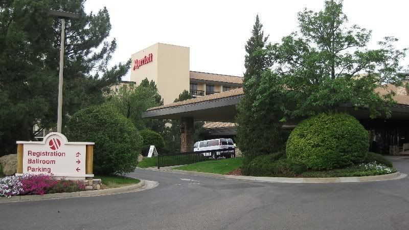
Having NAFO-related responsibilities that evening, Mike and Tim headed on to the Golden, Colorado Marriott while I stayed on in Crested Butte to meet up with Ed (Pegscrapper), Jacquie (Ms Nascar), Rick (Ric N Sac) and Karen (aka the Den Mother) who had, coincidentally, planned to stop in Crested Butte on their way to the first-ever North American FJR Owners meeting.
Tim and Mike crossed the Continental Divide (for the first time of many), caught up with Richard (Fairlaner) on the road and continued on to NAFO.
Thursday 24 July 2008
Joseph Crested Butte, Colorado to Golden, Colorado
Rick, Karen, Jacquie, Ed and I headed on to NFO together via US Highway 50 and CO Highway 285 (this photo was actually taken by Ed a day or two earlier, I believe, along Highway 550, north of Durango, Colorado).
NAFO has been covered extensively elsewhere so not much about it will be added here.
Friday 25 July 2008
NAFO
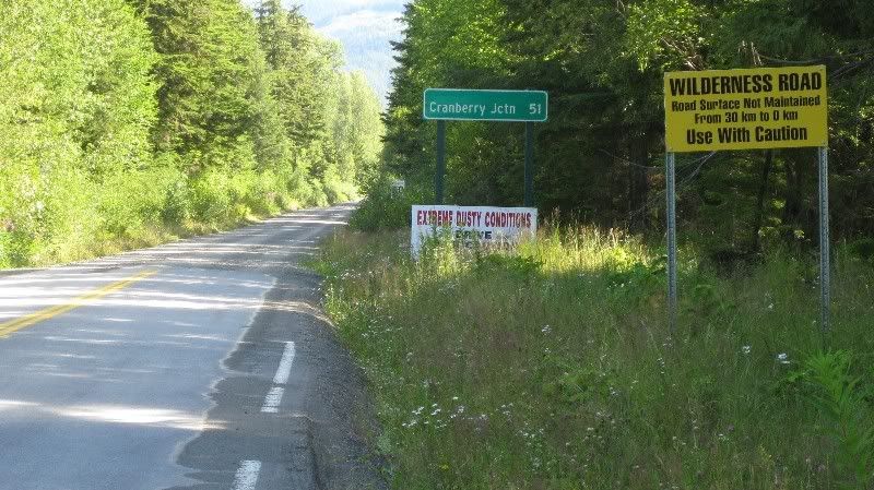
While at NAFO, we talked with several people who had been to various parts of Alaska. We gathered a lot of information about roads to take, sights to see and, of course, places to eat. I would like to sincerely thank everyone with whom Tim and I chatted. Your help made the journey even more enjoyable - except for the unpaved roads that were suggested. Those made the trip, shall we say, more interesting.
Saturday 26 July 2008
NAFO
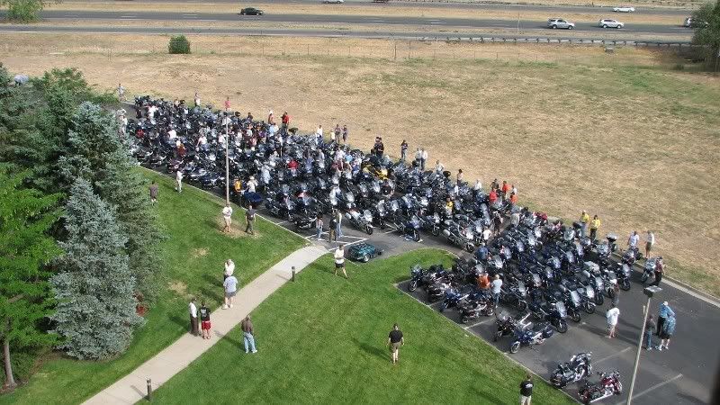
It turns out that about the time we were all finishing moving machinery around the parking lot, Tim was taking this shot of the assembled riders and their bikes from the window of his top floor executive suite. In hindsight, we should have been flipping him off.
Sunday 27 July 2008
Golden, Colorado to Cody, Wyoming
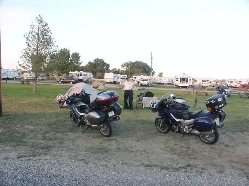
George (Coyote) decided to ride along with us miscreants for a day or so. The three of us headed out from Golden on Interstate 70 west. We turned off on CO 40 north followed by 125 north, to 230 north to 130 north to Interstate 80 west, to 287 north to 135 north to 26 north to 120 north and arrived in Cody late that evening. Tim and I set up at the local KOA campground while George, who was not traveling with camping gear, found a room in town. We all met for dinner in Cody. The town was packed with motorcycles (mostly Harleys, of course) and we ended up walking the length of the town twice before we found a place we could get into to eat. The KOA had nice, hot showers, but the campground never got dark and never grew quiet. Slept pretty well, though, all things considered.
Monday 28 July 2008
Cody, Wyoming to Glacier National Park, Montana
We rode 120 north out of town to Highway 296, the wonderful and, I feel, wonderfully-named Chief Joseph Highway. Big sweepers with some tighter turns, smooth road surface and gorgeous scenery. If you are in the area be sure not to miss riding this road. We stopped at a lookout to get a photo of the highway and to document our presence.
One of the many wonderful things about the Chief Joseph Highway is that it connects to Highway 212 - the equally wonderful, but very, very different Bear Tooth Pass road. Bear Tooth Pass is quite technical, tight in many spots, and is poorly maintained. It rises back up into the mountains and even in late July there was lots of snow and ice by the side of the road.
We bid goodbye to Coyote at the intersection. He headed west toward home while Tim and I headed north (and slightly east because that's where the Bear Tooth Pass road goes). Here is a photo of George with the motorcycles at the intersection of the Chief Joseph Highway and Bear Tooth Pass Road.
There were no pictures that really captured the essence of Bear Tooth Pass but here is one that does show some of the above-the-timberline scenery.
After descending from the top of the pass, we continued on Highway 78 north, Interstate 90 west and 89 north to St. Mary, Montana. This portion of the trip went smoothly except for a stretch of road where a woman wearing a day-glo orange vest and holding a stop sign on a pole awaited us. She asked how our motorcycles handled gravel. "Well," Tim told her, "that depends." "Okay," she asked, "how do they handle six to eight inches deep of freshly dropped gravel?" A fifty-mile detour ensued. But, what-the-hey, we're motorcyclists. Not a problem.
Most of the portion of the state of Montana that we rode through looked like this.
After the noise and light pollution of the KOA in Cody, I was able to convince Tim that it was worth it to forego the showers and that we should "set up shop" in a less suburban type of campground. We camped that night on the east side of Glacier National Park.
The folks at the adjoining campsite were friendly and well provisioned. As Tim and I were "cold camping", without any means of cooking food (we did not want to attract any bears), we took our neighbors up on their kind offer of a bite to eat, a beer or two to drink and a fire near which to sit. If I remember correctly, there might have been some Single Malt involved, also.
Tuesday 29 July 2008
Glacier National Park, Montana to Banff, Alberta Canada
After a fairly cold and damp night of camping, we arose, packed up our wet gear and headed west on the well known, and highly recommended, Going to the Sun Highway. We ran that east to west (no sun in our eyes, thank you) and then took Highway 2 to 93 north. We crossed the international border at Roosville. Tim had no trouble crossing as he had, at NAFO, been declared an Honorary Citizen of Canada, and had the pin to prove it. However, the border agent asked me three times in three different ways if I was carrying any weapons and/or ammunition. I kept my sarcasm in check on that sensitive issue but when he, while looking at my passport photograph, curtly asked me why I had not taken the opportunity to remove my helmet during the fifteen minutes we had waited in line before reaching his kiosk, I told him "All The Gear All The Time." He pondered that for a moment and then waved me on. We then headed north on 95 to CA 1 (that's Canada, not California though we were on that road also, later) then east and back south to Banff. We tried, along the way, to see a spot where, we had been told, "God goes to vacation" but that lake proved to be accessible only with reservations made months in advance because people had been stealing antiquities from the site. After two nights of camping, we checked into a nice hotel in Banff, spread our wet gear out to dry and, you guessed it, headed for a nice dinner. I drank some very good red wine with the meal. Tim drank, you guessed it again, Jack.
Wednesday 30 July 2008
Banff, Alberta to Jasper, Alberta
When, at a planning meeting for the trip, Gary (Duff) had suggested that Tim and I (and Gary, too, at the time we talked) head to the Canadian Rockies, I replied that I had been lucky enough to have been there already, several times, and, yes, I darned well would go again. Tim, however, had only heard of the wondrous sights. Well, Tim, here you are. Unfortunately, it is raining. On go the rain covers, and this time, our own rain gear. We head first through the town of Banff for a cruise around the golf course at the Banff Springs Hotel. Tim swears he saw a wolf while we putted along side one of the fairways. Although I missed seeing it, I believe the man saw what he said he saw. We stopped at Bow Falls for a break (we'd only been riding for half and hour so the break wasn't really needed) and a photo (definitely a must).
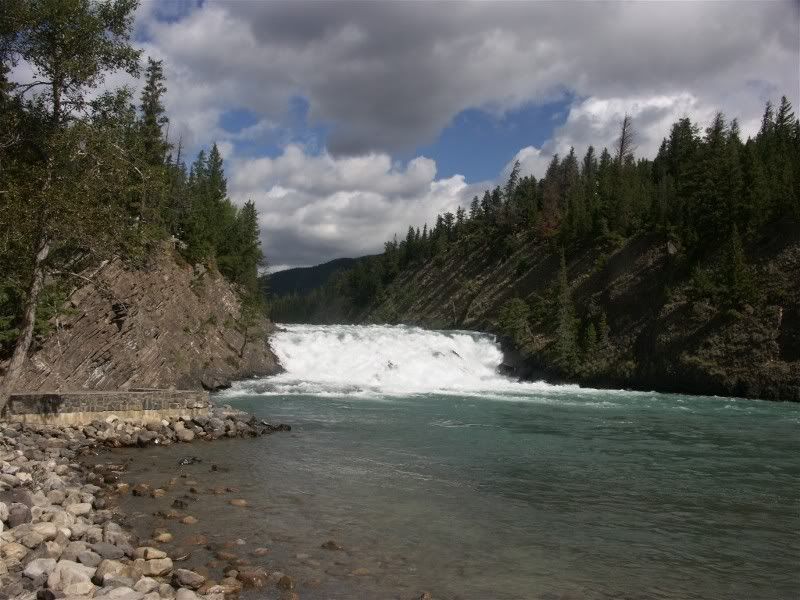
I don't know which was prettier, the sky or the falls, but it was a wonderful spot to linger. Fortunately, we only had a couple hundred miles of riding planned that day so "smell the roses" was high on the agenda.
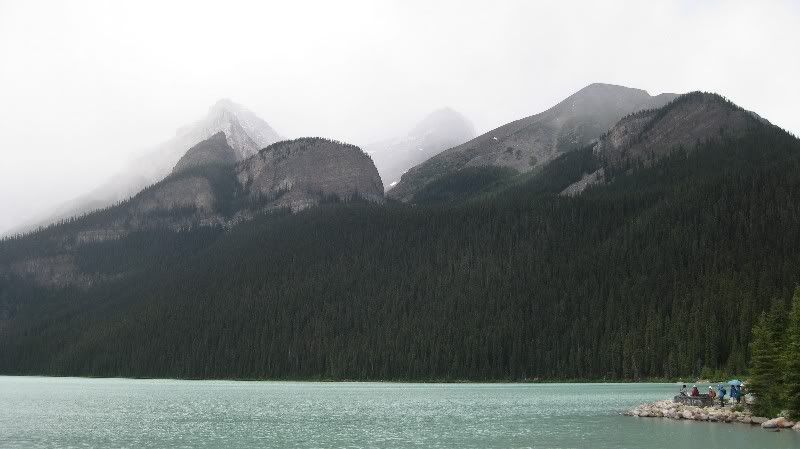
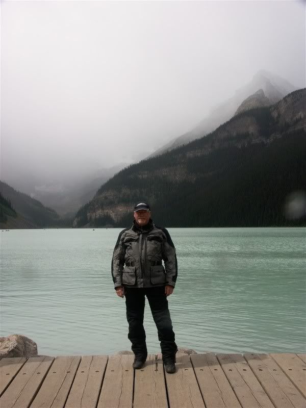
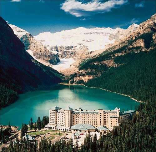
Next we rode north to Lake Louise - rightfully regarded as one of the world's most beautiful spots. It's so beautiful that dozens of busloads of tourists cannot spoil the view. Unfortunately, rain and low clouds can. And did. Here are two shots taken at the lake that day and one I dug up on line so those who have never been to Lake Louise can see what Tim, and you, have missed.
We then continued north along the Icefields Parkway, focusing our attention not only on the road and the scenery, but also on the sides of the road. We were definitely in elk and bear country and hitting one would not have made the trip more pleasant. We did see a Yosemite-style crowd of vehicles where a small black bear had been spotted in the woods just off the side of the road, and we also some awe-inspiring scenery. One of the advantages of traveling on a rainy day is that, if one is lucky, the storm will break at some point, the sky will partially clear, and the colors and light will become truly wonderful to see. We had a glorious afternoon's ride.
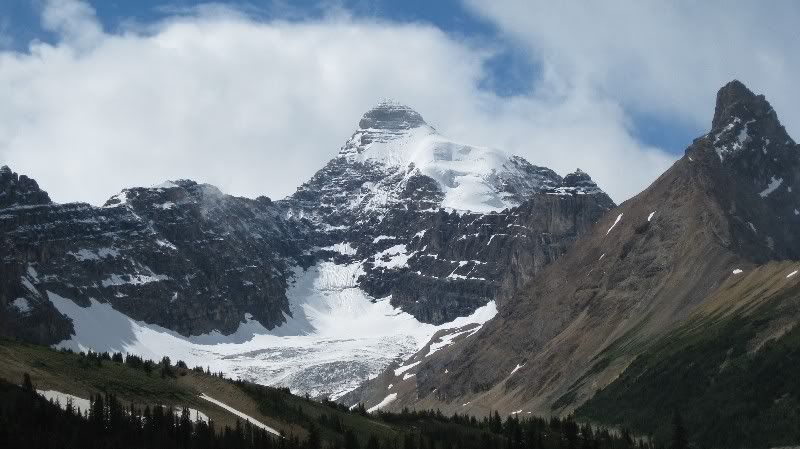
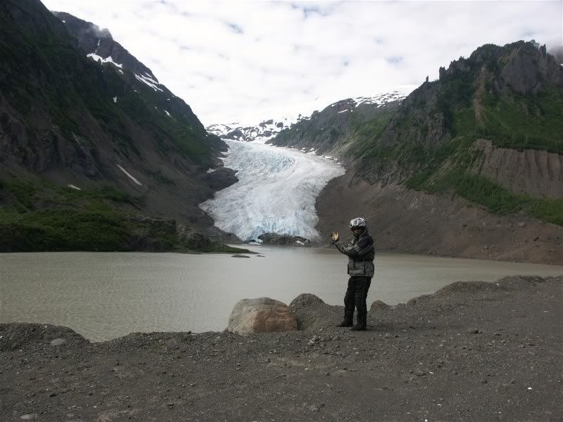
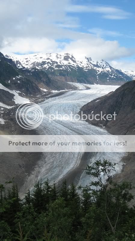
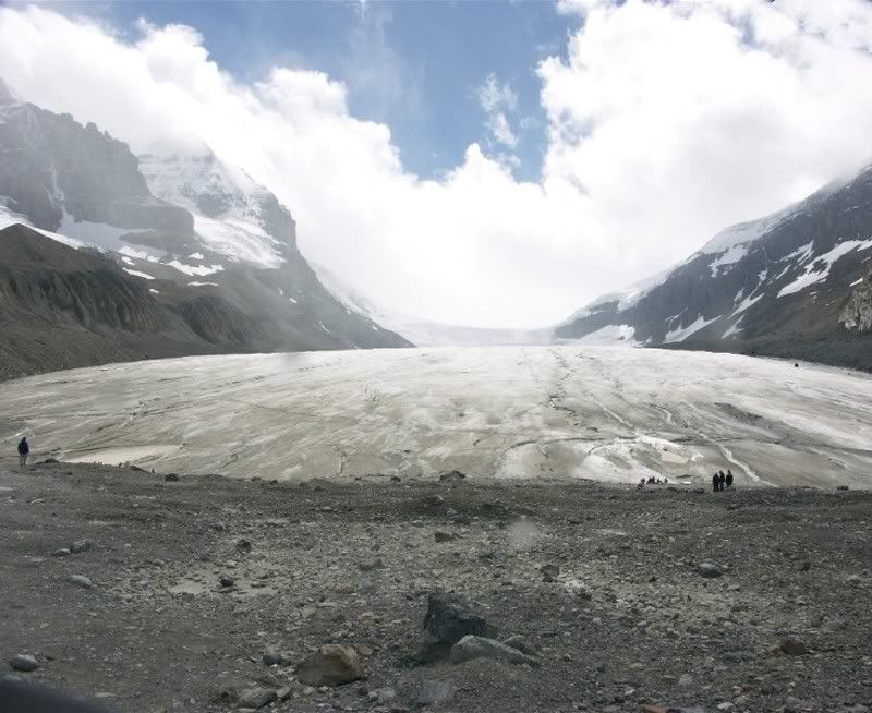
This shot is of the terminal moraine at the foot of the Columbia Ice Fields glacier. Water from the glacier flows to the Pacific Ocean, the Atlantic Ocean and the Arctic Ocean. A three-way continental divide if you will.
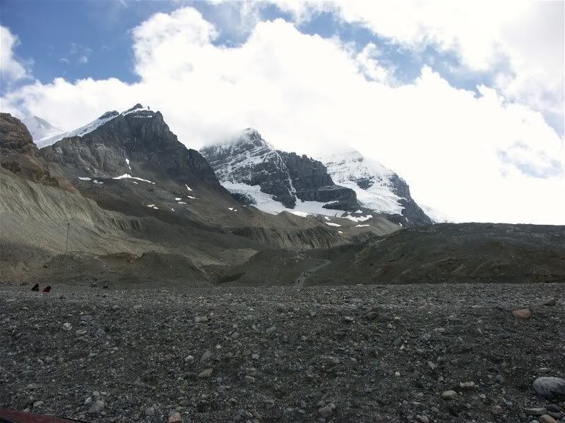
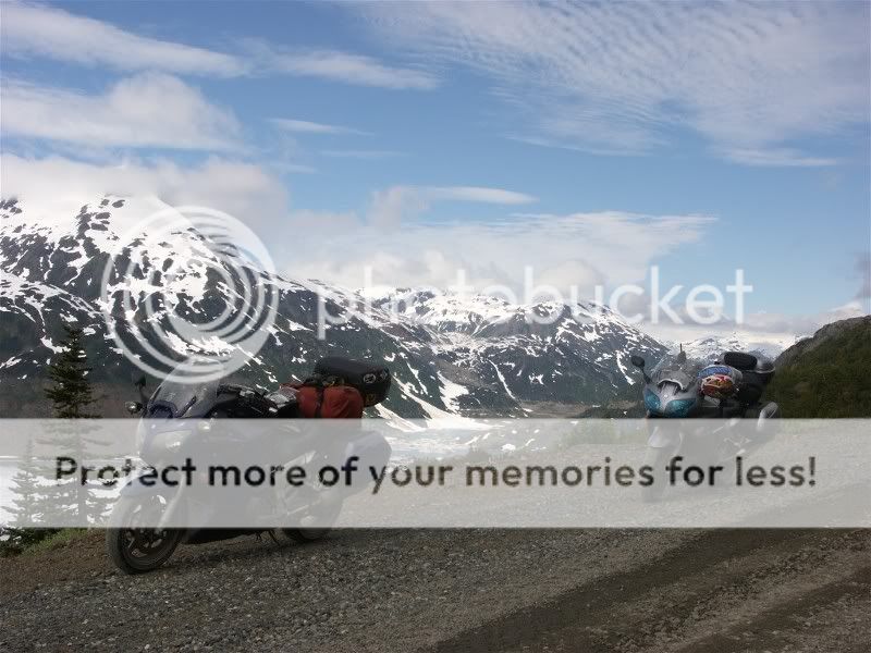
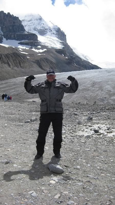
We parked the motorcycles, hiked up to the toe of the glacier and, because it was a bit chilly, were happy that motorcycle gear works pretty well in the mountains. Heck, it's all rip stop nylon, Gore-Tex, kevlar and polypropylene now anyhow.
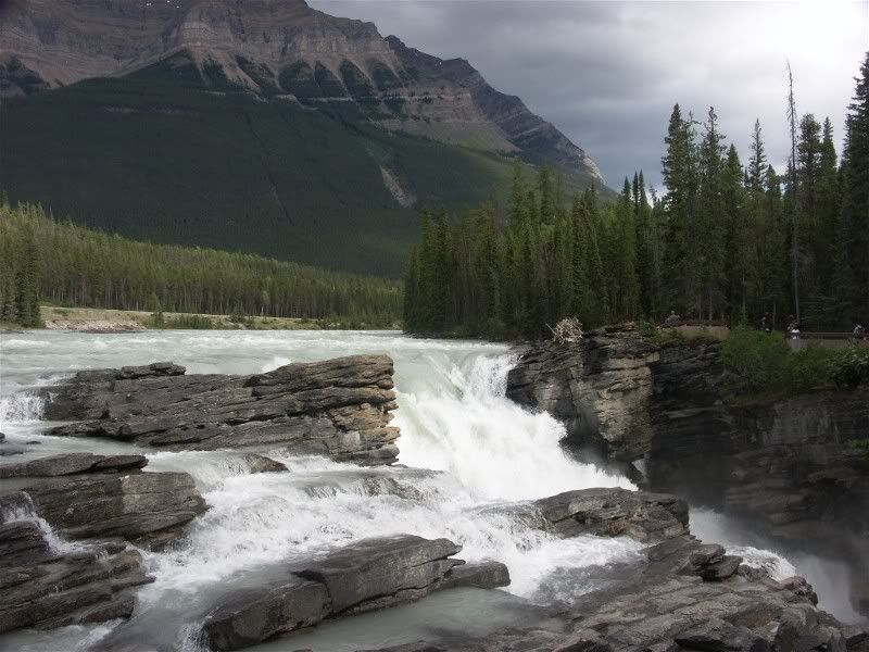
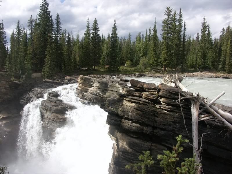
Continuing north, now there's a big surprise, we next stopped at Athabasca Falls. I have always loved this waterfall because you view it mostly from the top looking down, and because, while it is impressive in size, it's also small enough to be comprehensible. The photos do not begin to capture the raw power of the falls.
Just south of Jasper we saw several large elk by the side of the road. Fortunately, they stayed off the road as we rode past them. We continued into Jasper and checked into a hotel at the edge of town. Once again, walking to dinner was the order of the day. About halfway into the dozen-or-so-block-long walk to the center of town, I turned right to cut across a park. Tim asked what I was doing adding that "Town is that way" and pointing in the direction we had been walking. I explained that, having been to Jasper before, I knew an alternate, more pastoral, way to where we were going. We could have headed along either route. Why I picked one instead of the other I do not know, but, as we crossed the park, I saw my friend Sam from Boston standing there, thousands of miles from his home. "What are you doing here in Jasper?" we asked each other. "Tim and I are looking for an Italian restaurant for dinner.” "Well, we've got reservations at an Italian restaurant down the street," Sam replied. We joined Sam and several members of his traveling party for dinner. Small world.
Due to limitations imposed by the Forum's software, this ride report has been posted in four parts. This Post #1 is Part One. Post #2 (below) in this thread is Part Two, Post # 3 is Part Three and, of course, Post # 4 is Part Four.
ROUTE MAP
Thanks to the gallant efforts of Gary (Duff on the Forum), Hal (Kaitsdad), Jeff (HaulinAshe), and Rob (Pawtracks, his version appears below), enough data from Tim's GPS was able to be recovered/reconstructed so that a route map could be created:
HYDER OR BUST - TIM "TWO WHEEL NUT" BATES' ALASKAN ADVENTURE
This Ride Report represents an attempt to capture some of the feel, the flavor and the sensibilities of the ride that Tim and I took together just before and after the NAFO meet in Golden, Colorado. We traveled just under 6,000 miles on the FJRs and at least another three hundred on ferries. It was an incredible ride and, combined, we took well over a thousand photographs. Less than one-tenth of those are presented here, but hopefully Tim's joi de vive, his particular love of being on the open road, and his sense of adventure will come through. When I started this project, I naively thought that I had a chance at writing this up as if everything were normal. I was wrong. As a result, while many of the usual components of ride reports are to be found within, the report also contains occasional references to things as they are, as opposed to things being the way that we all wish they were.
PART ONE 19 July 2008 to 30 July 2008
CARPENTERIA, CALIFORNIA to JASPER, ALBERTA CANADA
Saturday 19 July 2008
Carpenteria, California and Tarzana, California to Williams, Arizona
Tim and I met up at Four Points (Palmdale), gassed up, checked out the radios (problems, as always, but that's another long story) and headed east on Highway 138. The day was a scorcher with temperatures reaching over 110 as we traveled north and then east on Interstate Highways 15 and 40. As we climbed up the hills toward Flagstaff things cooled down a bit. We stayed overnight in Williams. The town was basically sold out by the time we arrived and we ended up at a 60's-vintage motel that looked like nothing had been maintained, let alone updated, since the place originally opened, although we did have a great dinner at a local restaurant (al fresco b-b-q steaks, grilled veggies, baked potatoes and iced tea).
Sunday 20 July 2008
Williams, Arizona to Crested Butte, Colorado
We woke early, ready for our first full day on the road away from our respective homes. We rode AZ 64 north from Williams to the South Rim of the Grand Canyon. This portion of the ride climbed upward through forested, mountainous terrain.
After spending a couple of hours leisurely traversing the South Rim, we headed east to Highway 89 North. We then dropped back down into, and, once again found ourselves crossing, the desert. Our route took us up through Tuba City, we stopped for lunch at a Sonic ("America's Drive In") in Kayenta, AZ, and continued on Highway 160 to Four Corners, which Tim had never seen. On our way, we saw a Reservation Law Enforcement Officer, who was driving a pickup with a camper shell and towing a boat, pull over someone in a BMW sedan. Unfortunately, there is no photo but Tim laughed about it for weeks.
Temperatures were, again, in the triple digits as we turned off the highway and pulled into the Four Corners Monument. This roadside attraction is controlled by the local tribes who, I strongly suspect, laugh their asses off at the thought of the Whiteman's fascination with imaginary lines intersecting in the middle of the desert. Still, they are happy to collect entrance fees so folks can photograph this:
We continued north and stopped for gas in Dolores, Colorado where our climb up into the Colorado Rockies began. High-speed sweepers along a swiftly moving river put big smiles on our faces. We continued uphill, and upstream, to Rico, Colorado where we stopped to take a break and to chat about what we were seeing up the road above Lizard Head pass.
That was rain we were seeing, but we were not "seeing" clearly. We covered our tank bags and duffle bags with rain covers but, still being in the "it's-freaking-hot-so-what-if-it-rains-we'll-just-cool-off-and-it'll-be-great" mode, elected not to don our personal rain gear. Big mistake. Fifteen minutes, and a few thousand feet in elevation gain, later, it's pouring rain, hailing like crazy, the rear ends are stepping out more than a tad, and we are soaked and cold. Lizard Head Pass is as gorgeous as the more famous, and almost-adjacent-just-to-the-east, Million Dollar Highway, but we did not get to see much of it with our eyes glued to the road ahead.
We kept riding until we had dropped back down out of the inclement weather, stopped outside Telluride to change into dry clothing, and continued on Highways 62, 550 and 50 to Crested Butte, Colorado where I have been fortunate enough to have owned a small condo for the past fifteen years. We arrived in time to kill a few $9-a-pop imported French beers (I forget the brand but it was worth the cost, at least after this day's ride) at a local bistro and turned in.
Monday 21 July 2008
Crested Butte, Colorado
We headed down to the local hardware store so that I could buy, and install, an in-line fuse to replace one that had blown on my bike. At least we were hoping that a fuse had blown. Off with the panels. Yep, it's the fuse. My kind of problem. On with the panels. That being our only scheduled task, we spent the balance of a relaxing day hitting the local ski shops, visiting at the post office, and going for a ride. An afternoon thunderstorm cut the ride short so we spent the afternoon on the porch watching it rain. It was as heavy a downpour as either of us had seen in a long, long time. Lots of lightning and thunder, too. Some of it quite nearby.
Later, we took the shuttle bus down the hill into town (due to the rain and the fact that we planned to have a drink or two with dinner, we left the FJRs in the garage) where a friend who lives about five miles south met us with his truck. Now, my friend Michael Baim hails from Chicago and I knew Tim had friends in Crested Butte who also came from the Windy City. A quick "degrees-of separation" conversation ensued. Will anyone be surprised to find out that (1) the Baims knew Tim's friends very well and (2) that there was a lot to talk about over dinner?
Michael and his wife, Mary Shannon (an agnostic Jew and a "retired" Catholic, an eminently workable combination, as Tim and I had long since discovered) had prepared a feast of home grilled beef ribs, good red wine, salad, garlic bread, desert and more. At one point during the preparation phase someone asked if they should cut apart the "extra" slab o' ribs or put them away uncut. Silly question. After dinner, Tim and Michael had a pinball shoot-out on the Baim's wonderfully restored Adams Family-themed pinball machine.
Tuesday 22 July 2008
Crested Butte, Colorado
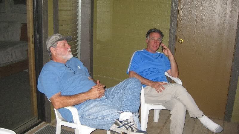
Tim and I cruised down to Elk Avenue, the main street, for lunch and parked ourselves in the sunshine on the patio of the Brick Oven Pizza restaurant. We spent a few hours enjoying the food, watching the local fauna stroll past, and waiting for Michael (madmike2) to arrive. Michael was visiting relatives not too far away (by his quite liberal standards) and decided to ride into town to visit. The three of us sat on the porch, talked about everything from motorcycles, to WFO 7 and NAFO, to politics, to family, to questions of faith, watched it rain and watched the sun set. A damned pleasant afternoon if I may say so myself. We walked up to the base of the ski area and ate dinner at the Avalanche, a local restaurant. King Crab Legs were the special at the Avalanche that night but neither Tim nor I ordered them. We were saving ourselves, at least seafood-wise, for Alaska
This is what Tim saw when he stood on the porch and looked toward the condo, Okay, nothing special, but . . . . .
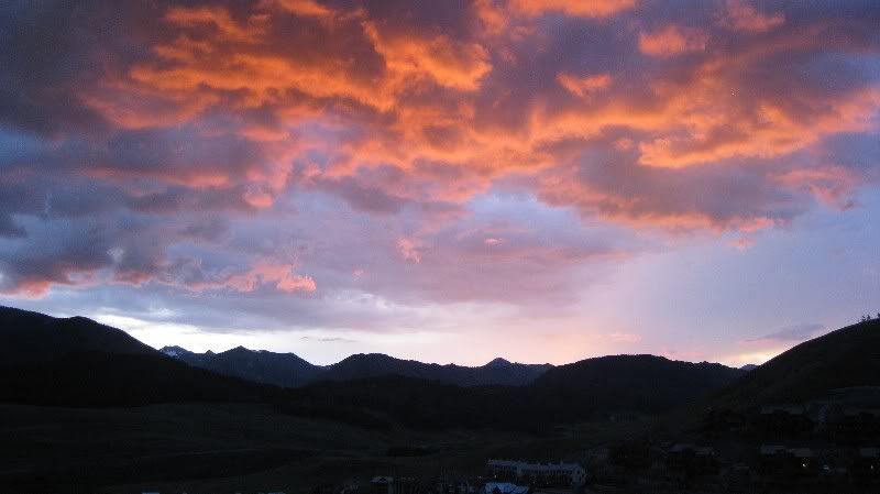
. . . . . . . fortunately, a more impressive sight was to be seen by turning around and looking toward the west . . . . . .
Wednesday 23 July 2008
Mike and Tim Crested Butte, Colorado to Golden, Colorado
Having NAFO-related responsibilities that evening, Mike and Tim headed on to the Golden, Colorado Marriott while I stayed on in Crested Butte to meet up with Ed (Pegscrapper), Jacquie (Ms Nascar), Rick (Ric N Sac) and Karen (aka the Den Mother) who had, coincidentally, planned to stop in Crested Butte on their way to the first-ever North American FJR Owners meeting.
Tim and Mike crossed the Continental Divide (for the first time of many), caught up with Richard (Fairlaner) on the road and continued on to NAFO.
Thursday 24 July 2008
Joseph Crested Butte, Colorado to Golden, Colorado
Rick, Karen, Jacquie, Ed and I headed on to NFO together via US Highway 50 and CO Highway 285 (this photo was actually taken by Ed a day or two earlier, I believe, along Highway 550, north of Durango, Colorado).
NAFO has been covered extensively elsewhere so not much about it will be added here.
Friday 25 July 2008
NAFO
While at NAFO, we talked with several people who had been to various parts of Alaska. We gathered a lot of information about roads to take, sights to see and, of course, places to eat. I would like to sincerely thank everyone with whom Tim and I chatted. Your help made the journey even more enjoyable - except for the unpaved roads that were suggested. Those made the trip, shall we say, more interesting.
Saturday 26 July 2008
NAFO
It turns out that about the time we were all finishing moving machinery around the parking lot, Tim was taking this shot of the assembled riders and their bikes from the window of his top floor executive suite. In hindsight, we should have been flipping him off.
Sunday 27 July 2008
Golden, Colorado to Cody, Wyoming
George (Coyote) decided to ride along with us miscreants for a day or so. The three of us headed out from Golden on Interstate 70 west. We turned off on CO 40 north followed by 125 north, to 230 north to 130 north to Interstate 80 west, to 287 north to 135 north to 26 north to 120 north and arrived in Cody late that evening. Tim and I set up at the local KOA campground while George, who was not traveling with camping gear, found a room in town. We all met for dinner in Cody. The town was packed with motorcycles (mostly Harleys, of course) and we ended up walking the length of the town twice before we found a place we could get into to eat. The KOA had nice, hot showers, but the campground never got dark and never grew quiet. Slept pretty well, though, all things considered.
Monday 28 July 2008
Cody, Wyoming to Glacier National Park, Montana
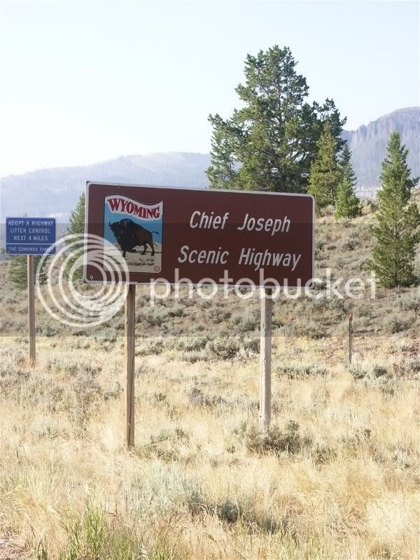
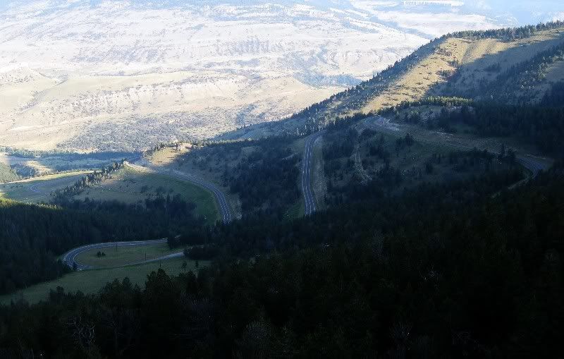
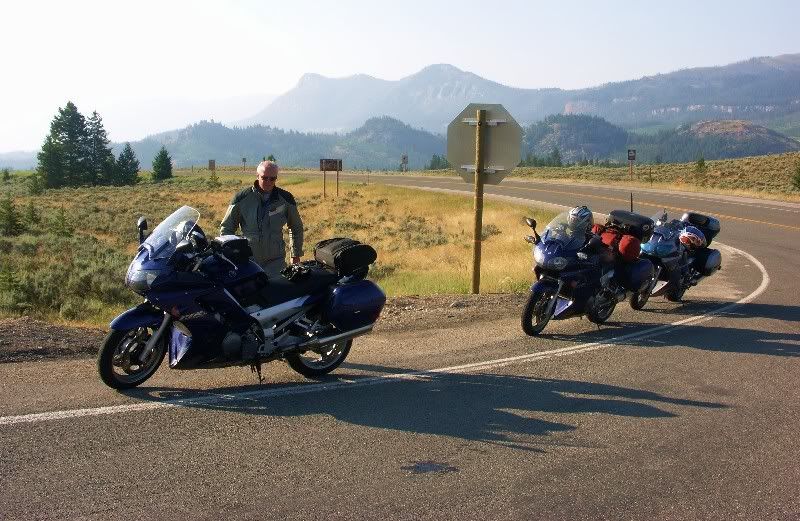
We rode 120 north out of town to Highway 296, the wonderful and, I feel, wonderfully-named Chief Joseph Highway. Big sweepers with some tighter turns, smooth road surface and gorgeous scenery. If you are in the area be sure not to miss riding this road. We stopped at a lookout to get a photo of the highway and to document our presence.
One of the many wonderful things about the Chief Joseph Highway is that it connects to Highway 212 - the equally wonderful, but very, very different Bear Tooth Pass road. Bear Tooth Pass is quite technical, tight in many spots, and is poorly maintained. It rises back up into the mountains and even in late July there was lots of snow and ice by the side of the road.
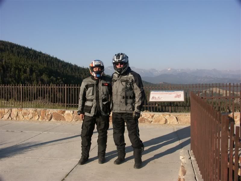
We bid goodbye to Coyote at the intersection. He headed west toward home while Tim and I headed north (and slightly east because that's where the Bear Tooth Pass road goes). Here is a photo of George with the motorcycles at the intersection of the Chief Joseph Highway and Bear Tooth Pass Road.
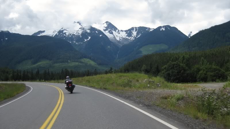
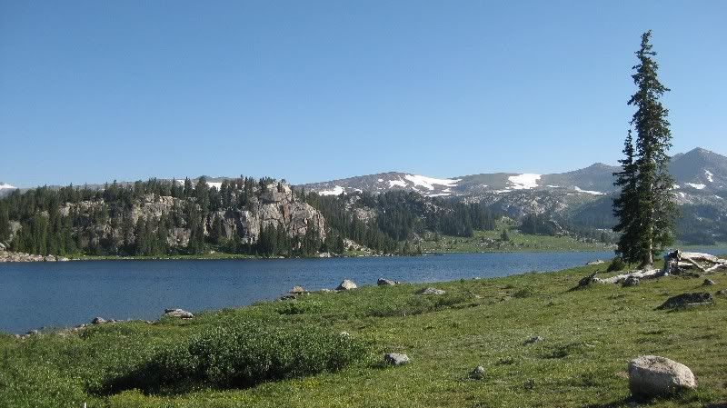
There were no pictures that really captured the essence of Bear Tooth Pass but here is one that does show some of the above-the-timberline scenery.
After descending from the top of the pass, we continued on Highway 78 north, Interstate 90 west and 89 north to St. Mary, Montana. This portion of the trip went smoothly except for a stretch of road where a woman wearing a day-glo orange vest and holding a stop sign on a pole awaited us. She asked how our motorcycles handled gravel. "Well," Tim told her, "that depends." "Okay," she asked, "how do they handle six to eight inches deep of freshly dropped gravel?" A fifty-mile detour ensued. But, what-the-hey, we're motorcyclists. Not a problem.
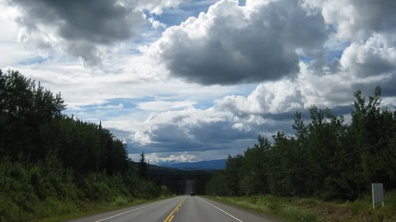
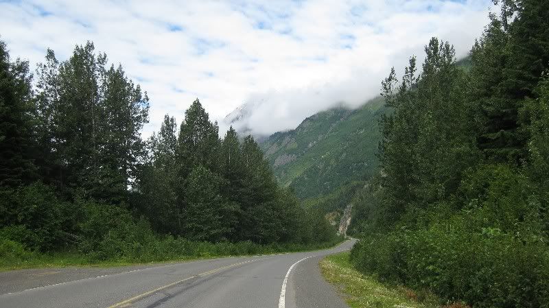
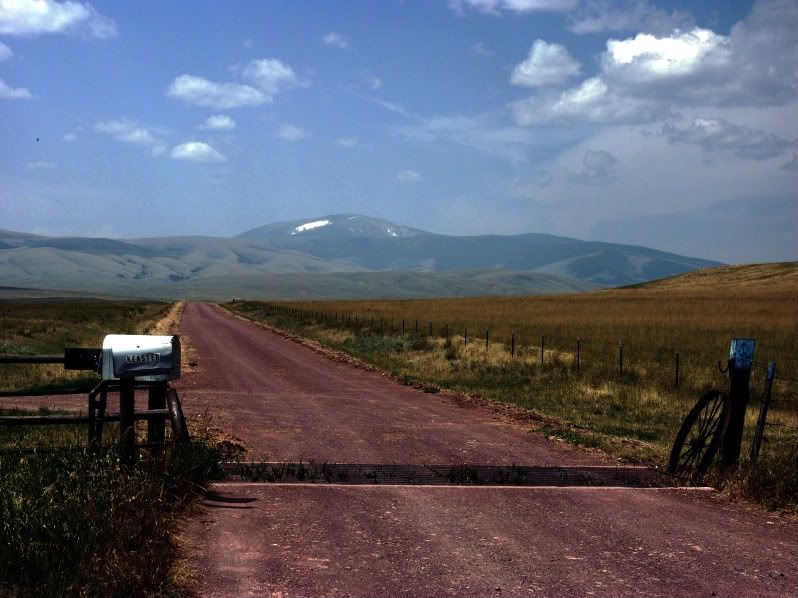
Most of the portion of the state of Montana that we rode through looked like this.
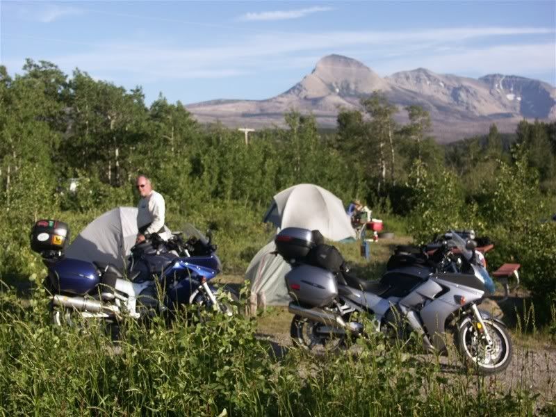
After the noise and light pollution of the KOA in Cody, I was able to convince Tim that it was worth it to forego the showers and that we should "set up shop" in a less suburban type of campground. We camped that night on the east side of Glacier National Park.
The folks at the adjoining campsite were friendly and well provisioned. As Tim and I were "cold camping", without any means of cooking food (we did not want to attract any bears), we took our neighbors up on their kind offer of a bite to eat, a beer or two to drink and a fire near which to sit. If I remember correctly, there might have been some Single Malt involved, also.
Tuesday 29 July 2008
Glacier National Park, Montana to Banff, Alberta Canada
After a fairly cold and damp night of camping, we arose, packed up our wet gear and headed west on the well known, and highly recommended, Going to the Sun Highway. We ran that east to west (no sun in our eyes, thank you) and then took Highway 2 to 93 north. We crossed the international border at Roosville. Tim had no trouble crossing as he had, at NAFO, been declared an Honorary Citizen of Canada, and had the pin to prove it. However, the border agent asked me three times in three different ways if I was carrying any weapons and/or ammunition. I kept my sarcasm in check on that sensitive issue but when he, while looking at my passport photograph, curtly asked me why I had not taken the opportunity to remove my helmet during the fifteen minutes we had waited in line before reaching his kiosk, I told him "All The Gear All The Time." He pondered that for a moment and then waved me on. We then headed north on 95 to CA 1 (that's Canada, not California though we were on that road also, later) then east and back south to Banff. We tried, along the way, to see a spot where, we had been told, "God goes to vacation" but that lake proved to be accessible only with reservations made months in advance because people had been stealing antiquities from the site. After two nights of camping, we checked into a nice hotel in Banff, spread our wet gear out to dry and, you guessed it, headed for a nice dinner. I drank some very good red wine with the meal. Tim drank, you guessed it again, Jack.
Wednesday 30 July 2008
Banff, Alberta to Jasper, Alberta
When, at a planning meeting for the trip, Gary (Duff) had suggested that Tim and I (and Gary, too, at the time we talked) head to the Canadian Rockies, I replied that I had been lucky enough to have been there already, several times, and, yes, I darned well would go again. Tim, however, had only heard of the wondrous sights. Well, Tim, here you are. Unfortunately, it is raining. On go the rain covers, and this time, our own rain gear. We head first through the town of Banff for a cruise around the golf course at the Banff Springs Hotel. Tim swears he saw a wolf while we putted along side one of the fairways. Although I missed seeing it, I believe the man saw what he said he saw. We stopped at Bow Falls for a break (we'd only been riding for half and hour so the break wasn't really needed) and a photo (definitely a must).
I don't know which was prettier, the sky or the falls, but it was a wonderful spot to linger. Fortunately, we only had a couple hundred miles of riding planned that day so "smell the roses" was high on the agenda.
Next we rode north to Lake Louise - rightfully regarded as one of the world's most beautiful spots. It's so beautiful that dozens of busloads of tourists cannot spoil the view. Unfortunately, rain and low clouds can. And did. Here are two shots taken at the lake that day and one I dug up on line so those who have never been to Lake Louise can see what Tim, and you, have missed.
We then continued north along the Icefields Parkway, focusing our attention not only on the road and the scenery, but also on the sides of the road. We were definitely in elk and bear country and hitting one would not have made the trip more pleasant. We did see a Yosemite-style crowd of vehicles where a small black bear had been spotted in the woods just off the side of the road, and we also some awe-inspiring scenery. One of the advantages of traveling on a rainy day is that, if one is lucky, the storm will break at some point, the sky will partially clear, and the colors and light will become truly wonderful to see. We had a glorious afternoon's ride.
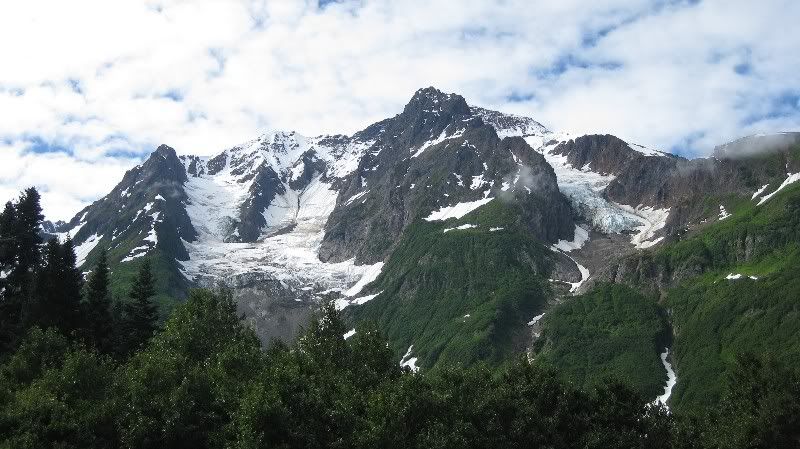
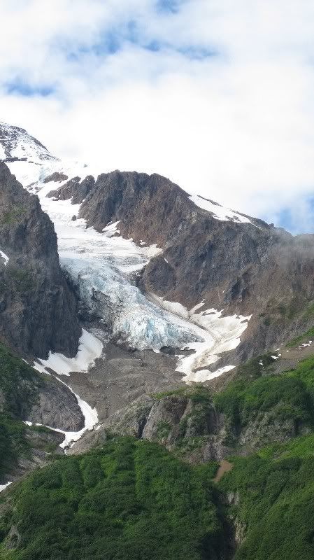
This shot is of the terminal moraine at the foot of the Columbia Ice Fields glacier. Water from the glacier flows to the Pacific Ocean, the Atlantic Ocean and the Arctic Ocean. A three-way continental divide if you will.
We parked the motorcycles, hiked up to the toe of the glacier and, because it was a bit chilly, were happy that motorcycle gear works pretty well in the mountains. Heck, it's all rip stop nylon, Gore-Tex, kevlar and polypropylene now anyhow.
Continuing north, now there's a big surprise, we next stopped at Athabasca Falls. I have always loved this waterfall because you view it mostly from the top looking down, and because, while it is impressive in size, it's also small enough to be comprehensible. The photos do not begin to capture the raw power of the falls.
Just south of Jasper we saw several large elk by the side of the road. Fortunately, they stayed off the road as we rode past them. We continued into Jasper and checked into a hotel at the edge of town. Once again, walking to dinner was the order of the day. About halfway into the dozen-or-so-block-long walk to the center of town, I turned right to cut across a park. Tim asked what I was doing adding that "Town is that way" and pointing in the direction we had been walking. I explained that, having been to Jasper before, I knew an alternate, more pastoral, way to where we were going. We could have headed along either route. Why I picked one instead of the other I do not know, but, as we crossed the park, I saw my friend Sam from Boston standing there, thousands of miles from his home. "What are you doing here in Jasper?" we asked each other. "Tim and I are looking for an Italian restaurant for dinner.” "Well, we've got reservations at an Italian restaurant down the street," Sam replied. We joined Sam and several members of his traveling party for dinner. Small world.
Last edited by a moderator: