A lot of us own and use some pretty fancy Garmin GPSes on our FJRs. These units are darned sophisticated devices, and some of us can be a bit intimidated by the technology. My objective in this thread is to show you one way that you can make your GPS work harder for you when you are out on the road, by using POI files. By the way, POI stands for "Point Of Interest". So these could be any sort of a place that you would be interested in finding. I'll be demonstrating this on a zumo 550 GPS but it applies (with just minor variations) on many other Garmin GPS units.
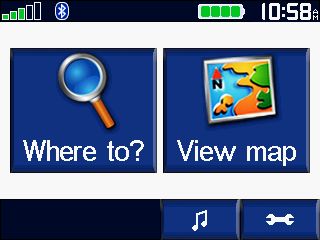
We all know how to find the closest services (fuel, food lodging, etc.) just by pressing the "Where To" button on the Top Menu screen. It's pretty intuitive,m espcecially if you've ever used a simple automotive GPS. That's pretty much the only mode those type of units will operate in.
Then select the "Food, Lodging..." button on the upper right
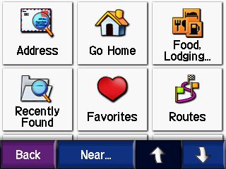
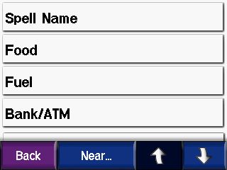
And drill down to the category of POI we are interested in
This will allow you to find any of the POIs that are included in your current mapset. The older your maps version is, the more outdated the POIs will be. The POIs actually change much more often than the roads do.
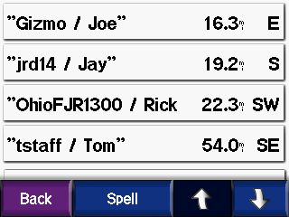
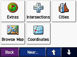
But, did you know that you can also find the nearest POIs along your currently running route? Or the ones closest to your current route's final destination? Or even tell it a completely different city from where you are currently? To do that, you just press the "Near" button on the bottom of the last screen shot above, which brings you to this screen:
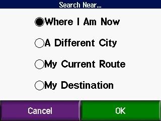
After selecting a different option and pressing OK, the POIs will subsequently be sorted based on their proximity to your new selection rather than Where I Am Now location. "My Current Route" can be really handy if your looking for gas or food and don't want to have to stray too far. Or "My Destination" is good for looking for hotels at the end of the day. "A Different City" is most useful if you already know a place exists and you know the name of the city/town it's in.
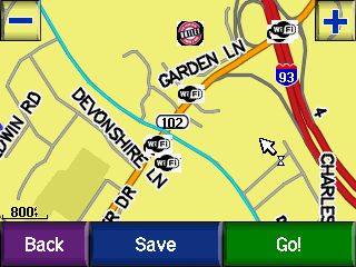
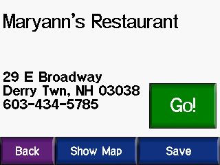
Once you find a POI that you like you can then save it for future reference by selecting the "Save" button at the lower right of the POI screen before you press "Go." It then gets added to your "Favorites" list.
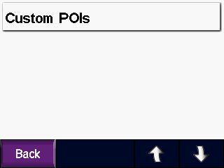
So that is how you can find the POIs that exist in your mapset. But that POI database, though fairly extensive, is not complete. There are some that are missing and many types of POIs that are not included at all, so that is where "Custom POIs" come in.
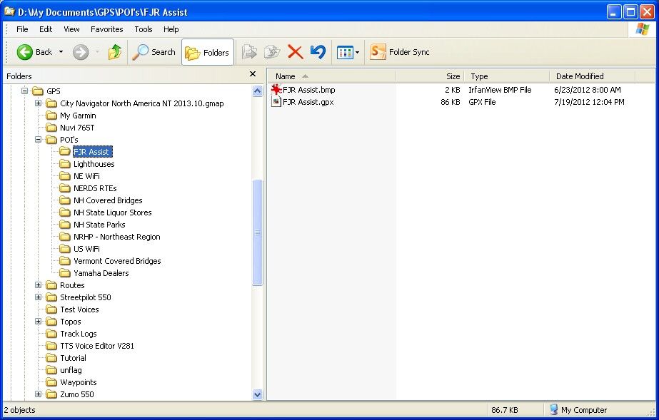
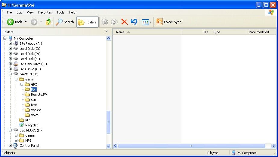
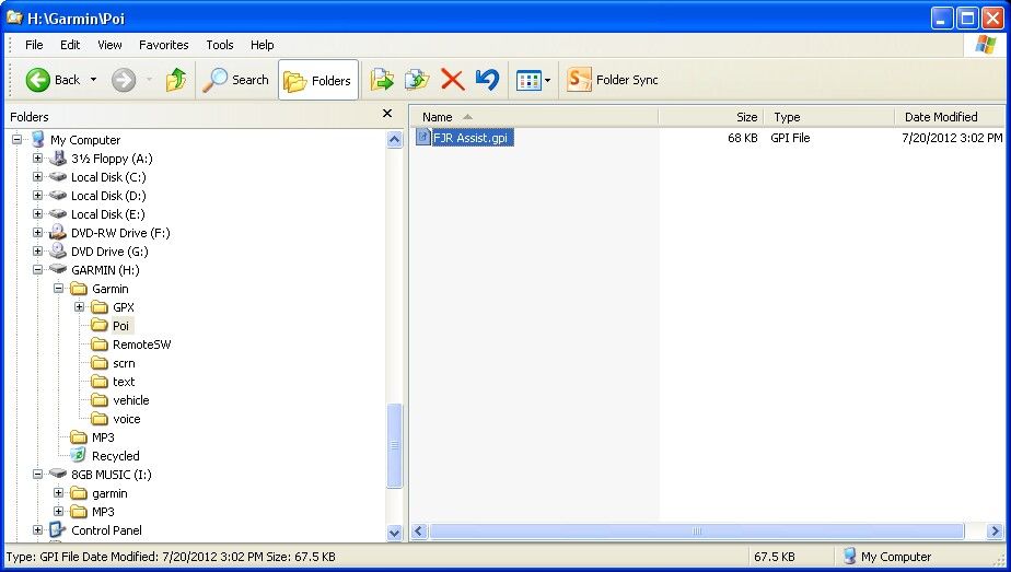
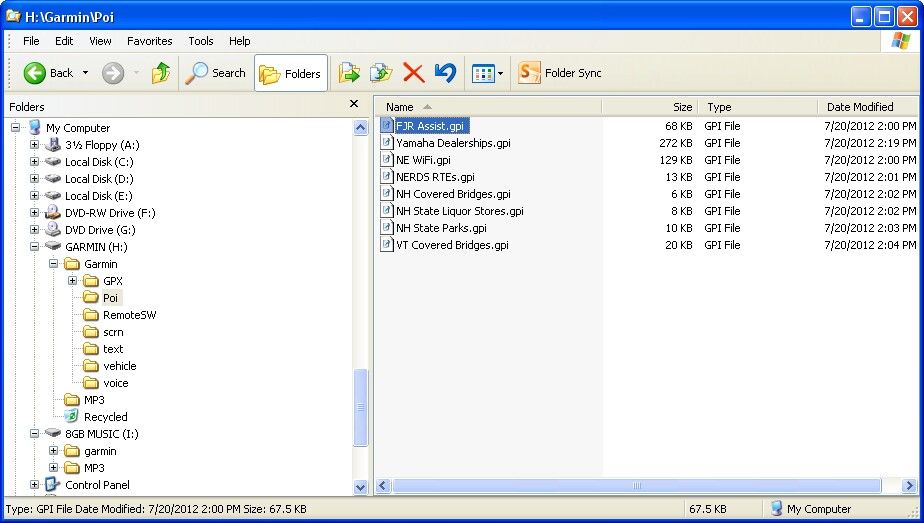
Custom POIs are just what they seem to be, a list of your own locations that you add to the GPS. They can be any category of locations that you might find useful. For instance, on my GPS I have custom POI files for all of the Yamaha Dealerships in the US and Canada, and also one with the FJR Assist list in it. Those could obviously come in quite handy when away on a trip. I also have one for all of the Covered Bridges in New Hampshire and another for Vermont, a file with all of the Lighthouses on the entire East Coast, one with all the State Parks in New Hampshire, a file with Free Wi-Fi locations throughout the US (mostly restaurants), another file with all of the New Hampshire State Liquor Store locations, and even the new file we are compiling in the NERDS Ride To Eat List thread.
But wait, you say... Why have the NERDS Ride To Eat restaurant list in a Custom POI file? Aren't all of those restaurants already in the mapset's POIs? Well, most are. But there have been quite a few that were not, and I've had to create the POIs from scratch using an address gleaned off of a Google search.
But there is an even bigger technical reason to keep these lists as Custom POI files rather than as saved "Favorites" and that is to keep your "Favorites" list less cluttered and more manageable. There are 57 NH Covered Bridges, 118 VT covered bridges, 67 NH State Parks, 77 State Liquor Stores, 502 in the FJR Assist List, 1090 Lighthouses, 283 Yamaha Dealerships in Canada, and 1371 in the US, and, get this... 69,043 free WiFi locations in the US in my Custom POI files. And we are already up to 62 locations right now (and growing) in the NERDS RTE list. Can you imagine trying to keep all of that in your "Favorites?" No way!
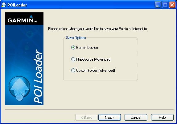
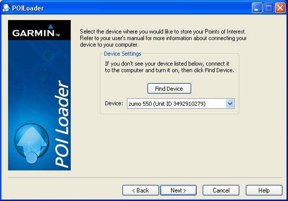
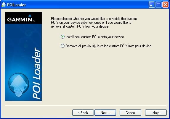
Well, obviously I did not plot and create all of those custom POI files myself. I mean, I don't have much of a life, but plotting out 69 thousand free wi-fi locations is a bit bigger task than even I am up for. No, no... these files can be downloaded and saved (for free). Or, as in the case of the NERDS RTE list, you can create your own.
In the next post I'll tell you how to do both.
We all know how to find the closest services (fuel, food lodging, etc.) just by pressing the "Where To" button on the Top Menu screen. It's pretty intuitive,m espcecially if you've ever used a simple automotive GPS. That's pretty much the only mode those type of units will operate in.
Then select the "Food, Lodging..." button on the upper right
And drill down to the category of POI we are interested in
This will allow you to find any of the POIs that are included in your current mapset. The older your maps version is, the more outdated the POIs will be. The POIs actually change much more often than the roads do.
But, did you know that you can also find the nearest POIs along your currently running route? Or the ones closest to your current route's final destination? Or even tell it a completely different city from where you are currently? To do that, you just press the "Near" button on the bottom of the last screen shot above, which brings you to this screen:
After selecting a different option and pressing OK, the POIs will subsequently be sorted based on their proximity to your new selection rather than Where I Am Now location. "My Current Route" can be really handy if your looking for gas or food and don't want to have to stray too far. Or "My Destination" is good for looking for hotels at the end of the day. "A Different City" is most useful if you already know a place exists and you know the name of the city/town it's in.
Once you find a POI that you like you can then save it for future reference by selecting the "Save" button at the lower right of the POI screen before you press "Go." It then gets added to your "Favorites" list.
So that is how you can find the POIs that exist in your mapset. But that POI database, though fairly extensive, is not complete. There are some that are missing and many types of POIs that are not included at all, so that is where "Custom POIs" come in.
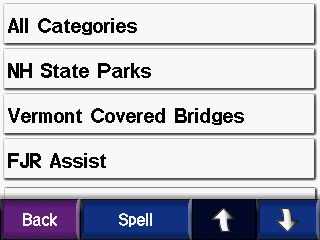
Custom POIs are just what they seem to be, a list of your own locations that you add to the GPS. They can be any category of locations that you might find useful. For instance, on my GPS I have custom POI files for all of the Yamaha Dealerships in the US and Canada, and also one with the FJR Assist list in it. Those could obviously come in quite handy when away on a trip. I also have one for all of the Covered Bridges in New Hampshire and another for Vermont, a file with all of the Lighthouses on the entire East Coast, one with all the State Parks in New Hampshire, a file with Free Wi-Fi locations throughout the US (mostly restaurants), another file with all of the New Hampshire State Liquor Store locations, and even the new file we are compiling in the NERDS Ride To Eat List thread.
But wait, you say... Why have the NERDS Ride To Eat restaurant list in a Custom POI file? Aren't all of those restaurants already in the mapset's POIs? Well, most are. But there have been quite a few that were not, and I've had to create the POIs from scratch using an address gleaned off of a Google search.
But there is an even bigger technical reason to keep these lists as Custom POI files rather than as saved "Favorites" and that is to keep your "Favorites" list less cluttered and more manageable. There are 57 NH Covered Bridges, 118 VT covered bridges, 67 NH State Parks, 77 State Liquor Stores, 502 in the FJR Assist List, 1090 Lighthouses, 283 Yamaha Dealerships in Canada, and 1371 in the US, and, get this... 69,043 free WiFi locations in the US in my Custom POI files. And we are already up to 62 locations right now (and growing) in the NERDS RTE list. Can you imagine trying to keep all of that in your "Favorites?" No way!
Well, obviously I did not plot and create all of those custom POI files myself. I mean, I don't have much of a life, but plotting out 69 thousand free wi-fi locations is a bit bigger task than even I am up for. No, no... these files can be downloaded and saved (for free). Or, as in the case of the NERDS RTE list, you can create your own.
In the next post I'll tell you how to do both.
")