Going to California

Yamaha FJR Motorcycle Forum

Help Support Yamaha FJR Motorcycle Forum:

This site may earn a commission from merchant affiliate links, including eBay, Amazon, and others.

Fontanaman

Robin Trower
Joined
Oct 29, 2009
Messages
2,005
Reaction score
1,060
Location
Spokane, Wa
My plans for dual sport riding for 6 days in September 2019 were ruined by unseasonably cold weather. Weather in Stanley Idaho around the time I left for California on September 19th. The prior two weeks were not much better.

GjFw4rv.jpg


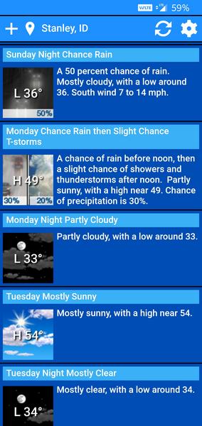
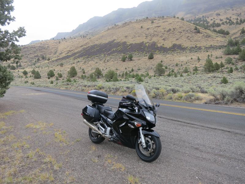
Stanley Idaho is at 6260’ elevation and some of the dual sport riding I wanted to do was 9000-11000 feet. Next year I will give this a go in July or August instead. Oh well. The DR650 isn’t going anywhere. I enjoy putting around on something completely different than the FJR

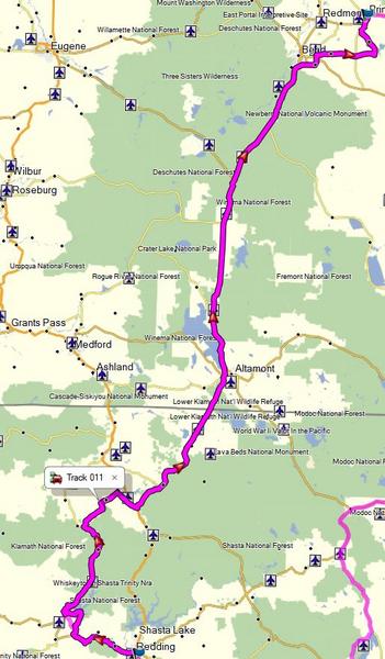
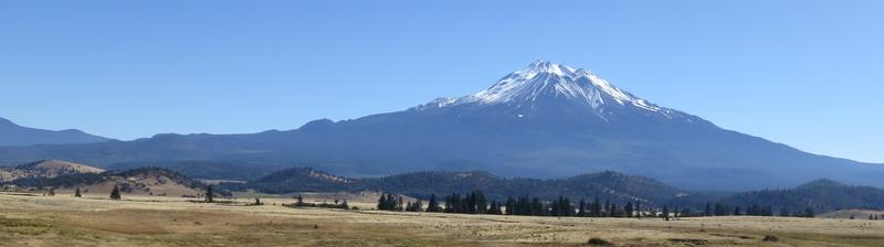
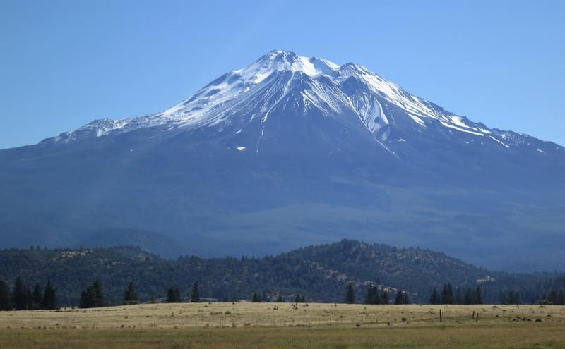
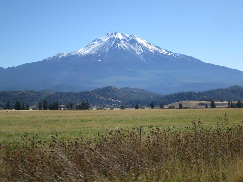
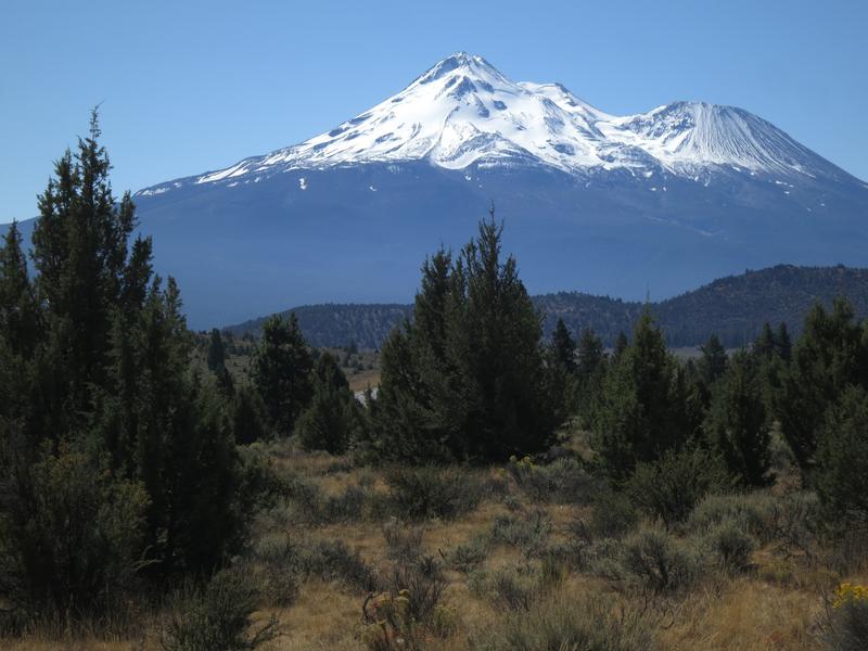
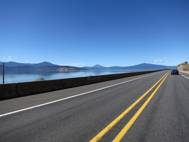
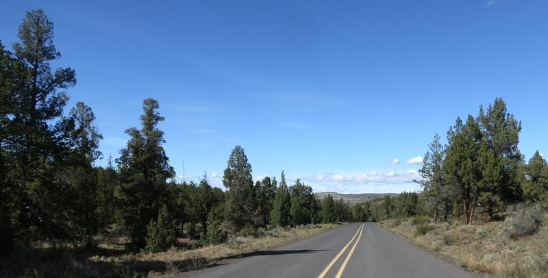
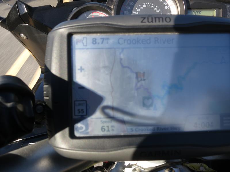
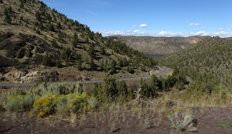
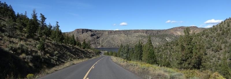
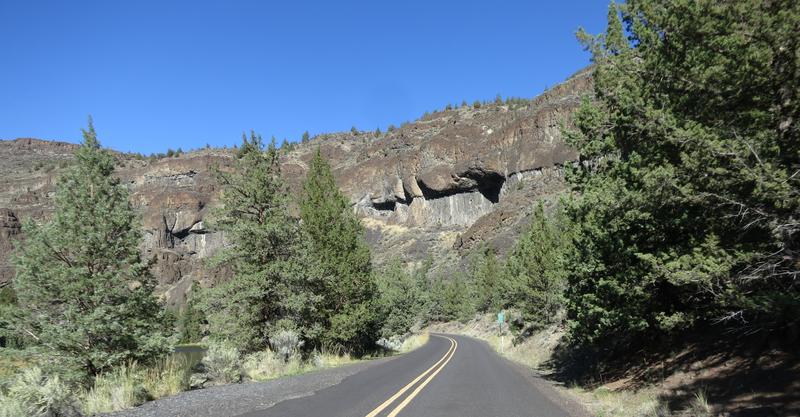
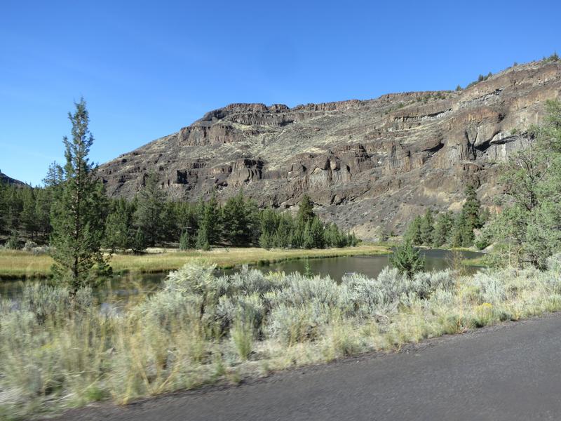
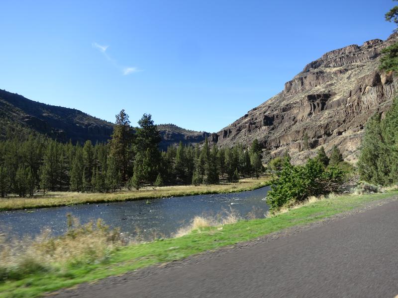
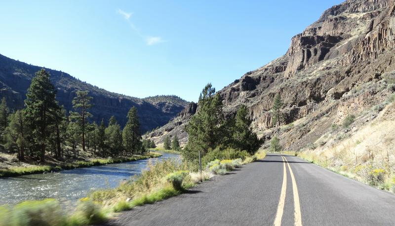
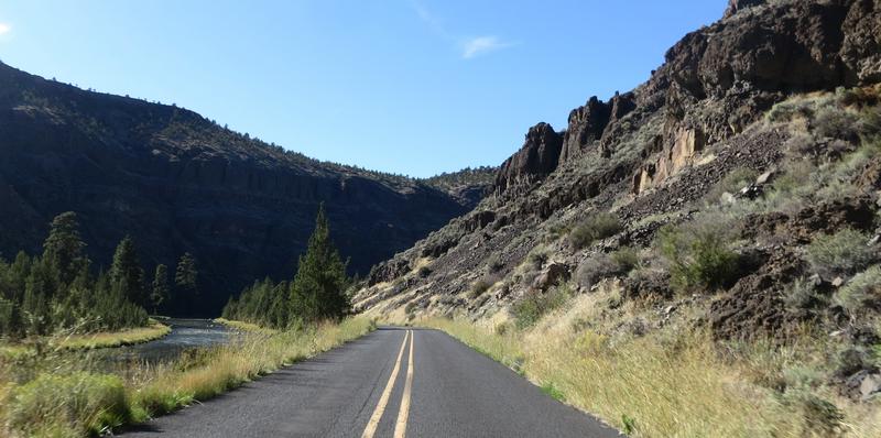
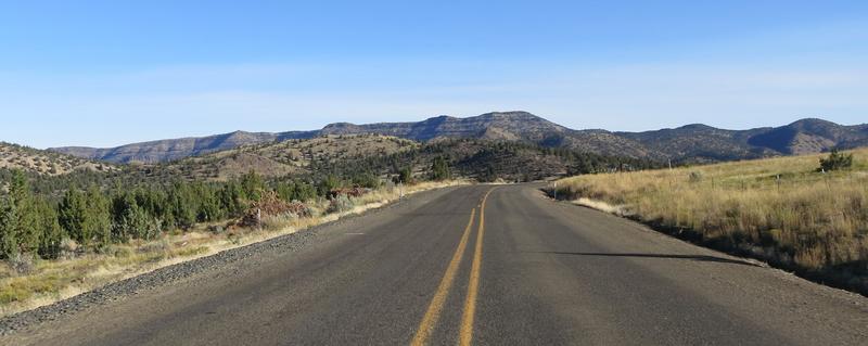
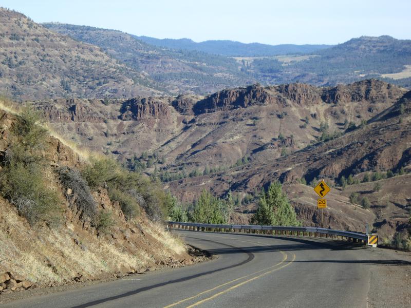
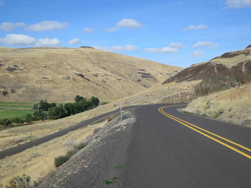
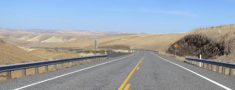
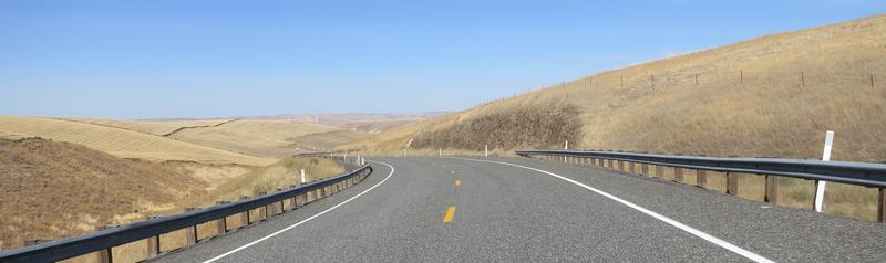
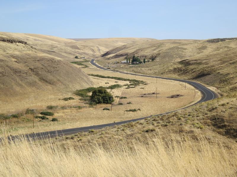
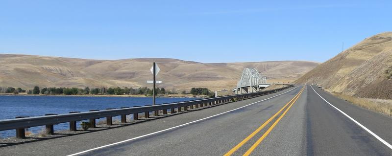
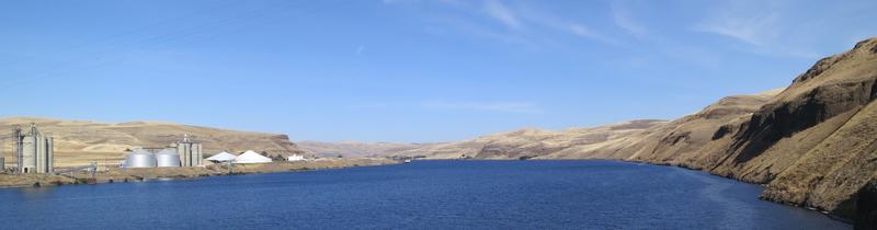
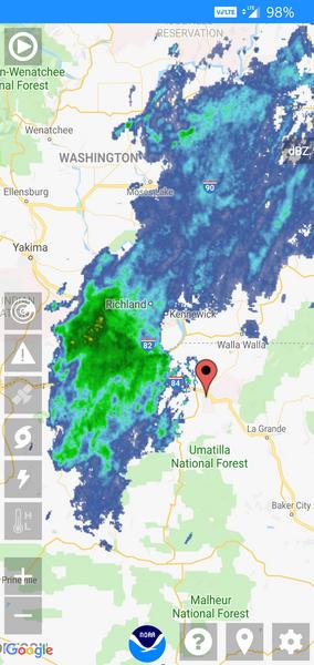
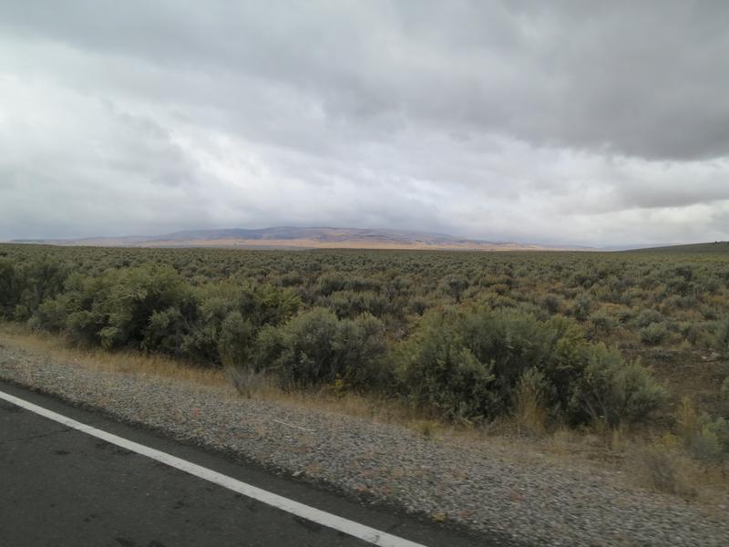
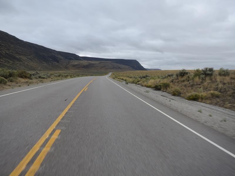
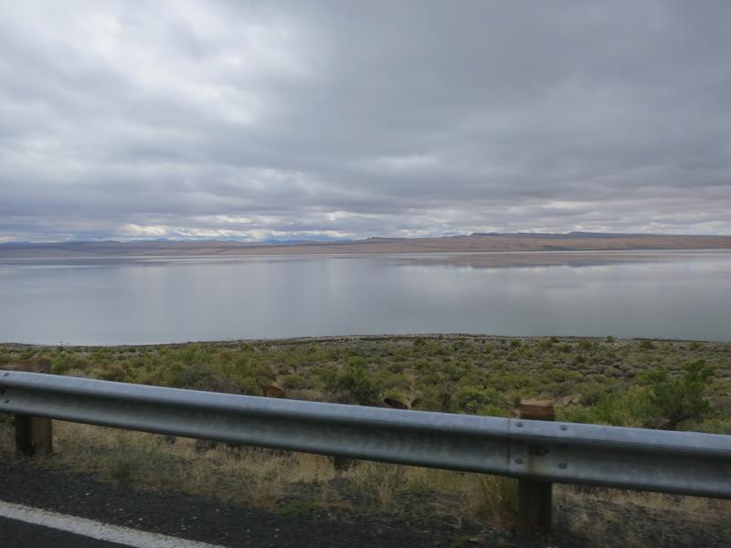
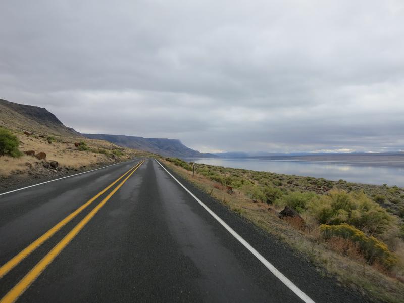
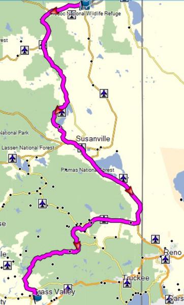
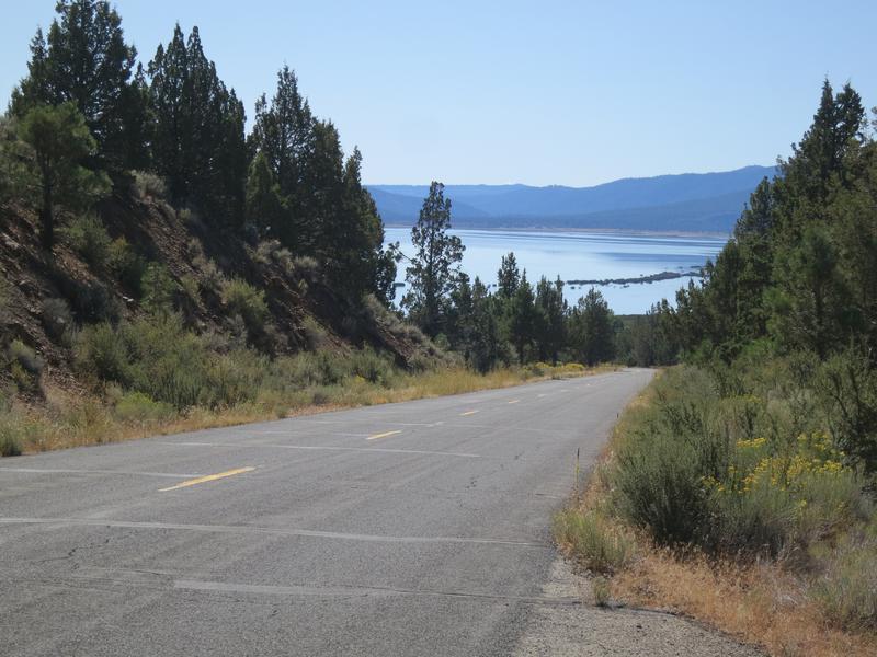
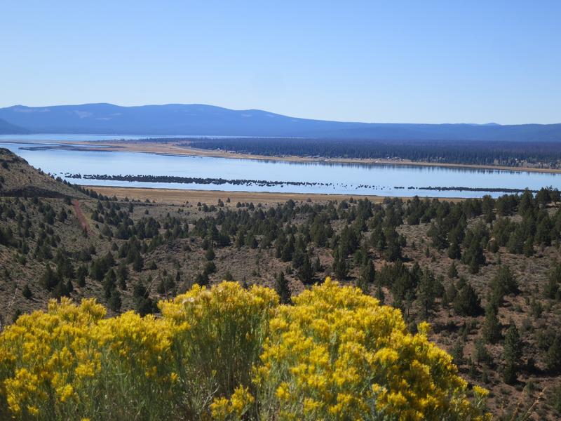
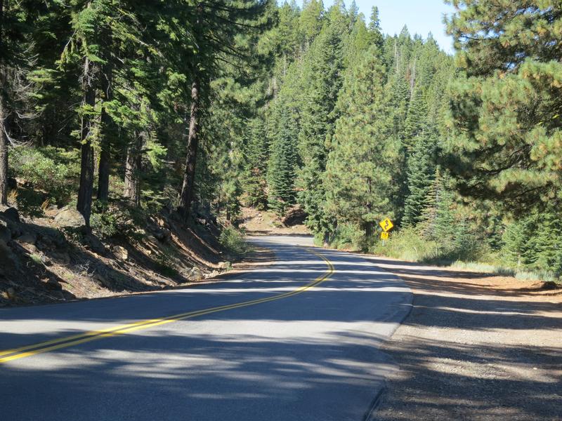
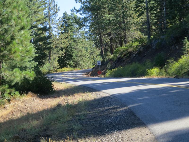
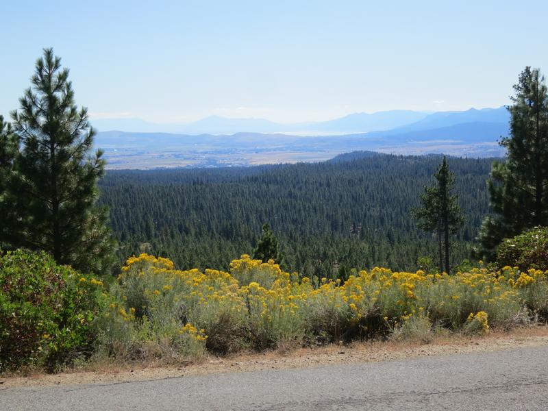
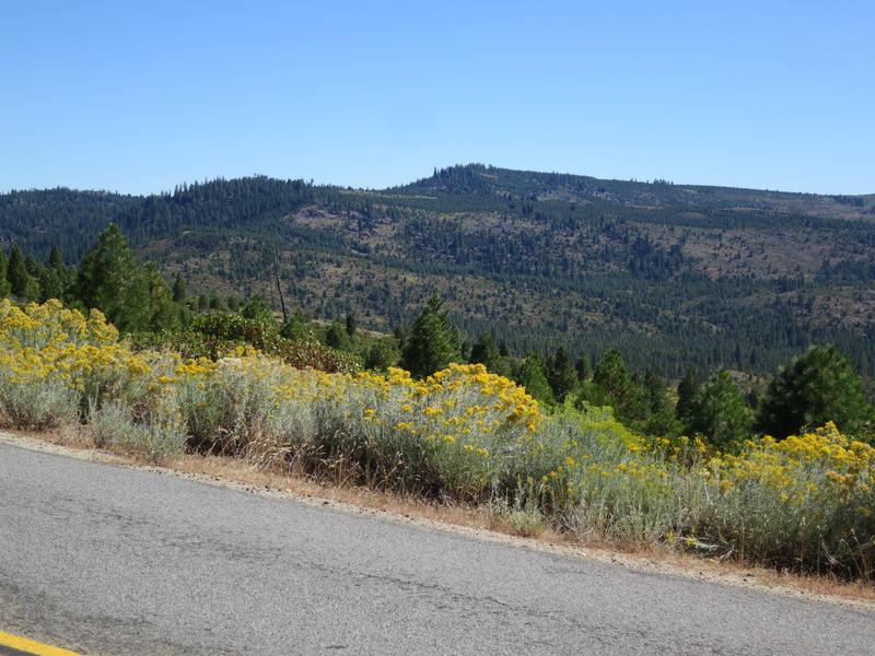
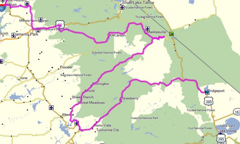
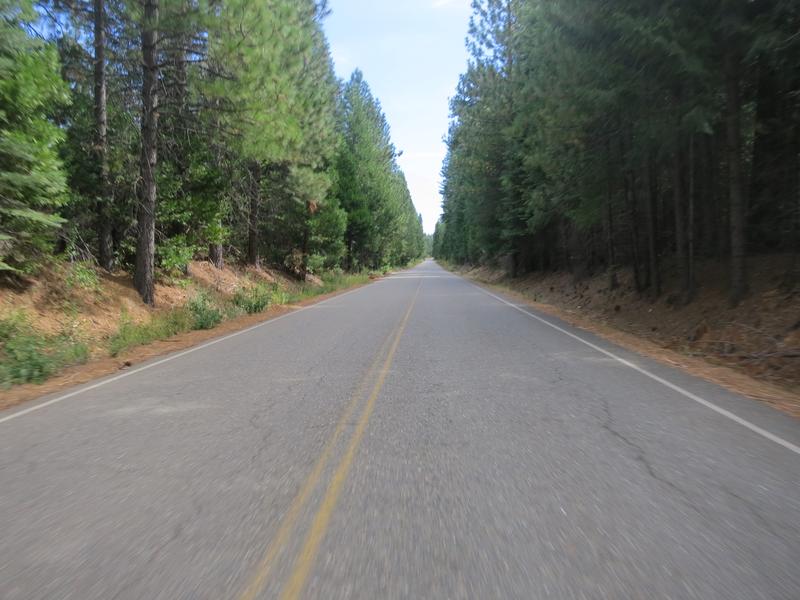
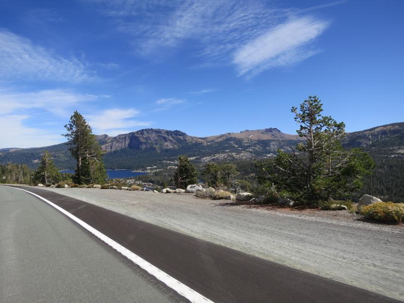
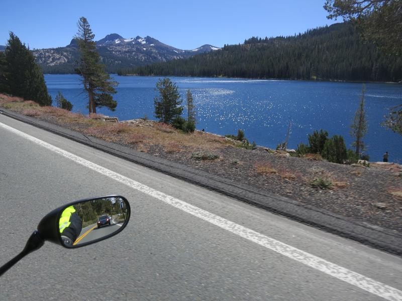
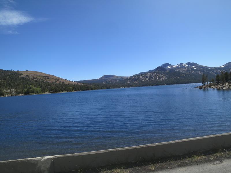
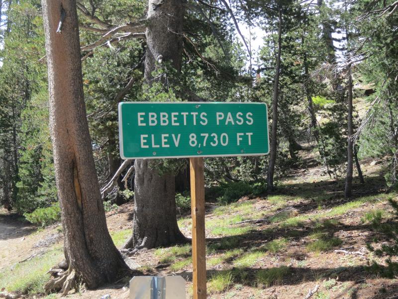
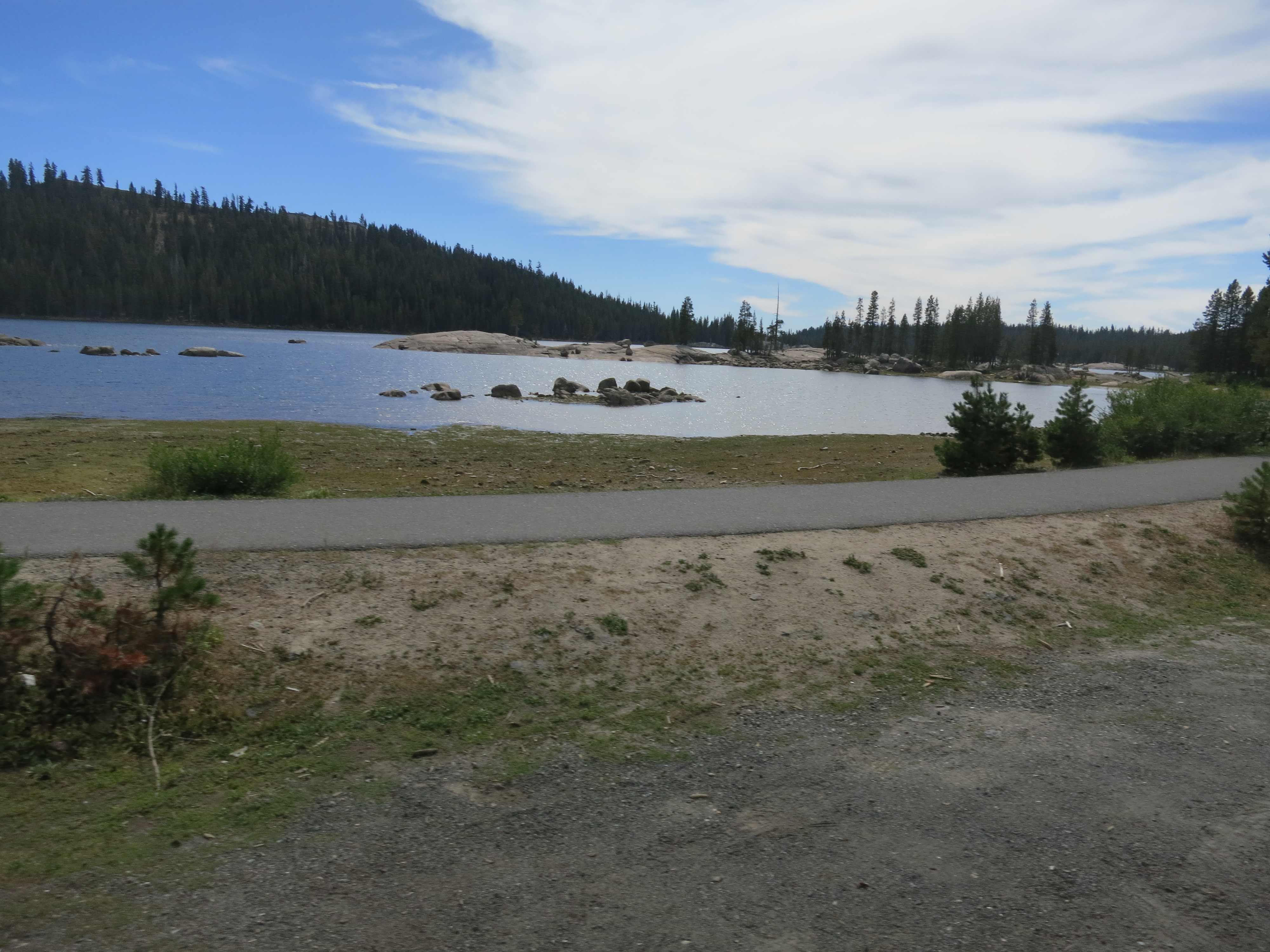
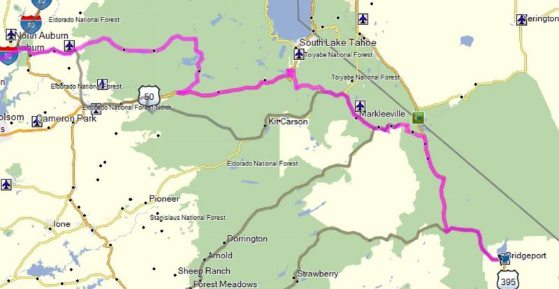
It is time to go where the weather is good before winter sets in. I haven’t been to the Sierras in California in quite a while, so let's go there. I also wanted to ride some roads I have never been on as well - always a good time. I contacts Bugs and say hey you want to go for a ride and he says yes. So now I have a destination and decide on taking 2.5 days to get there. So I leave round 2:00pm and ride from Spokane to Pendleton Oregon on the less direct route.

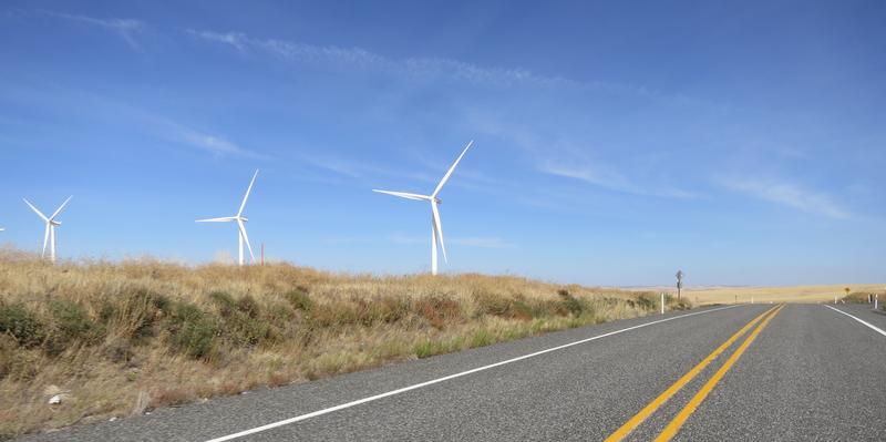
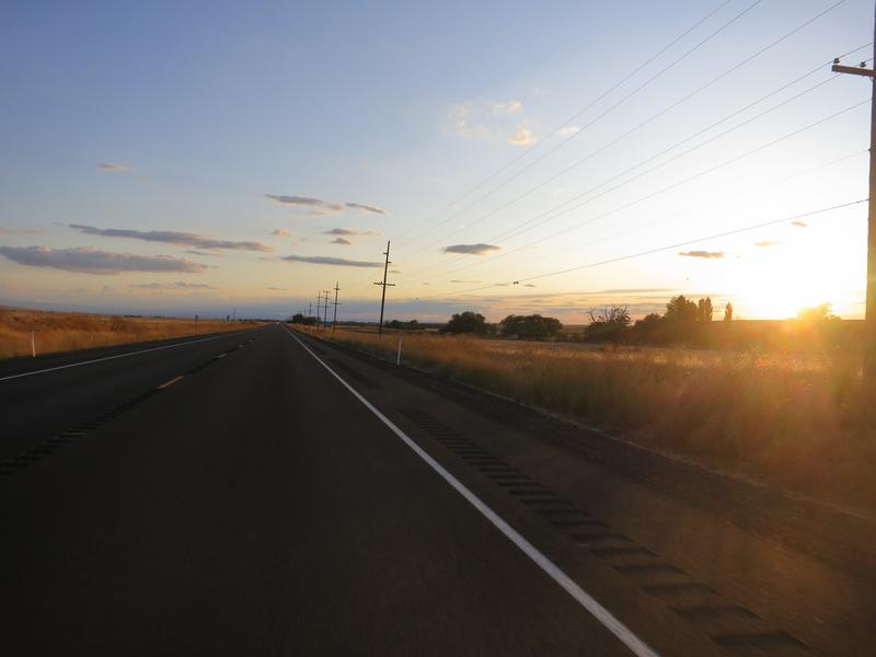
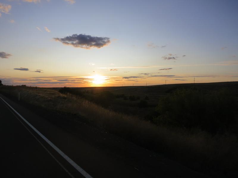
Sundown as I approach Pendleton and a sundown photo is an odd way to start a ride report.

rmsQtUk.jpg


UTWFc27.jpg


I found a hotel in the old town section and enjoyed Thursday night football at a local watering hole with some atmospheric scientists - nice group of people.

 
Nice RR there Fontanaman. I've rolled through Stanley in the summer, and was happy not to experience "weather" at that elevation.

Good luck in your quest to hit California.

 
Day 2

The route today is simple, ride down Hwy 395. The part between Pendleton Oregon and Mt. Vernon has some enjoyable twisty sections at Battle Mountain, and the Dale to Ukiah corridor.

I awoke to gray skies and based on the prior day’s weather forecast I was very surprised. I was even more surprised when I looked at the weather radar on my phone to see this shite:

mfehHk7.jpg


The pin is where I am. The system is moving from left to right meaning my parade will be rained on for about 150 miles. And so it was.

Recently I bought a Klim Latitude Hi Viz jacket to replace my 10 year old Rev-it! Jacket. The wife said you need to look better and the old jacket looks real bad. When the wife gives a green light to upgrade gear you count your blessings. This ride was the acid test and I must say I am very impressed. It rained and rained and I stayed dry, even around the neck. Two weeks prior during the Rueben Run I wore the jacket in 90 degree temps and it vented very well. The Latitude fits well in the arms and torso so the armor will stay in place in case I go pavement surfing. It has lots of nice features one expects from a premium product. It does not come with a insulation liner so I use my Gerbing heated jacket thus I carry less stuff. I like that as less is more.

After John Day Oregon there was a 15 miles stretch of 395 owned by Silves Ranch Resort. The cabins are actually huge homes on the hillside and all were painted in the theme and logo of Silvie's. They have a golf course and airport to boot. At $895/night it is a place the well healed to enjoy a authentic ranch experience.

The Garmin GPS helped me find the Broadway Deli in Burns Oregon. I had a very good 1/2 sandwich and pasta side where I spend about 1 hour just relaxing and having some coffee. Nicd folks and good food. Highly recommended.

Soon after Burns Oregon the rain quit for good and I got my camera out for the first time today. It is lonesome out here.


The rain means I took only a few photos today.

ftzJ3uh.jpg


75B6kOs.jpg


Lake Abert is large, shallow, alkali lake and has no fish but lots of shrimp. Interesting geology out here.

Nq7CdGr.jpg


kTSAohz.jpg


My 2009 FJR with about 105k miles.

Gml1i0l.jpg


I had to stop to take these photos.

pS3b4sF.jpg


JWVd3to.jpg


5MYA32j.jpg


I spent the night in Alturas California. Nothing memorable about this place other than it was geographically convenient. The hotel I stayed at, the Modoc Inn, was definitely a dump despite the great Google reviews. Skip this town if you can!

 
Day 3

I am a big fan of the Destination Highways series of books and maps. These books cover Southern British Columbia, Canada, Washington and Northern California. After that the authors stopped for reasons unknown. These maps and books are much better than a Butler map. The map gives you an overview and the book describes what the road is like helping you avoid goat trails. Each road is rated from 1 to x, in the case of Northern California x is 74. The rated roads are called Destination Highways and each of those has nearby Twisted Edges, twisty bits worth riding in there own right. So the Northern California book has 367 roads with a write up on each road. Their moto is ride like a local not a tourist.

0UpDDAh.jpg


With this in hand, I create a nice route to Doug’s place, including a couple of roads never ridden. It is going to be a good day!

Here is the route.

RNBpxQW.jpg


Things start out well enough. It was a blue sky day. Yes!

dNIIR5r.jpg


I got to ride the road around Eagle Lake, a first for me. It was very nice scenery with so so pavement.

C3Tquqd.jpg


gnnLnJ0.jpg


3bk4Gh6.jpg

Pretty good twisties.

N7gFjeM.jpg


vil4GXv.jpg


QG0fzer.jpg


TbgG223.jpg


jazzlgb.jpg


zEnFvsp.jpg


In Susanville the plan started to unravel. The silly GPS tried to take me down an unpaved road - damn Garmin will not transfer routes from Basecamp to the GPS as planned on Basecamp. The solution is to add a bunch of way points, but where, because you don't know where the damn thing will mis-route. My old 550 did a better job than the 595. I may give Google maps another go and simply listen to directions over the headset and use the GPS for finding gas stations.

Once I got the route figured out I was looking forward to Antelope Lake via the Janesville Grade Road, another virgin road to me. It was closed and later Doug told me it was closed due to a recent fire. More backtracking took me out to 395 to Hwy 70 where I ran into road construction. Bummer.

Things improved significantly when I arrived at Hwy 49. I knew I was in the right place.

kTZB95N.jpg


And then it gets better.

0xEY8Ll.jpg


I put the camera away - I was having too much fun riding this amazing road. The pavement on Hwy 49 is smooth and excellent asphalt. I had never ridden it from east to west and the hillside drops from right to left so the sight line is much shorter than going west to east. It is fun, it is awesome and it is twisty. Destination Highway rates it as the 9th best road in Northern California and I believe it.

Doug and Gail are excellent hosts. We shot the bull, talked about life and had a great time. Doug suggested a good route for my 4th day and it was excellent. Thanks very much Doug. Maybe next time we can go ride that piece of Hwy 120 I missed out on.

 
Good RR and pics. 

The silly GPS tried to take me down an unpaved road - damn Garmin
Has your Garmin not got an "Avoid unpaved roads" setting? - my Tomtom certainly has. [I've heard a lot worse than "damn Garmin" said (screamed) about Garmins 🤔]

 
Good RR and pics. 

Has your Garmin not got an "Avoid unpaved roads" setting? - my Tomtom certainly has. [I've heard a lot worse than "damn Garmin" said (screamed) about Garmins 🤔]
Yes it does and I use it but sometimes it does not work. What is really frustrating is the route I create on Basecamp sometimes will not transfer to the GPS faithfully. Instead the GPS makes up it own routes. 😡

 
Instead the GPS makes up it own routes.
The satnav will always make up its own route between the waypoints that your planning software creates.

I usually use Google Maps to create a route (may have to combine more than one route as it has a restricted number of waypoints), then having transferred it I try to check the route on Tomtom. If it diverts from what I want, I will add appropriate waypoints to force it to do my bidding.

Tedious, but better than going on a road I don't want to, or missing a road I do.

 
Day 4

Destination Highways is a great resource but Doug is better so I follow the route he suggested for today. It is Sunday and road construction traffic would be at a minimum and this provided lots of incentive to complete this 7.5 hour in the saddle trip.

The route in the next pic. In English is from Cool California Hwy 49 south -> Hwy 193 east -> Hwy 50 east -> Sky Park Drive south -> Mormon Emigrant Trail east -> Hwy 88 east -> Hwy 89 summit monitor Monitor Pass and uturn -> Hwy 4 west to Sonora -> Hwy 108 east -> Hwy 395 -> Bridgeport Inn in Bridgeport. I choose to stay in Bridgeport because I have been here several times and it was my bucket list. Plus it has great dining options!

Ayr4ntV.jpg


This is a photo of the Mormon Emigrant Trail.

1mtK9Yd.jpg


In the High Sierras - I forgot was pass this is near. It is all good.

mw6nCnm.jpg


cjrwyPP.jpg


vLZQfXh.jpg


Here is a photos near Monitor Pass. Wonderful place to ride a motorcycle.

oJGgURP.jpg


ODLSt4b.jpg


Agrhudg.jpg


A26Vnds.jpg


Ebbetts Pass aka Hwy 4 - a truly great road.

6ixelBW.jpg


Then the yellow stripe goes away for a while.

XGdulBf.jpg


Z70MoGO.jpg


It is very scenic Mosquito Lake near the Pacific Grade Summit

pIxtSaz.jpg


Gf8lYQj.jpg


OQUrJZo.jpg


Then it is on to Hwy 108 a personal favorite. This year it was under construction but this was Sunday and the crews were at home enjoying a day off. Was I lucky or what to miss 22 miles of slow and go on one of the premier roads in California.

Check out the perfect pavement!

cB9Zyoi.jpg


tbSn2Km.jpg


3p3FbWp.jpg


5BtlO4S.jpg


VoHSPX0.jpg


Years ago I was here and shot this photo just west of Sonora Pass. It is an all time favorite of mine. Tyler might be jealous, nahhhh.
icon_e_biggrin.gif


EJAYWjR.jpg


I decided to stay in the Bridgeport inn in Bridgeport. I was $140 to stay in the Mark Twain suite, meaning I got a private bathroom. Even better, the hotel has a very good restaurant where I dined on some excellent Prime Rib. It was an excellent day to be on the FJR on some of the best road in California.

 
Day 5

The goal for this trip was to ride in the Sierra’s north of Yosemite as I had been to Yosemite 2 year ago. Don’t care for the traffic that way anyway. The other goal was to ride Hwy 36 again but it was under construction and has been for two years. This year like two years ago it was open from for one hour around noon then in the late evening. I hope the Destroyers Of Twistiness (DOT aka usually known as the Department of Transportation) don’t impact the character of this road too much.

Today is Monday and I ponder my options of where to next. Doug suggested riding from Gerlach to Cederville a remote high desert ride - this would lack twisty road and end up at Hwy 395 and I had just road Hwy 395. I considering riding Hwy 120 east of Yosemite and around June Lake. The weather forecast was for snow at home in Spokane by Saturday. Time to head home. I had two bucket list items I could get on this trip. Ice House Road and Hwy 3 from south to north. This seemed the most appealing because I could enjoy some more mountain roads.

Here is the route for today less the boring part from Auburn to Redding California.

V3SCKJ1.jpg


I enjoy breakfast at the Bridgeport Inn. Happy now ~G?
icon_e_biggrin.gif


Iq7sDo8.jpg


I took Hwy 395 north to Hwy 89 and climbed to Monitor Pass. Destination Highway rates this as the best road in North California, hard not to agree.

gPkBe61.jpg


A photo at the summit lined by Quaking Aspens. I was here in the 1980’s for the first time on a motorcycle. It was early summer and the valley spread out below us was had lush green grass. It was a sight to behold and the valley in my memory stretched out forever on each side of the road you see ahead of you. My memory is more vivid than reality but it is a nice memory to have.

X9TGmRV.jpg


I end up on Hwy 50 a popular route for crossing the Sierras. Today there is construction and I end up a the back of the line, but the upside is no wait time. It was a long long line of traffic and passing would be futile so I just do the parade until Ice House Road. I Googled Ice House Road hoping to find some history about the name of the road. I found a lot about campgrounds and recreational activities but not anything about the history of this road. I was thinking they may have cut ice from the lake for rail cars prior to refrigeration as the North Pacific Railroad did in Thorp Washington along the Chicago to Seattle rail line.

Ice House Road

PZh2dFA.jpg


Union Valley or Ice House Reservoir

e0jQyTq.jpg


aVLjhMn.jpg


Ice House Road continues to the Wentworth Spring’s Road another great twisty mountain road where signs advise speed is monitored by aircraft. Green light for fun and no photos. The downside of this route is I get dropped into Auburn California and it is a slog in 90 degree heat to get to Redding, bummer. But is sets me up well for more mountain riding tomorrow.

 
Of course Bug is a great guy for riding advice in this neck of the woods 😁

But sorry you missed out on YFO Jim.  We rode most of those same roads (4, 108, 89, 120, etc...) just a few weeks ago.   The road conditions are just about perfect right now as you've shown.  I think that all of the major passes have been repaved and the ones I saw were all clean and smooth.

Nice report - please keep it coming :)  

 
Great RR.  It had been years since I had ridden NoCal so took the time to do so between Reuben Run and YFO.  It was fantastic.

I am becoming a big fan of CoPilot GPS.  An app for your phone.  It uses downloaded maps (to the phone) so even works without cell service.  It's not perfect, but after using it for a while I find it's my go-to way of planning a route.  Screw Garmin and basecamp.  I love Google Maps, but don't always have service.

 
108 has been in my "Top Two" for years (the other member of that club is CA 1 from Jenner to Leggett).  Russ Perry and I took 108 coming home after YFO just a couple weeks ago, also on a Sunday.  OUR side of the road was smooth and perfect, just like your pics.  But the westbound side was the old surface they'd been working on, so you wanted to be damn careful not to cross that yellow line, since there was about a two-inch dropoff from the nice fresh asphalt on our side.  And of course a two-inch obstacle to ride over to get back again.  But it was still gorgeous.  Sorry we missed you in Bridgeport tho.

 
I regret not going to Bridgeport, but my plan after the Reuben Run was to ride my DR650 in the Idaho Backwoods.  It didn't work out due to weather so the High Sierra's were calling.

Day 6

I have been on Hwy 3 several times but only north to south. Riding it from south to north is a bucket list item because the twisty bits go up hill.  It is a twisty road up to Scott Mountain Summit at 5400' elevation through the Shasta Trinity National Recreation Area. Lots of trees and one great road.

The route for today.

T5HE01N.jpg


Out of Redding I get on Hwy 299 and soon found myself in the Carr fire burn area. It was shocking. All along Whiskeytown Lake was burned. It was odd to see boats out on the lake surrounded by destruction.

Not long after leaving Hwy 299 going up Rush Creek road the GPS misrouted me, again. This time I stopped to check out the map and decide to follow the GPS. This worked out pretty well as I rode along Trinity Dam Boulevard a road I have never been on before - bonus!

Fun is ahead on Hwy 3.


6CH6ihw.jpg


Construction ruined my little parade and I had to run up the best sections of Hwy 3 behind a “follow me” car. Dang.

Hwy 3 leads to the Gazelle Callahan Road over Gazelle Sumit at 4921 feet. After the summit I am just riding along at 55 mph just taking it easy. I go around a right turn and the front end steps out, then catches. Whoa! I was happy I didn’t have the bike leaned over. I turn around to inspect what I hit. At 5 mph I could barely see a small bit of gravel in the road. I was happy I wasn’t pressing but it but started wonder about the future of and the risks involved.

Mt. Shasta

FSfkaiV.jpg


jafZNB9.jpg


JAXSOSP.jpg


pFjlWcY.jpg


IzjDDLZ.jpg


My route is Hwy 97 and I go by Upper Klamath Lake. It is hard to get a good shot in the north bound direction.

9mNtNDA.jpg


Hwy 395 is more lonesome than Hwy 97 but on this day traffic is light and the drone up to just south of Bend goes well.

I leave Hwy 97 just south of Bend for the Crooked River Road a nice bit of pavement with great scenery.

LVc1loX.jpg


KfhWRRB.jpg


It has a few twists too.

kJORrVD.jpg


gAX1Nuk.jpg


I like the rock formations.

3Le23NV.jpg


There are a lot of fly fishermen on the river. It is very peaceful. There are a few bicyclists too and the sight lines are good enough to avoid a collision.

tQmvKRJ.jpg


EVkB7rg.jpg


dEjcH01.jpg


48aR9hx.jpg


Prineville is at the north end of the Crooked River Road and is where I spent the night.

 
Day 7

Even though this is the last day of the trip it will be a good day because the roads home are good. To start with I get to ride in The Box, a phrase I coined for riding in NE Oregon. Any two lane road inside this box is likely a great motorcycle road. You can’t go wrong here.

I am happier than a clam in the sand, you could say mud but clams don’t live in mud. So sand it is.

Here is the route for today. I used Google maps because these roads are open year round and so Google maps works all the time, plus you can zoom and and see the route.

My Gerbing jacket came in handy this morning. The Rev’it Stratos GTX Gloves winter gloves worked great too. I didn’t turn on the heated grips. The humidity must have been low.

Kp8lQxR.jpg


This photo was taken near Ochoco Summit at 4700’ elevation.

After droning over Ochoco Summit I get to Micheal Oregon where I head north on Hwy 207 determined to keep the sticky side down after yesterday’s bobble. Easier said than done for chip seal roads are the rule in NE Oregon. Right hand turns can have gravel on the road from cars cutting the turn. So today is just going to be a cruise. So far so good and it not time to screw it up now. It is scenic so let’s enjoy that today.

Es10iH3.jpg


gGvjE6r.jpg


Dig this crazy landscape.

fhdvuAe.jpg


And a twisty road near the town of Hepner.

bcHTnyy.jpg


The roads I choose in Washington aren’t bad either.

GJAu7ZK.jpg


SKsb1q9.jpg


fi1wyhi.jpg


I had to pull over to take this photo but it was worth it.

d4IMFmr.jpg


About to cross the Snake River.

8gNiIUq.jpg


The Snake River.

sbm1gdE.jpg


Well I got home in one piece and had a great time. A special thanks to Doug for putting me up for the night and his advice on a great route through the Sierras. Thanks for following along.

 
Top